|
Date
|
Parcel
|
|
1658/01/01
|
|
Grantor
|
Grantee
|
Parcel
|
Acreage
|
Lib:No:Fol
|
Type
|
|
Thomas
Cornewalleys
|
|
Verina
|
1000
|
|
Patent
|
1658:
Verina, Thomas Cornewalleys, 1000 Acres.
Certificate
- Q:418; Patent
- Q:418
|
|
1681/06/07
|
|
Grantor
|
Grantee
|
Parcel
|
Acreage
|
Lib:No:Fol
|
Type
|
|
Humphrey
Davenport
|
|
Hemberry
|
600
|
|
Patent
|
June 7,
1681: Hemberry, Humphrey Davenport, 600 Acres.
Images and
transcribed text can be seen here.
Certificate
- 21:341; Patent
- CB:3:494
|
|
1683/01/01
|
|
Grantor
|
Grantee
|
Parcel
|
Acreage
|
Lib:No:Fol
|
Type
|
|
James
Fendall
|
|
Bright
Helmstone
|
1,000
|
|
Certificate
|
1683:
Bright Helmstone, James Fendall, 1000 Acres.
Certificate
- 21:554
|
|
1684/01/01
|
|
Grantor
|
Grantee
|
Parcel
|
Acreage
|
Lib:No:Fol
|
Type
|
|
Michael
Miller
|
|
Morthers
Gift
|
301
|
SD:A:477
|
Patent
|
1684: Michael Miller's patent of Morther's Gift, containing 300 acres, Patent
Record SD A, p. 477, contained within the following metes and
bounds: Beginning at a stone near Chester River standing one perch from
the water's edge, and running thence South eighty nine degrees East one
hundred and fifty two and a half perches to the Spencer land, thence
North one and a half degrees West two hundred and sixteen perches along
the Spencer's land to the woodland, thence North eighty nine degrees
West four perches, thence North one and a half degrees West one hundred
and four perches by and with a vacancy formerly owned by Richard
Frisby, thence South eighty nine degrees West to Cone Branch or
Barrisseee Creek, thence [by] a Southerly direction by and with said
Branch or Creek to Chester River, thence along Chester River to the
place of beginning, containing three hundred and one acres. Certificate
- 21:496
|
|
1685/01/01
|
|
Grantor
|
Grantee
|
Parcel
|
Acreage
|
Lib:No:Fol
|
Type
|
|
William
Hemsley
|
|
Goose
Haven
|
500
|
|
Patent
|
1685:
Goose Haven, William Hemsley, 500 Acres.
Certificate
- 22:143; Patent
- NS:B:467
|
|
1685/01/01
|
|
Grantor
|
Grantee
|
Parcel
|
Acreage
|
Lib:No:Fol
|
Type
|
|
William
Dixon
|
|
Cum
Whitton
|
360
|
|
Certificate
|
1685:
Cum Whitton, William Dixon, 360 Acres.
Certificate
- NS:B:126.
|
|
1686/01/01
|
|
Grantor
|
Grantee
|
Parcel
|
Acreage
|
Lib:No:Fol
|
Type
|
|
Thomas
Seaward
|
|
Seawards
Hope
|
300
|
|
Patent
|
1686:
Seawards Hope, Thomas Seaward, 300 Acres.
Certificate
- 22:227; Patent
- NS:B:443
|
|
1687/01/01
|
|
Grantor
|
Grantee
|
Parcel
|
Acreage
|
Lib:No:Fol
|
Type
|
|
John
Salter
|
|
Jericho
|
200
|
|
Certificate
|
1687:
Jericho, John Salter, 200 Acres.
Certificate
- 22:362
|
1693/
|
|
Grantor
|
Grantee
|
Parcel
|
Acreage
|
Lib:No:Fol
|
Type
|
|
Robert Smith
|
Nicholas Massey
|
Malton [in Talbot County]
|
150
|
LL:7:73
|
Deed
|
March 16, 1693: Nicholas Massey
of Talbot County in Maryland for 4,500 pounds of tobacco buys a 150
acre parcel called Malton from Robert Smith and wife Anne.
Witness: Richard Simon and [illegible signature]. |
| 1694/01/01 |
|
Grantor
|
Grantee
|
Parcel
|
Acreage
|
Lib:No:Fol
|
Type
|
|
Richard Smith
|
|
First Part of Free Gift
|
2000
|
|
Patent |
1694:
First Part of Free Gift (The), Richard Smith, 2000 Acres.
|
|
1695/01/01
|
|
Grantor
|
Grantee
|
Parcel
|
Acreage
|
Lib:No:Fol
|
Type
|
|
Phillip
Holleager
|
|
The
Forrest
|
500
|
|
Patent
|
1695:
Forrest (The), Phillip Holleager, 500 Acres.
Certificate
- C:3:481; Patent
- C:3:481
|
1695/10/10
|
|
Grantor
|
Grantee
|
Parcel
|
Acreage
|
Lib:No:Fol
|
Type
|
|
Nicholas Massey &
Josias Massey
|
|
The Outlett
[in Dorchester County]
|
110
|
|
Patent
|
October 10, 1695: Nicholas and
Josias Massey patent 110 acres, called The Outlett, out of a 1,000 acre
tract granted to John Taylor the previous year. Acting for the
Crown: Henry Darnall ... [the document is incomplete - GL,III, ed.] |
1701/10/07
|
|
Grantor
|
Grantee
|
Parcel
|
Acreage
|
Lib:No:Fol
|
Type
|
|
William Edmondson
|
Phillip Massey
|
Tilghmans Fortune
|
278
|
RF:9:75
|
Deed
|
October 7, 1701: Phillip Massey
of Talbot County, Maryland for 20,000 pounds of tobacco buys a 278 acre
tract of land called Tilghman's Fortune (adjacent to another piece of
Tilghman's Fortune previously sold to Robert Stapleford and also
adjacent to a tract owned by Thomas and John Booker) from William
Edmondson. Court proceedings involving Robt. Goldsborough, Wm.
Cousey, Thomas Robins, Robt. Ungle, and Thomas Emerson, Justices of the
Peace in the Crown's Court. |
|
1702/07/08
|
|
Grantor
|
Grantee
|
Parcel
|
Acreage
|
Lib:No:Fol
|
Type
|
|
Nicholas
Massey
|
|
Masseys
Hazard
|
90
|
|
Patent
|
July
8, 1702: Nicholas Massey's patent of Massey's Hazard, a 90 acre portion
of a 1,000 acre tract granted to Daniel Toaos [Toaes] in Kent County,
Maryland. Courses: Beginning at an old boundary white oak being the
first boundary of a tract of land formally taken up by Simon Whittmor
containing one thousand acres and running from said tree South three
hundred and sixty [illegible] [illegible] [illegible] ahead of the
aforesaid branch [illegible] down the [illegible] branch on its
illegible courses viz. North fifty two degrees West twenty nine
[illegible] North thirty [illegible] North sixteen degrees thirty
minutes [illegible] forty eight [illegible] North thirty three degrees
thirty minutes, East twenty [illegible] North sixteen degrees, West
ninety eight [illegible], North seventy nine perches, North thirty four
degrees thirty minutes, [illegible] seventy nine perches, then with a
straight line to the first marked tree containing and now laid out for
ninety acres. Acting for the Crown: Henry Darnell.
|
|
1702/07/08
|
|
Grantor
|
Grantee
|
Parcel
|
Acreage
|
Lib:No:Fol
|
Type
|
|
Nicholas
Massey
|
|
Masseys
Hazard
|
90
|
|
Patent
|
July 8, 1702: Nicholas Massey's
patent of Massey's Hazard, a 90 acre portion of a 1,000 acre tract in
Kent County, Maryland, and adjoining land formerly of Simon Gillmore.
Courses: Beginning at an old bounded white oak [illegible] being the
first boundary of a tract of land formerly taken up by Simon Gillmore
containing one thousand acres [illegible] from [to trees ?] South three
hundred & sixty [illegible] the [illegible] intersect the road
[illegible] branch, then down to branch on its [illegible] courses viz.
North fifty two degrees West twenty [lengths], then North thirty
[lengths], then North sixteen degrees thirty minutes [illegible] forty
eight [lengths], then North [illegible] degrees thirty minutes.
East twenty [lengths] then North sixteen degrees [illegible] ninety
eight [lengths], then North [illegible] 0110 [lengths], then North
thirty four degrees thirty minutes East seventy nine [lengths] then
with a straight line back to the first marked [illegible] [illegible]
& now laid out for ninety acres. Deputy Surveyor for the county:
Daniel Baes.
|
|
1704/01/01
|
|
Grantor
|
Grantee
|
Parcel
|
Acreage
|
Lib:No:Fol
|
Type
|
|
Thomas
Smith
|
|
Smiths
Parke
|
250
|
|
Patent
|
1704:
Smiths Parke, Thomas Smith, 250 Acres.
Certificate
- CD:144; Patent
- CD:145
|
|
1705/01/01
|
|
Grantor
|
Grantee
|
Parcel
|
Acreage
|
Lib:No:Fol
|
Type
|
|
Thomas
Usher
|
|
The
Neglect
|
87
|
|
Patent
|
1705:
Neglect (The), Thomas Usher, 87 Acres.
Certificate
- CD:246; Patent
- CD:246
|
|
1705/05/15
|
|
Grantor
|
Grantee
|
Parcel
|
Acreage
|
Lib:No:Fol
|
Type
|
|
Robert
Smith
|
|
The Out
Range
|
640
|
|
Patent
|
May
15, 1705: Out Range, Robert Smith, 640 Acres.
Unpatented Certificate Images can be seen here.
Certificate
- CC:5:499; Patent
- DD:P5:499
|
|
1708/01/01
|
|
Grantor
|
Grantee
|
Parcel
|
Acreage
|
Lib:No:Fol
|
Type
|
|
Robert
Smith
|
|
The
Forrest
|
440
|
|
Patent
|
1708:
Forrest (The), Robert Smith, 440 Acres.
Certificate
- DD:5:473; Patent
(Solomon Wright) - DD:5:473; Patent
(Solomon Wright) - PL:3:73
|
|
1708/01/01
|
|
Grantor
|
Grantee
|
Parcel
|
Acreage
|
Lib:No:Fol
|
Type
|
|
Walter
Meek
|
|
The
Exchange
|
100
|
|
Patent
|
1708:
Exchange (The), Walter Meek, 100 Acres.
Certificate
- DD:5:497; Patent
- DD:5:497; Patent
- PL:32
|
|
1708/03/26
|
|
Grantor
|
Grantee
|
Parcel
|
Acreage
|
Lib:No:Fol
|
Type
|
|
John Toas
|
Andrew
Hamilton
|
Hemberry
|
600
|
JS:N:78
|
Deed
|
March
26, 1708: John Toaes (Toas) of Kent County in Maryland sells for £200
to Andrew Hamilton of Northampton County a 600 acre portion of the
tract called Hemberry lying on the North side
of the Head of Chester River in Kent County, Witnesses: Norton
Knakkbuth, Peter Massey, Henry Clegg, John Arron, and the Justices of
the Peace Edward Blag and Phillip Hopkins. William Comegys, Esquire
acted as John Toaes's attorney in this matter. James Smith is Kent
County clerk.
|
|
1709/05/12
|
|
Grantor
|
Grantee
|
Parcel
|
Acreage
|
Lib:No:Fol
|
Type
|
|
John Toas
|
Sarah Massey
|
London
Bridge
|
350
|
JS:N:112
|
Deed
|
May 12,
1709: Sarah (nee Toaes or Toas, whose father was Daniel) Massey, bride
of Peter Massey, of Kent County in Maryland inherits a 350 acre parcel
called London Bridge from John Toaes (Toas) son of Daniel Toas and
represented by Andrew Hamilton, Esquire. Courses: Beginning at a
white oak standing on the side of a valley [illegible] half a mile up
the [blank] from Peter Massey towards the land [illegible] running
[illegible] West one hundred and forty perches then South East four
hundred perches then Northeast one hundred and forty perches then North
West four hundred perches to the first bounded tree containing by
estimation three hundred and fifty acres. Witnesses: Harry Clegg and
John [illegible]. Acting for the Crown: Harry Hopkins and William
Lott; James Smith, Kent County Clerk.
|
|
1711/03/03
|
|
Grantor
|
Grantee
|
Parcel
|
Acreage
|
Lib:No:Fol
|
Type
|
|
Thomas Massey
|
Robert Mansfield
|
Seawards Hope
|
150
|
JS:N:279
|
Deed
|
March
3, 1711 (Recorded May 30, 1712): Thomas Massey, planter of Kent County
in Maryland, sells for 6,000 pounds of tobacco a 150-acre tract
called Seawards Hope (given to him by
Thomas Seaward and lying next to a tract owned by one Parrott) to
Robert Mansfield, also a planter of Kent County. Courses:
Beginning at a marked white oak standing by a branch side and in the
line of said Parrott's land and running with the aforesaid Parrott's
[line] South East 240 perches to a marked pock hickory tree standing in
the woods; from the said tree running North East 100 perches and from
the end of the North East line, North West 240 perches to the aforesaid
branch, and then with the said branch South West 100 perches to the
first bounded tree, containing and laid out for 150 acres. Witnesses
acting for the Crown: Edward Blay and William Comegys; Kent County
clerk at the time was James Smith.
|
|
1712/05/15
|
|
Grantor
|
Grantee
|
Parcel
|
Acreage
|
Lib:No:Fol
|
Type
|
|
Peter Massey
|
John Clark
|
London
Bridge
|
50
|
JS:N:323
|
Deed
|
May
15, 1712 (recorded May 13, 1713): John Clark, planter, of Kent County
in Maryland, buys for 1,000 pounds of tobacco the entirety of a 50 acre
parcel called London Bridge from Peter Massey, planter, and wife Sarah
(accompanied by William Comegys, Esquire). Courses: Beginning at a
bounded poplar standing by the said branch in the South East line of
the said land and running thence South East one hundred forty and four
perches thence South West fifty and five perches the North West one
hundred forty and four perches and from thence North East fifty and
five perches to the first bounded poplar containing fifty acres.
Witnesses: William Comegys and Edward E. Nickaros. Acting for the
Crown: Edward [illegible], W. Lott; James Smith, Kent County Court
Clerk.
|
|
1714/06/05
|
|
Grantor
|
Grantee
|
Parcel
|
Acreage
|
Lib:No:Fol
|
Type
|
|
Peter Massey
|
John Clark
|
Partnership
|
200
|
BC:1:21
|
Deed
|
June 5, 1714 (recorded August 2, 1714):
John Clarke, brickmaker, of Kent County in Maryland buys for 2,500
pounds of tobacco a 200 acre parcel (part of Partnership, formerly
owned by the late Daniel Toas) from Peter Massey and wife Sarah, [late
(?) of Kent County - GL,III, ed.] Courses: Beginning at a bonded gum
standing in [illegible] woods at the end of the North [illegible] by
East line of the aforesaid tract of land and running from aforesaid gum
East four hundred and forty perches to a bounded Hickory and from said
hickory by a line drawn South seventy five perches and running thence
West four hundred and fifty perches until it intersects aforesaid North
[illegible] by East line of aforesaid tract of land bounding with said
intersections to [etc.] Containing two hundred acres. Witnesses:
Matthew Pines and [illegible] Johnson. Acting for the Crown: [two
illegible signatures]; James Smith, Kent County Clerk.
|
1714/06/12
|
|
Grantor
|
Grantee
|
Parcel
|
Acreage
|
Lib:No:Fol
|
Type
|
|
Peter Massey
|
Nicholas Massey
|
Johnsons Adventure [in
Queen Anne's County]
|
100
|
IK:A:6
|
Deed
|
June 12, 1714: Peter Massey hands
over, solely out of love and affection, a 100 acre parcel called
Johnson's Adventure (adjacent to land laid out for Symon Willmore) to
Nicholas Massey. Witnesses: Nicholas Bonds, John Collins, and
James Wilson, Senior; Francis Spry, and Bon Bonner. Acting for
the Crown: John Salter and John Whittington. |
|
1717/02/25
|
|
Grantor
|
Grantee
|
Parcel
|
Acreage
|
Lib:No:Fol
|
Type
|
|
Peter Massey
|
Nathaniel Hynson
|
Partnership
|
1,000
|
BC:1:283
|
Deed
|
February 25, 1717 (recorded June 16,
1718): Col. Nathaniel Hynson, gentleman, of Kent County in Maryland for
12 pounds buys a 1,000 acre portion of a 3,000 acre tract called
Partnership from Peter Massey and wife Sarah, daughter of Daniel Toas,
Sr. Courses: Beginning at a marked hickory tree standing on the
South West side of a plantation situate on the said land and running
from the said tree North West three hundred and thirty one perches from
thence North and by East one hundred and fifty seven perches from then
[illegible] five hundred and fifty two perches from thence South one
hundred and twenty perches from thence South West three hundred and
seventy four perches from thence West to the first bounded tree
containing one thousand acres. Witnesses: Edward Cosens, John
Williams, and John Blackiston. Acting for the Crown: James Kerry
and Sam. Harris; James Smith, Kent County Clerk.
|
|
1717/12/04
|
|
Grantor
|
Grantee
|
Parcel
|
Acreage
|
Lib:No:Fol
|
Type
|
|
Peter Massey
|
John Clark
|
Partnership
|
200
|
BC:1:260
|
Deed
|
December
4, 1717 (recorded March 28, 1718): John Clark of Kent County in
Maryland buys for 2,000 pounds of tobacco and 10 pounds current money a
200 acre parcel, part of Partnership, from Peter Massey, planter, and
wife Sarah (heir to Daniel Toas, mariner). Courses: Beginning at a
bounded oak standing South seventy three perches from a bounded
hickory. The aforesaid hickory is the Eastern most bounded tree of that
two hundred acres of land formerly sold by the said Peter and Sarah to
the said Clark and running from the aforesaid bounded oak South sixty
nine perches, bounding on the South by a line drawn West four hundred
sixty four perches, thence running North and by East seventy one
perches and a half until it intersects the first two hundred acres
bounding on the North and by East by a line East with the said
intersection unto the aforesaid oak, containing and laid out for two
hundred acres. Acting for the Crown: William Comegys and John March;
James Smith, Kent County Clerk. Witnesses: Samuel Parsons and William
Burke.
|
|
1718/03/17
|
|
Grantor
|
Grantee
|
Parcel
|
Acreage
|
Lib:No:Fol
|
Type
|
|
Peter Massey
|
Edward Holaday
|
Masseys
Venture
|
100
|
JS:W:24
|
Deed
|
March
17, 1718: Peter Massey, planter of Kent County in Maryland, sells, for
3,000 pounds of tobacco, to Edward Holaday, also planter of Kent
County, a 100 acre portion of the tract called Massey's Venture, lying
in Kent County and enclosed within the following metes and bounds:
Beginning at a bounded white oak being the Easternmost bounded tree of
the tract called Well Meaning and the beginning tree of Massey's
Venture, and running thence North sixty five degrees West two hundred
and twelve perches, thence North East seventy seven perches, thence
South sixty five degrees East two hundred and twelve perches, thence to
the aforesaid bounded white oak, lying in Kent County near the Cypress
Branch, containing one hundred acres. Witnesses: Samuel Lawrramore and
Samuel Wallis and Justices of the Peace John March and M. Tilden; James
Smith is Kent County clerk.
|
|
1718/08/27
|
|
Grantor
|
Grantee
|
Parcel
|
Acreage
|
Lib:No:Fol
|
Type
|
|
William
Comegys
|
|
Little
Forest
|
100
|
|
Patent
|
August
27, 1718: Little Forrest, William Comegys, 100 Acres.
Images can be seen here.
|
| 1719/03/16 |
|
Grantor
|
Grantee
|
Parcel
|
Acreage
|
Lib:No:Fol
|
Type
|
|
Peter
Massey and Nicholas Massey
|
division
|
Masseys Venture
|
100 & 100
|
JS:W:25
|
Agreement
|
March 16, 1718 (recorded May 8, 1719):
Nicholas Massey, Jr. and Peter Massey (brothers) divide the 200 acres
of Massey's Venture into two parts: The aforesaid Peter Massey to have
that part next adjoining the plantation where he now lives, the courses
of which are: Beginning at a bounded white oak, being the Easternmost
bounded tree of a tract called Well Meaning and the beginning tree of
Massey's Venture and running from the said tree North sixty five
degrees West two hundred and twelve perches, thence North East seventy
seven perches, thence South sixty five degrees East two hundred and
twelve perches, thence to the aforesaid bounded tree, containing one
hundred acres; and the said Nicholas Massey to have the remaining part
of Massey's Venture lying on the East side next adjoining a tract
belonging unto the said Nicholas Massey called The
Exchange. Witnesses: Samuel Lawrramore and Samuel Wallis and
Justices of the Peace John March and M. Tilden; James Smith is Kent
County clerk. |
| 1719/08/06 |
|
Grantor
|
Grantee
|
Parcel
|
Acreage
|
Lib:No:Fol
|
Type
|
|
Peter Massey and
Nicholas Massey
|
|
Masseys Venture
|
200
|
PL:4:382
|
Patent |
August 6, 1719: Peter Massey and Nicholas
Massey of Kent County in Maryland patent a 200 acre parcel called
Massey's Venture. Courses: Beginning at a bounded white oak standing
near the aforesaid branch and on the West side of a small branch
flowing out of said Cypress Branch it being the uppermost bounded tree
of a parcel of land called Well Meaning and running from the said oak
North sixty five degrees West two hundred and twelve perches thence
North East one hundred and twenty four perches thence South sixty five
degrees East one hundred and twelve perches thence with a straight line
to the first bounded tree containing and now laid out for two hundred
acres. Acting for the Crown: John Hart. Images can be seen here. Certificate
- FF:7:247; Patent
- FF:7:247; Patent
- PL:4:382 |
|
1720/07/21
|
|
Grantor
|
Grantee
|
Parcel
|
Acreage
|
Lib:No:Fol
|
Type
|
|
Nicholas
Massey
|
|
The
Exchange
|
100
|
PL:4:406
|
Patent
|
July
21, 1720: Nicholas Massey's patent of The Exchange, a 100 acre tract in
Kent County, Maryland. Courses: Beginning at a bounded red oak standing
on the West side of a branch called Black Pudding Branch, near the
mouth thereof, and on the North side of an old path that leads from Mr.
Gilbert Falconar's to the cypress swamp and running from the said red
oak North sixty five degrees West two hundred twenty five perches
thence Northeast forty perches, then East two hundred perches, thence
with a straight line to the first bounded tree, containing and laid out
for one hundred acres. Acting for the Crown: William Holland. Images can be seen here.
|
|
1720/10/02
|
|
Grantor
|
Grantee
|
Parcel
|
Acreage
|
Lib:No:Fol
|
Type
|
|
Thomas Brocklesby
|
Samuel Massey
|
Delphi;
and [not stated]
|
700; 1,000
|
JS:W:99
|
Lease
|
October 2, 1710: Samuel Massey,
merchant of the City of Cork, leases for 5/- and one Peppercorn
annually from Thomas Brocklesby, gentleman of the City of Cork, all of
two plantations, one called Delphi in Baltimore County, containing 700
acres, and the other in Cecil County containing a 1,000 acres, formerly
held and occupied by James Kendall, mariner. Witnesses: John Knight,
Ro[b]ert Follen, Nathaniel Griffiths, Mirby Hurd, and Thomas Wight and
Justice of the Peace of Philadelphia Nathan Stanbury and Kent County
Justices of the Peace Roger Mathews and Ira Dallahide; also Justices of
the Peace M. Tilden and John March; James Smith is Kent County
clerk. James Smith says this is recorded in Baltimore County's
Liber IS NA, Folio 564 [not found - GL,III, ed.]
|
|
1721/11/16
|
|
Grantor
|
Grantee
|
Parcel
|
Acreage
|
Lib:No:Fol
|
Type
|
|
Sarah Massey
|
Henry Evans
|
Bright
Helmstone
|
1,000
|
JS:W:224
|
Deed
|
November 16, 1721 (recorded May 8, 1722):
Tripartite indenture between Sarah Massey (widow of Samuel Massey,
deceased tallow chandler, of Philadelphia, and represented by James
Harris, Esquire), Simon Williams (gentleman of Philadelphia), and Henry
Evans (merchant of Philadelphia). Land parcel: Bright Helmstone in Kent County, 1,000
acres. One-third willed by Samuel Massey to wife Sarah, the other
two-thirds going to their children Sarah, Daniel, Wight, Elizabeth and
Mary Massey. Simon Williams acting as trustee-arbiter to oversee
the dividing of the lands between the heirs. Sarah sells all
1,000 acres for 100 pounds to Henry Evans. The parcel originally
was patented by James Kendall of Bright Hemston in England, which he
left to his wife Elizabeth Kendall and their daughter Elizabeth (who
later died); Elizabeth (nee Brocklesby) the mother willed the land to
her brother Edward Brocklesby, who in turn willed it to his brother
Thomas Brocklesby, who sold it to Samuel Massey in October 1710
(Baltimore County, Liber No.JS, Folio 62). Witneses: Gilbert
Falconar, [illegible], Charles Brockden, [illegible] Evans, and
[illegible] Ellis. Courses: Beginning at a corner marked pick hickory
standing on the south side of Choplank Road near the head of a branch
belonging to Sassafras River called the Mill Branch and running from
the said tree South East four hundred perches then with a line drawn
North East four hundred perches and from thence with a line drawn North
West four hundred perches and from thence with a line drawn to the
aforementioned pick hickory containing and laid out for one thousand
acres. Acting for the Crown: John March and Simon Wilmer, Justices of
the Peace for Kent County; James Smith, Kent County Clerk.
|
|
1723/01/01
|
|
Grantor
|
Grantee
|
Parcel
|
Acreage
|
Lib:No:Fol
|
Type
|
|
Phillip
Holleager
|
|
Part of
the Rich Levell
|
316
|
|
Patent
|
1723: Rich Levell (The) Part of,
Phillip Holleager, 316 Acres.
Certificate
- IL:A:102; Patent
- PL:5:349
|
|
1723/01/01
|
|
Grantor
|
Grantee
|
Parcel
|
Acreage
|
Lib:No:Fol
|
Type
|
|
Lambert
Wilmer
|
|
Part of
the Rich Levell
|
306
|
|
Patent
|
1723: Rich Levell (The) Part of,
Lambert Wilmer, 306 Acres.
Certificate
- IL:A:100; Patent
- PL:5:345
|
|
1723/01/01
|
|
Grantor
|
Grantee
|
Parcel
|
Acreage
|
Lib:No:Fol
|
Type
|
|
Augustine
Boyer
|
|
Part of
the Rich Levell
|
273
|
|
Patent
|
1723: Rich Levell (The) Part of,
Augustine Boyer, 273 Acres.
Certificate
- IL:A:101; Patent
- PL:5:347
|
|
1723/05/02
|
|
Grantor
|
Grantee
|
Parcel
|
Acreage
|
Lib:No:Fol
|
Type
|
|
Stephen
Miers
|
|
Miers
Chance
|
100
|
|
Patent
|
May 2,
1723: Miers Chance, Stephen Miers, 100 Acres.
Images can be seen here.
Certificate
- IL:A:89; Patent
- PL:5:382
|
|
1723/09/10
|
|
Grantor
|
Grantee
|
Parcel
|
Acreage
|
Lib:No:Fol
|
Type
|
|
John
Heyden
|
|
Rumford
|
123
|
|
Patent
|
September
10, 1723: Rumford, John Heyden, 123 Acres.
Images can be seen here.
Certificate
FF:7:394; Patent
- PL:5:485
|
|
1725/05/20
|
|
Grantor
|
Grantee
|
Parcel
|
Acreage
|
Lib:No:Fol
|
Type
|
|
Gilbert
Falconar
|
|
The Hope
|
210
|
|
Patent
|
May 20,
1725: Hope, Gilbert Falconer (Falconar), 210 Acres.
Images can be seen here.
Certificate
- IL:A:504; Patent
- PL:6:42
|
1726/11/24
|
|
Grantor
|
Grantee
|
Parcel
|
Acreage
|
Lib:No:Fol
|
Type
|
|
Thomas Hynson Wright
& wife Mary
|
James Massey
|
Friendship
|
100
|
IK:C:89
|
Deed
|
November 24, 1726: James
Massey, planter, for 5,500 pounds of tobacco buys a 100 acre portion of
a tract of land called Friendship
from Thomas Hynson Wright and wife Mary.
Witnesses:
Augustus Thompson and Humphrey Wells. Acting for the Crown: Augustus
Thompson and Humphrey Wells.
|
|
1727/01/01
|
|
Grantor
|
Grantee
|
Parcel
|
Acreage
|
Lib:No:Fol
|
Type
|
|
Edward
Mitchell
|
|
Mitchells
Chance
|
300
|
|
Patent
|
1727:
Mitchells Chance, Edward Mitchell, 300 Acres.
Certificate
- IL:A:121; Patent
- PL:6:550
|
|
1729/03/30
|
|
Grantor
|
Grantee
|
Parcel
|
Acreage
|
Lib:No:Fol
|
Type
|
|
Daniel Toers (Toas)
|
John Webb
|
New Town
|
200
|
JS:X:432
|
Deed
|
March [30], 1729: Daniel Toers (Toas)
of [illegible] County sells for £3 to John Webb of Kent County in the
Province of Maryland, all that part of the tract called New Town, lying
in Kent County on the North side of Chester River and contained within
the following metes and bounds: Beginning at a bound white oak standing
on the South side of the Dead Branch, one of the branches at the head
of Chester River, and running thence West down the said branch two
hundred perches, thence South and by East one hundred sixty two
perches, then East two hundred perches, thence [with a straight line]
to the first bounded white oak, containing two hundred acres.
Witnesses: George Pearce and Peter Massey; James Smith is Kent County
clerk.
|
1731/08/14
|
|
Grantor
|
Grantee
|
Parcel
|
Acreage
|
Lib:No:Fol
|
Type
|
|
Daniel Massey
|
Christopher Williams
|
Lower Foards
|
200
|
RT:A:69
|
Deed
|
August 14, 1731: Christopher
Williams of Kent County in Maryland for 7 pounds buys a 200 acre tract
of land called Lower Foards (adjoining land owned by Gilbert Falconar
and adjacent to Rings End that was owned by Thomas Collins) from Daniel
Massey. Witnesses: Gideon Pearce, Peter Massey, and John Johnson. |
|
1730/08/31
|
|
Grantor
|
Grantee
|
Parcel
|
Acreage
|
Lib:No:Fol
|
Type
|
|
William
Comegies
|
|
Fairfield
|
60
|
|
Patent
|
August
31, 1730: Fairfield, William Comegies (Comegys), 60 Acres.
Images can be seen here.
Certificate
- IL:B:433; Patent
(Peter Cole) - PL:7:547
|
|
1731/08/19
|
|
Grantor
|
Grantee
|
Parcel
|
Acreage
|
Lib:No:Fol
|
Type
|
|
Daniel
Whaley
|
|
Whaleys
Adventure
|
100
|
|
Patent
|
August
19, 1731: Whaleys Adventure, Daniel Whaley, 100 Acres.
Images can be seen here.
Certificate
- IL:B:459; Patent
- PL:8:210
|
|
1731/10/06
|
|
Grantor
|
Grantee
|
Parcel
|
Acreage
|
Lib:No:Fol
|
Type
|
|
Simon
Wilmer and wife Dorcus
|
Henry Cully and wife Christian
|
town lot
|
[not
stated]
|
JW:16:148
Not Found
|
Deed
|
October 6, 1731: Henry Cully and
wife Christian of Chestertown in Maryland, buy for £15 a parcel, part
of Lott 43 and all of Lott No. 44, extending from Cross Street to Club
Lane to the Free School of Kent County in Chestertown, from Simon
Wilmore, gentleman of Kent County and wife Dorcus. Acting for the
Crown: Witnesses Charles Hynson and Henry Evans, Justices of the Peace
for Kent County, and James Smith, Kent County clerk.
|
|
1732/04/06
|
|
Grantor
|
Grantee
|
Parcel
|
Acreage
|
Lib:No:Fol
|
Type
|
|
Edward
Harris
|
|
Snow Hill
|
42
|
|
Patent
|
April 6,
1732: Snow Hill, Edward Harris, 42 Acres.
Images can be seen here.
Certificate
- AM:1:263; Patent
- PL:8:265
|
|
1732/07/15
|
|
Grantor
|
Grantee
|
Parcel
|
Acreage
|
Lib:No:Fol
|
Type
|
|
Christopher
Hall
|
|
Christophers
Beginning
|
43
|
|
Patent
|
July
15, 1732: Christophers Beginning, Christopher Hall, 43 Acres.
Images can be found here.
Certificate
- AM:1:118; Patent
- PL:8:500
|
|
1732/08/09
|
|
Grantor
|
Grantee
|
Parcel
|
Acreage
|
Lib:No:Fol
|
Type
|
|
John
McDowgal
|
|
McDowgals
Chance
|
50
|
|
Patent
|
August
9, 1732: McDowgalls (McDugils) Chance, John McDowgall, 50 Acres.
Images can be seen here.
Certificate
- AM:1:64; Patent
- PL:8:531
|
|
1732/10/16
|
|
Grantor
|
Grantee
|
Parcel
|
Acreage
|
Lib:No:Fol
|
Type
|
|
George
Murfett
|
|
Murfetts
Chance
|
61
|
|
Patent
|
October
16, 1732: Murfetts Chance, George Morfett, 61 Acres.
Images can be seen here.
|
|
1732/12/15
|
|
Grantor
|
Grantee
|
Parcel
|
Acreage
|
Lib:No:Fol
|
Type
|
|
John
Fielden
|
|
The
Exchange
|
100
|
|
Certificate
|
December
15, 1732: Exchange, John Fielden, 100 acres.
Unpatented Certificate Images can be seen here.
|
|
1734/06/10
|
|
Grantor
|
Grantee
|
Parcel
|
Acreage
|
Lib:No:Fol
|
Type
|
|
Gideon
Pearce
|
|
Pearces
Meadows
|
200
|
|
Patent
|
June
10, 1734: Pearces Meadow(s), Gideon Pearce, 200 Acres.
Images can be seen here.
Certificate
- EI:3:158; Patent
- EI:4:273
|
|
1734/06/10
|
|
Grantor
|
Grantee
|
Parcel
|
Acreage
|
Lib:No:Fol
|
Type
|
|
Gideon
Pearce
|
|
Forrest
|
900
|
|
Patent
|
June
10, 1734: Forrest, Gideon Pearce, 900 Acres.
Images can be seen here.
|
|
1735/05/12
|
|
Grantor
|
Grantee
|
Parcel
|
Acreage
|
Lib:No:Fol
|
Type
|
|
Daniel Massey and wife Mary
|
Thomas Massey
|
Partnership
|
100
|
JS:18:145
|
Deed
|
May 12, 1735: Thomas Massey, planter, for
the price of £30 buys from Daniel Massey, carpenter, and wife Mary, the
100 acre parcel, Partnership, located in Kent County. Acting for
the Crown: James Harris and witnesses George Skirvan and Gideon Pearce,
Justices of the Peace; James Smith is Kent County clerk.
|
1735/07/24
|
|
Grantor
|
Grantee
|
Parcel
|
Acreage
|
Lib:No:Fol
|
Type
|
Thomas Hynson Wright and wife Mary
|
James Massey
|
Friendship [in Queen Anne's County]
|
120
|
RT:A:419
|
Deed
|
July 24, 1735: James Massey,
planter, for the price of 5,500 pounds of leaf tobacco, buys from
Thomas Hynson Wright and wife Mary a 120 acre tract called Friendship,
located along the Unicorn Branch in Queen Anne's County.
Witnesses: Humphrey Wells and Charles Downes. Acting for the
Crown: Mssrs. Wells & Downes and [even] T.H. Wright. |
|
1737/01/06
|
|
Grantor
|
Grantee
|
Parcel
|
Acreage
|
Lib:No:Fol
|
Type
|
|
[unknown]
|
Thomas Witherspoon
|
Town lot
|
[not
stated]
|
JS:22:10
|
Alienation
fine
|
January 6, 1737: Received of
Thomas Witherspoon the sum of 1p sterling being for an alienation fine
for the within mentioned lot, for the use of the Lord proprietary - by
James Harris, recorded January 29, 1737, by James Smith, Kent County
clerk. [Note: the rest of this deed is nowhere to be found, and Liber JS No.18, Folio 394 was a later deed, for
which this record would have foretold the future - GL,III,ed.]
|
|
1737/05/14
|
|
Grantor
|
Grantee
|
Parcel
|
Acreage
|
Lib:No:Fol
|
Type
|
|
Gideon Pearce and wife Ann
|
Thomas Witherspoon
|
Lot No.95
|
[not
stated]
|
JS:18:394
|
Deed
|
May 14,
1737: Thomas Witherspoon, skinner of Kent County in Maryland, buys for
£10 from Gideon Pearce, farmer, and wife Ann, also of Kent County, Lot
No.95 in the designed town, Georgetown, along the Sassafras
River. Acting for the Crown: witnesses Jervis Spencer and Thomas
Hynson, Justices of the Peace; James Smith is Kent County clerk.
|
1737/06/28
|
|
Grantor
|
Grantee
|
Parcel
|
Acreage
|
Lib:No:Fol
|
Type
|
Thomas Hynson Wright & wife Mary
|
James Massey
|
Friendship
|
65
|
RT:B:32
|
Deed
|
June 28, 1737: James Massey,
planter, for the sum of 2,700 pounds of tobacco and 16 pounds current
money of Maryland buys a 65 acre portion of Friendship (in Queen Anne's
County) lying adjacent to land sold by Richard Tilghman to Francis
Spry, from Thomas Hynson Wright and wife Mary. Witnesses:
Augustus Thompson and Humphrey Wells; acting for the Crown: Augustus
Thompson, Humphrey Wells, and Richard Tilghman Junior. |
| 1738/05/30 |
|
Grantor
|
Grantee
|
Parcel
|
Acreage
|
Lib:No:Fol
|
Type
|
|
Robert Newcomb, Wolmon
Gibson, Richard Gibson, John Craslick, John Writon & John Lockerman
|
|
Resurvey of Angels Rest
|
1312
|
|
Certificate |
May 30, 1738: Resurvey Of Angells
Rest, Robert Newcomb, Wolmon Gibson, Richard Gibson, John Craslick,
John Wrighton, and John Lockerman, 1312 Acres.
|
|
1740/01/03
|
|
Grantor
|
Grantee
|
Parcel
|
Acreage
|
Lib:No:Fol
|
Type
|
|
Henry Cully and wife Christian
|
Samuel Massey
|
Town Lots
43& 44
|
[not
stated]
|
JS:23:124
|
Deed
|
January
3, 1740: Samuel Massey buys for £720 from Henry Cully,
gentleman and wife Christian of Kent County in Maryland, a town lot in
Chestertown which Simon Wilmer of Kent County sold on October 6, 1731
unto Henry Cully and wife Christian, it being part of Lott 43 and all
of Lott No. 44, extending from Cross Street to Club Lane to the Free
School of Kent County in Chestertown (See Liber JS No.16, Folio
148). Acting for the Crown: Charles Hynson, James Harris, and
Justices of the Peace John Robinson and Thomas Williams acting as
witnesses; James Smith is Kent County clerk.
|
|
1740/01/20
|
|
Grantor
|
Grantee
|
Parcel
|
Acreage
|
Lib:No:Fol
|
Type
|
|
Samuel Massey and wife Sarah
|
Henry Cully and wife Christian
|
town lot
|
[not
stated]
|
JS:23:191
|
Mortgage Deed
|
January 20, 1740: Samuel Massey and wife
Sarah of Kent County in Maryland mortgage, with three payments of £240,
each due on December 20 in the three coming years 1743 through 1745,
unto Henry Cully and wife Christian, a town lot in Chestertown, it
being part of Lott 43 and all of Lott No. 44, extending from Cross
Street to Club Lane to the Free School of Kent County. Samuel Massey
& his wife Christian are to have full and free use of the property
so long as their agreed-upon payments are made to the Cullys. Acting
for the Crown: John Robinson and Justices of the Peace John Brown and
Thomas Williams acting as witnesses; James Smith is Kent County clerk.
|
|
1740/08/12
|
|
Grantor
|
Grantee
|
Parcel
|
Acreage
|
Lib:No:Fol
|
Type
|
|
George
Wilson
|
|
Angels
Lot Resurveyed
|
1045
|
|
Patent
|
August 12, 1740: Augells (Angels)
Lot Resurveyed, George Wilson & Simon Wilmer, 1045 Acres.
Images can be found here.
Certificate
- LG:C:146; Patent
- LG:B:140
|
|
1740/10/16
|
|
Grantor
|
Grantee
|
Parcel
|
Acreage
|
Lib:No:Fol
|
Type
|
|
Henry Cully and wife Christian
|
Samuel Massey
|
town lot
|
[not
stated]
|
JS:23:116
|
Deed
|
October
16, 1740: Samuel Massey, hatter, buys for £480 from Henry
Cully, gentleman, and wife Christian of Kent County in Maryland, a town
lot in Chestertown which Simon Wilmer of Kent County sold on October 6,
1731 unto Henry Cully and wife Christian, it being part of Lott 43 and
all of Lott No. 44, extending from Cross Street to Club Lane to the
Free School of Kent County in Chestertown (See Liber JS No.16, Folio
148). Acting for the Crown: Mr. Hynson, James Harris, and
Justices of the Peace Jno. Robinson and Thomas Williams acting as
witnesses; James Smith is Kent County clerk.
|
| 1741/10/07 |
|
Grantor
|
Grantee
|
Parcel
|
Acreage
|
Lib:No:Fol
|
Type
|
|
Nicholas Massey
|
|
The Slippe Alongside
Masseys Venture
|
25
|
EI:6:359
|
Patent |
October 7, 1741: Nicholas Massey patents a
25 acre parcel called The Slipe Alongside Massey's Venture (i.e.,
adjoining Massey's Venture) and pays Peter Massey 40 shillings for
Peter's share of the parcel. The petition was initiated by both
Nicholas and Peter Massey to make use of vacant land that they had
discovered between their properties, Massey's Venture and Johanne's
Lott, respectively. Courses: Beginning at a bounded hickory standing at
the end of the East line of a parcel of land now in possession of the
said Nicholas Massey called Massey's Venture lying in Kent County
aforesaid near the side of the branch that issues out of Chester River
and running from said hickory South sixty degrees East thirty eight
perches then South sixteen degrees West forty eight perches thence
South one hundred and forty perches then East twenty perches thence
South twenty four degrees West thirty two perches then North sixty six
degrees West sixty two perches then North East fifty eight perches then
by a straight line to the beginning, containing and now laid out for
twenty five acres. Acting for the Crown: Samuel Ogle, Chancellor; and
Benjamin Tasker, Esquire, Receiver General. |
|
1742/01/01
|
|
Grantor
|
Grantee
|
Parcel
|
Acreage
|
Lib:No:Fol
|
Type
|
|
George Vansant
|
David Witherspoon
|
|
|
JS:?:26
|
|
Not found in JS:N:26, JS:W:26, JS:X:26,
JS:24:26 or JS:25:26.
|
|
1742/08/30
|
|
Grantor
|
Grantee
|
Parcel
|
Acreage
|
Lib:No:Fol
|
Type
|
|
Henry
Knock
|
|
Chesterfield
Resurveyed
|
570
|
|
Patent
|
August
30, 1742: Chesterfield Resurveyed, Henry Knock, 570 Acres.
Images can be Found here.
Certificate
- LG:C:371; Patent
- EI:6:669
|
|
1742/12/17
|
|
Grantor
|
Grantee
|
Parcel
|
Acreage
|
Lib:No:Fol
|
Type
|
|
Samuel Massey and wife Sarah
|
Henry Cully and wife Christian
|
Lots
No.'s 43 & 44
|
[not
stated]
|
JS:24:81
|
Deed
|
December
17, 1742: Samuel Massey, inholder, and wife Sarah of Kent County
complete the transfer of the town lot in Chestertown, it being part of
Lott 43 and all of Lott No. 44, extending from Cross Street to Club
Lane to the Free School of Kent County, upon receipt of a final payment
of £440 from Henry Cully and wife Christian, of Chestertown.
Acting for the Crown: James Harris and witnesses, Justices of the Peace
Ebenezer Blackiston and Bedingfield Hands; James Smith is Kent County
clerk.
|
|
1742/12/17
|
|
Grantor
|
Grantee
|
Parcel
|
Acreage
|
Lib:No:Fol
|
Type
|
|
Samuel Massey and wife Sarah
|
Henry Cully and wife Christian
|
Lots
No.'s 43 & 44
|
[not
stated]
|
JS:24:86
|
Mortgage Deed to Collateralize a Debt
|
December
17, 1742: After a court battle over payments adding up to £1,160 and
1,000 pounds of tobacco, and for additional payments, Samuel Massey and
Sarah his wife finally execute an indenture mortgaging the town lot in
Chestertown, it being part of Lott 43 and all of Lott No. 44, extending
from Cross Street to Club Lane to the Free School of Kent County, to
Henry Cully and wife Christian of Queen Anne's County. Samuel Massey
and his wife Sarah can freely occupy the premises so long as their
indebtedness is discharged in a timely fashion. Acting for the Crown:
James Harris and witnesses, Justices of the Peace Ebenezer Blackiston
and Bedingfield Hands; James Smith is Kent County clerk.
|
|
1743/01/01
|
|
Grantor
|
Grantee
|
Parcel
|
Acreage
|
Lib:No:Fol
|
Type
|
|
Samuel
Massey
|
|
Jerman
Point
|
9
|
|
Certificate
|
1743: Jerman (Jormaine ?) Point, Samuel
Massey, 9 Acres.
Certificate - LG:C:296
|
|
1743/07/18
|
|
Grantor
|
Grantee
|
Parcel
|
Acreage
|
Lib:No:Fol
|
Type
|
|
Samuel Massey and wife Sarah
|
John Milbourne
|
Lot No. 43
|
[not
stated]
|
JS:24:415
|
Deed
|
July
18, 1743: Samuel Massey, hatter, and wife Sarah of Chestertown in Kent
County, Maryland, sell for ten thousand pounds of tobacco and and six
hundred and twenty five bushels of wheat unto John Milbourne a parcel
consisting of Lot No.43 in Chestertown. Courses: Beginning at the South
West corner of a brick house standing on the same lot on Cross Street
and running from thence with the said street North East seventy eight
feet, thence North West seventy eight feet, thence South West seventy
eight feet and from thence South West to the aforesaid street and place
of beginning. Acting for the Crown: James Harris and Justices of
the Peace for Kent County, Charles Hynson and Bedingfield Hands.
Witnesses: Mssrs. Calder and Nichols.
|
|
1743/08/15
|
|
Grantor
|
Grantee
|
Parcel
|
Acreage
|
Lib:No:Fol
|
Type
|
|
William
Woodland
|
|
Neglect
|
55
|
|
Patent
|
August
15, 1743: Neglect, William Woodland, 55 Acres.
Images can be seen here.
|
|
1744/01/29
|
|
Grantor
|
Grantee
|
Parcel
|
Acreage
|
Lib:No:Fol
|
Type
|
|
Samuel Massey and wife Sarah
|
John Milbourne
|
Lot No. 44
|
[not
stated]
|
JS:25:214
|
Deed
|
January 29, 1744: Samuel Massey sells, for
the sum of fifty thousand pounds of tobacco, Lot No.44, fronting on
Cross Street in Chestertown, Kent County, Maryland, and bounded on the
westward by the alley leading from Cross Street to Club Lane, on the
northward by the line of the Free School land, on the eastward by the
easternmost bounds of the said Lot No. 44 and to the southward by Cross
Street. Acting for the Crown and as witnesses: Justices of the
Peace, Bedingfield Hands and John Williamson; James Smith is Kent
County clerk.
|
|
1744/03/08
|
|
Grantor
|
Grantee
|
Parcel
|
Acreage
|
Lib:No:Fol
|
Type
|
|
William Stevenson
|
Samuel Massey
|
Lot No.67
|
[not
stated]
|
JS:25:210
|
Deed
|
March 8, 1744: Samuel Massey, hatter of
Chestertown in Kent County, buys for £40, 18/-, 7p. from William
Stevenson, heir and brother of the late John Stevenson, weaver, of
Chestertown, the two-thirds parts of Lott 67 in Chestertown in three
equal parts to be divided, being the Northmost two thirds parts of the
lot and all that remains thereof over and above the third part thereof
heretofore sold and conveyed by the same William to William Crane and
divided therefrom by a line running North East for the length of the
same lot. Acting for the Crown and as witnesses: Justices of the Peace
Charles Hynson and Bedingfield Hands; James Smith is Kent County clerk.
|
1745/03/03
|
|
Grantor
|
Grantee
|
Parcel
|
Acreage
|
Lib:No:Fol
|
Type
|
Peter Massey, Sr. and wife Jane, et al.
|
Peter Massey, Jr.
|
Johnsons Adventure with Masseys Hazard [in
Queen Anne's County]
|
140
|
RT:C:137
|
Deed
|
March 3, 1745: Peter Massey, Jr.
of Kent County in Maryland for 6,200 pounds of tobacco buys a 140 acre
tract of land called Johnson's Adventure with Massey's Hazard from
Peter Massey, Sr. planter, and wife Jane (Jean), Nicholas Massey,
planter, and wife Katherine, and James Massey and wife Rachel.
Witnesses: James Brown, and H. Wells, Jr. Acting for the Crown:
[illegible] Tilghman.
|
|
1745/12/08
|
|
Grantor
|
Grantee
|
Parcel
|
Acreage
|
Lib:No:Fol
|
Type
|
|
Mary Clay
|
Samuel Massey
|
Lot No.18
|
[not
stated]
|
JS:25:338
|
Deed
|
December 8, 1745: Samuel Massey of
Chestertown in Kent County, Maryland, buys for £60 from Mary Clay,
widow, also of Kent County, Lot No.18 in Chestertown that she inherited
from her father. Acting for the Crown: Witnesses, Justices of the
Peace John Brown and John Williamson; George Garnett; and James Smith
as Kent County clerk.
|
| 1747/06/15 |
|
Grantor
|
Grantee
|
Parcel
|
Acreage
|
Lib:No:Fol
|
Type
|
|
Samuel Massey, John
Howard & William Crane
|
|
Canada
|
1120
|
|
Patent |
June 15, 1747: Canada, Samuel
Massey, John Howard, and William Crane, 1120 Acre.
|
|
1747/10/09
|
|
Grantor
|
Grantee
|
Parcel
|
Acreage
|
Lib:No:Fol
|
Type
|
|
Samuel Massey and wife Sarah
|
Peregrine Browne
|
Jormaine
Point
|
6
|
JS:26:68
|
Deed
|
October
9, 1747: Samuel Massey, hatter of Kent County in Maryland sells for £40
the 6 acre tract called Jormaine (Jerman) Point
to Peregrine Browne, gentleman, also of Kent County. Courses: Beginning
at the base of a point on the West side of Turners Creek above the
landing which said barr being, South seventy eight degrees East three
perches from a bounded chestnut standing on a high bank of the said
point, and running thence South sixty three degrees West twenty six
perches, then South eighteen degrees West fourteen perches, then South
fifty two degrees West twenty two perches to the line of a tract of
land called Broad Oak, then running with the same line North six
degrees East thirty two perches, then North sixty five degrees east
twenty perches, then East twenty perches, then with a straight line to
the beginning. Acting for the Crown: George Garnett and Charles
Scott as witnesses; Justices of the Peace Charles Scott and [illegible
signature]; James Smith is Kent County clerk.
|
|
1747/11/10
|
|
Grantor
|
Grantee
|
Parcel
|
Acreage
|
Lib:No:Fol
|
Type
|
|
Zorobabel
French
|
|
French's
Lott
|
22
|
|
Patent
|
November
10, 1747: French's Lott, Zorababul (Zorobabel) French, 22 Acres.
Images can be seen here.
Certificate
- TI:1:154; Patent
- LG:C:596
|
|
1747/11/25
|
|
Grantor
|
Grantee
|
Parcel
|
Acreage
|
Lib:No:Fol
|
Type
|
|
Henry
Knock
|
|
Knocks
Range
|
70
|
|
Patent
|
November
25, 1747: Knocks Range, Henry Knock.
Images can be seen here.
|
| 1748/06/27 |
|
Grantor
|
Grantee
|
Parcel
|
Acreage
|
Lib:No:Fol
|
Type
|
|
William Smithers
|
|
Smithers Part of
Addition and Rumford Resurveyed
|
188
|
|
Patent
|
June 27, 1748: Smithers Part Of
Addition and Rumford Resurveyed, William Smithers, 188 Acres.
|
1748/06/28
|
|
Grantor
|
Grantee
|
Parcel
|
Acreage
|
Lib:No:Fol
|
Type
|
Peter Massey
|
John Seegar
|
Johnsons Adventure
|
100
|
RT:C:326
|
Deed
|
June 28, 1748: John Seegar,
mariner, of Queen Anne's County in Maryland for 55 pounds buys a 100
acre tract of land called Johnson's Adventure from Peter Massey,
carpenter, and wife Mary. Witnesses: James Brown, and H. Wells,
Jr. Acting for the Crown: Al. Tilghman. |
|
1749/02/06
|
|
Grantor
|
Grantee
|
Parcel
|
Acreage
|
Lib:No:Fol
|
Type
|
|
Samuel Massey and wife Sarah
|
Thomas Ringgold, Esq.
|
Lot No. 18
|
[not
stated]
|
JS:26:282
|
Deed
|
Folio page 283 needs to be rescanned. February
6, 1749: Samuel Massey, merchant, of Chestertown in Maryland, sells
Lott No.18 for £500GB to Thomas Ringgold, Esquire, also of Chestertown
in Kent County. Lot No.18 (formerly devised to Mary Clay
(formerly Maryll Wilmer) by her father Simon Wilmer) lies next to High
Street and the Main Wharf (called the Town Wharf) on the South West
side of High Street. Acting for the Crown: George Garnett and Justices
of the Peace Bedingfield Hands and W. Hynson; James Smith is Kent
County clerk.
|
|
1749/08/12
|
|
Grantor
|
Grantee
|
Parcel
|
Acreage
|
Lib:No:Fol
|
Type
|
|
John Wright
|
Peter Massey
|
The Forest
|
25
|
JS:26:254
|
Deed
|
August 12, 1749 (recorded October 24,
1749): Peter Massey of Kent County in Maryland for 3,000 pounds of
tobacco buys a 25 acre parcel called The Forest from John Wright
and wife Nollar. Witnesses: Jervis Spencer and S. Wilmer;
recorded by James Smith, Kent County Clerk. Acting for the Crown:
George Garnett.
|
1749/08/16
|
|
Grantor
|
Grantee
|
Parcel
|
Acreage
|
Lib:No:Fol
|
Type
|
|
Notley
Wright Massey & John Wright
|
division
|
The Forrest
|
440
|
JS:26:241
|
Deed |
August 16, 1749: Solomon Wright of Queen
Anne's County in Maryland bequeathed the 440 acre tract called The
Forrest to his sons Solomon Wright, Junior, (John Wright being son and
heir of Solomon) and Charles Wright (Notley Wright Massey being
daughter and heiress of Charles). In this division, John and Notley
agree to divide The Forrest
accordingly: Beginning at the end of seventy six perches from the
beginning tree of The Forrest, upon the first line from thence North
fifty four degrees East fifty eight perches, then North fourteen
perches, then North fifty four degrees east sixty perches, then North
four degrees West until it intersects the East by North line of The
Forrest, which line divides The Forrest into two parts, the westernmost
to be the property of John Wright, and the easternmost to go to Notley
Wright (Massey). Acting for the Crown: Justices of the Peace S.
Wilmer and Jervis Spencer; witnesses: Mr. Spencer and William Haley;
James Smith is Kent County clerk. |
|
1749/10/25
|
|
Grantor
|
Grantee
|
Parcel
|
Acreage
|
Lib:No:Fol
|
Type
|
|
William Crane and wife Grace
|
Samuel Massey
|
Cannada
|
1,120/3
|
JS:26:257
|
Deed
|
October
25, 1749: Samuel Massey of Kent County in Maryland buys for £100 the
one-third interest in the 1,120 acre tract called Cannada
that belongs to William Crane, also of Kent County; John Howard and
Samuel Massey already own the other two equal shares in Cannada. Acting
for the Crown: George Garnett and Justices of the Peace, B. Hands and
Jno. Williamson, acting as witnesses; James Smith is Kent County clerk.
|
|
1751/03/25
|
|
Grantor
|
Grantee
|
Parcel
|
Acreage
|
Lib:No:Fol
|
Type
|
|
John
Bordley
|
|
Bordleys
Gift
|
525
|
|
Patent
|
March
25, 1751: Bordleys Gift, John Bordley, 525 Acres.
Images can be found here.
Certificate
(Beale Bordley) - BY&GS:5:229; Patent
(John Bordley) - TI:4:472
|
|
1751/10/29
|
|
Grantor
|
Grantee
|
Parcel
|
Acreage
|
Lib:No:Fol
|
Type
|
|
Samuel Massey
|
Daniel Clark
|
town lot
|
[not
stated]
|
JS:27:66
|
Deed
|
October
29, 1751 (recorded November 11, 1751): Samuel Massey, inholder, of
Queen Anne's County in Maryland for 90 pounds buys a quarter part of
Plot 40 in Chestertown, said plot being the part sold to Daniel Clark
(the seller, working as a hatter) and wife Elizabeth by his father
George Clark. Witness: Charles Scott, Bedingfield Hands and
Lycos. Skirven. Acting for the Crown: George Garnett; James
Smith, Kent County Clerk.
|
|
1752/01/18
|
|
Grantor
|
Grantee
|
Parcel
|
Acreage
|
Lib:No:Fol
|
Type
|
|
Samuel Massey and wife Sarah
|
Jonathan Leatherberry
|
Lot No. 60
|
[not
stated]
|
JS:27:87
|
Deed
|
January
18, 1752: Samuel Massey, inholder, of Queen Anne's County in Maryland
sells for £100 a quarter part of Lott No.60 (formerly sold by George
Clark to his son Daniel Clark) to Jonathan Leatherberry, bricklayer, of
Kent County. Acting for the Crown: George Garnett and Justices of the
Peace Jacob Jones and Charles Scott; James Smith is Kent County Clerk.
|
|
1752/06/04
|
|
Grantor
|
Grantee
|
Parcel
|
Acreage
|
Lib:No:Fol
|
Type
|
|
Samuel Massey and wife Sarah
|
Hugh Morrison
|
Lot No. 67
|
[not
stated]
|
JS:27:175
|
Deed
|
June
4, 1752: Samuel Massey, hatter, of Chestertown in Kent County Maryland
sells for £30 to Hugh Morrison, tailor of Kent County, the two-thirds
parts of Lott 67 in Chestertown in three equal parts to be divided,
being the northernmost two thirds parts of the lot and all that remains
thereof over and above the third part thereof heretofore sold and
conveyed by William Stevenson to William Crane and divided therefrom by
a line running North East for the length of the same lot. Acting for
the Crown: George Garnett and Justices of the Peace Bedingfield Hands
and T. Bordley; James Smith is Kent County clerk.
|
|
1752/06/06
|
|
Grantor
|
Grantee
|
Parcel
|
Acreage
|
Lib:No:Fol
|
Type
|
|
Samuel Massey and wife Sarah
|
John Cox
|
Cannada
|
551
|
JS:27:215
|
Deed
|
June
6, 1752: Samuel Massey, merchant, of Kings Town in Queen Anne's County,
Maryland sells for £350 a 551 acre part of the tract called Cannada to
John Cox, farmer, of Cecil County in Maryland. Cannada lies
between the Cypress Branch and Dead Branch in Kent County: Beginning in
the third line of the original tract of Cannada and at the end of the
first line of John Howard's part thereof, and running thence South
fifty four degrees West forty eight perches, then West two hundred
perches, then South seventy perches, then West by North forty perches,
then North one hundred and twenty two perches, then West by North one
hundred perches, then South one hundred perches, then East ten perches,
then South twenty seven perches, then East by North two hundred and
sixty five perches, then East North East one hundred and forty perches,
then North one hundred and twenty perches, then South East one hundred
perches, then North seventy degrees East three hundred and seventy
eight perches to John Howard's part of said tract, thence with a
straight line to the beginning. Acting for the Crown: Justices of the
Peace Bedingfield Hands and T. Bordley; James Smith is Kent County
clerk.
|
|
1752/07/02
|
|
Grantor
|
Grantee
|
Parcel
|
Acreage
|
Lib:No:Fol
|
Type
|
|
Henry
Knock
|
|
Andover
Resurveyed
|
145
|
|
Patent
|
July
2, 1752: Andover Resurveyed, Henry Knock, 145 Acres.
Images can be found here.
|
|
1753/01/16
|
|
Grantor
|
Grantee
|
Parcel
|
Acreage
|
Lib:No:Fol
|
Type
|
|
Daniel
Massey
|
|
London
Bridge Renewed
|
710
|
|
Patent
|
January
1, 1753: London Bridge Renewed, Daniel Massey, 710 Acres.
Images can be seen here.
|
|
1753/08/10
|
|
Grantor
|
Grantee
|
Parcel
|
Acreage
|
Lib:No:Fol
|
Type
|
|
Rubard
Johnson & Philip Brooks
|
|
Out Range
|
145
|
|
Patent
|
August
10, 1753: Out Range, Rubard Johnson and Philip Brooks, 145 Acres.
Images can be seen here.
Certificate
- BC&GS:1:289; Patent
- Y&S:8:410
|
|
1753/08/10
|
|
Grantor
|
Grantee
|
Parcel
|
Acreage
|
Lib:No:Fol
|
Type
|
|
Luke Myers
|
|
Myers Luck
|
200
|
|
Patent
|
August
10, 1753: Myers Luck, Luke Myers, 200 Acres.
Images can be seen here.
Certificate
- GS:1:174; Patent
- Y&S:8:79
|
|
1753/08/11
|
|
Grantor
|
Grantee
|
Parcel
|
Acreage
|
Lib:No:Fol
|
Type
|
|
Richard
Tobbin
|
|
Tobbins
Lott
|
77
|
|
Patent
|
August
11, 1753: Tobbins Lott, Richard Tobbin, 77 Acres.
Images can be seen here.
Certificate
- BC&GS:1:287; Patent
- Y&S:6:362
|
1753/08/28
|
|
Grantor
|
Grantee
|
Parcel
|
Acreage
|
Lib:No:Fol
|
Type
|
|
James
Wrightson and wife Sarah Wrightson
|
David
Witherspoon
|
Angels Rest
|
139.5
|
JS:27:373
|
Deed |
August 28, 1753: David
Witherspoon, gentleman, of Newcastle County buys for £80 10/- from
James Wrightson, gentleman, of Talbot County in Maryland a 139.5 acre
part of Angels Rest lying between the Sassafras River and Chester River
and between the other portions belonging to Jacob Gibson and to John
Carslake: Beginning at the end of the North line of John Carslake's
part of Angels Rest according to a partition thereof lately made, and
running thence North fifty three perches and one quarter of a perch,
then West four hundred and twenty perches, then South fifty three
perches and one quarter of a perch, thence with a straight line to the
beginning. Possible intervention by the heirs of Bryan O'Meally. Acting
for the Crown: Justices of the Peace Bedingfield Hands and Charles
Scott; James Smith is Kent County clerk. |
|
1753/11/16
|
|
Grantor
|
Grantee
|
Parcel
|
Acreage
|
Lib:No:Fol
|
Type
|
|
William
Boyer
|
|
Phillips
Neglect
|
454
|
|
Patent
|
November
16, 1753: Philips Neglect, William Boyer, 454 Acres.
Images can be seen here.
|
| 1753/11/20 |
|
Grantor
|
Grantee
|
Parcel
|
Acreage
|
Lib:No:Fol
|
Type
|
|
Daniel
Massey and Abraham Falconar
|
petition
|
Partnership
|
[not stated]
|
JS:27:347
|
Commission
|
November 20, 1753: Daniel Massey of Kent
County in Maryland petitions the Court to re-establish the boundaries
of Partnership. Commissioners reviewing the depositions: Nicholas
Smith, William Smith, William Comegys, Junior, and Isaac Freeman.
Deponents: John Falconar, age 33, Nathan Massey, age about 30; and
Samuel Davis, age 38. Acting for the Crown: Bedingfield Hands,
Chief Justice, Justice of the Peace Jacob Jones, and James Smith, Kent
County Clerk. |
|
1753/12/20
|
|
Grantor
|
Grantee
|
Parcel
|
Acreage
|
Lib:No:Fol
|
Type
|
|
William Price and wife Sarah
|
David Witherspoon
|
Angels
Rest
|
319
|
JS:27:369
|
Deed
|
December 20, 1753: David
Witherspoon of Newcastle County buys a 319 acre portion of Angels Rest
for £200 from William Price, joiner, initially of Talbot County but
lately of Dorchester County in Maryland. Courses: Beginning at
the end of the second line of Angels Rest and running thence East four
hundred and twenty perches, then North one hundred and twenty perches,
then West four hundred and twenty perches, and then with a straight
line to the beginning. Acting for the Crown: Justices of the Peace
Bedingfield Hands and C. Whichcote; also Sam. Toney and W. Hynson;
acting as witnesses: James Tilghman and John Williamson; James Smith is
Kent County clerk.
|
|
1754/08/08
|
|
Grantor
|
Grantee
|
Parcel
|
Acreage
|
Lib:No:Fol
|
Type
|
|
Daniel
Massey
|
|
London
Bridge Renewed
|
710
|
|
Patent
|
August
8, 1754: London Bridge Renewed, Daniel Massey, 710 Acres.
Images can be seen here.
Certificate
- BC&GS:1:284; Patent
- BY&GS:4:592
|
|
1755/01/20
|
|
Grantor
|
Grantee
|
Parcel
|
Acreage
|
Lib:No:Fol
|
Type
|
|
John Massey
|
William Wilshire
|
Neglect
|
55
|
JS:28:112
|
Deed
|
January
20, 1755 (Recorded May 10, 1755): John Massey, planter of Queen Anne's
County in Maryland and wife Sarah Usher Massey, granddaughter of Thomas
Usher and cousin and heir of John Usher, sell for £55 a 55 acre tract
called Neglect to William Wilshire, also a
planter, of Kent County. Witnesses acting for the Crown: Justices
of the Peace, Joseph Williamson and William Ringgold; James Smith is
Kent County clerk.
|
| 1755/03/21 |
|
Grantor
|
Grantee
|
Parcel
|
Acreage
|
Lib:No:Fol
|
Type
|
|
David
Witherspoon & wife Hester Witherspoon
|
Daniel
Massey
|
Angels Rest
|
80
|
JS:28:93
|
Deed
|
March
21, 1755: Daniel Massey, inholder, of Kent County in Maryland buys for
£258 2/- 6p an 80 acre portion of Angels Rest from David Witherspoon,
Esquire, of New Castle County upon Delaware. Courses: Beginning
at the end of the third line of the original tract and running from
thence North one hundred and twenty two perches, then West fifty six
perches to the great road leading from the head of Sassafras River to
the head of Chester River, then South thirty degrees West with said
road sixty perches, then West forty six perches, then South seventy
perches to the third line of the whole original [tract] then running
East to the beginning (adjacent to and including a portion of
Partnership, and perhaps to be disputed by Bryant Amoly). Witnesses: J.
Wilmer, Nicholas Smith. Acting for the Crown: Joseph Nicholson;
James Smith, Kent County Clerk. |
|
1756/04/26
|
|
Grantor
|
Grantee
|
Parcel
|
Acreage
|
Lib:No:Fol
|
Type
|
|
Thomas Massey
|
John Cades and wife Margaret
|
Whaleys Adventure
|
100
|
JS:28:242
|
Bill of Sale
|
April
26, 1756: Thomas Massey sells for a legally enforeable bond of £100 the
100 acre tract known as Whaleys Adventure,
lying in Kent County on the South side of the Cypress Branch near the
head of Chester River, to John Cades and wife Margaret of Kent County. Thomas
Massey can stay in full possession and occupy the land and may keep it
if the bond is not discharged. Courses: Beginning at the
South East corner of Fair Dealing, and running thence West South West
one hundred and forty perches, then South one hundred and twenty
perches, then East North East [one] hundred and forty perches, then
with a straight line to the beginning. Thomas Gould attested to
the validity of John Cades' signature. Acting for the Crown: Justice of
the Peace S[imon] Wilmer; James Smith is Kent County clerk.
|
|
1756/06/05
|
|
Grantor
|
Grantee
|
Parcel
|
Acreage
|
Lib:No:Fol
|
Type
|
|
Dennis
Dulany
|
|
Remains
of My Lords Gracious Grant
|
6920
|
|
Patent
|
June
5, 1756: Remains of His (My) Lordship's Gracious Grant, Dennis Dulany,
6920 Acres.
Original Certificate Images can be seen here.
Patent
Images can be seen here.
|
|
1756/09/29
|
|
Grantor
|
Grantee
|
Parcel
|
Acreage
|
Lib:No:Fol
|
Type
|
|
George
Morfett
|
|
Morfetts
Lott
|
80
|
|
Patent
|
September 29, 1756: Morfetts
Lott, George Morfett, 80 Acres.
Images can be seen here.
Certificate
- BC&GS:5:261; Patent
- BC&GS:6:176
|
|
1756/11/30
|
|
Grantor
|
Grantee
|
Parcel
|
Acreage
|
Lib:No:Fol
|
Type
|
|
Elizabeth
Regrave
|
|
Fork
|
253
|
|
Certificate
|
November
30, 1756: Fork, Elizabeth Regrave, 253 Acres.
Unpatented Certificate Images can be seen here.
|
|
1758/06/09
|
|
Grantor
|
Grantee
|
Parcel
|
Acreage
|
Lib:No:Fol
|
Type
|
|
Daniel Massey
|
Henry Clarke
|
London
Bridge Renewed
|
50
|
JS:29:1
|
Deed
|
June 9, 1758: Henry Clark, planter, of Kent
County in Maryland buys for 20 pounds (paid to Peter Massey, father of
Daniel) a 50 acre parcel called London
Bridge (Renewed) from Daniel Massey and wife Mary. Courses:
Beginning at the North East corner of said land and being the North
corner of the land formerly called London Bridge and running from
thence South West fifty two perches than North West one hundred and
forty four perches then North East fifty two perches then to East one
hundred forty four perches to the first place of beginning, containing
and now laid out for fifty acres. Witnesses: J. Wilmer, Nicholas
Smith. Acting for the Crown: Joseph Nicholson; James Smith, Kent
County Clerk.
|
| 1759/02/02 |
|
Grantor
|
Grantee
|
Parcel
|
Acreage
|
Lib:No:Fol
|
Type
|
|
Jacob
Linegar
|
Daniel
Massey
|
Spring Garden; Angels
Lott
|
106
|
JS:29:60
|
Deed
|
February
2, 1759: Daniel Massey, inholder, of Kent County in Maryland for 143
pounds, 5 shillings buys a 106 acre total of parts of two tracts of
land, one being a part of Spring Garden (formerly sold by Gideon Pearce
to George Linegar, , father of the present Jacob Linegar, and adjacent
to Partnership) the other a part of Angel's Lott (formerly sold by
Simon Wilmer to George Linegar) from Jacob Linegar and wife
Grace. Notations: Sarah Linegar, mother of Jacob Linegar, retains
her dower rights during her natural life; and the chapel standing on 2
acres of the land is not included in the sale; Ann Howerly retains
ownership of eight acres; and land bequeathed by George Linegar to
Elizabeth Williams is also excepted. Possible interference with
Dennis Dulany's land, called Gracious Gift or Gracious
Grant. Courses: Beginning for the land bargained and hereby sold
premises at a red oak tree being the beginning tree of the tract of
land called Spring Garden and running East thirty two perches till it
is clear of a tract of land called Partnership and then beginning for
the hereby granted and sold premises and continuing East two hundred
and fifteen perches then North forty eight perches than West till
it comes to Angels Lott before mentioned then running North [illegible]
perches than West ninety six perches thence South ninety perches to
Spring Garden then with Spring Garden and continuing with the original
line of the same to the [illegible] called Partnership and continuing
with Partnership to the first line line of Spring Garden and to the
place of beginning. Acting for the Crown: Nicholas Smith, William
Rasin; and Joseph Nicholson; James Smith, Kent County Clerk. |
1759/05/26
|
|
Grantor
|
Grantee
|
Parcel
|
Acreage
|
Lib:No:Fol
|
Type
|
John Bordley & wife Isabella
|
Luke Myers
|
Bordley's Gift
|
85.5
|
JS:29:134
|
Deed
|
May 26, 1759: John Bordley,
merchant of Kent County, sells for £60 to Luke Myers an 85-1/2 acre portion of
the tract of land called Bordley's Gift, described by the following
metes and bounds: Beginning at
the end of the sixth course of the whole tract and running thence South
forty two perches to the running water of the said Cypress Branch then
running down by and with the main run of that branch the several
courses and distances following: Beginning at the end of the sixth
course of the whole tract and running thence South forty two perches to
the running water of the said Cypress Branch and running down by and
with the main run of that branch the several courses and distances
following: South seventy degrees West six perches thence South thirty
six degrees East six perches thence South ten degrees East six perches
thence South thirty nine degrees West twelve perches then West six
perches then South seventy degrees West six perches then South twelve
degrees West twelve perches then South twenty three degrees East thirty
six perches to intersect the North West line of the aforesaid tract of
land then Northwest two hundred ninety two perches then North sixty
degrees East seventy five perches then South West sixty perches thence
with a straight line to the beginning containing and now laid out for
eighty five acres and one-half acre of land. Acting for
the Crown: Justice of the Peace Bedingfield Hands and John Porter
acting as witnesses, John Nicholson, and James Smith, Kent County Clerk. |
|
1760/11/01
|
|
Grantor
|
Grantee
|
Parcel
|
Acreage
|
Lib:No:Fol
|
Type
|
|
Luke Myers & wife Elizabeth
|
Thomas Massey
|
Myers Luck
|
21.5
|
JS:29:300
|
Deed
|
November 1, 1760: Thomas Massey, planter of
Kent County in the Province of Maryland, buys for £19 7/- from Luke
Myers (Miers), also planter of Kent County, a part of the tract called Mier's (Myers) Luck that is enclosed within the
following metes and bounds: Beginning at a large stone at the corner of
Don Dulany's land, and also a corner of said Thomas Massey's land, and
thence running from said stone West South West one hundred and forty
perches, from thence North fifty three perches to the land of Elizabeth
Bock, from thence East with said Bock's line to the first place of
beginning, containing twenty one and a half acres. Witnesses: Justices
of the Peace Nicholas Smith and H. Callistor; Dennis Dulany is Kent
County clerk. Acting for the Crown: Joseph Nicholson.
|
|
1761/01/01
|
|
Grantor
|
Grantee
|
Parcel
|
Acreage
|
Lib:No:Fol
|
Type
|
|
James
Heath
|
|
Heaths
Range, the Second Part Resurveyed
|
1986
|
|
Patent
|
1761:
Heaths Range, The Second Part Resurveyed, James Heath, 1986 Acres.
Certificate
- BC&GS:19:201; Patent
- BC&GS:15:547
|
1761/03/31
|
|
Grantor
|
Grantee
|
Parcel
|
Acreage
|
Lib:No:Fol
|
Type
|
James Massey, Sr.
|
|
Masseys Part of Friendship Corrected [in Queen
Anne's County] |
211
|
BC&GS:14:375
BC&GS:16:271
|
Patent
|
March 31, 1761: James Massey, Sr.
of Queen Anne's County in Maryland patents Massey's Part of
Friendship Corrected, now totaling 211 acres (the sum of 94 acres in
Friendship (itself totaling 500 acres granted to Col. Richard
Tilghman) and 39 acres (bought from Thomas Hynson Wright by James
Massey) plus 115 acres in adjacent portions). Survey by Arthur
Emery; countersigned for the Crown by Edward Lloyd and H. Sharpe. |
| 1761/05/27 |
|
Grantor
|
Grantee
|
Parcel
|
Acreage
|
Lib:No:Fol
|
Type
|
|
Dennis
Dulany
|
Elijah
Massey
|
The Remains of My Lords
Gracious Grant
|
90
|
JS:29:383
|
Deed
|
May
27, 1761: Elijah Massey, farmer, of Kent County in Maryland leases for
15 pounds per annum a 90 acre parcel called The
Remains of My Lord's Gracious Grant (formerly leased to the late
Robert Ormond, and adjacent to John Brogan's land) from Dennis Dulany.
Courses: Beginning at a marked hickory by a branch called Black Pudding
Branch and running from said hickory South thirty five perches and
thence West one hundred and five perches then North one hundred and ten
perches thence East one hundred and sixty five perches to John Brogan's
land in South to Pudding Branch and down said branch to the first place
of beginning, containing ninety acres. Acting for the Crown: William
Rasin and James Pearce; Daniel Dulany, clerk. |
|
1761/06/05
|
|
Grantor
|
Grantee
|
Parcel
|
Acreage
|
Lib:No:Fol
|
Type
|
|
Daniel
Massey
|
|
Mitchells
Chance
|
[not
stated]
|
JS:29:390
|
Commission
|
June
5, 1761: Daniel Massey, Augustine Boyer, James Pearce and George Pearce
of Kent County in Maryland are made members of a commission set up to
re-establish the boundaries of a tract known as Mitchells Chance. Depositions were
taken from (1) William Sanders, age 55, who provided hearsay evidence
from his brother Thomas Sanders, about the activity of one Thomas
Jones, and about the adjoining tract, Pryors Neglect; and (2) Abraham
Fowler, age 36, who provided similar evidence heard from Jacob Caulk.
Daniel Massey and James Pearce signed the commission's opinion that the
boundary markers between Mitchells Chance and Pryors Neglect were
proven by the two witnesses. Simon Wilmer is Chief Justice of the
court; Dennis Delany the Kent County clerk, and William Rasin qualified
James Pearce. Michael Carman produced the two witnesses to the
commission.
|
|
1762/01/01
|
|
Grantor
|
Grantee
|
Parcel
|
Acreage
|
Lib:No:Fol
|
Type
|
|
Benjamin
Tasker
|
|
Bridge
Town Common
|
89
|
|
Patent
|
1762:
Bridge Town Common, Benjamin Tasker, 89 Acres.
Certificate
- BC&GS:19:200; Patent
(Thomas Gilpin) - BC&GS:16:419
|
|
1762/05/26
%%%%
|
|
Grantor
|
Grantee
|
Parcel
|
Acreage
|
Lib:No:Fol
|
Type
|
|
Ephraim Vansant and wife Elizabeth
|
Milcah Massey
|
Lot 46 in Georgetown
|
[not
stated]
|
DD:1:68
|
Deed
|
May 26, 1762: Milcah Massey, spinster
daughter of Daniel Massey, both of Kent County in Maryland, buys for
£23 from Ephraim Vansant, also of Kent County, Lott 46 in a tract
called Tolchester in Georgetown, Kent County, Maryland, upon the
Sassafras River at Ferry Point. Acting for the Crown: Justices of
the Peace Giles Cooke and James Pearce; Dennis Dulany is Kent County
clerk.
|
|
1764/01/17
|
|
Grantor
|
Grantee
|
Parcel
|
Acreage
|
Lib:No:Fol
|
Type
|
|
Thomas Witherspoon
|
Robert Dullis
|
Lot No. 95
|
[not
stated]
|
DD:1:457
|
Deed
|
January 17, 1764: Thomas
Witherspoon, son of Thomas Witherspoon, deceased, and executor of the
estate of David Witherspoon, also deceased, and Flora Witherspoon,
widow of the deceased Thomas, of the Territories of Pennsylvania and
Newcastle County, sell for £18 to Robert Dullis, Lott No.95 in
Georgetown which the late Thomas Witherspoon bought from Gideon Pearce,
also deceased, and where Robert Dullis now lives. Acting for the
Crown: Justices of the Peace Jno. Eccleston and J.S. Spencer; Dennis
Dulany is Kent County clerk.
|
|
1764/02/18
|
|
Grantor
|
Grantee
|
Parcel
|
Acreage
|
Lib:No:Fol
|
Type
|
|
Daniel Massey
|
Thomas Gilpin
|
London
Bridge Renewed
|
7.5
|
DD:1:563
|
Deed
|
February 18, 1764: Daniel Massey, planter of
Kent County in Maryland, sells for £20 a 7-1/2 acre portion plus
another 37 acre parcel of London Bridge
Renewed to Thomas Gilpin, also of Kent County. Courses for
the larger London Bridge Renewed tract: Beginning at a black oak
sapling marked with twelve notches, standing near where a line running
North West of the tract called London Bridge Renewed intersects the
North side of said Gilpin's mill race that leads the water from his
Cypress Dam to his mill, thence South East until it intersects the East
side of the said Gilpin's Condemned Land on the East side of the
Cypress Branch, being forty perches, thence North seventeen degrees
East sixteen perches, thence North eleven degrees East twelve perches,
thence North fifty degrees West six perches, thence West four perches,
being with the Condemned Land to where it intersects the East side of
the mill pond, thence up the mill pond on the East side until it
intersects the aforesaid Gilpin's land lot of John Jones, thence North
West to the South West corner thereof, thence North East fifty five
perches, thence North West to the West side of the mill pond, being
twenty eight perches thence [illegible] the pond according to the
several courses of the West side thereof until it comes to where the
first beginning black oak bears South seventeen degrees West, thence
with a straight line to the beginning, containing thirty two acres. And
for the smaller parcel: Beginning where the above land intersects the
East side of the said Gilpin's little mill pond, thence Northwardly up
the East side thereof as far as the pond arises, thence across to the
West side thereof, thence down the West side thereof until the first
beginning, bears South East, thence with a straight line to the
beginning, containing seven and a half acres. Both parcels now
conveyed by Daniel Massey to Thomas Gilpin total thirty nine and one
half acres. Acting for the Crown: J. Nicholson and Justices of the
Peace James Pearce and John Eccleston; Dennis Dulany is Kent County
clerk.
|
| 1764/02/18 |
|
Grantor
|
Grantee
|
Parcel
|
Acreage
|
Lib:No:Fol
|
Type
|
|
Thomas
Gilpin
|
Daniel
Massey
|
London Bridge Renewed
swap for Halls Harbour and Bridge Sound Commons
|
39.5 for 37
|
DD:1:490
|
Deed
|
February
18, 1764 (recorded March 5, 1764): Thomas Gilpin, merchant of
Philadelphia, for the quantity of 39.5 acres of land, part of a tract
called London Bridge Renewed, sells
to Daniel Massey of Kent County in Maryland all of the 37 acre tract of
land called Hall's Harbour and Bridge
Sound [Town ?] Commons. Courses: Beginning at a marked sassafras
post marked with twelve notches the said post standing where the South
East or North West line of said Massey land crosses the East side
bounding line of the [illegible] land of aforesaid mill of Thomas
Gilpin and running from thence South thirty seven degrees West eighty
two perches and South sixty nine [degrees] East forty four perches
thence South seventy eight [degrees] East sixteen perches then North
sixty two degrees East seventy perches and from thence with a straight
line to the first place of beginning, containing and now laid out for
thirty seven acres. Testes: James Pearce. Acting for the Crown:
Justices of the Peace James Pearce and [illegible] Eccleston; Joseph
Nicholson; and Dennis Dulany, Kent County Clerk. |
|
1764/08/28
|
|
Grantor
|
Grantee
|
Parcel
|
Acreage
|
Lib:No:Fol
|
Type
|
|
Joseph
Massey and Ebenezer Massey
|
|
The Slippe
|
6.5
|
BC&GS:20:367
|
Patent
|
August 28, 1764: Joseph Massey and
Ebenezer Massey patent of The Slippe, a 6.5 acre parcel (formerly owned
by Joshua Vansant, deceased) lying adjacent to Massey's Venture and
Addition to Fair Dealing, and The Exchange, all in Kent County,
Maryland. Courses: Beginning at the end of one perch south from a
hickory the beginning of the Slipe along Massey's Venture and running
West one hundred and eleven perches then North one perch then West
fifty one perches thence South West nine perches and East one hundred
and sixty eight perches thence with a straight line to the beginning
containing and now laid out for six acres and a half acre. Acting for
the Crown: Horatio Sharpe.
|
|
1764/09/29
|
|
Grantor
|
Grantee
|
Parcel
|
Acreage
|
Lib:No:Fol
|
Type
|
|
George
Moffitt
|
|
Addition
to Flower of the Forrest
|
120
|
|
Patent
|
September 29, 1764: Addition to
the Flower of the Forrest, George Moffitt, 120 Acres.
Images
can be found here.
Certificate
1764 - BC&GS:27:145; Patent
1764 - BC&GS:26:15
|
|
1764/11/17
|
|
Grantor
|
Grantee
|
Parcel
|
Acreage
|
Lib:No:Fol
|
Type
|
|
William Barnes
|
Sarah Massey
|
Partnership
|
285
|
DD:1:15
|
Deed
|
November 17,
1764: William Barnes sells for 10/- the 285 acre tract, part of
Partnership, to his sisters Sarah Barnes Massey (wife of Nathan Massey,
Portsmough, Virginia), Priscilla Barnes Green (wife of Cuthbert Green
of Kent County in Maryland), Rebecca Barnes Massey (wife of Joseph
Massey of Kent County in Maryland), and Jane Barnes of Kent
County, Maryland. Partnership lies near the head of Chester River in
Kent County on the South side of seven hundred acres of land, part of
the aforesaid tract sold Nathaniel Hynson, it being that part of the
aforesaid tract [that] was sold by Andrew Hamilton to Gilbert Falconar
for the quantity of two hundred and eighty five acres of land, which in
turn was sold by Abraham Falconar to William Barnes, Senior, who
bequeathed it to his son, William Barnes, Junior. Daniel Massey
of Kent County was appointed lawful attorney to complete the sale to
the four sisters. John Barnes attested to the validity of William
Barnes' signature; further attestations were made by William Steard and
Thomas Powell. Acting for the Crown: Joseph Nicholson and
Justices of the Peace William Rasin and Giles Cooke.
|
|
1764/12/24
|
|
Grantor
|
Grantee
|
Parcel
|
Acreage
|
Lib:No:Fol
|
Type
|
|
Benjamin
Palmer
|
|
Addition
to Cumwhitten
|
20.25
|
|
Patent
|
December
24, 1764: Addition To Cumwhitten, Benjamin Palmer, 20 1/4 Acres.
Images can be found here.
Certificate
1769 - BC&GS:40:47; Patent
1769 - BC&GS:39:87
|
|
1765/01/28
|
|
Grantor
|
Grantee
|
Parcel
|
Acreage
|
Lib:No:Fol
|
Type
|
|
George Vansant
|
Thomas Witherspoon
|
Adventure
|
255
|
DD:1:643
|
Deed
|
January 28, 1765: Thomas
Witherspoon of St. George's Hundred, Newcastle County on Delaware, buys
for 5/- the 255-acre tract called Adventure in Kent County, Maryland,
from George Vansant. Courses: Beginning at the end of one hundred and
twenty seven and a half perches on the second line of the whole
original tract, and running thence South East one hundred and twenty
seven and a half perches, thence North East three hundred and twenty
seven and a half perches, thence North West one hundred and twenty
seven and a half perches, thence with a straight line to the place of
beginning. Acting for the Crown: Justices of the Peace James
McLachlan and J. Maxwell; Dennis Dulany is Kent County clerk.
|
|
1765/03/08
|
|
Grantor
|
Grantee
|
Parcel
|
Acreage
|
Lib:No:Fol
|
Type
|
|
Thomas Witherspoon
|
George Vansant
|
Adventure
|
255
|
DD:2:7
|
Deed
|
March 8, 1765: Thomas Witherspoon
of St. Georges Hundred, New Castle County on Delaware, sells for 5/- to
George Vansant a 255 acre part of the tract called Adventure: Beginning
at the beginning tree of the original tract and running thence South
West three hundred and twenty perches, then South East one hundred and
twenty seven and a half perches, then North East three hundred and
twenty perches, thence with a straight line to the beginning. Acting
for the Crown: Justices of the Peace James McLachlan and Samuel
Thompson; John Nicholson; and Dennis Dulany, Kent County Clerk.
[Note: there is no note about Bryan Omelia in this deed - GL,III,ed.]
|
|
1765/06/11
|
|
Grantor
|
Grantee
|
Parcel
|
Acreage
|
Lib:No:Fol
|
Type
|
|
Joseph
Massey & Ebenezer Massey
|
|
Masseys
Venture Resurveyed
|
254.5
|
|
Patent
|
June 11, 1765: Masseys Venture Resurveyed,
Joseph Massey and Ebenezer Massey, 254 1/2 Acres.
Images can be seen here.
Certificate
- BC&GS:34:229; Patent
- BC&GS:33:41
|
|
1765/08/08
|
|
Grantor
|
Grantee
|
Parcel
|
Acreage
|
Lib:No:Fol
|
Type
|
|
Daniel Massey
|
Gilbert Falconar
|
London
Bridge Renewed
|
300
|
DD:2:88
|
Deed
|
August
8, 1765: Gilbert Falconar, farmer, of Kent County in Maryland buys for
50 pounds a 300 acre parcel called London
Bridge Renewed (adjacent to Hemberry,
owned by Humphrey Davenport) from Daniel Massey, gentleman, and wife
Mary. Courses: Beginning at a certain mulberry post, being the
beginning of a tract of land called Honberry taken by Humphrey
Davenport and running from thence North East two hundred and fifty
perches fence South East two hundred perches to the second South West
line of the aforesaid London Bridge Renewed thence South West two
hundred and fifty perches with the said line then North West two
hundred perches to the first beginning, containing and now laid out for
three hundred acres. Acting for the Crown: Justices of the Peace James
McLachlan and Samuel Thompson; John Nicholson; and Dennis Dulany, Kent
County Clerk.
|
|
1765/09/10
|
|
Grantor
|
Grantee
|
Parcel
|
Acreage
|
Lib:No:Fol
|
Type
|
|
Thomas Witherspoon and wife Susanna
|
William Parker
|
Adventure
|
125
|
DD:2:173
|
Deed
|
September 10, 1765: Thomas
Witherspoon of New Castle County in the Province of Pennsylvania and
wife Susanna sell for £250 a 125 acre portion of Adventure to William
Parker of Kent County in Maryland. Adventure had been taken up by Bryan
Omelia and lies on the South side of Sassafras River near the head of
Wilsons Creek. Courses: Beginning at the end of twenty four
perches on the North East line of Adventure and running from thence
with the said tract North East one hundred and eleven perches, from
thence by a line drawn North ninety perches, running from thence by a
line drawn North forty one degrees thirty minutes West sixty four
perches, running from thence South West one hundred and seventy seven
perches, from thence by a line drawn South East one hundred and twenty
seven and a half perches [line XXXX'd out] to the first beginning.
Acting for the Crown: J. Nicholson and Justices of the Peace James
McLachlan and Samuel Thompson; John Nicholson; and Dennis Dulany, Kent
County Clerk.
|
| 1765/10/09 |
|
Grantor
|
Grantee
|
Parcel
|
Acreage
|
Lib:No:Fol
|
Type
|
|
Catharine
Massey, spinster, and Nicholas Massey and wife Henrietta Massey
|
Joseph
Massey
|
Partnership
|
100
|
DD:2:157
|
Deed |
October 9, 1765: Joseph Massey, farmer of
Kent County, buys for £200 a 100 acre tract called Partnership from
Catharine Massey, spinster, and Nicholas Massey, farmer, and Henrietta,
his wife, also of Kent County. Courses: Beginning at a small Spanish
oak marked with nine notches standing near the head of a drain that
proceeds out of a branch called Pudding Branch running North two
hundred and forty eight perches and South thirty one degrees West
one hundred and eight perches thence South twenty two degrees West
forty two perches and South fourteen degrees West one hundred and
twenty four perches thence with a straight line to the beginning tree
containing one hundred acres. Witnesses: James MacLachlan and Samuel
Thompson. Acting for the Crown: Mssrs. MacLachlan, Thompson and
Nicholson; Kent County Clerk is Dennis Dulany. |
| 1766/08/19 |
|
Grantor
|
Grantee
|
Parcel
|
Acreage
|
Lib:No:Fol
|
Type
|
|
Joseph
Massey
|
Ebenezer
Massey
|
The Exchange, The Slip
Alongside Masseys Venture, and Masseys Venture
|
[not stated]
|
DD:2:337
|
Deed |
August 19,
1766 (recorded November 15, 1766): Ebenezer Massey, farmer of Kent
County, buys for £100 the tracts called The Exchange, The Slip
Alongside Massey's Venture, and Massey's Venture from Joseph Massey,
also a farmer of Kent county. Witnesses: R. Frisby and J.
Maxwell. Acting for the Crown: Mssrs. Frisby and Maxwell, and
J.W. Hall. Daniel Dulaney is Kent County Clerk. These
tracts lie alongside another tract called The Exchange belonging to
Nicholas Massey. |
| 1767/03/17 |
|
Grantor
|
Grantee
|
Parcel
|
Acreage
|
Lib:No:Fol
|
Type
|
|
Thomas
Gilpin
|
Luke Miers
|
London Bridge Renewed
and Mc Dugils Chance
|
37 &
20+
|
DD:2:388
|
Deed |
March 17, 1767: Luke Miers
(Myers), farmer of Kent County in Maryland, buys for £52 two tracts of
Kent County land: 37 acres of London
Bridge Renewed (part of a tract bought from John Jones by Mr.
Gilpin) and 20+ acres of McDugils Chance
(which Mr. Gilpin bought from Henry Clark), from Thomas Gilpin,
merchant of the City of Philadelphia. Courses for London Bridge
Renewed: Beginning at the North West corner of London Bridge Renewed
and running South West fifty five perches, then North West one hundred
and twelve perches, then North sixty nine degrees East thirty seven
perches, then North ten degrees East twenty eight perches, then South
East to the beginning. Courses for McDugils Chance (or Pond
Side): Beginning at the South East corner of McDugil's Chance and
running thence North twenty nine degrees East twenty perches, then
North thirty three degrees West thirty five perches, then North East
two perches, then North West ninety three perches, then South West
twenty seven perches, then South East to the beginning. Acting for the
Crown: J.W. Hall and Justices of the Peace James McLachlan and Samuel
Thompson; Dennis Dulany is Kent County clerk. |
1767/05/06
|
|
Grantor
|
Grantee
|
Parcel
|
Acreage
|
Lib:No:Fol
|
Type
|
John Falconar
|
James Massey
|
Friendship
[in Queen Anne's County]
|
30
|
RT:H:45
|
Deed
|
May 6, 1767: John Falconar of
Queen Anne's County in Maryland buys for 67 pounds, 10 shillings from
James Massey and wife Catharine a 30-acre parcel, part of a tract
called Friendship (originally granted to Richard Tilghman) and
adjoining lands belonging to Thomas Spry (purchased from William Spry).
Witnesses: Jon. Hall, Bn. Gould; acting for the Crown: John Tilghman. |
| 1768/09/17 |
|
Grantor
|
Grantee
|
Parcel
|
Acreage
|
Lib:No:Fol
|
Type
|
|
Azariah
Boshick & wife Elizabeth & Shaderick Boshick
|
Daniel
Massey
|
Spring Garden
|
1
|
DD:3:71
|
Deed |
September 17, 1768: Daniel Massey of Kent
County in Maryland buys for £50 a 1.0 acre portion of Spring Garden
from Azariah Boshick and Shaderick Boshick of Kent County on Delaware.
Courses: Beginning at a marked sassafras post on the South side of the
Main Road that leads from Georgetown to Pudding Branch, commonly called
the Chapple Road, and running from the said post South four degrees
West eleven perches, then East three degrees North twenty six and a
third perches, then with a straight line to the beginning. Possible
interference from the executors of the estate of George Linegar, late
of Kent County, who bequeathed a part of a tract of land to his
daughter Elizabeth. Acting for the Crown: Justices of the Peace Samuel
Thompson and J. Maxwell; Dennis Dulany is Kent County clerk. |
| 1769/02/01 |
|
Grantor
|
Grantee
|
Parcel
|
Acreage
|
Lib:No:Fol
|
Type
|
|
John McCombs & wife
Litisha; William McCombs; & Jacob McCombs & wife Catharine.
|
Elijah
Massey
|
Angels Rest
|
128 + 124 perches,
less 7
|
DD:3:107
|
Deed |
February 1, 1769: Elijah Massey, farmer of
Kent County in Maryland, buys for £284 5/- a 120 acre portion of the
307 acre tract called Angels Rest from John McCombs, William McCombs,
and Jacob McCombs. Courses: Beginning at the end of two hundred and
sixty one and one half perches on the second line of the original tract
of Angels Rest and running thence East four hundred and twenty perches,
then South one hundred and nineteen perches, then West one hundred and
fourteen perches, then North ninety five perches, then West three
hundred and six perches, then with a straight line to the beginning of
the aforesaid lines. Excepted are seven acres in an interior parcel
lying on the East side of the Main Road that leads from the head of
Sassafras River to the head of Chester [River] which the said John
McCombs previously sold to Robert Little of Kent County. Acting for the
Crown: J.W. Hall and Justices of the Peace James McLachlan and Samuel
Thompson; Dennis Dulany is Kent County clerk. |
|
1769/04/21
|
|
Grantor
|
Grantee
|
Parcel
|
Acreage
|
Lib:No:Fol
|
Type
|
|
Thomas
Ringgold
|
|
Ringgolds
Part of the Adventure Resurveyed
|
1448.75
|
|
Patent
|
April
21, 1769: Ringgolds Part of the Adventure Resurveyed, Thomas Ringgold,
1448 3/4 Acres.
Images can be seen here.
Certificate
- BC&GS:37:49; Patent
- BC&BS:33:372
|
|
1769/09/06
|
|
Grantor
|
Grantee
|
Parcel
|
Acreage
|
Lib:No:Fol
|
Type
|
|
Edward
Cornegys
|
|
Cornegys
Resurvey
|
276.5
|
|
Patent
|
September
6, 1769: Cornegys Resurvey, Edward Cornegy, 276 1/2 Acres.
Images
can be found here.
|
|
1770/08/27
|
|
Grantor
|
Grantee
|
Parcel
|
Acreage
|
Lib:No:Fol
|
Type
|
|
John Vansant & wife Jane
|
Sarah Massey
|
Spring
Garden
|
8
|
DD:3:351
|
Deed
|
August 27, 1770: Sarah Massey of Kent County
in Maryland buys for £51 an 8 acre portion of Spring Garden from John
Vansant. Courses: Beginning at the end of one perch West from a marked
hickory standing near the North East corner of a Chapel and running
thence North three degrees East twelve perches, then North one degree
West fourteen perches, then North fourteen degrees West fourteen
perches and six feet, then South sixty seven degrees West thirty five
perches and five feet, then South ten degrees East thirty four perches,
then North eighty degrees East four perches, then North six perches,
and from thence with a straight line to the beginning. Acting for the
Crown: Justices of the Peace James McLachlan and Samuel Thompson;
Dennis Dulany is Kent County clerk.
|
|
1770/12/29
|
|
Grantor
|
Grantee
|
Parcel
|
Acreage
|
Lib:No:Fol
|
Type
|
|
Thomas Witherspoon and wife Susanna
|
Charles McClain
|
Number Twelve
|
0.5
|
DD:3:379
|
Deed
|
December 29, 1770:Thomas
Witherspoon of New Castle County on Delaware sells, for £44, Lott
Number 12 in Georgetown (laid out by David Witherspoon and purchased
from Solomon Jarvis), Kent County, Maryland, on the Sassafras River to
Charles McClain of Kent County, Maryland. Acting for the Crown: J.W.
Hall and Justices of the Peace J. Maxwell and Samuel Thompson; Dennis
Dulany is Kent County clerk.
|
1771/01/05
|
|
Grantor
|
Grantee
|
Parcel
|
Acreage
|
Lib:No:Fol
|
Type
|
|
Daniel
Massey
|
George
Newcomb
|
Pearces
Rambler
|
50
|
DD:3:389
|
Indenture
|
January 5, 1771: Daniel Masee,
planter of Kent County on Delaware in the Province of Pennsylvania, and
his wife Mary sell for £30 to George Vansant Newcomb,
planter of Kent County in the Province of Maryland, 50 acres of the
tract known as Pearces Rambler (metes and bounds) lying in Kent County
in Maryland.
|
|
1771/03/19
|
|
Grantor
|
Grantee
|
Parcel
|
Acreage
|
Lib:No:Fol
|
Type
|
|
Thomas Witherspoon
|
Elijah Massey
|
Angels
Rest
|
139.5
|
DD:3:406
|
Deed
|
March
19, 1771: Elijah Massey of Kent County in Maryland buys for 250 pounds
(of Pennsylvania money) buys a 139.5 acre portion of a parcel called
Angel's Rest (other parts belonging to John Carlslocks and Jacob
Galifons) from Thomas Witherspoon and wife Susanna. Possible
intervention by Bryan Omeally. Courses: Beginning at the end of the
North line of John Carslocks part of Angels Rest according to a
partition thereof heretofor [illegible] and running thence North fifty
three perches and one quarter of a perch thence East four hundred and
twenty perches thence South fifty three perches and one quarter of a
perch then with a straight line to the first beginning, containing and
now laid out for one hundred thirty nine and one half of an acre.
Witnesses: J. Maxwell and Samuel Thompson. Acting for the Crown:
W. Hall; Kent County Clerk: Dennis Dulany.
|
|
1771/09/10
|
|
Grantor
|
Grantee
|
Parcel
|
Acreage
|
Lib:No:Fol
|
Type
|
|
John Vansant
|
Sarah Massey
|
Spring
Garden
|
1
|
DD:3:362
|
Deed
|
September 10, 1770: Sarah Massey of Kent
County in Maryland buys for £30 a one acre portion of Spring Garden
from John Vansant, merchant of Kent County. Courses: Beginning at the
end of the sixth line of a parcel of land deeded from Abraham Flaherty
to John Vansant and running from thence North nine degrees West
fourteen perches, then East twelve perches and twelve feet, then South
thirteen perches, then with a straight line to the beginning. Acting
for the Crown: Justices of the Peace James Anderson and Emory Sadler;
Dennis Dulany is Kent County clerk.
|
|
1771/10/08
|
|
Grantor
|
Grantee
|
Parcel
|
Acreage
|
Lib:No:Fol
|
Type
|
|
Ebenezer Massey
|
Thomas Gilpin
|
Masseys
Venture Resurveyed
|
1.5
|
DD:3:499
|
Deed
|
October 8, 1771: Ebenezer Massey, farmer of
Kent County in Maryland, sells for £5 5/- a 1.5 acre portion of Masseys Venture Resurveyed to
Thomas Gilpin, merchant of Kent County. Courses: Beginning at a white
oak standing on the East side of the Pudding Branch above where it
empties into the Cypress Branch, and also being the beginning tree of a
tract of land called Myers (Miers) Chance,
thence from said tree South thirteen degrees West forty six perches,
then North West seventeen perches, then North seventy degrees East
eight perches, then with a straight line to the beginning. Acting for
the Crown: Justices of the Peace, Samuel Thompson and James Hynson;
Dennis Dulaney is Kent County clerk.
|
|
1771/11/28
|
|
Grantor
|
Grantee
|
Parcel
|
Acreage
|
Lib:No:Fol
|
Type
|
|
Daniel Massey
|
petition
|
Spring
Garden
|
[not
stated]
|
DD:3:526
|
Commission
|
November
28, 1771: Daniel Massey of Kent County in Maryland petitions the Court
to reestablish the boundaries of Spring Garden by collecting and
reviewing depositions. Commissioners: Augustine Boyer, Alexander
Baird, John Lambert Wilmer, and William Woodall, all of Kent
County. Deponents: Joseph Rogers, age 40; Henry Clark, age 58;
and John Broxton, age 61. Acting for the Crown: Samuel Thompson;
Thomas Smith; Dennis Dulany, Kent County Clerk.
|
| 1772/04/04 |
|
Grantor
|
Grantee
|
Parcel
|
Acreage
|
Lib:No:Fol
|
Type
|
|
Ebenezer
Massey
|
Isaac
Spencer and William Woodall, commissioners
|
Masseys Venture
Resurveyed
|
[not stated]
|
DD:5:54
|
Commission |
April 4,
1772: Ebenezer Massey petitions the Kent County, Maryland Court to
re-establish the boundaries of Massey's
Venture Resurveyed lest they be lost and forgotten.
Commissioners: Isaac Spencer, Samuel Davis, William Blackiston and
William Woodall. Meeting held November 24, 1774; depositions were taken
by William Woodall and Isaac Spencer from (1) Daniel Massey, about 60
years old, who remembered the location of a cypress post and that the
land was laid out by Gilbert Falconar for the late Nicholas Massey; and
(2) Gilbert Falconar, age 33, who confirmed the location of the
aforesaid cypress post as of 1766. Acting for the Crown: R.
Cruickshank, Esquire; attesting to the qualifications of the
commissioners: James Hynson and John Comegys; recorded June7, 1775, by
Dennis Dulaney, Kent County clerk. |
|
1773/01/01
|
|
Grantor
|
Grantee
|
Parcel
|
Acreage
|
Lib:No:Fol
|
Type
|
|
James
Pearce
|
|
Pearces
Meadow
|
57.25
|
|
Patent
|
1773:
Pearces Meadow, James Pearce, 57 1/4 Acres.
Certificate
- BC&GS:45:278; Patent
- BC&GS:46:202
|
| 1773/03/28 |
|
Grantor
|
Grantee
|
Parcel
|
Acreage
|
Lib:No:Fol
|
Type
|
|
Daniel
Massey
|
Isaac
Spencer, William Woodall, Alexander Baird, & Thomas Boyer, Junior,
commissioners
|
Partnership
|
[not stated]
|
DD:4:291
|
Commission
|
March
28, 1773: Daniel Massey of Kent County in Maryland petitions the Court
to re-establish the boundaries of Partnership. Commissioners:
Isaac Spencer, William Woodall, Alexander Baird, & Thomas
Boyer. Deponents: James Swaney, age 52; Henry Clark, age 60;
William Woodland, age 50; & Henry Clark (again). Acting for
the Crown: Henry Hynson; Dennis Dulany, Kent County Clerk. |
|
1773/09/02
|
|
Grantor
|
Grantee
|
Parcel
|
Acreage
|
Lib:No:Fol
|
Type
|
|
Gilbert Falconar
|
Lambert Massey
|
London
Bridge Renewed
|
4
|
DD:4:205
|
Deed
|
September 2, 1773: Lambert Massey of Kent
County in Maryland buys for "rents, covenants and agreements" a part of
London
Bridge Renewed from Gilbert Falconar, planter, also of Kent
County. Courses: Beginning at a marked white oak post and running
from thence North seventy eight degrees West twenty perches, then North
twelve degrees East thirty three perches, thence South seventy eight
degrees East twenty perches, and thence with a straight line to the
beginning. Tenure of Lambert Massey and his heirs is to be thirty years
at a yearly rent of £4 Pennsylvania money; and Lambert is not to "sell,
dispose or traffic any wet or dry goods, excepting iron and wood."
Acting for the Crown: Justices of the Peace J. Maxwell and James
Hynson; Dennis Dulany is Kent County clerk. |
1774/07/13
|
|
Grantor
|
Grantee
|
Parcel
|
Acreage
|
Lib:No:Fol
|
Type
|
Samuel Ridgeway and wife Littilia
|
Eleazer Massey
|
Reviving Springs
|
|
RT:K:355
|
Deed
|
July 13, 1774: Eleazer Massey of
Queen Anne's County in Maryland buys for 370 pounds from Samuel
Ridgeway and wife Littilia a tract of land called Reviving Springs
(formerly owned by William Lambden). Witnesses: Edmund Farrell,
Sarah Farrell, and Nathan Buchannan. |
| 1774/07/13 |
|
Grantor
|
Grantee
|
Parcel
|
Acreage
|
Lib:No:Fol
|
Type
|
Richard Jeffreys
|
Eleazer Massey
|
Killmanors Plains
|
73
|
RT:K:356
|
Lease
|
July 13, 1774:
Eleazer Massey of Queen Anne's County in Maryland leases for 50 pounds
(for a 7-year term) from Richard Jeffreys (free Negro, formerly tenant
to John Wilson of Kent County) a 73-acre tract of land called
Killmanors Plains. Witness: Nachel Downes. |
|
1775/06/09
|
|
Grantor
|
Grantee
|
Parcel
|
Acreage
|
Lib:No:Fol
|
Type
|
|
Samuel Davis, Jr.
|
Elijah Massey
|
Smiths
Park
|
100
|
DD:5:62
|
Deed
|
June
9, 1775: Elijah Massey, farmer, of Kent County in Maryland for 500
pounds buys a 100 acre parcel adjacent to a tract called Smith's Park[e] from Samuel Davis, Jr., son
of Philip Davis, deceased. Courses: Beginning at a marked Spanish oak
tree being the easternmost bound of a tract called Smith's Park and
running from the said oak South West 106 perches to the land belonging
formerly to Robert Little, deceased, and from thence East thirty
degrees South with the same lines 195 perches thence North 146 perches
and thence with a straight line to the first tree containing and laid
out for 100 acres. Acting for the Crown: Thomas Smith; James Hynson,
William Rogers; Dennis Dulany, Kent County Clerk.
|
|
1775/06/09
|
|
Grantor
|
Grantee
|
Parcel
|
Acreage
|
Lib:No:Fol
|
Type
|
|
Samuel Davis, Jr.
|
Elijah Massey
|
Angels
Lott
|
100
|
DD:5:61
|
Deed
|
June
9, 1775: Elijah Massey, farmer, of Kent County in Maryland for 5
shillings buys a 100 acre parcel, part of Angel's Lott (adjacent to
land of the late Robert Little) from Samuel Davis, Jr., son of Philip
Davis, deceased, who had bought the land from Simon Wilmer, also
deceased. Courses: Beginning at a marked Spanish oak tree being the
easternmost bounds of the tract call Smith's Park and running from the
said oak South West 106 perches to the land formerly of Robert Little,
now deceased, and from thence East thirty degrees South with said
Little's land 195 perches then North 146 perches and thence with a
straight line to the first tree, containing and laid out for 100 acres.
Acting for the Crown: James Hynson, William Rogers; Dennis Dulany, Kent
County Clerk.
|
|
1775/06/09
&&&&
|
|
Grantor
|
Grantee
|
Parcel
|
Acreage
|
Lib:No:Fol
|
Type
|
|
Thomas Smith and wife Hannah
|
Samuel Davis, Jr.
|
[no name
given]
|
[not
stated]
|
DD:5:66
|
Deed
|
June 9, 1775: Thomas Smith,
cordnainer of Kent County in Maryland sells for £10 a lot located on
the Sassafras River to Samuel Davis, Junior. Courses: Beginning
at a corner post standing by the main road, twenty feet Southerly from
a corner post of a lot lately in the possession of Thomas Gilpin and
running thence Westerly parallel with the said Gilpin's line for eight
perches, then Southerly upon a square with the first line until it
intersects the first line of the land purchased by Benjamin Davis of
Simon Wilmer, Esquire, then with said line to the aforesaid road, then
by and with the said road to the first beginning post. Acting for the
Crown: Thomas Smyth and Justices of the Peace James Anderson and James
Porter; Dennis Dulany is Kent County clerk.
|
|
1779/02/16
|
|
Grantor
|
Grantee
|
Parcel
|
Acreage
|
Lib:No:Fol
|
Type
|
|
Sophia Charlotte Massey
|
John Page
|
Verinia;
and Snow Hill
|
50
|
DD:5:349
|
Deed
|
February 16, 1779: Sophia Charlotte Massey.
gentleman of Kent County in Maryland sells for £1,500 a 50 acre parcel
taken from the Kent County tracts called Verinia
and Snow Hill to John Page, merchant, also of
Kent County. Courses: Beginning at a white oak tree being the beginning
tree of the tract called Snow Hill standing at the end of the South
South West line of the tract called Verinia and running thence East one
hundred and thirty five and one half perches [to] where is now set up a
locust post marked with eight notches, thence North twenty six and one
half perches, then West and by South one hundred and sixteen perches,
until it intersects the South South West line of the original tract
called Verinia, thence with that line to the beginning.
Witnesses: Robert Maxwell and Samuel Davis; Ezekiel Forman is Kent
County clerk.
|
| 1781/03/19 |
|
Grantor
|
Grantee
|
Parcel
|
Acreage
|
Lib:No:Fol
|
Type
|
|
Daniel
Toas Massey, et al.
|
Massey,
et al.
|
Partnership
|
110
|
EF:6:37
|
Division
|
March 19, 1781 (recorded May 19, 1781): Mary
Massey, et al, widow of Daniel Massey, inherits the tract called
Partnership, 110 acres of which are to be divided amongst the heirs:
John Massey (100 acres) his four grandsons Daniel Toas Massey, Stephen
Massey, Joseph Massey, and John Massey, (two thirds of the unstated
remainder) and his 10 granddaughters (one acre each), from Mary Massey
to receive the last one third of the remainder from among the four
grandsons' lands. Commissioners: Robert Maxwell, James Pearce,
and Nathaniel Comegys under a bond of 10,000 pounds of specie. Mary
Massey is the widow of Daniel Massey, decedent, whose Will is being
settled. Guardians for the underage heirs: Abraham Falconar,
guardian to Joseph Massey, son of Joseph; Josiah Massey, guardian to
John Massey, son of said Joseph. Note: the acreage of Partnership
is nowhere mentioned, and the survey of the entire tract is not
included in this document. Adjoining tracts include Henry Clark's
land and Holdman Johnston's heirs' land.
Whereas Daniel Massey, late of Kent County, deceased, did in his last
Will amongst other things devise a part of a tract of land lying and
being in Kent County, Maryland and on the West side of Chester Road and
South side of the Chapel Road between his son John Massey and ten of
his granddaughters and four of his grandsons, sons of his son Joseph
Massey, deceased viz.: Daniel Toas Massey, Stephen Massey, Joseph
Massey, and John Massey, which said land he requested by his will might
be divided between his grandsons aforesaid by three honest farmers as
by said will may appear and we, the subscribers, being appointed by the
parties concerned to make the aforesaid division as like to give our
opinion how Mary Massey widow of the aforesaid Daniel shall have her
thirds of the said lands laid out for her and how the ten acres of the
said land left by his Will to his ten granddaughters had best be laid
out for them and how the hundred acres of the said land left in his
Will to his son John Massey had best be laid out for him and on our
considering of the said Will and devising the land and premises and
examining a plat of the said land to show us the quantity of woodland
and cleared land contained in the whole we are of opinion to make it
most convenient and most to advantage of the parties concerned the
hundred acres of land devised to his son John Massey be laid out as
follows: To begin where the N to E line of the said tract comes to
Henry Clark's part of the aforesaid land and reversing the N to E line
[illegible] fifty six perches then East such a number of perches as to
make it contain one hundred acres of land clear of the aforesaid Henry
Clark's land on the South side of the road that leads from George Town
to the Chapel; and we are of the opinion that the ten acres of land
devised to the said Daniel Massey's granddaughters be laid out as
follows viz.: To begin in the road at the corner on the West side of
Chester Road and the South side of Chapel Road and to be laid out in a
long square as follows: to run down by and with the road that leads
from the Chapel to George Town one hundred perches of length and to
extend so far back towards Chester River as to contain ten acres of
land and that divided into ten lots of one acre each in such manner
that each of the said lots that shall come to the road that leads from
the Chapel to George Town aforesaid; and with respect to the division
of the remainder of the said land amongst the four grandsons aforesaid
we have divided as follows: into four lots or equal parts, beginning
for the first lot North in the main road that leads to the head of
Chester [River] at that corner of the said land belonging hope to
Holdman Johnston's heirs and running from thence North by East seventy
eight perches and one quarter of a perch and West till it intersects
the N by E line of the original tract; and for the second lot, #2 to
begin at the end of this 78 1/4 perches aforesaid and to run from
thence North by East seventy nine perches and then West till it
intersects the northbound line of the original tract; and for the third
lot #3 to begin at the end of the seventy nine perches aforesaid and to
run northbound seventy eight perches and from thence West till it
intersects the northbound line of the original tract as aforesaid; and
for the fourth lot #4 all the remainder of the said land on the west
side of the Chester Road and South side of the Chapel Road except that
hundred and ten acres of land left in the Will of the said Daniel
Massey to his son John Massey and his ten granddaughters and the and
after the said division the grandsons and their illegible and lots for
to know which of the lots by the division aforesaid should fall to each
party and we hereby certify the lot #1 fell to Stephen Massey, lot #2
to Daniel Toas Massey, lot #3 to Joseph Massey and the lot #4 to John
Massey; and we are of opinion that Mary Massey, widow of the aforesaid
Daniel, should have her thirds of the land belonging and laid out as
above for the four grandsons laid out for her as follows: to begin in
the Chester Road on that corner of the land adjoining to the land
belonging to the heirs of Holdman Johnston and to run West with said
Johnston's land such a number of perches as that the northbound line
from the end thereof to extend to a road that leads to the Chapel from
George Town shall include between that line and Chester Road one third
of all the cleared land that is laid out for the four grandsons
aforesaid, all which land with the buildings and improvements thereon
the said Mary Massey is to have for her thirds of her four grandsons'
cleared land and for the said Massey's part of the woodland belonging
to the four grandsons we are of opinion it ought to be laid out in the
lots #'s 2, 3, & 4 with West lines from the grandsons' cleared
lands to extend to the northbound line of the original tract in such a
manner that the lines shall take her thirds equally alike from each of
the #2, 3 & 4 and it is our opinion that the said Mary Massey shall
be obliged to cut down what wood or timber she may want for firewood or
to keep the plantation in repair as nearly equal alike as can be judged
just from each of her grandsons' woodland that she is possessed of or
that is laid out for her thirds and that the wood or other timber that
she may have occasion to cut shall be cut adjoining to her grandsons
cleared land and lastly we are of the opinion that Mary Massey shall
have a road or roads alongside of the division lines from her cleared
land to her woodlands and that her grandsons shall have a like
privilege of a road or roads from the Chester roads alongside of the
West lines of the division through her cleared land to their cleared
land. Ben. Chambers is Kent County Clerk. |
|
1781/10/04
|
|
Grantor
|
Grantee
|
Parcel
|
Acreage
|
Lib:No:Fol
|
Type
|
|
Stephen Massey
|
Daniel Toas Massey
|
Partnership
|
[not
stated]
|
EF:6:64
|
Deed
|
October 4, 1781: Daniel Toas Massey of Kent
County in Maryland for 1,200 pounds in specie buys a parcel, part
of Partnership, from Stephen Massey, son of Joseph Massey, heir to
Daniel Massey, grandfather of Daniel Toas Massey. Witnesses:
William Henry and Robert Maxwell. Ben Chambers is Kent County
Clerk.
|
|
1782/08/10
|
|
Grantor
|
Grantee
|
Parcel
|
Acreage
|
Lib:No:Fol
|
Type
|
|
Oliver
Smith & wife Elizabeth Smith
|
Thomas
Cooper
|
Free Gift
|
209
|
EF:6:124
|
Deed
|
August 17, 1782: Oliver Smith and
his wife Elizabeth Smith, both of Kent County in the State of Maryland,
sell for £727 to Thomas Cooper of Cecil County the tract lying in Kent
County near George Town called the First Part of
Free Gift, which is contained within the following metes and
bounds: Beginning at a marked sassafras tree (where there is a stone
now placed) by the side of the main Road leading from George Town to
Town Side on Chester River, which said tree stood where is a stone now
placed, which is near to and adjoining to the end of George William
Forrester's first line on the said Main Road, and running from the said
sassafras tree/stone South thirty eight and a half degrees East two
hundred and fifty three perches, thence West South West three perches,
then running West three hundred and twenty and a half perches till it
intersects the Main Road leading from George Town to Town Side
aforesaid, and then running by and with the meanders of the said Main
Road home to the beginning sassafras tree/stone aforesaid, containing
two hundred and nine acres. Witnesses: Justices of the Peace William
Henry and Robert Maxwell; Ben Chambers is Kent County clerk.
|
|
1783/09/18
|
|
Grantor
|
Grantee
|
Parcel
|
Acreage
|
Lib:No:Fol
|
Type
|
|
Joseph Burchinall and wife Elizabeth
|
Stephen Miers
|
The Hope
|
[not
stated]
|
EF:6:204
|
Deed
|
September 18, 1783: Joseph
Burchinall and wife Elizabeth of Kent County in the State of Delaware,
for £100, a one half portion of The Hope
(previously granted on May 28, 1747 by John Falconar unto Daniel
Cunningham, father of Joseph's wife Elizabeth) to Stephen Miers of
Caroline County in the State of Maryland. Witnesses: Justices of the
Peace Robert Maxwell and Jonathan Worth; Ben Chambers is Kent County
clerk.
|
|
1784/03/18
|
|
Grantor
|
Grantee
|
Parcel
|
Acreage
|
Lib:No:Fol
|
Type
|
|
Daniel Toas Massey
|
Charles Wiggins
|
Partnership
|
500
|
EF:6:414
|
Lease
|
March
18, 1784 (recorded March 18, 1785): Charles Wiggon (Wiggins) of
New Castle County leases a 500 acre portion of Partnership from Daniel
Toas Massey of Kent County in Maryland; Daniel to provide two good
horses, plow and gear; and Charles to pay in wheat and cornhills
planted. Witnesses:James Gilbert and Lou Niemann.
|
1786/03/18
|
|
Grantor
|
Grantee
|
Parcel
|
Acreage
|
Lib:No:Fol
|
Type
|
Eleazer Massey
|
Absalom Gibbs
|
Hillmanning Plains
|
58.5
|
CD:1:439
|
Deed
|
March 18, 1786: Absalom Gibbs,
free Negro and planter of Queen Anne's County in Maryland, for 28
pounds, 16 shillings and 7 pence buys a 58.5 acre tract of land called
Hillmanning Plains from Eleazer Massey, gentleman. Witnesses: V.
Downs, and John Lacey. |
| 1786/06/22 |
|
Grantor
|
Grantee
|
Parcel
|
Acreage
|
Lib:No:Fol
|
Type
|
|
Joseph
Parsons
|
Abednago
Massey and Elisha Massey
|
The Hope & Myers Luck
|
308.5
|
EF:7:49
|
Deed |
June
22, 1786: Abednago Massey and Elisha Massey of Kent County in the State
of Maryland buy for £900 a combined 308-1/2 acres of the tracts called The Hope and Myers Luck
from Joseph Parsons, also of Kent County. Courses: Beginning at a
marked black oak standing at the end of the South East and dividing
line of the original tract of The Hope and being the beginning of Miers
Resurvey, and running from thence North forty and one half degrees West
two hundred and six perches, then North fifty eight degrees East sixty
eight perches, then West one hundred and seventy two perches, then
North East eleven perches, then East thirty perches, then South one
hundred and seventy four perches, then West by North thirty four
perches, then South by West one hundred and fifty two perches, then
West fifty four perches, then North West by West one hundred and thirty
two perches, and from thence with a straight line to the
beginning. Witnesses: Justices of the Peace John Woodland and
Robert Maxwell; Ben Chambers is Kent County clerk. |
1786/07/21
|
|
Grantor
|
Grantee
|
Parcel
|
Acreage
|
Lib:No:Fol
|
Type
|
|
Abednago
Massey
|
Arthur Miller
|
Godlington
|
|
EF:7:189
|
Petition
|
July
21, 1786: ArthurMiller petitions to have the boundaries of the Kent
County land parcel known as Godlington be re-surveyed.
Depositions by William Cannaday (age illegible), Nathaniel Richetts (64
years old).
|
|
1787/06/21
|
|
Grantor
|
Grantee
|
Parcel
|
Acreage
|
Lib:No:Fol
|
Type
|
|
Abraham Falconar and wife Sarah
|
Stephen Massey
|
London Bridge Renewed
|
3.5
|
EF:7:173
|
Deed
|
[middle page needs to be
rescanned]June 21, 1787: Abraham Falconar of Queen
Anne's County in the State of Maryland sells for £600 a 3-1/2 acre
portion of London Bridge Renewed,
lying in Bridgetown, Kent County, to Stephen Massey of Kent County.
Courses: Beginning at a stake [illegible] the dividing line between
Gilbert Falconar's land and that of the heirs of Thomas Gilpin,
deceased, crosses the Duck Creek Road and in the middle thereof running
thence North seventy eight degrees West ten perches to a lot leased by
Gilbert Falconar to a certain Lambert Massey, thence North twelve
degrees East thirty nine perches, thence North seventy eight degrees
West twenty perches, thence North twelve degrees East to the land
belonging to the heirs of Thomas Gilpin, thence South seventy six
degrees Est thirty three perches more or less to the old divisor line
between Gilbert Falconar and the heirs of Thomas Gilpin, thence along
and with the said boundary South unto the beginning. Witnesses:
Justices of the Peace John Woodland and John Thomas; Ben Chambers is
Kent County clerk.
|
|
1787/08/18
|
|
Grantor
|
Grantee
|
Parcel
|
Acreage
|
Lib:No:Fol
|
Type
|
|
Richard
G. Smith
|
|
Smyths
Park
|
176
|
|
Certificate
|
August
18, 1787: Smyths Park, Richard G. Smith, 176 Acres.
Images can be seen here.
|
|
1787/09/27
|
|
Grantor
|
Grantee
|
Parcel
|
Acreage
|
Lib:No:Fol
|
Type
|
|
Elisha Massey and Abednago Massey
|
Joseph Parsons
|
Hope
Resurveyed; and Myers Luck
|
308.5
|
EF:7:210
|
Deed
|
September 27, 1787: Joseph Parsons of
(Kent) County in Maryland buys for 900 pounds a 308.5 acre parcel
called Hope Resurveyed and Mier's (Myers) Luck
from Abednago Massey and Elisha Massey. Courses: Beginning at a marked
black oak standing at the end of the South East and dividing line of
the original tract of The Hope and being the
beginning of Mier's Resurvey and running from thence North fifty and a
half degrees West two hundred and six perches then North fifty eight
degrees East sixty eight perches then West one hundred and seventy two
perches then Northeast eleven perches them East fourteen perches thence
South one hundred and seventy four perches then West by North eighteen
perches and South by West one hundred and fifty two [perches] then West
fifty four perches then North West by West one hundred and thirty two
perches and from thence in a straight line to the first beginning,
containing and now laid out for three hundred and eight and a half
acres. Witnesses: John Thomas and James Henry. Ben Chambers is
Kent County Clerk.
|
| 1787/10/03 |
|
Grantor
|
Grantee
|
Parcel
|
Acreage
|
Lib:No:Fol
|
Type
|
|
Gilbert
Falconar
|
Ebenezer
Massey
|
Partnership, Masseys
Venture Resurveyed, The Exchange, and London Bridge Renewed
|
[not stated]
|
EF:7:212
|
Deed |
October 3, 1787: Ebenezer Massey of Kent
County in the State of Maryland buys for 5/- from Gilbert Falconar,
also of Kent County, all of the tract called Partnership which lies
within the lines of two tracts of land, the property of Ebenezer
Massey, called Masseys Venture
Resurveyed and [The] Exchange, also all that tract of land called
Partnership which lies to the Eastward of James Hynson's lines,
the whole breadth of the two tracts of land called Masseys Venture
resurveyed and [The] Exchange, and also all that part of the aforesaid
tract called Partnership, and that part of four other tracts of land
called London Bridge Renewed which
lie to the eastward of the road leading from the Head of Chester to the
Head of Sassafras iver, and to the Northward of the Long Meadow Branch
as far up as Luke Miers line. Witnesses: Justices of the Peace James
Henry and John Thomas; Ben Chambers is Kent County clerk. |
|
1788/05/03
|
|
Grantor
|
Grantee
|
Parcel
|
Acreage
|
Lib:No:Fol
|
Type
|
|
Daniel Toas Massey
|
John Field
|
Partnership
|
[not
stated]
|
EF:7:297
|
Deed
|
May 3, 1788: John Field, merchant, of the
City of Philadelphia for 678 pounds, 9 shillings, and 4 pence buys a
parcel in Kent County, a part of Partnership that Daniel Toas Massey
bought from his brother Stephen Massey in a deed of April 24,
1781. Witnesses: John Scott and [illegible] Nicols. Ben
Chambers is Kent County Clerk.
|
1788/07/14
|
|
Grantor
|
Grantee
|
Parcel
|
Acreage
|
Lib:No:Fol
|
Type
|
|
Abednago
Massey
|
Emmanuel
Kent
|
|
|
EF:7:365
|
Petition
|
July 14, 1788:Alexander Maxwell
& John Whillington ...
|
|
1789/09/04
|
|
Grantor
|
Grantee
|
Parcel
|
Acreage
|
Lib:No:Fol
|
Type
|
|
Daniel Toas Massey
|
Joseph Massey
|
Partnership
|
375
|
EF:7:482
|
Deed
|
September 4, 1789: Joseph Massey (farmer
and brother of Daniel Toas Massey) of Queen Anne's County in Maryland
for 635 pounds buys a 375 acre portion of Partnership in Kent County
from Daniel Toas Massey, farmer, and wife Sarah, who thereby
relinquishes her right of dower. Courses: Beginning at a stone by the
West side of the main road leading from the head of Chester [River] to
the head of Sassafras River which stone stands at the East end of the
East and West line of division between the said Joseph [illegible]
contained [illegible] Massey and running from the said stone West
with the said line of division four hundred and eighty perches to the
North line of the aforesaid tract of land thence with that line
reversed eighty two perches until it intersects the line of division
between the said Daniel and the said Joseph thence East with that
division line two hundred and eighty perches to a stone standing in the
said line thence South ten degrees West and eighty perches to
another stone then East two hundred and two perches to a stone standing
on the West side of the aforesaid main road thence with that road to
the first mentioned stone at the place of beginning, containing by
estimation three hundred and seventy five acres. Witnesses: John Thomas
and W. Grindage. Ben Chambers is Kent County Clerk.
|
|
1790/01/04
|
|
Grantor
|
Grantee
|
Parcel
|
Acreage
|
Lib:No:Fol
|
Type
|
|
Heirs of
Thomas Gilpin
|
Lewis
Inry and Elizabeth Inry Massey
|
Rich
Leville
|
0.5
|
EF:7:527
|
Deed
|
January
4, 1790: Lewis Inry and Elizabeth (nee Massey) Inry of Kent County in
Maryland buy for an additional 16 pounds, 2 shillings and 6 pence (over
68 pounds, 5 shillings, 6 pence already paid) for a 0.5 acre
parcel called Rich Leville (which Simon Wilmer once sold to Benjamin
Dawes) from the heirs of Thomas Gilpin (Sarah Massey had sold the
land to Thomas Gilpin, who died before the transaction could be
completed; afterwards Sarah Massey also died intestate, having born
John Massey, who was lost at sea, and the aforesaid Elizabeth Massey,
sole surviving heir) i.e., Lydia Gilpin, Thomas Fisher, Samuel Rowland
Fisher, Miers Fisher, and Joshua Gilpin, collectively represented by
William Tilghman, Esquire. Courses: Beginning at a locust post standing
on the West side of the main road which passes or goes from Simon
Willman Mill on the Herring Branch or run to Robert Lewis's mill at the
head of Sassafras River and from the said post running on a range or
parallel line with the front walk of the house wherein the said
Benjamin Dawes now lives to wit: Nor sixty eight degrees West and nine
perches, thence North two degrees East nine perches, thence South sixty
eight degrees East nine perches, thence with the direct line to the
place of beginning, containing and now laid out for half an acre.
Witnesses: Samuel Crosby, Joseph Pryon, John Thomas, John Woodland,
John Scott, and [illegible] Nicols. Ben Chambers is Kent County
Clerk.
|
|
1790/02/23
|
|
Grantor
|
Grantee
|
Parcel
|
Acreage
|
Lib:No:Fol
|
Type
|
|
Joseph Massey
|
John Warder
|
Partnership
|
200
|
EF:7:532
|
Deed
|
February
23, 1790: Joseph Massey (as partner and together with the late Abraham
[?] Massey), merchant of Kent County in the State of Maryland, sells,
for (shortening a long story involving a debt and Susannah Warder
Parkes Humpany, merchant of the City of Philadelphia and Jeremiah
Warder) £348 5/- 5-1/2p, a 200 acre part of the tract called
Partnership which Joseph inherited from Daniel Massey, deceased, unto
John Warder of the City of Philadelphia. Courses: Beginning at a
stone laid on the West side of the main road leading from the Head of
Sassafras River to the Head of Chester River, then running West two and
a half degrees North three hundred and eighty perches with the division
line of the said Joseph Massey and a certain John Massey's lands, then
South eleven degrees and one quarter degree West seventy eight perches
to the division line of Daniel Toas Massey and said Joseph Massey's
lands, then East two and a half degrees North three hundred and eighty
perches until it intersects the main road from the Head of
Chester River to the Head of Sassafras River, then by and with
the said road to the place of beginning. Witnesses: James Houston and
John Page, Jr. and Justices of the Peace John Scott and James
Claypoole; Ben Chambers is Kent County clerk.
|
|
1790/07/15
|
|
Grantor
|
Grantee
|
Parcel
|
Acreage
|
Lib:No:Fol
|
Type
|
|
Corenlius Vansant
|
Elijah Massey
|
Angels
Rest
|
142
|
BC:3:45
|
Deed
|
July 15, 1790: Elijah Massey of Kent County
in the State of Maryland buys for £410 in specie a 140 acre portion of
the tract called Angels Rest from Cornelius Vansant, who purchased the
tract from Jacob Gibson. Courses: Beginning at the original beginning
of Angels Rest where now there is planted a large stone, and running
from thence four hundred and twenty perches West to a parcel of stones
at the end of the first line of the original Angels Rest, then
South fifty four and a half perches, then East four hundred and twenty
perches to intersect the home line of the original Angels rest, then
North fifty four and a half perches to the beginning. Witnesses:
Justices of the Peace John Thomas and W. Grindage; Ben Chambers is Kent
County clerk.
|
1790/07/28
|
|
Grantor
|
Grantee
|
Parcel
|
Acreage
|
Lib:No:Fol
|
Type
|
John Massey
|
|
Bridgewater [in Queen Anne's County]
|
507
|
STW:1:454
|
Valuation
|
July 28, 1790: John Massey was a
minor when this valuation was done so as to estimate the amount of
yearly payment his guardian William Hathaway should pay John for
operating his own 507 acre plantation, called Bridgewater.
Justice of the Peace Abraham Falconar and two good citizens, Francis
Rochester and Abraham Millon, visited the land and premises to do so,
coming up with a valuation of fifty pounds annually, reduced because
the wife of William Falconar had a dower right to one-third of such
income, leaving John Massey with 33 pounds and change per year. |
|
1791/02/07
|
|
Grantor
|
Grantee
|
Parcel
|
Acreage
|
Lib:No:Fol
|
Type
|
|
Thomas Witherspoon
|
John C. Vansant
|
The
Adventure
|
36
|
BC:3:148
|
Deed
|
February 7, 1791: Thomas
Witherspoon of New Castle County and State of Delaware, gentleman,
sells for £81 to John Clark Vansant, also of New Castle County,
part of a tract called The Adventure, lying in Kent County, Maryland,
alongside another part of The Adventure owned by Mr. Vansant, John
Hurtt, and others. Courses: Beginning at the end of two hundred
perches on the division line of the aforesaid tract called The
Adventure, and running thence South forty one and a half degrees East
sixty four perches, then North twenty seven and a half perches, then
North seventy and a quarter degrees East fifty perches, then North
twenty degrees West forty seven perches, then East fifty six perches to
the home line of the original tract of The Adventure, then with the
aforesaid home line North forty five degrees West fifty seven perches
to the aforesaid division line of the Adventure, then with a straight
line to the beginning. Witnesses: Justices of the Peace John Thomas and
W. Grindage; Ben Chambers is Kent County clerk.
|
|
1791/04/09
|
|
Grantor
|
Grantee
|
Parcel
|
Acreage
|
Lib:No:Fol
|
Type
|
|
Stephen Miers
|
Luke Miers
|
[not
stated]
|
[not
stated]
|
BC:3:178
|
Deed
|
April 9, 1791: Stephen Myers
(Miers) of Queen Anne's County in Maryland sells for £161 a tract of
land (previously sold to Stephen Miers by Joseph Burchinall and wife)
to Luke Miers, Junior, of Kent County. Witnesses: Samuel Chew and James
Claypoole; Ben Chambers is Kent County clerk.
|
|
1792/03/13
|
|
Grantor
|
Grantee
|
Parcel
|
Acreage
|
Lib:No:Fol
|
Type
|
|
George
Moffett
|
|
Moffets
Lott
|
4
|
|
Patent
|
March
13, 1792: Moffetts Lott, George Moffett, 4 Acres.
Images can be seen here.
Certificate
- IC:F:718; Patent
- IC:H:49
|
|
1793/08/13
|
|
Grantor
|
Grantee
|
Parcel
|
Acreage
|
Lib:No:Fol
|
Type
|
|
James Miers and wife Elizabeth
|
Luke Miers
|
[not
named]
|
12
|
BC:3:500
|
Deed
|
August 13, 1793: Luke Miers of
Kent County in the State of Maryland buys for £67 10/- a 12 acre
tract of land in Kent County from James Miers of Queen Anne's County in
Maryland. The land was inherited by James Miers from his late father
Luke Miers and was laid out in the name of James Miers by William
Thomas, George Vansant Mann, and Benjamin Comegys agreeable to the Will
of Luke Miers. Courses: The land lies in Kent County on the main road
leading from the Head of Chester River to Duck Creek in the State
of Delaware; beginning at a stone standing on the edge of the main road
and running Northward by a line of a lot of land belonging to Luke
Miers, son of John Miers, until it shall intersect land of William
Miers, Junior, son of the present Luke Miers, and then by and with the
land of William Miers, Junior, until it shall intersect the North West
corner of a lot of land which was devised by Luke Miers, deceased, to
the children of Joseph Rawlings, and then by and with the line of their
lot until it shall intersect the aforesaid main road, and then by and
with the road to the first beginning stone. Witnesses: Justices of the
Peace John Thomas and W. Thomas; Ben Chambers is Kent County clerk.
|
|
1794/03/08
|
|
Grantor
|
Grantee
|
Parcel
|
Acreage
|
Lib:No:Fol
|
Type
|
|
James Woodland and wife Mary
|
Casparis Meginniss
|
Tolchester
|
5
|
BC:4:55
|
Deed
|
March 8, 1794: James Woodland of
Kent County in the State of Maryland sells for £510 4/- 7p to Casparis
Meginniss, also of Kent County, all that portion of the tract called
Tolchester lying in Kent County that lies within the following metes
and bounds: Beginning at the road that leads to the Head of Sassafras,
where theroad from the Head of Chester crosses to come to Georgetown,
and running from thence East fifteen perches, then North and by West
fifty three perches, then West fifteen perches, then with a straight
line to the beginning, containing five acres (excepting forty feet on
the East end of the fifteen perches on the road leading to the Head of
Sassafras and to run back one hundred and thirty nine feet North West).
Witnesses: Justices of the Peace John Maxwell and John Comegys. Ben
Chambers is Kent County clerk.
|
| 1794/03/17 |
|
Grantor
|
Grantee
|
Parcel
|
Acreage
|
Lib:No:Fol
|
Type
|
|
Daniel
Toas Massey and wife Sarah Massey
|
Abraham
Woodland
|
Partnership
|
431.25
|
BC:4:36
|
Deed |
March
17, 1794: Daniel Toas Massey, farmer of Kent County in the State of
Maryland sells for £3,018 15/- a 431-1/4 acre portion of Partnership to
Abraham Woodland. Courses: Beginning at a small gum tree standing
in the South Prong of a little branch or drain called The Horse Penn
drain and at the end of three hundred and twenty two and a half perches
in the third line of the original tract of Partnership, and running
from the said tree with thye said line of Partnership North by East one
hundred and fifty seven and a quarter perches to a stone standing at
the South West corner of a lot of the aforesaid tract belonging to the
heirs of Joseph Sturgis, deceased, then on the division line between
the said Daniel Toas Massey and a certain Joseph Massey, the following
three courses, to wit: East two hundred and forty perches to a stone
standing at the end of the third line of a parcel of land which was
conveyed by the said Daniel Toas Massey to the above named Joseph
Massey, then South eight and three quarters degrees West seventy nine
and a half perches to another stone, then East one hundred and ninety
five perches to a stone standing on the West side of the main road
leading from Masseys Cross Roads to the Head of Chester [River], then
East two thirds of a perch to the middle of the aforesaid road, then
with said road the three following courses, to wit: North thirteen
degrees East sixty perches, then North twenty two and a quarter degrees
East forty perches, then North thirty and a half degrees East one
hundred and sixteen perches, then East one perch to a stone standing in
the South line of the original tract of Partnership, which said stone
was established and agreed by the said Daniel Toas Massey and a certain
Joseph Newman & William Little, deceased, in his life tine, and a
certain James Blackiston as a boundary between them, South two hundred
and sixty nine and three quarters perches until it shall intersect a
line drawn East from the aforesaid original place of beginning, then
with the said east line reversed to the aforesaid beginning.
Witnesses: Justices of the Peace John Thomas and W. Thomas; Ben
Chambers is Kent County clerk. |
|
1794/07/05
|
|
Grantor
|
Grantee
|
Parcel
|
Acreage
|
Lib:No:Fol
|
Type
|
|
Abraham Woodland
|
Daniel Toas Massey
|
Partnership
|
[not
stated]
|
BC:4:64
|
Deed
|
July
5, 1794: Daniel Toas Massey, farmer, of Kent County in Maryland for 5
shillings and settlement of various debts buys [back] a part of the
tract called Partnership from AbrahamWoodland; i.e., Abraham can keep
the land that he previously bought from Daniel if he pays the debts in
the stated periodic installments. Witnesses: John Thomas, and W.
Thomas. Ben Chambers is Kent County Clerk.
|
|
1794/08/12
|
|
Grantor
|
Grantee
|
Parcel
|
Acreage
|
Lib:No:Fol
|
Type
|
|
Lewis Blackiston and wife Frances
|
Luke Miers
|
Out Range
|
6.5
|
BC:4:108
|
Deed
|
August 12, 1794: Lewis Blackiston
of Kent County in the State of Maryland sells a 6-1/2 acre portion of
Out Range for £20 6/- 3p to Luke Miers of Kent County. Courses:
Beginning at a stone standing at the end of the first line of the land
of Doctor John Thomas, being also a part of the tract called Out Range,
and running thence from said stone North West by West eighty one
perches to a stake standing in the aforesaid Luke Miers' field, thence
South East by South sixty eight perches to a stone being the corner of
the end of the second line of the land of Doctor John Thomas, and
running thence to the place of beginning. Witnesses: Justices of the
Peace John Thomas and W. Thomas; Ben Chambers is Kent County clerk.
|
1795/04/22
|
|
Grantor
|
Grantee
|
Parcel
|
Acreage
|
Lib:No:Fol
|
Type
|
Oliver Smith
|
Daniel Toas Massey
|
Collins His Range or Collins Range
|
300
|
STW:3:307
|
Deed
|
April 22, 1795: Daniel Toas Massey, farmer of Kent County, buys
for $1,500 a 300 acre tract of land called Collins His Range or
Collins' Range from Oliver Smith, also farmer of Kent County.
Witnesses: Robert George Jackson, T. Roberts and Dan Knock. |
|
1795/06/09
|
|
Grantor
|
Grantee
|
Parcel
|
Acreage
|
Lib:No:Fol
|
Type
|
|
Elisha Massey
|
James Woodland
|
Smiths
Park
|
250
|
BC:4:240
|
Deed
|
June
9, 1795: James Woodland of Kent County in Maryland for 5 shillings buys
a 250 acre parcel called Smith's Park from Elisha Massy (Massey) and
wife Sarah Massey, widow of James Hynson, who inherited the land from
her late husband. Witnesses: John Thomas, and W. Thomas.
Ben Chambers is Kent County Clerk.
|
| 1795/10/07 |
|
Grantor
|
Grantee
|
Parcel
|
Acreage
|
Lib:No:Fol
|
Type
|
|
William
Massey
|
Lewis
Blackiston
|
Masseys Venture
Resurveyed, [The] Exchange, and Partnership
|
[not stated]
|
BC:4:269
|
Deed |
October
7, 1795: William Massy (Massey) of Baltimore County in Maryland sells
for £300 one-sixth portions of Massey's
Venture Resurveyed, The Exchange, and Partnership in Kent County to
Lewis Blackiston of Kent County. William was bequeathed Masseys
Venture Resurveyed, The Exchange, and Partnership by his father,
Ebenezer Massey. Witnesses: Justices of the Peace J.W. Comegys
and J. Maxwell; Ben Chambers is Kent County clerk. |
1796/02/09
|
|
Grantor
|
Grantee
|
Parcel
|
Acreage
|
Lib:No:Fol
|
Type
|
Benoni Harris
|
Benjamin Massey
|
Reviving Springs [in Queen Anne's County]
|
|
STW:3:482
|
Deed
|
February 9, 1796: Benjamin Massey
of Kent County in Maryland buys back for 586 pounds, 6 shillings, 8
pence (to be paid in installments) from Benoni Harris and wife Sarah a
tract of land called Reviving Springs (purchased from Benjamin Massey
and wife Sarah.) Witnesses: Dan. Knock, T. Roberts. |
1796/02/15
|
|
Grantor
|
Grantee
|
Parcel
|
Acreage
|
Lib:No:Fol
|
Type
|
Benjamin Massey
|
Benoni Harris
|
Reviving Springs
|
|
STW:3:491
|
Deed
|
February 15, 1796: Benoni Harris
of Kent County in Maryland for 6,200 pounds of tobacco buys a tract of
land called Reviving Springs (which Eleazer Massey purchased from
Samuel Ridgeway, Esq. and wife Littilia, and deeded to Sarah (nee
Harris) Massey, now the wife of Benoni Harris, and Elizabeth
Massey) from Benjamin Massey, gentleman, and wife Elizabeth
Massey. Witnesses: T. Roberts and Dan. Knock. |
|
1796/03/22
|
|
Grantor
|
Grantee
|
Parcel
|
Acreage
|
Lib:No:Fol
|
Type
|
|
Hannah Myers
|
Luke Myers
|
The Hope
|
90.25
|
BC:4:350
|
Deed
|
March 22, 1796: Luke Myers
(Miers), farmer of Kent County in the State of Maryland buys for £137
one moiety or half part in a 90-1/4 acre tract called The Hope, lying in Kent County and descended to
seller Hannah Myers from her deceased mother Mary Cunningham Myers.
Witnesses: Justices of the Peace John Thomas and William Spencer; Ben
Chambers is Kent County clerk.
|
|
1796/04/15
|
|
Grantor
|
Grantee
|
Parcel
|
Acreage
|
Lib:No:Fol
|
Type
|
|
Hannah Myers
|
Jonathan Jester
|
[not
stated]
|
6.0
|
BC:4:357
|
Deed
|
April 15, 1796: Hannah Myers
(Miers), daughter of the late Luke Myers (Miers) of Kent County in the
State of Maryland, sells for £18 the 6 acre parcel of land (that she
was bequeathed by her father) to Jonathan Jester, also of Kent County.
Witnesses: Justices of the Peace John Thomas and William Spencer; Ben
Chambers is Kent County clerk.
|
|
1796/07/18
|
|
Grantor
|
Grantee
|
Parcel
|
Acreage
|
Lib:No:Fol
|
Type
|
|
Elisha Massey
|
Cornelius Comegys
|
[all
possessions]
|
[none]
|
BC:4:526
|
Deed
(forced bankruptcy sale)
|
July
18, 1796: The bankrupt Elisha Massey of Kent County in the State of
Maryland sells for 5/- everything except the clothes on his back to
Cornelius Comegys, appointed as Trustee on June 22, 1796, to receive
the property of Mr. Massey for the benefit of his creditors. Witnesses:
Justices of the Peace John Comegys and J. Maxwell; Thomas Worrell is
Kent County clerk.
|
|
1796/08/15
|
|
Grantor
|
Grantee
|
Parcel
|
Acreage
|
Lib:No:Fol
|
Type
|
|
William Maxwell
|
Rachel Moody and Harry Massey
|
Tobins Lot
|
1.0
|
BC:4:442
|
Deed
|
August 15, 1796: Rachel Moody and Harry
Masey, free Negroes of Kent County in Maryland purchase as tenants in
common the parcel called Tobins (Tobbins) Lot,
lying in Kent County, for £3 from William Maxwell, also of Kent
County. Courses: Beginning at a marked white oak standing on the
South side of a road leading from Masseys Cross Roads to William
Dotsons and running South sixty for degrees East twelve perches, then
South twenty eight degrees West thirteen perches sand [illegible] feet,
then North sixty four degrees West twelve perches, then with a straight
line to the beginning. Witnesses: Justices of the Peace J. Maxwell and
John Comegys; Ben Chambers is Kent County clerk.
|
| 1796/08/20 |
|
Grantor
|
Grantee
|
Parcel
|
Acreage
|
Lib:No:Fol
|
Type
|
|
Daniel
Massey
|
Lewis
Blackiston
|
Masseys Venture
Resurveyed,The Exchange, and Partnership
|
[not stated]
|
BC:4:447
|
Deed
|
August
20, 1796: Lewis Blackiston of Kent County in Maryland buys, for 262
pounds, 10 shillings, three parcels called Massey's Venture Resurveyed,
The Exchange, and Partnership, from Daniel Massey. Witnesses:
John Thomas, and Ia. Parker. Ben Chambers is Kent County Clerk. |
1798/03/19
|
|
Grantor
|
Grantee
|
Parcel
|
Acreage
|
Lib:No:Fol
|
Type
|
|
Ebenezer Massey, deceased
|
William Massey, Ebenezer
Palmer & his wife Sarah, Lewis Blackiston & Milcah Massey
Blackiston, with Daniel Massey, Mary Massey, and Araminta Massey
|
Massey's Venture
Resurveyed, Exchange and part of Partnership
|
266
|
TW:2:425
|
Commission |
March 19,
1798:
Proceedings of the Second Judicial District of the State of Maryland
before Chief Justice James Tilghman, Esquire, and Samuel Chew &
Philip Reed, Esquire, Associate Justices. William Massey, Ebenezer
Palmer & his wife Sarah, Lewis Blackiston & Milcah Massey
Blackiston, by her guardian Lewis Blackiston, petition the court that
they, together with Daniel Massey, Mary Massey, and Araminta Massey are
entitled as heirs to Ebenezer Massey, who died intestate, to the
following tracts of land in Kent County: Massey's Venture Resurveyed,
Exchange and part of Partnership. Daniel Massey, Mary Massey, and
Araminta Massey are infants, under the age of twenty one years, so the
petitioners request that a commission be formed to decide whether to
partition or sell off the referenced lands. James Scott is attorney for
the petitioners; James Parker is guardian to Mary Massey and Araminta
Massey. The commissioners are to be selected from Nathaniel Comegys,
William Spencer, William Thomas, Samuel Johnson, and Oliver Smith, all
of Kent County. The commissioners subsequently decided that the land
could not be divided, as the heirs would get less than fifty acres
each, and the lands were not worth more than £7 1/- per acre, whereupon
they adjourned for several months to the second Monday October of 1797,
whereupon none of the heirs took the option of receiving the lands and
then paying to the other heirs their fair shares, so the commission
decided that the lands would be sold and the proceeds divided among the
heirs. The terms of the sale are that one quarter of the purchase money
be required at time of sale, and the remainder to be paid in two equal
yearly installments with legal interest, the sale to be held on January
2, 1798. Subsequently the lands were sold at public auction to Lewis
Blackiston for £7 15/- 8p per acre, thereby amounting to a total price
of £2,076 4/- 1p. The proceeds were allotted as follows: Lewis
Blackiston produced two deeds, one dated May 25, 1795 and the other
dated April 14, 1796 which conveyed to him the interests of William
Massey and Daniel Massey; Lewis Blackiston is further entitled to one
sixth of the land by virtue of his guardianship of his daughter Milcah
Massey Blackiston; one half of the purchase money goes to Lewis
Blackiston to be retained in his own hands; Ebenezer Palmer gets £346
8p; Mary Massey is allotted £346 8p; and Araminta Massey gets £346 8p.
Signed by all of the aforesaid commissioners; Thomas Worrell is Kent
County clerk. |
| 1799/05/18 |
|
Grantor
|
Grantee
|
Parcel
|
Acreage
|
Lib:No:Fol
|
Type
|
|
Daniel
Massey and wife Susanna Massey
|
John
Greenwood
|
London Bridge Renewed
and Halls Harbour
|
65 & 29
|
TW:1:194
|
Deed |
May 18, 1799: Daniel Massey of Kent County
in the State of Maryland sells for £164, 10/, portions of London Bridge Renewed and Halls
Harbours, totaling 94 acres, to John Greenwood of Queen Anne's County.
Courses for the part of London Bridge Renewed: Beginning at the end of
fifty perches on the fifth line of London Bridge Renewed, and running
thence with that line eighty three and one third perches, and North
West eighty three perches, and North eleven and three quarters degrees
East twenty six perches, and North eleven degrees West sixty four
perches, and North seventy and one half degrees East twenty nine
perches, and South eighty five degrees East two perches,, and from
thence with a straight line to the beginning, containing sixty five
acres. Courses for the part of Halls Harbour, adjoining:
Beginning where the South East or North West line of said Massey's land
crosses the East side bounding line of the Condemned Land of the Mill
of Thomas Gilpin, and running from thence South thirty seven degrees
West eighty two perches, then South sixty nine degrees East forty four
perches, then South twenty eight degrees East sixteen perches, then
North sixty two degrees East seventy perches, and from thence with a
straight line to the beginning, containing twenty nine acres.
Witnesses: Justices of the Peace John Thomas and James Parker; Thomas
Worrell is Kent County clerk. |
|
1800/01/14
|
|
Grantor
|
Grantee
|
Parcel
|
Acreage
|
Lib:No:Fol
|
Type
|
|
John
Comegys and wife Elizabeth
|
Daniel
Massey and wife Susanna
|
town lot
|
0.25
|
STW:5:173
|
Deed
|
January
14, 1800: Daniel Massey and wife Susanna of Queen Anne's County in
Maryland buys for £375 from John Comegys, Esquire, and wife Elizabeth a
1/4 acre tract of land adjoining land owned by William Moss. Courses:
Beginning at the northeast corner of the said brick messuage and
running from thence north forty five degrees west thirteen perches,
thence south forty five degrees west to a lot of ground formerly
belonging to a certain William Moss, since deceased, then with said lot
south forty five degrees east to the main road leading from the head of
Chester to Church Hill and said county then by and with the said road
to the beginning aforesaid, containing by estimation one quarter of an
acre. Witnesses: Ia. Parker, John Hurtt.
|
|
1800/03/22
|
|
Grantor
|
Grantee
|
Parcel
|
Acreage
|
Lib:No:Fol
|
Type
|
|
Daniel Massey and wife Susanna
|
John Comegys and wife Elizabeth
|
London
Bridge Renewed
|
204.5
|
TW:1:363
|
Deed
|
March 22, 1800: Daniel Massey, gentleman of
Kent County in the State of Maryland sells for £1,227 a 204-1/2 acre
portion of London Bridge Renewed to
John Comegys and wife Elizabeth, also of Kent County. Courses:
Beginning at a stone standing at or near the end of the first line of a
tract of land described by a deed of salefrom Daniel Massey and wife
(since deceased) to Gilbert Falconar (since deceased) and running from
said stone North forty six and one half degrees East sixty four
perches, then North twenty eight and one quarter degrees East twenty
perches, then North twenty four degrees East twelve perches, then North
fourteen and three quarter degrees East thirty four perches, then North
forty four and a half degrees East twenty five perches to the South
East line of the original tract of land called London Bridge Renewed,
then with that line South forty eight degrees East two hundred and
thirty two perches to Gilpin's Mill Pond, then down by and with the
said Mill Pond South fifty one and three quarter degrees West nineteen
perches, then South six and three quarter degrees West six perches,
then South twenty one degrees East eleven perches, then South thirty
seven and a half degrees West eight perches, then South eighty degrees
West fourteen perches, then North Seventy six and a half degrees West
eight perches, then South thirty degrees West fifty two perches, then
South twenty six degrees East fifty four perches, then South forty two
and three quarter degrees East eight perches to the Mill Race, then
South sixty seven and a half degrees West sixteen perches, then North
forty eight degrees West fifty five and a half perches to the Little
Mill Pond, then up, by and with the same North four degrees West twelve
perches, then North seventy one degrees West eleven perches, then North
forty six and a half degrees East nineteen perches, then North eleven
and three quarter degrees West fourteen perches, then North fifty three
and a quarter degrees West eight perches, then North sixteen degrees
West sixteen perches, then North nine degrees East four perches, then
North sixteen and three quarter degrees West eight and a quarter
perches to a white oak standing by the side of the said pond, then
across the said pond South seventy two and three quarter degrees West
sixteen and a quarter perches, then down the said pond on the West side
thereof and binding with the same South sixty two and a half degrees
East twelve perches, then South fourteen and three quarter degrees West
fourteen perches, then South six degrees East sixteen perches, then
South thirty nine and a half degrees East sixteen perches, then South
fifty five degrees West twenty five and one third perches to the second
line of the said tract described by the said Deed from the said Daniel
Massey and wife (since deceased) to the said Gilbert Falconar (since
deceased) and then with that line to the aforesaid place of beginning.
A thirty square foot burial plot is reserved for the family of Daniel
Massey and is excepted. Witnesses: Justices of the Peace James Parker
and John Hurtt; Thomas Worrell is Kent County clerk.
|
1800/08/09
|
|
Grantor
|
Grantee
|
Parcel
|
Acreage
|
Lib:No:Fol
|
Type
|
Noah Massey
|
William Massey
|
Slave: Robert [in Queen Anne's County]
|
...
|
STW:5:269
|
Deed
|
August 9, 1800: William Massey of
Carlisle [Caroline ?] County, State of Maryland, for the sum of £15
buys an 8 year old Negro boy named Robert from Noah Massey, farmer of
Kent County. Witnesses: Thom. Roberts and Wm. Frederick.
The deed is endorsed to the effect that if Noah Massey returns the £15
with legal interest on or before the next August 20th, then the
transaction shall be of no effect, meaning that this deed is a mortgage
instrument for a short-term loan. |
1800/11/10
|
|
Grantor
|
Grantee
|
Parcel
|
Acreage
|
Lib:No:Fol
|
Type
|
|
Richard
Fillingame
|
Nathaniel
Miller and Notley Massey
|
Deans
Adventure
|
29.75
|
TW:1:479
|
Indenture
|
November 10, 1800: Richard
Fillingame sells for 148 pounds, 15 shillings to Nathaniel Miller (and
his wife Notley Massey) the tract of land called Deans Adventure,
containing 29-3/4 acres and lying in Kent County adjoining the land
called Millers Delight, lands bought by Nathaniel Miller from Benjah
Fillingame & his wife Hannah, and land of Richard [illegible]
bought of Milcah Broadus.
|
|
1801/02/20
|
|
Grantor
|
Grantee
|
Parcel
|
Acreage
|
Lib:No:Fol
|
Type
|
|
William
Geddes
|
Benjamin
Massey
|
Angels Lot
|
120
|
TW:1:525
|
Deed
|
February
20, 1801: Benjamin Massey of Kent County in Maryland for 500 pounds
buys a 120 acre parcel called Angel's Lott (adjoined by land of John
Gibson) from William Geddes, Esquire, and wife Mary (represented by
John Thomas, Esquire) of Philadelphia, who inherited the land from
Simon Wilmer, father of Mary (nee Wilmer) Geddes. Witnesses:
Margaret Geddes, William H. Jester, and Edward Shippen, whose signature
was attested to by Pennsylvania Governor Thomas McKean and in turn by
James Trimble, Acting Secretary to the Governor; and John Comegys and
Ia. Parker. Another transaction involved land devised to William
Geddes by John Pryon of New Castle County, Delaware. Thomas
Worrell is Kent County Clerk.
|
|
1801/10/26
|
|
Grantor
|
Grantee
|
Parcel
|
Acreage
|
Lib:No:Fol
|
Type
|
|
Samuel
Sutton
|
|
Suttons
Forrest
|
38+
|
|
Patent
|
October
26, 1801: Suttons Forrest, Samuel Sutton, 58 Acres, 1 Rod, 13 1/2
Perches.
Images
can be seen here.
Certificate
- IC:B:55; Patent
- IC:B:48
|
|
1801/12/18
|
|
Grantor
|
Grantee
|
Parcel
|
Acreage
|
Lib:No:Fol
|
Type
|
|
William Massey
|
John Wright
|
town lot
|
0.5
|
TW:2:50
|
Deed
|
December
18, 1801: William Massy (Massey) of the City of Baltimore in the State
of Maryland sells for £18 15/-to John Wright of Georgetown in Kent
County a 1/2 acre lot bequeathed to him by Milcah Massey. The lot is
bounded on one side by the property of James Pearce and on another side
by the parcel owned by John Rumsey. John Wright satisfied this deed
with a payment of $50, [thereby establishing a contemporary exchange
rate of $2.67 per £ - GL,III,ed.] Witnesses: Justices of the Peace John
Comegys and James Parker; Thomas Worrell is Kent County clerk.
|
|
1802/03/15
|
|
Grantor
|
Grantee
|
Parcel
|
Acreage
|
Lib:No:Fol
|
Type
|
|
Elijah Massey and Nicholas Massey
|
Benjamin Massey
|
[no name]
|
100
|
TW:2:149
|
Deed
|
March 15,
1802: Benjamin Massey of Kent County, Maryland buys for 700 pounds from
Elijah Massey and Nicholas Massey a 100-acre parcel of land that
adjoins lands belonging to the estate of Robert Little. Courses:
Beginning at a marked Spanish oak tree being the easternmost bounds of
a tract of land called Smyths Park and
running from the said oak Southwest one hundred and six perches to the
land belonging (formerly) to Robert Little (deceased) and from thence
East thirty degrees south with the same lands one hundred and
ninety-five perches then North one hundred and forty-six perches and
then with a straight line to the first tree containing and laid out for
one hundred acres. Witnesses: Justices of the Peace John Comegys and
John Thomas; Thomas Worrell is Kent County clerk.
|
| 1803/01/01 |
|
Grantor
|
Grantee
|
Parcel
|
Acreage
|
Lib:No:Fol
|
Type
|
|
Daniel
Toas Massey
|
Mary P.
Woodland, Hannah W. Woodland, Samuel W. Woodland, & Margaret B.
Woodland
|
[unknown]
|
[unknown]
|
TW:2:531
|
Deed |
The digital copies of
TW:2 end abruptly at TW:2:460 in mid-sentence.
|
1804/09/27
|
|
Grantor
|
Grantee
|
Parcel
|
Acreage
|
Lib:No:Fol
|
Type
|
|
William
G. Miers
|
Stephen
Denning Vansant
|
Bordleys
Gift
|
[not stated]
|
BC:8:224
see BC:8:227
|
Deed
|
September 27, 1804: William G.
Miers sells for $500 to Stephen Denning Vansant the tracts together
called Bordleys Gift.
|
|
1805/02/20
|
|
Grantor
|
Grantee
|
Parcel
|
Acreage
|
Lib:No:Fol
|
Type
|
|
William G. Miers
|
Stephen Denning Vansant
|
town lot
in Georgetown; and Bardleys Gift
|
[not
stated]
|
TW:3:206
|
Deed
|
February 20, 1805: William G.
Miers of Baltimore, formerly of Kent County in the State of Maryland
sells for $500.00 to Stephen Denning Vansant all his part of an
undivided lot at Georgetown Cross Roads that belongs to the heirs of
Jacob Vansant, and also all his part of a parcel of woodland called
Bardleys Gift, a.k.a. Miers Resurvey. Bardleys
(Bordleys) Gift alias Miers Resurvey lies in Kent County on the
Dead Branch and formerly belonged to William Miers, deceased.
Witnesses: Justices of the Peace Ephraim Vansant and Cornelius Comegys;
Thomas Worrell is Kent County clerk.
|
1805/07/16
|
|
Grantor
|
Grantee
|
Parcel
|
Acreage
|
Lib:No:Fol
|
Type
|
|
[Nicholas
Massey ?] & Nathaniel Miller
|
James
Frisby
|
Millers
Delight, Long Acre & Deans Adventure
|
300
|
TW:3:251 or TW:1:479
|
Indenture
|
July 16, 1805: To secure a debt
of 507 pounds, 9 shillings, 3 pence owing to James Frisby, Nathaniel
Miller [and Nicholas Massey? ] mortgage the tracts called Millers Delight, Long Acre & Deans
Adventure, containing in all ... acres and promising to repay 553
pounds, 14 shillings, 7 pence in two installments by the appointed
dates.
|
|
1805/08/26
|
|
Grantor
|
Grantee
|
Parcel
|
Acreage
|
Lib:No:Fol
|
Type
|
|
Benjamin Massey and wife Elizabeth
|
Frederick Boyer
|
[not
named]
|
100
|
TW:3:263
|
Deed
|
August
26, 1805: Benjamin Massey of Kent County in the State of Maryland sells
a 100 acre tract for £700 to Frederick Boyer, also of Kent County.
Courses: Beginning at a marked Spanish oak tree being the Easternmost
bounds of a tract called Smiths (Smyths) Park,
and running from the said oak South West one hundred and sixty perches
to the land formerly belonging to Robert Little (deceased), and from
thence East thirty degrees South with the same lands one hundred and
ninety five perches, thence with a straight line to the first tree.
Witnesses: Justices of the Peace Cornelius Comegys and Ephraim Vansant;
Thomas Worrell is Kent County clerk.
|
| 1805/09/05 |
|
Grantor
|
Grantee
|
Parcel
|
Acreage
|
Lib:No:Fol
|
Type
|
|
Elijah
Massey, Benjamin Massey and wife Elizabeth
|
Casparis
Meginniss
|
Angels
Rest
|
54.5; and 2.25
|
TW:3:274
|
Deed |
September 5, 1805: Elijah Massey and
Benjamin Massey of Kent County in the State of Maryland sell a 54-1/2
acre portion and a 2-1/4 acre portion of Angels Rest for £552 to
Casparis Meginniss, also of Kent County. Courses: Beginning at a stone
standing on the South line of Angels Lot, it being a bounds between
Benjamin Massey and Casparis Meginniss described in the plat by the
letter "A" and running from said stone South fifty nine degrees East
thirty five and three quarter perches to the main road leading from the
Head of Sassafras River to Masseys Cross Roads, then with said road
North thirty nine and a half degrees East one hundred perches to a
tract called Smiths
(Smyths) Park, then with that tract North West one hundred and
fourteen and three quarter perches to the end of the first line of
Smiths Park, then South nineteen degrees West forty two perches to a
stone, a bounds between Elijah Massey and Casparis Meginniss, then with
Angels lot one hundred and a half perches to the beginning, containing
fifty four and a half acres. Also a part of Angels Rest: Beginning at a
stone standing at the end of the second or West four hundred and twenty
perch line of Meginniss' part of Angels Rest Resurveyed and running
from said stone North one and three quarter perch, then East four
hundred and twenty perches, thence with a straight line to the
beginning, containing two and one quarter acres. Witnesses: Justices of
the Peace Ephraim Vansant and Cornelius Comegys; Thomas Worrell is Kent
County clerk. |
|
1805/09/05
|
|
Grantor
|
Grantee
|
Parcel
|
Acreage
|
Lib:No:Fol
|
Type
|
|
Benjamin Massey
|
Casparis Meginniss
|
Partnership
|
145; 117
|
TW:3:275
|
Deed
|
September
5, 1805: Benjamin Massey of Kent County in the State of Maryland sells
two portions of Partnership, one of 145 acres, the second containing
117 acres, for £447 10/- to Casparis Meginniss, also of Kent County.
Courses: Beginning at the beginning of the fourth line of the said
tract and running thence East by and with the said line four hundred
and forty perches to the end thereof, thence with the fifth line of the
said tract South forty five perches, then West one hundred and eighty
perches, then South eleven and a half perches, thence a west line until
it intersects the third line of Partnership, thence with the third line
of Partnership to the end thereof and the beginning of the part hereby
bargained and sold, containing one hundred and forty five acres.
Also, another part of Partnership: Beginning at the end of forty five
perches in the fifth line of Partnership and at the end of the second
line of that part of the said tract which was sold to the said Casparis
Meginninss by Ann Hynson by a deed dated December 18, 1800 and running
thence by and with the said fifth line of Partnership South forty nine
perches, thence West to where the same line intersects the third or
North and by East line of Partnership, thence by and with the said
North and by East line to where it intersects the fifth line of the
part of Partnership heretofore sold to Casparis Meginniss, thence by
and with the fifth, fourth and third lines of the said part of
Partnership, reversed to the beginning and laid out for one hundred and
seventeen acres. Witnesses: Justices of the Peace Ephraim Vansant and
Cornelius Comegys; Thomas Worrell is Kent County clerk.
|
|
1805/10/17
|
|
Grantor
|
Grantee
|
Parcel
|
Acreage
|
Lib:No:Fol
|
Type
|
|
Casparis Meginniss and wife Mary
|
Benjamin Massey
|
Partnership
|
145 and
117
|
TW:3:299
|
Deed
|
October 17, 1805: Benjamin Massey of Kent
County in the State of Maryland buys for £1,700 two portions of
Partnership, one of 145 acres and the second having 117 acres, lying in
Kent County, from Casparis Meginniss of Kent County and his wife Mary.
Courses: Beginning at the beginning of the fourth line of the original
Partnership tract and running thence East by and with the said line
four hundred and forty perches to the end thereof, thence with the
fifth line of the said tract South forty five perches, thence West one
hundred and eighty perches, then South eleven and a half perches,
thence a West line until it intersects the third line of Partnership,
thence with the third line of Partnership to the end thereof and the
beginning of the part hereby bargained and sold, containing one hundred
and forty five acres. Also, another part of Partnership:
Beginning at the end of forty five perches in the fifth line of
Partnership and at the end of the second line of that part of said
tract which was bargained and sold to the said Casparis Meginniss by
Ann Hynson by a deed dated December 18, 1800, and running thence by and
with the same line until it intersects the third or North and by East
line of Partnership, thence by and with the third or North and by East
line to where it intersects the fifth line of the part of Partnership
heretofore bargained and sold as aforesaid to the said Casparis
Meginnis, thence by and with the fifth, fourth and third lines of the
said part of Partnership reversed to the beginning, containing one
hundred and seventeen acres. Witnesses: Justices of the Peace
Ephraim Vansant and Cornelius Comegys; Thomas Worrell is Kent County
clerk.
|
|
1806/03/18
|
|
Grantor
|
Grantee
|
Parcel
|
Acreage
|
Lib:No:Fol
|
Type
|
|
Elijah Massey and Casparis Meginniss
|
|
Angels Rest
|
[not
stated]
|
TW:3:388
|
Agreement
|
March 18, 1806: Casparis Meginniss and
Elijah Massey make an agreement regarding the boundaries of Angels
Rest: A bounded red oak tree with a bulge at the bottom standing on the
West side of a tract of land called Angels Rest and running from thence
East to a stone standing in the South East corner of the said Casparis
Meginniss part of Angels Rest shall be the boundary line of the lands
of the said Casparis Meginniss and Elijah Massey; a performance bond of
£500 is hereby set. Witnesses: Justices of the Peace Ephraim
Vansant and James Clayton; Thomas Worrell is Kent County clerk.
|
|
1808/02/19
|
|
Grantor
|
Grantee
|
Parcel
|
Acreage
|
Lib:No:Fol
|
Type
|
|
Elijah Massey
|
Benjamin Massey
|
Angels Rest
|
121
|
BC:5:187
|
Deed
|
February 19, 1808: Elijah Massey of Kent
County in the State of Maryland sells for 7/- 6p to Benjamin Massey,
also of Kent County, the 121 acre parcel of Angels Rest that Elijah
bought from John William and [illegible name.] Witnesses: Justices of
the Peace William Farrell and Cornelius Comegys; Ben Chambers is Kent
County clerk.
|
|
1808/03/08
|
|
Grantor
|
Grantee
|
Parcel
|
Acreage
|
Lib:No:Fol
|
Type
|
|
Benjamin Massey and wife Elizabeth
|
Casparis Meginniss
|
Angels Lot
|
54.5
|
BC:5:207
|
Deed
|
March 8,
1808: Benjamin Massey of Kent County in the State of Maryland sells a
54-1/2 acre portion of Angels Lot for £552 10/- to Casparis Meginniss.
Courses: Beginning at a stone standing in the South line of Angels Lot,
it being a bounds between Benjamin Massey and Casparis Meginniss
described in the plat by the letter "A" and running from said stone
South fifty nine degrees East thirty five and three quarter perches to
the main road leading from the Head of Sassafras River to Masseys Cross
Roads, then with the said road North thirty nine and a half degrees
East one hundred perches to the tract of land called Smiths (Smyths) Park, then with that tract
North West one hundred and fourteen and three quarter perches to the
end of the first line of Smiths Park, then South nineteen degrees West
forty two perches to a stone, a bounds between Elijah Massey and
Casparis Meginniss, then with Angels Lot one hundred and a half perches
to the beginning. Witnesses: Justices of the Peace Ephraim Vansant and
Cornelius Comegys; Ben Chambers is Kent County clerk.
|
|
1809/12/02
|
|
Grantor
|
Grantee
|
Parcel
|
Acreage
|
Lib:No:Fol
|
Type
|
|
William Miers and wife Mary
|
William Webb
|
Bardleys
Gift
|
10
|
BC:6:41
|
Deed
|
December 2, 1809: William Miers
of Kent County in the State of Maryland sells for £3 a 10 acre portion
of Bardleys (Boardleys) Gift to William
Webb, also of Kent County. Courses: Beginning at the lines of the
[illegible] John Dulen and William Anderson lots purchased from ther
same tract and running thence until it joins the West line of a tract
of land called Out Range conbtaining about ten acres, lying in Kent
County, it being the said William Miers' part of the said tract that
was devised to William by the Will of his grandfather Luke Miers, late
of Kent County. Witnesses: Justices of the Peace Ephraim Vansant and
Thomas Mullin; Ben Chambers is Kent County clerk.
|
|
1810/01/11
|
|
Grantor
|
Grantee
|
Parcel
|
Acreage
|
Lib:No:Fol
|
Type
|
|
William Miers
|
Rebecca Derming and Thomas Horworth
|
Bardleys
Gift
|
12
|
BC:6:87
|
Deed
|
January 11, 1810: William Miers
of Kent County in the State of Maryland sells for £80 a 12 acre portion
of Bardleys (Boardleys) Gift (which James
Miers inherited from his late father Luke Miers, also the father of
William Miers, and which was laid out for and in the name of James
Miers by William Thomas, George Vansant Mann, and Benjamin Comegys
agreeable to the Will of Luke Miers, deceased on a deed dated May 18,
1793) to Rebecca Derming and Thomas Horworth, also of Kent County.
Courses, lying in Kent County on the main road leading from the Head of
Chester River to Duck Creek in the State of Delaware: Beginning at a
stone standing on the North side of the aforesaid road and running
Northward by a line of a lot of land late the property of Luke Miers,
deceased, son of Joseph Miers, deceased, until it comes to a stone in
the line of the land which was devised to the said William Miers by his
grandfather Luke Miers, thereby and with that line South seventy four
degrees East to a stone at the North West corner of a lot, which was
devised by Luke Miers, deceased, to the children of Joseph Rawlings,
and thereby and with the line of their lot until it shall intersect the
aforesaid main road, and thereby and with this road to the first
beginning stone. The parcel is to be shared in equal portions of six
acres each by the two purchasers. Mary Horworth, mother of William
Miers and of Mary Miers, wife of William Miers, relinquishes her dower
right to the said land. Witnesses: Justices of the Peace Ephraim
Vansant and Thomas Mullin; Ben Chambers is Kent County clerk.
|
|
1810/02/17
|
|
Grantor
|
Grantee
|
Parcel
|
Acreage
|
Lib:No:Fol
|
Type
|
|
William Miers and wife Mary
|
William McDaniel
|
Bardleys
Gift
|
6.0
|
BC:6:108
|
Deed
|
February 17, 1810: William Miers
of Kent County in the State of Maryland sells for $42.00 to William
McDaniel, also of Kent County. Courses: Beginning at the North West
corner of a lot called Bordleys Gift,
formerly belonging to Jonathan Jester and now belonging to Nicholas
Smith, and running from thence North seventy four degrees West thirty
two perches, thence North sixteen degrees East eighteen perches, thence
North eighty six and a half degrees East forty one and a half perches,
thence with a straight line to the beginning. Witnesses: Ephraim
Vansant and Thomas Mullin; Ben Chambers is Kent County clerk.
|
| 1810/02/19 |
|
Grantor
|
Grantee
|
Parcel
|
Acreage
|
Lib:No:Fol
|
Type
|
|
Moses
Tennant and wife Frances H. Tennant
|
Benjamin
Massey
|
Angels Rest; and
Partnership
|
60; and 15
|
BC:6:106
|
Deed |
February
19, 1810: Benjamin Massey of Kent County in the State of Maryland buys,
for $1,500.00, a 60 acre portion of Angels Rest and 15 acres of
woodland in Partnership from Moses Tenannt and wife Frances H. Tennant,
also of Kent County. The parcel lies in the North West corner of the
roads leading from Masseys Cross Roads to the Head of Sassafras River
and from the aforesaid Cross Roads to Georgetown, containing sixty
acres, and also fifteen acres of woodland contained and being in the
before-mentioned tract called Partnership adjoining the lands of the
heirs of the late John Massy (Massey) and John Neuman [spelling ? -
GL,III,ed.] Witnesses: Justices of the Peace Cornelius Comegys and
Ephraim Vansant; Ben Chambers is Kent County clerk. |
|
1810/03/27
|
|
Grantor
|
Grantee
|
Parcel
|
Acreage
|
Lib:No:Fol
|
Type
|
|
William
Palmer and wife Sarah Palmer
|
Stephen
Boyer
|
Adventure
|
40
|
BC:6:132
|
Deed
|
March 27, 1810: William Palmer of
Kent County in the State of Maryland sells for $520.00 to Stephen
Boyer, also of Kent County, all of the tract called Adventure, which
Matthew Richardson devised to his son William Richardson and which
Matthew Richardson sold to William Palmer, which is contained within
the following metes and bounds: Beginning at the North East corner of
Adventure at a stone as designated for the beginning of William
Palmer's land and running South one hundred and forty five perches
until it intersects John Richardson's part of Adventure, thence West by
and with the line as formerly laid down and dividing between William
Richardson and John Richardson forty four and an eighth perches, then
North one hundred and forty five perches to the East line of that part
which said William Richardson sold to said William Palmer, thence East
to the beginning stone, containing forty acres, being one half of the
eighty acres which William Richardson sold to William Palmer.
Witnesses: Justices of the Peace Ephraim Vansant and Cornelius Comegys.
Ben Chambers is Kent County clerk.
|
|
1810/08/31
|
|
Grantor
|
Grantee
|
Parcel
|
Acreage
|
Lib:No:Fol
|
Type
|
|
George Reynolds Massey and wife Sarah
|
John Thomas
|
London
Bridge Renewed
|
3.0
|
BC:6:202
|
Deed
|
August
31, 1810: George Reynolds Massey, gentleman of New Castle County in the
State of Delaware, sells a 3 acre portion of London Bridge Renewed in Bridge Town,
Kent County, Maryland for $200.00 to Doctor John Thomas of Kent County
in the State of Maryland. Courses, bounded by the following lots and
parcels: On the South bounded by the Publick Road leading from Smyrna
to Popes Landing on the Chester River, adjoining to and on the North
side of said road, and running by and with the most Southerly line of a
lot sold by Gilbert Falconar to Helathiel [spelling ? - GL,III,ed.]
Ireland and including what is known as Irelands Lot, bounded on the
West by land deeded by Gilbert Falconar to Isaac Spencer, bounded on
the North by a parcel swold by Gilbert Falconar to Thomas Gilpin,
and on the East by ground conveyed by Gilbert Falconar to Abraham
Falconar and William Miers, containing three acres. Witnesses:
Cornelius Comegys and Benjamin Massey; Ben Chambers is Kent County
clerk.
|
|
1811/01/01
|
|
Grantor
|
Grantee
|
Parcel
|
Acreage
|
Lib:No:Fol
|
Type
|
|
Casparis
Meginniss
|
|
Angels
Rest Resurveyed
|
279.13
|
|
Patent
|
1811:
Angel's Rest Resurveyed, 279 1/8 Acres.
Images can be seen here.
Certificate - [misfiled]; Patent
- IC:C:254
|
|
1811/03/19
|
|
Grantor
|
Grantee
|
Parcel
|
Acreage
|
Lib:No:Fol
|
Type
|
|
Winder Massey
|
Elijah Massey
|
Angels
Rest
|
142
|
BC:6:356
|
Deed
|
March 19, 1811: Winder Massey of the City of
Baltimore in the State of Maryland buys a 142 acre portion of Angels
Rest for $1.00 from his grandfather Elijah Massey, who purchased the
tract from Cornelius Vansant, deceased, who in turn had obtained it
from Jacob Gibson. Ann Massey, mother of Winder Massey, now lives
on Angels Rest. Courses: Beginning at the original beginning of
the survey of Angels Rest where now is planted a large stone, and
running from there four hundred and twenty perches West to a parcel of
stones at the end of the first line of said land, then South fifty four
and a half perches, then East four hundred and twenty perches to
intersect the home line of the original tract of Angels Rest, then
North fifty four and a half perches to the beginning. Witnesses:
Justices of the Peace Cornelius Comegys and Ephraim Vansant; Ben
Chambers is Kent County clerk.
|
|
1811/06/20
|
|
Grantor
|
Grantee
|
Parcel
|
Acreage
|
Lib:No:Fol
|
Type
|
|
Josiah Massey
|
William Redding
|
Forrest
|
245
|
BC:6:448
|
Deed
|
June
20, 1811: Josiah Massey of Kent County in the State of Maryland sells
for $4,000.00 to William Redding, also of Kent County, a portion of the
tract called Forrest, the metes and bounds of which are: Beginning at
the end of seventy six perches from the beginning of the original
survey of Forrest, and on the first line and running North fifty four
degrees East fifty eight perches, thence North fourteen perches, thence
North fifty four degrees East sixty perches, thence North four degrees
West until it intersects the East by North line of the original survey
of Forrest, thence with said line to the end thereof, thence South
fifty degrees East one hundred and sixty perches to the end of the
first line of [Beading] thence South fifty degrees West to the
beginning of Forrest, containing two hundred and forty five acres.
Witnesses: Justices of the Peace Ephraim Vansant and Cornelius Comegys.
Ben Chambers is Kent County clerk. [Note: this looks to me like a wash
sale ... see
the following deed - GL,III, ed.] |
|
1811/06/20
|
|
Grantor
|
Grantee
|
Parcel
|
Acreage
|
Lib:No:Fol
|
Type
|
|
William Redding
|
Josiah Massey
|
Forrest
|
245
|
BC:6:450
|
Deed
|
June
20, 1811: William Redding of Kent County in the State of Maryland sells
back, for the same $4,000.00, to Josiah Massey, also of Kent County, the
exact same parcel which Josiah Massey sold to William Redding in the
preceding deed, executed the same day. The metes and bounds
are identical, as are the other participants. |
|
1811/07/15
!!!!!!
|
|
Grantor
|
Grantee
|
Parcel
|
Acreage
|
Lib:No:Fol
|
Type
|
|
Benjamin
Massey
|
|
The
Forest and Chester Grove
|
127.5
|
BC:6:473
|
Deed
|
Page01,
Page02,
Page03,
Page04,
Page05.
July 15,
1811: Benjamin Massey and John Thomas, Justices of the Peace of Kent
County in Maryland, witness a deed of sale of portions of The Forest
and Chester Grove in Kent County totaling 127-1/2 acres for $618.00
from Joshua Vansant of the Borough of Wilmington in the State of
Delaware and his wife Elizabeth to John Newcomb of Kent County in the
State of Maryland. Ben Chambers is Kent County clerk.
|
|
1811/07/15
|
|
Grantor
|
Grantee
|
Parcel
|
Acreage
|
Lib:No:Fol
|
Type
|
|
Winder Massey
|
Benjamin Massey
|
Angels
Rest
|
142
|
BC:6:479
|
Deed
|
July 15,
1811 (recorded August 15, 1811): Benjamin Massey, Esquire, of Kent
County, buys for £710 the 142 acre tract called Angels Rest from Winder
Massey, gentleman of Baltimore County, who had bought the tract from
his grandfather Elijah Massey. Courses: Beginning at the original
beginning of the aforesaid Angels Rest where there now is planted a
large stone and running from thence four hundred and twenty perches
West to a panel of stones at the end of the first line of the said
tract of land thence South fifty four and a half perches then East four
hundred and twenty perches to intersect [illegible] line of the
original tract of said land and North fifty four perches and a half to
the beginning containing and laid off for one hundred and forty two
acres. Witnesses: Ephraim Vansant and Cornelius Comegys.
|
| 1811/07/16 |
|
Grantor
|
Grantee
|
Parcel
|
Acreage
|
Lib:No:Fol
|
Type
|
|
Elijah
Massey
|
Pamela
Lambden Massey and Francis Massey
|
Angels Rest
|
229
|
BC:6:476
|
Deed |
July 16, 1811: Elijah Massey, out of love
and affection for Pamela Lambden Massey (daughter of Benjamin Massey)
and Francis Massey (daughter of James Massey) gives the 229 acre tract
called Angels Rest (Elijah's present home) to Pamela and Francis as
tenants in common with the proviso that, should Pamela die unmarried
before the age of 21, her share of Angels Rest should go to Carolyn
Massey (another daughter of Benjamin Massey). Angels Rest was
acquired by Elijah from Thomas Witherspoon and adjoins lands of
Casparis Meginniss and Benjamin Massey. Witnesses: Charles
Harding and William Farrell, Junior. Ben Chambers recorded the
deed as Kent County Clerk. |
|
1811/09/17
|
|
Grantor
|
Grantee
|
Parcel
|
Acreage
|
Lib:No:Fol
|
Type
|
|
Casparis
Meginniss
|
|
Meginniss
Part of Angels Rest Resurveyed
|
279+
|
|
Patent
|
September
17, 1811: McGinnes Part of Angels Rest Resurveyed, Casparis Meginness,
279 1/8 Acres.
Images can be seen here.
|
|
1811/09/22
|
|
Grantor
|
Grantee
|
Parcel
|
Acreage
|
Lib:No:Fol
|
Type
|
|
Benjamin Massey
|
Winder Massey
|
Angels
Rest
|
142
|
BC:7:10
|
Deed
|
September 22, 1811: Benjamin Massey,
Esquire, in order to secure a debt of £710 owed to Winder Massey,
gentleman of Baltimore, sells in a mortgage deed the 142 acre tract
called Angels Rest to Winder for $5.00, which sale becomes null and
void if Benjamin makes payment of £355 on October 1, 1811 and another
payment of £355 on October 1, 1812, plus legal interest. In the
meantime, Benjamin is free to occupy and use the land and premises as
he wishes. Winder Massey had previously obtained the land (on
March 19, 1811) from his grandfather and sold it to Benjamin in an
earlier transaction. Courses: Beginning at the original beginning of
the aforesaid Angels Rest were now there is planted a large stone and
running from there thence four hundred and twenty perches West to a
parcel of stones at the end of the first line of said tract of land,
thence South fifty four perches and a half, thence East four hundred
and twenty perches to intersect the home line of the original tract of
said land, thence North fifty four perches and a half to the beginning
containing and laid off for one hundred and forty two acres. Witnesses:
Kent County Justices of the Peace Ephraim VanSant and Cornelius
Comegys; Ben Chambers is Kent County Clerk.
|
|
1812/03/17
|
|
Grantor
|
Grantee
|
Parcel
|
Acreage
|
Lib:No:Fol
|
Type
|
|
Frederick Boyer
|
Casparis Meginniss
|
Smiths
Park and Angels Lot
|
181; 180
|
BC:7:358
|
Deed of
mortgage to secure a debt
|
March 17, 1813: Casparis
Meginniss of Kent County in the State of Maryland buys for $5.00
portions of Smiths (Smyths) Park and Angels
Lot totaling 361 acres from Frederick Boyer, also of Kent County, to
secure a debt of $2,200.00 owed by Mr. Boyer to Mr. Meginniss.
Frederick Boyer can remain on the land without interference if he makes
good on the debt within a year, in which case the sale becomes null and
void. Witnesses: Jervis Spencer and Samuel Boyer; Ben Chambers is Kent
County clerk.
|
|
1812/12/07
|
|
Grantor
|
Grantee
|
Parcel
|
Acreage
|
Lib:No:Fol
|
Type
|
|
Casparis Meginniss and wife Martha
|
Benjamin Massey
|
Partnership
|
[not
stated]
|
BC:7:215
|
Release of mortgage
|
December 7, 1812: Benjamin Massey of Kent
County in the State of Maryland completes the purchase of the tract
called Partnership from Casparis Meginniss which was initiated August
19, 1805. Witnesses: Justices of the Peace Cornelius Comegys and
Ephraim Vansant; Ben Chambers is Kent County clerk.
|
|
1812/12/18
|
|
Grantor
|
Grantee
|
Parcel
|
Acreage
|
Lib:No:Fol
|
Type
|
|
Jonathan Vanhorn and wife Elizabeth
|
Benjamin Massey
|
Goose
Haven
|
142
|
BC:7:289
|
Deed
|
December 18, 1812: Jonathan
Vanhorn and wife Elizabeth of Bucks County in the Commonwealth of
Pennsylvania sell a 142 acre portion of Goose
Haven for $876.00 to Benjamin Massey of Kent County in the State of
Maryland. Courses: Beginning at a white oak in the woods and running
from thence North eighty one degrees West two hundred and eighty two
perches to a stone on the West side of the Mill Branch, then South nine
and three quarter degrees East one hundred and four and a half perches
to a stone, then South eighty seven and one half degrees East by and
with the lands of Arthur Whatley two hundred and fifty four perches,
then with a straight line to the beginning. Goose Haven descended to
Elizabeth, the daughter and heir of William Comegys, from William
Comegys, Senior. Witnesses: Justices of the Peace William Farrell, Jr.
and John Thomas; Ben Chambers is Kent County clerk.
|
|
1813/01/18
|
|
Grantor
|
Grantee
|
Parcel
|
Acreage
|
Lib:No:Fol
|
Type
|
|
Winder Massey
|
Benjamin Massey
|
Goose
Haven
|
142
|
BC:7:289
|
Deed
|
January 18, 1813: Benjamin Massey of Kent
County and State of Maryland buys for $826.87 the 142 acre tract called
Goose Haven (said tract inherited by
Elizabeth (nee Comegys) Vanhorn from the William Comegys, Senior and
her own father William, and adjoining the land of Arthur Wheatley) from
Jonathan Vanhorn and wife Elizabeth Vanhorn. Courses: Beginning at a
white oak in the woods and running from thence North eighty one degrees
West two hundred and eighty two perches to a stone on the west side of
the Mill Branch, then South nine degrees and three quarters of the
degree East one hundred and four perches and one half of a perch to a
stone, thence South eighty seven degrees and one half degree East by
and with the lands of Arthur Wheatley two hundred and fifty four
perches, then with a straight line to the beginning, containing one
hundred and forty two acres. Witnesses: John Thomas and William
Farrell, Junior; Ben Chambers is Kent County Clerk.
|
|
1813/02/03
|
|
Grantor
|
Grantee
|
Parcel
|
Acreage
|
Lib:No:Fol
|
Type
|
|
Winder Massey
|
Benjamin Massey
|
Angels
Rest
|
142
|
BC:7:309
|
Deed
|
February 3, 1813: Winder Massey of the city
of Philadelphia transfers ownership of the 142 acre tract called Angels
Rest back to Benjamin Massey, having received timely repayment of the
£710 debt plus legal interest owed by Benjamin to Winder. Winder
previously had been given the land by his grandfather (on March 19,
1811) and subsequently sold it to Benjamin. Courses: Beginning at the
original beginning of the aforesaid Angels Rest, where now there is
planted a large stone, and running from thence West four hundred and
twenty perches to a parcel of stones at the end of the first line of
said tract of land, thence South fifty four perches and a half, thence
East four hundred and twenty perches to intersect the home line of the
original tract of lot of said land, thence North fifty four perches and
a half to the beginning and containing and laid out for one hundred and
forty two acres. Witnesses: Kent County Justices of the Peace Jervis
Spencer and Samuel Boyer; Ben Chambers is Kent County clerk.
|
|
1813/09/16
|
|
Grantor
|
Grantee
|
Parcel
|
Acreage
|
Lib:No:Fol
|
Type
|
|
Casparis Meginniss, Esquire
|
Captain Benjamin Massey
|
Meginniss
Part of Angels Rest Resurveyed
|
[not
stated]
|
BC:7:442
|
Agreement
|
September 16, 1813: Casparis Meginniss and
Benjamin Massey of Kent County in the State of Maryland agree on the
boundaries of a tract now called Meginniss
Part of Angels Rest Resurveyed as determined by the following
Patent of Reurvey granted September 17, 1811 and performed by Simon
Hicks, Esquire, Kent County Surveyor: Beginning at a stone agreed by
the parties to be a bounds of these lands and which is now fixed as the
beginning of the tract of land called Meginniss Part of Angels Rest
Resurveyed, another stone to be set there and marked with the letter
"CM" on the North side and "BM" on the South side, and also a locust
post marked with twelve notches; thence running North one hundred and a
half perches to an old corner stone of the parties, part of Angels
Rest, where also must be set a stone and post marked and bound as above
as the second of the resurvey, from thence [West ? illegible] four
hundred and twenty perches to another old stone of Benjamin Massey and
Casparis Meginniss part of Angels Rest, which is said to be in the
South line of Angels Rest originally,where now is to be set a stone and
post as marked above, to be called the third bound of Meginniss Part of
Angels Rest Resurveyed, then North fifteen and three quarter perches to
the tract of land called Drugans Delight, then West eleven and a half
perches with that land to the tract called Pearces Rambles, then with
that tract the two following courses: South one hundred and twenty five
perches, then West sixty two perches to Drugans Delight, then South
fourteen perches which is said [to be] the East line of Partnership,
then with that tract East seventy three and a quarter perches to the
South line of the original survey of Angels Rest, then with that tract
North twenty two perches to a red oak tree with a swell at the top of
the ground, now to be marked with twelve notches and a stone to be set
up on the East side marked with the letters "CM" on the North and "BM"
on the South and called the fourth bounds of Meginniss Part of Angels
Rest Resurveyed, which is the corner of the parties' parts of the
original survey of Angels Rest and said to stand in the South line
thereof, from thence with a straight line to the beginning, and whence
it is not known where the East line of Partnership runs, and that last
line is the bounds of Meginniss Part of Angels Rest Resurveyed.
It is directed that the East line of Meginniss Part of Angels Rest
Resurveyed be [illogical and confusing sentence follows ... - GL,III,
ed.] Witnesses: John Hoodall and Simon Hicks, Surveyor of Kent County;
Ben Chambers is Kent County clerk.
|
|
1813/12/30
|
December 30, 1813: William Miers,
of Kent County in the State of Maryland, in order to secure a bond of
$1,600.00 and settle a debt for $800.00 toWilliam Gilbert of Queen
Anne's County, mortgages the land situate and lying in Kent County near
the Head of Chester where Ebenezer Miers now lives adjoining land
belonging to the heirs of John Greenwood, deceased, and known as the
land of William Miers, said mortgage to become null and void if the sum
of $800.00 plus legal interest is paid to William Gilbert before August
1, 1816. Witnesses: Justices of the Peace Edward Eubanks and Jo. Mann;
Ben Chambers is Kent County clerk.
|
|
1814/01/11
|
|
Grantor
|
Grantee
|
Parcel
|
Acreage
|
Lib:No:Fol
|
Type
|
|
Benjamin Massey
|
James Meredith
|
Goose
Haven
|
142
|
BC:8:52
|
Deed
|
January 11, 1814 (recorded March 23,
1814): Benjamin Massey and wife Elizabeth of Kent County and State of
Maryland sell for $1,065 a 142 acre tract of land called Goose Haven (previously purchased by Benjamin
from Elizabeth {nee Comegys} Vanhorn, to whom it was deeded by her
father William Comegys, and adjoining one parcel owned by John Nicoret
and another parcel owned by Arthur Wheatley) to James Meredith, once of
Queen Anne's County and now of Kent County. Courses: Beginning at a
white oak tree in the woods and running from thence North eighty one
degrees West two hundred and eighty two perches to a stone on the West
side of the Mill Branch and the West side of a bank fence, then South
nine degrees and three quarters of the degree East one hundred and four
perches and one half of a perch to a stone on the west side of a bank
fence adjoining the land of John Nicoret, thence South eighty seven
degrees and one half of a degree East, thence South eighty seven
degrees and one half of the degree East by and with the lands of Arthur
Wheatley two hundred and fifty four perches, then with a straight line
to the beginning, containing one hundred and forty two acres.
Witnesses: Edward Eubanks and Joseph Manor; Ben Chambers is Kent County
clerk.
|
|
1814/12/19
|
|
Grantor
|
Grantee
|
Parcel
|
Acreage
|
Lib:No:Fol
|
Type
|
|
William Miers
|
William Gilbert
|
Bardley's
Resurvey
|
200
|
BC:8:227
|
Deed
|
December 19, 1814: William Miers
of Kent County in the State of Maryland sells for $1,200 to William
Gilbert of Queen Anne's County all of Bardleys Resurvey and all the
tracts of parcels held and owned by William Miers {himself} and
occupied by Ebenezer Miers, 200 acres more or less. Witnesses:
Justices of the Peace Jesse Knock and Edward Eubanks; Ben Chambers is
Kent County clerk.
|
|
1815/02/14
|
|
Grantor
|
Grantee
|
Parcel
|
Acreage
|
Lib:No:Fol
|
Type
|
|
David Semans
|
Benjamin Massey
|
Adventure
|
18+
|
BC:8:296
|
Deed
|
February
14, 1815 (recorded March 21, 1815): Benjamin Massey, of Kent County and
State of Maryland, buys for $180 an 18+ acre tract called Adventure
from David Semans of Venice County in the State of New York.
David Semans [Senior] the father of the present grantor, had purchased
Adventure from Catherine Semans, one of the daughters and heirs of
Lambert Semans, whose father, William Semans, purchased the land from
Thomas Ringgold, which land the present David Semans, the grantor
within named, took at the valuation which the commissioners duly
appointed by the Court of Kent County had determined. Courses:
Beginning at a black gum in a small swamp and running from thence South
five degrees West twenty four and one half perches to an oak of said
land, thence North eighty eight and one half degrees East fifteen
perches to a white oak of Solomon Semans' part of said land, thence
North two degrees West forty six perches, thence West thirteen perches,
thence North two degres West sixteen perches to an oak in William
Semans' line, thence South eighty nine degrees West sixty six perches
to Benjamin Morrey's land, thence with said Morrey's line south two and
a half degrees East and fifteen perches, thence East ten perches and
one-eighth of a perch, thence South two and a half degrees East twenty
four and a half perches, thence with a straight line to the beginning,
containing eighteen acres and eighty perches. Witnesses: Jesse Knock
and Edward Eubanks; Ben Chambers is Kent County Clerk.
|
| 1815/03/03 |
|
Grantor
|
Grantee
|
Parcel
|
Acreage
|
Lib:No:Fol
|
Type
|
|
James
Connor
|
Benjamin
Massey
|
half of Burck, all of
Peach's Addition and all of French's Lott
|
64.63
|
BC:8:298
|
Deed |
March 3, 1815 (recorded March 21, 1815):
Benjamin Massey, of Kent County and State of Maryland, buys for $1.00
the combined 64-5/8 acres of three tracts, i.e., one half of Burck, all
of Peach's Addition and all of French's Lott,
from James Connor and wife Elizabeth, also of Kent County.
Adjoining the tracts are a parcel called Purks and a stream called the
Black Pudding Branch. Courses: Beginning at a stone, the original
beginning of a tract of land called Purks, and running with that tract
south eighty five degrees West one hundred perches, then South ninety
perches and a half perch, then East ninety nine perches, thence South
fifty eight degrees East thirty two perches to a branch called Black
Pudding Branch, then North thirty one degrees and three quarters of a
degree East twenty six perches, thence South seventy two degrees and a
half West sixteen perches, thence South twenty one degrees and one
quarter of a degree West ten perches, thence South fifty two degrees
one quarter of a degree West sixteen perches, thence South seven
degrees and one quarter of a degree East fourteen perches, thence North
fifty five degrees and three quarters of a degree East twelve perches,
then north two degrees and one quarter of a degree West thirty one
perches, then with a straight line to the beginning containing sixty
four acres and five-eighths of an acre. Witnesses: Edward Eubanks and
Jesse Knock; Ben Chambers is Kent County Clerk. |
| 1815/03/13 |
|
Grantor
|
Grantee
|
Parcel
|
Acreage
|
Lib:No:Fol
|
Type
|
|
Stephen Boyer and
Frederick Boyer
|
William Barroll
|
Angels Lott, Angels Lott
Resurveyed, Angels Rest & Spring Garden; Adventure; The Adventure,
Peak Level & Heath's Range; and Beasci's [illegible] & Resurvey
or Mill Fork
|
580; 40; 306; and 60
|
BC:8:492
|
Deed |
March 13,
1815: Stephen Boyer of Kent County in the State of Maryland sells for
$8,000.00 (secured by a bond of $16,000.00) to Frederick Barroll, also
of Kent County, payable in two installments of $4,000.00 with legal
interest paid on March 1, 1817 and March 1, 1818, the tracts of land
called Angels Lott, Angels Lott Resurveyed, Angels Rest, and Spring
Garden, as well as the additional tract called Adventure, containing
forty acres, that was conveyed to Stephen Boyer by William Palmer by a
deed dated March 10, 1810, better described in Liber BC No.6 Folio 132
and 133. Additionally included are the lands now in the possession of
William H. Boyer as tenant to the said Frederick Boyer, consisting of
The Adventure, Peak Level, and Heath's
Range, this part containing three hundred and six acres, it being
the plantation that belonged to Thomas Boyer, formerly of Kent County,
now deceased, father of Frederick Boyer and Stephen Boyer, who died
intestate, that fell to Frederick Boyer as eldest son of Thomas
Boyer. Another two tracts that adjoin the above are included and
are Beasci's [illegible] and Resurvey or Mill Fork, which belong to
Frederick Boyer and contain sixty acres, and also a number of slaves,
including Natt (or Nathaniel) about twenty five years old, George,
about twenty years old, Sandy (or Alexander) about eighteen years old,
John about sixteen years old, Shaddrock (or Thade) about twelve years
old, Luke about twelve years old, Will (or William) about thirteen
years old, Joe (or Joseph) about ten years old, Shaddrock (or Shade)
about two years old, Boll about thirty five years old, Batt about
eighteen years old, and Ann about six years old. Witnesses: Justices of
the Peace James Hodges, Junior and James Arthur; Richard Ringgold is
Kent County clerk. |
|
1815/03/25
|
|
Grantor
|
Grantee
|
Parcel
|
Acreage
|
Lib:No:Fol
|
Type
|
|
Ann Sturgis and Rachel Sturgis
|
Joshua Massey
|
Lots
No.27 through 29 in Georgetown
|
[not
stated]
|
BC:8:520
|
Deed
|
March 25, 1815: Joshua Massey of Kent County
in the State of Maryland buys for $800.00 from Ann Sturgis and Rachel
Sturgis three town lots in Georgetown, No's 27 through 29, that they
inherited from Joseph Sturgis, deceased, and that Joseph Sturgis had
bought from Nathaniel Tilghman. Witnesses: Justices of the Peace
Jo. Mann and Edward Eubanks; William Scott is Kent County clerk.
[Note: There are two apparently identical sets of files ... hence, two
linked deeds - GL,III, ed.]
|
|
1816/04/08
|
|
Grantor
|
Grantee
|
Parcel
|
Acreage
|
Lib:No:Fol
|
Type
|
|
Ann
Sturgis & Rachel Sturgis
|
William
S. Cooper
|
Partnership
|
12
|
BC:8:540
|
Deed
|
April 8, 1816: Ann Sturgis and Rachel
Sturgis of Kent County in the State of Maryland sell for $300.00 to
William S. Cooper, also of Kent County, all the 12 acre tract called
Partnership, lying in Kent County, which was sold under the direction
of the High Court of Chancery of Maryland by John Davidson, trustee,
for the sale of lands in Kent County which were given to Ann Sturgis
and Rachel Sturgis and which are contained within the following metes
and bounds: Beginning at a stone fixed at the West end of a division
line between Daniel Toas Massey and Joseph Massey and running thence
North eleven and a quarter degrees East fifty five and a half perches
to a stone, thence North eighty seven degrees East thirty five annd a
quarter perches to another stone, thence North eleven and a quarter
degrees West fifty five and a half perches to another stone, and thence
with a straight line to the beginning, containing twelve acres.
Witness: Justices of the Peace Jesse Knock and Edward Eubanks; William
Scott is Kent County clerk.
|
| 1816/08/29 |
|
Grantor
|
Grantee
|
Parcel
|
Acreage
|
Lib:No:Fol
|
Type
|
|
Thomas Pearce & wife
Catharine Pearce
|
William S. Cooper
|
Comegys Resurvey
|
123+
|
WS:1:68
|
Deed |
August 29,
1816: Thomas Pearce and his wife Catharine Pearce, both of Kent County
in the State of Maryland, sell for $1,186.56 to William S. Cooper, also
of Kent County, all the 123+ acre tract known as Comegy's
(Cornegys) Resurvey, lying in Kent County and contained within the
following metes and bounds: Beginning at a stone marked JB 1788
standing on the West side of the Goose Haven Branch (a.k.a. Old Mill
Branch) and running North eleven degrees West one hundred and five
perches by and with Augustine Boyer's land until it intersects James
Salisbury's land, thence North sixty five and a half degrees East
eighty five perches with James Salisbury's land till it intersects the
Main Road, thence South fifty nine degrees East thirty two and a half
perches with said road, thence South five degrees East twenty five
perches, thence South fourteen and a half degrees East four perches,
thence South one half degree East one hundred and twenty three perches
to a gum in [House] Branch, thence South three and a half degrees East
forty six perches, thence South eighty five and a half [degrees] West
ninety and three fifths perches to Augustine Boyer's land and the [Old]
Mill Branch, thence North eleven degrees East seventy six perches,
thence [by] a straight line to the the beginning, containing one
hundred and twenty three acres, two roods, and eleven perches.
Witnesses: Justices of the Peace Robert P. Pennington and James
Salisbury; William Scott is Kent County clerk. |
|
1817/01/18
|
|
Grantor
|
Grantee
|
Parcel
|
Acreage
|
Lib:No:Fol
|
Type
|
|
Cornelius Comegys
|
Benjamin Massey
|
Partnership
|
5
|
WS:1:213
|
Deed
|
January
18, 1817: Benjamin Massey, Esquire, of Kent County in Maryland buys and
holds in trust for Nathaniel Comegys, "true person of color," of Kent
County a five acre parcel, part of tract called Partnership in Kent
County that was sold by Philip Reed, Esquire, acting as trustee for the
estate of William Clark, to Cornelius Comegys, and for which a deed of
sale had been drawn up with Nathaniel but for which Nathaniel had been
unable to pay. Benjamin and Nathaniel came to an understanding
wherein Benjamin would enter into a new indenture and purchase the
parcel for $35.00, which Benjamin completed on the same day.
Witnesses: Justices of the Peace William Redding and James Salisbury;
William Scott is Kent County clerk.
|
| 1817/04/12 |
|
Grantor
|
Grantee
|
Parcel
|
Acreage
|
Lib:No:Fol
|
Type
|
|
Cuthbert
Hall and wife Eve Hall
|
Josiah
Massey
|
Jericho, Addition to
Cumwhitten, Christophers Beginning, and Fork
|
363.75
|
WS:1:288
|
Deed |
April 12, 1817: Josiah Massey, farmer of
Kent County in the State of Maryland, buys for $7,290.00 the 364-3/4
acres of the combined parcels, Jericho, Addition to Cumwhitten, Christophers Beginning, and Fork, from Cuthbert Hall, gentleman, also of Kent
County. Courses: Beginning a stone standing at the original beginning
of Jericho and from thence running North eighty two degrees West
seventeen perches, thence running South sixty seven and a half degrees
West seventy five and a third perches, thence South sixty three and a
half degrees West sixteen perches, thence twenty five and a quarter
degrees East one and a third perches, thence South sixty seven degrees
West thirty one perches, thence South twenty degrees West sixteen links
[16/25 perch - GL,III, ed.], thence South sixty six degrees West twenty
three perches, thence South sixty nine and a half degrees West twenty
perches, thence North fifty six degrees West forty five perches, thence
South twenty seven degrees West twenty links, thence North fifty six
and a half degrees East sixty three perches, thence North thirty six
and a half degrees West one hundred and sixty perches, thence North
thirty five degrees West twenty nine perches, thence North forty nine
and a half degrees East forty perches, thence thirty seven degrees East
ten perches, thence North thirty nine degrees East eighteen and a half
perches, thence twenty two and three quarters degrees West forty three
and a third perches, thence North forty eight degrees West twenty five
and a third perches, thence North fifty four degrees East three and a
quarter perches, [thence] East nine perches, [thence] North eighty
eight degrees East one hundred and twenty seven and a half perches,
thence South one and a quarter degrees East one hundred and eight
perches, thence South seven degrees West twenty six perches, thence
South eleven degrees East sixty seven and a third perches, thence South
sixty eight and a half degrees East fifty eight perches, thence North
thirty five and a quarter degrees East six and a quarter perches,
thence South sixty and a half degrees East forty perches and twenty
links, thence North eighty one and a half degrees East sixty perches,
thence South eighty eight degrees East seventeen and a third perches,
thence South eighty six degrees East ten perches, thence North eighty
seven degrees East forty eight perches, thence South one degrees East
sixteen and a half perches, thence South five degrees East twenty
perches, thence South eighty two degrees East two and a quarter
perches, thence South thirty two and a half degrees East ten and a
quarter perches, thence South twenty five degrees East eighteen
perches, thence South thirty two degrees East twenty perches, thence
with a straight line to the beginning. Excepted is the quarter
acre of an existing graveyard. Witnesses: Justices of the Peace William
Redding and James Salisbury; William Scott is Kent County clerk. |
|
1817/04/12
|
|
Grantor
|
Grantee
|
Parcel
|
Acreage
|
Lib:No:Fol
|
Type
|
|
Cuthbert Hall and wife Eve
|
Josiah Massey
|
Ringgolds
Part of the Adventure Resurveyed
|
50+
|
WS:1:294
|
Deed
|
April 12, 1817: Josiah Massey, farmer of
Kent County in the State of Maryland, buys for $500.00 the 50+ acre Ringgolds Part of the Adventure Resurveyed
from Cuthbert Hall, gentleman, also of Kent County. Courses: Beginning
at the end of fifty three perches East from the original beginning of
that part of the said tract that was bought by Samuel Davis, the father
of the late Samuel Davis, Junior by Thomas Ringgold as recorded in the
deed dated August 11, 1769, and running thence the reverse of the
home line of the aforesaid deed from the said Ringgold to the said
Davis, Est one hundred and eighty seven perches to the part of the said
tract formerly belonging to Cornelius Harkins, then with that land
North forty three perches, then West one hundred and eighty seven
perches to William Turner's part of the said tract, then South forty
three perches to the beginning. Witnesses: Justices of the Peace
William Redding and James Salisbury; William Scott is Kent County clerk.
|
|
1819/06/24
|
|
Grantor
|
Grantee
|
Parcel
|
Acreage
|
Lib:No:Fol
|
Type
|
|
Henry Wallis and wife Rebecca
|
Josiah Massey
|
House
& lot
|
[not
stated]
|
WS:2:443
|
Deed
|
June 24, 1819: Josiah Massey of Kent County
in the State of Maryland buys for $100.00 a house and lot at Georgetown
Cross Roads next to his shop from Henry Wallis and his wife Rebecca,
also of Kent County. Courses: Beginning at a stone marked "W" standing
on the North side of ther public road leading from Georgetown
Cross Roads to Chestertown, Maryland, and running from said stone North
seven degrees West thirty two feet nine inches to the North East course
of said Josiah Massey's shop, thence by and with the North end of said
shop South eighty three degrees West until it comes to Christopher
Fields' kitchen, thence South seven degrees East fifteen feet six
inches to the South East corner of said kitchen, thence North eighty
three degrees East three feet nine inches to said shop, thence South
seven degrees East seventeen feet to a stone, thence with a straight
line to the beginning. Witnesses: Justices of the Peace James Salisbury
and John Hayes; William Scott is Kent County clerk.
|
|
1819/09/27
|
|
Grantor
|
Grantee
|
Parcel
|
Acreage
|
Lib:No:Fol
|
Type
|
|
Josiah Massey and wife Ann
|
John S. Newman
|
The
Forrest
|
245
|
WS:2:520
|
Deed
|
September 27, 1819: Josiah Massey, farmer,
and wife Ann, both of Kent County in the State of Maryland, sell 245
acres of The Forrest for $5,600.00 to
John S. Neuman, farmer, also of Kent County. Courses: Beginning at a
bound red oak standing at the end of the first line of a tract called
Morentz on the East side of the Prickly Pear Branch in Kent County and
running thence North fifty degrees West seventy five perches, then
North fifty four degrees East fifty eight perches, then North Fourteen
perches, then North fifty four degrees East sixty perches, then North
four degrees West until it intersects the East by North line of the
said tract, then East by North until it intersects the South fifty
degrees east line, then South fifty degrees East one hundred and sixty
perches to the end of the first line of Hedding, then South fifty
degrees West by and with the said land to the first red oak. Witnesses:
Justices of the Peace James Salisbury and John Hayes; William Scott is
Kent County clerk.
|
| 1819/09/27 |
|
Grantor
|
Grantee
|
Parcel
|
Acreage
|
Lib:No:Fol
|
Type
|
|
Josiah
Massey and wife Ann Massey
|
John S.
Newman
|
Addition to the Flower
of the Forrest and Moffetts Lot
|
8+
|
WS:2:523
|
Deed |
September 27, 1819: Josiah Massey, farmer,
and wife Ann, both of Kent County in the State of Maryland, sell Addition
to the Flower of the Forrest and Moffetts
Lot for $150.00 to John S. Neuman, farmer, also of Kent County.
Courses: Beginning at a stone now set up and where it is supposed the
South fifty degree East line of Hedding and the North West line of the
Flower of the Forrest intersect each other, and running from said line
North forty nine degrees West by and with Flower of the Forrest one
hundred and forty one perches to James Salisbury bank, then South forty
two degrees West by and with the said bank five perches and twenty six
links, thence North forty seven degrees nigh, by and with one other
bank forty two perches and twenty links, thence South seventy nine and
three quarter degrees West thirteen and a quarter perches, which comes
to a tract of land called The Forrest, thence with a straight line to
the beginning. Witnesses: Justices of the Peace James Salisbury and
John Hayes; William Scott is Kent County clerk. |
|
1820/01/27
|
|
Grantor
|
Grantee
|
Parcel
|
Acreage
|
Lib:No:Fol
|
Type
|
|
John Wiley
|
Jesse
Knock
|
[not
stated]
|
[unknown]
|
WS:3:253
|
Deed
|
January 27, 1820: John Wiley of
Kent County in the State of Maryland sells for $314.94 to Jesse Knock,
also of Kent County, the land sold at public auction by Eduard Brown,
Esquire, then Sheriff of Kent County, to John Wiley, the land initially
possessed of the debtor, William Miers. John Wiley subsequently
bargained and conveyed the land to Jesse Knock for the remaining
balance of William Miers's debt. Witnesses: Justices of the Peace
Casparis Meginniss and Edward Eubanks. William Scott is Kent County
clerk.
|
|
1820/02/09
|
|
Grantor
|
Grantee
|
Parcel
|
Acreage
|
Lib:No:Fol
|
Type
|
|
Benjamin Massey and wife Elizabeth
|
William Anderson
|
Pinacle
|
64.63
|
WS:2:352
|
Deed
|
February
9, 1820: Benjamin Massey and wife Elizabeth of Kent County in the State
of Maryland sell for $350.00 the 64-5/8 acre parcel called Pinacle to
William Anderson, also of Kent County. Courses: Beginning at a
stone, the original beginning of a tract of land called Burck, and
running with that [illegible] South eighty four degrees West one
hundred perches, then South ninety and a half perches, then East ninety
perches, then South fifty eight degrees East thirty two perches to
Black Pudding Branch, then North thirty one and three quarter degrees
East twenty six perches, then North seventy two and a half degrees West
nineteen perches, then South twenty one and a quarter degrees West ten
perches, then North fifty two and a quarter degrees West sixteen
perches, then North seven and a quarter degrees East fourteen perches,
then North fifty five and three quarter degrees East twelve perches,
then North two and a quarter degrees West thirty six perches, then with
a straight line to the beginning. Witnesses: Justices of the Peace
Edward Eubanks and Nat. [illegible surname]; William Scott is Kent
County clerk.
|
| 1820/03/13 |
|
Grantor
|
Grantee
|
Parcel
|
Acreage
|
Lib:No:Fol
|
Type
|
|
Benjamin
Massey
|
Benjamin
Masden and Nathan Bunker, d.b.a. Masden & Bunker
|
Partnership
|
262
|
WS:3:227
|
Mortgage deed to secure a debt |
March
13, 1820: Benjamin Massey of Kent County in the State of Maryland, in
order to secure a debt of $430.41, sells for $5.00 two tracts of land
totaling 262 acres to Benjamin Masden and Nathan Bunker, trading as the
firm of Masden & Bunker of the City of Philadelphia, the sale to
become null and void if the debt is repaid according to the schedule in
this deed The parcels were conveyed in one deed, in which Benjamin
Massey bought them from Casparis Meginniss, recorded in Liber TW No.3 Folio 299, 300, & 301, dated August
19, 1805. Witnesses: Justices of the Peace Edward Eubanks and James
Salisbury; William Scott is Kent County clerk. |
| 1821/12/29 |
|
Grantor
|
Grantee
|
Parcel
|
Acreage
|
Lib:No:Fol
|
Type
|
|
Arthur
Seegar and wife Francis Massey Seegar
|
Benjamin
Massey
|
Angels Rest
|
1/2 share of 229
|
WS:3:474
|
Deed |
December 29, 1821: Francis Massey Seegar,
wife of Arthur Seegar, (both of Queen Anne's County in the State of
Maryland) having reached the age of twenty one, completes the sale of her share of Angels Rest that had been willed to her
and her sister Pamela Lambden Massey by Elijah Massey when Francis
was a minor, on April 16, 1811. Benjamin Massey of Kent County is
the buyer, at $3,000.00. According to the referenced
deed, Pamela Lambden Massey is the daughter of Benjamin Massey and
Francis Massey is the daughter of James Massey. Witness: Chief
Judge of the Second Judicial District of Maryland, [Richard Tilghman]
Earle; William Scott is Kent County clerk. |
| 1822/01/18 |
January 18, 1822: Benjamin Masden and Nathan
Bunker of the City of Philadelphia in the Commonwealth of Pennsylvania
request that a commission review the deed that
they executed with Benjamin Massey of Kent County in the State of
Maryland in which he sold them for $5.00 the 262 acres in combined
tracts of Partnership to secure a debt that he owed the firm of Masden
& Bunker. Commissioners are to be chosen from: John Bartlett,
John White, and Henry White, merchants of the City of Philadelphia.
Witness: Mr. William L. Rhodes; William Scott is Kent County clerk. |
| 1822/08/07 |
|
Grantor
|
Grantee
|
Parcel
|
Acreage
|
Lib:No:Fol
|
Type
|
|
Benjamin Massey
|
Joshua W. Massey
|
Angels Rest, Angels Lot,
Partnership, and Spring Garden
|
154
|
TW:4:177
|
Deed |
August 7, 1822 (Recorded January 16,
1823): Joshua W. Massey of Queen Anne's County in Maryland for
$3,996.00 buys the combined 154 acres of portions of the parcels: Part
of a tract of land called Angels Rest, part of a tract of land called
Angels Lot, part of a tract of land called Partnership, and part of the
tract of land called Spring Garden; said several parts and parcels of
land are contained within the following described lines and bounds:
Beginning at the end of the third line of Angels Rest and running
thence South fifty one and one quarter degrees West three hundred and
thirty two perches until it intersects the eleventh line of the survey
made by Thomas Gale for Benjamin Massey, thence with said survey South
eighty one degrees East ninety four perches, thence South seventy five
degrees East sixty and one quarter perches, thence North twenty six and
one quarter degrees East fourteen and one fourth perches, thence South
seventy three degrees East twelve and four fifths perches, then North
twenty eight degrees East one hundred and eighty one and one half
perches and North thirty four degrees East sixty five and one quarter
perches, thence to the beginning North fifty nine degrees West thirty
five and one sixteenth part of a perch, containing and now laid out for
one hundred and fifty four acres and six perches. Witnesses: Edward
Eubanks and John McDaniel, Justices of the Peace for Kent County.
Recorded by Joseph Wickes, Kent County clerk. |
| 1822/08/08 |
|
Grantor
|
Grantee
|
Parcel
|
Acreage
|
Lib:No:Fol
|
Type
|
|
Joshua W.
Massey
|
Emily Ann
Massey
|
Angels Rest, Angels Lot,
Partnership, and Spring Garden
|
154
|
TW:4:179
|
Deed |
August 8, 1822 (Recorded January 16,
1823): Emily Ann Massey of Kent County in Maryland buys for $3,696.00
the combined 154 acres of parts of the tracts, Angel's Rest, Angel's
Lot, Partnership, and Spring Garden from Joshua W. Massey of Queen
Anne's County in a land swap between Ebenezer T. Massey and Emily Ann
Massey of Kent County and Joshua W. Massey and Pamela Lambden Massey of
Queen Anne's County, said swap being made possible by Act of the
Legislature of Maryland passed February 21st, 1822, Chapter 164, and
endorsed as to the equivalence in value of the lands by a commission
formed of James Parker, Mr. Osborne, and William Moffitt. Courses:
Beginning at the end of the third line of Angels Rest and running
thence South fifty one and one quarter degrees [illegible] three
hundred and thirty two perches until it intersects the eleventh line of
the survey made by Thomas Gale for Benjamin Massey, thence with the
said survey South eighty one degrees East ninety four perches, thence
South seventy five degrees East sixty and one fourth perches, thence
North twenty six and three fourths degrees East fourteen and one fourth
perches, thence South seventy three degrees East twelve and three
fifths perches, thence North twenty eight degrees East one hundred
eighty and one half perches, thence North thirty five degrees East
sixty one and one fourth perches, thence to the beginning North fifty
nine degrees West thirty five and one sixteenth part of a perch,
containing and now laid out for one hundred and fifty four acres and
six perches. Witnesses: Edward Eubanks and John McDaniel, Justices of
the Peace for Kent County. Recorded by Joseph Wickes, Kent County clerk. |
|
1823/01/30
|
|
Grantor
|
Grantee
|
Parcel
|
Acreage
|
Lib:No:Fol
|
Type
|
|
Joshua W. Massey and Pamela L. Massey.
|
Benjamin H. Massey and Caroline E. Massey
|
Angels Lot
|
139.5
|
TW:4:188
|
Deed
|
January
30, 1823: Joshua W. Massey and Pamela L. Massey of Queen Anne's County
in the State of Maryland sell for $1.00 to Benjamin Massy (Massey) for
his natural life and Caroline E. Massy (Massey) for ever a 139-1/2 acre
portion of Angels Lot that Pamela L[ambden] Massey was given by her
grandfather Elijah Massy (Massey). Witnesses: Justices of the Peace
Edward Eubanks and John McDaniel; Joseph Wickes is Kent County clerk.
|
1823/03/03
|
|
Grantor
|
Grantee
|
Parcel
|
Acreage
|
Lib:No:Fol
|
Type
|
|
James
Bradshaw
|
Josiah
Massey and Joseph Ireland, Jr.
|
Lot 75,
Chestertown
|
|
TW:4:232
|
Deed
|
March 3, 1823: James Bradshaw
sells for $5 to Joseph Ireland, Junior, and Josiah Massey
... Michael Smith & William Palmer ... Lot No. 75, Chestertown ...
|
|
1823/04/08
|
|
Grantor
|
Grantee
|
Parcel
|
Acreage
|
Lib:No:Fol
|
Type
|
|
William
Barroll
|
Stephen
Boyes
|
Tracts
too numerous to mention
|
[not
stated]
|
TW:4:231
|
Release
of Mortgage
|
April 8, 1823: William Barroll of
Kent County in the State of Maryland releases for the further payment
of $1.00 by Stephen Boyer, also of Kent County, the mortgage
which Stephen Boyer executed and has recently satisfied. Witnesses:
Justices of the Peace William S. Lassell and William [illegible
surname]. H. Worrell is Kent County clerk.
|
|
1823/07/23
|
|
Grantor
|
Grantee
|
Parcel
|
Acreage
|
Lib:No:Fol
|
Type
|
|
Benjamin
Comegys and wife Ellen
|
John
Turner, Junior
|
London
Bridge Renewed
|
204.5
|
TW:4:282
|
Deed
|
July
28, 1823: Benjamin Comegys and wife Ellen, both of Kent County in the
State of Maryland, swell for $1,090.00 a 204-1/2 acre portion of London Bridge Renewed to John Turner,
Junior, also of Kent County. Courses: Beginning at a stone standing at
or near the end of the first line of a tract of line described by the
deed of sale from Daniel Massey and wife, since deceased, to Gilbert
Falconar, also since deceased, and running from said stone North forty
six and a half degrees East sixty four perches, then North twenty four
degrees East twelve perches, then North fourteen and three quarter
degrees East thirty four perches, then North forty four and a half
degrees East twenty five perches to the line of the original tract of
land called London Bridge Renewed, and then with that line South forty
eight degrees East two hundred and thirty two perches to Gilpins mill
pond, then down by and with the said mill pond, South fifty one and
three quarter degrees West nineteen perches, then South six and three
quarters degrees West six perches, then South twenty one degrees East
eleven perches, then South thirty seven and a half degrees West eight
perches, then South eighty degrees West fourteen perches, then North
seventy six and a half degrees West eight perches, then South thirty
degrees West fifty two perches, then South twenty six degrees East
fifty four perches, then South forty two and three quarter degrees East
eight perches to the mill race, then South sixty seven and a half
degrees West sixteen perches, then North forty eight degrees West fifty
five and a half perches to the little mill pond, then up by and with
the same North four degrees West, twelve perches, then North
seventy one degrees West eleven perches, then North forty six and
a half degrees East nine perches, then North fifteen degrees East
nineteen perches, then North eleven [illegible last line of page 282] and three quarter degrees West fourteen perches, then
North fifty three and one quarter degrees West eight perches, then
North sixteen degrees West sixteen perches, then North nine degrees
East four perches, then North sixteen and three quarter degrees West
eight and a quarter perches, to a white oak tree standing by the side
of the said pond, then across the said pond, South seventy two and
three quarter degrees West sixteen and a half perches, then down the
said pond on the West side thereof and binding with the same South
sixty two and a half degrees East twelve perches, then South fourteen
and three quarter degrees West fourteen perches, then South six degrees
East sixteen perches, then South thirty nine and a half degrees East
sixteen perches, then South fifty five degrees West twenty five and a
third perches to the second line of the said Daniel Massey-Gilbert
Falconar land deed, and then with the said line to the aforesaid place
of beginning, now laid out for two hundred and four and a half acres,
excepting thirty square feet laid out for Daniel Massey and heirs
[as a burial ground - GL,III,ed.] Witnesses: Justices of the Peace
Michael Smith and John McDaniel; Thomas Worrell is Kent County clerk.
|
| 1823/08/09 |
|
Grantor
|
Grantee
|
Parcel
|
Acreage
|
Lib:No:Fol
|
Type
|
|
Benjamin Massey
|
Ebenezer T. Massey
|
Angels Rest, Angels Lot,
Partnership, and Spring Garden
|
384
|
TW:4:178
|
Deed |
August 9, 1822 (Recorded January 16,
1823): Ebenezer Thomas Massey buys for $12,218.75 the combined 384 acre
parcels, including Angel's Rest, Angel's Lot, Partnership, and Spring
Garden, from Benjamin Massey. Courses: Part of a tract of land
called Angels Rest and part of a tract of land called Angels Lot and a
part of a tract of land called Partnership and part of a tract of land
called Spring Garden: said several parcels of land are contained within
the following described lines and bounds: Beginning for the [illegible]
thereof at a certain stone planted at the end of the third line of
Angels Rest of which stone is likewise a boundary of Meginniss's land
and running from there West four hundred and twenty perches to a
bounded oak, thence South twenty and one fourth perches to the East
line of Partnership, thence West one hundred and thirty three perches
to the North by East line of Partnership, and South by West ninety six
and one half perches, thence East one hundred ninety six and one half
perches to a road leading from Georgetown [illegible] road to Massey's
Crossroads, then with said road South twenty two and one half degrees
East twelve perches, thence South thirty six degrees East fourteen
perches and South fifty two and one half degrees East eighteen perches
and South seventy six degrees East thirty seven perches, thence South
fifty five degrees East thirty four perches, thence South eighty one
degrees East twenty four perches, thence to the beginning in a straight
line containing and now laid out for three hundred and eighty four
acres [illegible] and 24 perches of land. Also another tract of land
containing four acres being a part of Partnership which said tract of
land said Benjamin Massey purchased of Cornelius Comegys in which he,
said Cornelius Comegys, purchased of Philip [illegible] trustee for the
estate of William [illegible]. Witnesses: Edward Eubanks and John
McDaniel, Justices of the Peace for Kent County. Recorded by Joseph
Wickes, Kent County clerk. |
1824/05/30
|
|
Grantor
|
Grantee
|
Parcel
|
Acreage
|
Lib:No:Fol
|
Type
|
|
Benjamin
Masden and Nathaniel Bunker
|
Ebenezer
T. Massey
|
Partnership
|
262
|
TW:4:420
|
Commission |
May
30, 1824: Benjamin Masden and Nathaniel Bunker of the City of
Philadelphia authorize the Clerk of Kent County to set up a commission
to authorize the execution of a deed of transfer to Ebenezer T. Massey
of Kent County in the State of Maryland for land conveyed in a mortgage
recorded by deed on January 7, 1820. Accordingly, Thomas Worrell,
Esquire, Clerk of Kent County Court is hereby authorized to direct the
commissioners Samuel Spackman, John White and John J. Caroling, Junior,
merchants of the City of Philadelphia to take, receive and certify
[the] acknowledgement. Witnesses: James L. Reinbold and Thomas A.
Alexander; recorded by Thomas Worrell, Kent County clerk. [Note: the
previous commission was set up to review a sale to Benjamin Massey; in
the interim, Benjamin sold the land, presumably the two portions of
Partnership totaling 262 acres, to Ebenezer T. Massey - GL,III,ed.] |
|
1824/09/20
|
|
Grantor
|
Grantee
|
Parcel
|
Acreage
|
Lib:No:Fol
|
Type
|
|
Benjamin
Massey and wife Elizabeth
|
Solomon
Simans
|
[The]
Adventure
|
18
|
TW:4:476
|
Deed
|
September 20, 1824: Benjamin Massy
(Massey) and wife Elizabeth of Kent County in the State of Maryland
sell for $94.00 to Solomon Simons, also of Kent County, a portion of
[The] Adventure which the said Benjamin Massey had purchased from David
Simans, Junior. Courses: Beginning at a black gum standing in a small
swamp and running thence South five degrees West seventy four and a
half perches to a white oak on the line of Solomon Simans' land, thence
North two degrees West forty six perches, thence West thirteen perches,
thence North two degrees West sixteen perches to an oak in William
Simans' line, thence South eighty nine degrees West sixty six perches
to Benjamin Mooney's land, thence with the said Mooney's line South two
and a half degrees East fifteen perches, thence [what direction ?
GL,III,ed.] ten and one eighth perches, thence South two and a half
degrees East seventy four perches, thence with a straight line to the
beginning. Witnesses: Justices of the Peace George C. Sanders and
Christopher Hale; Thomas Worrell is Kent County clerk.
|
|
1824/10/09
|
|
Grantor
|
Grantee
|
Parcel
|
Acreage
|
Lib:No:Fol
|
Type
|
|
Jesse Knock
|
William Miers
|
[not
stated]
|
[not
stated]
|
TW:4:491
|
Deed
|
October 9, 1824: William Miers of
Kent County in the State of Maryland buys for a nominal sum from Jesse
Knock, also of Kent County, the land which John Wiley, deceased, sold
to Jesse Knock by deed recorded in Liber WS No. 3,
folio 253, 254, & 255 subject to the condition that Jesse Knock
can keep the land until his outlay of $314.93 had been received as
profit thereon, and which is now apparent. Witnesses: Justices of the
Peace Isaac Hines and John McDaniel. [The name of the Kent County
clerk, Thomas Worrell, had been inadvertently obliterated in the
digital record, but has been reconstituted from the immediately
preceding deed. GL,III,ed.]
|
| 1824/11/11 |
|
Grantor
|
Grantee
|
Parcel
|
Acreage
|
Lib:No:Fol
|
Type
|
|
Benjamin
Masden and Nathan Bunker
|
Ebenezer
T. Massey
|
Partnership
|
262
|
TW:4:580
|
Authorization of a release of mortgage
|
November 11, 1824: Benjamin Masden and
Nathan Bunker of the City of Philadelphia are issued the authorization
of a commission set up to review the transfer of land previously sold
by deed of mortgage to Benjamin Massey. Benjamin then
independently sold the land to Ebenezer T. Massey. The
commissioners are Samuel Spackman, John White, and John Harding,
Junior, Esquire of the City of Philadelphia. Richard Tilghman Earle,
Chief Judge of the Second Judicial District of Maryland is the witness;
Thomas Worrell is Kent County clerk. |
1825/03/25
|
|
Grantor
|
Grantee
|
Parcel
|
Acreage
|
Lib:No:Fol
|
Type
|
|
Benjamin
Massey
|
Ebenezer
T. Massey
|
|
|
TW:4:581
see TW:4:580
|
Indenture
|
March 25, 1825: Benjamin Massey
sells certain land to Ebenezer T. Massey through the intermediaries
Benjamin Masden & Nathan Bunker, the
rights and title to those lands obtained by deed bearing date January
7, 1820, contingent on the payment since made of $3,430.41 with
interest by Benjamin Massey
to
Benjamin Masden &
Nathan Bunker. |
|
1827/03/17
|
|
Grantor
|
Grantee
|
Parcel
|
Acreage
|
Lib:No:Fol
|
Type
|
|
Josiah Massey and wife Ann
|
William Palmer
|
Fork; and
Jericho
|
225+
|
JNG:1:40
|
Deed
|
March 17, 1827: Josiah Massey and wife Ann
of Kent County in the State of Maryland sell for $1.00 to William
Palmer, also of Kent County, the following tracts: All of Fork and part of Jericho,
lying on the West side of the main road leading from Georgetown to New
Market: Beginning at the beginning of Palmer's Purchase of Hurth and
running with the main road South twenty seven degrees West forty six
perches, [thence] South thirty one [degrees] West ninety five and a
half perches, thence North fifty six and a half [degrees] West seventy
three and a half perches, [thence] North thirty two [degrees] East
fifty three perches, [thence] South thirty six and a half [degrees]
West one hundred and fifty perches, [thence] South thirty five
[degrees] West twenty nine perches, [thence] North forty nine and a
half [degrees] East forty perches, [thence] North forty seven
[degrees]East ten perches, [thence] North twenty two and three quarter
[degrees] West forty three and one quarter perches, [thence] North
forty eight [degrees] West twenty five and one third perches, [thence]
North fifty four [degrees] East three and a quarter perches, [thence]
East nine perches, [thence] North eighty eight [degrees] East one
hundred and twenty seven and a half perches, [thence] South half a
degree West one hundred and thirty five [perches], and then South three
tenths of a perch, South eleven degrees East forty six perches,
[thence] South forty four and a half [degrees] East two perches, from
thence with a straight line to the beginning, containing two hundred
and twenty five acres, three zoads, eighteen perches. Witnesses:
Justices of the Peace William F. Gleaves and Joseph Ireland, Jr.;
Joseph N. Gordon is Kent County clerk.
|
1827/03/30
|
|
Grantor
|
Grantee
|
Parcel
|
Acreage
|
Lib:No:Fol
|
Type
|
|
Josiah Massey and Joseph
Ireland, Junior
|
Michael Smith, William
Palmer, and James Bradshaw
|
[not stated]
|
[not stated]
|
TW:4:1078
|
Deed |
March 30, 1827: Josiah Massey and Joseph
Ireland, Junior, of Kent County in the State of Maryland, with the
consent of William Palmer and James Bradshaw, sell the lands mentioned
in a separate deed of trust dated March 3, 1823, to Michael Smith, also
of Kent County. Witnesses: Justices of the Peace William S. Lassell and
E.B. Gibbs; recorded by Joseph N. Gordon, Kent County clerk. [Note: The
Land Records Index directs me to TW:4:231, which is another deed with a
slightly later date and for a different transaction between other
people - GL,III, ed.] |
|
1828/03/08
|
|
Grantor
|
Grantee
|
Parcel
|
Acreage
|
Lib:No:Fol
|
Type
|
|
Augustin Hall
|
Ebenezer T. Massey
|
[not
stated]
|
17
|
JNG:1:236
|
Deed
|
March 8, 1828: Augustin Hall, free Negro of
Kent County in the State of Maryland, sells the 17 acre lot whereon he
now lives for $125.00 to Ebenezer T. Massey, also of Kent County.
The land lies in Kent County on the road leading from Masseys Cross
Roads to Georgetown Cross Roads and is the parcel which the aforesaid
Augustin Hall purchased from William Glascow and wife in January 1800.
Witnesses: Justices of the Peace George C. Sanders and Lemuel Vansant;
Joseph N. Gordon is Kent County clerk.
|
| 1829/03/14 |
|
Grantor
|
Grantee
|
Parcel
|
Acreage
|
Lib:No:Fol
|
Type
|
|
Sheriff Morgan Browne on
behalf of Josiah Massey
|
William Palmer
|
Jericho; Comwhitton; and
Christophers [Beginning]
|
364
|
JNG:1:487
|
Forced public sale to settle a court judgment
|
March
14, 1829: Sheriff Morgan Browne of Kent County in the State of Maryland
executes a writ of fieri facias wherein Ephraim Vansant obtained a
judgment against Josiah Massey, late of Kent County as the sum of
$433.66 and $4.89-1/3 for damages plus $6.23 for costs for delay of
execution, and so a public sale was held of the tracts Jericho, Comwhitton,
and Christophers, totaling 364 acres, which Josiah Massey had obtained
from Cuthbert Hall by deed dated March 11, 1817. However, no one
appeared to make a bid; in a later public sale William Palmer appeared
to make a bid and obtained the land for a high bid of $1,634.56.
Witnesses: Justices of the Peace John Harrison and David Arthur; Joseph
N. Gordon is Kent County clerk. |
|
1830/03/18
|
March 18, 1830: William Thomas ([son ?] of
John) of Kent County in the State of Maryland, in order to take
advantage of the bankruptcy laws of Maryland, transfers for 5/- to
Ebenezer T. Massey, also of Kent county, the 500 acre parcel in Queen
Anne's County, Maryland, that was formerly owned by Lewis Blackiston,
deceased, from whom William Thomas leased the land, and against which
Samuel G. Gibson has executed a lien for a large sum of money.
Also included is a one acre lot which William Thomas had purchased from
Richard Lacy (free Negro) as well as the following list of personal
property which have been conveyed to Alexander C. Cosden by Bill of
Sale: One [illegible], ten trunks, one [illegible], one tin canister,
one silver ladle, thirty six silver spoons, one pair of silver sugar
tongs, one bureau, one small stove, and one pianoforte. Excluded are
wearing apparel and bedding for himself and family. Ebenezer T. Massey
also acquires Mr. Thomas's debts in this transaction. Witnesses:
Justices of the Peace James Bradshaw and William Camp; Joseph N. Gordon
is Kent County clerk.
|
1830/10/06
|
|
Grantor
|
Grantee
|
Parcel
|
Acreage
|
Lib:No:Fol
|
Type
|
|
Ebenezer
T. Massey
|
Augustin
Hall
|
residence
|
17
|
JNG:2:333
|
Indenture
|
October 6, 1830: Ebenezer T.
Massey completes the sale of the parcel on which the freed slave
Augustin Hall resides, and for which E.T. Massey financed its $60
acquisition fee, purchased by Augustin Hall from William Glasgow &
wife.
|
| 1831/06/06 |
|
Grantor
|
Grantee
|
Parcel
|
Acreage
|
Lib:No:Fol
|
Type
|
|
William
Palmer and wife Sarah Palmer
|
Thomas
O.D. Massey and Josiah Massey, Junior
|
Jericho, Christophers
Beginning, Addition to Cumwhitten; and Ringgolds Adventure
|
137+; 137+;and 50
|
JNG:2:414
|
Deed |
June 6,
1831: William Palmer and wife Sarah of Kent County in the State of
Maryland sells for $600.00 several parcels of land totalling 187+ acres
to Thomas Orkney Denny Massey and Josiah Massey Junior, the children of
Josiah Massey and Ann Massey. Courses for the first group,
consisting of Jericho, Christophers Beginning, and Addition to Cumwhitten: Beginning
at a stone set up at the beginning of Jericho and running with the oak
fencing North eighty two degrees West seventeen perches, then South
sixty seven and a half degrees West seventy five and a third perches,
then South sixty three and a half degrees West sixteen perches, then
South twenty five and a quarter degrees East one and q third perches,
then South sixty seven degrees West thirty one perches, then South
sixty six degrees West twenty three perches, then South sixty nine and
a half degrees West twenty perches, then North fifty six degrees West
forty five perches to the middle of the main road leading from
Georgetown to New Market, then by and with said road North thirty one
degrees East ninety five and a half perches, then North twenty seven
degrees East forty six perches, then North thirty five and a quarter
degrees East six and a quarter perches, then South sixty and a half
degrees East forty and eight tenths degrees, then North eighty one
degrees East sixty perches, then South eighty eight degrees West
seventeen and one third perches, then with the oak fencing South eighty
six degrees East ten perches, then North eighty seven degrees East
forty eight perches, then South five degrees East twenty perches, then
South eighty two degrees East two and a quarter perches, then South
thirty two and a half degrees East ten and a quarter perches, then
South twenty five degrees East eighteen perches, then South thirty two
degrees East twenty perches, and from thence to the beginning,
containing one hundred and thirty seven acres and three roods, mainly
being the lands conveyed to William Palmer by Morgan Browne, then late
Sheriff of Kent County, bearing deed the date of February 16, 1829; see
Liber JNG No.1 Folio 489, and also by Charles B. Tilden with deed of
January 30, 1830. Another parcel herein conveyed is Ringgolds Adventure or Ringgolds Part of the
Adventure Resurveyed, containing fifty acres, which William Palmer
acquired from Charles B. Tilden by deed bearing date January 30, 1830,
and described in a deed from Samuel Davis to Cuthbert Hale dated March
19, 1803. Witnesses: Justices of the Peace Robert B. Pennington and
Henry Hurtt; Joseph N. Gordon is Kent County clerk. |
| 1831/10/07 |
|
Grantor
|
Grantee
|
Parcel
|
Acreage
|
Lib:No:Fol
|
Type
|
|
Hannah Riley
|
David Cummins
|
Meginniss Part of Angels
Rest Resurveyed, Angels Lot and Smiths Park; and a woodland
|
400
|
JNG:2:458
|
Deed of transfer of a mortgage |
October
7, 1835: Hannah Riley signs over for $300.00 to David Cummins all her
right, title and interest in the mortgage deed dated January 23, 1835,
executed with Ebenezer T. Massey (JNG:3:514) that covers the parcels, Meginniss Part of Angels Rest Resurveyed,
Angels Lot and Smiths (Smyths) Park; and a
woodland, totaling 400 acres. Witness: Justice of the Peace C.R.
Hackett; Joseph N. Gordon is Kent County clerk. |
1833/03/12
|
|
Grantor
|
Grantee
|
Parcel
|
Acreage
|
Lib:No:Fol
|
Type
|
|
Perry
Massey
|
Joseph
Oliver & Walter Covington
|
|
2
|
JNG:3:341
|
Indenture
|
March 12, 1833: Perry Massey,
free negro, mortages his two acre property (adjoining land of John
Greene & Jacob Riley) to Joseph Oliver of Queen Anne's County and
Walter Covington of Kent County to cover his debt of $54.32 to be paid
in two equal installments by March 12, 1835.
|
|
1833/03/19
|
|
Grantor
|
Grantee
|
Parcel
|
Acreage
|
Lib:No:Fol
|
Type
|
|
William Myers and wife Ann
|
Perry Massey
|
Bardleys
Gift
|
2+
|
JNG:3:112
|
Deed
|
March 19, 1833: William Myers and wife Ann
of Kent County in the State of Maryland sell Bardleys
(Bordleys) Gift for $24.80 to Perry Massey, free Negro, also of
Kent County. Courses: Beginning at the North East corner of a lot
belonging to Benjamin Riley, free Negro, on the East side of the Dead
Branch at a stone there planted and running North sixty and a half
degrees West twenty five and six tenths perches, [then] North seventy
eight degrees West sixteen perches, [then] North twenty two and a half
degrees East eight perches, then South sixty seven and a half degrees
East thirty nine and eight tenths perches, [then] South sixteen degrees
East nine perches to the place of beginning, containing two acres and
ten perches. Witnesses: Justices of the Peace John McDaniel and William
Millan; Joseph N. Gordon is Kent County clerk.
|
|
1833/08/06
|
August 6, 1833: John B. Eccleston, acting as
Trustee for Chancery Court, sells for $5.00 a 2 acre parcel of land
formerly owned by Thomas Numberg, deceased, late of Kent County, along
with debts owed by Mr. Numberg, to Ebenezer T. Massey of Kent
County. The land is located at Massey's Cross Roads in Kent
County, being a lot formerly owned by Mary Newnam, deceased. Thomas
Numberg had bought the Newnam property under a commission from Kent
County Court but had failed to satisfy several bonds given to the heirs
of Mary Neenam; hence this forced sale, wherein Mr. Massey becomes
obliged to settle the debt and discharge the liens instead. Certified
by: Justices of the Peace William T. Lysell and Carl L. Thandberg.
|
|
1834/03/18
|
|
Grantor
|
Grantee
|
Parcel
|
Acreage
|
Lib:No:Fol
|
Type
|
|
Mary Thomas
|
Ebenezer T. Massey
|
London
Bridge Renewed
|
5
|
JNG:3:354
|
Deed
|
March 18, 1834: Mary Thomas of Kent County
in the State of Maryland sells for $2,000.00 to Ebenezer T. Massey part
of the parcel called London Bridge Renewed,
which was conveyed by Ann Thomas to James Parker and Catherine Parker,
his wife, with provisions in favor of Catherine, reference being to the
deed dated July 11,1827 and to her Will of the same date.
Witnesses: Justices of the Peace John McDaniel and William Millan;
Joseph N. Gordon is Kent County clerk.
|
|
1834/05/08
|
|
Grantor
|
Grantee
|
Parcel
|
Acreage
|
Lib:No:Fol
|
Type
|
|
Joseph
Wright and wife Ann Eliza Wright
|
John
Turner, Junior
|
London
Bridge Renewed
|
204.5
|
TW:4:410
|
Deed
|
May
8, 1834: Joseph Wright and wife Ann Eliza Wright, both of Kent County
in the State of Maryland, sell for $1,090.00 to John Turner, Junior,
also of Kent County a portion of the tract called London Bridge Renewed that is contained
within the following metes and bounds: Beginning at a stone at or near
the end of the first line of a tract the deed between Daniel Massey and
wife, sonce deceased, to Gilbert Falconar, also deceased, and running
from said stone North forty six and a half degrees East sixty four
perches, then North twenty eight and a quarter degrees East twenty
perches, then North twenty four degrees East twelve perches, then North
fourteen and three quarter degrees East twenty five perches to the line
of the original tract called London Bridge Renewed, and then with that
line South forty eight degrees East two hundred and thirty two perches
to Gilpin's Mill Pond, then down by and with the said mill pond [South]
fifty one and three quarter degrees West nineteen perches, then South
six and three quarter degrees West sixteen perches, then South twenty
one degrees East eleven perches, then South thirty seven and a half
degrees West eight perches, then South eighty degrees West fourteen
perches, then North twenty six and a half degrees West Eight
perches, then South thirty degrees West fifty two perches, then South
twenty six degrees East fifty four perches, then South forty two and
three quarter degrees East eight perches to the mill race, then South
sixty seven and a half degrees West sixteen perches, then North forty
eight degrees West fifty five and a half perches to the little mill
pond, then up by and with the same North four degrees West twelve
perches, then North seventy one degrees West eleven perches, then North
forty six and a half degrees East nine perches, then North fifteen
degrees East nineteen perches, then North eleven and a quarter degrees
West fourteen perches, then North fifty three and a quarter degrees
West eight perches, then North sixteen degrees West sixteen perches,
then North nine degrees East four perches, then North sixteen and three
quarter degrees West eight and a quarter perches to a white oak tree
standing by the side of of the said pond, then across the pond South
seventy two and three quarter degrees West sixteen and a half perches,
then down the said pond on the West side thereof and bending with the
same South sixty two and a half degrees East twelve perches, then South
fourteen and three quarter degrees West fourteen perches, then South
six degrees East sixteen perches, then South thirty nine and a half
degrees East sixteen perches, then South fifty five degrees West twenty
five and a third perches to the second line of the tract described in
the Daniel Massey and wife deed, and then with the said line to the
place of beginning, containing two hundred and four and a half acres.
Excepted [still ! - GL,III, ed.] are thirty square feet of ground
reserved to Daniel Massey and his heirs. Witnesses: Justices of the
Peace Michael Smith and John McDaniel. Thomas Worrell is Kent County
clerk.
|
| 1834/09/17 |
|
Grantor
|
Grantee
|
Parcel
|
Acreage
|
Lib:No:Fol
|
Type
|
|
Samuel C.
Meginniss and wife Ann Meginniss
|
Emily Ann
Massey
|
Meginniss Part of Angels
Rest Resurveyed, Angels Lot, Smiths Park, Spring Garden, and Partnership
|
475
|
JNG:3:436
|
Deed |
September 17, 1834: Emily Ann Massey of Kent
County in the State of Maryland buys, for $4,500.00 from Samuel C.
Meginniss and wife Ann Meginniss of Queen Anne's County, the tracts
called Meginniss Part of Angels Rest
Resurveyed, Angels Lot, Smiths (Smyths) Park,
and 20 acres of woodland in Spring Garden and Partnership. The
lands were devised to Samuel C. Meginniss and Hannah Riley by Casparis
Meginniss, late of Kent County by his Will dated February 9, 1828.
Witnesses: Justices of the Peace John McDaniel and William Millan;
Joseph N. Gordon is Kent County clerk. |
| 1834/12/22 |
|
Grantor
|
Grantee
|
Parcel
|
Acreage
|
Lib:No:Fol
|
Type
|
|
Hannah
Riley
|
Ebenezer
T. Massey
|
Meginniss Part of Angels
Rest Resurveyed, Angels Lot and Smiths Park; and a woodland
|
400
|
JNG:3:501
|
Deed |
December 22, 1834: Hannah Riley of Kent
County in the State of Maryland sells for $4,500.00 to Ebenezer T.
Massey portions of the following tracts: Meginniss
Part of Angels Rest Resurveyed, Angels Lot and Smiths (Smyths) Park; and a 20 acre woodland
adjoining a woodlot owned by Samuel Carlock, being the same lands
devised to the said Hannah Riley and Samuel C. Meginniss by the Will of
their father, Casparis Meginniss, late of Kent County, dated February
9, 1828. Courses: Beginning ast a stone which stands at the end
of the first line of that part of Angels rest which formerly belonged
to Richard Gibson, and running from thence South fifty nine degrees
East thirty five and three quarter perches to the public road leading
from Massey's Cross Roads to the head of Sassafras [River], thence by
and with said road thirty nine and a half degrees East one hundred
perches, thence North twenty two degrees East eight perches, [then]
North sixteen degrees East one hundred and thirty three and one sixth
perches, [then] North forty eight and three quarter degrees West fifty
one and a quarter perches, thence South forty three degrees West one
hundred twenty four and a half perches, thence South nineteen degrees
West forty two perches, thence West four hundred and twenty perches,
thence North fifteen and three quarter perches, thence West eleven and
a half perches, then South one hundred and twenty five perches,
[thence] West sixty two perches, thence South fourteen perches, thence
East seventy three and a half perches, thence North twenty two perches,
thence East four hundred and twenty perches to the beginning,
containing four hundred acres. Witnesses: Justices of the Peace Rich.
Semans and C.R. Hackett; Joseph N. Gordon is Kent County clerk. |
1835/01/20
|
|
Grantor
|
Grantee
|
Parcel
|
Acreage
|
Lib:No:Fol
|
Type
|
|
Ebenezer T. Massey
|
Hannah Riley
|
Meginniss Part of Angels
Rest Resurveyed, Angels Lot and Smiths Park; and a woodland
|
400
|
JNG:3:514
|
Deed of mortgage to cover a debt
|
January
20, 1835: Ebenezer T. Massey of Kent County in the State of Maryland
sells for $5.00 to Hannah Riley, also of Kent County, the tracts for
which he promised to pay $4,500.00 in a deed dated December 22, 1834: Meginniss Part of Angels Rest Resurveyed,
Angels Lot and Smiths (Smyths) Park; and a
woodland, totaling 400 acres. The debt is to be paid in
installments and be fully paid with legal interest by January 1, 1839,
in which case the sale of the listed tracts becomes null and void.
Witnesses: Justices of the Peace C.R. Hackett and Rich. Semans; Joseph
N. Gordon is Kent County Clerk. |
|
1835/03/18
|
|
Grantor
|
Grantee
|
Parcel
|
Acreage
|
Lib:No:Fol
|
Type
|
|
William R. Massey
|
Henry Bruce
|
[not
stated]
|
[not
stated]
|
JNG:3:516
|
Mortgage
to
secure a debt
|
March 18, 1835: William R. Massey of the
City and County of Baltimore in the State of Maryland sells for $1.00
to Henry Bruce of the same place to cover a debt of $678.06 that Massey
owes Bruce. The stated collateral is the real estate on the
Eastern Shore of Maryland comprising the estate of Joshua W. Massey,
deceased. The due date is one month from the date of the present deed;
if the debt is paid, the sale becomes null and void. Witnesses:
Justices of the Peace John Mitchell and Samuel Pickering; certification
by Thomas Kell, Clerk of Baltimore City Court; Joseph N. Gordon is Kent
County clerk.
|
| 1835/11/02 |
|
Grantor
|
Grantee
|
Parcel
|
Acreage
|
Lib:No:Fol
|
Type
|
|
Ebenezer T. Massey and
Stephen Boyer
|
Samuel Hurlock
|
His Lordships Gracious
Grant & Adventure
|
176 & 161+
|
JNG:4:87
|
Deed |
November 2, 1835: Commissioners Ebenezer T.
Massey and Stephen Boyer of Kent County in the State of Maryland sell
for $5.00 to Samuel Hurlock 337+ acres (worth $3,779.925) of the tracts
called [The Remains of] His Lordships
Gracious Grant and two lots in [The] Adventure. Samuel Hurlock
petitioned the Kent County Court that Mary Newman died intestate,
leaving these lands to her minor children: Nathan, James and Lorenzo
Newman, and to William and Elizabeth Newman, but that William Newman
improperly (because of the minority of three of the children) sold the
real estate to Samuel Hurlock in a deed dated December 30, 1834. The
commissioners (originally Ebenezer T. Massey, Stephen Boyer, and the
late George Meginniss) had evaluated the lands in question and decided
that they be sold in their entirety (rather than breaking them up among
the heirs) and the proceeds divided proportionately among the
heirs. Consequently, they sold His Lordhips Gracious Grant to
Samuel Hurlock for $15.00 per acre and 32+ acres of the land called
[The] Adventure to Samuel Hurlock at $5.75 per acre, and another plot
at $4.875 [per acre]. Courses for His Lordhips Gracious Grant:
Beginning at the end of the first line of Joseph Caldre's part of said
land that is South three degrees East seventy five perches from a stone
by the side of the road leading from Massey's cross Roads to The
Chapple, it being a corner of Reginald Blackiston's land and running
from thence South seventy two and three quarter degrees East one
hundred and twenty five and a third perches, then North eighty nine
degrees East forty eight perches, then North eighty nine degrees East
sixty two perches, then South three degrees East one hundred and eight
perches, then South seventy one and a half degrees West thirty six
perches, then West twenty eight perches, then North eighty and a half
degrees West thirty perches, then South eighty five degrees West sixty
six perches, then North sixty degrees West thirty two perches, then
North seventy five degrees West eighty perches, then South twenty seven
degrees West fifteen and a half perches, then South fifty eight degrees
West nine and a half perches to an oak on Blackiston's line, and from
thence North three degrees West one hundred and sixty two perches to
the beginning, containing one hundred and seventy six acres.
Courses for the two lots comprising parts of [The] Adventure: Beginning
at the North West corner of the lot sold by the commissioners to
Casparis Meginniss and running from thence South one degrees East one
hundred and sixteen+ perches, then South eighty nine degrees, thirty
seven minutes West eighty eight and six tenths perches, then North
three quarters of a degree West one hundred and seventeen and two
tenths perches, then South eighty eight and a half degrees East eighty
seven perches to the beginning, containing sixty four acres and sixty
three and one fifth perches, and bounded on the South East by the lands
of John and William Richardson's heirs, on the South West by lands
belonging to the heirs of Mary Newman, on the North West by lands that
formerly belonged to Joseph Calder and wife, and on the South East by a
lot of land sold by the said commissioners to the said Casparis
Meginniss. Witnesses: Justices of the Peace William Millan and John
McDaniel; Joseph N. Gordon is Kent County clerk. |
|
1837/03/07
|
March 7, 1837: James F. Browne, formerly tax
collector for Kent County in the State of Maryland, sells at auction
the 120 acre tract called Rumford to settle a
tax bill of $3.12 owed by the heirs of Joshua W. Massey. Pamela
L[ambden] Massey is the high bidder at $6.00 through her agent Ebenezer
T. Massey of Kent County. Witnesses: Justices of the Peace W.P.
Matthews and Ira F. Younger; Joseph N. Gordon is Kent County clerk.
|
| 1837/07/25 |
|
Grantor
|
Grantee
|
Parcel
|
Acreage
|
Lib:No:Fol
|
Type
|
|
Philip B. Travilla
|
William F. Smith (Smyth)
|
Free Gift; Chance and
Chester Grove; and Partnership
|
344
|
JNG:5:55
|
Deed |
July 25, 1837: Philip B. Travilla, formerly
Sheriff of Kent County in the State of Maryland, sells for $5.00 and
the assumption of various damages and costs to William F. Smith
(Smyth), also of Kent County, the tracts called [First
Part of] Free Gift; Chance and Chester Grove; and Partnership,
totaling 344 acres, in order to satisfy a writ
of fieri facias issued for the plaintiffs Presby Spruance, Enoch
Spruance, Matthias George, and Benjamin S. Elliott against Charles W.
Bridles, formerly of Kent County, by Kent County Court in
Chestertown. Ann Bridle, formerly Ann Massey, retains a one third
interest in the lands as wife of Charles W. Bridles. The tract Free
Gift (209 acres) was devised by Thomas Cooper to William S. Cooper by
his Will dated November 8, 1788; the tract called Chance and Chester
Grove (123 acres) was deed by Thomas Pearce to William S. Cooper dated
July 25, 1816; and the partial tract named Partnership (12 acres) was
deeded from Ann Sturgis and Rachel Sturgis to William S. Cooper on
March 1, 1816. All of these lands were devised to Ann Bridles (then Ann
Massey) by William S. Cooper in his Will dated April 20, 1819, subject
to the life estate of Ann Smith, then Ann Cooper, in one third part of
said lands, as by the said Will of William S. Cooper. William F. Smith
became the highest bidder in the requisite auction. Witness: John
B. Eccleston; Joseph N. Gordon is Kent County clerk. |
1837/11/07
|
|
Grantor
|
Grantee
|
Parcel
|
Acreage
|
Lib:No:Fol
|
Type
|
|
Hannah Riley, Nathaniel
Meginnis, and Bethsheba Meginnis; and David Cummins
|
Ebenezer T. Massey
|
Meginniss Part of Angels
Rest Resurveyed, Angels Lot and Smiths Park; and a woodland
|
400
|
JNG:5:134
|
Deed of release of a mortgage |
November 7, 1837: Hannah Riley, Nathaniel
Meginnis, and Barsheba Meginnis of Kent County in the State of Delaware
and David Cummins of Kent County in the State of Maryland release to
Ebenezer T. Massey of Kent County, Maryland, the lands which Ebenezer
T. Massey had mortaged to Hannah Riley in a deed of mortgage dated
January 20, 1835 (JNG:3:514-516): Meginniss Part of Angels Rest Resurveyed,
Angels Lot and Smiths (Smyths) Park; and a
woodland, totaling 400 acres, which Casparis Meginniss had devised to
her and Casparis C. Meginniss in his Will dated February 9, 1828. In
another deed (JNG:2:458-461) Hannah Riley indemnified Nathaniel
Meginnis, and Barsheba Meginnis against all manner of harm that should
arise because of her guardianship of Casparis M. Riley. Hannah
Riley also signed over her interest in the $4,500.00 mortgage to David
Cummins in a deed (JNG:4:60). Witnesses: Justices of the Peace John
McDaniel and C.R. Haskell; Joseph N. Gordon is Kent County clerk. |
| 1839/01/04 |
|
Grantor
|
Grantee
|
Parcel
|
Acreage
|
Lib:No:Fol
|
Type
|
|
Ebenezer T. Massey and
wife Emily Ann Massey
|
Joseph Dodson
|
[not stated]
|
2
|
JNG:6:67
|
Deed to settle a debt |
January
4, 1839: Ebenezer T. Massey of Kent County in the State of Maryland
sells for $600.00 to Joseph Dodson of Cecil County a two acre tract
located near Massey's Cross Roads that was sold to Ebenezer T. Massey
by decree of the Chancery Court of Maryland by John B. Eccleston as
trustee for the disposal of the real estate of Thomas Numbus, deceased,
for the payment of his debts. The land was formerly owned by Mary
Newman; and after her death it was purchased by Thomas Numbus.
Witnesses: Justices of the Peace C.W. Hackett and Samuel E. [illegible
surname]; Joseph N. Gordon is Kent County clerk. |
| 1839/05/08 |
|
Grantor
|
Grantee
|
Parcel
|
Acreage
|
Lib:No:Fol
|
Type
|
|
Ebenezer
T. Massey
|
Wiliam A.
Brice
|
Mansion Farm &
Forrest Farm, Bright Helmstead, and Pearce's Meadows & Phillip's
Neglect
|
200.75; 211+; and 56+
|
JNG:6:128
|
Deed |
May 8, 1839: Ebenezer T. Massey, Nathaniel
Meginniss, Joseph Moffett, and Ebenezer Welch, commissioners of Kent
County in the State of Maryland, sell to William A. Brice, also of Kent
County, in response to the petition of William A. Brice, Simon W. Boyer
and his wife Sarah Adelaid Boyer, alleging that James Brice, late of
Kent County, possessed lands in Kent County containing a total of about
five hundred acres, and stating that William A. Brice and Sarah Adelaid
Brice, together with Elizabeth Ann Amelia Brice were the only children
of the decedent, but as Elizabeth Ann Amelia Brice was a minor, no
division had yet been made, which the petitioners now ask the Court to
undertake. The lands, known as the Mansion Farm, are worth about $10.25
per acre, making the value $2,458.36; the lands, known as Forest Farm,
worth about $10.00 per acre, amounts to about $2,716.00.
William A.Brice, as the eldest, chose to take all the lands at issue
and to issue bonds for the proper shares of the other heirs to settle
their claims against the estate of James Brice. The courses for
these lands are: Beginning at a stone on the South side of the public
road leading from the Head of Sassafras to Georgetown Cross Roads and
also the beginning of the tract of land which James Brice purchased of
Robert Clothier and running with said land South fifty one and a half
degrees East two hundred and sixteen perches to a stone, it being a
corner of the land of said James Brice's purchase of Robert Clothier,
then North nineteen and a half degrees East one hundred and seventy two
perches to a stone near the corner of Davis's Industry near the edge of
the waters of Ally's Mill Pond, then North thirty one and a half
degrees East sixty seven perches to the beginning of Mill Fork, then
North seventy one degrees West one hundred and thirteen perches to the
aforesaid road, then with said road South fifty five degrees West
eighty perches, then South fifty and a half degrees West ninety six
perches, then South forty and a half degrees [West or East ?] twelve
perches to the first beginning, containing two hundred and three
quarter acres. Also, another tract called Bright Helmstead: Beginning
at a stone marked EH set on the North side of the main road called
Hansons Lane and running thence South forty eight degrees East four
hundred perches, then South forty two degrees West thirty eight perches
to a marked white oak tree, thence North forty eight degrees West one
hundred and ninety five and 4/10 perches, thence South forty two
degrees West fifty two perches, then North forty seven and a half
degrees West one hundred and twenty eight perches, then South forty two
and a half degrees West eighty one and 3/10 perches, then North forty
seven and a half degrees West ninety four perches, and from thence with
a straight line to the beginning, containing two hundred and eleven
acres, two roods, and twenty one perches. Also, additional tracts
called Pearce's Meadows and Phillip's
Neglect: Beginning at a stone set on the North side of the
aforesaid road called Hansons Lane and running North fifty six degrees
East forty six and three quarter perches to a stone, then North seventy
six degrees East twelve perches to intersect the North fifty one and a
half degrees West line of Brice's part of Pearce's Meadows, then with
said line reversed South fifty one and a half degrees East seventeen
perches to a bounded stone, then South forty eight degrees East one
hundred and fifty one and 8/10 perches to a bounded white oak tree (now
cut down) then South fifty five degrees West fifty seven and 7/10
perches until it intersects the four hundred perch line of the tract
called Brighthelmstead, then with that line reversed to the beginning,
containing fifty six acres and three perches. Witnesses: Samuel E.
Misare and Charles W. Hackets; Joseph N.Gordon is Kent County clerk.
[Note: William A. Brice subsequently sold much of these lands to Simon
W. Boyer; see Liber JNG No.6, Folio 133, not included here - GL,III,ed.] |
| 1840/06/01 |
|
Grantor
|
Grantee
|
Parcel
|
Acreage
|
Lib:No:Fol
|
Type
|
|
Joshua I.
Massey and wife Harriett Maria Massey
|
Samuel I.
Jarman
|
Andover, part of
Chesterfield; and Knocks Range
|
154+, 70+ & 72+
|
JNG:7:50
|
Deed |
June
1, 1840: Joshua I. Massey and wife Harriett Maria Massey of Queen
Anne's County in the state of Maryland sell for $200.00 to Samuel I.
Jarman, also of Queen Anne's County, several Kent County tracts: Andover, part of Chesterfield, and Knocks Range, totaling about 306 acres.
Said Harriett is widow of Peregrine Little and married Joshua I. Massey
after Mr. Little's death. Witnesses: Justices of the Peace for
Queen Anne's County Arthur E. Sudler and Hiram Wallis; Joseph N. Gordon
is Kent County clerk. |
|
1841/07/24
|
|
Grantor
|
Grantee
|
Parcel
|
Acreage
|
Lib:No:Fol
|
Type
|
|
John C.
Turner & wife Hannah B. Turner
|
Janett T.
Rasin
|
London
Bridge Renewed
|
204.5
|
JNG:7:460
|
Deed
|
July
24, 1841: John C. Turner and wife of the City of Baltimore in the State
of Maryland sell one undivided ninth part of London Bridge Renewed for $500.00 to
Janett T. Rasin of Millington in Kent County. Courses: Beginning
at a stone standing at or near the end of the first line of a tract of
land described in a deed from Daniel Massey and wife, since deceased,
to Gilbert Falconar, also deceased, and running from said stone North
forty six and a half degrees East sixty four perches, then North twenty
eight and a quarter degrees East twenty perches, then North twenty four
degrees East twelve perches, then North fourteen and three quarter
degrees East thirty four perches, then North forty four and a half
degrees East twenty five perches to the line of the original tract of
land called London Bridge Renewed, and then with that line South forty
eight degrees East two hundred and thirty two perches to Gilpin's mill
pond, then down, by and with the said mill pond South fifty one and
three quarter degrees West nineteen perches, then South six and three
quarter degrees West six perches, then South twenty one degrees East
eleven perches, then South thirty seven and a half degrees West eight
perches, then South eighty degrees West fourteen perches, then North
seventy six and a half degrees West eight perches, then South thirty
segrees West fifty two perches, then South twenty six degrees East
fifty four perches, then South forty two and three quarter degrees East
eight perches to the mill race, then South sixty seven and a half
degrees West sixteen perches, then North forty eight degrees West fifty
five and a half perches to the little mill pond, then up, by and with
the same, North four degrees West twelve perches, then North seventy
one degrees West eleven perches, then North forty six and a half
degrees East nine perches, then North fifteen degrees East nineteen
perches, then North eleven and [three] quarter degrees West fourteen
perches, then North fifty three and a quarter degrees West eight
perches, then North sixteen degrees West sixteen perches, then North
nine degrees East four perches, then North sixteen and three quarter
degrees West eight and a quarter perches to a white oak standing by the
side of said pond, then across the said pond, South seventy two and
three quarter degrees West sixteen and a half perches, then down and
with said pond on the West side thereof and binding with the same,
South sixty two and a half degrees East twelve perches, then South
fourteen and three quarter degrees West fourteen perches, then South
six degrees East sixteen perches, then South thirty nine and a half
degrees East sixteen perches, then South fifty five degrees West twenty
five and a third perches to the second line of said tract of land
described by said deed of sale from Daniel Massey and wife since
deceased, and then with the said line to the aforesaid place of
beginning, containing two hundred and four and a half acres. Witnesses:
Justices of the Peace for the City of Baltimore A.H. Pennington and
Henry W. Gray; and Thomas Hall, Baltimore County clerk; Joseph N.
Gordon is Kent County clerk.
|
1841/09/14
|
|
Grantor
|
Grantee
|
Parcel
|
Acreage
|
Lib:No:Fol
|
Type
|
|
Nathan
Mansfield and wife Julia
|
Thomas
O.D. Massey and Josiah Massey
|
Town lot
|
[not stated]
|
JNG:7:491
|
Deed |
September
14, 1841: Thomas O.D. Massey and Josiah Massey, both of Kent County in
the State of Maryland, buy for $800.00 from Rathan Mansfield and
his wife Julia, a lot in the village of Chesterville, which the
aforesaid Nathan Mansfield had bought from Francis E. Foreman, and on
which a mortgage balance of $628.00 plus about one year's interest is
due as of January 1, 1842, which encumbrance will be transferred with
the present deed to Thomas O.D. Massey and Josiah Massey. Witnesses:
Justices of the Peace Henry Hurtt and Richard Moffett. |
|
1841/11/26
|
|
Grantor
|
Grantee
|
Parcel
|
Acreage
|
Lib:No:Fol
|
Type
|
|
Nathan Mansfield
|
Thomas O.D. Massey
|
Jerico
or [Jericho ?]
|
107
|
JNG:8:12
|
Deed
|
November
26, 1840: Josiah Massey, Thomas O.D. Massey and Mary Amanda Melvina
Massey, his wife of Kent County in the State of Maryland sell the 107
acre tract called Jerico (Jericho) for $1,500 to
Nathan Mansfield, also of Kent County, which had been conveyed to
Josiah Massey and Thomas O.D. Massey by William Palmer. Courses:
Beginning at a stone standing on the East side of the main road leading
from Chesterville to Georgetown Cross Roads, and running from said
stone by and with the Corper Land [along] the two following courses:
South sixty and a half degrees East forty and eight tenths perches,
then North eighty one degrees East sixty perches, then South twenty one
degrees East forty perches, then South thirty two and a half degrees
East forty eight and a half perches, then South twenty [six] degrees
East [two illegible lines at the bottom of the page - duly reported]
and two thirds perches, then North sixty seven degrees West sixteen
perches, then South seventy five and a quarter degrees West one and a
third perches, then South sixty seven degrees West thirty one perches,
then South sixty six degrees West seventy three perches, then
South sixty nine and a half degrees West twenty perches, then North
fifty six degrees West forty five perches to the middle of the
aforesaid main road, then by and with said road the three following
courses to the aforesaid beginning: North thirty one degrees East
ninety five and a half perches, then North twenty seven degrees East
forty six perches, then North thirty five and a quarter degrees East
six and a quarter perches to the aforesaid beginning, containing one
hundred and seven acres. Witnesses: Justices of the Peace Henry Hurtt
and Richard Moffatt; Joseph N. Gordon is Kent County clerk.
|
|
1842/02/22
|
|
Grantor
|
Grantee
|
Parcel
|
Acreage
|
Lib:No:Fol
|
Type
|
|
Pamela L. Massey
|
Jeremiah Cosden
|
The
Forest (Forrest) and Rumford
|
118+
|
JNG:8:102
|
Deed
|
February 22, 1842: Parmelia (Pamela) L.
Massey of Cumberland County in the State of Pennsylvania sells for
$810.00 to Jeremiah Cosden of Kent County in the State of Maryland the
tracts called The Forest (Forrest) and Rumford,
totaling 118+ acres. Courses: [illegible lines at the bottom of
the page] minutes West one hundred and fifty four and 18/25 perches,
thence North sixty nine and a half degrees West twelve and 8/25
perches, then North fifty three degrees West forty five perches, then
South forty two degrees West four perches, then South eighty five
degrees West twenty five and a half perches, then South six and a half
degrees West one hundred and ninety five perches to the main road
aforesaid, and from thence with a straight line to the beginning,
containing one hundred and eighteen acres, two roods and thirty two
perches. This is the same parcel deeded to Parmelia (Pamela) L. Massey
by James F. Browne, Esquire, former [tax] collector of Kent County.
Witnesses: Samuel Hepburn Judge of the Court of Cumberland County,
Pennsylvania and William D. Seymour; George Sunderson is Clerk of
Cumberland County Court; and Joseph N. Gordon is Kent County clerk.
|
| 1842/06/13 |
|
Grantor
|
Grantee
|
Parcel
|
Acreage
|
Lib:No:Fol
|
Type
|
|
William
F. Smith (Smyth)
|
Josiah
Massey
|
Free Gift; Chance and
Chester Grove; and Partnership
|
209; 123; and 12
|
JNG:8:214
|
Deed |
June
13, 1842: Josiah Massey of Kent County in the State of Maryland buys
for $690.00 from William F. Smyth (Smith) 344 acres of land consisting
of portions of the tracts called [First
Part of] Free Gift (209 acres), Chance and Chester Grove (123
acres) and a part of Partnership (12 acres) which William F. Smith had
bought of Philip B. Travilla, Sheriff of Kent County in 1837 and
recorded in Liber
JNG No.5, Folio 55, 56 & 57, and subject to the life estate of
Ann Smith, formerly Ann Cooper, in one third part of said lands.
Witnesses: Justices of the Peace Richard Moffatt and George McLaughlin;
Joseph N. Gordon is Kent County clerk. |
| 1842/06/13 |
|
Grantor
|
Grantee
|
Parcel
|
Acreage
|
Lib:No:Fol
|
Type
|
|
Josiah Massey
|
William F. Smyth
|
Free Gift; Chance and
Chester Grove; and Partnership
|
209; 123; and 12
|
JNG:8:215
|
Mortgage Deed to Secure a Debt |
June
13, 1842: Josiah Massey of Kent County in the State of Maryland
executes his mortgage for $693.93 to William F. Smith (Smyth) also of
Kent County, to secure payment of the purchase price of the land ([First Part of] Free Gift; Chance and Chester
Grove; and Partnership, totaling 344 acres) purchased by Josiah Massey
from William Smith and recorded in Liber JNG
No.8, Folio 214, said conveyance to become null and void upon
satisfactory repayment of the debt and interest. Witnesses: Justices of
the Peace Richard Moffett and George McLaughlin; Joseph N. Gordon is
Kent County clerk. |
|
1842/07/18
|
|
Grantor
|
Grantee
|
Parcel
|
Acreage
|
Lib:No:Fol
|
Type
|
|
Thomas O.D. Massey
|
Josiah Massey
|
town lot
|
[not
stated]
|
JNG:8:218
|
Deed
|
June
18, 1842: Josiah Massey of Kent County in the State of Maryland buys
for $600.00 from Thomas O.D. Massey, also of Kent County, a half share
of a house and lot in Chesterville, Kent County, which had been deeded
to Thomas O.D. Massey and Josiah Massey by Nathan Mansfield, subject to
a $600.00 mortgage in favor of Frances E. Forman. The lot and house are
situated in Chesterville in the North West fork or angle made by the
crossing of the roads in the Village of Chesterville and bounded on the
North by a lot purchased of William and John Spencer, trustees of Isaac
Spencer, deceased. Witnesses: Justices of the Peace Richard Moffatt and
George McLaughlin; Joseph N. Gordon is Kent County clerk.
|
|
1842/07/27
|
|
Grantor
|
Grantee
|
Parcel
|
Acreage
|
Lib:No:Fol
|
Type
|
|
Thomas Gilpin
|
Nicholas L. Wood
|
town lot
|
[not
stated]
|
JNG:8:247
|
Deed
|
July 27, 1842: Thomas Gilpin of
the City of Philadelphia in the State of Pennsylvania sells for $300.00
to Nicholas L. Wood of the city of Baltimore in the State of Maryland,
a house and lot in the Village of Millington in Kent County, now in the
tenure of John McDaniel, bounded on the North side by a lot that is the
property of Samuel Chase, on the East side by Sassafras Street over a
frontal distance of sixty feet, on the South by property formerly of
the said Thomas Gilpin, but sold by him by indenture, dated November 9,
1839, to Michael Smith of the Village of Millington, and on the West by
property of Thomas Walker, being a lot which Thomas Gilpin did by
agreement dated May 14, 1828 agree to sell to Nicholas L Wood upon
payment of the consideration money. Witnesses: Charles Gilpin and
Charles B. Barry; Joseph N. Gordon is Kent County clerk.
|
| 1842/08/10 |
|
Grantor
|
Grantee
|
Parcel
|
Acreage
|
Lib:No:Fol
|
Type
|
|
Josiah Massey
|
Nathan Mansfield
|
Choice, Christophers
Beginning, and Addition to Cornulees
|
137+
|
JNG:8:254
|
Deed |
August
10, 1842: Josiah Massey of Kent County in the State of Maryland sells
for $800.00 to Nathan Mansfield, also of Kent County, an undivided
moiety or half share in the tracts called Choice, Christophers Beginning, and Addition to Cornulees (Cumwhitten),
which had been deeded by William Palmer to Thomas O.D. Massey and the
aforesaid Josiah Massey, the courses of which are: Beginning at a stone
set up at the beginning of the tract called Choice, and running thence
with the out fencing North eighty two degrees West seventeen perches,
then South sixty seven and a half degrees West seventy five and a third
perches, then South sixty three and a half degrees West sixteen
perches, then South seventy five and a quarter degrees East one and a
third perches, then South sixty seven degrees West thirty one perches,
then South sixty six degrees West seventy three perches, then South
sixty nine and a half degrees West twenty perches, then North fifty six
degrees West forty five perches to the middle of the main road leading
from Georgetown to New Market, then by and with said road North thirty
degrees East ninety five and a half perches, then North twenty seven
degrees East forty [six] perches, then North thirty five and a quarter
degrees East six and a quarter perches, South sixty and a half degrees
East forty and 8/10 perches, then North eighty degrees East sixty
perches, then North eighty eight degrees East seventeen and a third
perches, then with the out fencing, South eighty six degrees East ten
perches, then North eighty seven degrees East forty eight perches, then
North one degree East sixteen and a half perches, then South five
degrees East twenty perches, then South eighty two degrees East two and
a quarter perches, then South thirty two and a half degrees East ten
and a quarter perches, then South twenty five degrees East eighteen
perches, then South thirty two degrees East twenty perches and from
thence to the beginning, containing one hundred and thirty seven acres
and three roods. These lines include all the land already conveyed by
the said Josiah Massey to the said Nathan Mansfield, but it being
doubtful that the said Josiah Massey was yet of age at the time the
aforesaid deed to Nathan Mansfield was executed, the present deed
should correct that doubt. Witnesses: Richard Moffett and George
McLaughlin; recorded by Joseph N. Gordon, Kent County clerk. |
|
1842/08/10
|
|
Grantor
|
Grantee
|
Parcel
|
Acreage
|
Lib:No:Fol
|
Type
|
|
Thomas O.D. Massey
|
Nathan Mansfield
|
[not
stated]
|
32
|
JNG:8:253
|
Deed
|
August
10, 1842: Thomas O.D. Massey of Kent County in the State of Maryland
sells for $600.00 to Nathan Mansfield, also of Kent County, his half
share (moiety) in a 32 acre parcel deeded to the aforesaid Thomas O.D.
Massey and Josiah Massey, his brother, by William Palmer by deed
executed April 7, 1831; a part of the tract has since been deeded to
Nathan Mansfield by Thomas O.D. Massey and his wife, but a moiety in
that tract was not included. That is the share now being transferred to
Nathan Mansfield. Witnesses: Justices of the Peace Richard Moffatt and
J.M. Comegys; Joseph N. Gordon is Kent County clerk.
|
| 1842/08/16 |
|
Grantor
|
Grantee
|
Parcel
|
Acreage
|
Lib:No:Fol
|
Type
|
|
Josiah
Massey
|
Nathan
Mansfield
|
Joice, Christophers
Beginning and Addition to Cumwhitten
|
137+
|
JNG:8:254
|
Deed |
August 16, 1842: Josiah Massey of Kent
County in the State of Maryland sells for $800.00 to Nathan Mansfield,
also of Kent County, his half or undivided moiety in the tracts called
Joice, Christophers Beginning
and Addition to Cumwhitten,
which had been deeded by William Palmer to Thomas O.D. Massey and
Josiah Massey, who might have been a minor at that time. Courses:
Beginning at a stone set at the beginning of the tract called Joice and
running with the out fencing North eighty two degrees West seventeen
perches, then South sixty seven and a half degrees West seventy five
and a third perches, then South sixty three and a half degrees West
seventeen perches, then South seventy five and a quarter degrees East,
one and a third perches, then South sixty seven degrees West thirty one
perches, then South sixty six degrees West seventy three perches, then
South sixty nine and a half degrees West twenty perches, then North
fifty six degrees West forty five perches to the middle of the
[illegible] road leading from Georgetown to new Market, then by and
with the said road North thirty degrees East ninety five and a half
perches, then North twenty seven degrees East forty [six] perches, then
North thirty five and a quarter degrees east six and a quarter perches,
then South sixty and a half degrees East forty and eight tenths
perches, then North eighty degrees East sixty perches, then North
eighty eight degrees East seventeen and a third perches, then with the
out fencing South eighty six degrees East ten perches, then North
eighty seven degrees East forty eight perches, then North one degree
east sixteen and a half perches, then South five degrees East twenty
perches, then South eighty two degrees East two and a quarter perches,
then South thirty two and a half degrees East ten and a quarter
perches, then South twenty five degrees East eighteen perches, then
South thirty two degrees East twenty perches, and from thence to the
beginning, containing one hundred and thirty seven acres and three
roods. Witnesses: Justices of the Peace Richard Moffatt and George
McLaughlin; Joseph N. Gordon is Kent County clerk. |
1843/01/21
|
|
Grantor
|
Grantee
|
Parcel
|
Acreage
|
Lib:No:Fol
|
Type
|
|
Josiah Massey & Mary
A.M. Massey, wife of Thomas O.D. Massey
|
Thomas E. Gooding
|
Town lot
|
0.25
|
JNG:9:86
|
Deed |
January 21, 1843: Josiah Massey
and Mary A.M. Massey, wife of Thomas O.D. Massey, all of Kent County in
the State of Maryland, sell for $1,000.00 to Thomas E. Gooding, also of
Kent County, a 0.25 acre lot and two story brick house in Chesterville
that was formerly owned by John Armstrong and which contained about one
quarter acre of land. Witnesses: Justices of the Peace Richard
Moffett and J.M. Comegys; Joseph N. Gordon is Kent County clerk.
[Record image cut off on left side - GL,III, ed.]
|
1843/05/05
|
|
Grantor
|
Grantee
|
Parcel
|
Acreage
|
Lib:No:Fol
|
Type
|
|
Josiah Massey, Thomas
O.D. Massey & wife Mary A.M. Massey
|
Edward Record
|
Ringgolds Adventure
|
50
|
JNG:9:137
|
Deed |
May 5, 1843: Josiah Massey and Thomas
O.D. Massey and his wife Mary A.M. Massey, all of Kent County in the
State of Maryland, sell for $240.00 to Edward Record, also of Kent
County, the parcel called Ringgold's Adventure, lying in Kent County
adjoining the lands of David Blackiston and the land belonging to the
heirs of Joseph Moffett, deceased and others, said to be part of a
tract conveyed by William Palmer to said Josiah Massey and Thomas O.D.
Massey by deed dated April 7, 1831, containing about fifty acres.
Witnesses: Justices of the Peace Richard Moffett and J.M. Comegys;
Joseph N. Gordon is Kent County clerk. [Record image edges cut off on either side -
GL,III, ed.] |
1844/09/17
|
|
Grantor
|
Grantee
|
Parcel
|
Acreage
|
Lib:No:Fol
|
Type
|
|
George N. Newnam &
wife Mary Newnam
|
Ebenezer T. Massey
|
Angels Lot, Angels Rest
& Spring Garden
|
135-1
|
JNG:9:495
|
Deed |
September
17, 1844: Ebenezer T. Massey of Kent County in the State of Maryland
buys for $2,145.00 from George N. Newnam and his wife Mary Newnam, both
of Queen Anne's County, the plantation lying in Kent County within the
following metes and bounds: Beginning at the centra[words cut off]
Roads, at Masseys Cross Roads, and running along the middle of the road
towards Myrna, South sixty six and three quarter degrees East seventy
two perches, thence South sixty nine and a half degrees East thirty
four perches, thence North eighty nine and three quarter degrees East
sixty eight and 2/10 perches, thence north eight and a half degrees
West, eleven and [?]/10 perches, thence North sixty seven and three
quarter degrees East thirty five perches to a stake in cleared ground
near a large cherry tree [clipped words] allowed corner of George
Briscoe's and land belonging to William Cacy. formerly to the late
Stephen Boyer, and thence North one half degrees West [?]rty five and
6/10 perches, thence North forty eight and a half degrees West twenty
two and 6/10 perches, thence North eighty two and three quarter degrees
West one hundred and twenty five and 3/10 perches, thence South twenty
nine and three quarter degrees West, one hundred and twenty two and
6/10 perches along the middle of the road leading from the head of
Sassafras to the place of beginning, containing one hundred and thirty
five acres, excepting the farm enclosed within the above plantation as
described here: Beginning at the North West corner, [North ?] eighty
and three quarter degrees West four perches, then South nine and a
quarter degrees West four perches, thence South eighty and [???] fourth
degrees East four perches, thence North nine and a quarter degrees
[East or West ?] four perches to the place of beginning, containing
sixteen square perches, which the said George N. Newnam and his wife
Mary reserve for themselves and their relatives for the purpose of
burying the dead, with the right of egress and ingress; and also
excepting one acre of land at and adjoining Massey's [truncated]
bounded on the West by the public road from said Masseys Cross Roads to
the Head of Sassafras, and on the South by the Smyrna Road, and on the
other sides by [truncated] or plantation so as aforesaid described,
being composed of and ma[??] of the tracts called Angels Lot, Angels
Rest and Spring Garden. Witnesses: Justices of the Peace Arthur E.
Sudler and John J. Elliott; Joseph N. Gordon is Kent County clerk. |
|
1845/02/10
|
|
Grantor
|
Grantee
|
Parcel
|
Acreage
|
Lib:No:Fol
|
Type
|
|
Ebenezer
T. Massey and wife Emily A.
|
Eleanor
F. Massey
|
Parker
property
|
8
|
JNG:10:58
|
Deed
|
February
10, 1845: Ebenezer T. Massey and his wife Emily A. Massey of Kent
County in the State of Maryland sell for $2,000.00 to Eleanor F.
Massey, also of Kent County, the lot in the Town of Millington, Kent
County, known as the Parker property, which is located on the North
side of the street running from the center of said town, Westwardly to
Wells' warehouse, and which was purchased by the said Ebenezer T.
Massey from Mary Thomas, and which contains eight acres. Witnesses:
Justices of the Peace Richard Moffett and Joseph Woodall; Joseph N.
Gordon is Kent County clerk.
|
| 1845/03/24 |
|
Grantor
|
Grantee
|
Parcel
|
Acreage
|
Lib:No:Fol
|
Type
|
|
William F. Smyth
|
Josiah Massey
|
Free Gift, Chance,
Chester Grove & Partnership
|
344
|
JNG:10:88
|
Release of Mortgage |
March
24, 1845: Josiah Massey of Kent County in the State of Maryland
satisfies his indebtedness of $693.90 plus accrued interest to William
F. Smyth, also of Kent County, and is consequently released from his
mortgage (recorded in Liber JNG No.8, Folio 215)
of that amount which had been applied to his tracts [First Part of] Free Gift, Chance, Chester Grove
and part of Partnership, altogether three hundred and forty four acres,
lying in Kent County, and so Josiah Massey now owns those tracts free
and clear. Justices of the Peace Witnesses: Joseph N. Wilton and Amos
Gore; Joseph N. Gordon is Kent County clerk. |
| 1849/01/25 |
|
Grantor
|
Grantee
|
Parcel
|
Acreage
|
Lib:No:Fol
|
Type
|
|
George Vickers
|
Josiah Massey
|
Free Gift, (Chester
Grove, Chance & Comegys Resurvey), & Partnership
|
209, 123+, and 12
|
JNG:12:132
|
Deed |
January
25, 1849: Josiah Massey of Kent County in the State of Maryland buys
for $2,527.00 from George Vickers, trustee appointed by the High Court
of Chancery to dispose of the real estate of Ann Bridles, late Ann
Massey and formerly Ann Cooper, late of Kent County, deceased, by a
bill filed by Josiah Massey against Susanna Massey and others, who on
December 31, 1845, disposed to Josiah Massey a parcel called [First Part of] Free Gift, containing two
hundred and nine acres, a plantation called Chester Grove, Chance, and Comegys (Cornegys) Resurvey, the three
together containing one hundred and twenty three acres, two roods and
twenty three perches, also a woodlot called Partnership, containing
twelve acres, all lying in Kent County, whose purchase price of two
thousand five hundred and twenty seven dollars has now been satisfied. [First Part of] Free Gift was devised to Ann
Cooper, then Ann Massey, by William S. Cooper, by his Last Will and
Testament, which is also the land conveyed to Thomas Cooper by Oliver
Smith and his wife by deed dated August 17, 1782, and recorded in Liber EF No.6, Folio 124. The plantation
consisting of the three tracts called Chester Grove, Chance and Comegys
Resurvey is described in a deed from Thomas Pearce to William S. Cooper
dated July 25, 1816, and recorded in Liber WS No.1,
Folio 68. The woodlot called Partnership was conveyed to William S.
Cooper by Annie Sturgess and Rachel Sturgess by deed dated March 1,
1816, and recorded in Liber BC No.8, Folio 540.
Witnesses: Justices of the Peace William S. Lassell and E. Sudler;
Joseph N. Gordon is Kent County clerk. |
| 1849/02/20 |
|
Grantor
|
Grantee
|
Parcel
|
Acreage
|
Lib:No:Fol
|
Type
|
|
Josiah Massey & wife
Mary I. Massey
|
William R. Faunce
|
Chance, Chester Grove
& Comegys Resurvey
|
123+
|
JNG:12:195
|
Deed |
February
20, 1849: Josiah Massey and his wife Mary I. Massey, both of Kent
County in the State of Maryland, sells for $500.00 to William R.
Faunce, of Montgomery County in the State of Pennsylvania, the tracts
and parts of tracts in Kent County called Chance, Chester Grove, and Comegys
(Cornegys) Resurvey, containing one hundred and twenty three acres,
two roods and eleven perches, described in a deed dated July 25, 1816,
and recorded in Liber WS No.1, Folio 68. Witnesses: Joseph Redue and
Justices of the Peace John T. Hurtt and William A. Millor; Joseph
N.Gordon is Kent County clerk. |
| 1849/02/20 |
|
Grantor
|
Grantee
|
Parcel
|
Acreage
|
Lib:No:Fol
|
Type
|
|
William R. Faunce
|
Josiah Massey
|
Chance, Chester Grove
& Comegys Resurvey
|
123+
|
JNG:12:196
|
Mortgage Deed to Secure a Debt |
February
20, 1849: William R. Faunce, of Montgomery County in the State of
Pennsylvania, executes his mortgage of $500.00 on the parcel consisting
of Chance, Chester Grove and Comegys
(Cornegys) Resurvey, covering one hundred and twenty three acres,
two roods, and eleven perches, to be repaid to Josiah Massey in
increments, starting with one hundred dollars due on or before August
1, 1849, next, two hundred dollars more without interest until payable,
and last, on or before June 1, 1850, the last two hundred dollars, also
without interest until due. The present conveyance becomes null and
void when the $500.00 debt is fully paid. Witnesses: Justices of the
Peace John T. Hurtt and William A. Millor; Joseph Reduce is Kent County
clerk. |
| 1851/02/18 |
|
Grantor
|
Grantee
|
Parcel
|
Acreage
|
Lib:No:Fol
|
Type
|
|
Ebenezer T. Massey &
wife Emily Ann Massey
|
William Thompson
|
Newnams Purchase
|
20
|
JR:1:371
|
Deed |
February 18, 1851: Ebenezer T. Massey
and his wife Emily Ann Massey, both of Kent County in the State of
Maryland, sell for $35.00 to William Thompson (Tomson), also of Kent
County, all that tract lying in Kent County called Newnam's Purchase,
containing twenty acres, formerly owned by Casparis Meginniss, and now
adjoining the lands of Nathaniel Meginniss, Senior, W. Boyer, James
Spear, and others. Witnesses: Justices of the Peace Thomas Stewart and
John T. Briscoe; Joseph Reduce is Kent County clerk. |
1851/05/16
|
|
Grantor
|
Grantee
|
Parcel
|
Acreage
|
Lib:No:Fol
|
Type
|
|
Josiah Massey & wife
Mary I. Massey
|
John V. Solaway
|
Little Forest
|
2+
|
JR:1:444
|
Deed |
May 16, 1851: Josiah Massey and his wife
Mary I. Massey, both of Kent County in the State of Maryland, sell for
$25.00 to John V. Solaway, also of Kent County, all the tract called
Little Forest, lying in the upper part of Kent County and adjoining the
lands of Joseph Massey, Hannah W.W. Ireland, and said Josiah Massey,
and contained within the following metes and bounds: Beginning at a
stone at the South East corner of the said lot and at the Massey land
called Massey's Farm, and from thence North seven and a quarter degrees
East seven and 4/10 perches, thence North sixty two and a half degrees
West eighteen and 6/10 perches, thence North seventy seven degrees West
thirteen and 6/10 perches, thence South nineteen and a half degrees
West eleven and 7/10 perches, thence South five degrees East ten ten
perches, thence [by a straight line] to the place of beginning,
containing two acres, three roods, and twenty six perches. Witnesses:
Justices of the Peace Samuel Comegys and John Talbott; Joseph Reduce is
Kent County clerk. |
|
1852/09/06
|
|
Grantor
|
Grantee
|
Parcel
|
Acreage
|
Lib:No:Fol
|
Type
|
|
Samuel W.
Comegys
|
Elijah E.
Massey
|
Partnership
& Fairfield
|
342.75
|
JR:2:307
|
Deed
|
September
6, 1852: Elijah E. Massey of Kent County in the State of Maryland
assumes the debts of Samuel W. Comegys, also of Kent County, in
exchange for all his estate, real, personal, and mixed, consisting of
the following lands lying in Kent County: Partnership and Fairfield, consisting of three hundred and forty
two and three quarter acres, which Elijah E. Massey assumes the
responsibility to sell his personal effects as soon as practicable,
either by public sale or private transaction, at the best price that
can be reasonably attained, and to apply the proceeds of such sales
first to cover the sales costs and expenses, and then to settle Samuel
W. Comegys' debts without any preference or priority, and should the
proceeds be insufficient to cover these costs and debts, then to sell
the real estate in similar manner until the debts are paid, and any
remaining residue to be placed in trust equally for Anne Matilda and
Charles Enelin, the children of Samuel W. Comegys, until their arrival
respectively at the age of twenty one years or marriage, whichever
first occurs, per stirpes. Witnesses: G.L. Dulaney and John A. Thomas
and Judge William L. Marshall of the Court of Common Pleas; Lambert S.
Norwood is Clerk of the Court of Common Pleas in the Fifth Judicial
Circuit of Maryland; and James F. Gordon is Kent County clerk.
|
|
1852/10/30
|
|
Grantor
|
Grantee
|
Parcel
|
Acreage
|
Lib:No:Fol
|
Type
|
|
George
Vickers, trustee
|
Josiah
Massey
|
Comwhitton
& Chance
|
10
|
JR:2:352
|
Deed
|
October
30, 1852: Josiah Massey of Kent County in the State of Maryland buys
for $205.00 from George Vickers, trustee appointed by Kent County Court
to sell and dispose of the real estate of James Boon, late of Kent
County, deceased, for the repayment of his debts on a bill filed by
Mary Briscoe and others against Charlotte Boon and others, and who
consequently conveyed a woodlot containing ten acres, being part of
tracts called Comwhitton (Cum Whitton) and
Chance, contained in the parcel called Lot No.2 within the following
metes and bounds: Beginning at a stone upon the main road at the end of
the third line of the whole tract No.3 and running with the third,
second, and first lines reversed as follows: North eighty six degrees
East sixty three perches to a stone, thence North eight and a half
degrees East forty seven and 75/100 perches to three stones, thence
North eighty six and a half degrees West one and a half perches to a
stone, thence South fifty three and a half degrees West eighty seven
perches to a stone upon said road, thence South forty seven and a half
degrees East one and a half perches to the beginning, containing ten
acres. Witnesses: Justices of the Peace William S. Lassell and William
B. Wilmer; James F. Gordon is Kent County clerk.
|
| 1853/01/11 |
|
Grantor
|
Grantee
|
Parcel
|
Acreage
|
Lib:No:Fol
|
Type
|
|
Josiah Massey & wife
Mary Jane Massey
|
Trustees, PS #8, 3rd
Election Dist.
|
part of Massey's Farm
|
0.25
|
JFG:1:34
|
Deed |
January
11, 1853: Josiah Massey and his wife Mary Jane Massey, both of Kent
County in the State of Maryland, sell for $12.50 to the Trustees of
School District No.8 of the Third Election District of Kent County,
including John McCummins, William Gooding, S.I. Nowland, William B.
Turbitt, and John Talbott, all that parcel lying in Kent County in the
North West corner of said Josiah Massey's farm and bounded by the
public road leading from George Town Roads to Millington on the North,
bounded on the West by the public road leading from George Town Cross
Roads to Chesterville, supposed to contain forty perches (40/160 acre).
Witnesses: Justices of the Peace John Talbott and William S. Miller;
James F. Gordon is Kent County clerk. |
|
1853/04/19
|
|
Grantor
|
Grantee
|
Parcel
|
Acreage
|
Lib:No:Fol
|
Type
|
|
James B.
Ricand, trustee
|
John L.
Palmatory
|
Michael
Miller patent
|
301
|
JFG:1:193
|
Deed
|
April 19, 1853: James B. Ricand
of Kent County in the State of Maryland sells for to John L. Palmatory,
complainant in the case of Palmatory vs. Edwin Crouch, Mary R. Crouch
and others, the 301 acre parcel called Morther's
Gift, lying in Kent County which was patented by Michael Miller in
1684, recorded in Liber
SD No.A, Folio 477, and adjoining the lands of lately Isaac
Spencer's heirs and others, and contained within the following metes
and bounds: Beginning at a stone near Chester River standing one perch
from the water's edge, and running thence South eighty nine degrees
East one hundred and fifty two and a half perches to the Spencer land,
thence North one and a half degrees West two hundred and sixteen
perches along the Spencer's land to the woodland, thence North eighty
nine degrees West four perches, thence North one and a half
degrees West one hundred and four perches by and with a vacancy
formerly owned by Richard Frisby, thence South eighty nine degrees West
to Cone Branch or Barrisseee Creek, thence [by] a Southerly direction
by and with said Branch or Creek to Chester River, thence along Chester
River to the place of beginning, containing three hundred and one
acres, it being the same land conveyed by William Granes and wife to
William L. Hurtt by deed dated January 27, 1846. Witnesses: Justices of
the Peace Wiliam Lassell and John Russell; James F. Gordon is Kent
County clerk.
|
| 1854/02/14 |
|
Grantor
|
Grantee
|
Parcel
|
Acreage
|
Lib:No:Fol
|
Type
|
|
Elijah E. Massey, Samuel
W. Comegys & George A. Comegys
|
James Spear
|
Fairfield
|
110+
|
JFG:2:37
|
Deed |
February
14, 1854: Elijah E. Massey, Samuel W. Comegys and George A. Comegys,
all of Kent County in the State of Maryland, as part of the sale of
real estate in order to satisfy the debts of Samuel W. Comegys,
executing the bond of Elijah E. Massey as trustee to secure his
faithful performance [recorded in Liber JR No.2, Folio 307] have sold to James Spear,
also of Kent County, part of the tract lying in Kent County called Fairfield, containing one hundred and ten acres
and thirty perches, for $3,815.22, who is desirous of obtaining clear
title to said land free of the dower right of George A.C. Comegys, wife
of the said Samuel W. Comegys. Consequently, Elijah E. Massey has
prevailed on the said Samuel W. Comegys and George A.C. Comegys to
unite in this deed to perfect the title to the said land. Therefore,
Elijah E. Massey is to receive the purchase money and proceed to the
execution of his said trust [described in Liber JR
No.2, Folio 307] for the sale of the tract called Fairfield that is
contained within the following metes and bounds: Beginning at a stone
at the North East corner of said tract and running thence South forty
four and a half degrees West two hundred and sixty nine perches to the
main road, thence with the road by the following courses: North three
and three quarter degrees West twenty four perches, thence North eleven
degrees West twenty perches, thence north two degrees West sixty two
perches, thence North four and a half degrees East thirty two perches,
thence North nineteen degrees East sixty perches, thence South sixty
eight degrees East forty seven perches, and thence North eighty five
degrees East one hundred and twenty nine and a half perches to the
beginning, containing one hundred and ten perches and thirty perches,
subject to a road or [right of] way on the first line of said land as
now used. Witnesses: Justices of the Peace William Medders and John E.
Stewart; James F. Gordon is Kent County clerk. |
|
1854/08/10
|
|
Grantor
|
Grantee
|
Parcel
|
Acreage
|
Lib:No:Fol
|
Type
|
|
John E.
Cole
|
Doctor
Charles H.B. Massey
|
Town lot
|
1
|
JFG:2:219
|
Deed
|
August 10, 1854: Doctor Charles H.B.
Massey of Kent County in the State of Maryland buys for $300.00 from
John E. Cole, also of Kent County, the lot lying in Masseys Cross Roads
in Kent County which was devised to John E. Cole by the Last Will and
Testament of the late John Cole to Abraham Cole for life and after his
death to the said John E. Cole and his heirs, bounded on two sides by
the main or public roads and on the other two sides by the lands of the
late Ebenezer T. Massey and containing one acre. Witness: William A.
Miller; James F. Gordon is Kent County clerk.
|
1854/09/23
|
|
Grantor
|
Grantee
|
Parcel
|
Acreage
|
Lib:No:Fol
|
Type
|
|
Elijah E. Massey, Samuel
W. Comegys & George A. Comegys
|
Joseph Morris
|
woodlot
|
40
|
JFG:2:275
|
Deed |
September
23, 1854: Elijah E. Massey, Samuel W. Comegys and George A. Comegys,
all of Kent County in the State of Maryland, as part of the sale of
real estate in order to satisfy the debts of Samuel W. Comegys,
executing the bond of Elijah E. Massey as trustee to secure his
faithful performance [recorded in Liber JR No.2,
Folio 307] have sold to Joseph Morris, also of Kent County, the
woodlot lying in Kent County that is bounded by the lands of William
Cacy, Jacob Clayton and William Boyer and William Brice, containing
forty acres, for $240.00, provided that Joseph Morris receives clear
title free of the dower right of George A. Morris, wife of Samuel W.
Comegys, which has subsequently been bargained into the sale. Witness:
Justice of the Peace John E. Stewart; James F. Gordon is Kent County
clerk. |
| 1854/12/13 |
|
Grantor
|
Grantee
|
Parcel
|
Acreage
|
Lib:No:Fol
|
Type
|
|
John L. Palmatory &
wife Lydia N. Palmatory
|
Thomas G.H. Massey &
Charles H.B. Massey
|
Michael Miller patent
|
301
|
JFG:2:401
|
Deed |
December
13, 1854: Thomas G.H. Massey and Charles H.B. Massey, both of Kent
County in the State of Maryland, buy for $10,000.00 as tenants in
common from John L. Palmatory and his wife Lydia N. Palmatory, also of
Kent County, all that 301 acre tract called Morther's Gift in Kent County which was
patented by Michael Miller in 1684 and recorded in Liber
LD No.A, Folio 477, situate on Chester River and adjoining the
lands lately [owned by] Isaac Spencer's heirs and others, and contained
within the following metes and bounds: Beginning at a stone near
Chester River standing one perch from the water's edge and running from
thence South eighty nine degrees East one hundred and fifty two and a
half perches to the Spencer land, thence North one and a half degrees
West two hundred and sixteen perches along the Spencer land to the
woodland, thence North eighty nine degrees West four perches, thence
North one and a half degrees West one hundred and four perches by and
with a vacancy formerly owned by Richard Frisby, thence South eighty
nine degrees West to Cone Branch or Banisses Creek, thence a Southerly
direction by and with the said branch or creek to Chester River, thence
along Chester River to the place of beginning, containing three hundred
and one acres, being the same lands which were conveyed by William
Graves and wife to William Thomas Trent, and which were conveyed to the
said John L. Palmatory by James B. Ricand, trustee, by deed dated April
12, 1853, and recorded in Liber JFG No.1, Folio
193. Witnesses: Justices of the Peace William Lapell and M..
Russell; James F. Gordon is Kent County clerk. |
| 1855/01/01 |
|
Grantor
|
Grantee
|
Parcel
|
Acreage
|
Lib:No:Fol
|
Type
|
|
Elijah E. Massey, Samuel
W. Comegys & George Ann C. Comegys
|
Samuel Hurlock
|
Fairfield
|
58
|
JFG:3:443
|
Deed |
January
1, 1855: Elijah E. Massey, Samuel W. Comegys and George A. Comegys, all
of Kent County in the State of Maryland, as part of the sale of real
estate in order to satisfy the debts of Samuel W. Comegys, executing
the bond of Elijah E. Massey as trustee to secure his faithful
performance [recorded in Liber JR No.2, Folio 307]
have sold for $1,595.00 to Samuel Hurlock, also of Kent County, the
tract called Fairfield, containing fifty
eight acres, free and clear of the dower right of George Ann C.
Comegys, widow of Samuel W. Comegys. Fairfield is situated near the
Town of Millington and is contained within the following metes and
bounds: Beginning at a stone on the East side of the road leading from
Millington to the Head of Sassafras River and running thence East one
hundred and forty seven perches, thence South sixty two degrees [East
or West ?] thence South thirty one degrees East twenty eight perches,
thence South eighty four degrees [East or West ?] [umpteen] and 6/10
perches, thence West seventy six and a half perches, thence North
eleven degrees East one hundred and seventy two and 8/10 perches,
thence West on hundred and eighteen and a quarter perches to the
beginning, containing fifty eight acres. Witness: Justice of the Peace
John E. Stewart; James F. Gordon is Kent County clerk. |
1855/01/18
|
|
Grantor
|
Grantee
|
Parcel
|
Acreage
|
Lib:No:Fol
|
Type
|
|
Thomas G.H. Massey &
Charles H.B. Massey
|
John L. Palmatory &
wife Lydia N. Palmatory
|
Michael Miller patent
|
301
|
JFG:3:485
|
Mortgage Deed to Secure a Debt |
January
18, 1855: Thomas G.H. Massey and Charles H.B. Massey, as tenants in
common of Kent County in the State of Maryland execute their mortgage
for $7,355.29 to John L. Palmatory and his wife Lydia N. Palmatory and
give penalty bond for $14,710.58 to secure payment of $7,355.29 to the
Palmatorys for the Michael Miller patent property called Morther's Gift, lying in Kent County and
containing three hundred and one acres. The indebtedness is to be
repaid in several installments with legal interest on or before
December 1, 1857. Once the indebtedness is fully satisfied, this
conveyance becomes null and void. This is the same land that was
conveyed to the said John L. Palmatory by James B. Ricand, trustee,
[recorded in Liber JFG No.1, Folio 193] and
by the said John L. Palmatory to the said Thomas G.H. Massey and
Charles H.B. Massey [recorded in Liber JFG No.2,
Folio 401] and now occupied by the said John L. Palmatory.
[Nevertheless, the language goes on to say that Thomas G.H. Massey
& Charles H.B. Massey are to have free access to the lands without
hindrance ... ? GL,III, ed.] Witness: Justice of the Peace
William Medders; James F. Gordon is Kent County clerk. |
| 1855/04/25 |
|
Grantor
|
Grantee
|
Parcel
|
Acreage
|
Lib:No:Fol
|
Type
|
|
Hannah Atkinson, John B.
Parrott & wife Ann Rebecca Parrot
|
Josiah Massey
|
[not named]
|
26.5
|
JFG:3:12
|
Deed |
April 25, 1855: Josiah Massey of Kent
County in the State of Maryland buys for $1,000.00 from Hannah
Atkinson, John B. Parrott and his wife Ann Rebecca Parrott, also of
Kent County, a 26-1/2acre tract of land which lies in Kent County and
was formerly bought by Pearce Lanch from John Gleane's estate and which
descended to the said Hannah Atkinson and John B. Parrott, and which is
enclosed within the following metes and bounds: Beginning at a bound
stone set up at the end of the second line of part of the same tract
sold to John Leevner standing in the middle of the branch that crosses
the road from Chestertown to Still Pond, the said stone being on the
West side of the said road and about two perches from that road, and
running thence South West eighty six perches to another stone at the
end of the first line of Tuner's Lot aforesaid, marked with the letters
PI and IT, thence South East fifty four perches to a stone marked with
the letters PL, thence North East sixty six perches to a stone marked
PL on the East side of the road aforesaid, then North seventeen and
three quarter degrees West thirty eight perches, then with a straight
line to the beginning, containing twenty six and a half acres. Witness:
Justice of the Peace C.L. Lusby; James F. Gordon is Kent County clerk. |
| 1856/01/15 |
|
Grantor
|
Grantee
|
Parcel
|
Acreage
|
Lib:No:Fol
|
Type
|
|
Josiah Massey & wife
Mary Jane Massey
|
James A. Tolson
|
[not named]
|
13
|
JFG:3:305
|
Deed |
January 15, 1856: Josiah Massey and his
wife Mary Jane Massey, both of Kent County in the State of Maryland,
sell for $650.00 to James A. Tolson, also of Kent County, the 13 acre
tract lying in Kent County which had been part of the estate of John
Gleane and which was sold to Pearce Lanch, and which is contained
within the following metes and bounds: Beginning at a stone marked PL
and IT (which stone is eighty six perches) South West from a stone in
the middle of the Branch that crosses the road from Chestertown to
Still Pond Cross Roads, and running from said beginning stone South
West fifty four perches to a stone marked PL, thence North East thirty
eight and a half perches, thence North West fifty four perches, thence
South West thirty eight and a half perches to the beginning, containing
thirteen acres, it being part of the land conveyed to the said Josiah
Massey by John B. Parrott and his wife [and recorded in Liber JFG No.3, Folio 12]. |
| 1857/03/06 |
|
Grantor
|
Grantee
|
Parcel
|
Acreage
|
Lib:No:Fol
|
Type
|
|
Josiah Massey & wife
Mary Jane Massey
|
James A. Tolson
|
[not stated]
|
13.5
|
JFG:4:351
|
Deed |
March
6, 1857: Josiah Massey and his wife Mary Jane Massey, both of kent
County in the State of Maryland, sell for $475.00 to James A. Tolson,
also of Kent County, the 13-1/2 acre tract lying in Kent County which
had been part of the estate of John Gleane and which was sold to Pearce
Lanch, and which is contained within the following metes and bounds:
Beginning at a bounded stone set up at the second line of part of the
same tract sold to John Turner, standing in the middle of the Branch
thgat crosses the road from Chestertown to Still Pond, the said stone
being on the West side of the said road and about two perches from the
same, and running thence South West eighty six perches to another stone
at the end of the first line of Turner's lot aforesaid, marked with the
letters PT, from thence South East fifty four perches to a stone marked
with the letters PL, thence North East sixty six perches to a stone
marked PL on the East side of the road aforesaid,, t hence North
seventeen and three quarter degrees West thirty eight perches, thence
with a straight line to the beginning, containing twenty six and a half
acres (excepting a thirteen acre portion which was conveyed by the said
Josiah Massey and wife to the said James A. Tolson by deed dated
December 19, 1855, and recorded in Liber JFG
No.3, Folio 305) it being the residue of the land conveyed to the
said Josiah Massey and wife by John B. Parrott and wife. Witness: James
Granes; James F. Gordon is Kent County clerk. |
| 1857/05/28 |
|
Grantor
|
Grantee
|
Parcel
|
Acreage
|
Lib:No:Fol
|
Type
|
|
Daniel Jones
|
John T. Massey
|
Lot in George Town Cross
Roads
|
435 sq. feet
|
JFG:4:454
|
Deed |
May 28, 1857: John T. Massey, son of the
late Thomas O.D. Massey, both of Kent County in the State of Maryland,
buys for $36.00 from Daniel Jones, also of Kent County, a lot of ground
in George Town Cross Roads that is contained within the following metes
and bounds: Beginning at a stone marked W standing on the North side of
the public roasd running from said Cross Roads to Chestertown, and
running from said stone North seven degrees West thirty two feet nine
inches to the North east corner of the shop on said lot, then by and
with the North end of said shop South eighty three degrees West fifteen
feet two inches until it comes to the Kitchen, formerly the property of
Christopher Fields (now Mrs. Hannah Ireland) then South seven degrees
East fifteen feet six inches to the South East corner of said Kitchen,
thence North eighty three degrees East three feet nine inches to the
said shop, thence South seven degrees East seventeen feet to a stone,
thence with a striaght line to the beginning, containing four hundred
and thirty five square feet. Previously, Joseph Moffett was appointed
trustee by Kent County Court to dispose of the real estate of Josiah
Massey, father of the said Thomas O.D. Massey, and sold a lot of ground
in George Town Cross Roads to the said Daniel Jones for $36.06, which
was duly recorded in a written agreement between Daniel Jones and
Josiah Massey during Josiah Massey's lifetime, then intended to be
conveyed from Daniel Jones through Thomas O.D. Massey to his son John
T. Massey herein named. The present deed completes this transaction. |
| 1858/02/23 |
|
Grantor
|
Grantee
|
Parcel
|
Acreage
|
Lib:No:Fol
|
Type
|
|
Thomas F. Copper &
wife Mary Rebecca Copper
|
Josiah Massey
|
[none named]
|
[not stated]
|
JKH:1:90
|
Mortgage Deed to Secure a Debt |
February
23, 1858: Thomas F. Copper and his wife Mary Rebecca Copper, of Kent
County in the State of Maryland execute a mortgage for $1,348.75 to
Josiah Massey, also of Kent County, to secure their indebtedness to
Josiah Massey in that amount for the purchase of unnamed
property. The amount is to be paid in a number of
installments. At the end of this record is the statement by
George Vickers, executor of the estate of Josiah Massey, deceased, that
the full amount of the balance of the mortgage was paid by Josiah
Massey on December 20, 1866, and the implied transfer of the mortgaged
property thereby becomes null and void. Witness: Jesse K. Hines, Kent
County clerk. |
| 1859/03/07 |
|
Grantor
|
Grantee
|
Parcel
|
Acreage
|
Lib:No:Fol
|
Type
|
|
John T. Palmatory et al.
|
Thomas G.H. Massey &
Charles H.B. Massey
|
Michael Miller patent
|
301
|
JKH:1:411
|
Release of Mortgage |
March 7, 1859: release John T.
Palmatory (Palmatary) of York Count in the State of Virginia releases
Thomas G.H. Massey and Charles H.B. Massey, both of Kent County in the
State of Maryland, from their mortgage deed for $7,355.29 recorded in Liber JFG No.2, Folio 485 and dated December 1,
1854, and hereby complete the transfer of title for the tract lying in
Kent County and containing three hundred and one acres, being the same
lands [probably Morthers Gift] that were
conveyed by John T. Palmatory by James R. Ricand, trustee, and by John
T. Palmatory and wife to Thomas G.H. Massey and Charles H.B. Massey and
then occupied by John T. Palmatory. Witness: Judge John R. Clapton of
the Circuit Court of York County, Virginia; Bolivar Shield is York
Count, Virgina ,Court clerk; recorded by Jesse K. Hines, Kent County
clerk. |
| 1860/05/21 |
|
Grantor
|
Grantee
|
Parcel
|
Acreage
|
Lib:No:Fol
|
Type
|
|
Thomas Broxon & wife
Temperance Ann Broxon
|
Josiah Massey
|
Stenenton
|
163+
|
JKH:2:45
|
Mortgage to Secure a Debt |
May
21, 1860: Thomas Broxon and his wife Temperance Ann Broxon, both of
Kent County in the State of Maryland, execute a mortgage for $1,500.00
to Josiah Massey, also of Kent County, to cover the purchase price of
Stenenton, a 163+ acre farm lying in Kent County, which was conveyed to
Stephen Secates by Samuel W. Spencer and wife and recently conveyed by
Stephen Secates and wife and Josiah Massey and wife to the said
Temperance Ann Broxon, repayment to occur in a number of installments.
Witness: Justice of the Peace James S. Davis. At the end is an
assignment of the mortgage by Josiah Massey to Thomas W. Eliason dated
May 19, 1860. Jesse K. Hines is Kent County clerk. |
|
|
Grantor
|
Grantee
|
Parcel
|
Acreage
|
Lib:No:Fol
|
Type
|
|
Thomas Broxon & wife
Temperance Ann Broxon
|
Stephen Stecates &
Josiah Massey
|
Stenenton
|
163+
|
JKH:2:49
|
Deed
to Secure a
Debt
|
May 22, 1860:
|
|
1860/07/16
|
|
Grantor
|
Grantee
|
Parcel
|
Acreage
|
Lib:No:Fol
|
Type
|
|
Elijah E.
Massey
|
Sabrina
C. Taylor
|
all her
own
|
whatever
it may be
|
JKH:2:112
|
Marriage Contract
|
July
16, 1860: Be it remembered that on the 16th day of July A.D. [1860] A
marriage contract was brought to be recorded among the land records of
Kent County which is in the following words to wit: Articles of
Agreement and Indenture made this second day of July in the year
eighteen hundred and sixty. Between Elijah E. Massey of Queen Anne
County in the State of Maryland of the one part and Sabrina C. Massey
of Kent County in the said State of the other part: Whereas a marriage
is about to be entered into, and solemnized, between the said Elijah E.
Massey and Sabrina C. Taylor. And whereas the said Sabrina C. Taylor is
entitled in fee to a house and lot and improvements in the Town of
Millington in Kent County and to sundry personal estate and whereas it
is the agreement and intention of the parties, that the said Sabrina C.
Taylor after marriage shall have the same right, power and control over
her property real and personal as she now has and as if she were single
and unmarried, and shall have also the right and power to make and
execute her Last Will and Testament or writing in the nature of a Last
Will and Testament executed in the presence of three witnesses, after
her marriage, and to devise and dispose of her property real and
personal, as if she were sole and unmarried. Now this Indenture and
Agreement. Witnesseth that the said Elijah E. Massey for and in
consideration of the premises aforesaid and of the contemplated
marriage, doth hereby covenant, contract and agree to and with the
[said] Sabrina C. Taylor, her heirs, executors and administrators, that
in case the said marriage shall be entered into and solemnized, that
she shall have the free use, control, management and power over her
real and personal estate, which she now has or may hereafter acquire or
become possessed of or entitled to, and the power to dispose of, lease,
assign, convey, transfer and set over and to receive the considerations
therefor, in the same manner and to the same extent, and with the same
legal effect, as if she were sole and unmarried, and that she may and
shall have the right and power to make and execute her Last Will and
Testament or paper or writing purporting to be her Last Will and
Testament, in the presence of three witnesses or more, but not less
than three, and that such Last Will and Testament of paper purporting
to be her Last Will and Testament may be probated and recorded, and
have the same effect and operation in law and equity, as if the said
Sabrina C, Taylor were single or sole and had never been married. The
said Elijah E. Massey also further covenants and agrees and binds
himself to Joseph F. Jones of the State of Delaware and the friend of
the said Sabrina C. Taylor, his executors, administrators and assigns
and as the friend of the said Sabrina C. Taylor selected by her, to
permit and suffer the said Sabrina C. Taylor, notwithstanding the said
marriage may take effect and be entered into, to have and exercise all
the power and control over and use of her real and personal estate
owned and hereafter be acquired by her, and with the power or lease,
assignment, transfer and conveyance and receipt of the considerations
therefor, as herein before contracted for, and also the power and right
to make and execute her Last Will and Testament in the making of her
Last Will and Testament, disposing of her said property, as if she were
sole and unmarried, as hereinafter contracted and provided for, and
that the creditors of the said Elijah E. Massey shall have no claim to,
no proceedings against any of her said estate real or personal, but
that the control over shall remain to, and be vested in her, as if she
were sole and unmarried, without the molestation or disturbance of
anyone. The covenant of said Elijah E. Massey shall not be required or
be necessary to any will to be made. In witness whereof the said Elijah
E. Massey and Sabrina C. Taylor have hereto set their hands and seals
the day and year first herein before written.
Signed, sealed & delivered
in the presence of
William B. Turbit, J.P.
|
1861/01/21
|
|
Grantor
|
Grantee
|
Parcel
|
Acreage
|
Lib:No:Fol
|
Type
|
|
John Donahoe & wife
Mary Donahoe
|
Josiah Massey
|
Comwhitton & Chance
|
10
|
JKH:2:382
|
Mortgage Deed to Secure a Debt |
January
21, 1861: John Donahoe and his wife Mary Donahoe, both of Kent County
in the State of Maryland, execute a mortgage bond for $320.00 to secure
the indebtedness of John Donohoe to Josiah Massey, also of Kent County,
in the amount of $160.00, and initiate the conditional transfer to
Josiah Massey of a 10 acre lot (called Cum Whitton & Chance) of land
in the Third, now the Fifth Election District of Kent County and lying
upon the public road leading from the Catholic Church to Millington and
adjoining the lands of William Armstrong, Moses Lambson, Patrick Quin
and the Mssrs. Cockrand, and contained within the following metes and
bounds: Beginning at a stone upon the Main Road which is upon a line of
Moses Lambson's lands and running from thence with Moses Lambson's land
North eighty six degrees East sixty three perches to a stone on a line
of Patrick Quin's lands, then North eight and a half degrees East forty
seven and three quarter perches to three stones, then North eighty six
and a half degrees West one and a half perches to a stone, then South
fifty three and a half degree West eighty seven perches to a stone upon
the said Main Road, then with the said Main Road South forty seven and
a half degrees East one and a half perches to the beginning, containing
ten acres. Said transfer to become null and void if the repayment of
the stated debt is completed satisfactorily. Witness: Justice of the
Peace William B. Turbit; Jesse K. Hines is Kent County clerk. At the
end of this record is the notation that George Vickers, executor of the
estate of Josiah Massey, releases this mortgage on December 23, 1865. |
| 1861/01/22 |
|
Grantor
|
Grantee
|
Parcel
|
Acreage
|
Lib:No:Fol
|
Type
|
|
Josiah Massey and wife
Mary Jane Massey
|
John Donahoe
|
Comwhitton & Chance
|
10
|
JKH:2:395
|
Deed |
January
22, 1861: Josiah Massey and his wife Mary Jane Massey, both of Kent
County in the State of Maryland, sell for $200.00 to John Donahoe, also
of Kent County, a 10 acre lot of land in the Third, now the Fifth
Election District of Kent County and lying upon the public road leading
from the Catholic Church to Millington and adjoining the lands of
William Armstrong, Moses Lambson, and Patrick Quin. The land is
described in a deed from George Vickers, Esquire, trustee for the sale
of the real estate of the late Col. James Boon of Kent County, dated
September 20, 1852, and recorded in Liber JR No.2, Folio 252, as a part
of Comwhitton (Cum Whitton) and Chance and
described as Lot A on Plat No.2 filed in the aforesaid proceedings,
contained within the following metes and bounds: Beginning at a stone
upon the Main Road at the end of the third line of the whole tract No.3
and running with the third, second and first lines reversed as follows:
North eighty six degrees East sixty three perches to a stone, thence
North eight and a half degrees East forty seven and three quarter
perches to three stones, then North eighty six and a half degrees West
two and 64/100 perches to a stone, thence South fifty three and a half
degrees West eighty seven perches to a stone upon said road, thence
South forty seven and a half degrees East one and a half perches to the
beginning, containing ten acres. Witness: Justice of the Peace William
B. Turbit; Jesse K. Hines is Kent County clerk. |
| 1861/04/15 |
|
Grantor
|
Grantee
|
Parcel
|
Acreage
|
Lib:No:Fol
|
Type
|
|
Thomas G.H. Massey &
wife Mary G. Massey
|
Doctor Charles H.B.
Massey
|
Palmatory
Farm (a.k.a. Michael Miller
patent)
|
301
|
JKH:2:504
|
Deed |
April 15, 1861: Thomas G.H. Massey and
his wife Mary G. Massey, both of Kent County in the State of Maryland,
sell for $9,000.00 to Doctor Charles H.B. Massey, also of Kent County,
all their undivided moiety or half part of the plantation lying in the
First Election District of Kent County, adjoining the lands of William
L. Spry, Henry B. Slaughter and others, usually called the Palmatory
Farm [a.k.a. Morthers Gift], containing
three hundred and one acres, being it the same which was conveyed by
John L. Palmatory and wife to the said Thomas G.H. Massey and Charles
H.B. Massey as tenants in common by deed dated December 1, 1854, and
recorded in Liber JFG No.2, Folio 401.
Witness: Justice of the Peace James L. Davis; Jesse K. Hines is Kent
County clerk. |
|
1862/10/28
|
|
Grantor
|
Grantee
|
Parcel
|
Acreage
|
Lib:No:Fol
|
Type
|
|
John T.
Massey
|
John
Pennington
|
Town lot
|
435 sq.
feet
|
JKH:3:306
|
Deed
|
October
28, 1862: John T. Massey of Kent County in the State of Maryland sells
for $40.00 to John Pennington, also of Kent County, the Shop and lot in
Galena, Kent County, which is contained within the following metes and
bounds: Beginning at a stone marked W, standing on the North side of
the public road leading from the Cross Roads in Galena to Church Town
and running from said stone North seven degrees West thirty two feet
nine inches to the North east corner of the Shop on said lot, then by
and with the North end of said Shop South eighty three degrees West
fifteen feet two inches until it comes to the Kitchen, thence North
eighty three degrees East three feet nine inches to the said Shop,
thence South seven degrees East seventeen feet to a stone, and thence
with a straight line to the beginning, containing 435 square feet,
being the same Shop and lot conveyed by Daniel Jones to the said John
T. Massey by deed dated April 27, 1857, and recorded in Liber JFG No.4, Folio 454. Witness: Justice of
the Peace Philip Medders; Jesse K. Hines is Kent County clerk.
|
| 1863/02/10 |
|
Grantor
|
Grantee
|
Parcel
|
Acreage
|
Lib:No:Fol
|
Type
|
|
Jervis Spencer &
wife Catharine P. Spencer
|
Charles H.B. Massey
|
Suttons Forest
|
15+
|
JKH:3:429
|
Deed |
February
10, 1863: Charles H.B. Massey of Kent County in the State of Maryland
buys for $475.13 from Jervis Spencer and his wife Catharine P. Spencer,
also of Kent County, the tract called Suttons
Forest, lying in Kent County, that is contained within the
following metes and bounds: Beginning at a stone set upon the public
road leading from Chestertown to the Town of Millington where the said
land joins the land of Sarah Welch, and running with the line of the
original tract reversed, South five and three quarter degrees East
eight and 44/100 perches, then South thirty one and a half degrees West
ten perches, then South eighteen and three quarter degrees West
fourteen perches, then East seventy five perches, then South 1/8 degree
East ninety one and a quarter perches, then East four and 20/100
perches, then North three quarter degree West one hundred and twenty
one and 45/100 perches to the said public road, then with the said
public road reversed West sixty nine perches to the beginning,
containing fifteen acres, three roods and fourteen perches. The tract
is woodland, lying upon the public road leading from Chestertown to
Millington and joining the lands of Sarah Welch, Charles H.B. Massey
and others, being a portion of those tracts which were conveyed by
William Knight and his wife Isabella A. Knight to the said Jervis
Spencer. Witness: Justice of the Peace Philip Medders; Jesse K. Hines
is Kent County clerk. |
| 1863/04/21 |
|
Grantor
|
Grantee
|
Parcel
|
Acreage
|
Lib:No:Fol
|
Type
|
|
Josiah Massey & wife
Mary Jane Massey
|
Edward B. Woodall
|
Free Gift
|
29+
|
JKH:3:541
|
Deed |
April
21, 1863: Josiah Massey and his wife Mary Jane Massey, both of Kent
County in the State of Maryland, sell for $1,470.31 to Edward B.
Woodall, also of Kent County, all the 15+ acre tract called [First Part of] Free Gift, lying in Kent County
within the following metes and bounds: Beginning at a stone on the
County Road leading to George Town, and running from thence by the said
road South forty two degrees West sixty two perches, thence South
thirty five degrees West twenty and 22/25 perches, thence South sixty
degrees East fifty and 23/25 perches, thence North eighty five degrees
East fifty two perches, thence North ten degrees West twenty five and
17/25 perches, thence North thirty two degrees West seventy and 15/25
perches to the beginning, containing twenty nine acres, one rood and
twenty five perches, being part of the lands conveyed to Josiah Massey
by George Vickers, trustee, and being part of the Cooper Farm. Witness:
Justice of the Peace Elijah Crossley; Jesse K. Hines is Kent County
clerk. |
1864/01/13
|
|
Grantor
|
Grantee
|
Parcel
|
Acreage
|
Lib:No:Fol
|
Type
|
|
Josiah Massey & wife
Mary Jane Massey
|
Andrew Woodall
|
Free Gift &
Partnership
|
171+ & 8
|
JKH:4:63
|
Deed |
January 13, 1864: Josiah Massey and his
wife Mary Jane Massey, both of Kent County in the State of Maryland,
sell for $7,210.75 to Andrew Woodall, also of Kent County, (1) all the
15+ acre tract called [First Part of] Free Gift,
lying in Kent County on the public road leading from Millington to
Galena and from Galena to Chestertown, adjoining the lands of Edmond B.
Woodall and Lambson and contained within the folowing metes and bounds:
Beginning in the center of said road leading from Millington to Galena
on a line with the lands of Moses Lambson, and running thence with the
center of the road the two following courses: North twenty five degrees
West twelve perches, thence North thirty eight and a half degrees West
two hundred and thirty three and 7/10 perches to School House Lot No.8,
thence with the lines of said lot the two following courses: South
fifty three and a quarter degrees West sixteen ans 4/10 perches, thence
North sixty one degrees West three and 6/10 perches to the center of
said road leading from Galena to Chestertown, thence with the center of
the road South forty two degrees West one hundred and thirty two
perches to a point in the center of said road on a line with the land
recently purchased by said Edward B. Woodall from Josiah Massey, thence
with said land South thirty two and a half degrees East sixty nine and
7/10 perches,thence South eleven and three quarter degrees East twenty
seven and 1/10 perches, thence partly with the lands of Edward B.
Woodall and partly with the lands of Moses Lambson, South eighty nine
and a half degrees East one hundred and ninety one and 6/10 perches,
thence North eighty nine and a half degrees East twenty and 8/10
perches to the aforesaid beginning, containing one hundred and seventy
one acres, three roods and four perches; and (2) all that tract called
Partnership, lying in Kent County that is contained within the
following metes and bounds: Beginning for the said lot of woodland on a
line with the lands of John Solloway, Patrick Quin, and Wes. J. Taylor,
and running thence with the lands of Wes. J. Taylor North thirteen
degrees East thirty nine perches to a stone on a line with the lands of
William P. Cochran and William Cacy, thence with the lands of William
Cacy North thirty five and a quarter degrees East twenty seven and 2/10
perches to a stone in a low place surrounded by green briars, thence
South two degrees West fifty one and 6/10 perches to the said lands of
John Solloway, thence with said lands North seventy three and a half
degrees West thirty six perches to the aforesaid beginning, containing
eight acres, two roods, and thirty nine perches, being the lands
conveyed to the said Josiah Massey by George Vickers, trustee, dated
December 11, 1848, and recorded in Liber JNG
No.12, Folio 132. |
|
1864/07/21
|
|
Grantor
|
Grantee
|
Parcel
|
Acreage
|
Lib:No:Fol
|
Type
|
|
George B. Money &
wife Mary W. Money
|
Charles H.B. Massey
|
Town lot
|
1.0
|
JKH:4:350
|
Deed |
July 21, 1864: Charles H.B. Massey of
Kent County in the State of Maryland buys for $1,000.00 from George B.
Money and his wife Mary W. Money, both of Delaware City in New Castle
County in the State of Delaware, all that messuage and parcel located
in Kent County that is contained within the following metes and bounds:
Bounded on the West by the public road leading from the Head of
Sassafras River to Millington, on the South by the public road leading
from Galena to Smyrna, and on the North and East by land of the
devisees of Ebenezer T. Massey, containing one acre, it being the same
premises described as No.2 in a deed executed by Charles E. Marchant
and his wife Hannah Matilda Marchant dated March 9, 1864, and also in a
similar deed of conveyance executed by Patrick McConaughr and his wife
Marian A.E. McConaughr, David Robertson and his wife Emma E. Robertson,
and Joseph E. Money and his wife Susan Frances Money, dated April 26,
1864. Dr. Massey paid with a note for $500.00, payable in sixty days
and another for $500.00, payable in ninety days. Witnesses: E.R. Money
and Notary Public Francis McIntire of Delaware City; Robert W. Bramble;
Jesse K. Hines is Kent County clerk. |
1866/02/19
|
February 19, 1866:
|
|
1867/03/28
|
|
Grantor
|
Grantee
|
Parcel
|
Acreage
|
Lib:No:Fol
|
Type
|
|
Emily Ann Massey and
B.H.C. Massey & wife Bersheba Massey
|
Joseph A. Wickes, trustee
|
Ebenezer T. Massey lands
|
405
|
JKH:6:216
|
Mortgage Deed to Secure a Loan |
March 28,
1867: Emily Ann Massey of the City of Philadelphia in the State of
Pennsylvania and B.H.C. Massey and his wife Bersheba Massey of Kent
County in the State of Maryland sell for $4,194.90 to Joseph A. Wickes,
also of Kent County, by order of Judge John M. Robinson of the Circuit
Court for Kent County in the case of Augusta Wickes vs. Augusta M.
Wickes and others for the sale of the real estate. [Joseph A. Wickes]
was [authorized] to loan for five years the purchase money amounting to
four thousand one hundred and ninety for dollars and ninety cents to
such person as he might deem proper, the interest to be paid annually
and the sum or sums thus loaned by him to be secured by judgment on
mortgage on real estate situated in Kent County, as by this deed he has
so done to B.H.C. Massey and Emily Ann Massey. The mortgaged land lies
in the First Election District of Kent County on the West side of the
public road leading from Masseys Cross Roads to the head of Sassafras
River and is contained within the following metes and bounds: Beginning
at a large stone on the West side of said road, which stone is also the
beginning of the lands of R.B.M. Massey, and running thence with said
road North twenty seven degrees East eight perches, thence with said
road North seventeen degrees East eighty two and 32/100 perches to a
stone, thence with said road North eighteen and a half degrees East
forty nine and 20/100 perches to a stone, thence North forty six and
three quarter degrees West fifty eight and 24/100 perches with the
private road leading to the farm of the late Hannah Greenwood, thence
with said private road South forty four degrees West [thirty] six
perches, thence with said private road North sixty one and a half
degrees West five and 48/100 perches, thence West four hundred and
eighty six and 40/100 perches to a stone, thence South three quarter
degree East ninety six perches to a stone, thence South sixty five
degrees East two hundred and fifty one and 36/100 perches, thence South
eighty eight and a half degrees East two hundred and eighty perches to
the beginning, containing four hundred and five acres, it being the
tract which was devised by the late Ebenezer T. Massey to his widow,
the said Emily Ann Massey, for and during her natural life, and after
her death to the said B.H.C. Massey in fee. This conveyance is to
become void and of no effect if the said loan is repaid satisfactorily
under the terms stated within the mortgage. Witnesses: Notary Public
Edward Wilcox of the City of Philadelphia, Alonzo P. Rutherford (as to
the signature of Emily Ann Massey), Justices of the Peace John T. Hurtt
and James [illegible] of Kent County, and John M. Robinson; Jesse K.
Hines is Kent County clerk. |
|
|
Grantor
|
Grantee
|
Parcel
|
Acreage
|
Lib:No:Fol
|
Type
|
|
|
|
|
|
|
|
|
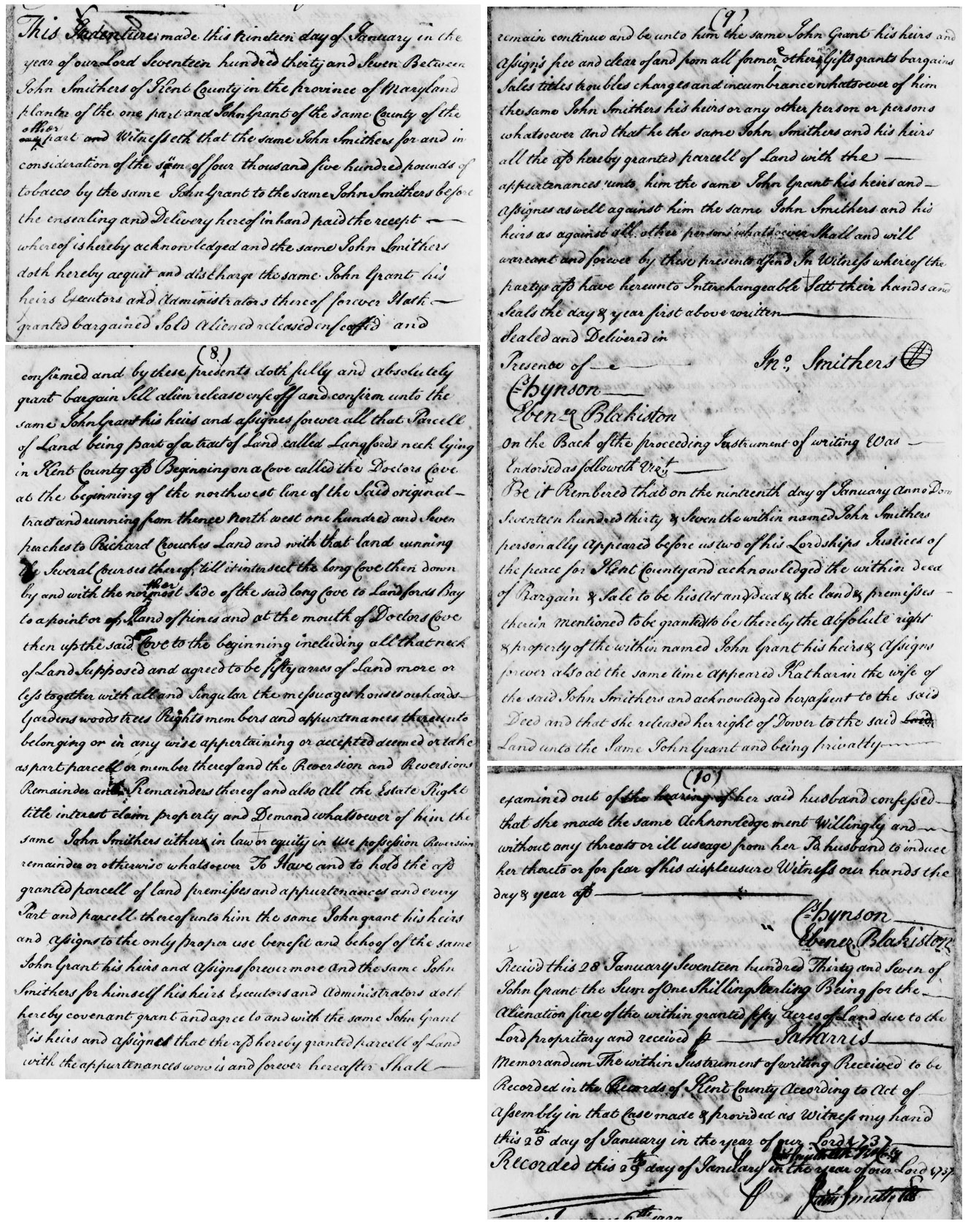
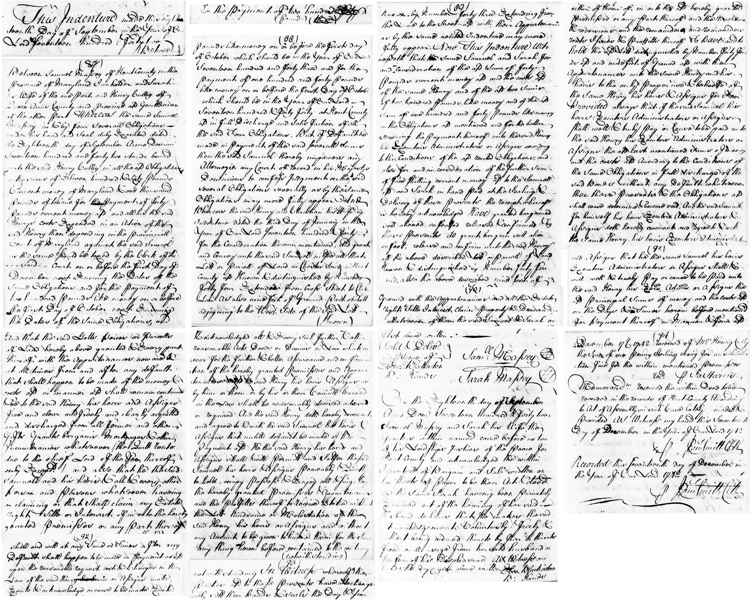
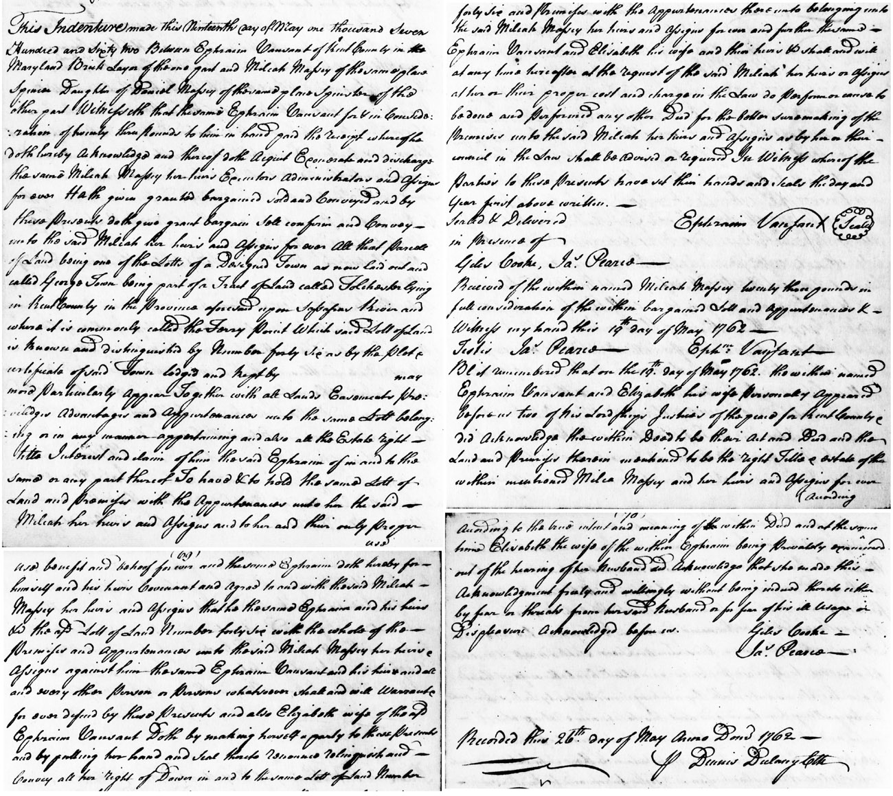
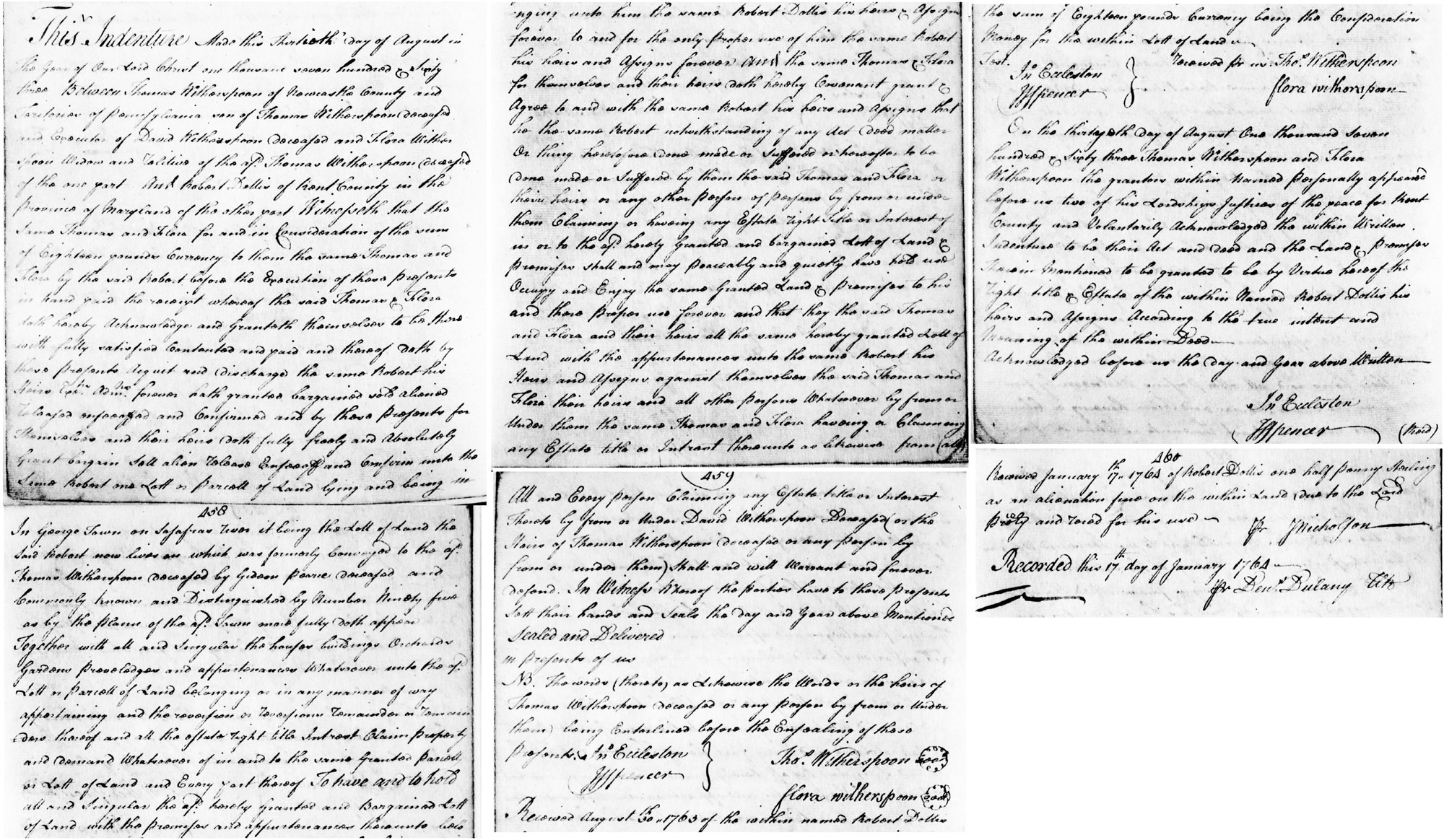
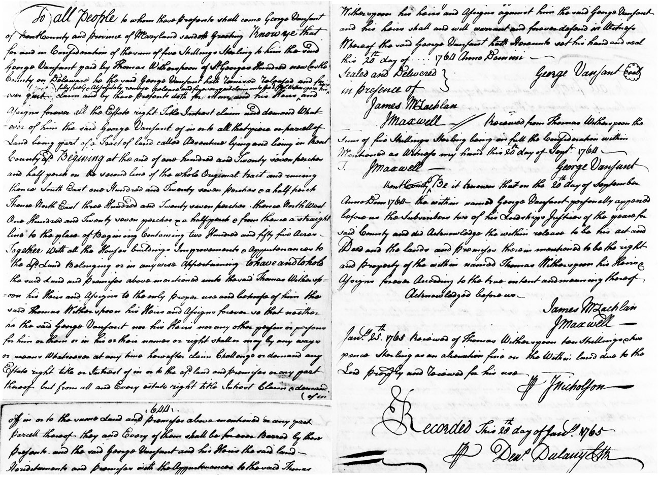
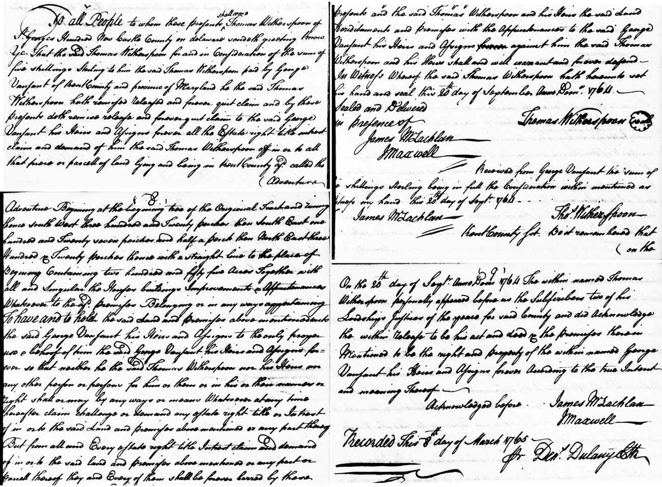
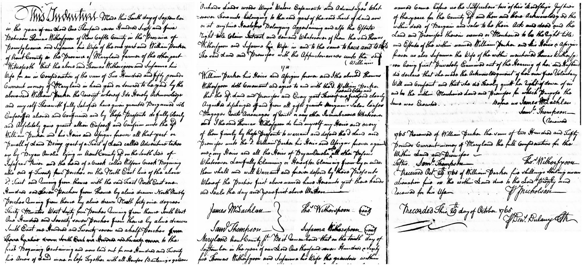
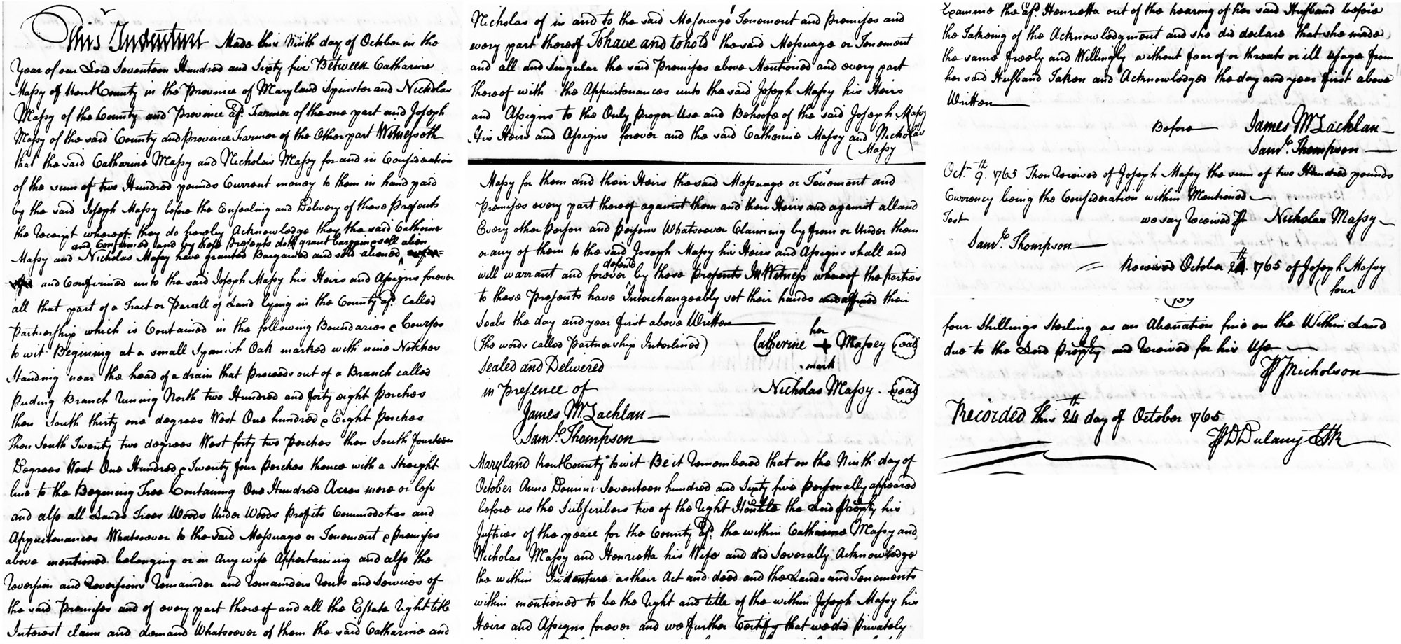
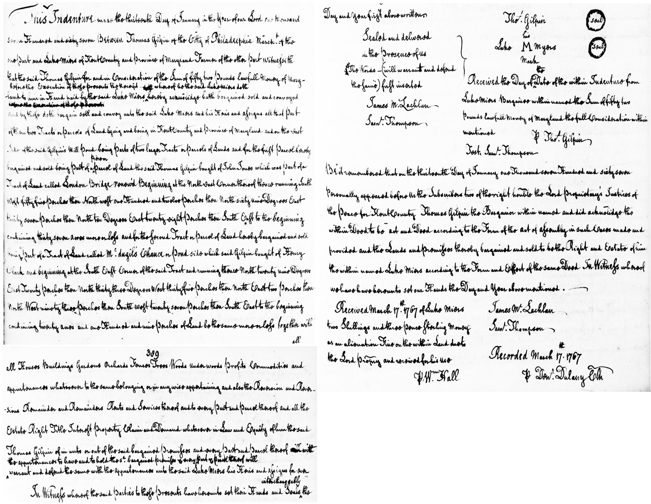
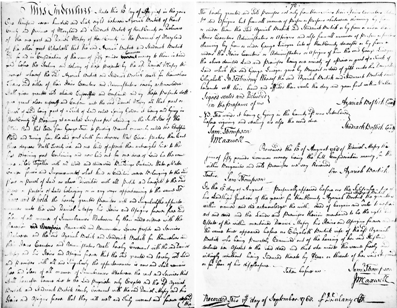
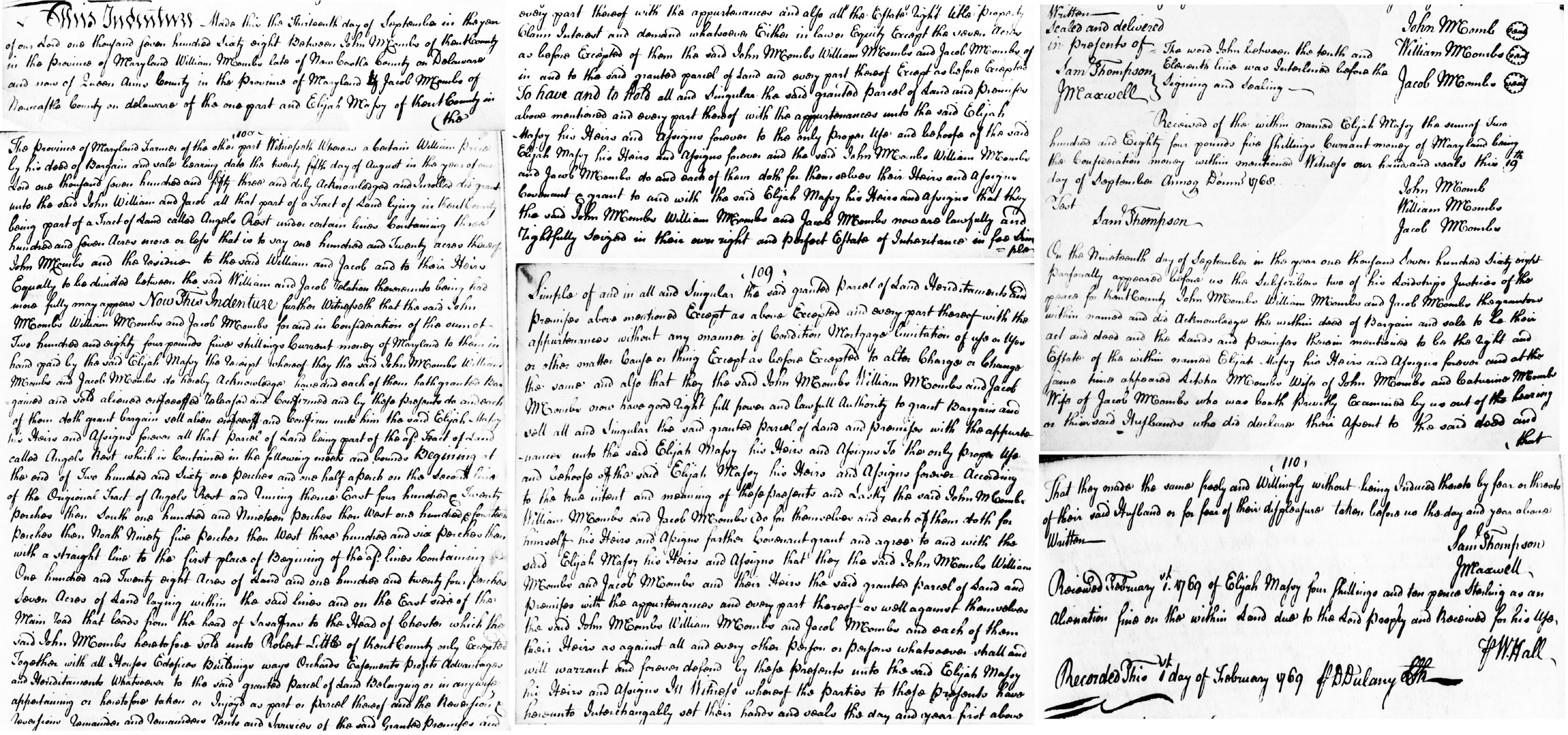
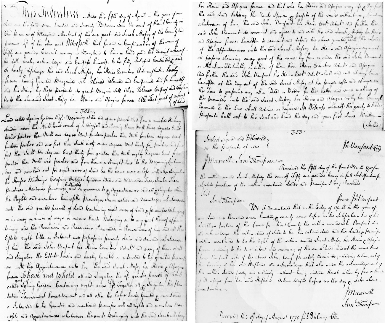
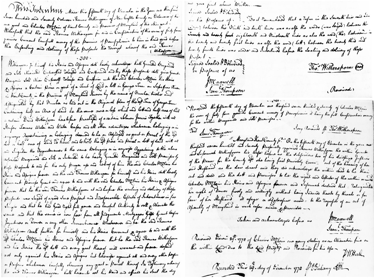
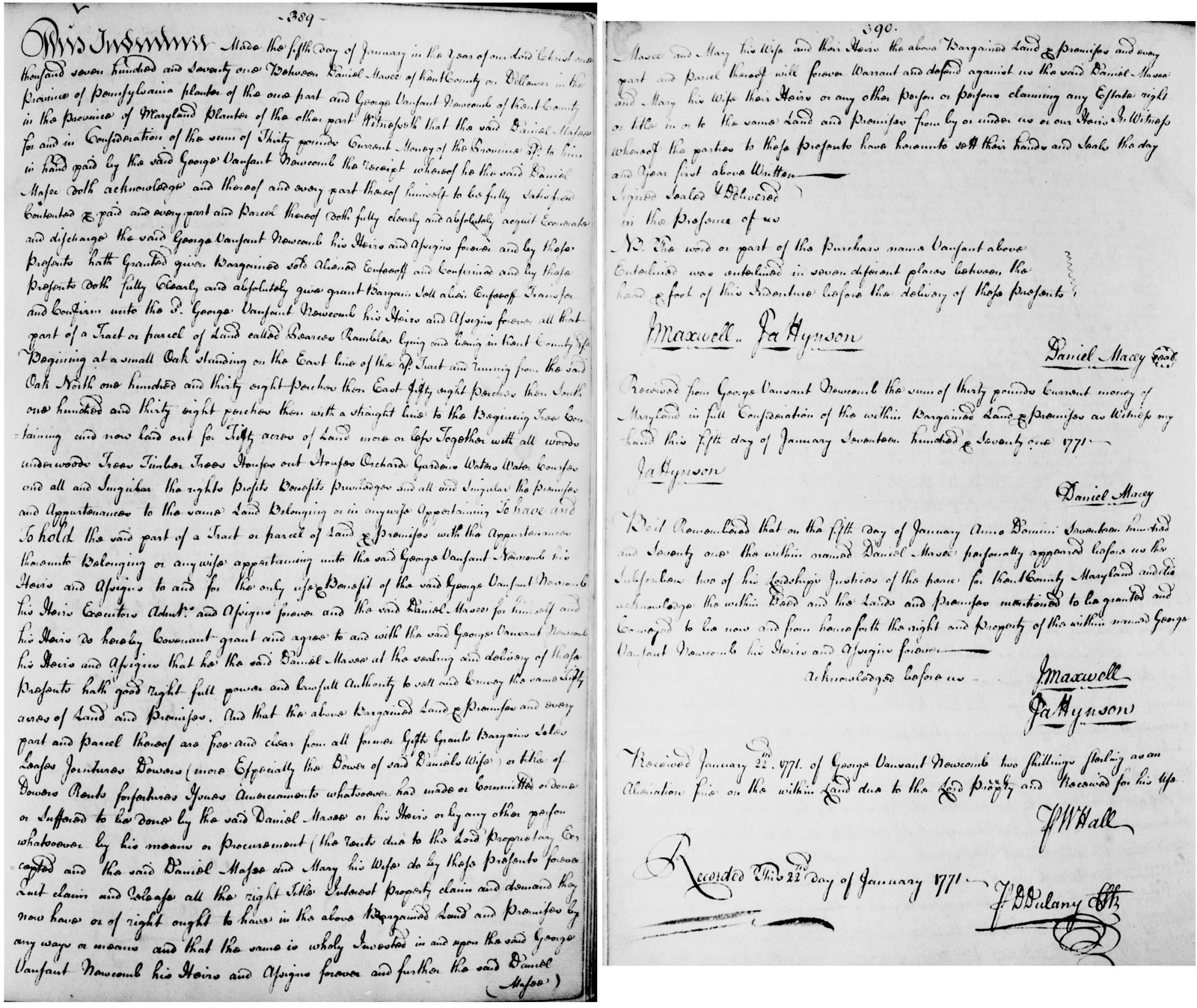
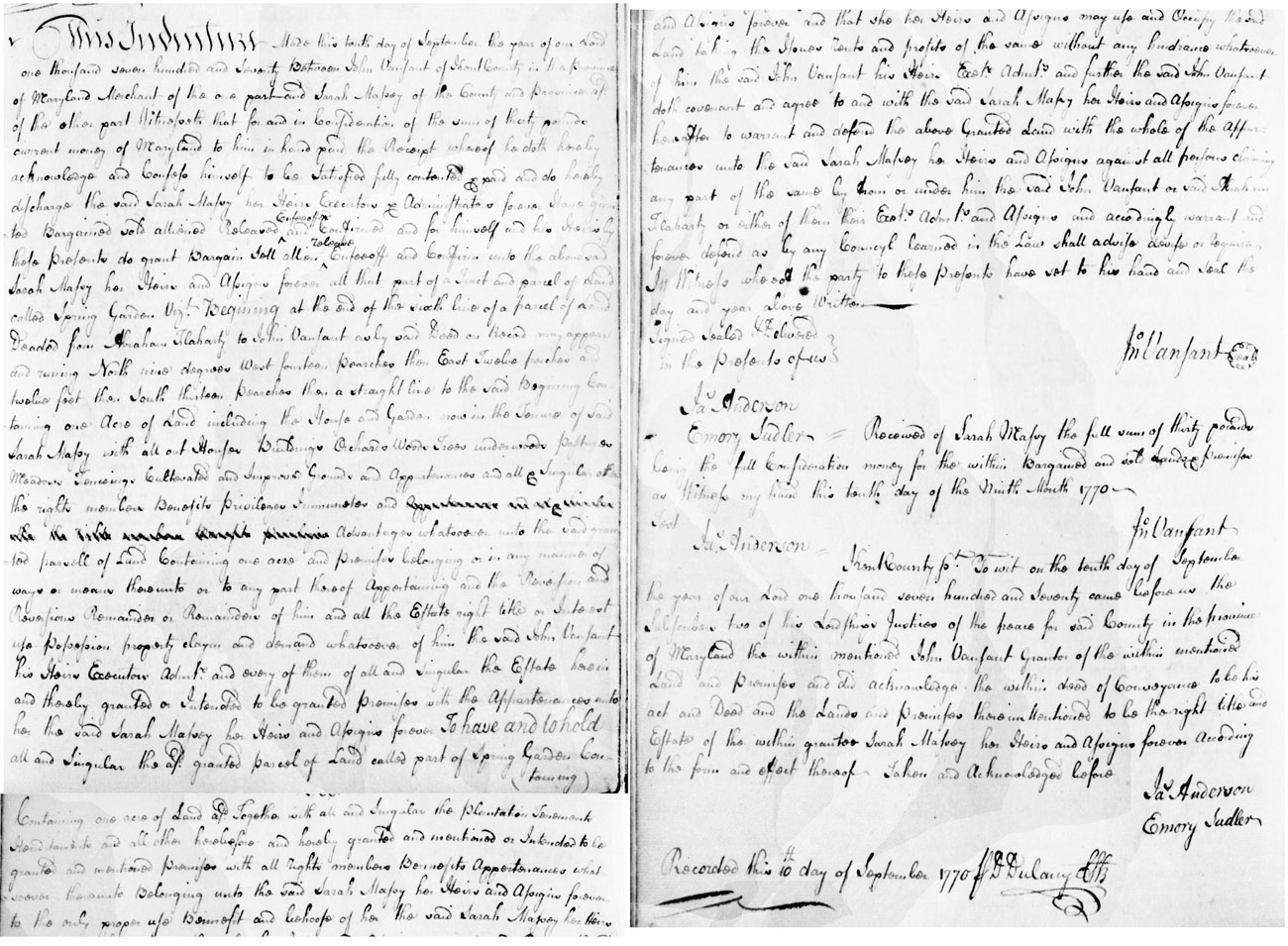
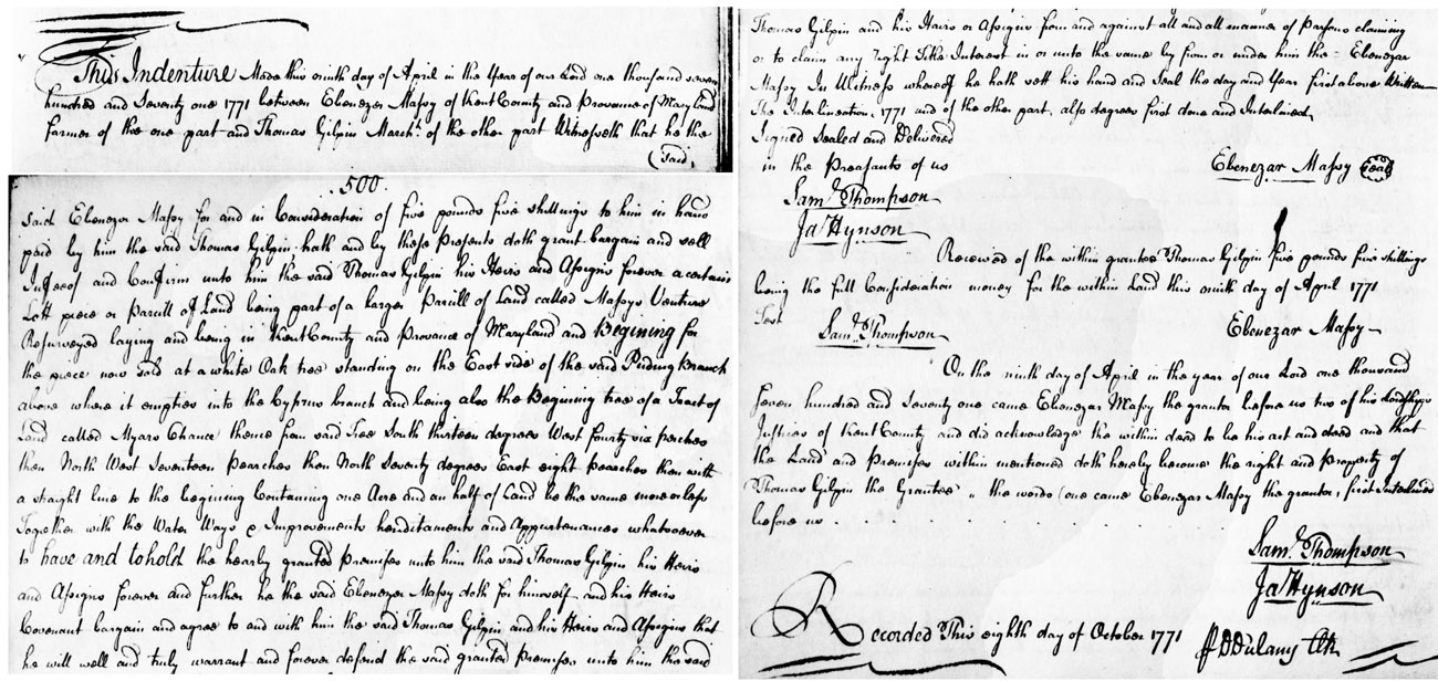
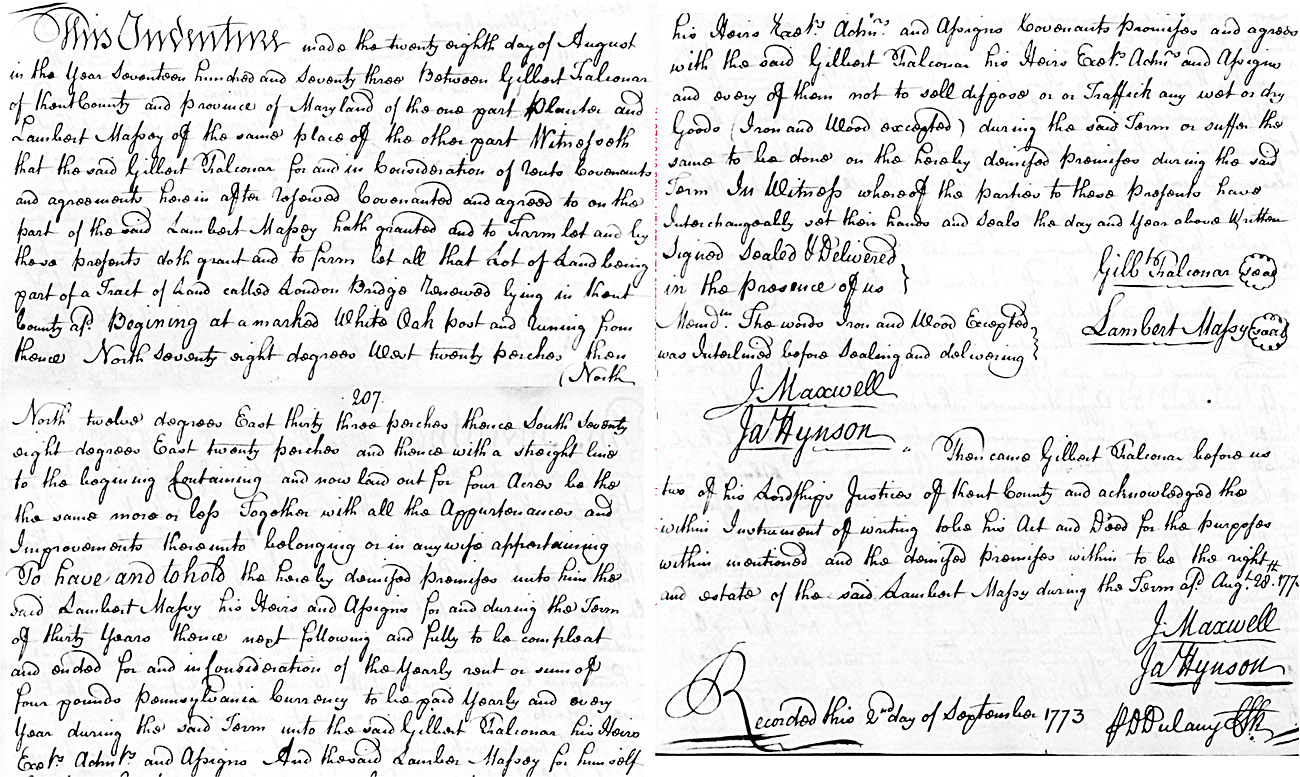
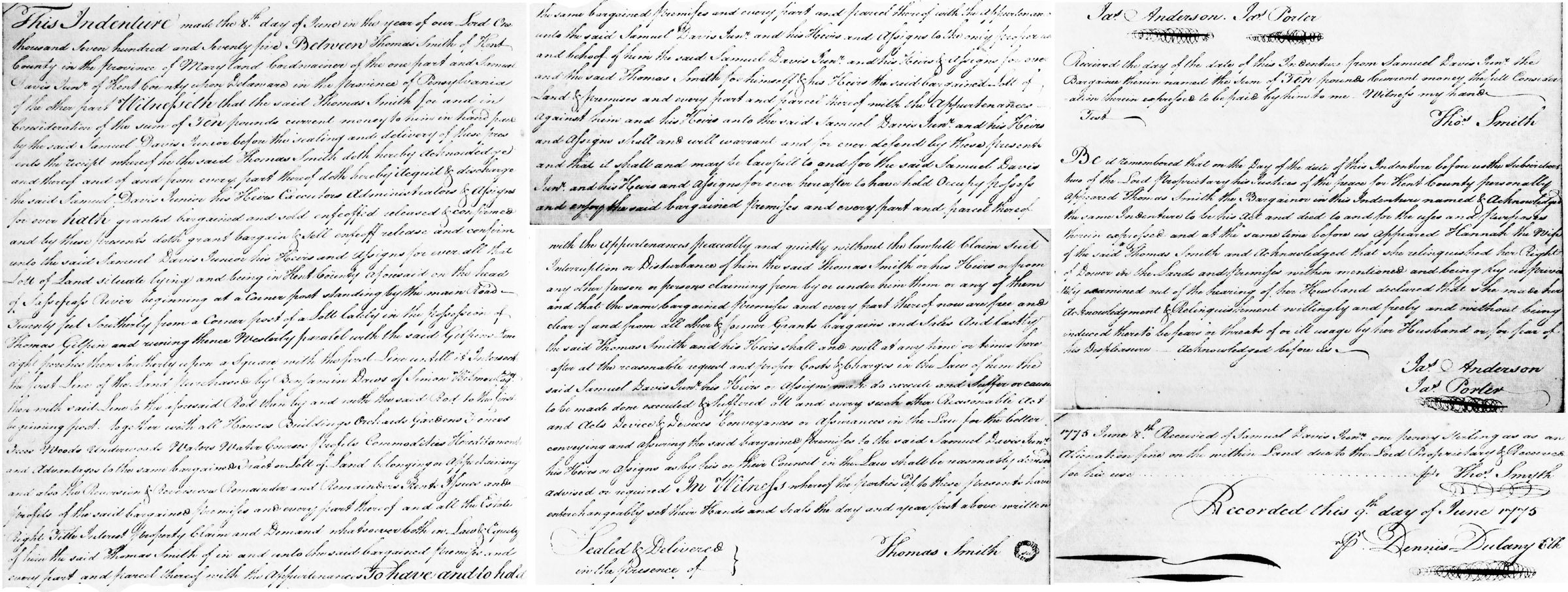
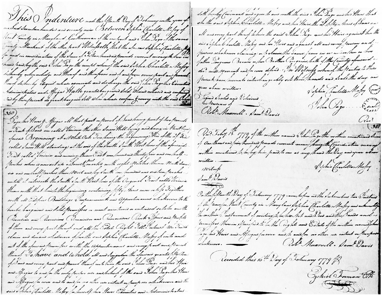
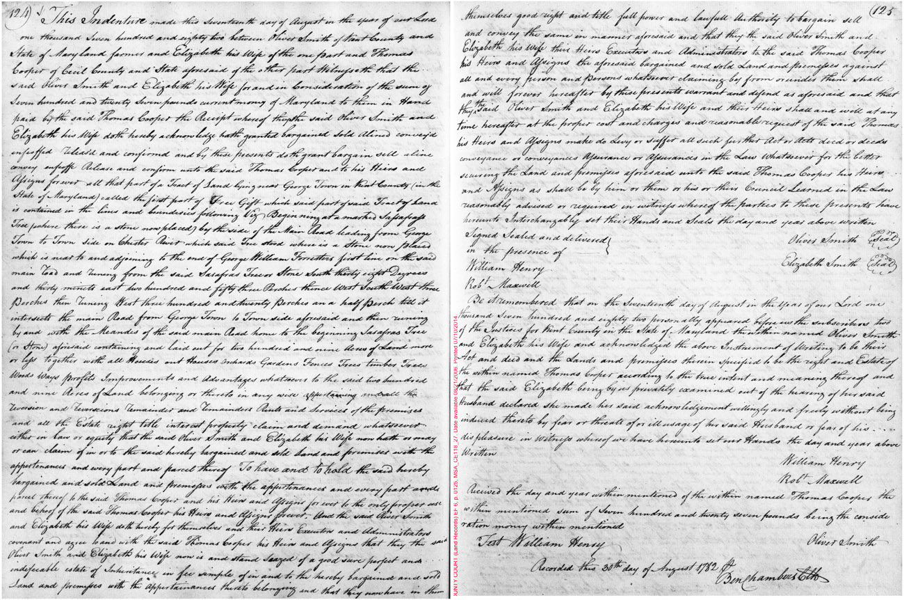
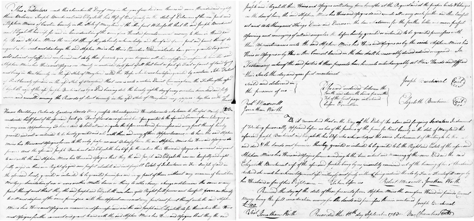
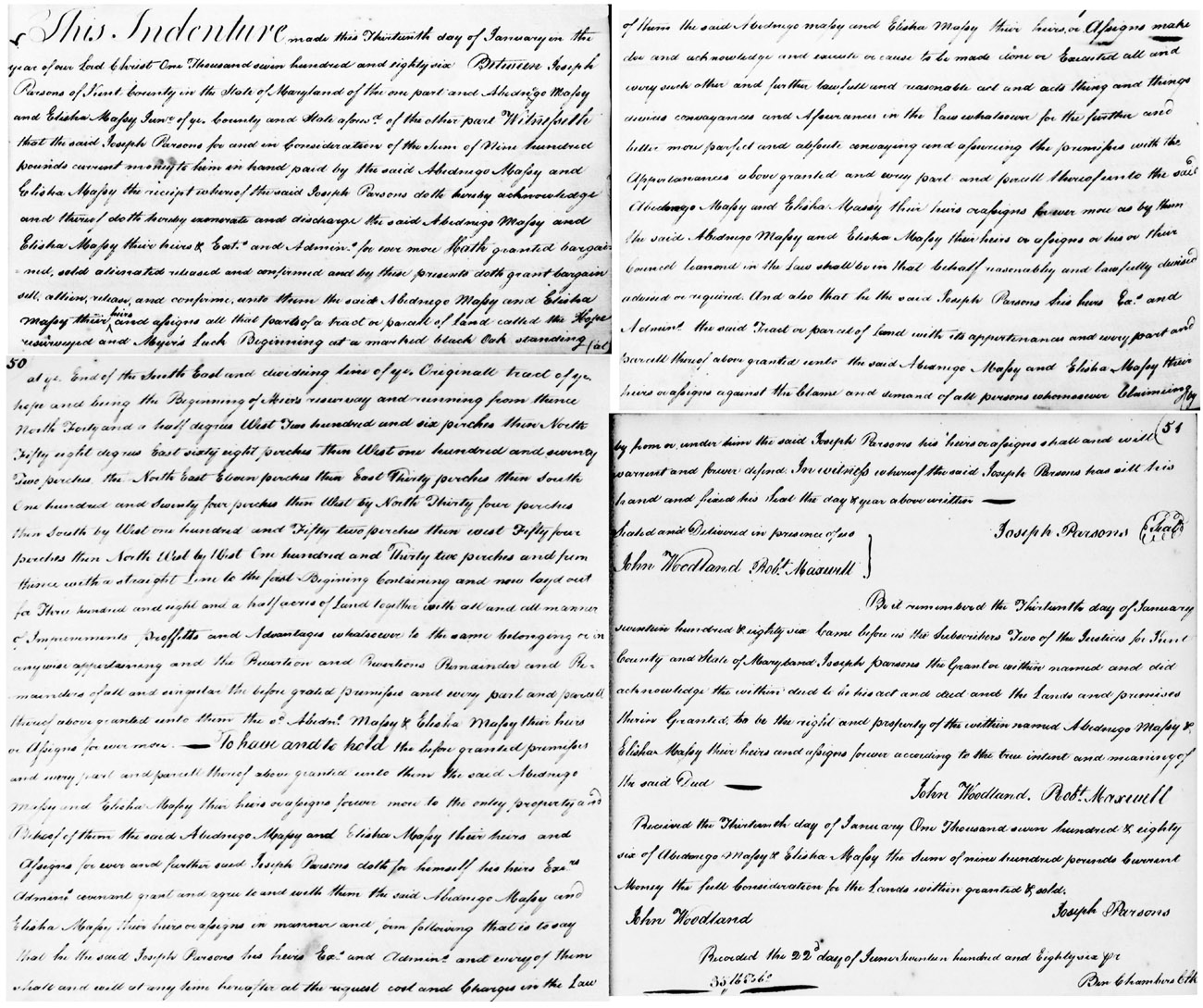
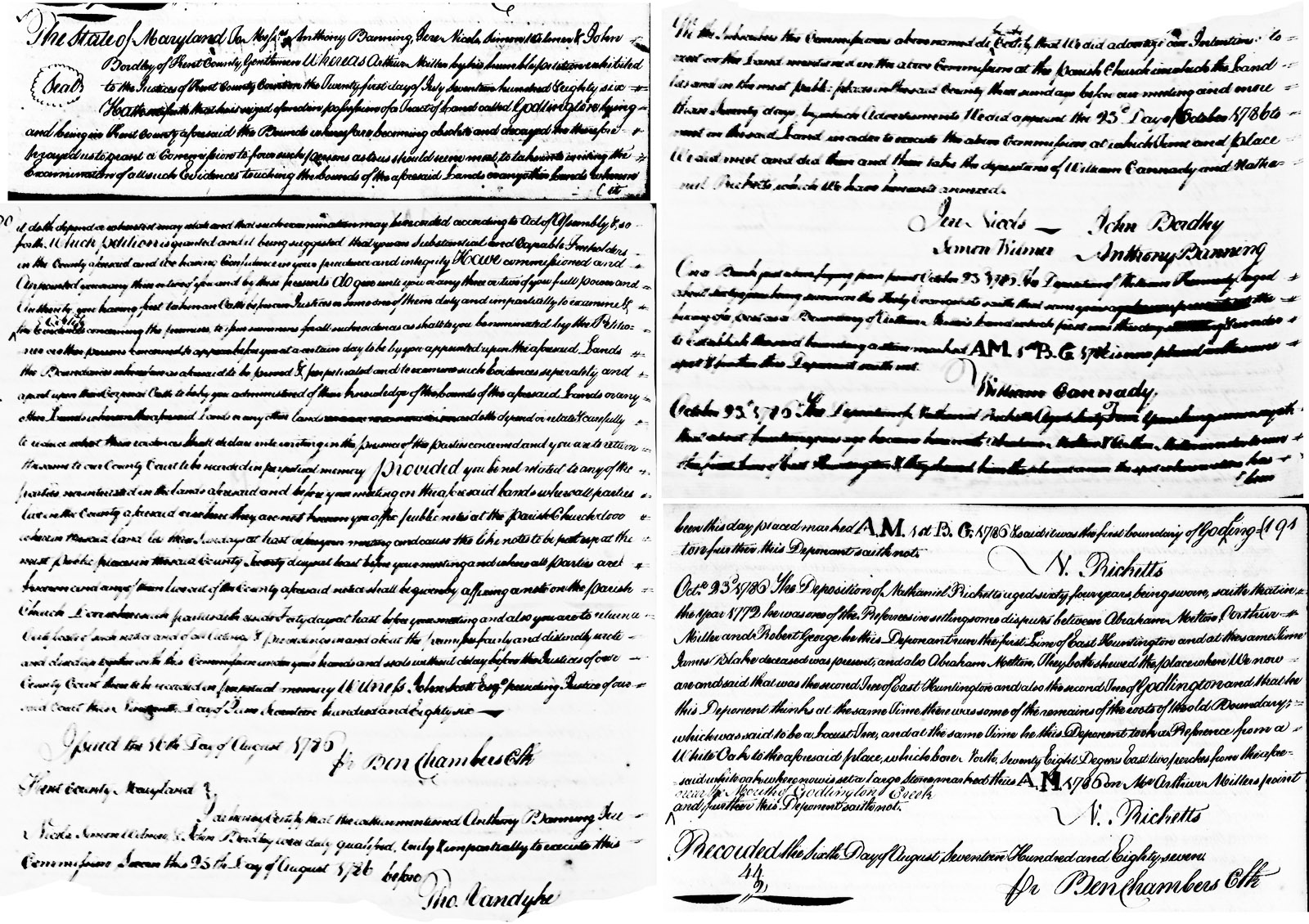
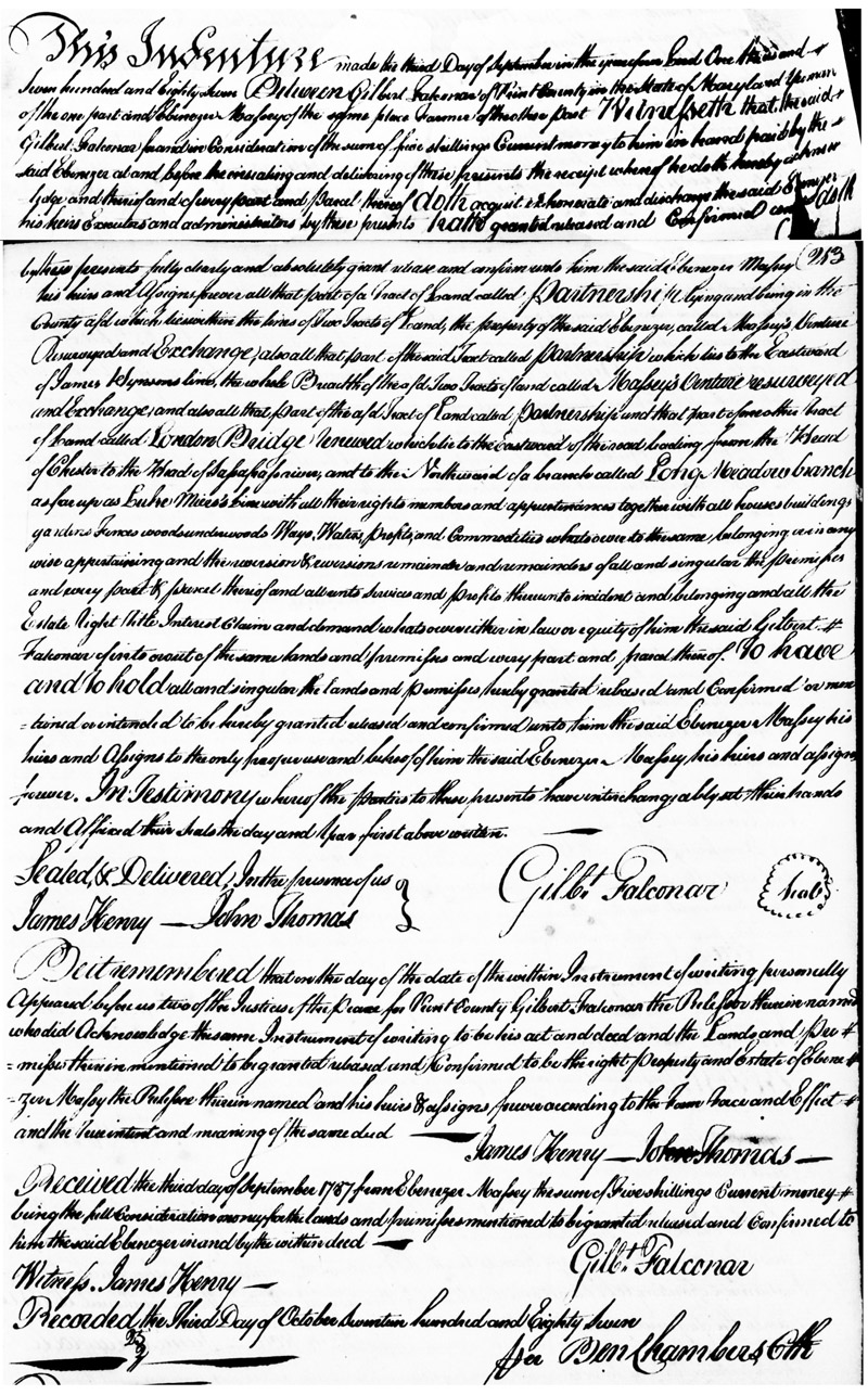
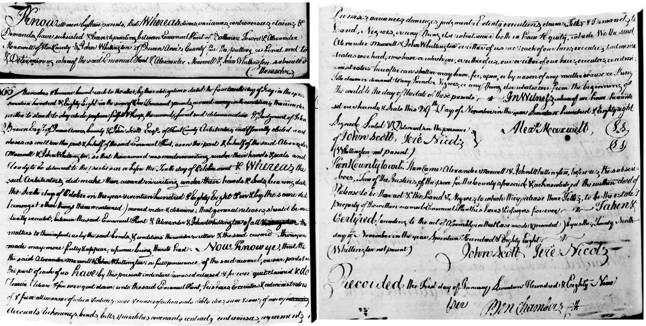
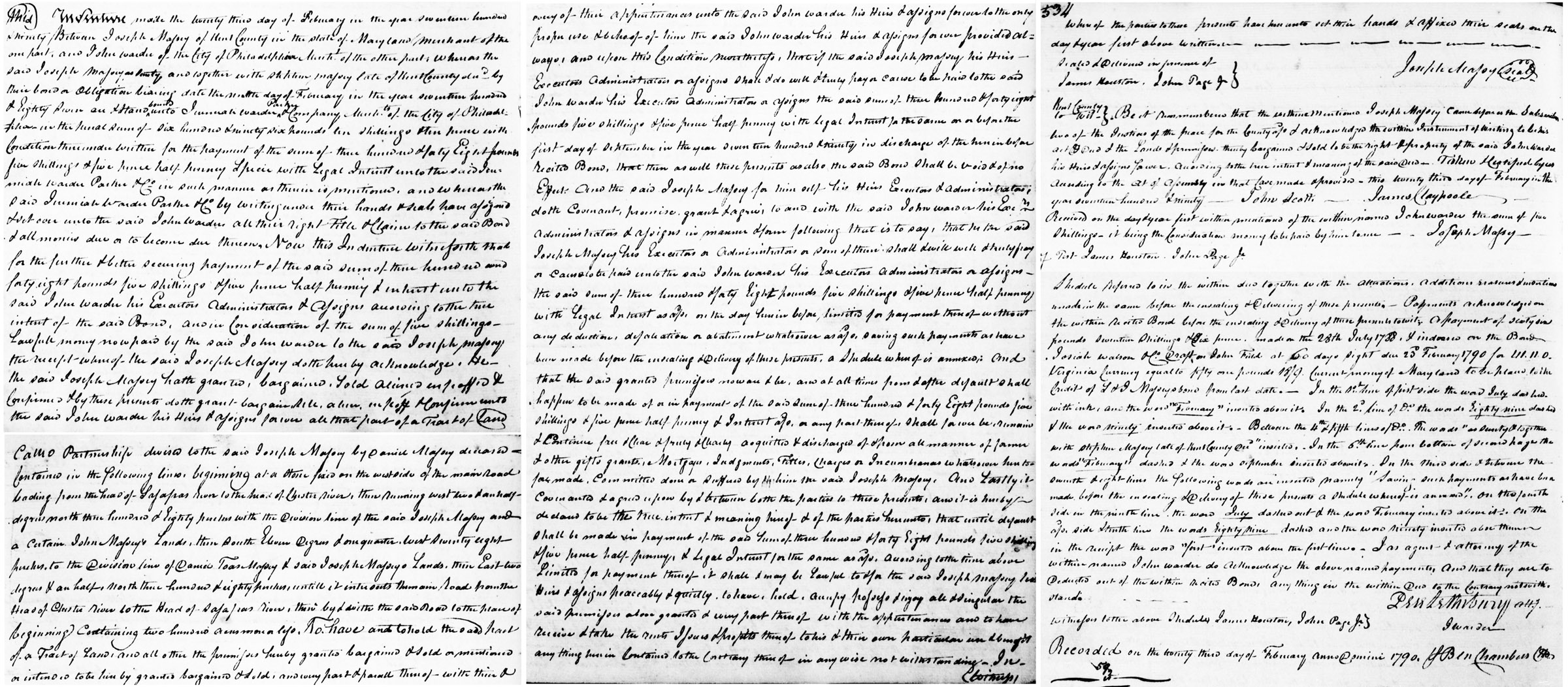
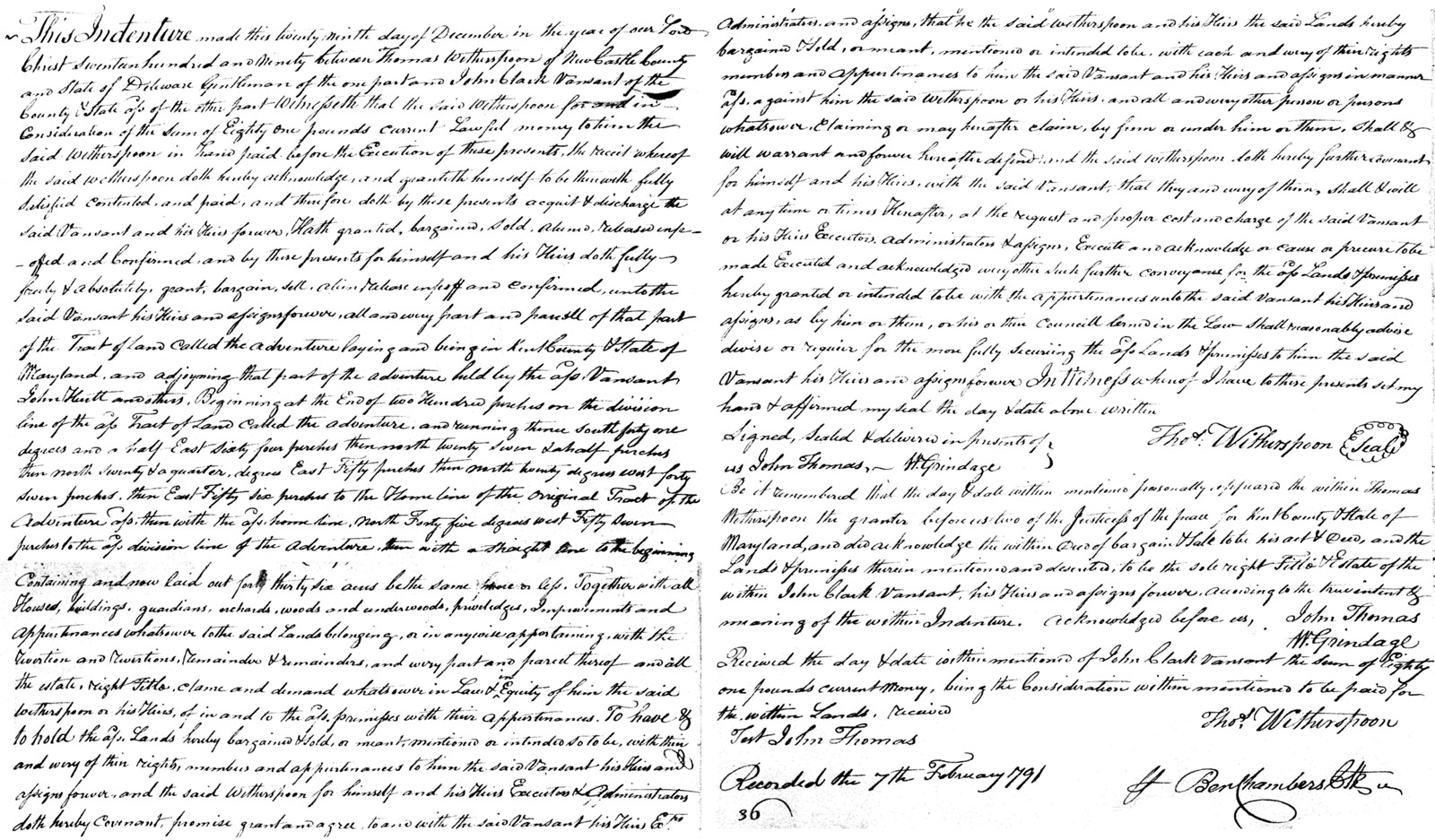
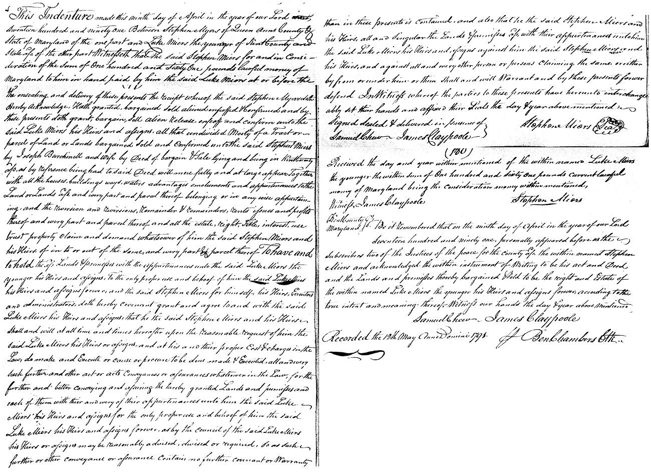
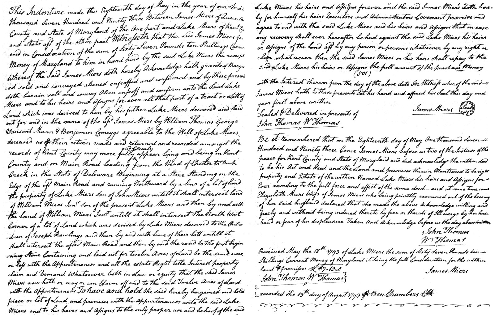
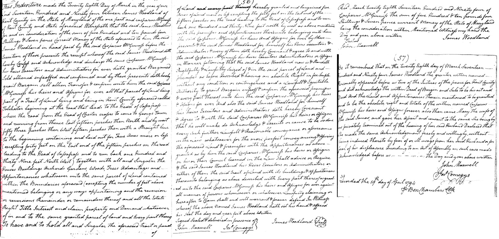
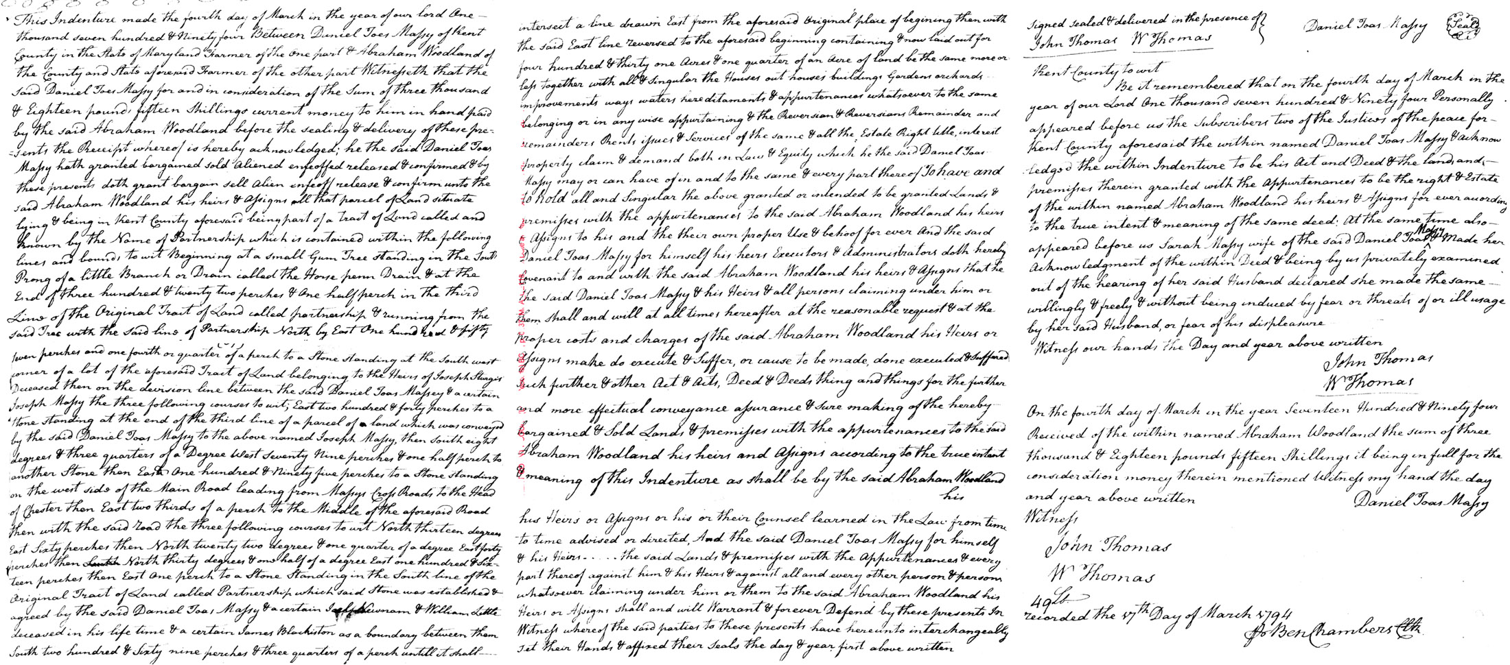
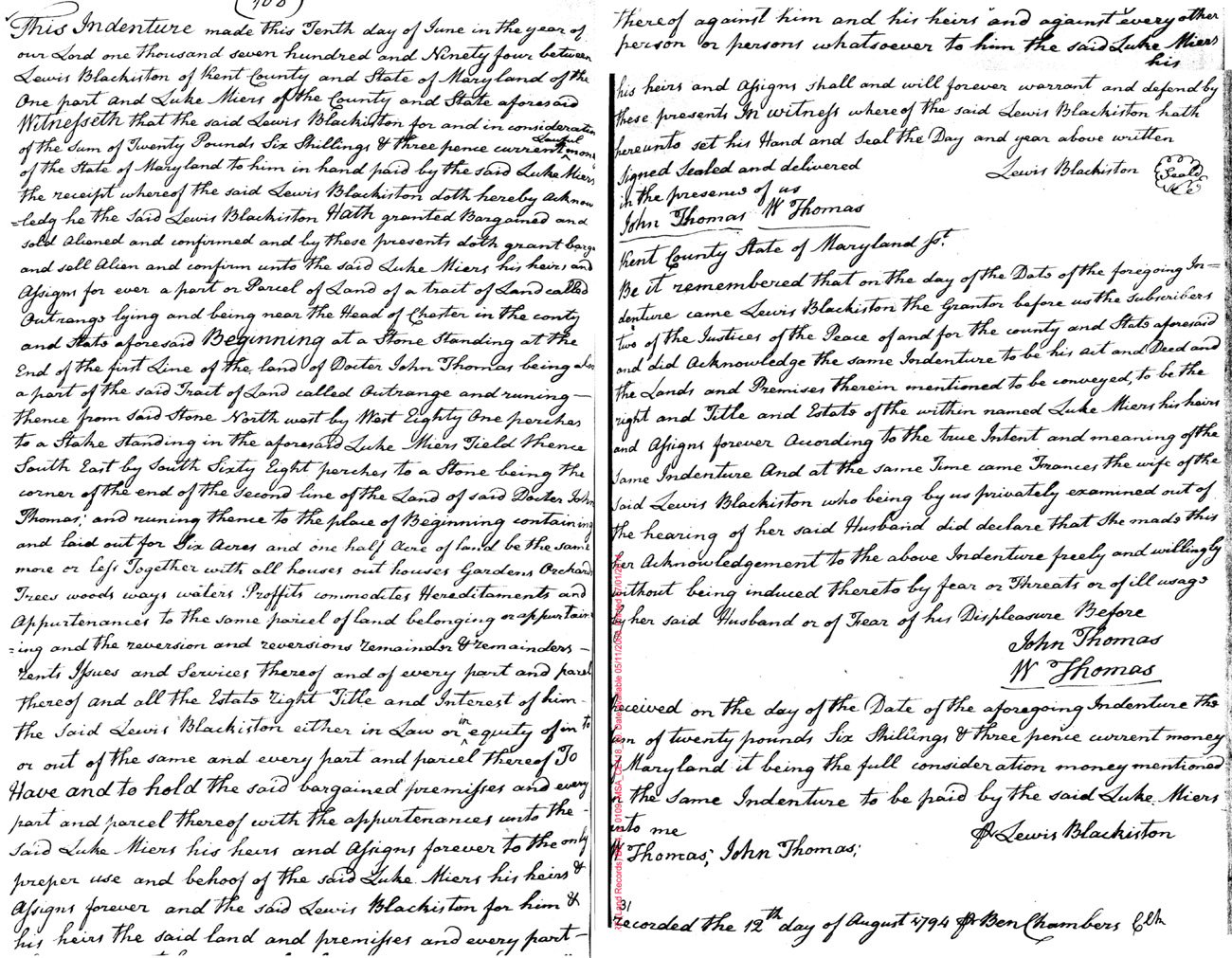
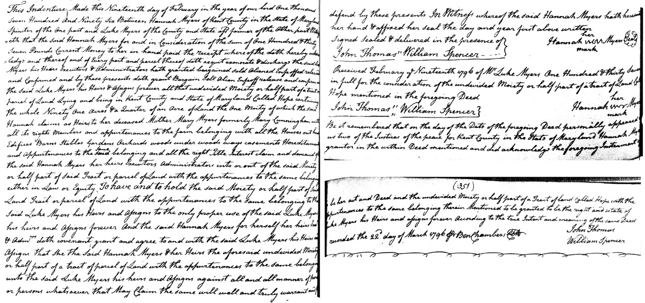
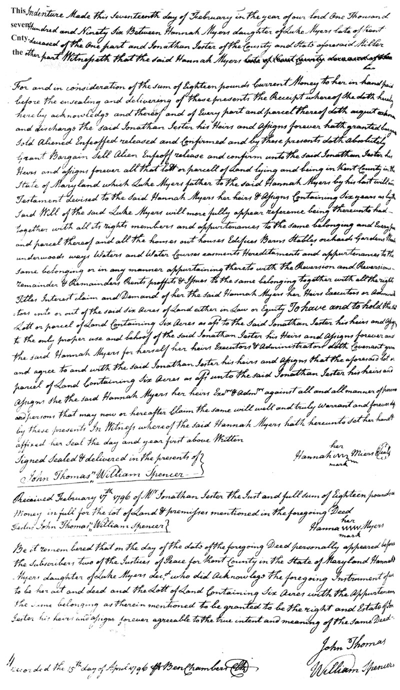
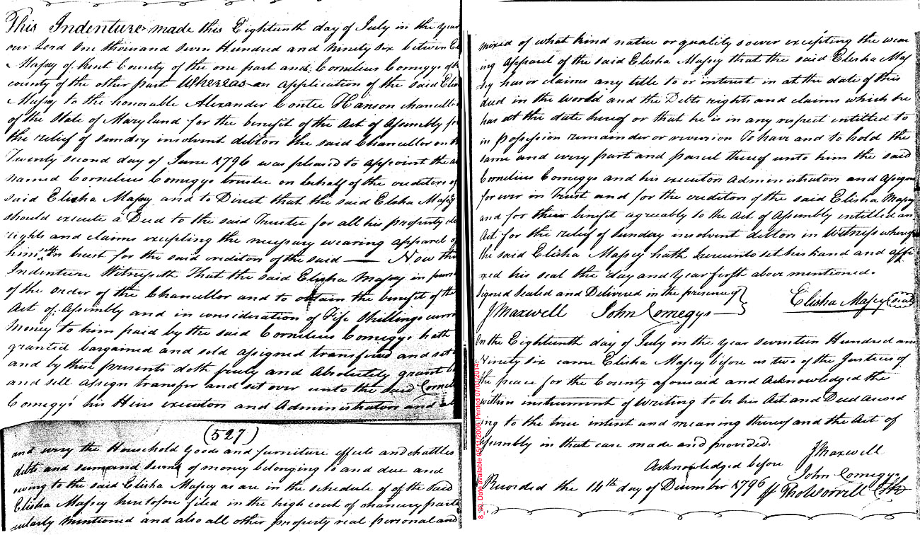
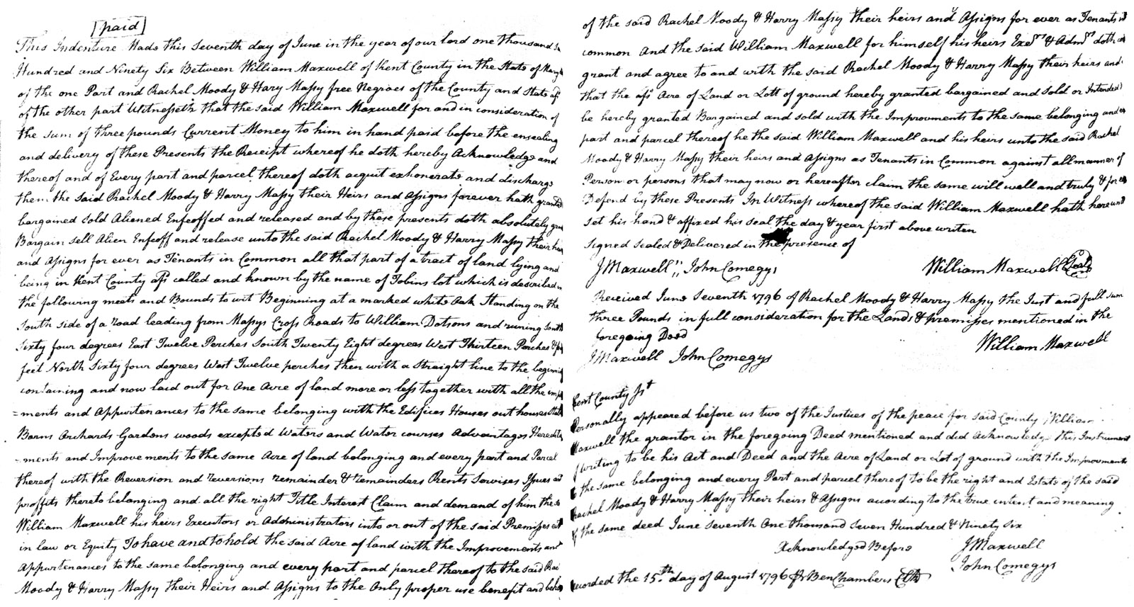
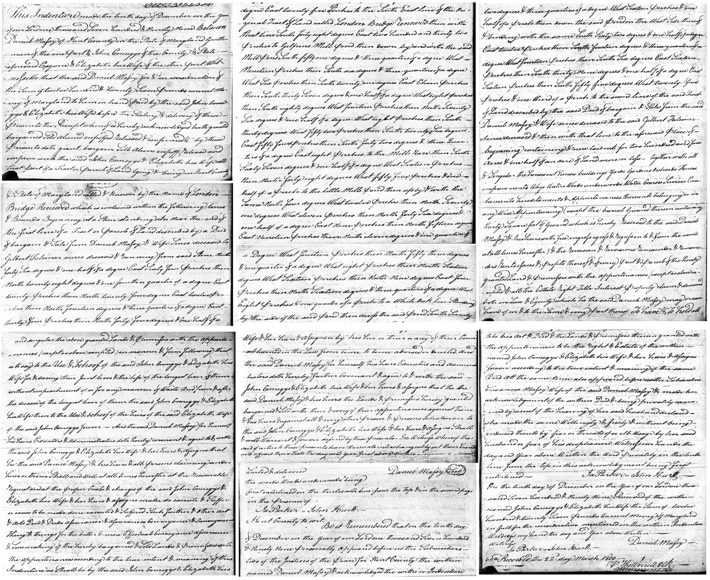
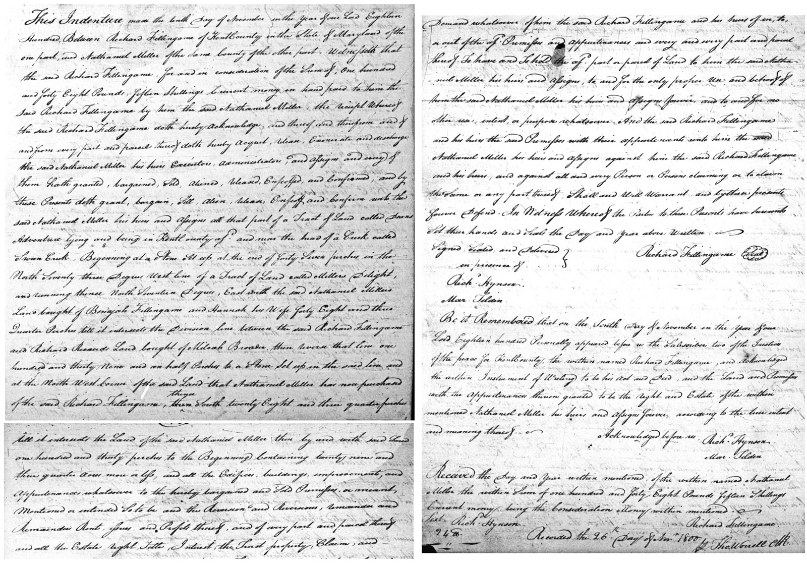
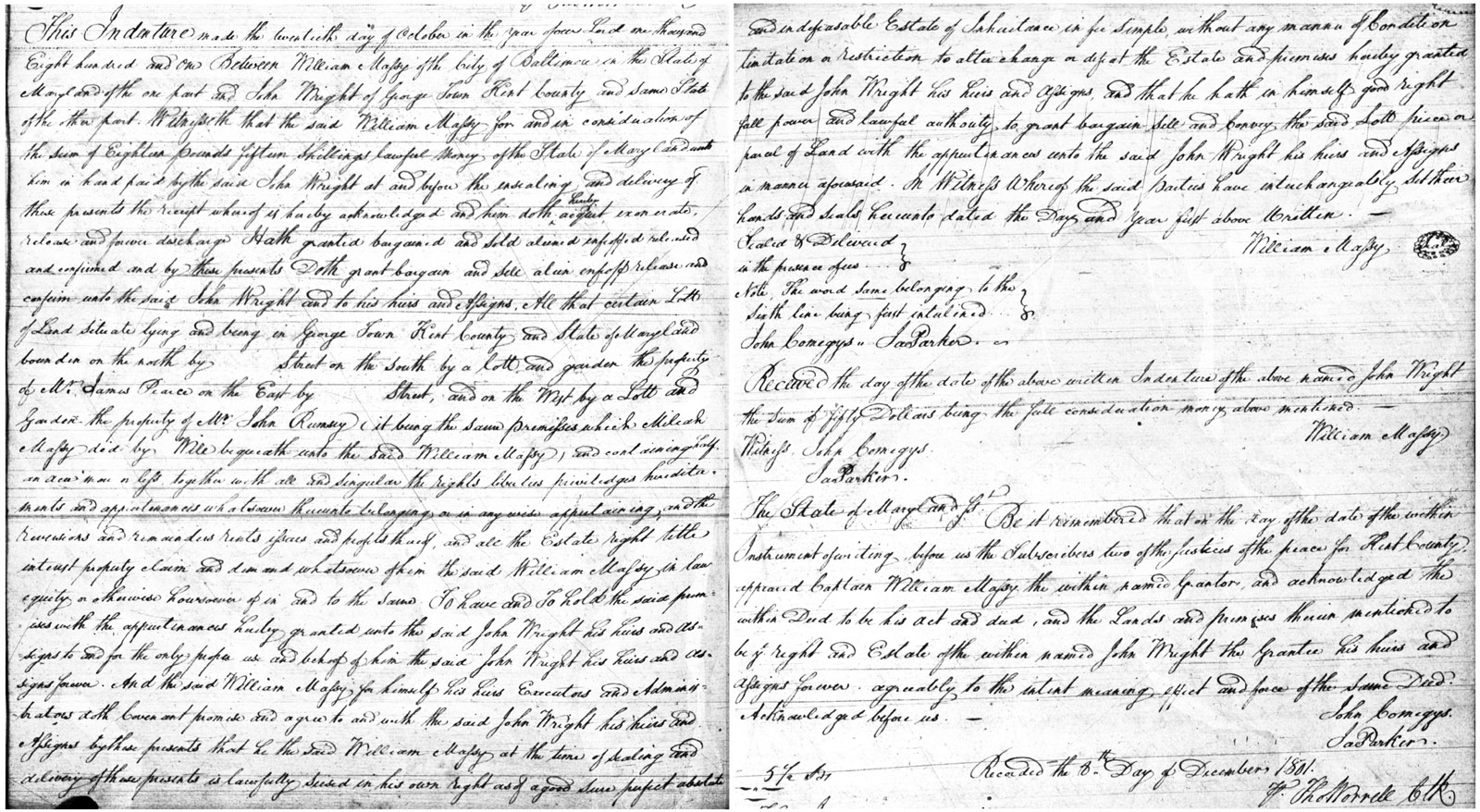
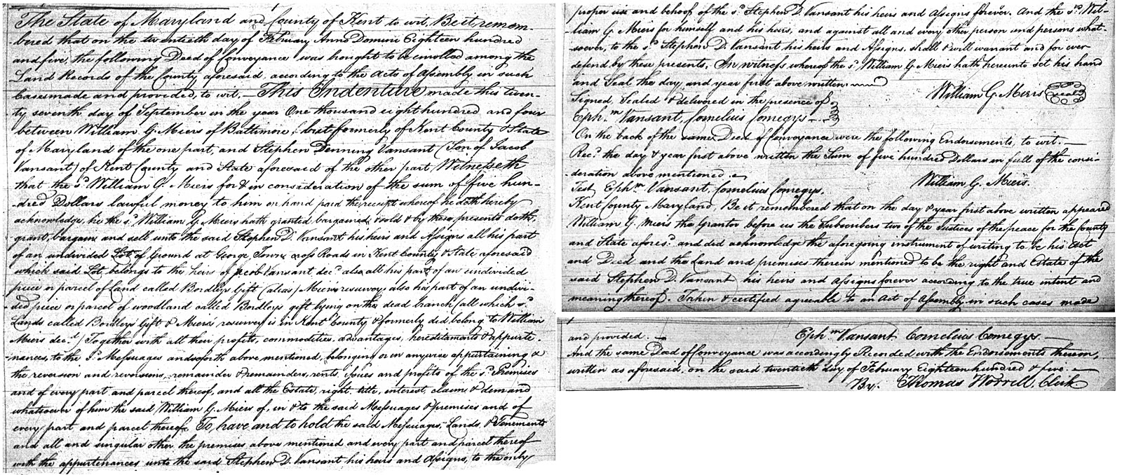
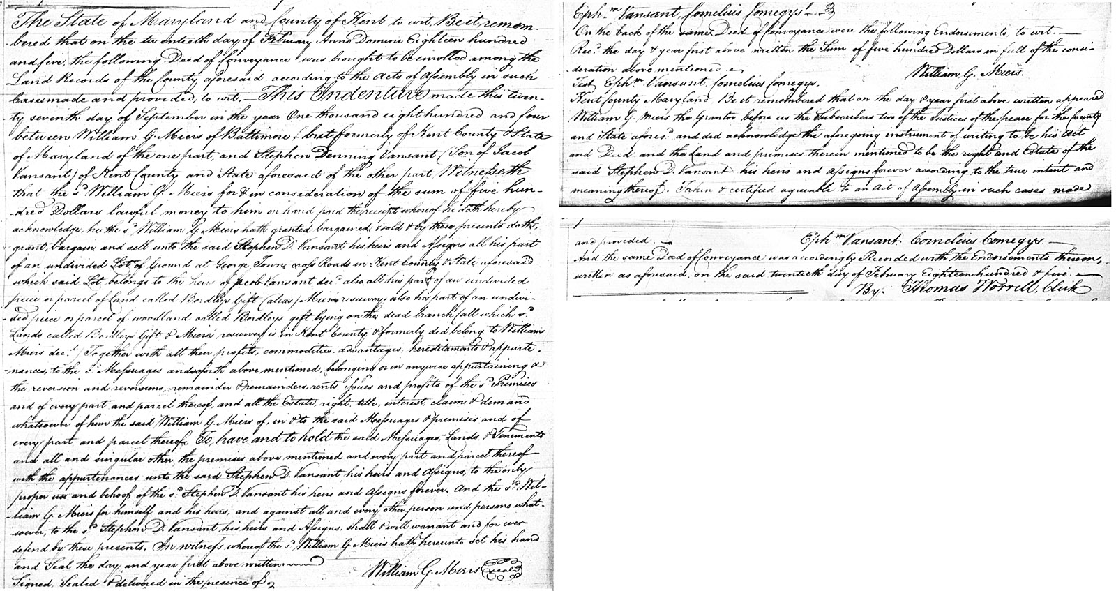
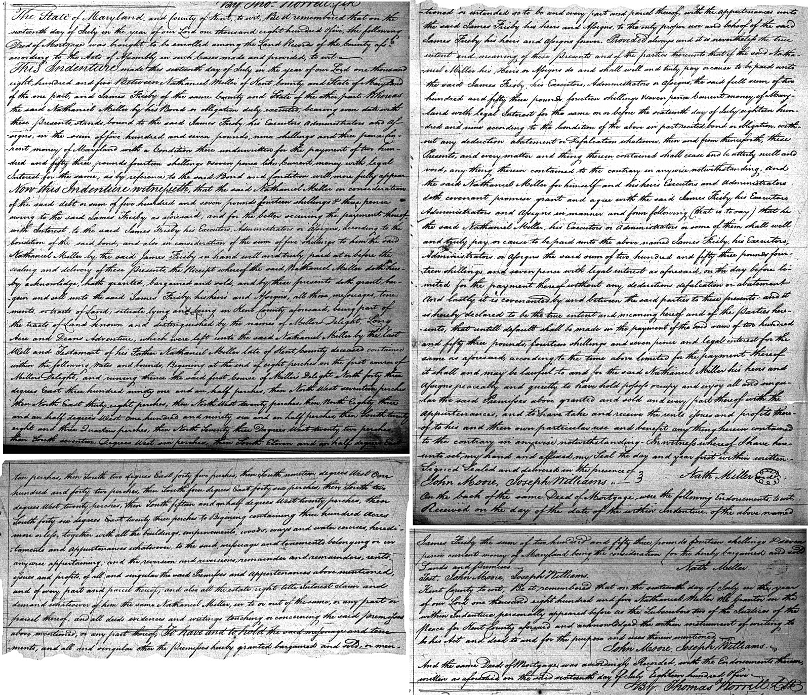
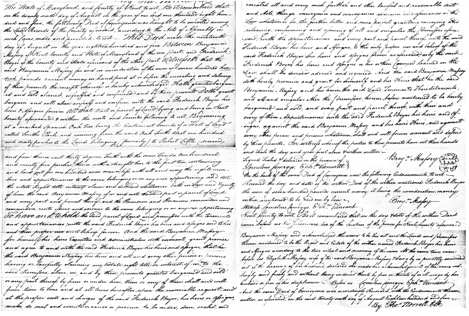
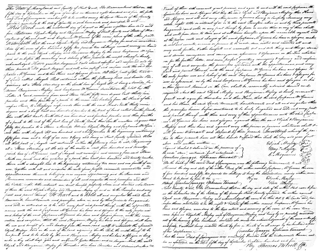
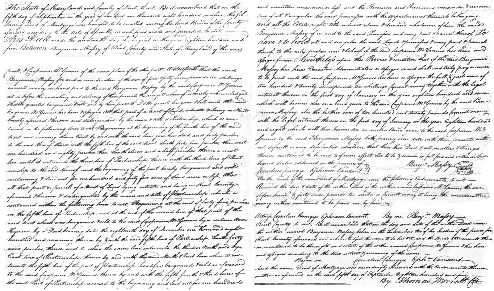
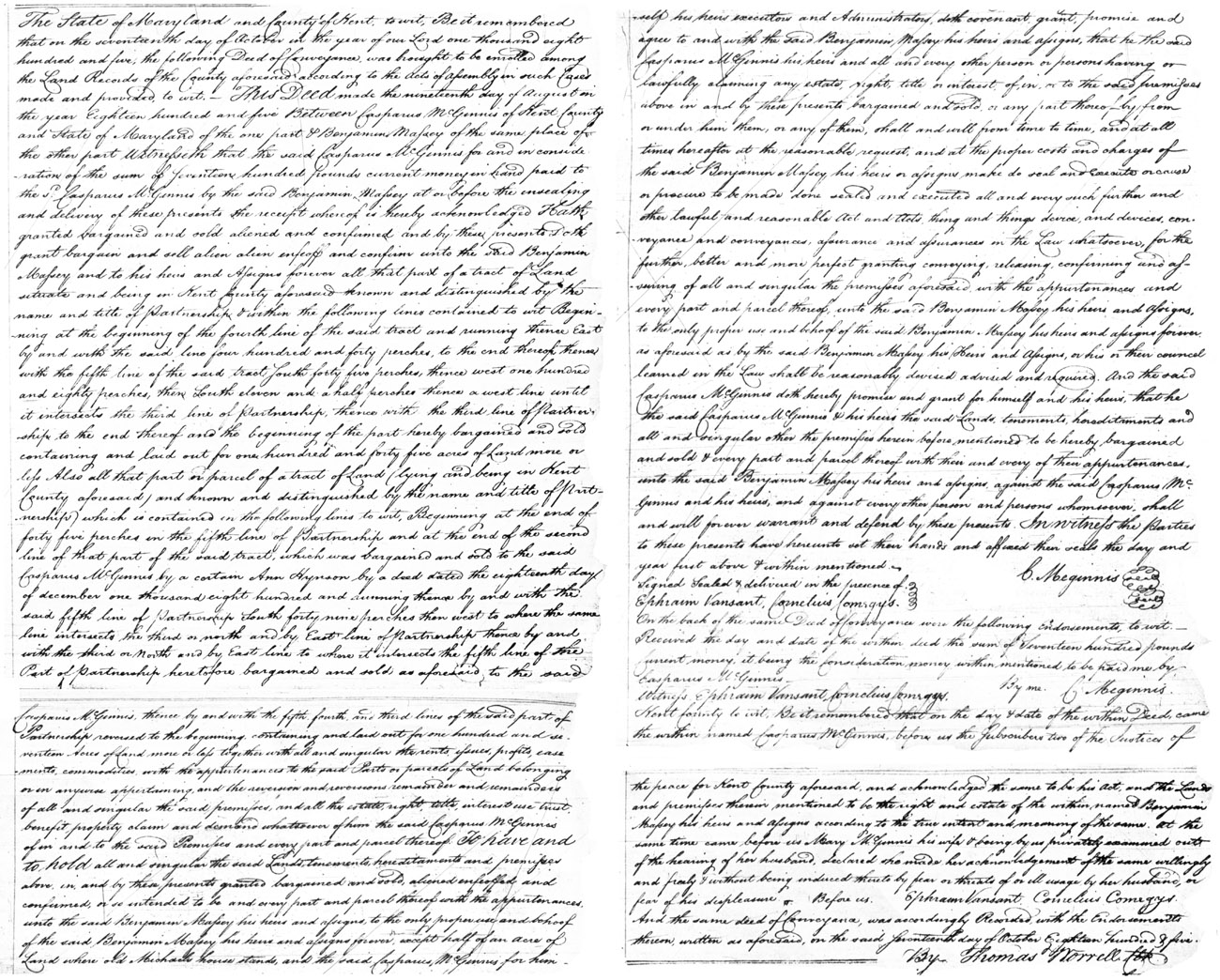
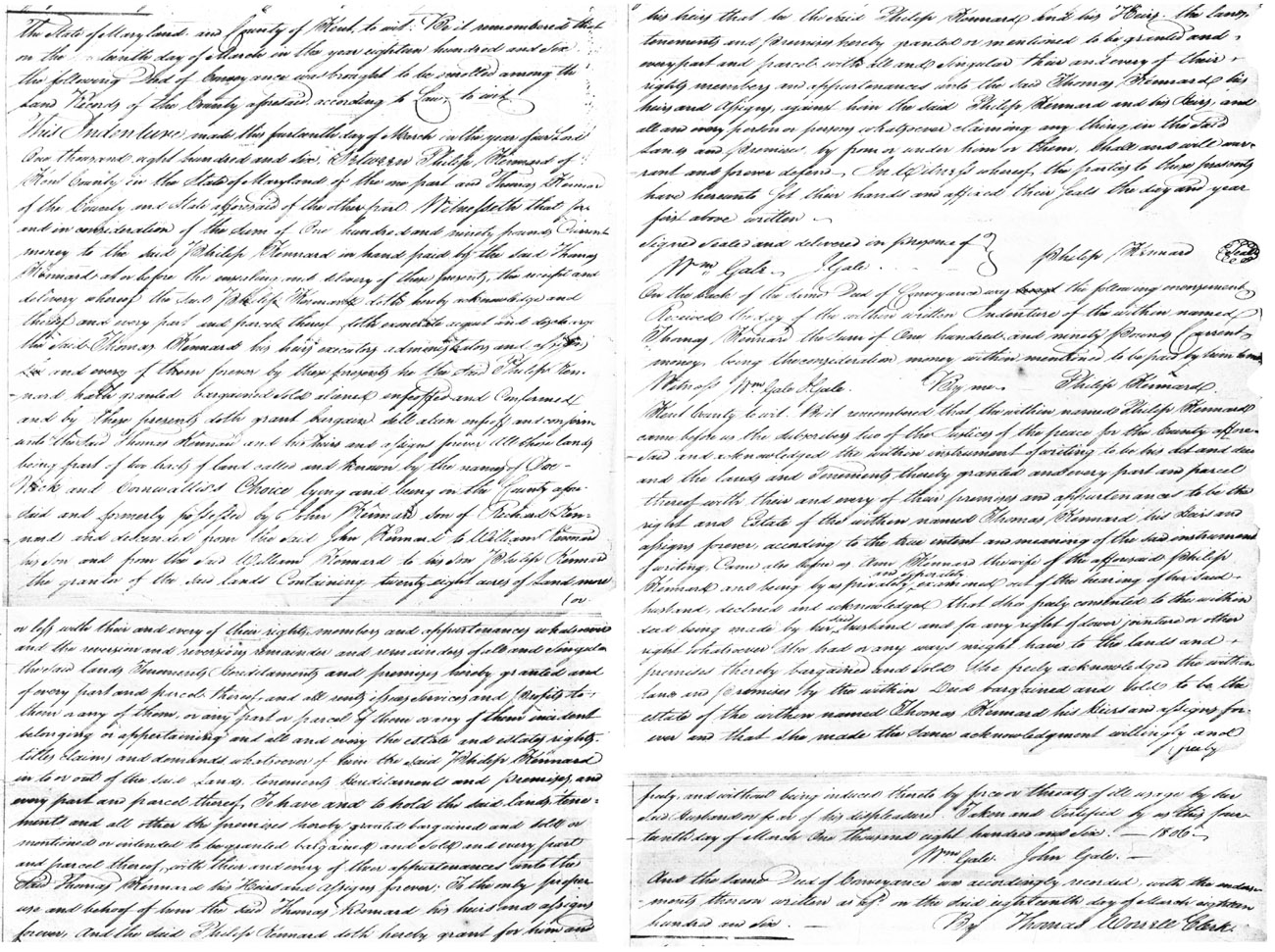
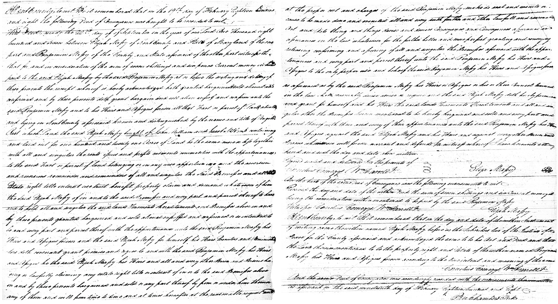
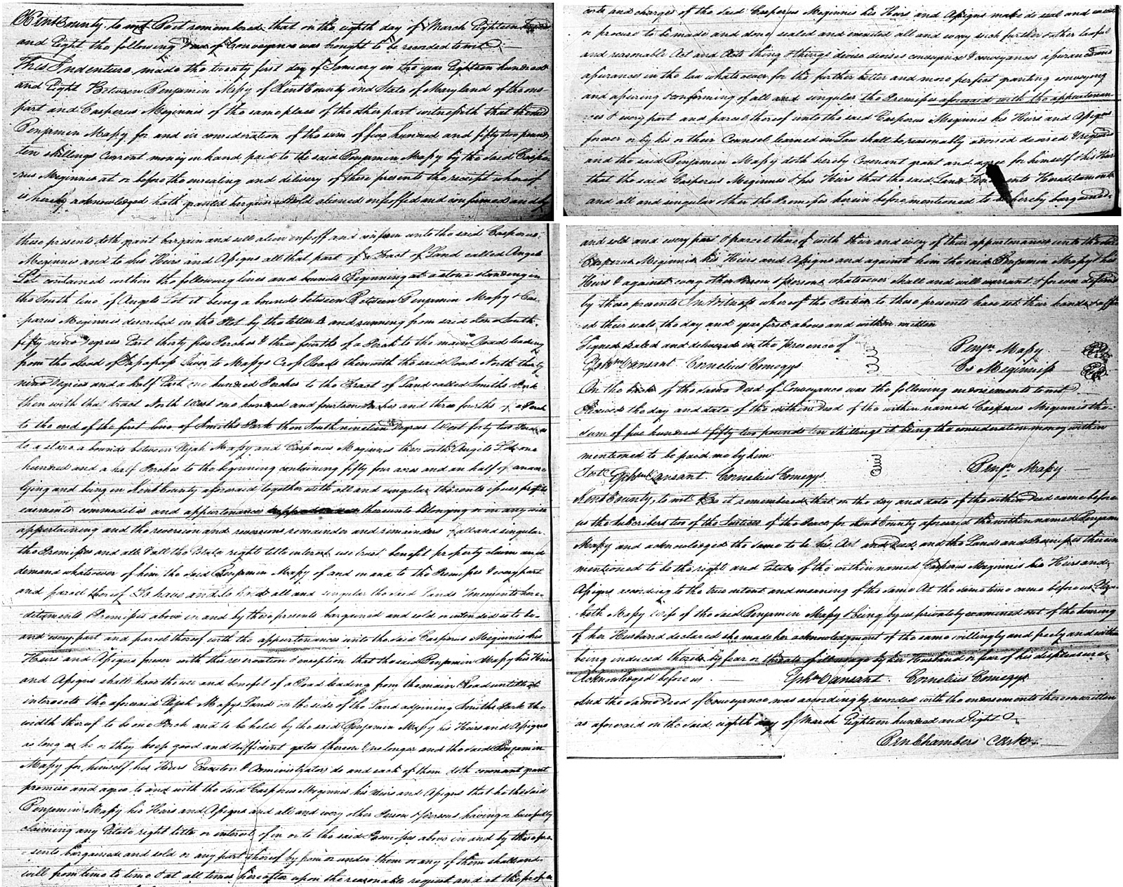
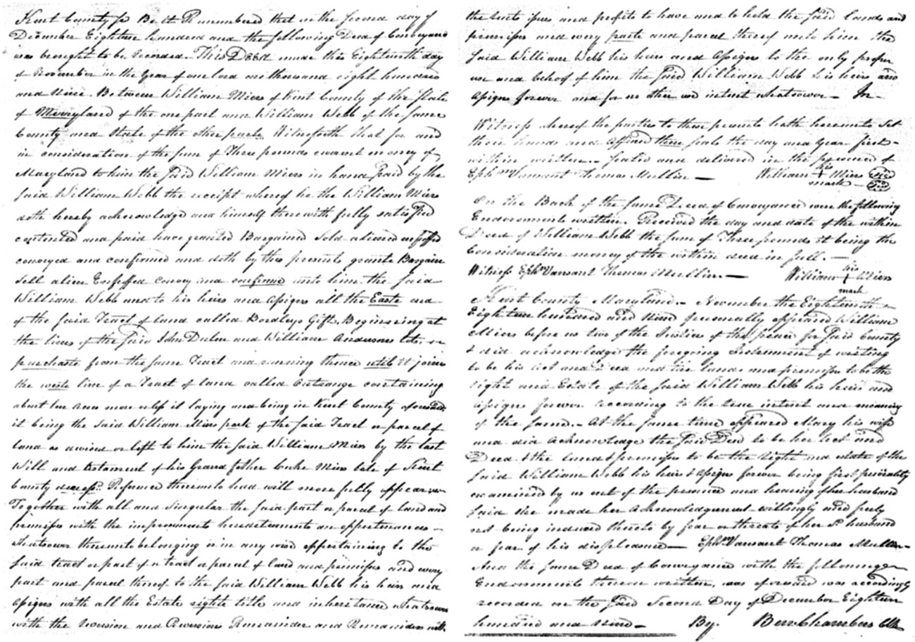
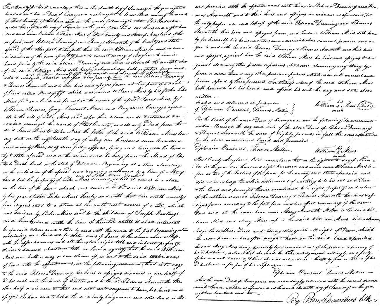
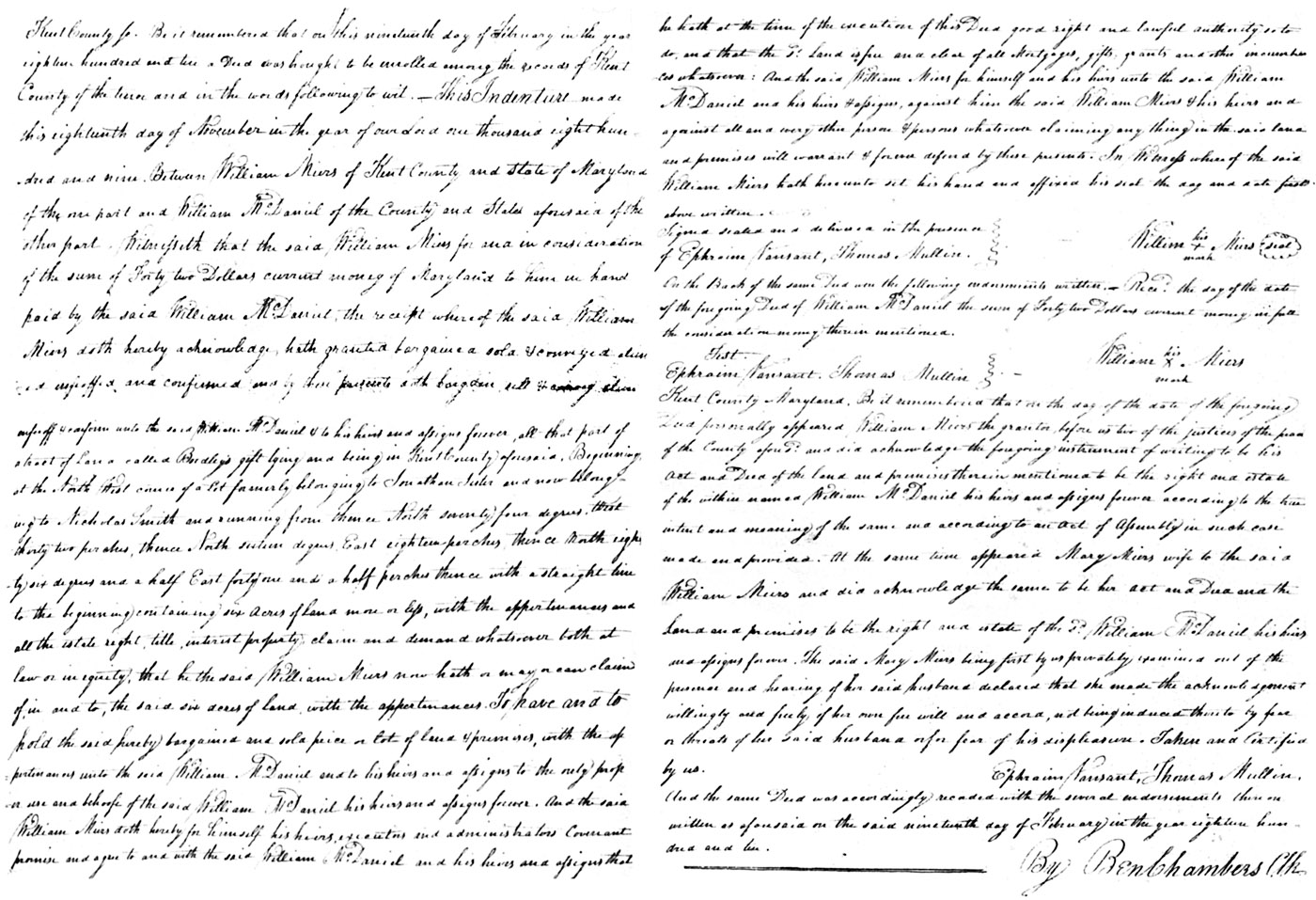
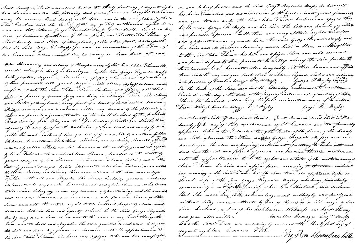
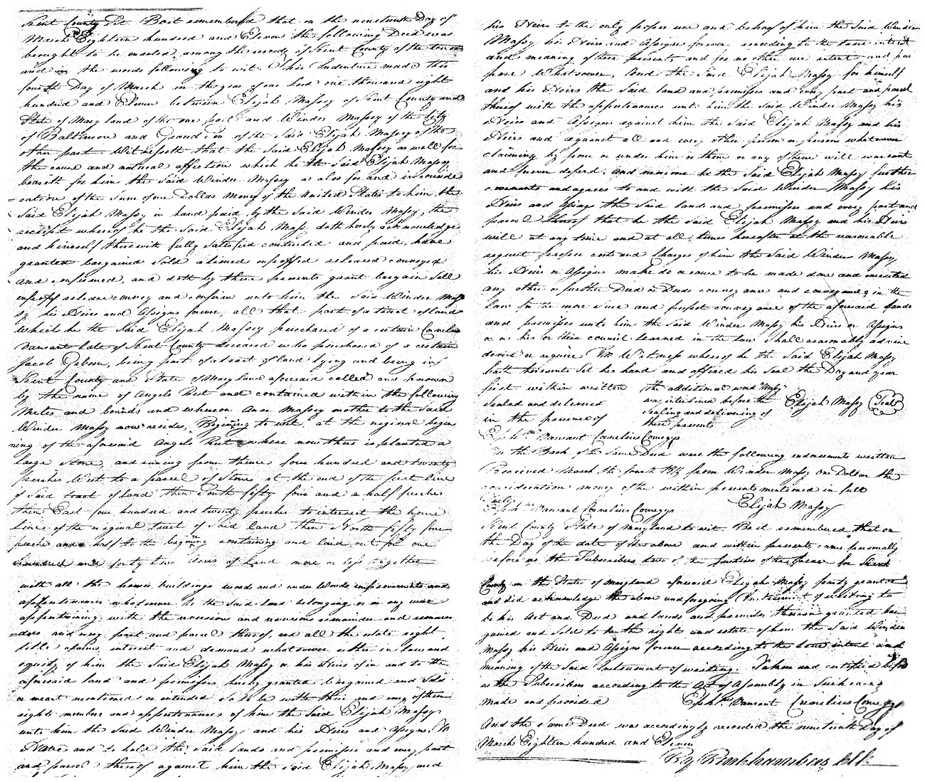
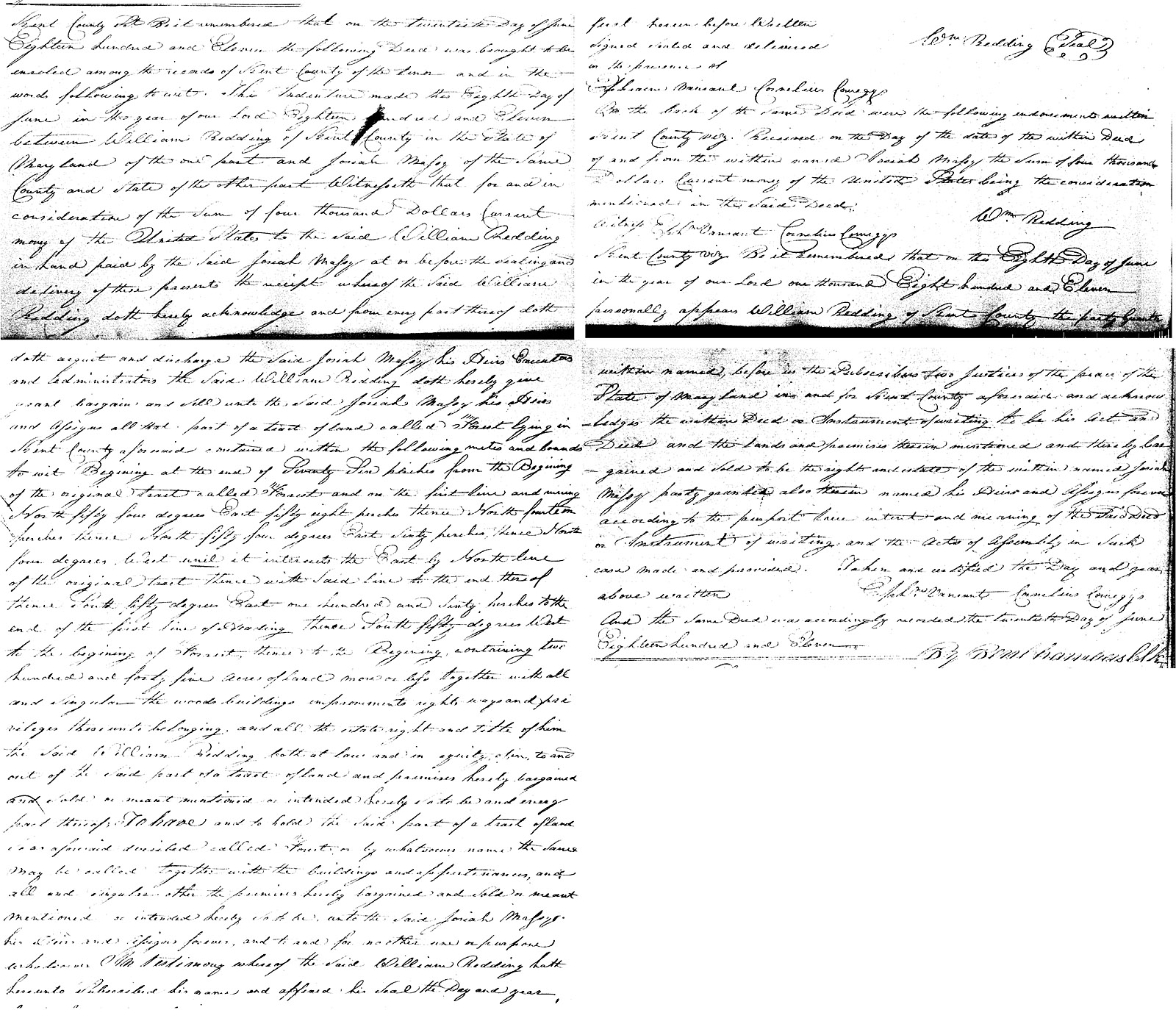
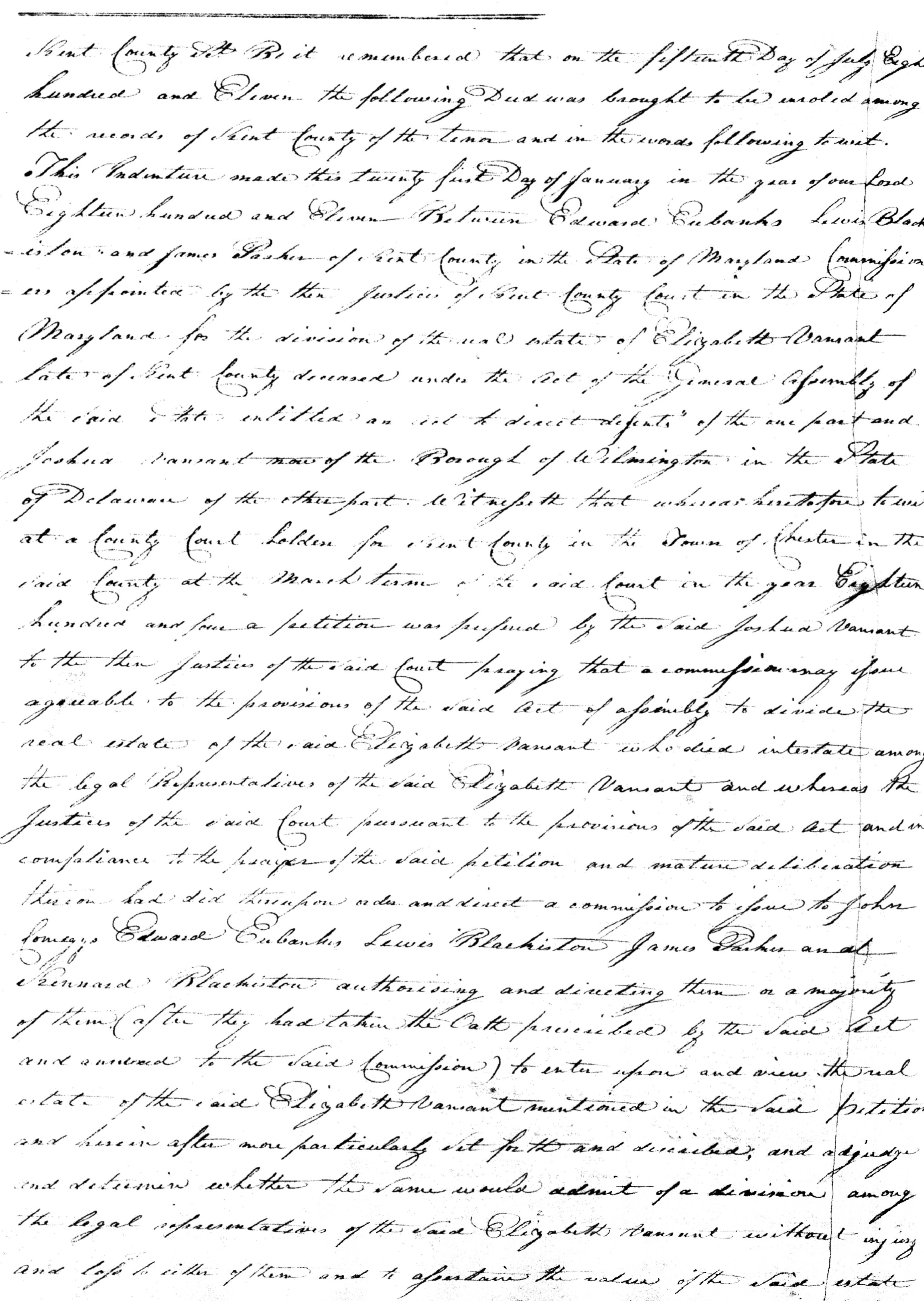
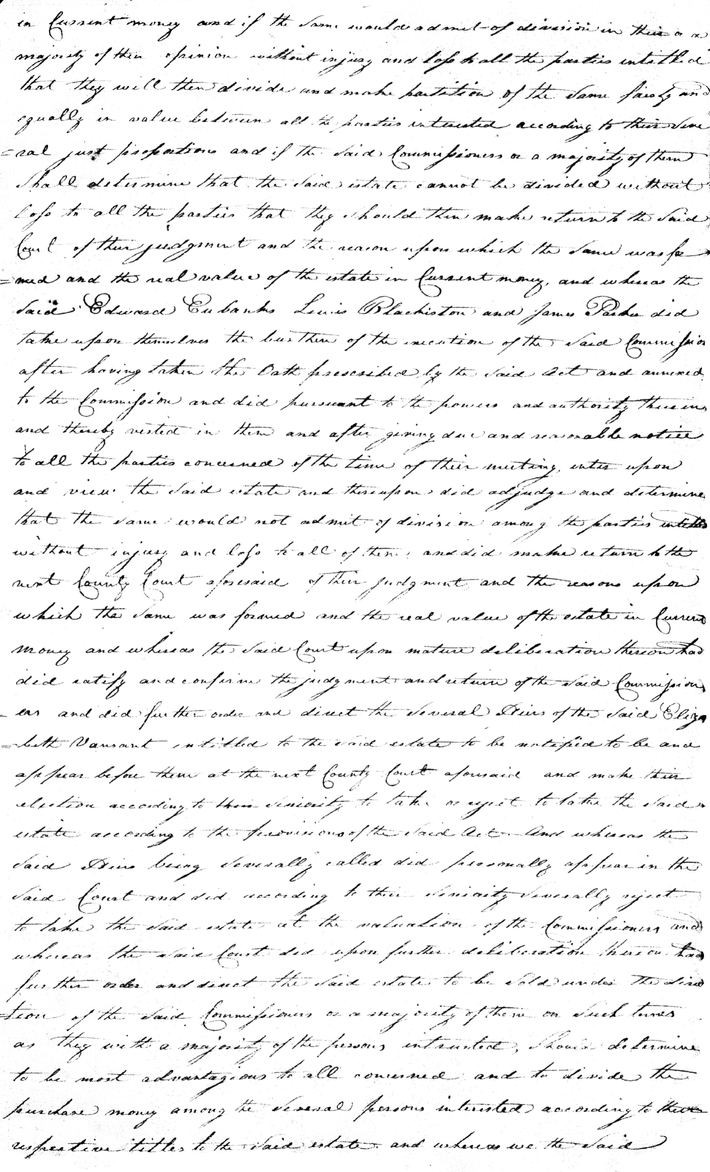
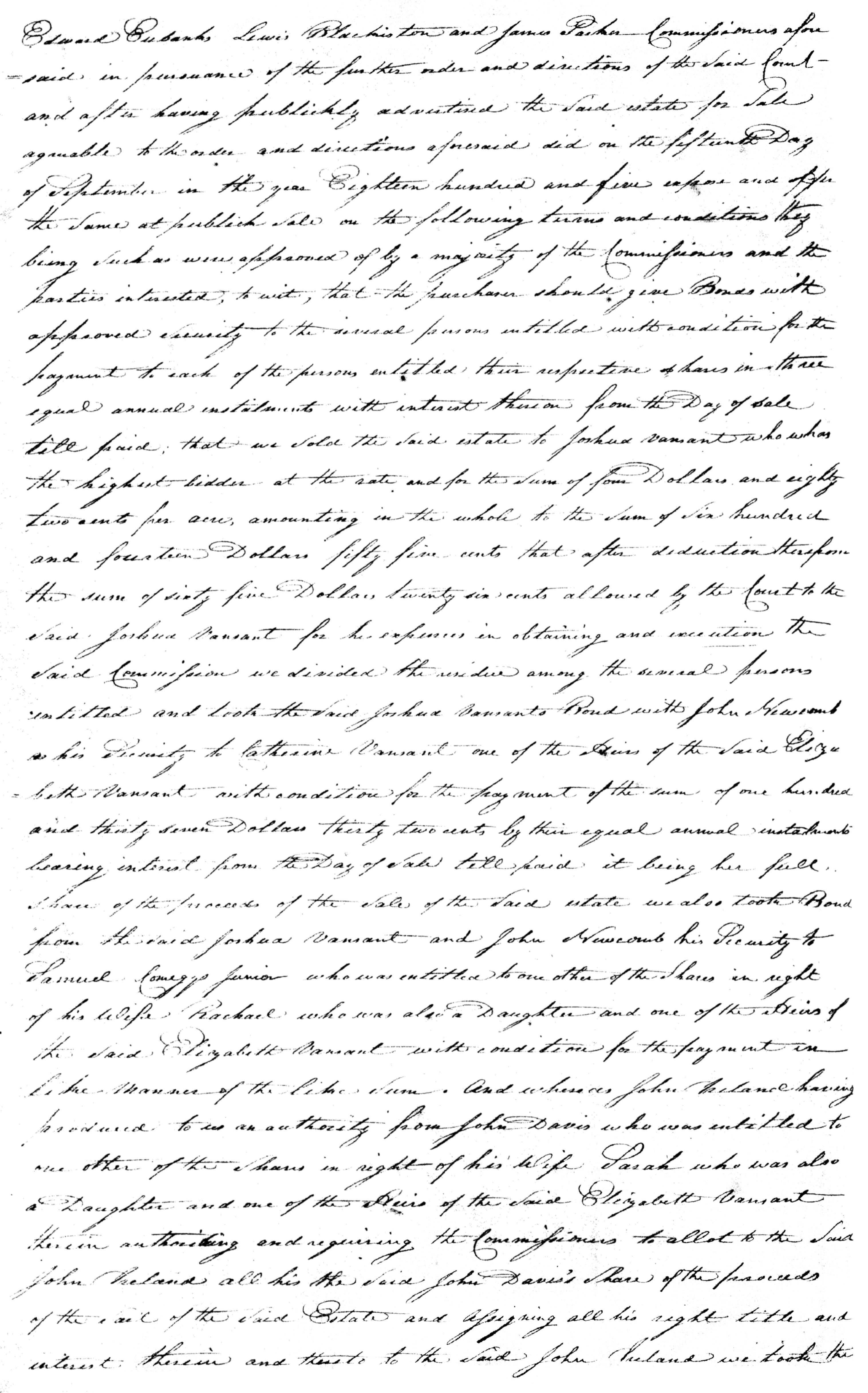
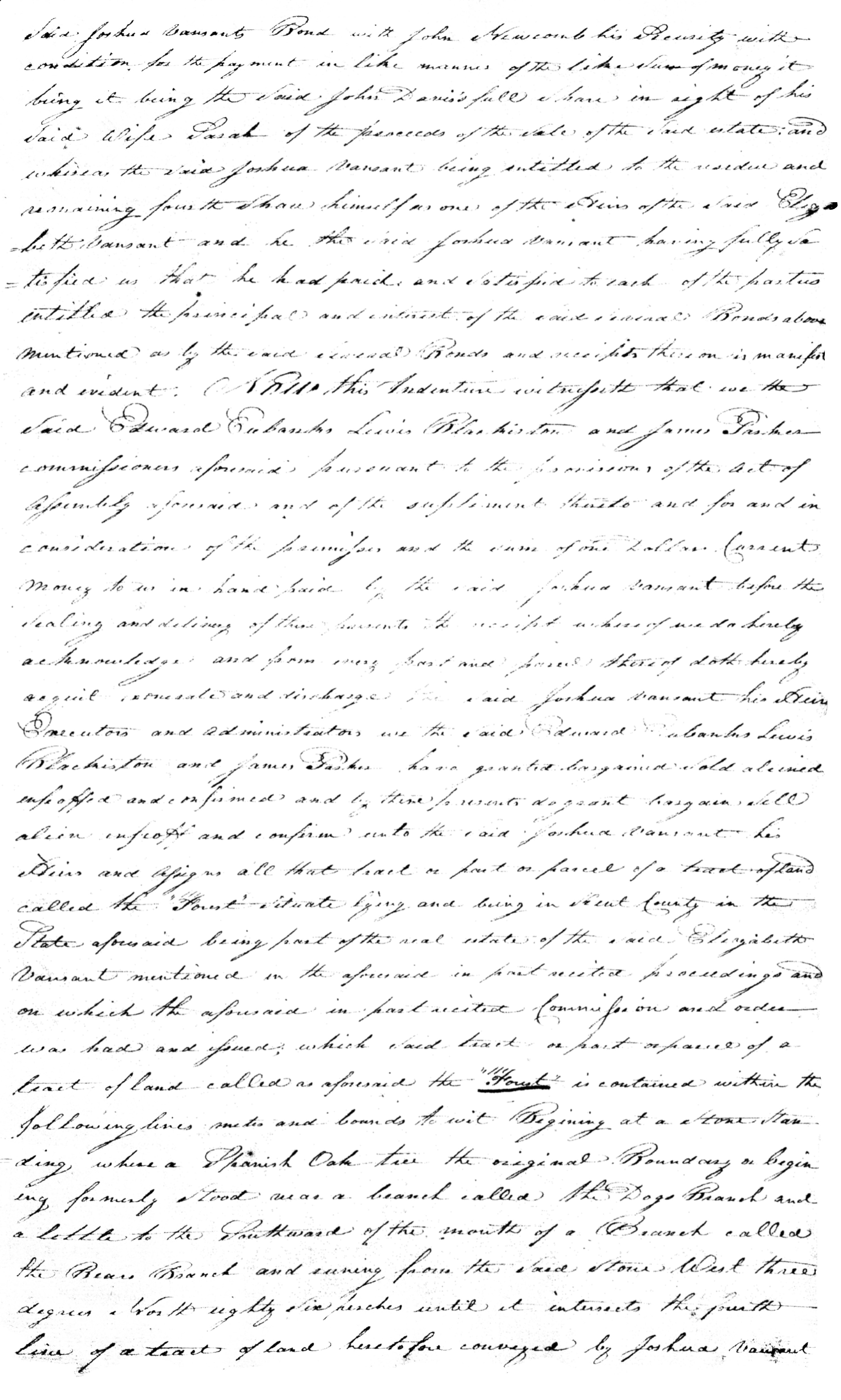
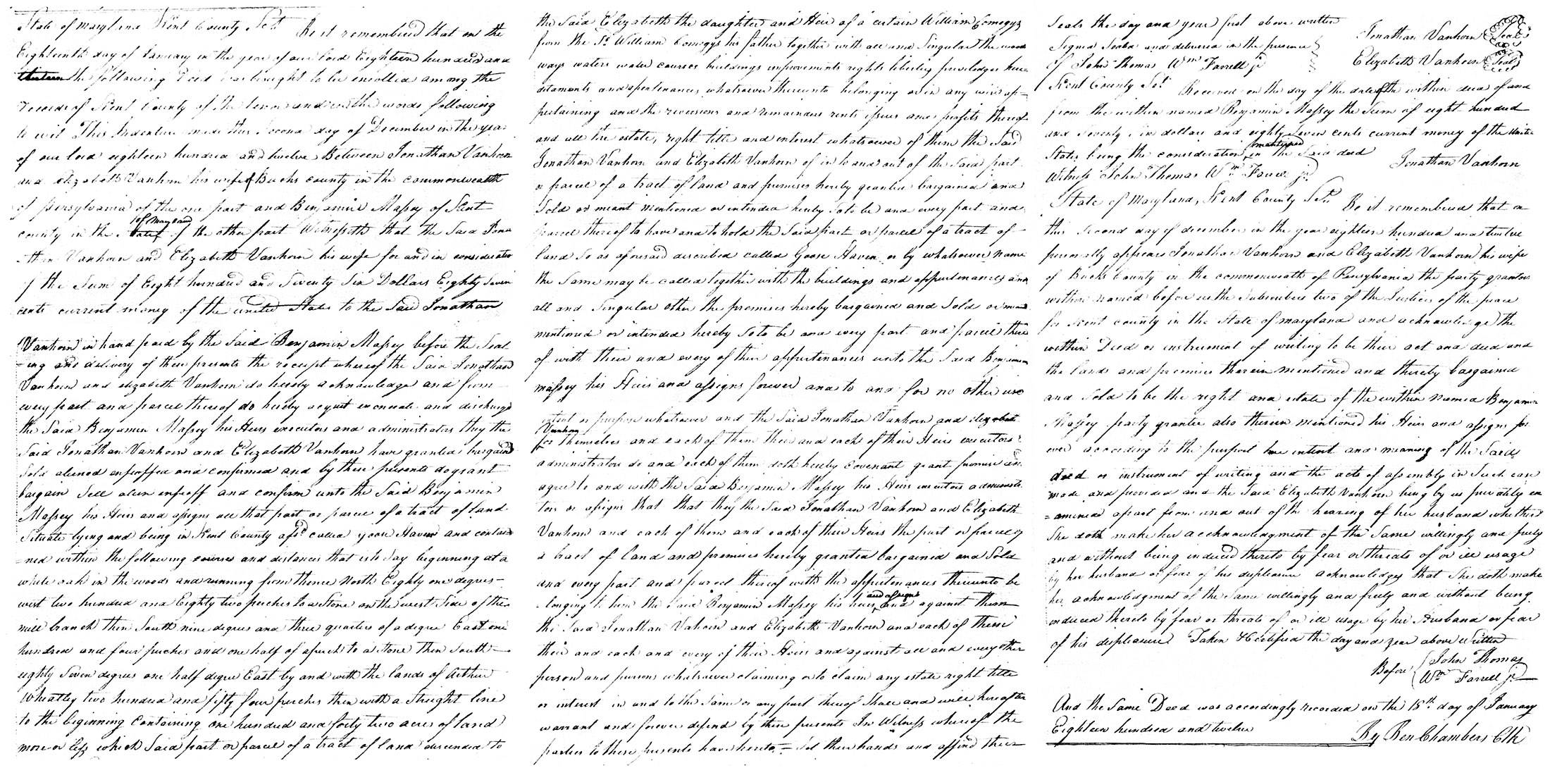
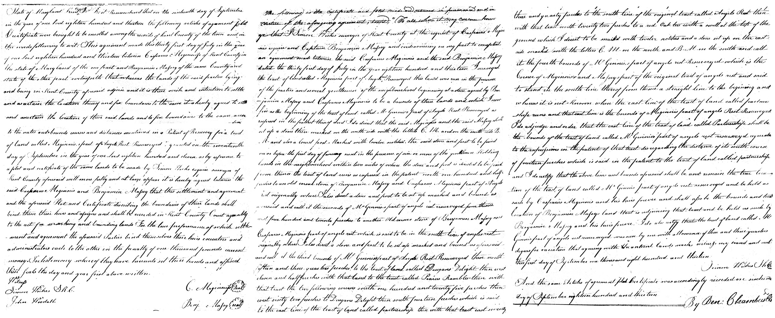
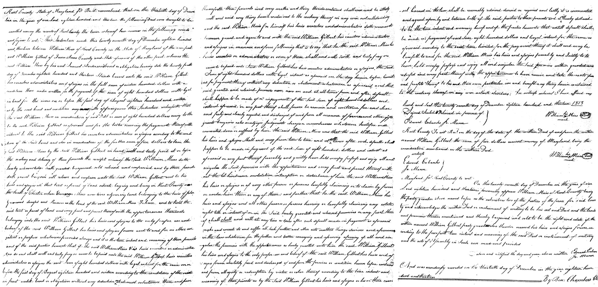
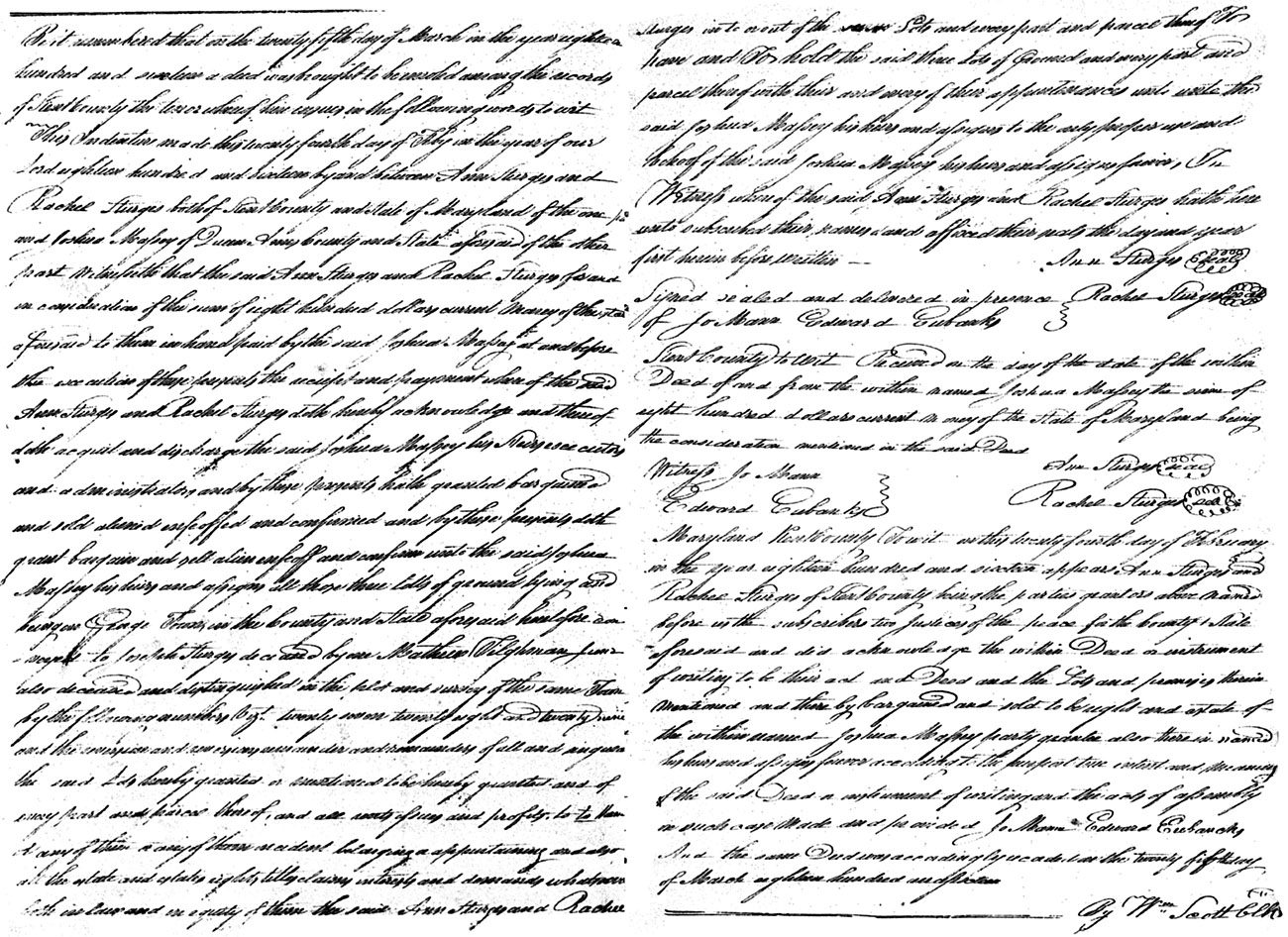
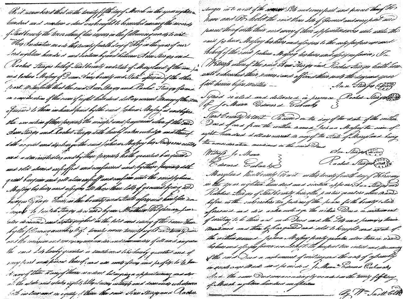
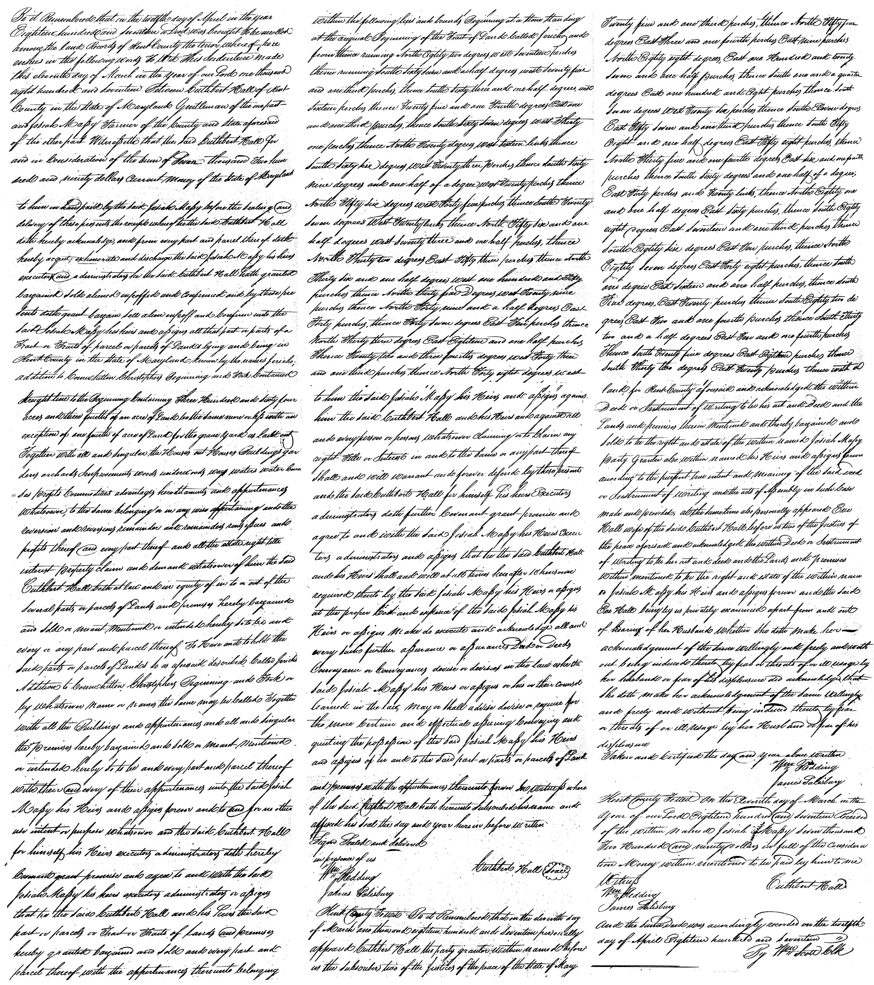
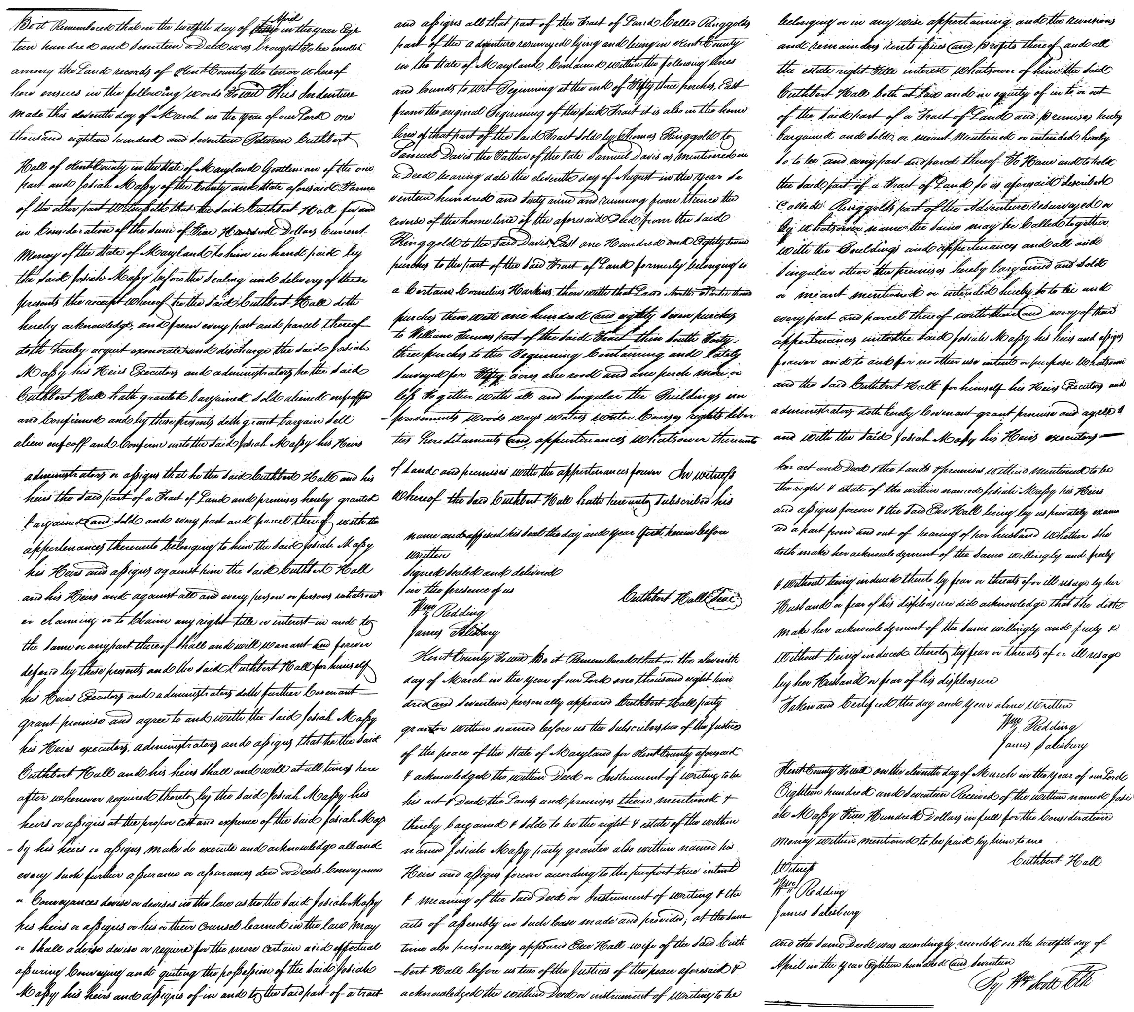
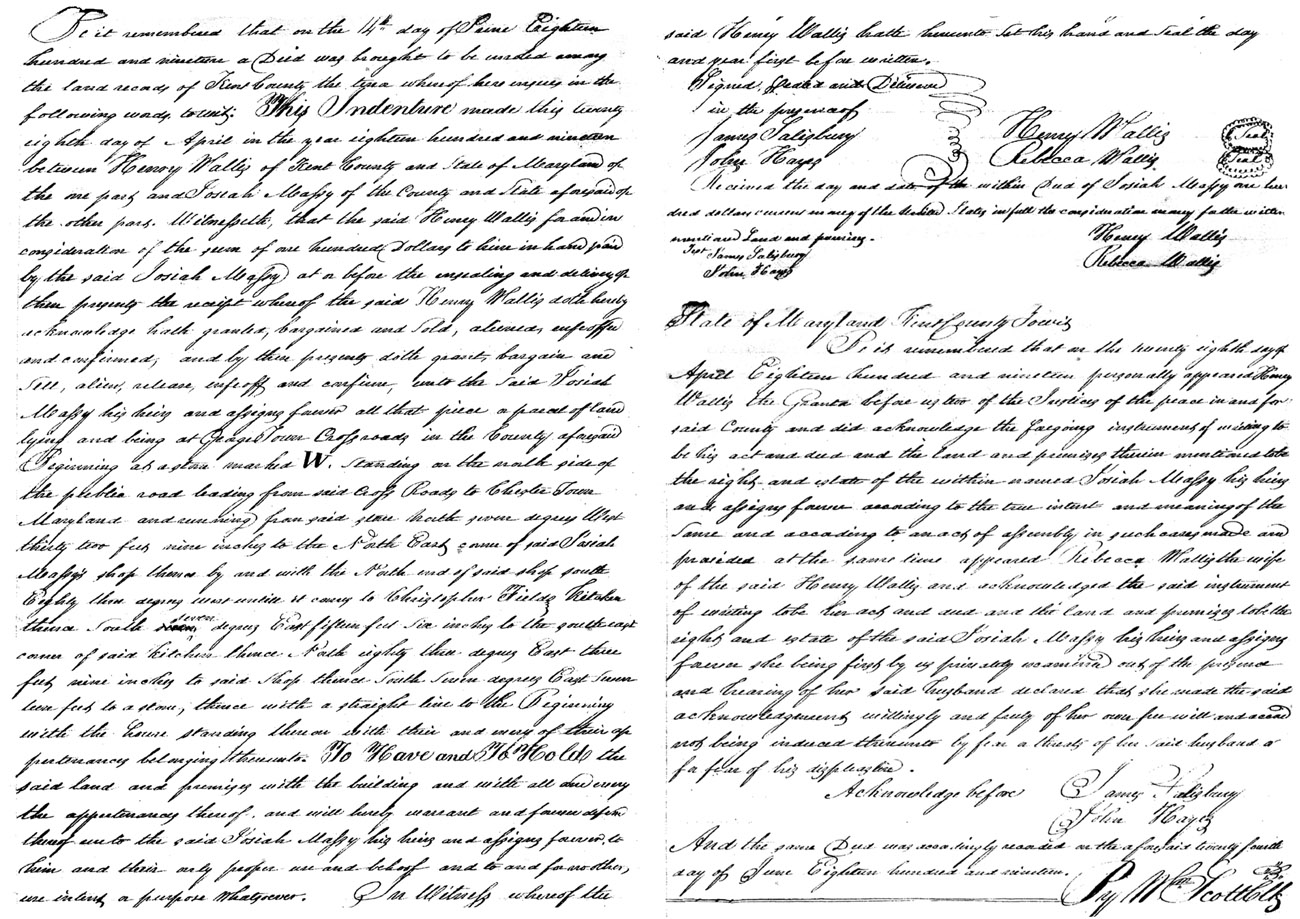
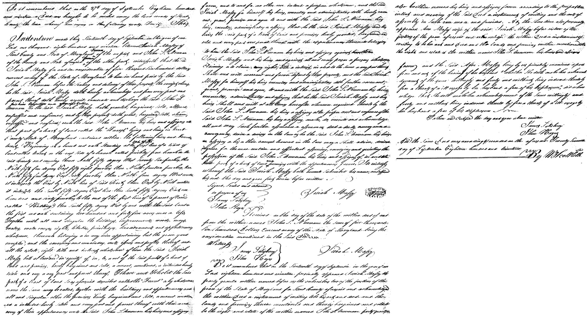
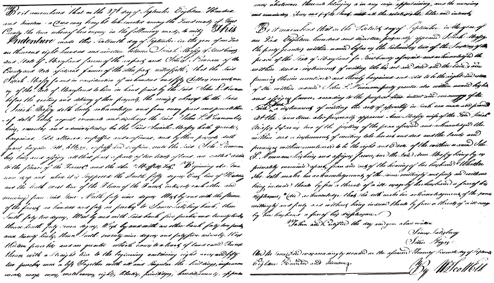
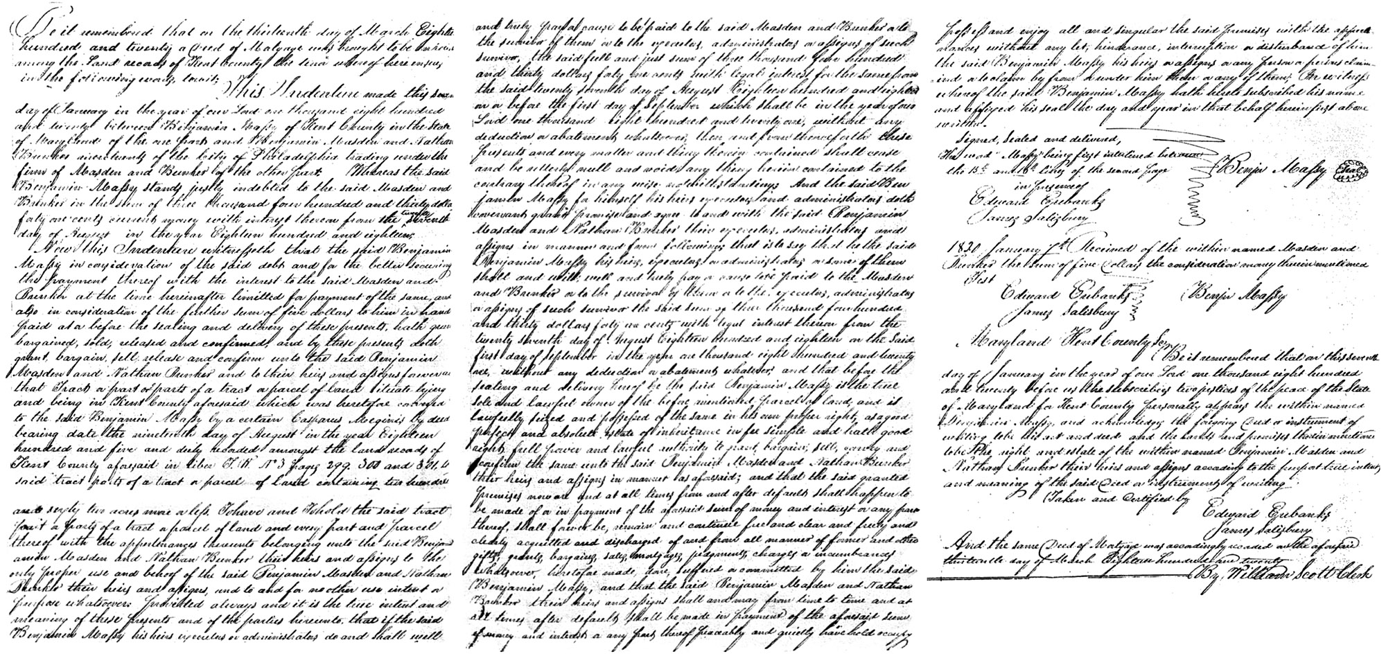
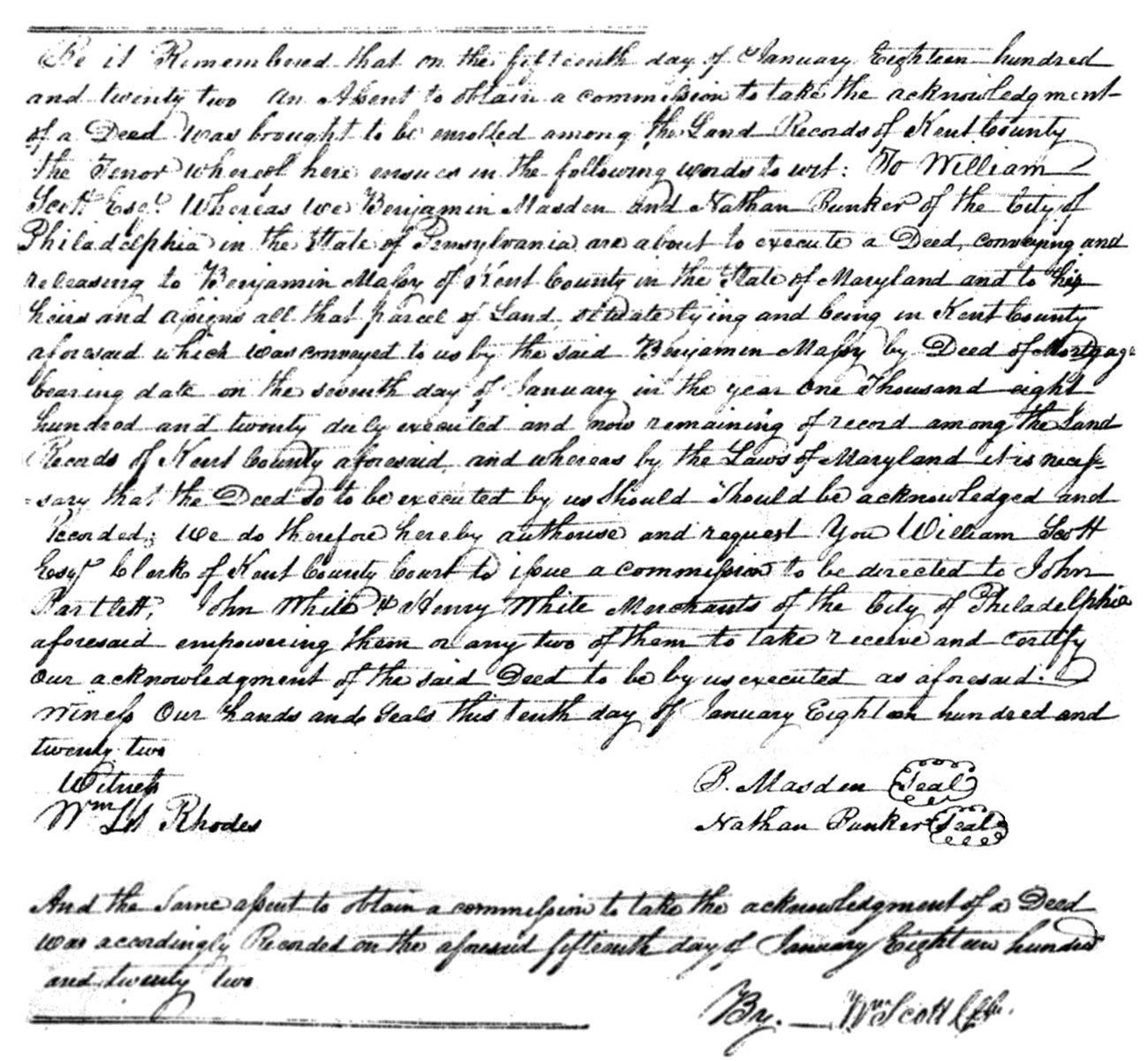
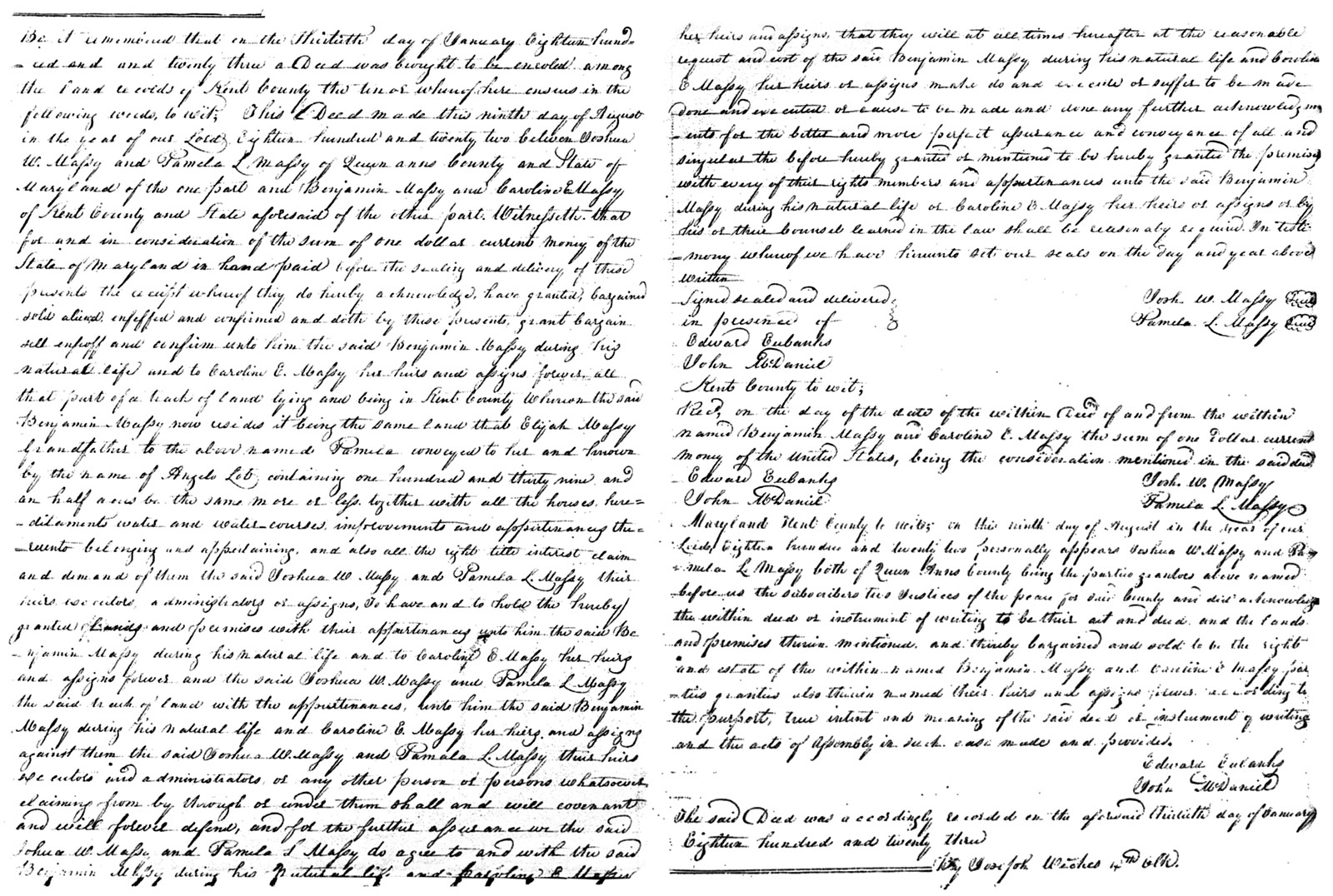
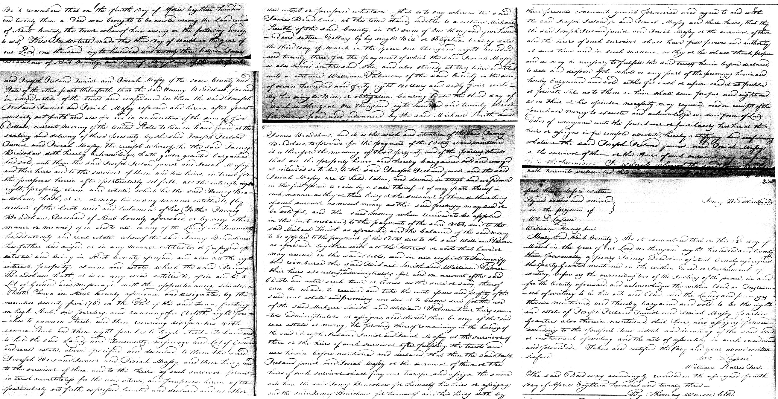
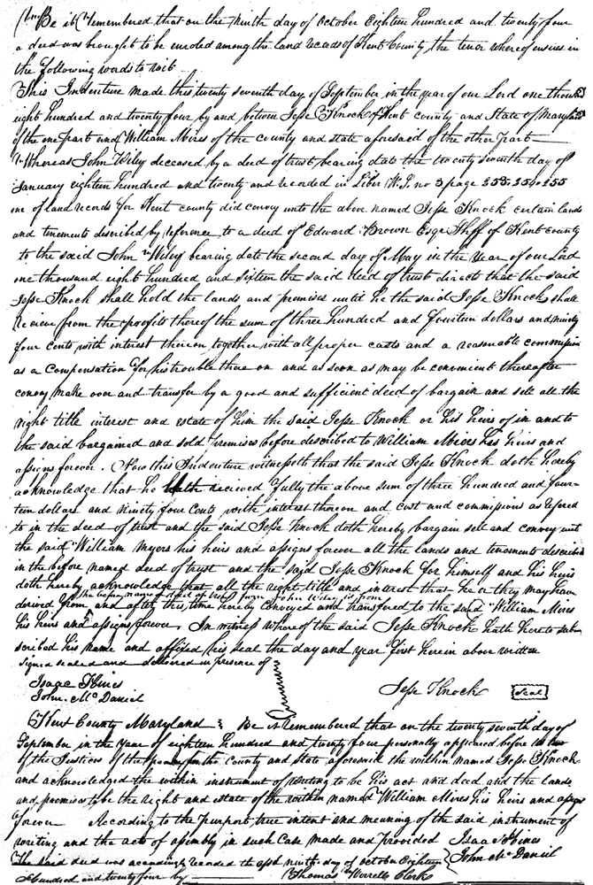
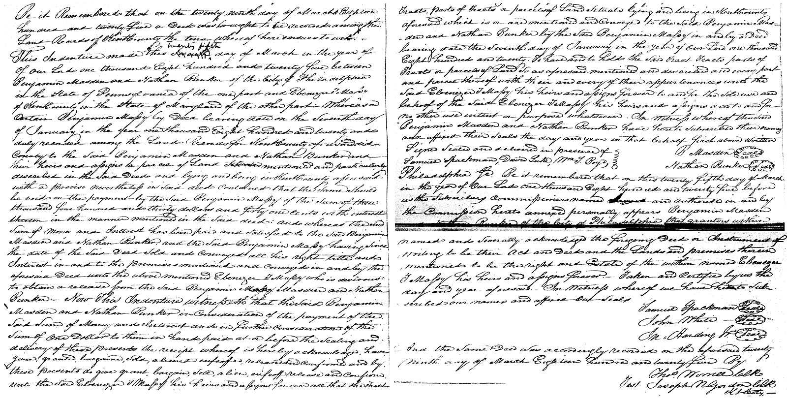
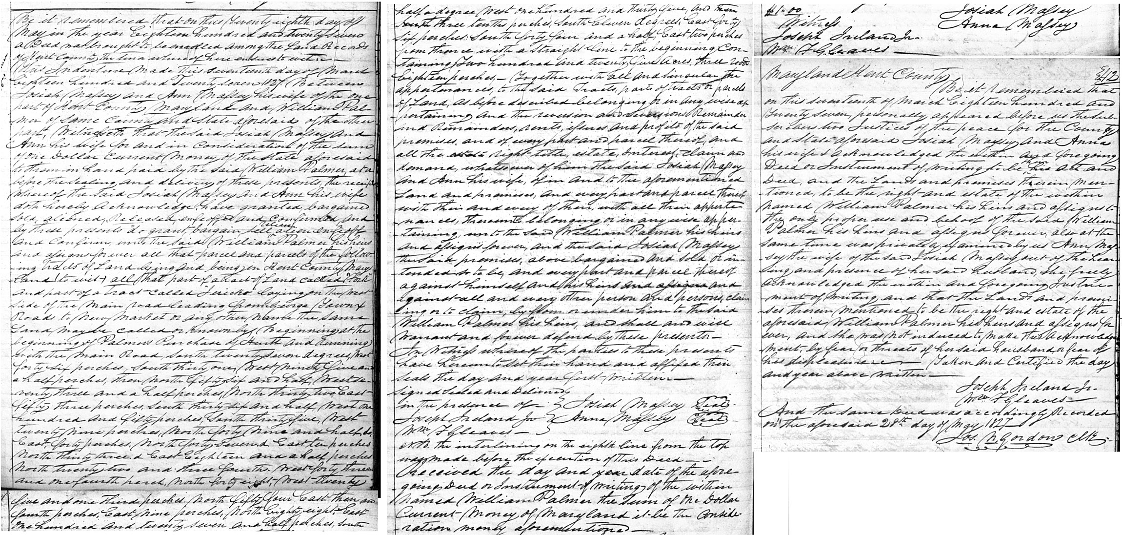
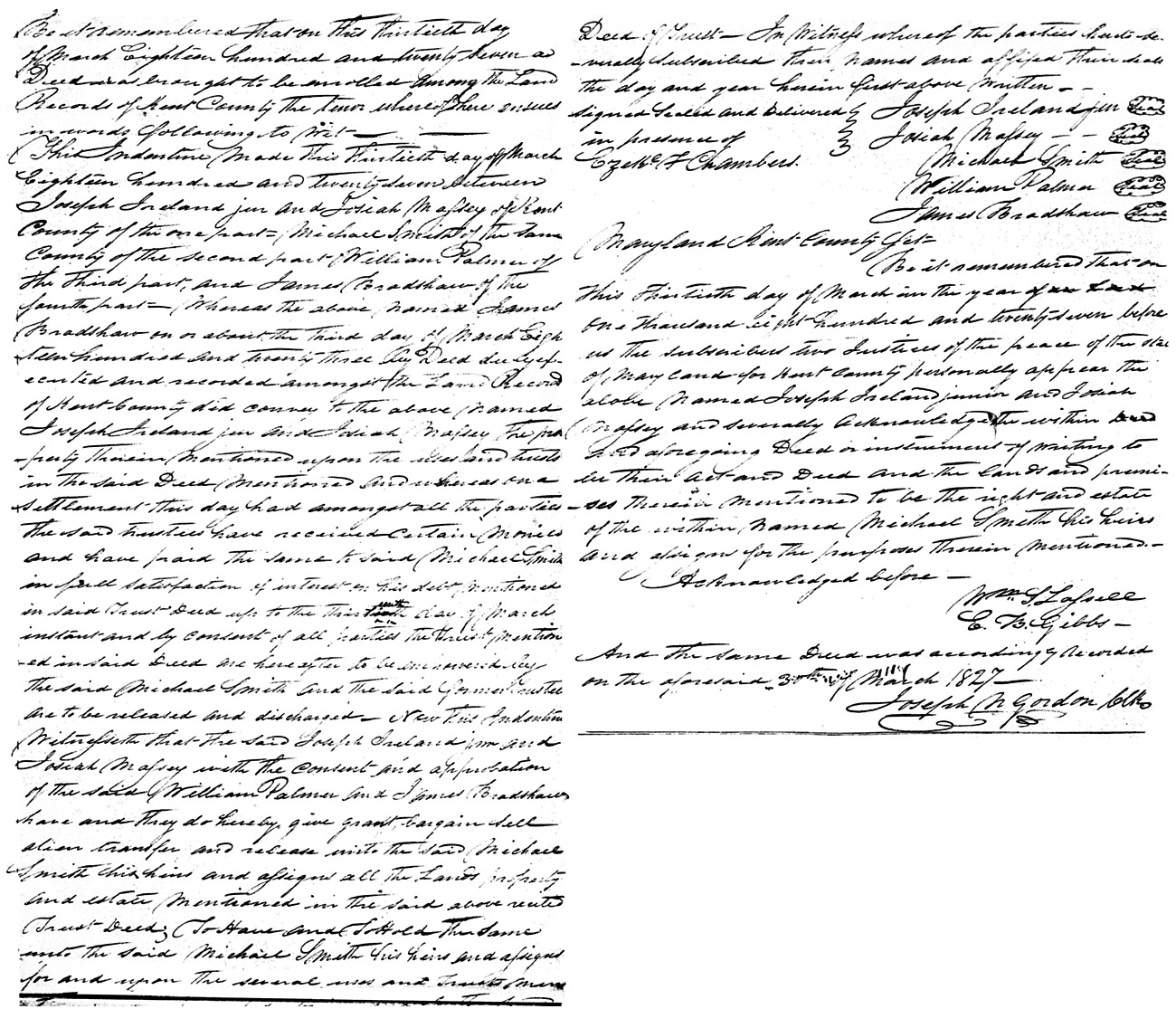
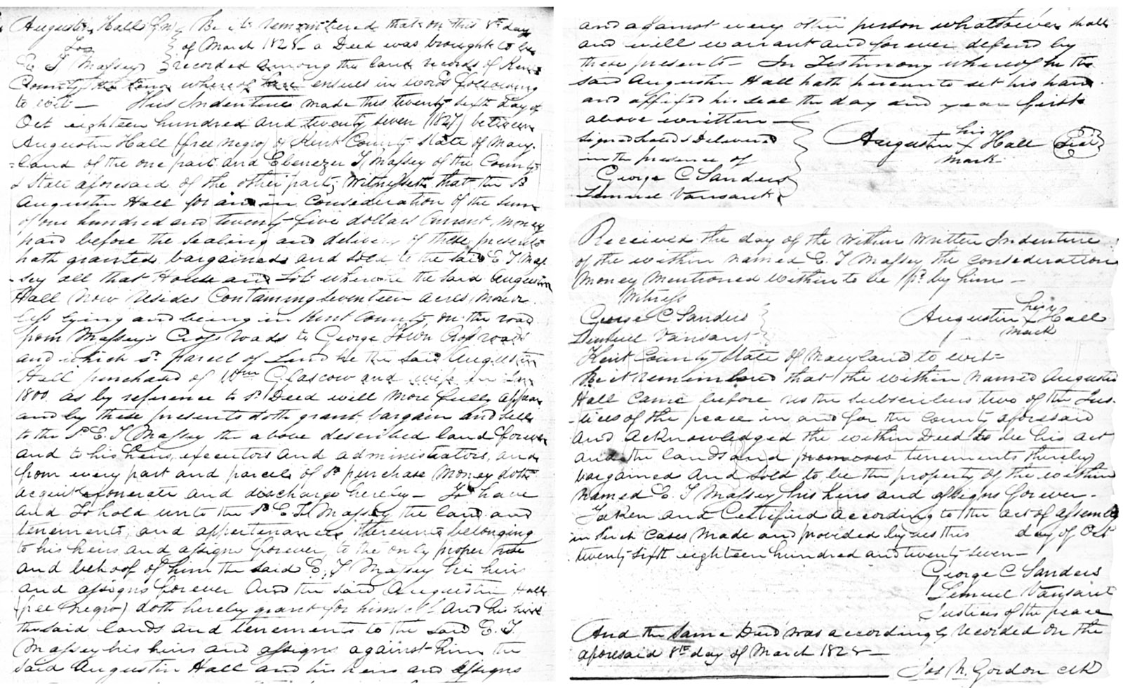
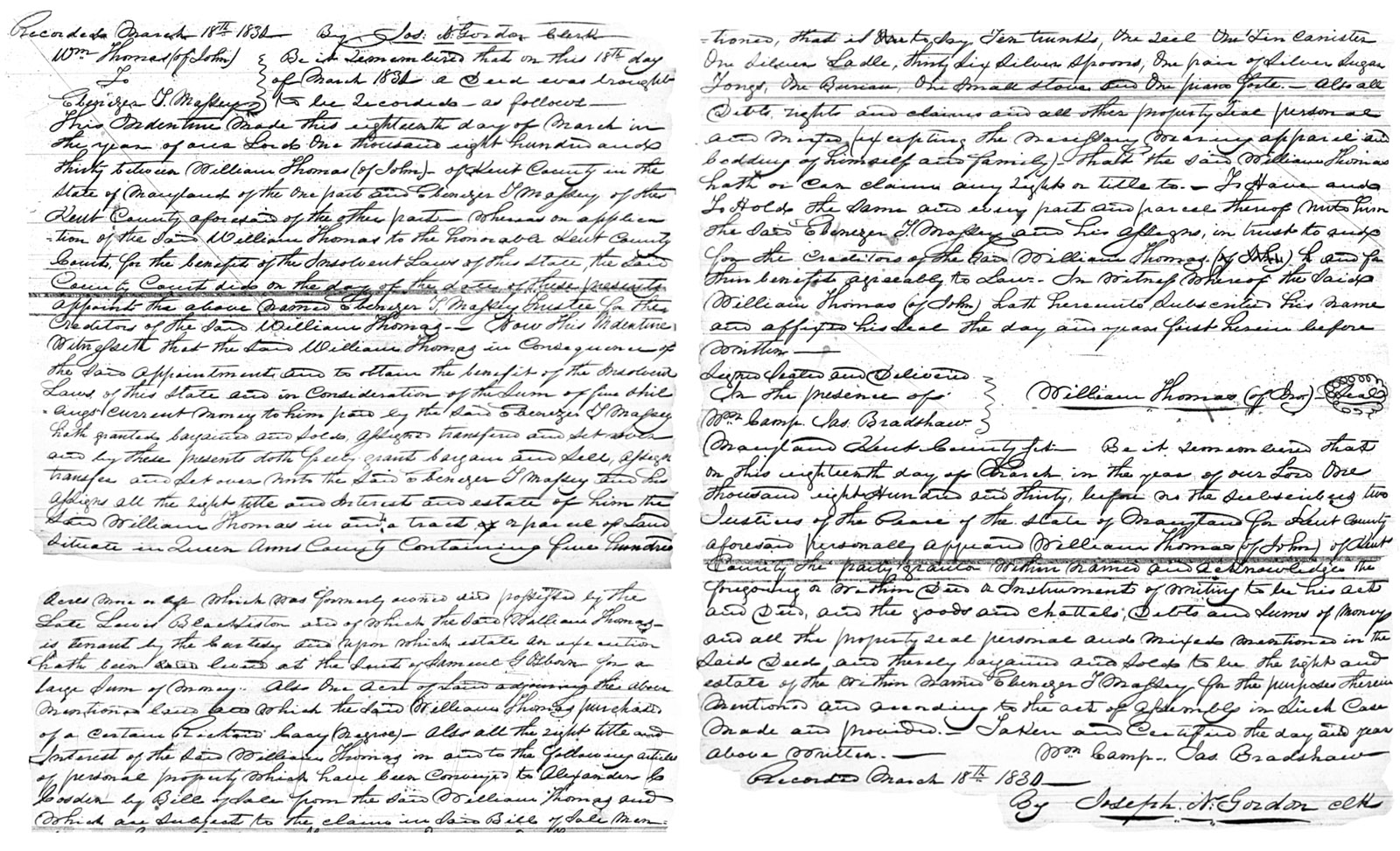
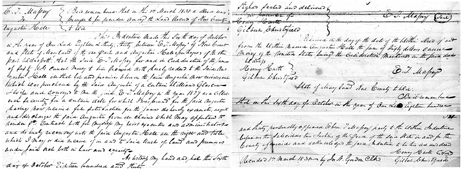
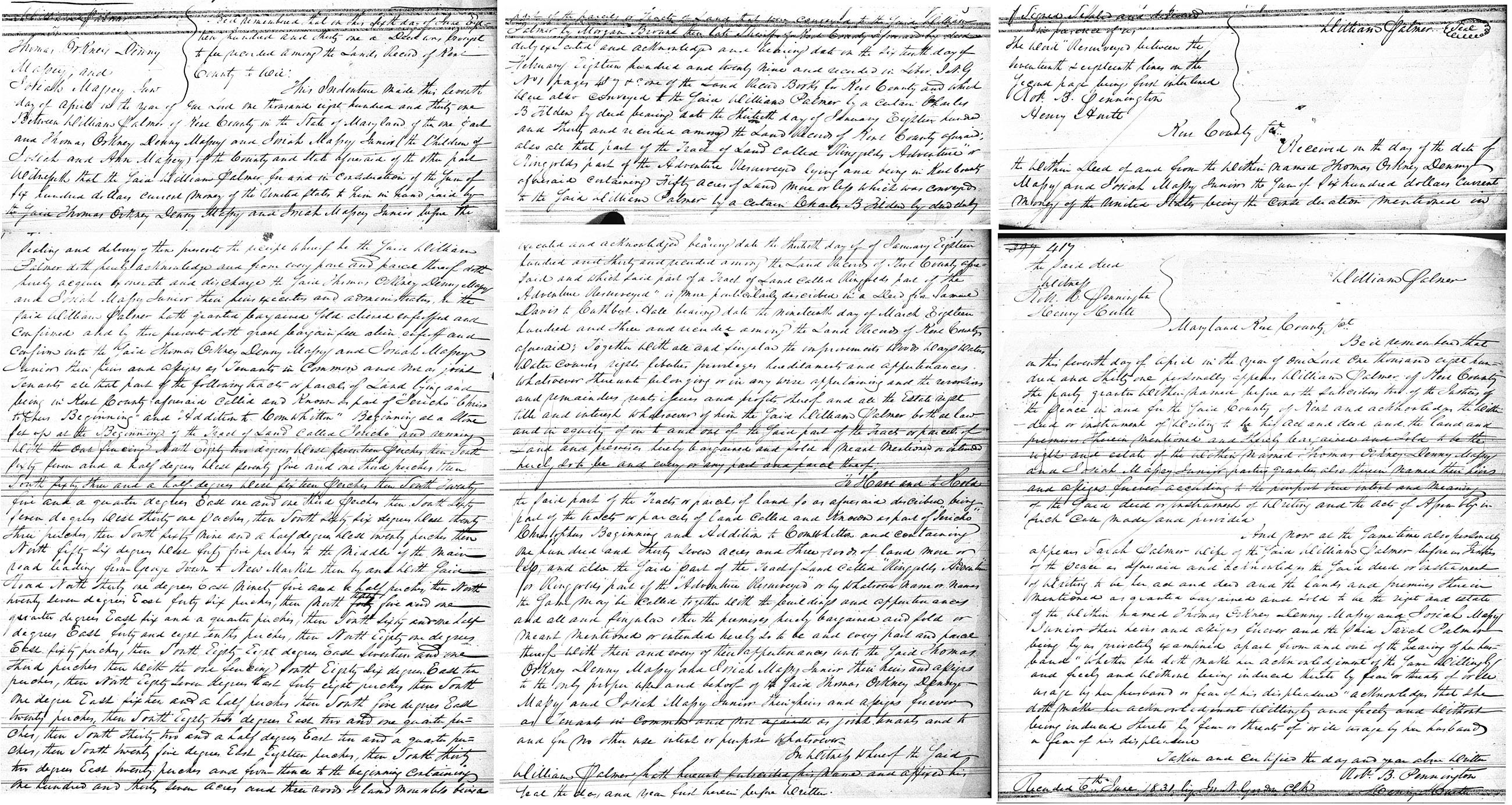
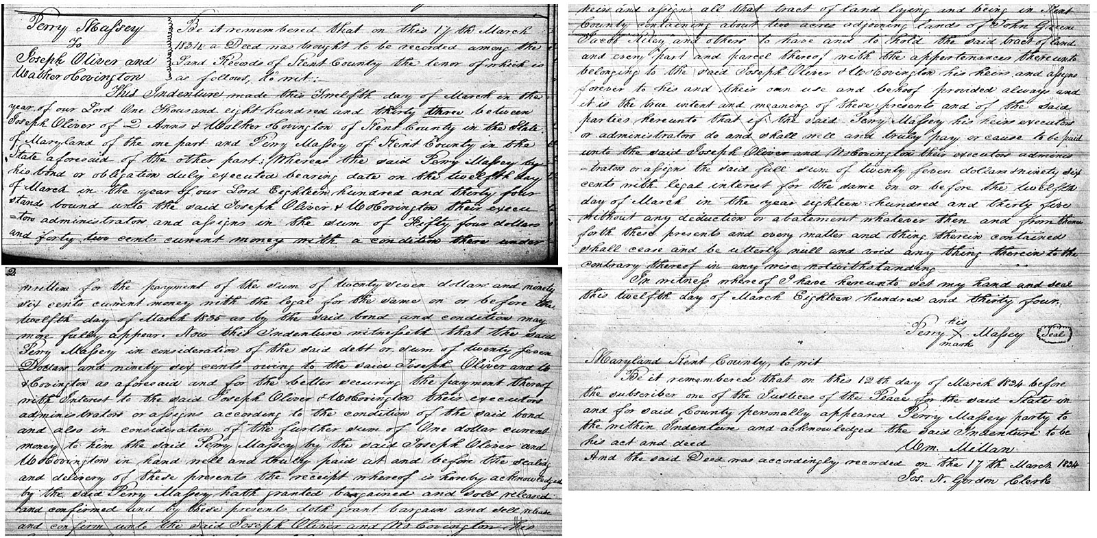
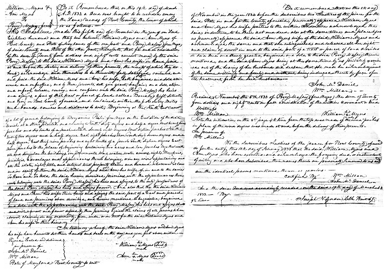
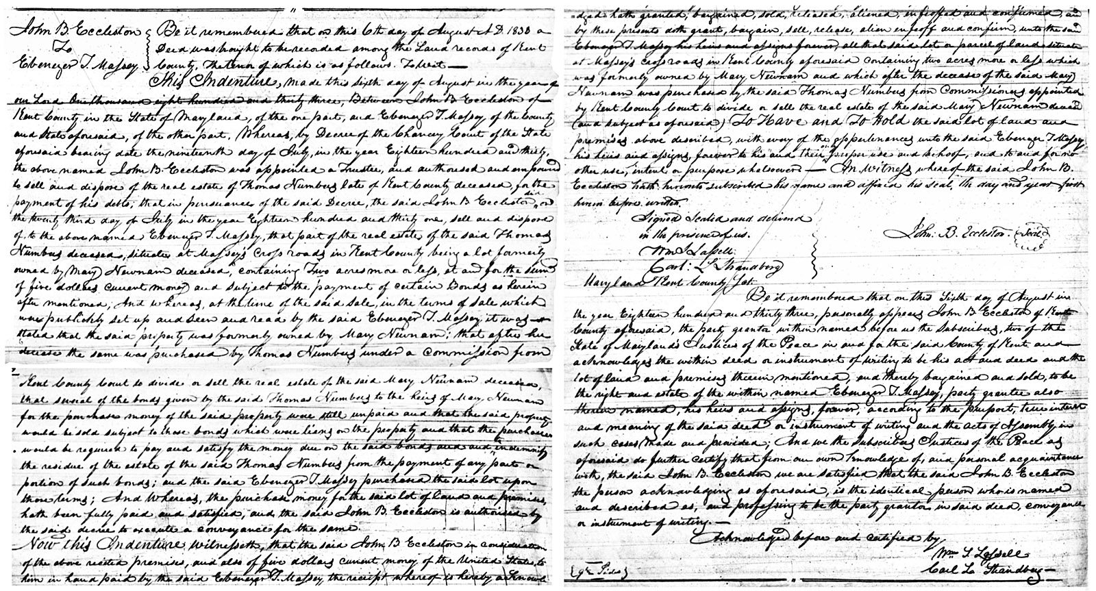
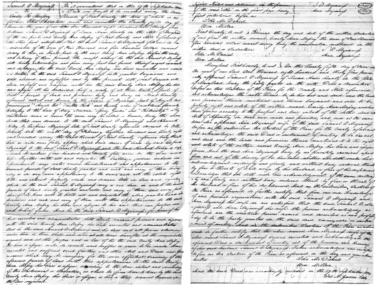
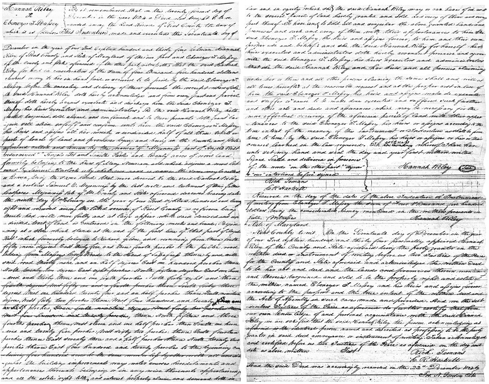
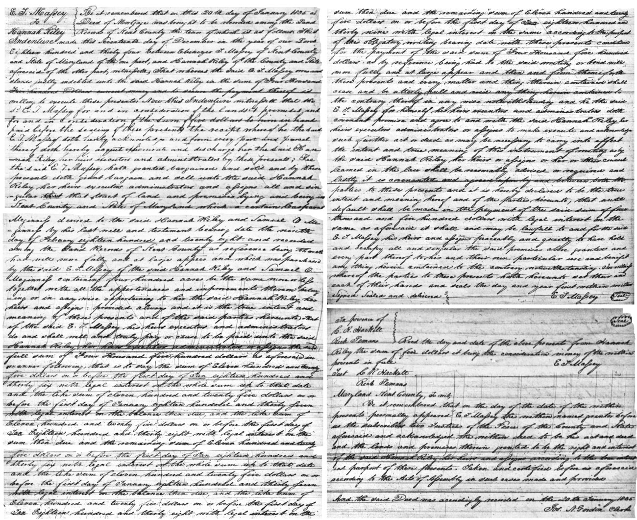
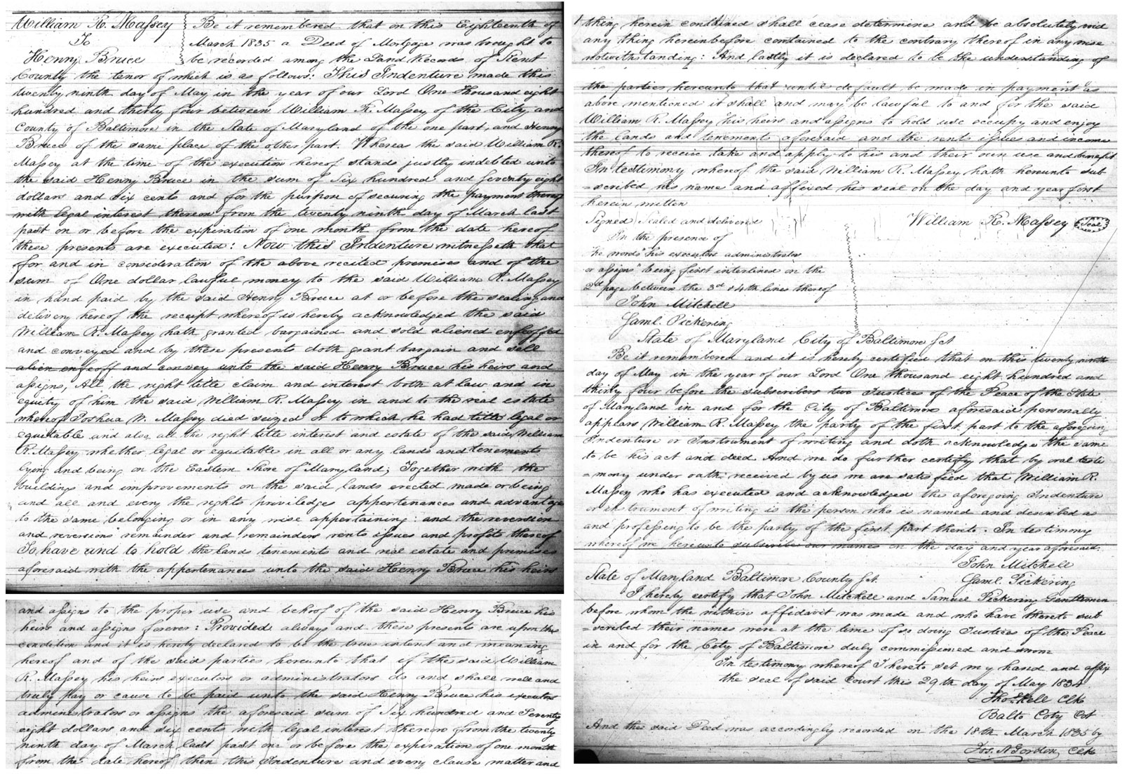
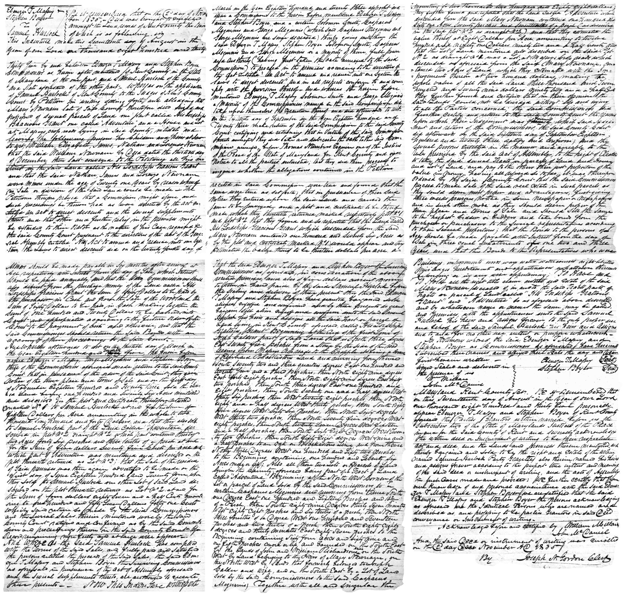
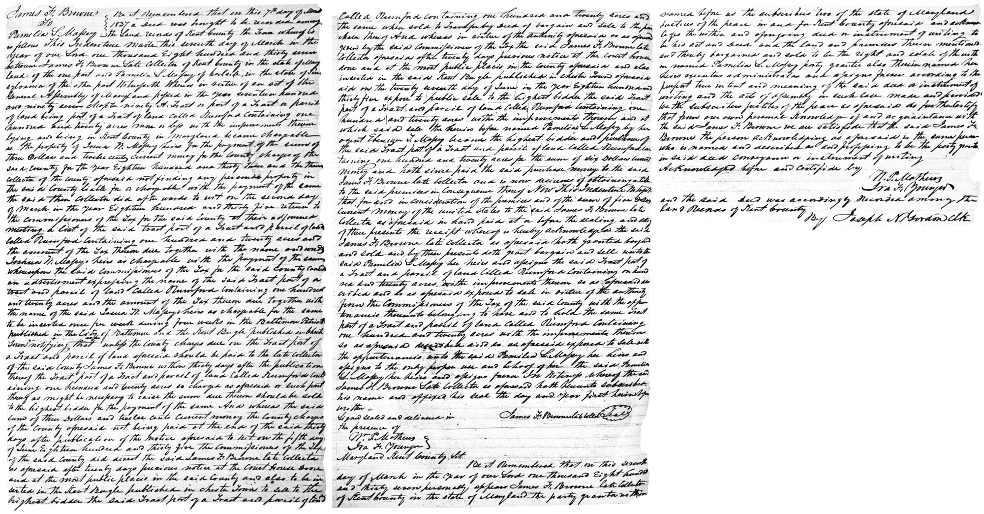
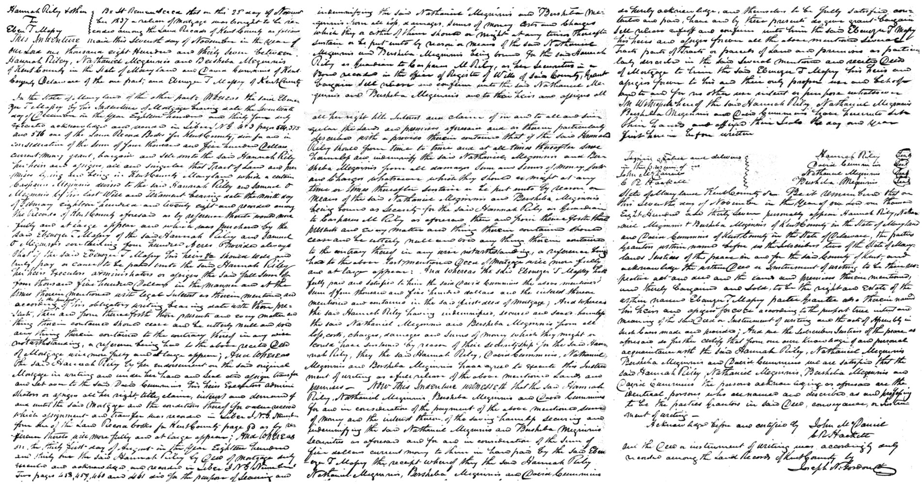
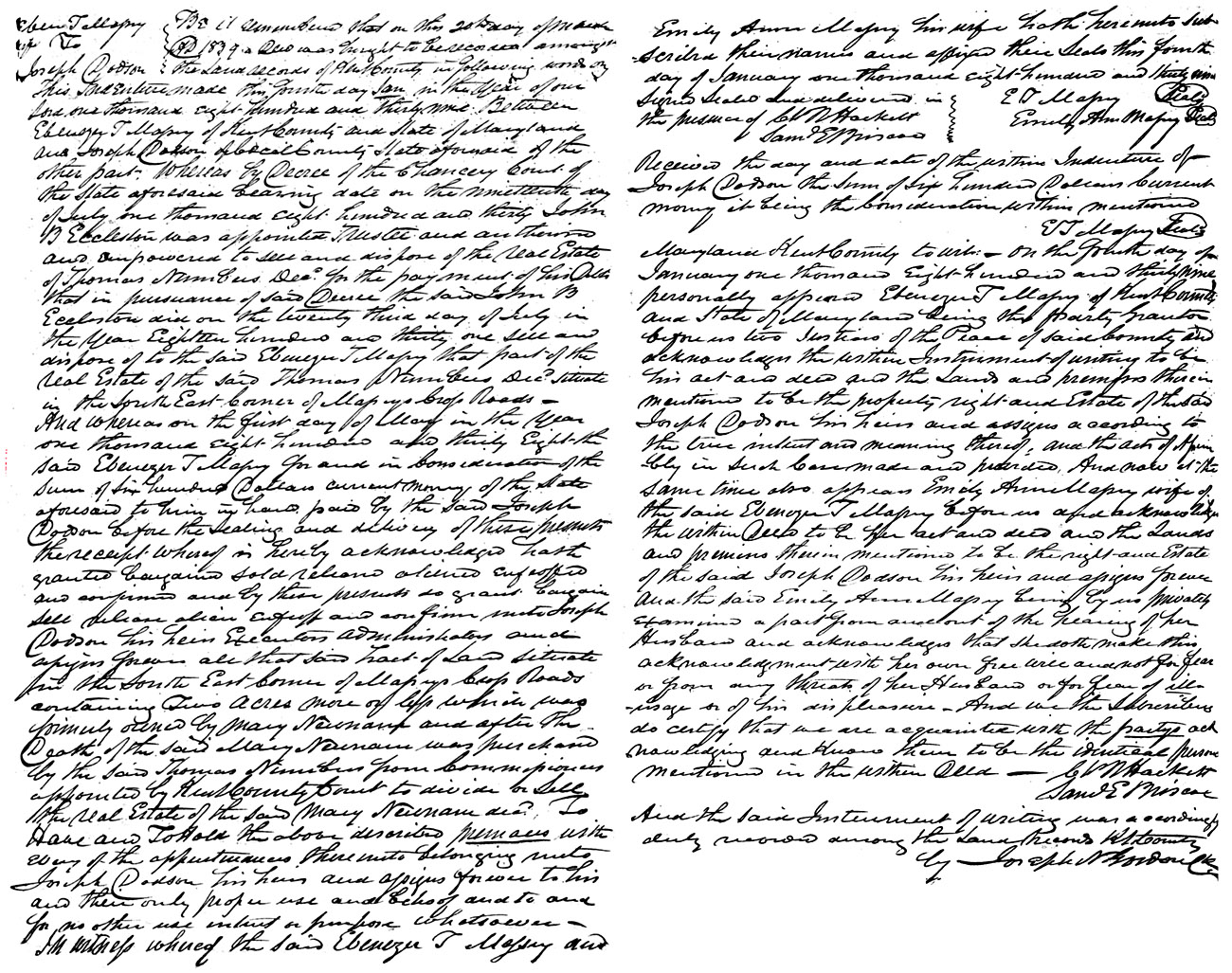
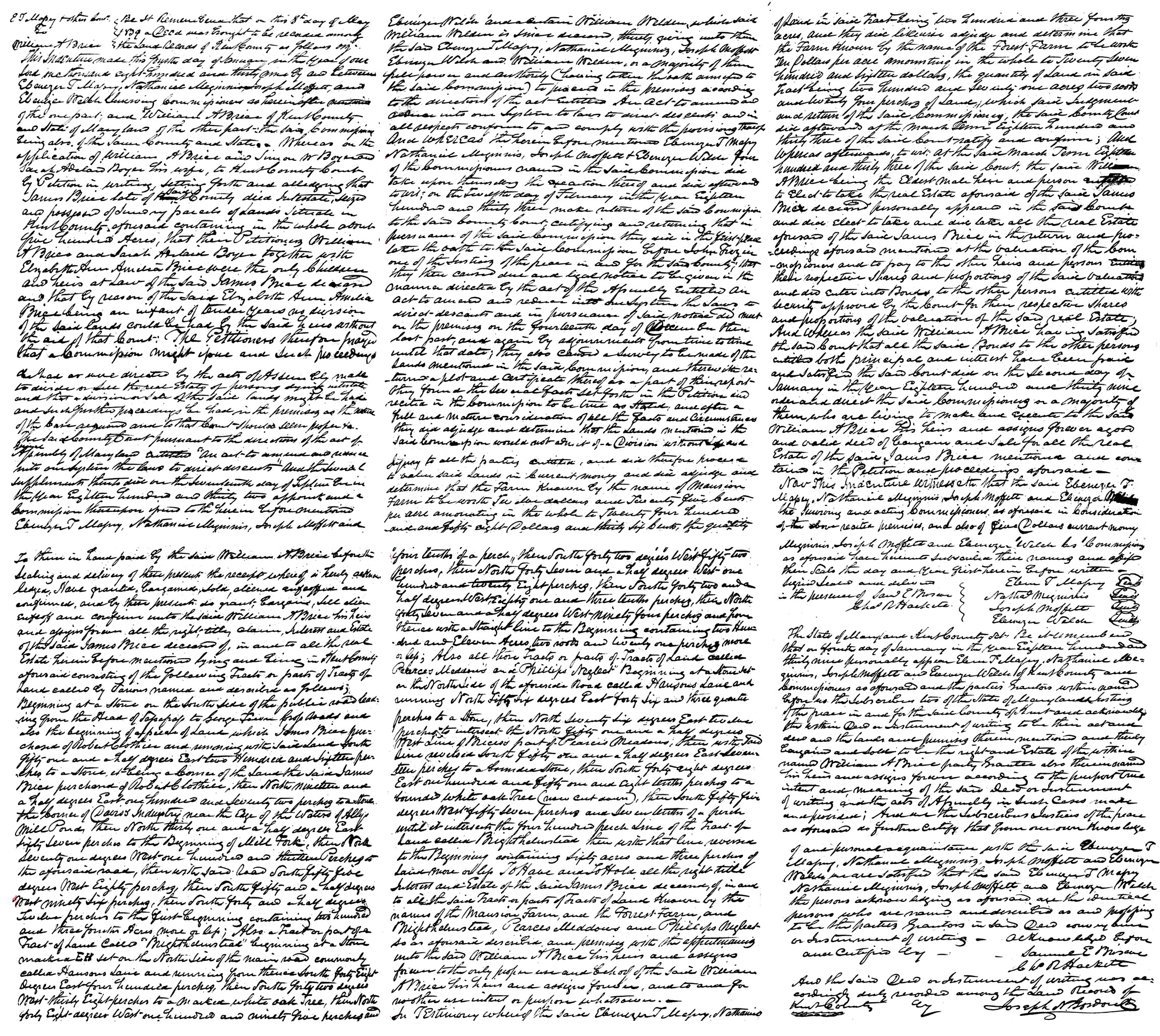
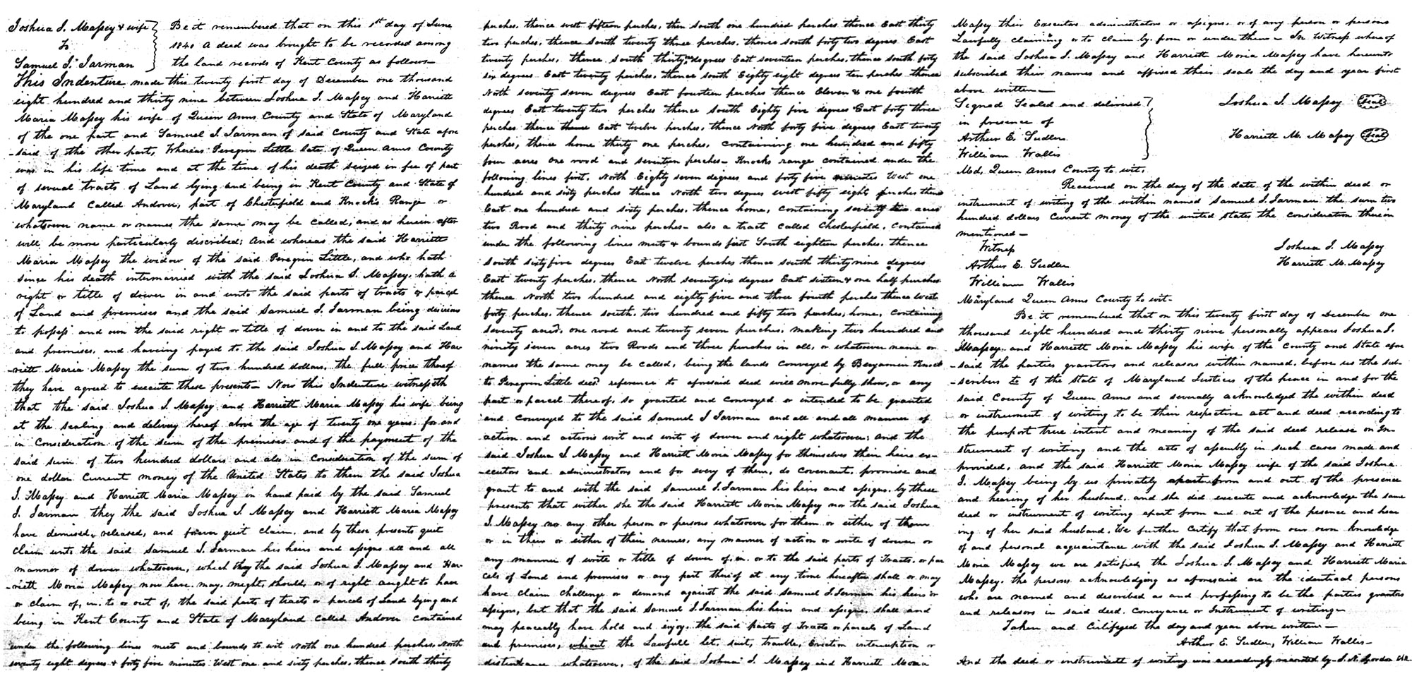
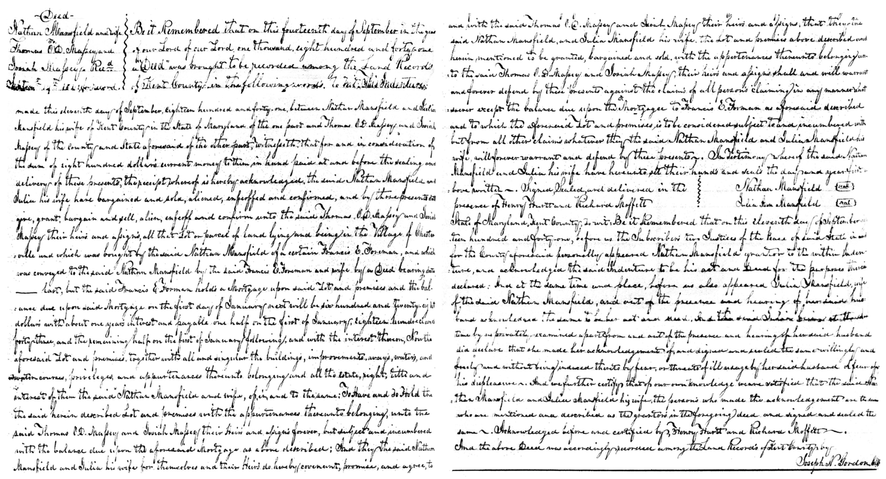
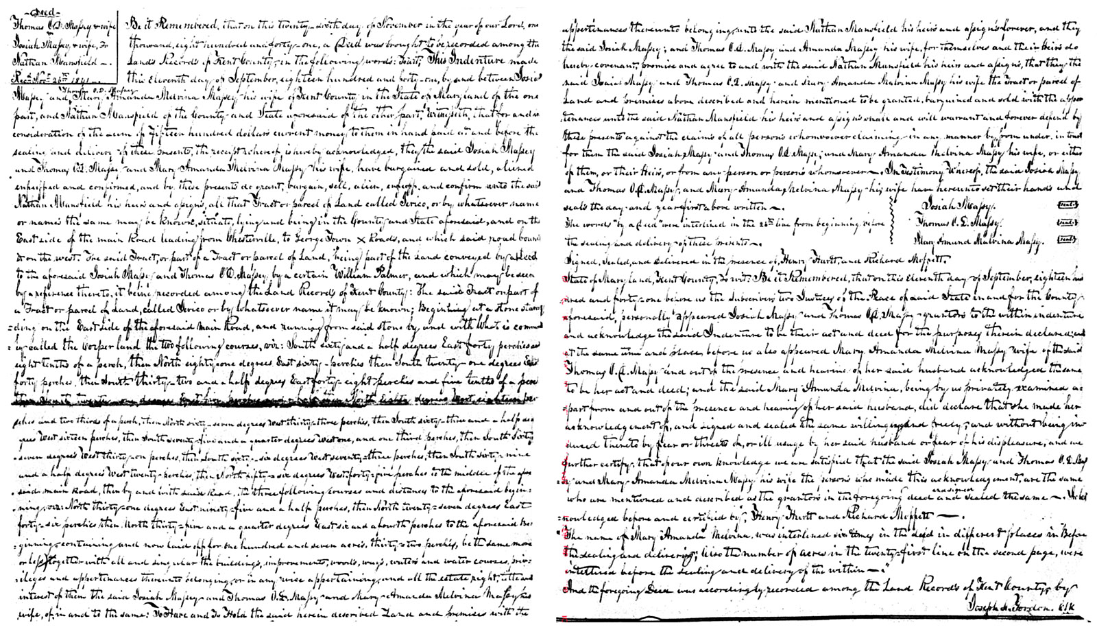
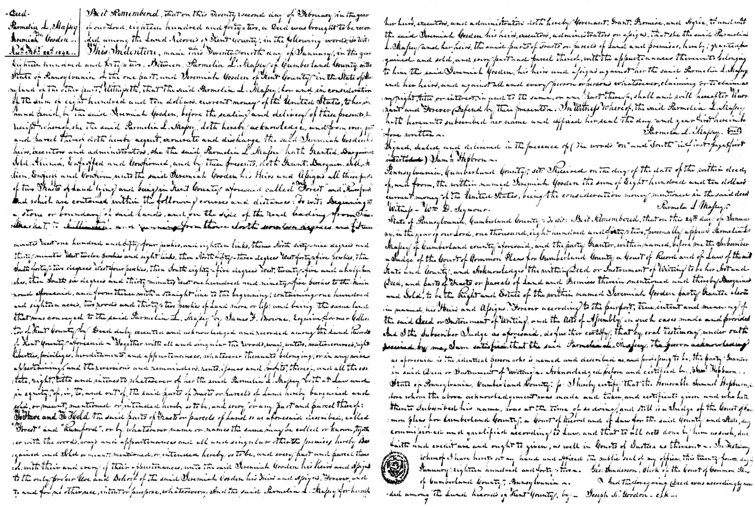
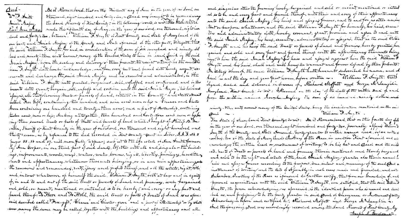
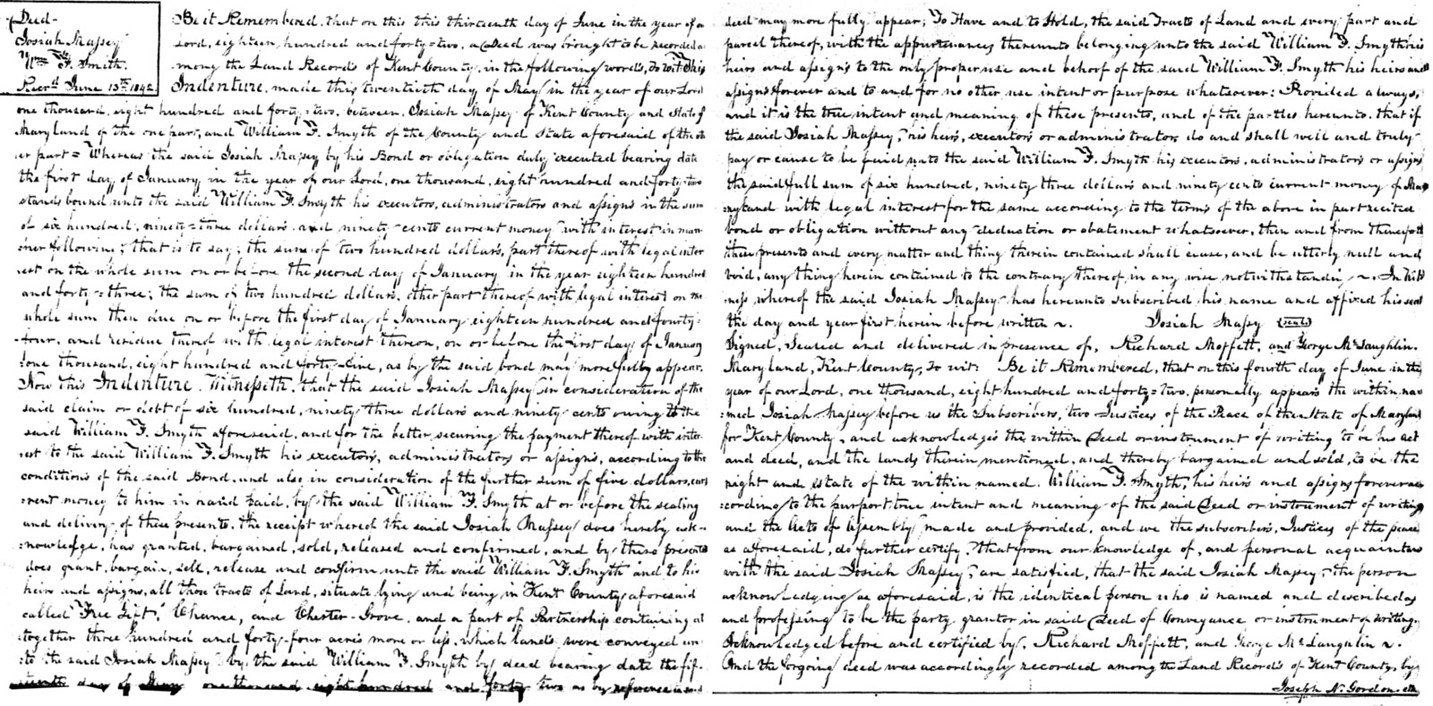
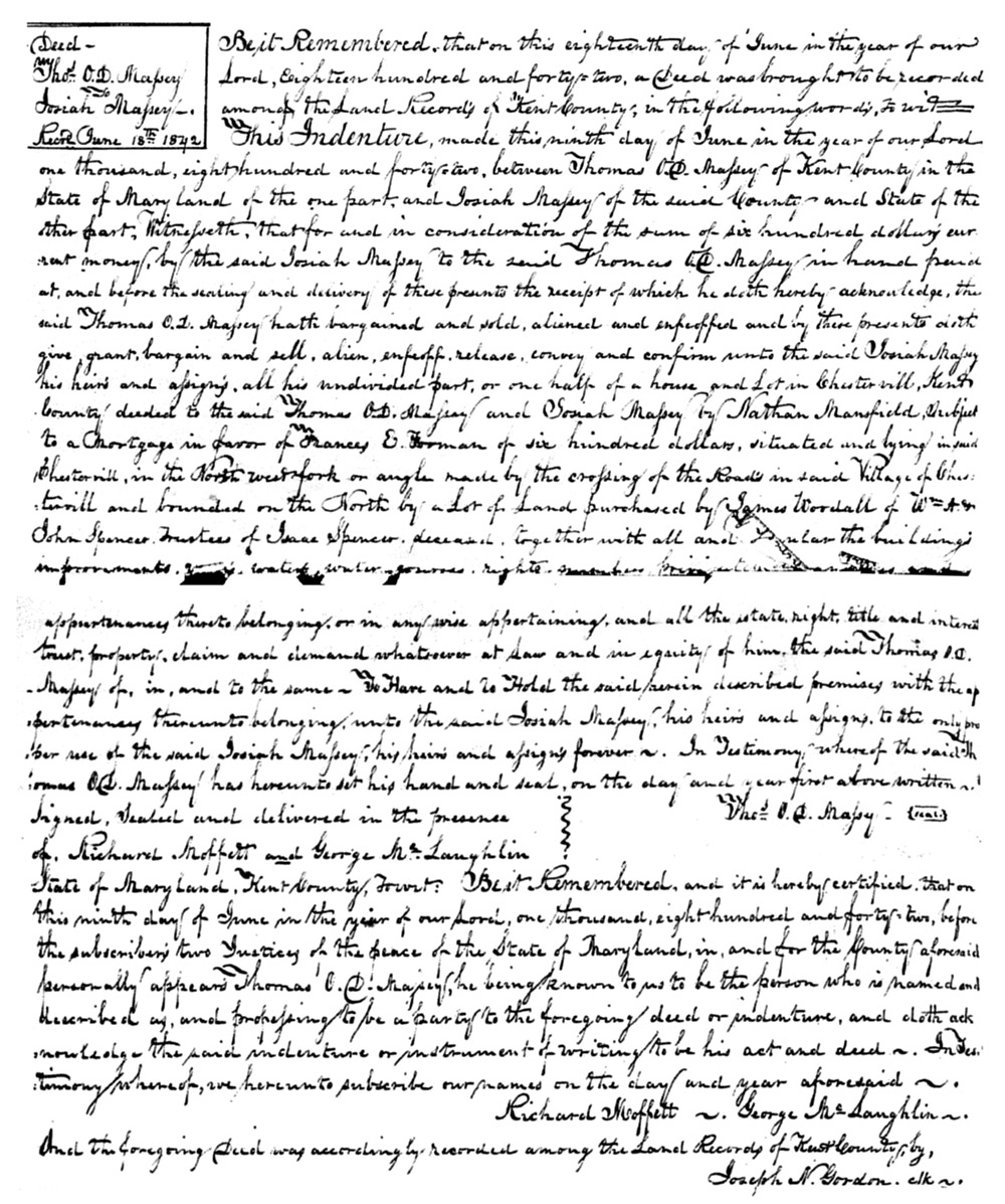
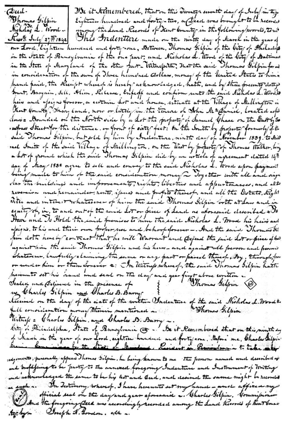
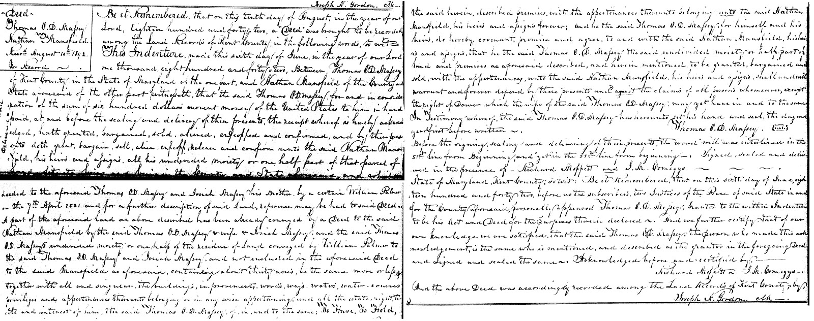
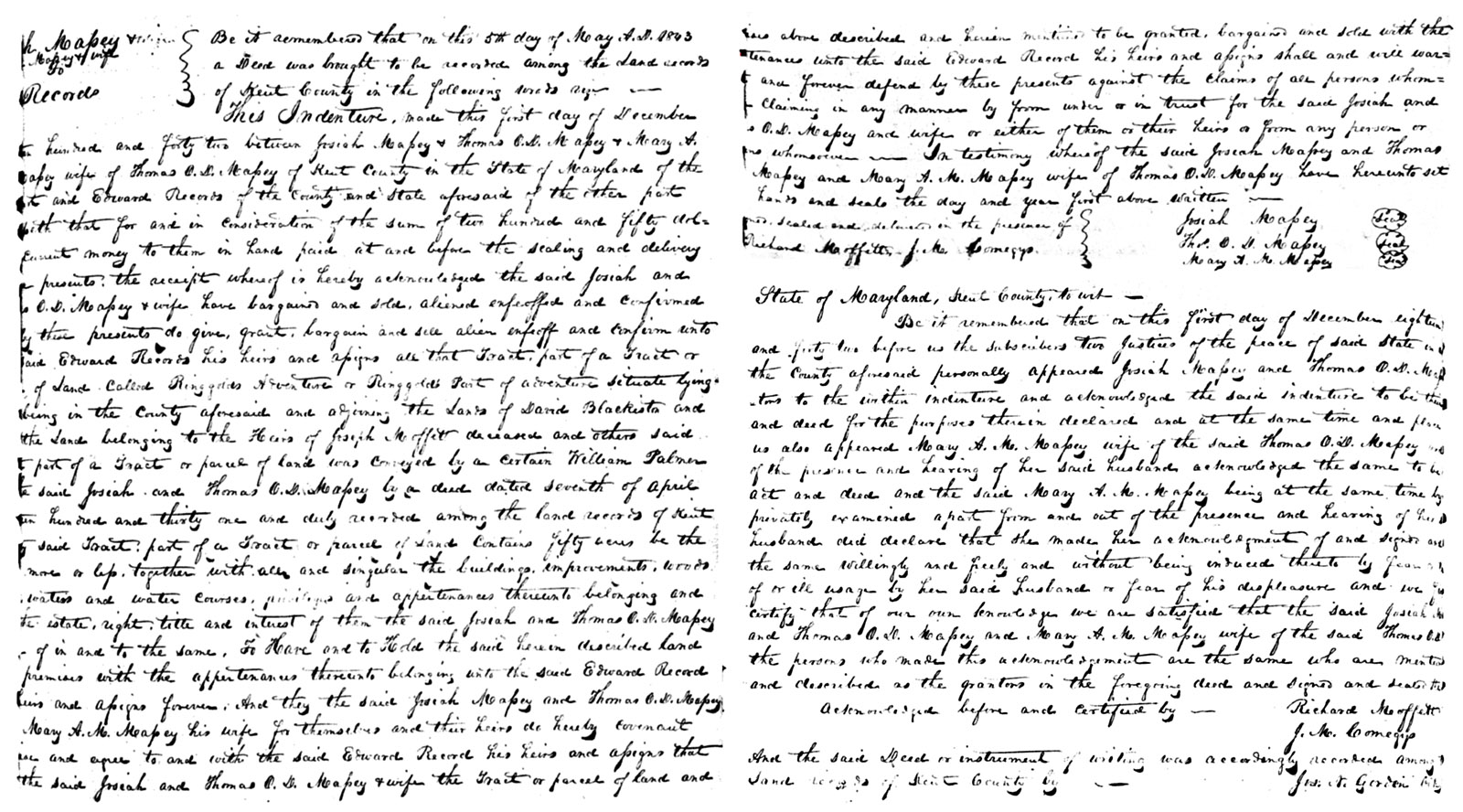
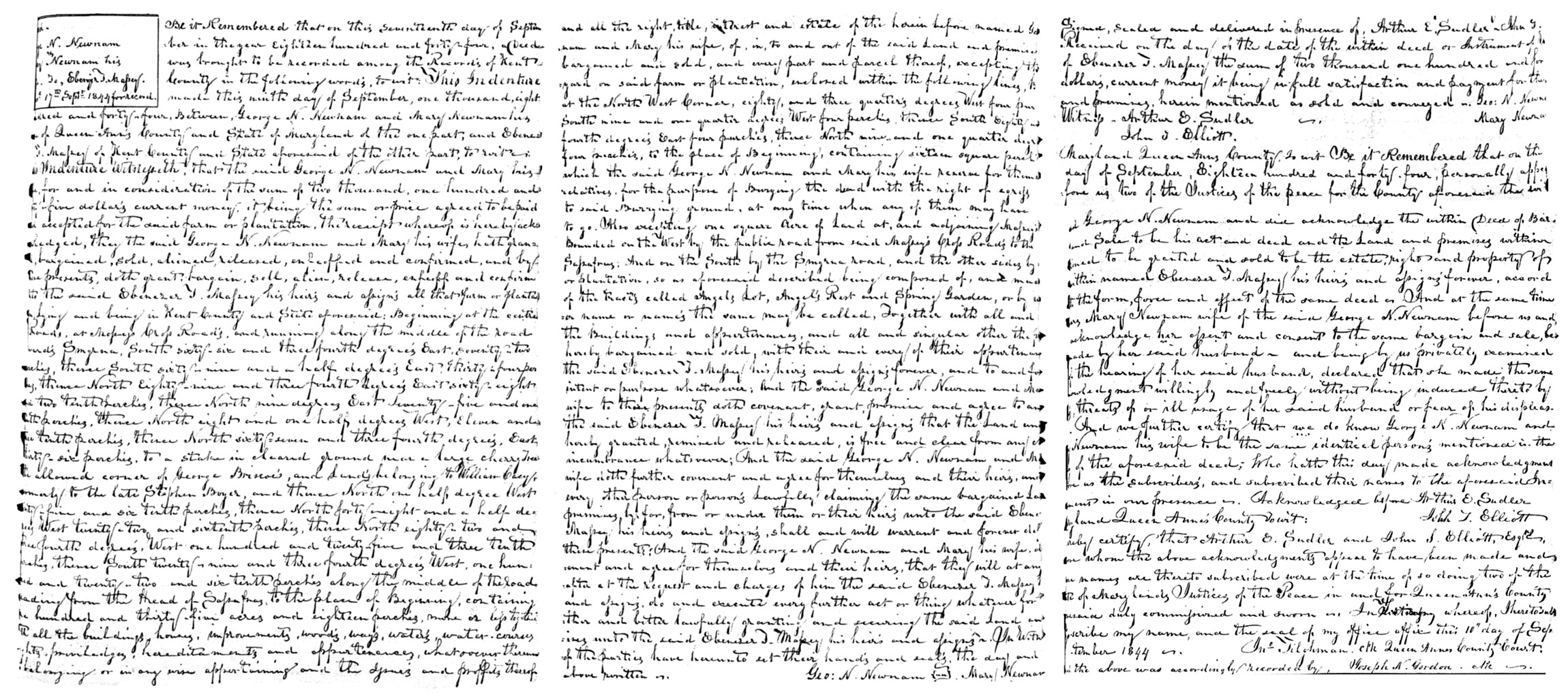
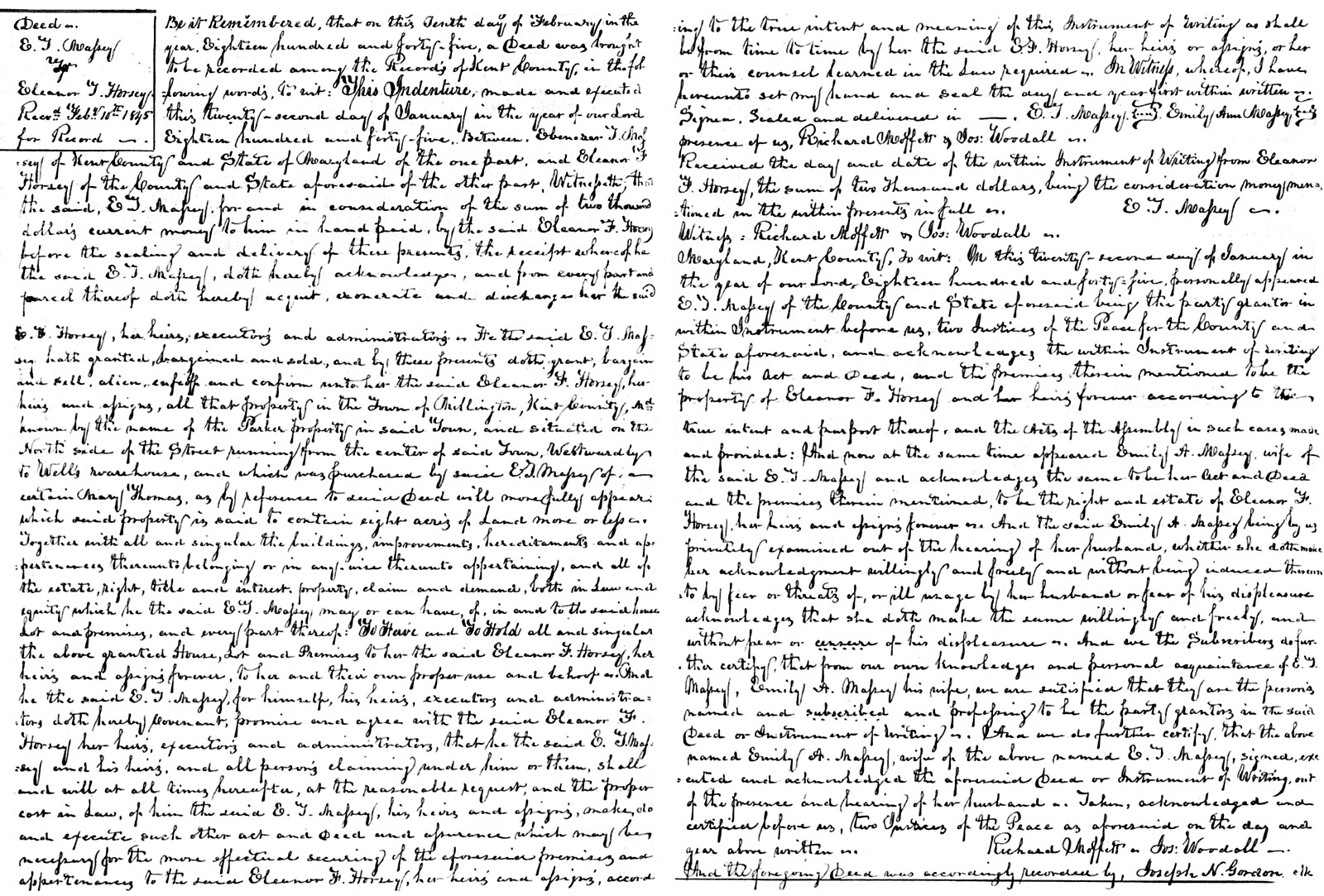
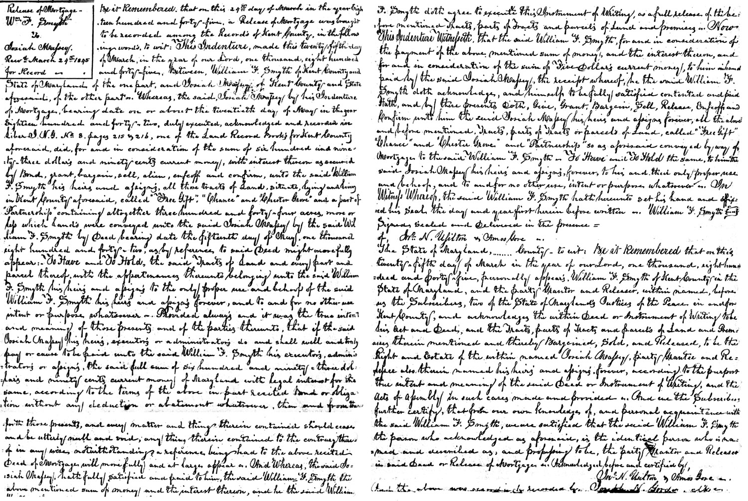
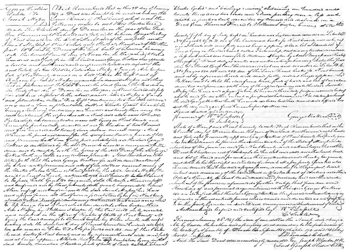
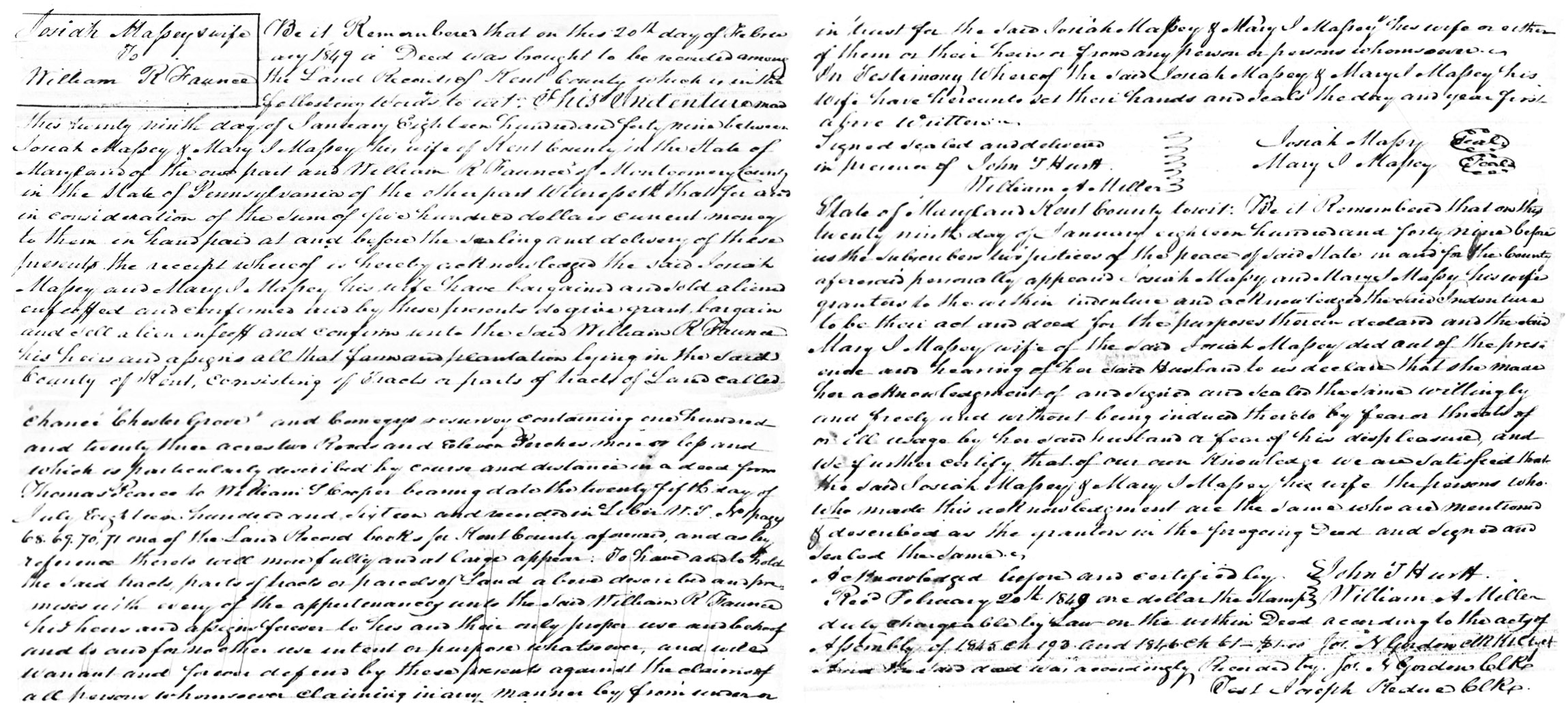
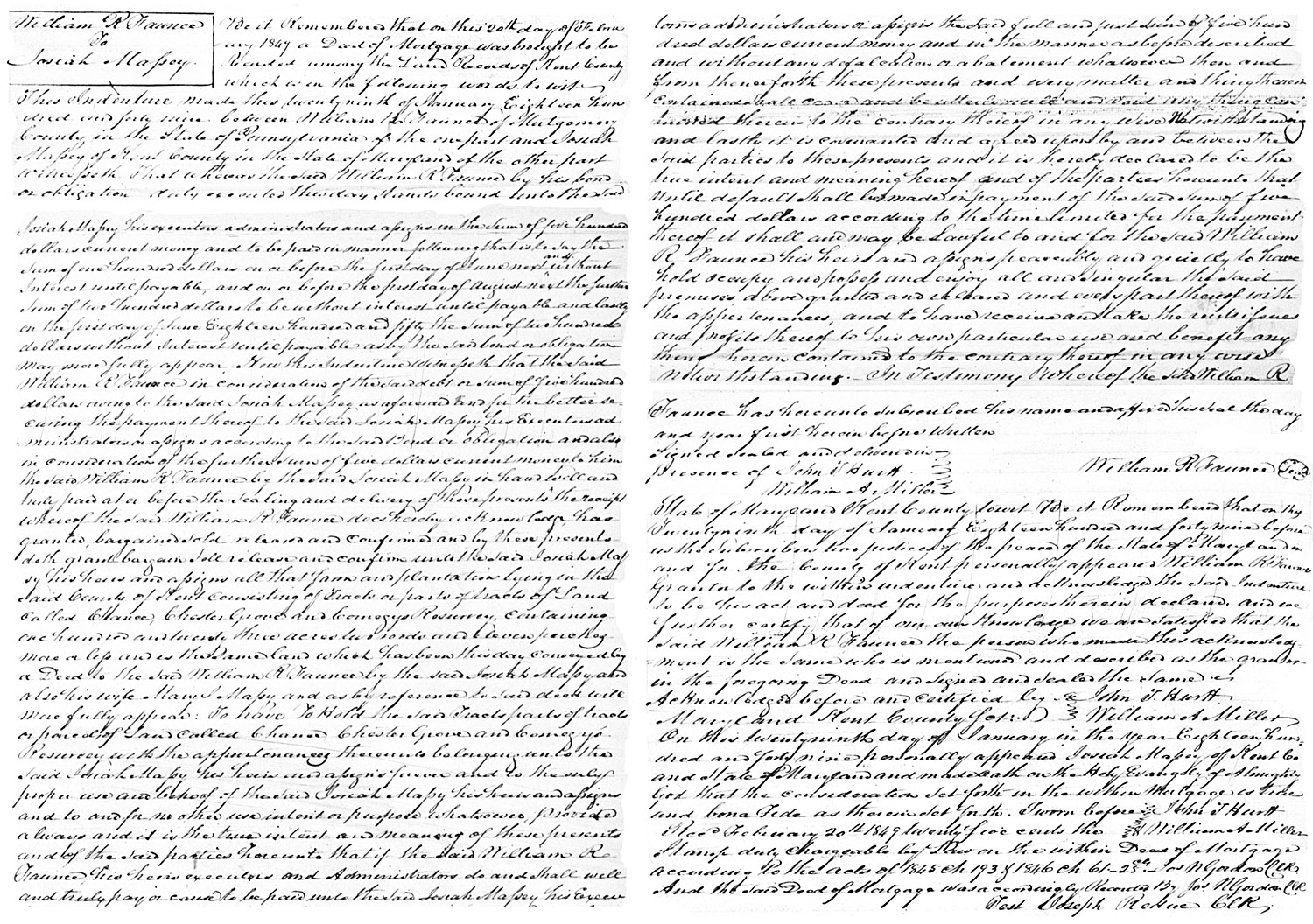
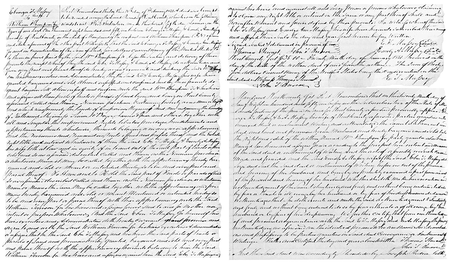
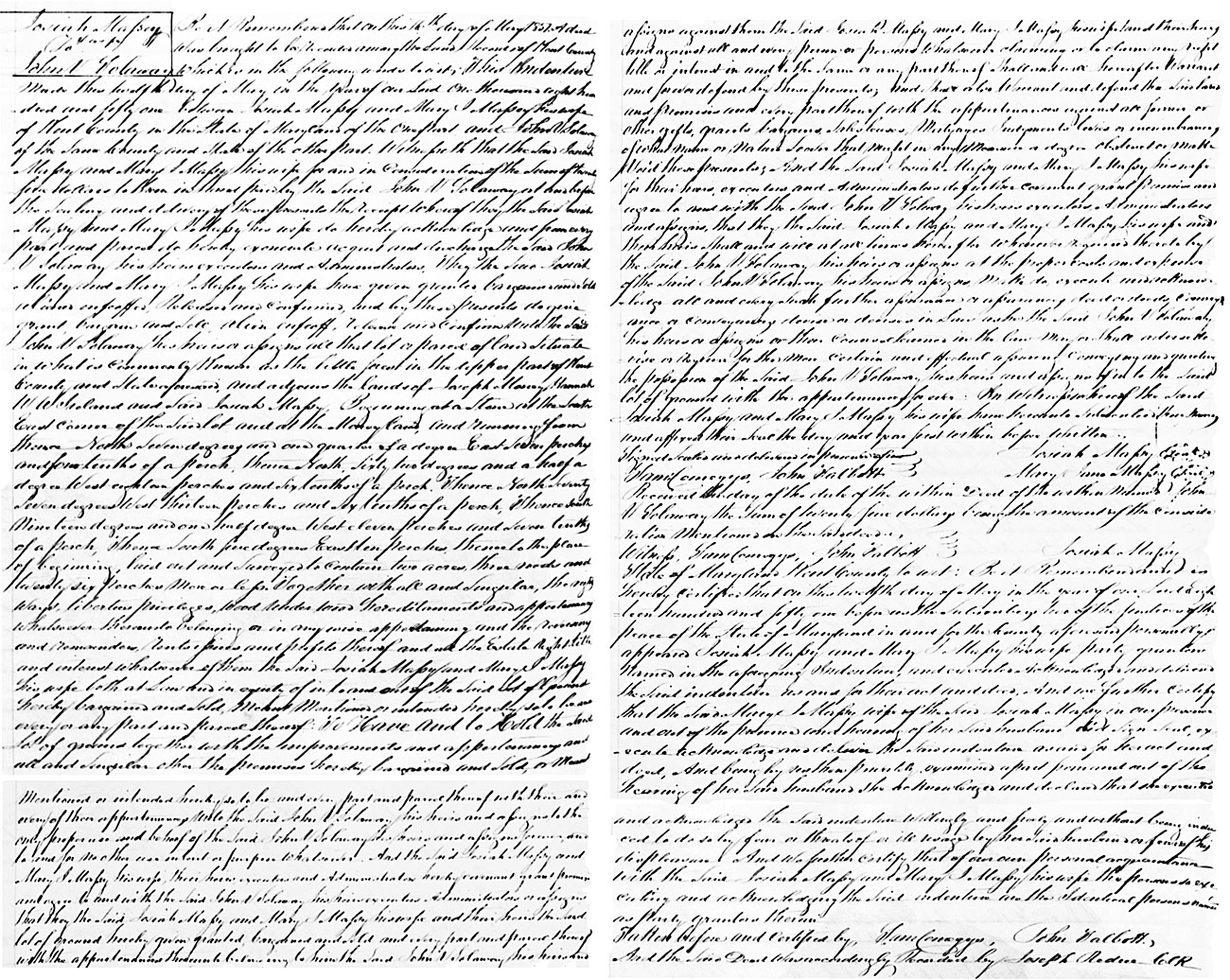
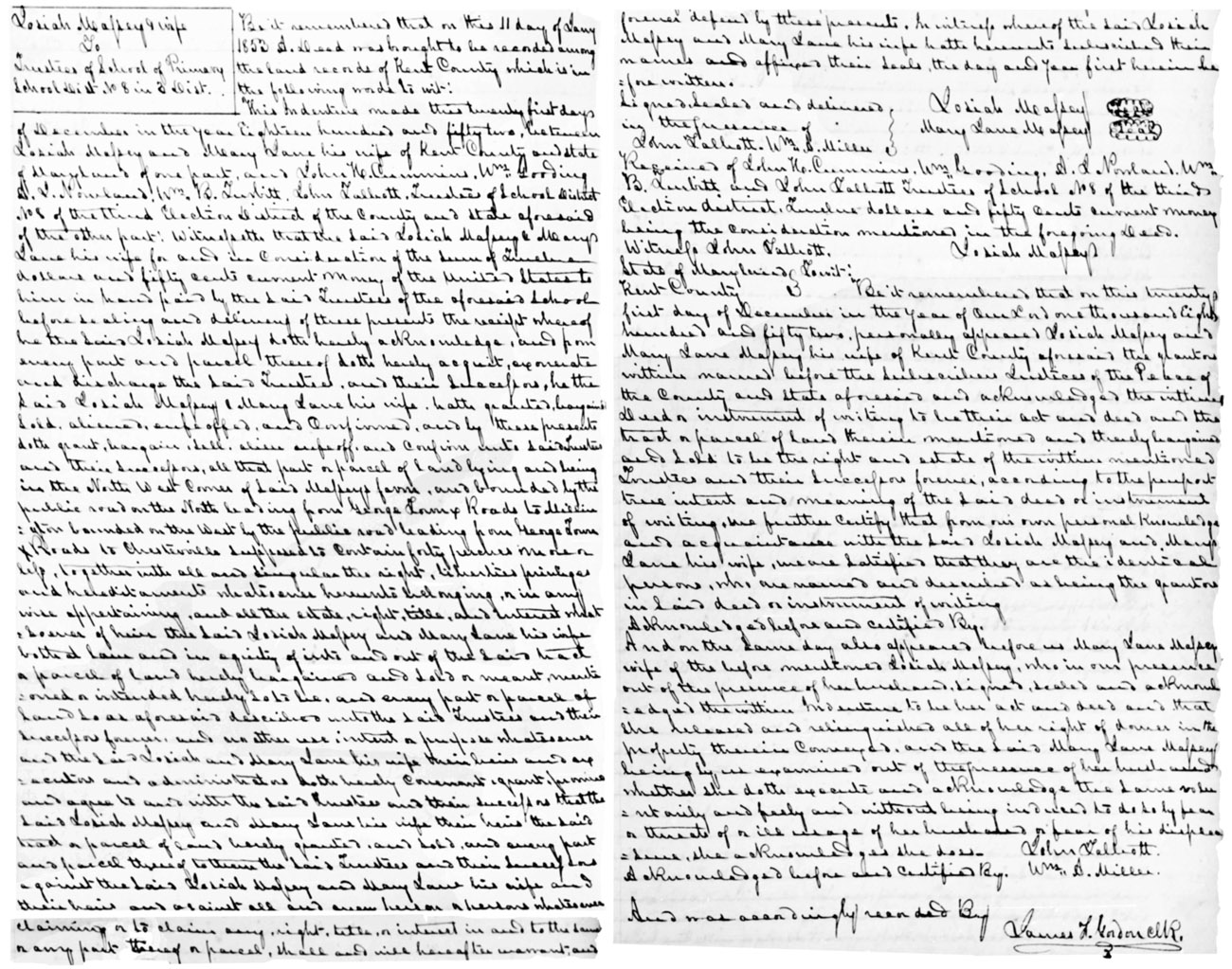
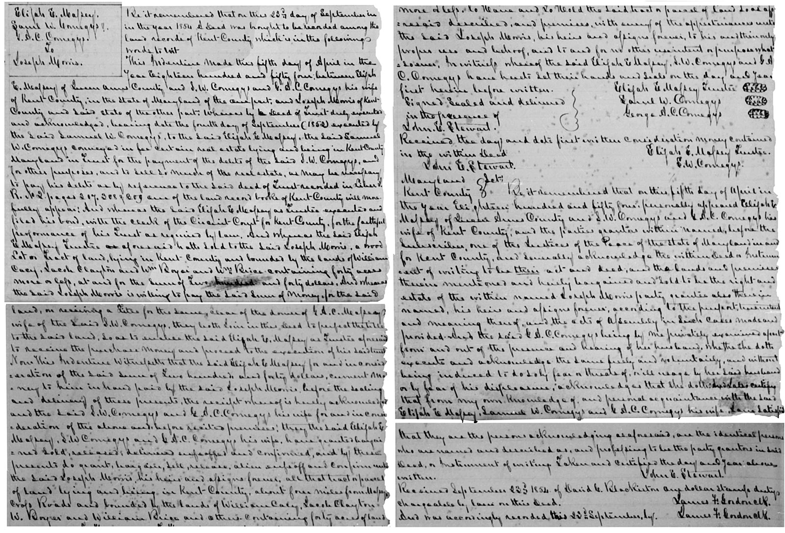
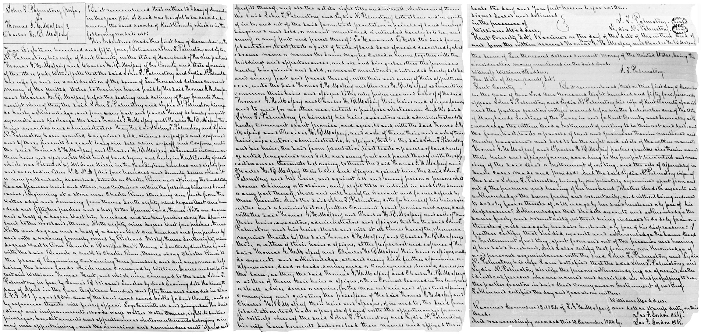
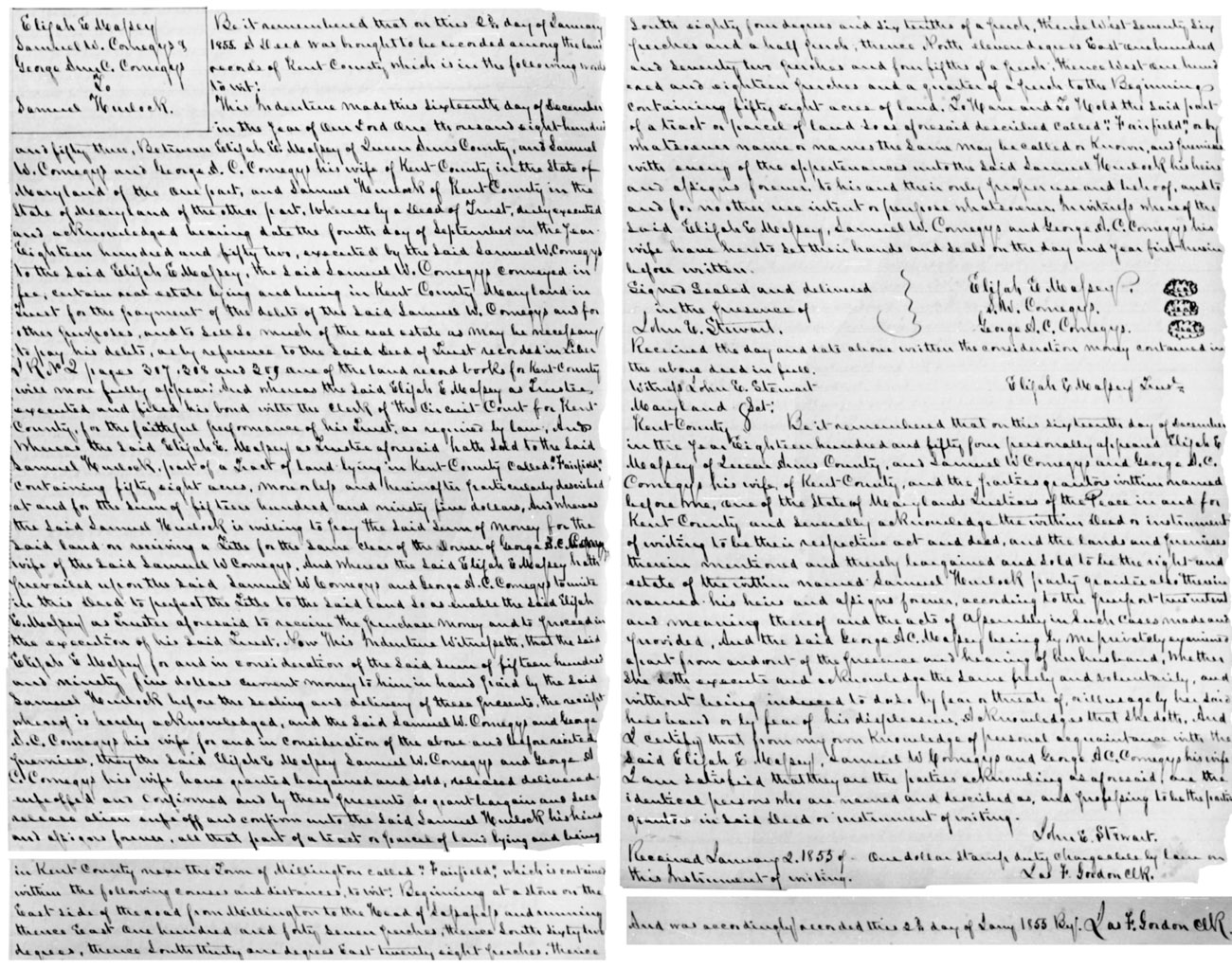
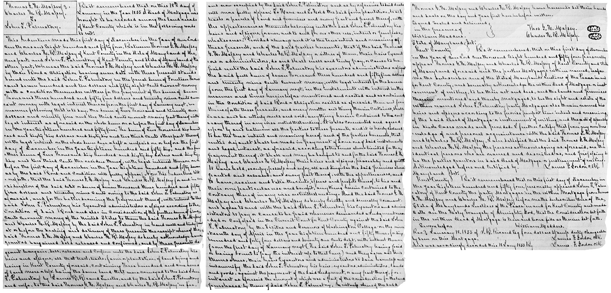
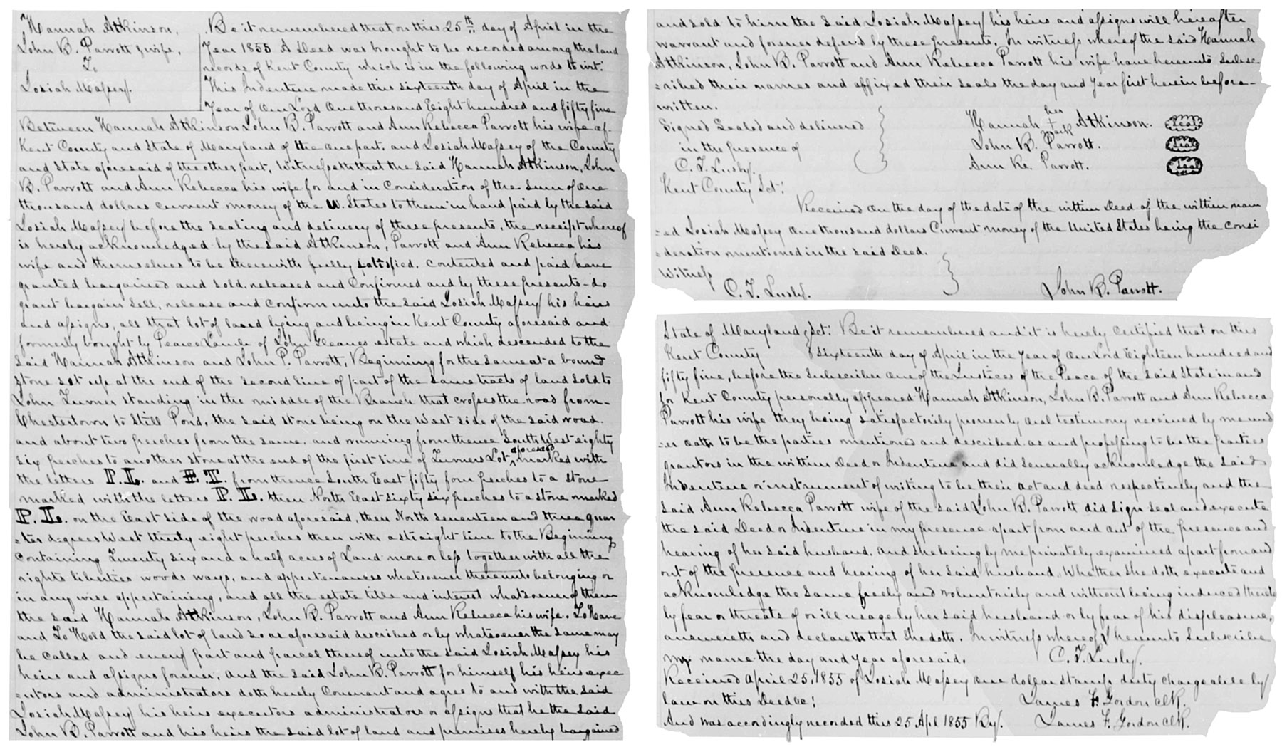
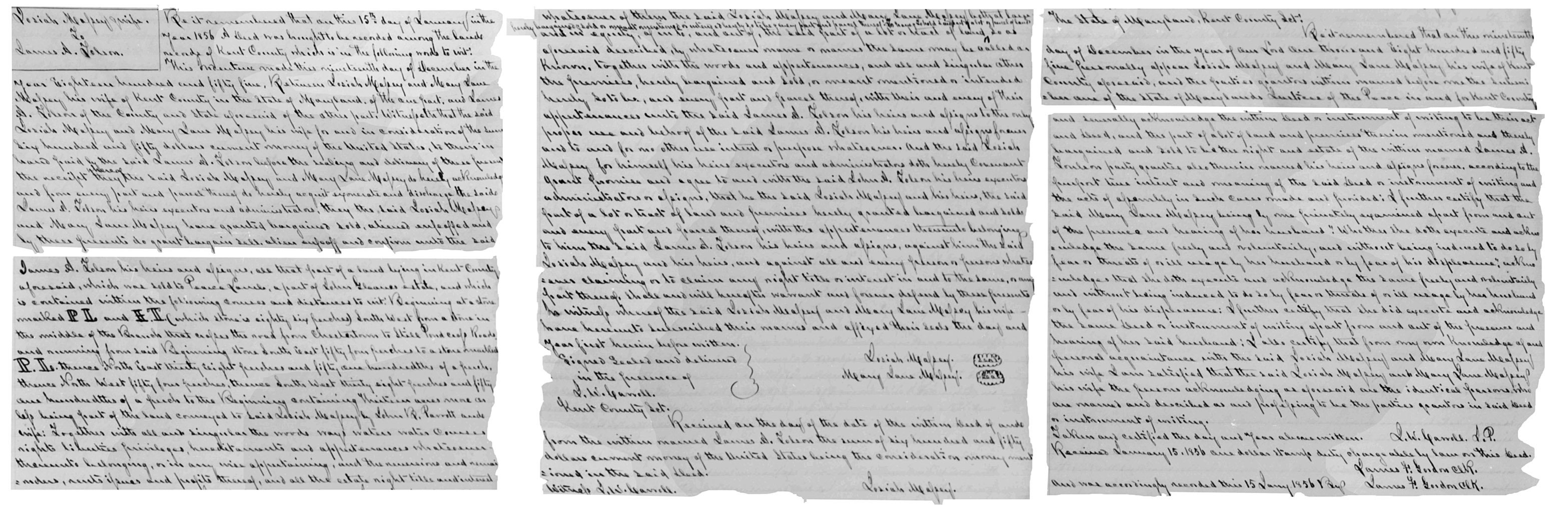
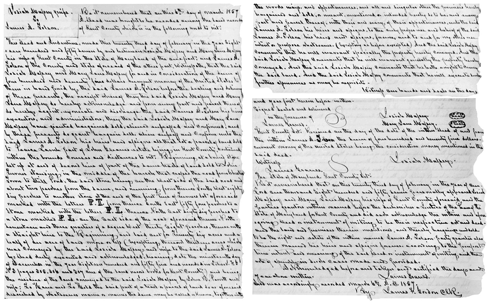
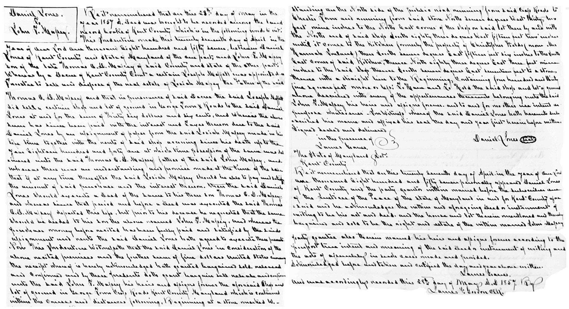
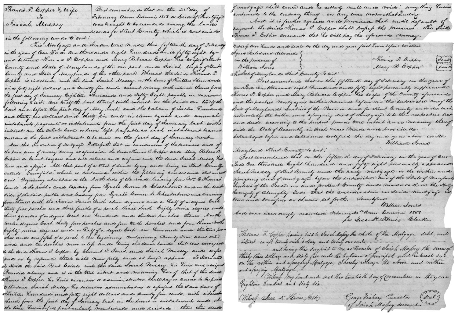
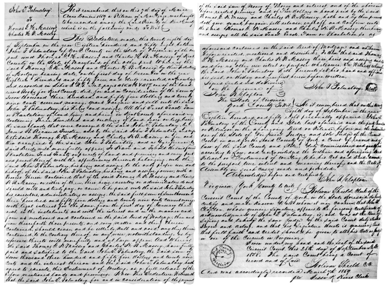
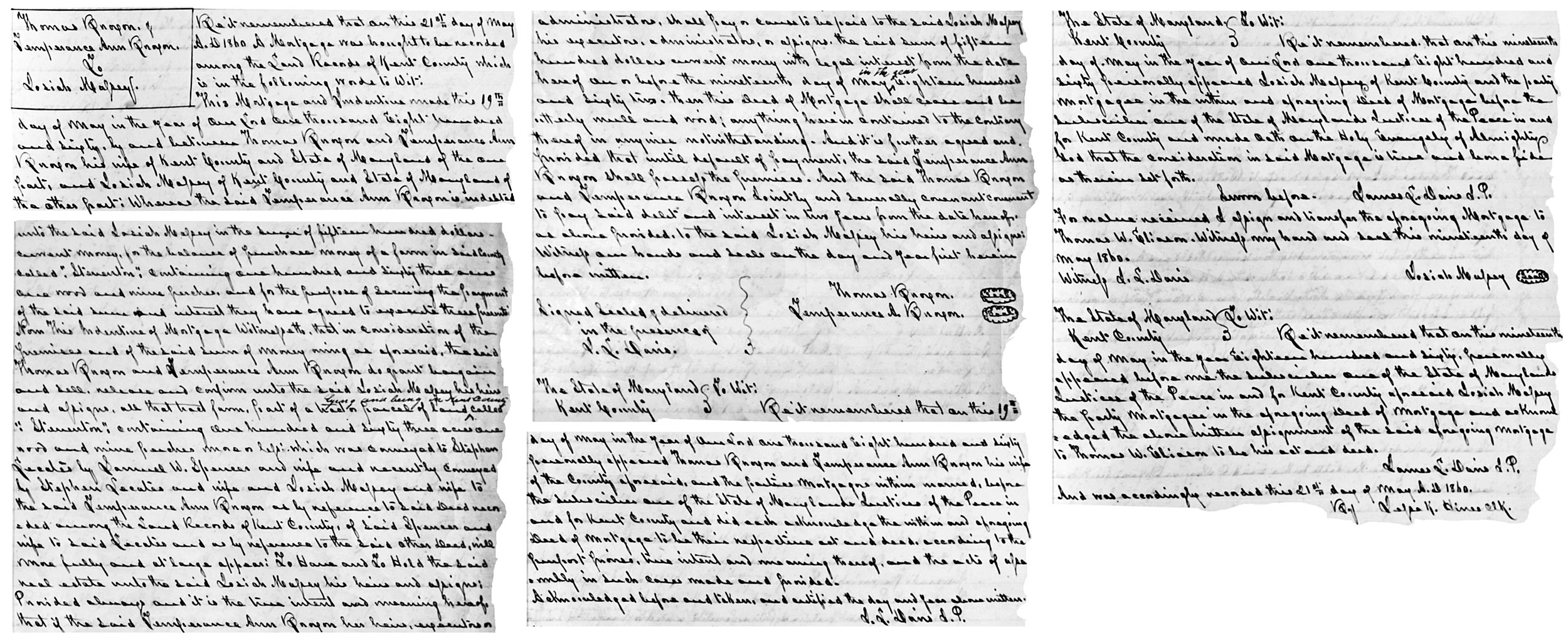
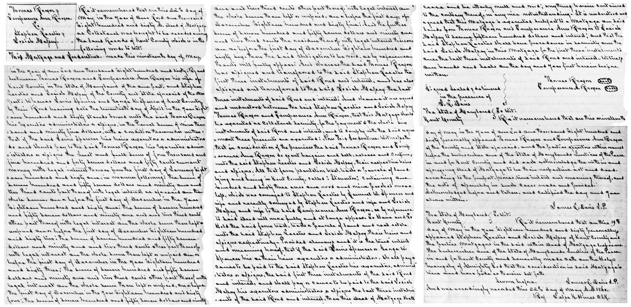
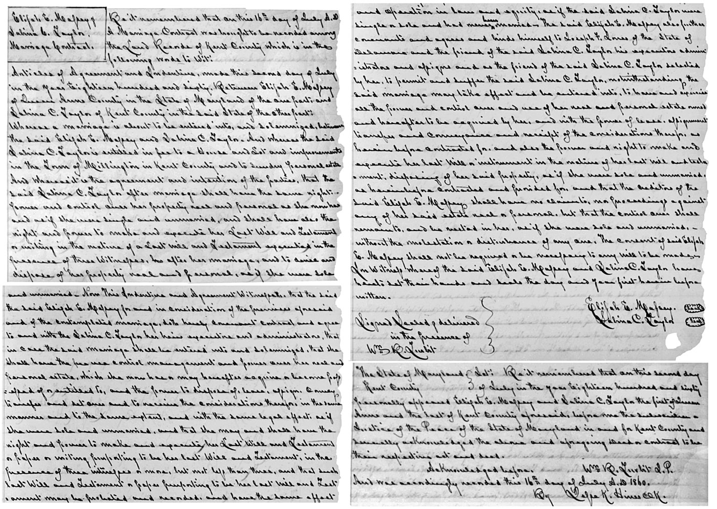
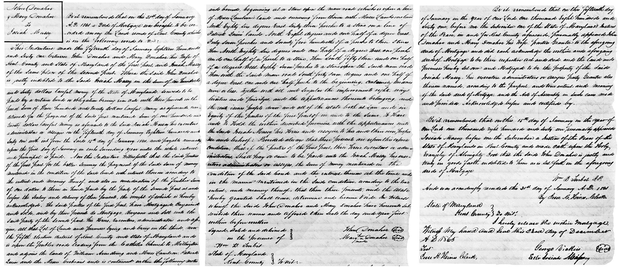
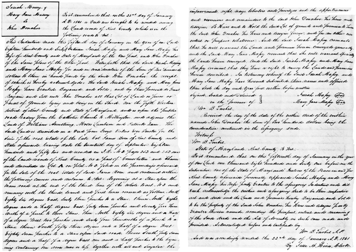
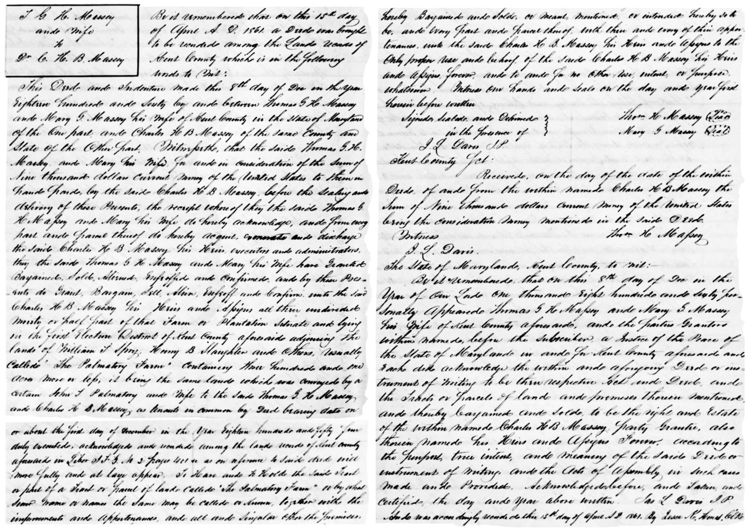
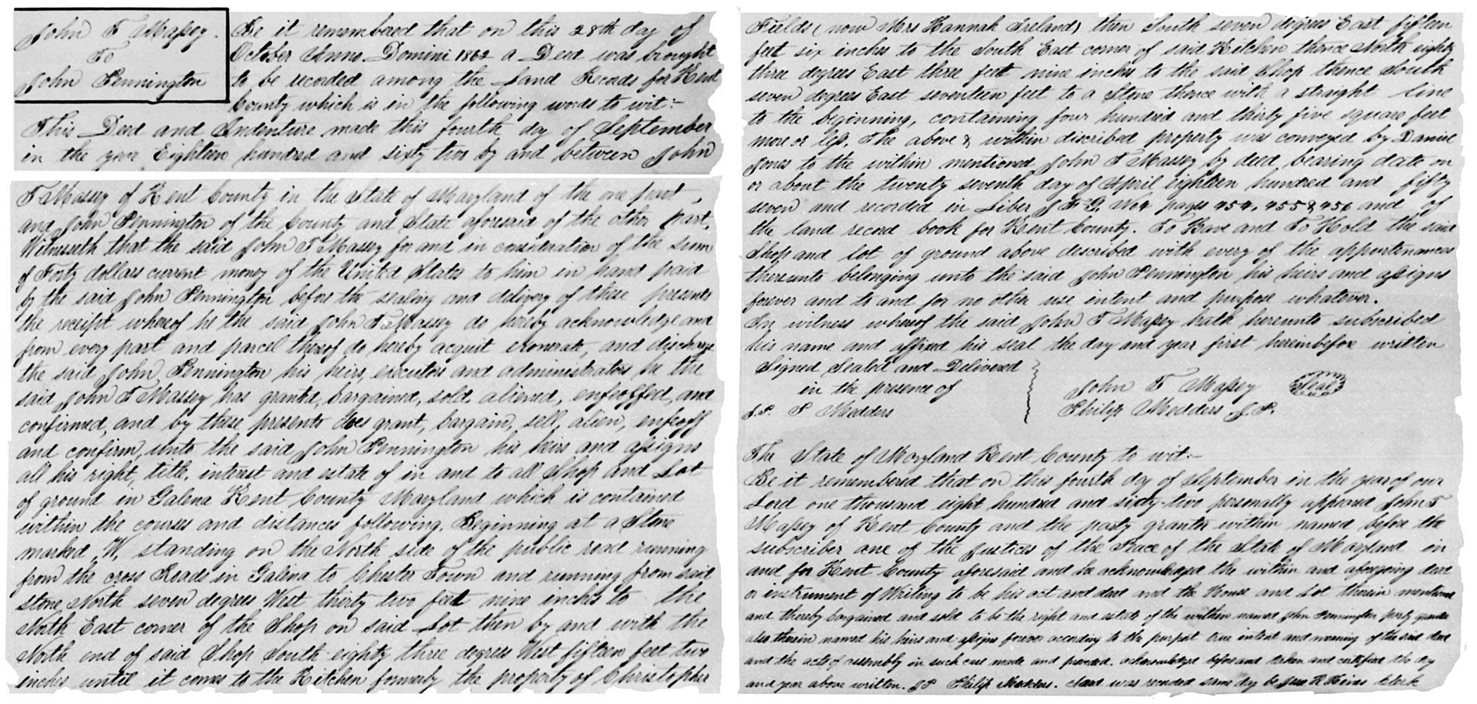
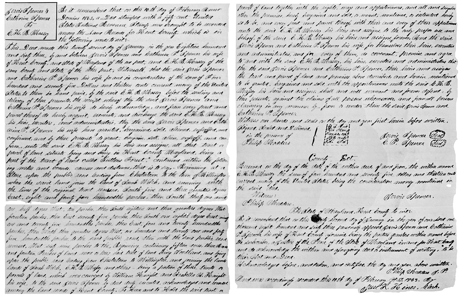
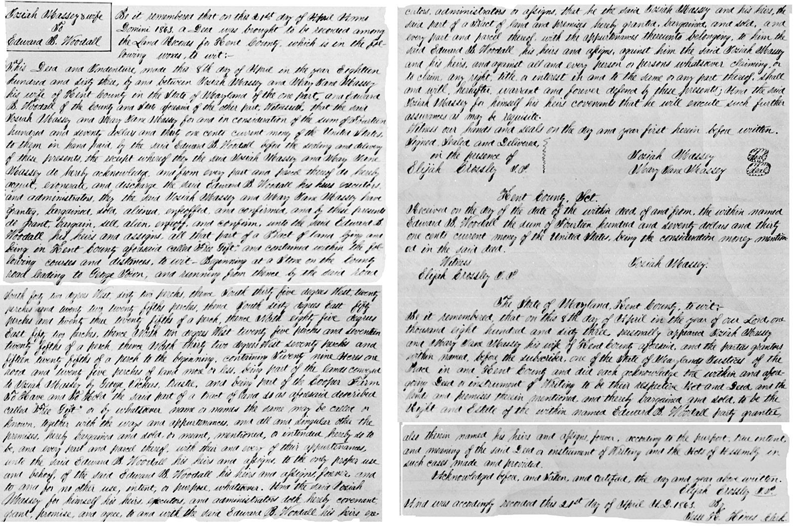
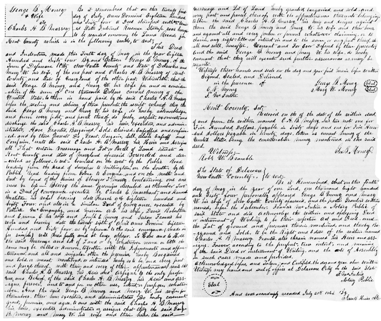
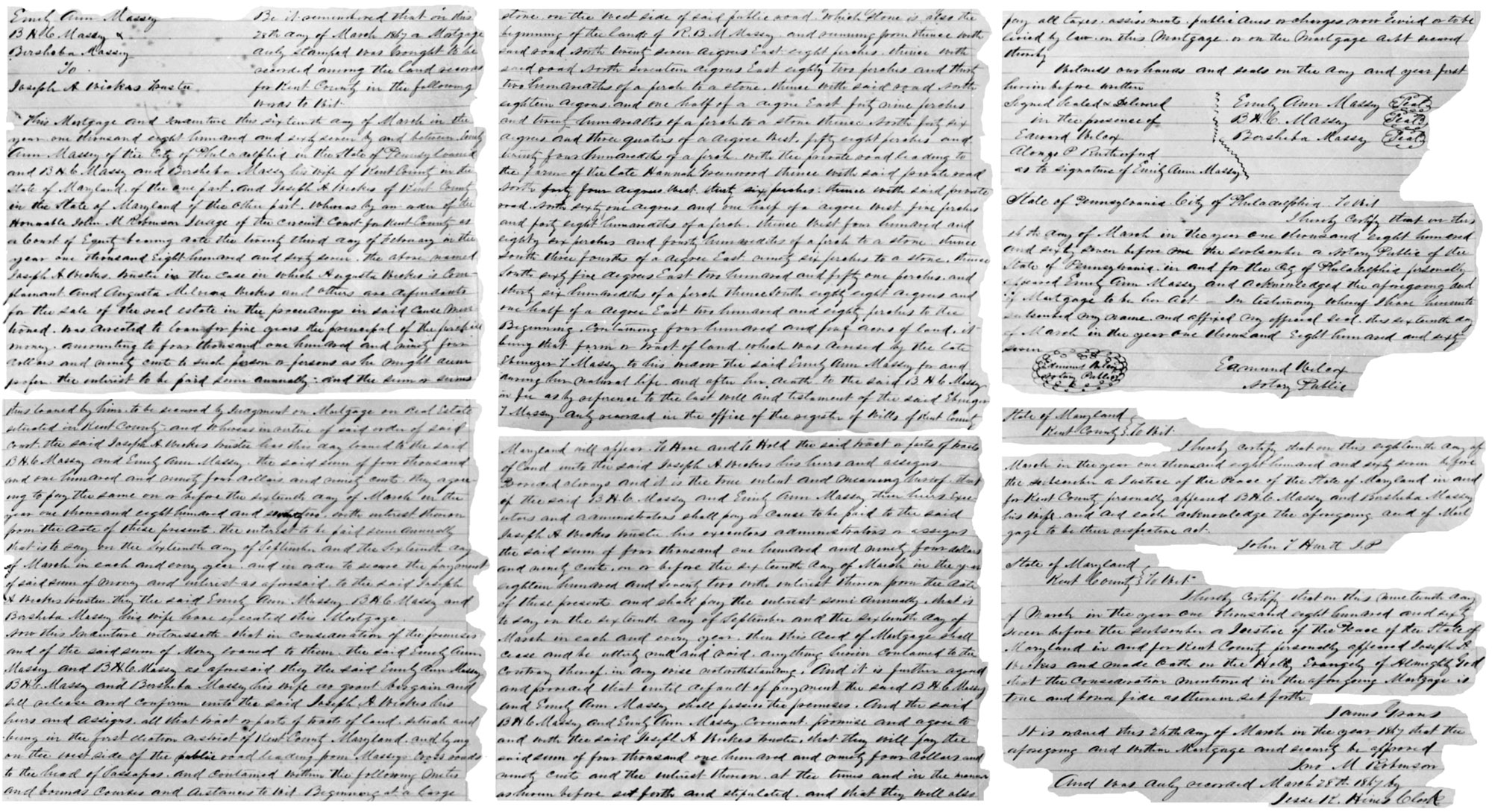