Date
|
Parcel
|
1658/01/01
|
|
Grantor
|
Grantee
|
Parcel
|
Acreage
|
Lib:No:Fol
|
Type
|
|
Henry Coursey
|
|
Lords Gift
|
1050
|
Q:257
Q:257
|
Patent
|
1658:
Lords Gift: 1050 acres - Developer/Owner:
Henry Coursey.
Note: there are two other parcels called Lords Gift: one by Stephen Tully; the other by John Tillotson.
|
1673/01/01
|
|
Grantor
|
Grantee
|
Parcel
|
Acreage
|
Lib:No:Fol
|
Type
|
|
Richard Tilghman
|
|
Poplar Hill
|
600
|
17:314
|
Certificate
|
1673:
Poplar Hill: 600 acres - Developer/Owner: Richard Tilghman
Note: there is another Poplar Hill, by James
Hawkins.
|
1674/01/01
|
|
Grantor
|
Grantee
|
Parcel
|
Acreage
|
Lib:No:Fol
|
Type
|
|
Stephen Tully
|
|
Tullys Lot
|
300
|
15:284
|
Certificate
|
1674:
Tullys Lot: 300 acres - Developer/Owner: Stephen Tully
|
1676/01/01
|
|
Grantor
|
Grantee
|
Parcel
|
Acreage
|
Lib:No:Fol
|
Type
|
|
John Broadrib
|
|
Bath
|
500
|
19:358
15:307
|
Patent
|
1676:
Bath: 500 acres - Developer/Owner: John Broadrib
|
1676/01/01
|
|
Grantor
|
Grantee
|
Parcel
|
Acreage
|
Lib:No:Fol
|
Type
|
|
William Hemsley
|
|
Hemsley
|
300
|
19:407
|
Certificate
|
1676:
Hemsley: 300 acres - Developer/Owner: William Hemsley
|
1677/01/01
|
|
Grantor
|
Grantee
|
Parcel
|
Acreage
|
Lib:No:Fol
|
Type
|
|
Stephen Tully
|
|
Ashlon or Ashton
|
300
|
19:466
15:285
|
Patent
|
1677:
Ashlon, Ashton: 300 acres - Developer/Owner: Stephen Tully
|
1681/01/01
|
|
Grantor
|
Grantee
|
Parcel
|
Acreage
|
Lib:No:Fol
|
Type
|
|
Vincent Lowe
|
|
The Beginning
|
500
|
CB:2:250
21:286
|
Patent
|
1681:
The Beginning: 500 acres - Developer/Owner: Vincent Lowe
Note: there are two other The Beginning's: One by William Hollingsworth; the other
by Arthur Emory
III.
|
1681/01/01
|
|
Grantor
|
Grantee
|
Parcel
|
Acreage
|
Lib:No:Fol
|
Type
|
|
Phillemon Lloyd
|
|
Durland or Darland
|
400
|
21:221
|
Certificate
|
1681:
Durland, Darland: 400 acres - Developer/Owner: Phillemon Lloyd
There are two tracts called Durland or Darland; the other is by Rebecca Lloyd.
|
1683/01/01
|
|
Grantor
|
Grantee
|
Parcel
|
Acreage
|
Lib:No:Fol
|
Type
|
|
Albert Johnson
|
|
Alberts Delight
|
200
|
SD:A:326
21:356
|
Patent
|
1683:
Albert's Delight 1683/??/?? 200 acres - Developer/Owner: Albert Johnson
Note: There's another tract called Albert's Delight (or Abbott); by Nathaniel Crisp.
|
1683/01/01
|
|
Grantor
|
Grantee
|
Parcel
|
Acreage
|
Lib:No:Fol
|
Type
|
|
John Salisbury
|
|
Bradfords Addition
|
100
|
SD:A:121
21:377
|
Patent
|
1683:
Bradford[s] Addition 1683/??/?? 100 acres - Developer/Owner: John
Salisbury
|
1683/01/01
|
|
Grantor
|
Grantee
|
Parcel
|
Acreage
|
Lib:No:Fol
|
Type
|
|
John Whittington
|
|
Chestnut Neck
|
150
|
SD:A:328
21:390
|
Patent
|
1683: Chestnut Neck: 150 acres -
Developer/Owner: John Whittington
Note: There are two tracts called
Chestnut Neck; the other is by John Hamor, Jr.
|
1683/01/01
|
|
Grantor
|
Grantee
|
Parcel |
Acreage |
Lib:No:Fol |
Type |
|
Thomas Collins
|
|
Collins His Range or
Collins Range
|
300
|
CB:3:489
21:229
|
Patent
|
1683:
Collins His Range or Collins Range: 300 acres - Developer/Owner: Thomas Collins
|
1683/01/01
|
|
Grantor
|
Grantee
|
Parcel
|
Acreage
|
Lib:No:Fol
|
Type
|
|
Stephen Tully
|
|
Lords Gift
|
300
|
SD:A:205
21:228
|
Patent
|
1683:
Lords Gift: 300 acres - Developer/Owner: Stephen Tully
Note: there are two other parcels called Lords Gift: one by Henry Coursey; the other by John Tillotson.
|
1683/01/01
|
|
Grantor
|
Grantee
|
Parcel
|
Acreage
|
Lib:No:Fol
|
Type
|
|
James Smith
|
|
Smiths Delight
|
300
|
SD:A:499
21:495
|
Patent
|
1683:
Smiths Delight: 300 acres - Developer/Owner: James Smith
|
1683/01/01
|
|
Grantor
|
Grantee
|
Parcel
|
Acreage
|
Lib:No:Fol
|
Type
|
|
Stephen Tully
|
|
Stepney
|
200
|
NS:B:63
21:492
|
Patent
|
1683:
Stepney: 200 acres - Developer/Owner:
Stephen Tully
There are two parcels called Stepney; the other is by James Sedwick. |
1685/01/01
|
|
Grantor
|
Grantee
|
Parcel
|
Acreage
|
Lib:No:Fol
|
Type
|
|
James Hall
|
|
Halls Harbor
|
500
|
NS:B:104
22:113
|
Patent
|
1685:
Halls Harbor: 500 acres - Developer/Owner: James Hall
|
1686/01/01
|
|
Grantor
|
Grantee
|
Parcel
|
Acreage
|
Lib:No:Fol
|
Type
|
|
Lawrence Knowles
|
|
Knowles Range
|
500
|
NS:B:253
22:215
|
Patent
|
1686:
Knowless Range, Knowles Range: 500 acres - Developer/Owner: Lawrence
Knowles
|
1686/01/01
|
|
Grantor
|
Grantee
|
Parcel
|
Acreage
|
Lib:No:Fol
|
Type
|
|
George Robotham
|
|
Robothams Park
|
500
|
NS:2:213
22:224
|
Patent
|
1686:
Robothams Park: 500 acres - Developer/Owner: George Robotham
|
1687/01/01
|
|
Grantor
|
Grantee
|
Parcel
|
Acreage
|
Lib:No:Fol
|
Type
|
|
Thomas Collins
|
|
Killemanam Plains
|
500
|
22:341
|
Certificate
|
1687:
Killemanam Plains: 500 Acres
Developer/Owner: Thomas Collins
|
1687/01/01
|
|
Grantor
|
Grantee
|
Parcel
|
Acreage
|
Lib:No:Fol
|
Type
|
|
Daniell Toaes
|
|
Lower Foards
|
200
|
NS:2:586
22:313
|
Patent
|
1687:
Lower Foards: 200 acres - Developer/Owner: Daniell Toaes
|
1687/01/01
|
|
Grantor
|
Grantee
|
Parcel
|
Acreage
|
Lib:No:Fol
|
Type
|
|
James Ridgely
|
|
Ridleys Chance
|
200
|
NS:2:419
22:296
|
Patent
|
1687:
Ridleys Chance: 200 acres - Developer/Owner: James Ridgely
|
1687/01/01
|
|
Grantor
|
Grantee
|
Parcel
|
Acreage
|
Lib:No:Fol
|
Type
|
|
Peter Sayer
|
|
Sayers Forrest
|
2,250
|
22:417
|
Certificate
|
1687:
Sayers Forrest: 2250 acres - Developer/Owner: Peter Sayer
There are two tracts called Sayer's Forrest; the other is by Charles Blake. |
1687/01/01
|
|
Grantor
|
Grantee
|
Parcel
|
Acreage
|
Lib:No:Fol
|
Type
|
|
William Hackett
|
|
Southampton
|
150
|
IB&IL:C:275
22:247
|
Patent
|
1687:
Southampton: 150 acres - Developer/Owner: William Hackett
|
1688/01/01
|
|
Grantor
|
Grantee
|
Parcel
|
Acreage
|
Lib:No:Fol
|
Type
|
|
James Clayland
|
|
Bridgewater, Bridge Water
|
300
|
NS:2:661
22:340
|
Patent
|
1688:
Bridgewater, Bridge Water: 300 acres - Developer/Owner: James Clayland
|
1688/01/01
|
|
Grantor
|
Grantee
|
Parcel
|
Acreage
|
Lib:No:Fol
|
Type
|
|
John Hollingsworth
|
|
Jerusalem
|
400
|
NS:2:189
22:192
|
Patent
|
1688:
Jerusalem: 400 acres - Developer/Owner: John Hollingsworth
|
1688/01/01
|
|
Grantor
|
Grantee
|
Parcel
|
Acreage
|
Lib:No:Fol
|
Type
|
|
Thomas Smithson
|
|
Reviving Springs
|
500
|
NS:2:629
22:339
|
Patent
|
1688: Reviving Springs: 500 acres
- Developer/Owner: Thomas Smithson
|
1688/01/01
|
|
Grantor
|
Grantee
|
Parcel
|
Acreage
|
Lib:No:Fol
|
Type
|
|
Francis Sheppard
|
|
Sheppards Forrest
|
400
|
NS:B:671
22:214
|
Patent
|
1688:
Sheppards Forrest: 400 acres - Developer/Owner: Francis Sheppard
|
1688/01/01
|
|
Grantor
|
Grantee
|
Parcel
|
Acreage
|
Lib:No:Fol
|
Type
|
|
James Sedwick
|
|
Stepney
|
300
|
NS:2:631
22:366
|
Patent
|
1688:
Stepney: 300 acres - Developer/Owner: James Sedwick
There are two parcels called Stepney; the other one is by Stephen Tully.
|
1702/01/01
|
|
Grantor
|
Grantee
|
Parcel
|
Acreage
|
Lib:No:Fol
|
Type
|
|
Nicholas Massey
|
|
Masseys Hazard
|
90
|
DS:F:436
DD:5:48
|
Patent
|
1702:
Masseys Hazard: 90 acres - Developer/Owner: Nicholas Massey
|
1707/01/01
|
|
Grantor
|
Grantee
|
Parcel
|
Acreage
|
Lib:No:Fol
|
Type
|
|
William Hollingsworth
|
|
The Beginning
|
100
|
PL:3:123
DD:5:569
|
Patent
|
1707:
The Beginning : 100 acres - Developer/Owner: William Hollingsworth
Note: there are two other The
Beginning's: One by Vincent Lowe; the other by Arthur Emory III. |
1714/01/01
|
|
Grantor
|
Grantee
|
Parcel
|
Acreage
|
Lib:No:Fol
|
Type
|
|
Charles Blake
|
|
Sayers Forrest
|
2,250
|
RY:1:235
EE:6:181
|
Patent
|
1714:
Sayers Forrest 1714/??/?? 2250 acres - Developer/Owner: Charles Blake
There are two tracts called Sayer's Forrest; the other is by Peter Sayer.
|
| 1714/06/12 |
|
Grantor
|
Grantee
|
Parcel
|
Acreage
|
Lib:No:Fol
|
Type
|
|
Peter
Massey
|
Nicholas
Massey
|
Johnsons
Adventure
|
100
|
IK:A:6
|
Deed
|
June 6, 1714: Peter Massey hands
over, solely out of love and affection, a 100 acre parcel called
Johnson's Adventure (adjacent to land laid out for Symon Willmore) to
Nicholas Massey. Johnson's
Adventure lies on the East side of a small branch running out of
the Unicorn Branch on the South side of the Chester River. Courses: Beginning at a marked white oak,
being the first bounded tree of a parcel of land formerly laid out for
Symon Willmore and running from thence South with that land three
hundred and twenty perches, then West one hundred perches and from
thence with a straight line to the first tree containing one hundred
acres. Witnesses: Nicholas Bonds, John Collins, and James Willson,
Senior; Francis Spry, and Bon Bonner. Acting for the Crown: John
Salter and John Whittington.
Peter Massey's
attorney is Nicholas Hands, Esquire.
|
1723/01/01
|
|
Grantor
|
Grantee
|
Parcel
|
Acreage
|
Lib:No:Fol
|
Type
|
|
David Perkins
|
|
Woodridge
|
200
|
PL:5:545
|
Patent
|
1723:
Woodridge: 200 acres - Developer/Owner: David Perkins
Another tract with a similar name is Wood[b]ridge
Corrected.
|
1723/07/01
|
|
Grantor
|
Grantee
|
Parcel
|
Acreage
|
Lib:No:Fol
|
Type
|
|
Edward Wright
|
|
Hazard
|
100
|
Pat. cert. 446
|
Patent
|
July
1, 1723: Hazard: 100 acres - Edward Wright
|
1724/01/01
|
|
Grantor
|
Grantee
|
Parcel
|
Acreage
|
Lib:No:Fol
|
Type
|
|
Francis Spry
|
|
Sprys Adventure
|
150
|
PL:6:49
IL:A:233
|
Patent
|
1724:
Sprys Adventure: 150 acres - Developer/Owner: Francis Spry
There are two tracts called Spry's Adventure; the other one is by Thomas Hynson Wright.
|
1726/01/11
|
|
Grantor
|
Grantee
|
Parcel
|
Acreage
|
Lib:No:Fol
|
Type
|
|
Richard Bennett
|
|
Bennetts Outlett
|
695
|
Pat cert. 83
|
Patent
|
January
11, 1726: Coomerys Addition (a.k.a. Bennetts Outlett): 695 acres -
Richard Bennett
|
1726/05/01
|
|
Grantor
|
Grantee
|
Parcel
|
Acreage
|
Lib:No:Fol
|
Type
|
|
Thomas Hynson Wright
|
|
Sprys Adventure
|
150
|
Pat. cert. 982
|
Patent
|
May
1, 1726: Sprys Adventure: 150 acres - Thomas Hynson Wright
There are two tracts called
Spry's Adventure; the other one is by Francis
Spry.
|
| 1726/11/24 |
|
Grantor
|
Grantee
|
Parcel
|
Acreage
|
Lib:No:Fol
|
Type
|
|
Thomas Hynson Wright and
wife Mary
|
James Massey
|
Friendship
|
100
|
IK:C:89
|
Deed
|
November 24, 1726: James Massey,
planter, for 5,500 pounds of tobacco buys a 100 acre portion of a tract
of land called Friendship in Queen Anne's County from Thomas Hynson
Wright and wife Mary. Courses: Beginning at a small white oak marked
with the sign of six notches, that is, three and three opposed, and
running thence West South West two hundred and twenty four perches,
thence South ten degrees East eighty one perches, thence East North
East two hundred and ten perches, then North thirty seven degrees West
fifty one perches, thence North thirty seven degrees East fifty eight
perches, thence straight to the aforesaid white oak marked with six
notches as aforesaid, containing and now laid out for one hundred
acres. Witnesses: Augustus Thompson and Humphrey Wells. Acting for the
Crown: Augustus Thompson and Humphrey Wells.
|
1727/10/17
|
|
Grantor
|
Grantee
|
Parcel
|
Acreage
|
Lib:No:Fol
|
Type
|
|
John Rowles &
wife;Joseph Weeks & wife.
|
|
Widows Lott
|
287
|
PL:7:13
IL:A:744
|
Patent
|
October
17, 1727: Widows Lott - 287 acres - Developer/Owner: John Rowles and
wife, and Joseph Weeks, and wife.
|
1728/05/16
|
|
Grantor
|
Grantee
|
Parcel
|
Acreage
|
Lib:No:Fol
|
Type
|
|
Richard Bennett
|
|
Hemsleys Reserve
|
185
|
PL:7:176
Cert.1728
|
Patent
|
May
16, 1728: Hemsleys Reserve [Rectified]- 185 acres - Developer/Owner:
Richard Bennett
|
1728/07/08
|
|
Grantor
|
Grantee
|
Parcel
|
Acreage
|
Lib:No:Fol
|
Type
|
|
Thomas Hynson Wright
|
|
Relief or Releif
|
1,145
|
Pat. cert. 853
|
Patent
|
July
8, 1728: Relief, Releif - 1,145 acres - Developer/Owner: Thomas Hynson
Wright
|
1728/10/08
|
|
Grantor
|
Grantee
|
Parcel
|
Acreage
|
Lib:No:Fol
|
Type
|
|
William Massey
|
|
Paccolott or Paccolett
|
18
|
Pat cert. 758
|
Patent
|
October
8, 1728: Paccolott, Paccolett - 18 acres - Developer/Owner: William
Massey
|
1728/10/10
|
|
Grantor
|
Grantee
|
Parcel
|
Acreage
|
Lib:No:Fol
|
Type
|
|
William Massy
|
|
Hazard
|
110
|
Pat. cert. 445
|
Patent
|
October
10, 1728: Hazard - 110 acres - Developer/Owner: William Massy
|
1729/08/17
|
|
Grantor
|
Grantee
|
Parcel
|
Acreage
|
Lib:No:Fol
|
Type
|
|
Richard Bennett
|
|
Broomley Lambeth
|
1,750
|
PL:7:38
IL:A:760
|
Patent
|
August
17, 1729: Bloomly Lambath, Broomily Lambeth - 1,750 acres -
Developer/Owner: Richard Bennett
|
| 1731/08/14 |
|
Grantor
|
Grantee
|
Parcel
|
Acreage
|
Lib:No:Fol
|
Type
|
|
Daniel
Massey
|
Christopher
Williams
|
Lower
Foards
|
200
|
RT:A:69
|
Deed
|
August 14, 1731: Christopher
Williams of Kent County in Maryland for 7 pounds buys a 200 acre tract
of land called Lower Foards
(adjoining land owned by Gilbert Falconar and adjacent to Rings End
that was owned by Thomas Collins in Queen Anne's County) from Daniel
Massey. Courses: Beginning at a marked oak near above where this land
called Rings End intersects the [Chester] River and from that oak runs
East and by South up the river two hundred perches and from the end of
the East and by South line runs South and by West one hundred and sixty
perches and from the said line runs West and by North two hundred
perches then on a straight line to the beginning bounded on the North
by the river containing and laid out for two hundred acres. Witnesses:
Gideon Pearce, Peter Massey, and John Johnson.
|
1733/01/01
|
|
Grantor
|
Grantee
|
Parcel
|
Acreage
|
Lib:No:Fol
|
Type
|
|
Rebecca Lyod (Lloyd)
|
|
Darland or Durland
|
1,750
|
PL:8:763
AM:1:277
|
Patent
|
1733:
Darland: 1750 acres - Developer/Owner: Rebecca Lyod (Lloyd)
There are two
tracts called Darland or Durland: the other is by Phillemon Lloyd.
|
1734/06/10
|
|
Grantor
|
Grantee
|
Parcel
|
Acreage
|
Lib:No:Fol
|
Type
|
|
John Tillotson
|
|
Lords Gift
|
350
|
EI:1:384
EI:3:368
|
Patent
|
June
10, 1734: Lords Gift: 350 acres - Developer/Owner: John Tillotson
|
1734/06/10
|
|
Grantor
|
Grantee
|
Parcel
|
Acreage
|
Lib:No:Fol
|
Type
|
|
Thomas Hynson Wright
|
|
Timber Swamp
|
200
|
EI:4:55
EI:3:360
|
Patent
|
June
10, 1734: Timber Swamp: 200 acres - Developer/Owner: Thomas Hynson
Wright
|
1734/10/24
|
|
Grantor
|
Grantee
|
Parcel
|
Acreage
|
Lib:No:Fol
|
Type
|
|
Thomas Hynson Wright
|
|
Toms Fancy Enlarged
|
2,100
|
Pat cert.
1061
|
Patent
|
October
24, 1734: Toms Fancy Enlarged: 2,100 acres - Developer/Owner: Thomas
Hynson Wright
|
1735/01/01
|
|
Grantor
|
Grantee
|
Parcel
|
Acreage
|
Lib:No:Fol
|
Type
|
|
John Hamor, Jr.
|
|
Chestnut Neck
|
340
|
Unpat. cert 45
|
Certificate
|
1735:
Chestnut Neck: 340 acres - Developer/Owner: John Hamor, Jr.
There are two tracts called
Chestnut Neck; the other is by John Whittington.
|
| 1735/07/24 |
J
|
Grantor
|
Grantee
|
Parcel
|
Acreage
|
Lib:No:Fol
|
Type
|
|
Thomas Hynson Wright and
wife Mary
|
James Massey
|
Friendship
|
120
|
RT:A:419
|
Deed
|
uly 24, 1735: James Massey,
planter, for the price of 5,500 pounds of leaf tobacco, buys from
Thomas Hynson Wright and wife Mary a 120 acre tract called Friendship,
located along the Unicorn Branch in Queen Anne's County. Courses:
Beginning at a small white oak marked with six notches viz.: three and
three opposite, and running thence West South West two hundred and
fifty perches then south nine degrees East eighty one perches then East
North East two hundred and forty perches then North fifty four degrees
West forty one perches and from thence with a straight line to the
tree, containing one hundred and twenty acres. Witnesses: Humphrey
Wells and Charles Downes. Acting for the Crown: Mssrs. Wells
& Downes and [even] T.H. Wright.
|
1735/10/07
|
|
Grantor
|
Grantee
|
Parcel
|
Acreage
|
Lib:No:Fol
|
Type
|
|
John Ross
|
|
Westminister
|
297
|
EI:4:444
EI:5:155
|
Patent
|
October
7, 1735: Westminister or Westminster: 297 acres - Developer/Owner: John
Ross
There are two similar tracts: The
other Westminister by William Neavite.
|
| 1737/06/28 |
|
Grantor
|
Grantee
|
Parcel
|
Acreage
|
Lib:No:Fol
|
Type
|
|
Thomas Hynson Wright and
wife Mary
|
James Massey
|
Friendship
|
65
|
RT:B:32
|
Deed
|
June 28, 1737: James Massey,
planter, for the sum of 2,700 pounds of tobacco and 16 pounds current
money of Maryland buys a 65 acre portion of Friendship, lying adjacent
to land sold by Richard Tilghman to Francis Spry, from Thomas Hynson
Wright and wife Mary. Courses: Beginning at the end of the line South
seventy degrees West two hundred and twenty perches of the said tract
of land sold by Col. Richard Tilghman to Francis Spry and running from
thence by the line aforesaid reversed North seventy four degrees East
one hundred and sixty perches and South nine degrees East forty one
perches and from thence with a straight line to the aforesaid beginning
at the end of the South seventy four degrees West line of Francis
Spry's land aforesaid containing sixty five acres. Witnesses: Augustus
Thompson and Humphrey Wells; acting for the Crown: Augustus Thompson,
Humphrey Wells, and Richard Tilghman Junior.
|
| 1741/10/03 |
|
Grantor
|
Grantee
|
Parcel
|
Acreage
|
Lib:No:Fol
|
Type
|
|
Morgan
Ponder
|
Samuel
Massey
|
Poplar
Hill
|
100
|
RT:B:372
|
Deed
|
October 3, 1741: Samuel Massey,
hatter of Queen Anne's County in Maryland, buys for £63 one half of a
100 acre portion of Poplar Hill from Morgan Ponder, planter, also of
Queen Anne's County. Morgan Ponder acquired all 100 acres from
William Eubank in a deed dated July 9, 1724. The present tract is on
the South side of Chester River and is the lowermost hundred acres of Poplar Hill. Courses: Beginning at
the end of one hundred perches on the West-South line of Poplar Hill
from the first bounded tree, and running thence West South West fifty
perches, thence South South East three hundred and twenty perches,
thence East North East fifty perches, thence North North West to the
first beginning as in and by the said deed. Now the said Morgan Ponder
has sold one half of the said 100 acres to John Collins, i.e., the
portion lying West or adjacent to Chester River, and it is now owned by
Maury Rippon. Samuel Massey's 50 acre part of Poplar Hill lies
uppermost or furthest from the side of Chester River. [Nowhere is the
boundary between the two 50 acre portions of Poplar Hill spelled out. -
GL,III,ed.] Acting for the Crown: Mr. Tilghman and Justices of the
Peace James Brown and John Earle.
|
1742/08/03
|
|
Grantor
|
Grantee
|
Parcel
|
Acreage
|
Lib:No:Fol
|
Type
|
|
Thomas Walker
|
|
Toms Adventure
|
50
|
Pat. cert. 1059
|
Patent
|
August
3, 1742: Toms Adventure [Addition]: 50 acres- Developer/Owner: Thomas
Walker
|
| 1743/07/28 |
|
Grantor
|
Grantee
|
Parcel
|
Acreage
|
Lib:No:Fol
|
Type
|
|
John Andrew & wife
Hannah Andrew, Boynton Newnam & wife Hannah Newnam
|
John Massey & James
Massey
|
Smiths Delight
|
118.5
|
RT:C:6
|
Deed
|
July 28, 1743: John Massey and
James Massey, shoemakers of Queen Anne's County in Maryland, buy for
6,000 pounds of leaf tobacco from John Andrew, planter, and Hannah his
wife, as well as Boynton Newnam and Hannah his wife, all of Queen
Anne's County, the 118-1/2 acre parcel called Smith's
Delight. Description: Beginning at the [East ?] line of the
land of Richard Ponder and his wife Sarah and containing 118-1/2 acres,
lying next to the Red Lyon Branch, lying to the Eastward of the said
land of Richard Ponder & Sarah his wife as by deed of partitions
made between Esokil Hamour and Richard Ponder & Sarah his wife by
deed dated September 11, 1727. Acting for the Crown: Mr. Tilghman and
Justices of the Peace James Brown and H. Wells, Junior. [Note: the
Massey name is variously written Mattoy and McCoyes here ... GL,III,ed.]
|
1744/05/17
|
|
Grantor
|
Grantee
|
Parcel
|
Acreage
|
Lib:No:Fol
|
Type
|
|
Christopher Spry
|
|
Sprys Chance
|
21
|
PT:1:27
LG:C:406
|
Patent
|
May
17, 1744: Sprys Chance: 21 acres - Developer/Owner: Christopher Spry
There are two other tracts called
Spry's Chance; one by ; and the other by .
|
| 1744/08/08 |
|
Grantor
|
Grantee
|
Parcel
|
Acreage
|
Lib:No:Fol
|
Type
|
|
Henry
Raveland and wife Elizabeth
|
Samuel
Massey
|
[not
stated]
|
100
|
RT:C:73
|
Deed
|
August 8, 1744: Samuel Massey,
hatter of Kent County in Maryland, buys for £40 from Henry Raveland and
his wife Elizabeth of St. Marys County one moiety or half part interest
in a 100 acre parcel inherited by Elizabeth Ayres Raveland from her
father George Ayres. Acting for the Crown: Richard Tilghman and
Justices of the Peace for St. Marys County Thomas Aisquith and Phillip
Starke, and Justices of the Peace for Queen Anne's County Richard Ward
and Hay Slk Soun, Junior.
|
| 1744/08/28 |
|
Grantor
|
Grantee
|
Parcel
|
Acreage
|
Lib:No:Fol
|
Type
|
|
John Sartain and unnamed
wife
|
James Massey
|
Friendship
|
85
|
RT:C:64
|
Deed
|
August 28, 1744: James Massey of
Queen Anne's County in Maryland buys for 4,200 pounds of leaf tobacco
from John Sartain and his unnamed wife an 85 acre portion of the tract
called Friendship in Queen Anne's County. Courses: Beginning at
the end of sixteen perches in the South seventy four degrees West line
of [the] part of said tract called Friendship sold by Soll. Tilghman to
Francis Spry where there is a small red oak marked with six notches
(i.e., three and three opposite) standing on the side of a hill on the
South West side of the Unicorn Branch, and running from the end of the
sixteen perches as aforesaid still South seventy four degrees West one
hundred and twenty perches, and North fifteen and a half degrees West
one hundred and eight perches, and East North East one hundred and
three perches, and South thirty three degrees West twelve perches to
the beginning of the South seventy four degrees West line as aforesaid,
and with that line to the aforesaid place of beginning at the small red
oak, containing eighty five acres. Acting for the Crown: Justices of
the Peace William Tilghman and H. Wells, Junior.
|
| 1745/03/03 |
|
Grantor
|
Grantee
|
Parcel
|
Acreage
|
Lib:No:Fol
|
Type
|
|
Peter Massey, Sr. &
wife Jane, Nicholas Massey & wife Katherine Massey, & James
Massey & wife Rachel
|
Peter Massey, Jr.
|
Johnsons Adventure with
Masseys Hazard
|
140
|
RT:C:137
|
Deed
|
March 3, 1745: Peter Massey, Jr.
of Kent County in Maryland for 6,200 pounds of tobacco buys a 140 acre
tract of land called Johnson's Adventure with Massey's Hazard from
Peter Massey, Sr. planter, and wife Jane (Jean), Nicholas Massey,
planter, and wife Katherine, and James Massey and wife Rachel.
Witnesses: James Brown, and H. Wells, Jr. Acting for the Crown:
[illegible] Tilghman.
|
| 1745/08/26 |
|
Grantor
|
Grantee
|
Parcel
|
Acreage
|
Lib:No:Fol
|
Type
|
|
John
Dempster and wife Joan
|
Samuel
Massey
|
Poplar
Hill
|
234
|
RT:C:125
|
Deed
|
August 26,1745: Samuel Massey,
hatter of Kent County in Maryland, buys for £250 from John Dempster of
Queen Anne's County a 234 acre portion of Poplar Hill. Courses: Beginning
at a cedar post standing at the mouth of a small branch of Chester
River called Fishing Creek on the South side of Chester River and
running from the said post South South East three hundred and twenty
perches, then East North East one hundred and two and a half perches,
then North North West three hundred and ninety six perches until it
comes to Chester River, then running down by and with the same unto the
beginning cedar post standing at Fishing Creek aforesaid, containing
two hundred and thirty four acres. Acting for the Crown: Richard
Tilghman and Justices of the Peace James Brown and H. Wells, Junior.
|
1745/11/04
|
|
Grantor
|
Grantee
|
Parcel
|
Acreage
|
Lib:No:Fol
|
Type
|
|
George Baynard
|
|
Baynards Pasture
|
239
|
BT&BY:2:23
LG:C:461
|
Patent
|
November
4, 1745: Baynards Pasture: 239 acres - Developer/Owner: George Baynard
|
| 1745/11/08 |
|
Grantor
|
Grantee
|
Parcel
|
Acreage
|
Lib:No:Fol
|
Type
|
|
John
Haymor
|
Samuel
Massey
|
Chestnut
Neck
|
300
|
RT:C:128-129
|
Lease
|
November 8, 1745: Samuel Massey,
hatter of Kent County in Maryland, leases for £5 plus three years of
Indian corn from John Haymor of Queen Anne's County a 300 acre tract
called Chestnut Neck. Courses:
Beginning at the mouth of a small creek called Dividing Creek and
running thence up and with said creek and the branch thereof to a
ditch, then with that ditch to intersect a parcel of land called Poplar Hill, then running with the
same unto the mouth of a small brook called Fishing Creek, and thence
running down by and with Chester River unto the mouth of Dividing Creek
aforesaid, containing three hundred acres. Acting for the Crown: George
Garnett and Justices of the Peace James Brown and H. Wells, Junior.
|
| 1745/11/08 |
|
Grantor
|
Grantee
|
Parcel
|
Acreage
|
Lib:No:Fol
|
Type
|
|
John
Haymor
|
Samuel
Massey
|
Chestnut
Neck
|
300
|
RT:C:129
|
Deed
|
November 8, 1745: Samuel Massey,
hatter of Kent County in Maryland, buys for £295 from John Haymor,
planter of Queen Anne's County, the 300 acre tract called Chestnut Neck. Courses: Beginning at
the mouth of a small creek called Dividing Creek and running thence up
with the said creek and the branch thereof to a ditch, then with that
ditch to intersect a parcel of land called Poplar Hill, then running with the
same unto the mouth of a small creek called Fishing Creek, and thence
running down by and with Chester River unto the mouth of Dividing Creek
aforesaid, containing three hundred acres. Witnesses: Lambert Wilmer
and George Garnett; acting for the Crown: Richard Tilghman and Justices
of the Peace James Brown and H. Wells, Junior.
|
| 1745/11/08 |
|
Grantor
|
Grantee
|
Parcel
|
Acreage
|
Lib:No:Fol
|
Type
|
|
Samuel
Massey and wife Sarah
|
Henry
Cully
|
Poplar
Hill
|
27
|
RT:C:130
|
Deed
|
November 8, 1745: Samuel Massey,
hatter of Kent County in Maryland, sells for £27 to Henry Cully a 27
acre portion of the tract called Poplar
Hill, formerly owned by John Dempster. Courses: Beginning at the
lowermost corner of Kingstown in Queen Anne's County by the riverside
and being also a corner of Henry Cully's lot in said town and running
from thence South thirty five degrees West eleven perches, then South
fifty five degrees east one hundred sixty eight perches until it
intersects the division line between the said Samuel Massey's and John
Novill's parts of Poplar Hill aforesaid and then with that line of
division North North West ninety four perches until it intersects the
main road leading into Kingstown, then with that road North fifty five
degrees West twenty five perches until it intersects Kingstown
aforesaid, then running along with the said town South thirty five
degrees West forty perches to the corner thereof, then with said town
to the place of beginning, containing twenty seven acres. Acting for
the Crown: Richard Tilghman and Justices of the Peace James Brown and
H. Wells, Junior.
|
| 1747/02/01 |
|
Grantor
|
Grantee
|
Parcel
|
Acreage
|
Lib:No:Fol
|
Type
|
|
Samuel
Massey and wife Sarah
|
James Auld
|
Lot No.19
|
[not
stated]
|
RT:C:286
|
Deed
|
February 1, 1747: Samuel Massey,
hatter of Chestertown in Kent County Maryland, and his wife Sarah sell
for £5 Town Lot No.19 in Kingstown, Queen Anne's County, to James Auld
of Dorchester County. Witnesses: Henry Hooper and Robert Jenkins Henry.
Acting for the Crown: Justice of the Peace Henry Hooper.
|
| 1747/03/24 |
|
Grantor
|
Grantee
|
Parcel
|
Acreage
|
Lib:No:Fol
|
Type
|
|
Samuel
Massey and wife Sarah
|
Daniel
Bird
|
Lot No.8
|
[not
stated]
|
RT:C:297
|
Deed
|
March 24, 1747: Samuel Massey,
hatter of Kent County in Maryland sells for £5 to Daniel Bird of
Bedford in Great Brittain, mariner, Town Lot No.8 in Kingstown in Queen
Anne's County. Acting for the Crown: Justices of the Peace James Brown
and H. Wells, Junior.
|
| 1747/10/01 |
|
Grantor
|
Grantee
|
Parcel
|
Acreage
|
Lib:No:Fol
|
Type
|
|
William Henissey and
wife Elizabeth
|
Samuel Massey
|
Chestnut Neck
|
50
|
RT:C:340
|
Deed
|
October 1, 1747: Samuel Massey,
hatter of Kent County in Maryland buys for £21 from William Henissey,
carpenter, and wife Elizabeth (daughter and devisee of John Haymor,
late of Queen Anne's County), both of Queen Anne's County, a fifty acre
tract, part of Chestnut Neck
in Queen Anne's County, lying opposite to Chestertown. Courses:
Beginning at the mouth of Fishing Creek, being also where the land
called Poplar Hill ends, and
running thence down by and with Chester River unto a small cove and
little marsh which is as follows: first South seventy two degrees West
twenty three perches, then South thirty [seven] degrees West twenty
perches, then South twenty degrees West eight [perches] then South
forty perches to the aforesaid cove, then running up the same South
fifty six degrees East thirty perches, then South twenty three degrees
West two perches, then East sixty two perches unto the aforesaid land
called Poplar Hill, thence with the same unto the beginning, containing
fifty acres. Acting for the Crown: Richard Tilghman and Justices of the
Peace James Brown and H. Wells, Junior.
|
| 1747/11/24 |
|
Grantor
|
Grantee
|
Parcel
|
Acreage
|
Lib:No:Fol
|
Type
|
|
Samuel
Massey and wife Sarah
|
William
Dames
|
Poplar
Hill
|
50
|
RT:C:251
|
Deed
|
November 24, 1747: Samuel Massey,
hatter of Kent County in Maryland, sells for £67 to William Dames,
merchant of Chestertown, a 50 acre portion of the tract called Poplar Hill in Queen Anne's County,
which was heretofore conveyed by [illegible] Ponder unto the aforesaid
Samuel Massey by deed dated June 9, 17xx. Acting for the Crown: Richard
Tilghman and Justices of the Peace for Kent County Charles Hynson and
Beddingfield Hands.
|
| 1747/12/02 |
|
Grantor
|
Grantee
|
Parcel
|
Acreage
|
Lib:No:Fol
|
Type
|
|
Samuel
Massey and wife Sarah
|
John
Haymor
|
Chestnut
Neck
|
300
|
RT:C:273
|
Deed
|
December 2, 1747: Samuel Massey,
hatter of Chestertown in Maryland, sells for £100 and 8,000 pounds of
tobacco to John Haymor, planter of Queen Anne's County, 300 acres of a
tract called Chestnut Neck in Queen
Anne's County on the Chester River. Courses: Beginning at the mouth of
Dividing Creek and running thence up with the said creek and the branch
thereof to a ditch, then with that ditch to intersect a parcel of land
called Poplar Hill, then running
with the same unto the mouth of Fishing Creek, and thence running down
by and with Chester River unto the mouth of Dividing Creek, containing
three hundred acres. Acting for the Crown: James Hynson and Justices of
the Peace for Kent County Charles Hynson and Beddingfield Hands. James
Smith is Kent County clerk.
|
1748/01/01
|
|
Grantor
|
Grantee
|
Parcel
|
Acreage
|
Lib:No:Fol
|
Type
|
|
James Maccoy
|
|
McCoys Pleasure
|
129
|
BY&GS:2:18
BY&GS:1:336
|
Patent
|
1748:
McCoys Pleasure, Maccoys Pleasure: 129 acres - Developer/Owner: James
Maccoy
|
| 1748/02/18 |
|
Grantor
|
Grantee
|
Parcel
|
Acreage
|
Lib:No:Fol
|
Type
|
|
Samuel
Massey and wife Sarah
|
Mary
Williams
|
Lot No.17
|
[not
stated]
|
RT:C:303
|
Deed
|
February 18, 1748: Samuel Massey,
hatter of Chestertown in Kent County Maryland, sells for £5 to Mary
Williams, widow of the same place, Lot No.8 in Kingstown in Queen
Anne's County. Acting for the Crown: Charles Beale and Justices of the
Peace James Brown and H. Wells, Junior.
|
1748/05/18
|
|
Grantor
|
Grantee
|
Parcel
|
Acreage
|
Lib:No:Fol
|
Type
|
|
Edward Roe
|
|
Roes Chance
|
247
|
Pst. cert. 888
|
Patent
|
May 18,
1748: Roes Chance: 247 acres - Developer/Owner: Edward Roe
|
| 1748/06/28 |
|
Grantor
|
Grantee
|
Parcel
|
Acreage
|
Lib:No:Fol
|
Type
|
|
Peter
Massey
|
John
Seegar
|
Johnsons
Adventure
|
100
|
RT:C:326
|
Deed
|
June 28, 1748: John Seegar,
mariner, of Queen Anne's County in Maryland for 55 pounds buys a 100
acre tract of land called Johnson's Adventure in Queen Anne's County
from Peter Massey, carpenter, and wife Mary. Courses: Beginning at a
marked white oak being a bounded tree of Simon Wilmon's land and
running with his land South three hundred and twenty perches thence
West one hundred perches and from thence with a straight line to the
aforesaid beginning tree containing one hundred acres. Witnesses: James
Brown, and H. Wells, Jr. Acting for the Crown: Al. Tilghman.
|
| 1749/04/27 |
|
Grantor
|
Grantee
|
Parcel
|
Acreage
|
Lib:No:Fol
|
Type
|
|
Samuel
Massey and wife Sarah
|
Daniel
Surrell
|
Lots
No.9, 20 and 23
|
[not
stated]
|
RT:C:378
|
Deed
|
April 27, 1749: Samuel Massey,
merchant of Chestertown in Kent County, sells for £15 to Daniel
Surrell, merchant of the same place, Town Lots No.'s 9, 20, and 23 in
Kingstown in Queen Anne's County. The lot is bounded on the one side by
Front Street, on the one side by King Street, on the opposite sides by
the lots numbered 8 and 16, and the lot numbered twenty, bounded by
Queen Street, Baltimore Street and by the lots numbered 21 and 29, and
also the lot numbered 23, bounded by Chestnut Street and Queen Street
and by the lots numbered 22 and 26. Witnesses: Henry Hooper and Robert
Jenkins Henry. Acting for the Crown: Justice of the Peace Henry Hooper.
|
| 1749/12/05 |
December 5, 1749: James
Massey's patent of Massey's Addition, a 23.75 acre parcel in Queen
Anne's County in Maryland; surveyed for the Crown by John Emory and
countersigned by Benjamin Tasker. Courses: Beginning at a red oak
bounded with twelve notches standing on the East side of the Unicorn
Branch in a point below Hadley's… Over going and run from said red oak
North twenty three degrees East seventy four perches and North thirty
degrees West eighteen perches and North thirty seven degrees West
thirty four perches and North thirty three degrees East thirty nine
perches and South twenty degrees East eighty one perches and South
thirty degrees West sixteen perches and South sixty eight perches and
from there with a straight line to the said beginning red oak,
containing and now laid out for twenty three and a half acres.
|
| 1750/01/03 |
|
Grantor
|
Grantee
|
Parcel
|
Acreage
|
Lib:No:Fol
|
Type
|
|
William
Dames
|
Samuel
Massey
|
Chestnut
Neck
|
300
|
RT:C:437
|
Deed
|
January 3, 1750: Samuel Massey,
merchant of Chestertown, buys for £250 from William Dames, merchant of
Queen Anne's County, the 300 acre tract called Chestnut Neck in Queen Anne's County,
which William Dames lately bought of John Haymor (Hamor) and Sarah
Firth as recorded by deed recorded in Queen Anne's County. Witnesses:
Josiah Willson and Thomas Taylor; acting for the Crown: Richard
Tilghman and Justice of the Peace George Stewart.
|
1750/06/22
|
|
Grantor
|
Grantee
|
Parcel
|
Acreage
|
Lib:No:Fol
|
Type
|
|
Edward Neale
|
|
Neales Residence
|
819
|
BY&GS:2:415
BY&GS:5:13
|
Patent
|
June
22, 1750: Neales Residence: 819 acres - Developer/Owner: Edward Neale
|
1752/09/27
|
|
Grantor
|
Grantee
|
Parcel
|
Acreage
|
Lib:No:Fol
|
Type
|
|
Stead Lowe
|
|
Steads Go Between
|
71
|
Pat. cert.
|
Patent
|
September
27, 1752: Steads Go Between: 71 acres - Developer/Owner: Stead Lowe
|
| 1753/01/24 |
|
Grantor
|
Grantee
|
Parcel
|
Acreage
|
Lib:No:Fol
|
Type
|
|
Samuel
Massey and wife Sarah
|
Edward
Lloyd
|
Chestnut
Neck
|
300
|
RT:D:130
|
Deed
|
January 24, 1753: Samuel Massey,
inholder of Queen Anne's County in Maryland, sells for £240 3/- 1p to
Edward Lloyd, Esquire, of Talbot County, the 300 acre tract called Chestnut Neck in Queen Anne's County,
which was conveyed, first to William Dames by John Haymor (Hamor) and
Sarah Firth, and then by William Dames to Samuel Massey, both
duly recorded in Queen Anne's County's land records. Acting for the
Crown: Justices of the Peace James Brown and M. Wright.
|
1753/08/10
|
|
Grantor
|
Grantee
|
Parcel
|
Acreage
|
Lib:No:Fol
|
Type
|
|
Humphrey Wells, Junior
|
|
Bath Meadows
|
36
|
Y&S:6:266
GS:1:360
|
Patent
|
August
10, 1853: Bath Meadows: 36 acres - Developer/Owner: Humphrey Wells,
Junior
|
| 1753/08/31 |
|
Grantor
|
Grantee
|
Parcel
|
Acreage
|
Lib:No:Fol
|
Type
|
|
John
Hadley
|
James
Massey, Senior
|
Friendship
|
30
|
RT:D:186
|
Deed
|
August 31, 1753: James Massey,
Senior, planter of Queen Anne's County, buys, for £20 and 1,000 pounds
of tobacco, 30 acres of a tract called Friendship from John
Hadley of the same place. Courses: Beginning at a locust post
marked IM standing in the East North East line of the part of
Friendship in Queen Anne's County sold by Thomas Hynson Wright to James
Massey, Senior, and running from the said locust post, first South
twenty one degrees East forty eight perches, then East North East one
hundred and nine perches, then North thirty five degrees East forty
eight perches, then North fifty four degrees West eleven perches, from
thence with a straight line to the aforesaid locust post, containing
about thirty acres. Acting for the Crown: Richard Tilghman and Justices
of the Peace James Brown and John Seegar.
|
| 1753/08/31 |
|
Grantor
|
Grantee
|
Parcel
|
Acreage
|
Lib:No:Fol
|
Type
|
|
John
Hadley
|
James
Massey, Junior
|
Friendship
|
50
|
RT:D:187
|
Deed
|
August 31, 1753: James Massey,
Junior, planter of Queen Anne's County in Maryland, buys 50 acres of
the tract called Friendship in Queen Anne's County for £40 and 2,000
pounds of tobacco from John Hadley of the same place. Courses:
Beginning at a locust post marked IM that stands in the East North East
line of the part of Friendship that Thomas Hynson Wright sold to James
Massey, Senior, and running from said locust post first South twenty
one degrees East forty eight perches, then West South West one hundred
and seventy one perches, then North nine degrees West forty nine
perches, from thence with a straight line to the beginning locust post,
containing about fifty acres. Acting for the Crown: Richard Tilghman
and Justices of the Peace James Brown and John Seegar.
|
1753/09/20
|
|
Grantor
|
Grantee
|
Parcel
|
Acreage
|
Lib:No:Fol
|
Type
|
|
Samuel Massey
|
|
Masseys Addition
|
40-1/2
|
GS:2:92
BC&GS:1:38
|
Patent
|
September
20, 1753: Masseys Addition: 40-1/2 acres - Developer/Owner: Samuel
Massey
|
1755/05/22
|
|
Grantor
|
Grantee
|
Parcel
|
Acreage
|
Lib:No:Fol
|
Type
|
|
Samuel Massey
|
|
Masseys Right
|
23
|
BC&GS:3:75
BC&GS:4:113
|
Patent
|
May
22, 1755: Masseys Right: 23 acres - Developer/Owner:
Samuel Massey
|
1756/02/13
|
|
Grantor
|
Grantee
|
Parcel
|
Acreage
|
Lib:No:Fol
|
Type
|
|
Vincent Benton
|
|
Bentons Luck
|
79
|
Pat. cert. 90
|
Patent
|
February
13, 1756: Bentons Luck: 79 acres - Developer/Owner: Vincent Benton
|
1756/04/09
|
|
Grantor
|
Grantee
|
Parcel
|
Acreage
|
Lib:No:Fol
|
Type
|
|
William Green
|
|
Greens Discovery
|
43-3/4
|
Pat. cert. 403
|
Patent
|
April
9, 1756: Greens Discovery: 43-3/4 acres - Developer/Owner: William Green
|
1756/05/28
|
|
Grantor
|
Grantee
|
Parcel
|
Acreage
|
Lib:No:Fol
|
Type
|
|
Thomas Harris
|
|
Harris' Hazard
|
59-1/2
|
Pat. cert. 437
|
Patent
|
May
28, 1756: Harrises Hazard: 59-1/2 acres - Developer/Owner: Thomas Harris
|
1757/03/04
|
|
Grantor
|
Grantee
|
Parcel
|
Acreage
|
Lib:No:Fol
|
Type
|
|
John Bracca
|
|
Marshland
|
12
|
Pat. cert. 643
|
Patent
|
March
4, 1757: Marshland: 12 acres - Developer/Owner: John Bracca
|
| 1757/08/24 |
|
Grantor
|
Grantee
|
Parcel
|
Acreage
|
Lib:No:Fol
|
Type
|
|
Nicholas
Massey, Junior
|
William
Newnam
|
Paccolott
|
18
|
RT:E:149
|
Deed
|
August 24, 1757: Nicholas Massey,
planter of Kent County in Maryland, sells for £10 to William Newnam,
planter of Queen Anne's County, an 18 acre portion of the tract called Paccolett in Queen Anne's County,
lying on the Western side of the Unicorn Branch. Courses: Beginning at
a bounded red oak standing near the said branch by a path that leads
from William Jackson's to Mr. Humphrey Well's, and running thence North
thirty seven degrees West eighty perches, then North fifty three
degrees East thirty six perches, then South thirty seven degrees East
eighty perches, and from thence with a straight line to the aforesaid
red oak, containing eighteen acres. Signed, "Nicholas Massey, Junior."
Acting for the Crown: Richard Tilghman and Justices of the Peace George
Wells and John Brown.
|
| 1758/02/17 |
|
Grantor
|
Grantee
|
Parcel
|
Acreage
|
Lib:No:Fol
|
Type
|
|
Robert
Sands and wife Mice
|
Samuel
Massey
|
Lot No.6
|
[not
stated]
|
RT:E:197
|
Deed
|
February 17, 1758: Samuel Massey,
merchant of Queen Anne's County in Maryland, buys Lot No.6 in
Kingstown, Queen Anne's County, for £30 from Robert Sands, planter of
the same place. Lot No.6 was lately occupied by Sarah Elleen, widow,
deceased. Acting for the Crown: Justice of the Peace Beddingfield Hands.
|
1759/08/21
|
August
21, 1859: Harriss's Rambles (Rambler): 2,122 acres - Developer/Owner:
Thomas Harris
|
1760/04/18
|
|
Grantor
|
Grantee
|
Parcel
|
Acreage
|
Lib:No:Fol
|
Type
|
|
John Bracca
|
|
Marsh Land
|
836
|
Pat. cert. 644
|
Patent
|
April
18, 1760: Marsh Land: 836 acres - Developer/Owner: John Bracca
|
| 1760/06/24 |
|
Grantor
|
Grantee
|
Parcel
|
Acreage
|
Lib:No:Fol
|
Type
|
|
John Spry
and wife Mary
|
Moses
Massey
|
Friendship
|
21
|
RT:F:82
|
Deed
|
June 24,
1760: Moses Massey, planter of Queen Anne's County in Maryland, buys
for £17 from John Spry, planter of the same place, 21 acres of the
tract called Friendship in Queen Anne's County, located on the Unicorn
Branch. Courses: Beginning at the beginning of the said John Spry's
part of Friendship and running thence South ten degrees East eight
perches, then South seventy four degrees West one hundred and twenty
seven perches, then North ten degrees West twenty seven perches to
where it intersects the fourth line of John Spry's part of Friendship,
then North seventy four degrees East one hundred and nineteen perches,
and from thence with a straight line to the beginning, containing
twenty one acres. Acting for the Crown: Richard Tilghman and Justices
of the Peace George Wells and Bn. Roberts.
|
| 1760/08/25 |
|
Grantor
|
Grantee
|
Parcel
|
Acreage
|
Lib:No:Fol
|
Type
|
|
James
Massey
|
John
Buckingham
|
Friendship
Corrected
|
8
|
RT:F:362
|
Deed
|
August 25,
1760: James Massey, planter of Queen Anne's County in Maryland sells
for £16 10/- to John Buckingham of the same place, an 8 acre portion of
a tract called Friendship Corrected in Queen Anne's County, lying on
the West side of the Unicorn Branch and on the West South West side of
the main road that runs through the said tract of land. Courses:
Beginning at the end of sixty six perches upon the third line of
Friendship Corrected, and running from thence West South West sixty
eight perches, then South South East twenty perches, then East North
East sixty six perches, then North North West to the beginning,
containing eight acres. Acting for the Crown: Richard Tilghman
and Justices of the Peace George Wells and Bn. Goulding.
|
1761/01/01
|
1761:
Sprys Chance: 16 acres - Developer/Owner: William Sprys (Spry)
|
| 1761/03/31 |
March 31, 1761: James Massey, Sr.
of Queen Anne's County in Maryland patents Massey's
Part of Friendship Corrected, now totaling 211 acres (the sum of 94
acres in Friendship (itself totaling 500 acres granted to Col.
Richard Tilghman) and 39 acres (bought from Thomas Hynson Wright by
James Massey) plus 115 acres in adjacent portions). Courses: Beginning
at a locust post marked {IM} and standing in the East North East line
of part of said tract of land sold by Thomas Hynson Wright to James
Massey Senior and run from said Locust post South twenty one degrees
East forty eight perches and West South West one hundred and forty two
perches and North nine degrees West forty nine perches and from thence
with a straight line to the said beginning locust post, containing
within those lines thirty nine acres of land, and for the second part
of said tract, beginning at the end of the line South seventy four
degrees West two hundred and seventy perches of the said tract of land
sold by Col. Richard Tilghman to Francis Fry and run from thence, by
the line aforesaid reverse North Seventy four degrees East one hundred
and thirty two perches and North fifteen degrees and thirty minutes
West one hundred and eight perches and West South West one hundred and
sixty perches and South nine degrees and forty one perches and from
thence with a straight line to the said beginning containing within
those lines ninety four acres of land, And lastly for describing the
out bounds of the whole tract and reducing the same into one entire
tract now called Massey's part of Friendship Corrected lying and being
in the county aforesaid, Beginning at the aforesaid locust post marked
{IM} and standing in the East North East line of part of said tract of
land sold by Thomas Hynson Wright to James Massey, Senior, and run from
said locust post West South West one hundred and thirty two perches and
North nine degrees West eighty eight perches and West South West one
hundred and thirty four perches and South six degrees East twenty eight
perches and East North East one hundred and nine perches and South nine
degrees East one hundred and seventy four perches and South East
forty seven perches and South West one hundred and six perches South
fifty four degrees East seventeen perches and Northeast one hundred and
seven perches and South East twenty two perches and North East twenty
perches and North four degrees East twenty one perches and North West
twenty eight perches in North seventy four degrees East one hundred and
thirty two perches and North fifteen degrees and thirty minutes West
one hundred and eight perches and West South West sixteen perches and
from thence with a straight line to the aforesaid beginning locust post
containing and now laid out for two hundred and eleven acres. Survey by
Arthur Emery; countersigned for the Crown by Edward Lloyd and H. Sharpe.
|
| 1761/03/31 |
|
Grantor
|
Grantee
|
Parcel
|
Acreage
|
Lib:No:Fol
|
Type
|
|
James Massey, Sr.
|
|
Masseys Part of
Friendship Corrected
|
211
|
BC&GS:16:271
|
Patent
|
March 31, 1761: James
Massey, Sr. of Queen Anne's County in Maryland patents Massey's
Part of Friendship Corrected, now totaling 211 acres. Acting for
the Crown: Edward Lloyd and Horatio Sharpe.
|
1762/01/01
|
|
Grantor
|
Grantee
|
Parcel
|
Acreage
|
Lib:No:Fol
|
Type
|
|
Edward Lloyd
|
|
Chestnutt Neck Corrected
|
362
|
BC&GS:16:541
BC&GS:19:184
|
Patent
|
1762:
Chestnutt Neck Corrected: 362 acres - Developer/Owner: Edward Lloyd
See also the tracts called Chestnut Neck: One by John
Whittington; the other by John
Hamor, Jr.
|
| 1762/06/22 |
|
Grantor
|
Grantee
|
Parcel
|
Acreage
|
Lib:No:Fol
|
Type
|
|
John Massey
|
James Massey
|
Masseys Part of
Friendship Corrected
|
13.25
|
RT:F:220
|
Deed
|
June 22, 1762: John Massey,
planter (son of James Massey, deceased) of Queen Anne's County in
Maryland for 2 pounds, 2 shillings buys a 13.25 acre tract of land
called Massey's Part
of Friendship Corrected from James Massey, planter. Courses:
Beginning at the end of the first line of the aforesaid tract of land
and running thence by and with the second line of the same tract of
land north nine degrees West eighty eight perches and thence West South
West twenty and five perches thence South nine degrees East eighty
eight perches and from thence with a straight line to the beginning
aforesaid at the end of the first line aforesaid containing thirteen
acres and one quarter of an acre. Witnesses: George Wells, and William
Roberts. Acting for the Crown: [illegible] Tilghman.
|
1762/09/11
|
September
11, 1762: Wood[b]ridge Corrected: 736 acres - Developer/Owner:
Gideon Emory
Another tract with a similar
named is called simply, Woodridge.
|
1762/10/06
|
|
Grantor
|
Grantee
|
Parcel
|
Acreage
|
Lib:No:Fol
|
Type
|
|
Thomas Robinson &
Edward Godwin
|
|
Partnership Addition
|
50
|
Pat. cert. 773
|
Patent
|
October 6, 1762: Partnership
Addition: 50 acres - Developer/Owners: Thomas Robinson & Edward
Godwin
|
| 1763/03/23 |
|
Grantor
|
Grantee
|
Parcel
|
Acreage
|
Lib:No:Fol
|
Type
|
|
John Spry
and wife Mary
|
Moses
Massey
|
Friendship
|
70
|
RT:F:314
|
Deed
|
March 23,
1763: Moses Massey, planter of Queen Anne's County in Maryland buys for
£60 from John Spry, planter of the same place, the unsold residual part
of the tract called Friendship which John Spry inherited from his late
father. Acting for the Crown: Richard Tilghman and Justices of the
Peace Jonathan Hall and Benjamin Gould.
|
1763/07/25
|
July
25, 1763: Tolsons Hardship: 188 acres - Developer/Owner: Alexander
Tolson
|
| 1763/08/25 |
|
Grantor
|
Grantee
|
Parcel
|
Acreage
|
Lib:No:Fol
|
Type
|
|
James
Massey
|
John
Buckingham
|
Friendship
Corrected
|
8.25
|
RT:F:362
|
Deed
|
August 25, 1763: John Buckingham of Queen Anne's County in
Maryland for 16 pounds 10 shillings buys an 8.25 acre tract of land
called Friendship Corrected from James Massey. Courses: Beginning at
the end of sixty six perches upon the third line of said land and runs
from thence West South West sixty eight purges and South South East
twenty perches and East North East sixty six perches and North North
West to the beginning, containing eight acres and one quarter acre.
Witnesses: George Walls (Wells) and B.W. Gould.
|
1763/09/29
|
September
29, 1763: Nasbys Addition: 302 acres - Developer/Owner: Charles Basnett
(Robert Bassett)
|
1763/10/14
|
|
Grantor
|
Grantee
|
Parcel
|
Acreage
|
Lib:No:Fol
|
Type
|
|
Arthur Emory III
|
|
The Beginning
|
4-1/2
|
Pat. cert. 73
|
Patent
|
October
14, 1763: The Beginning: 4-1/2 acres - Developer/Owner: Arthur Emory III
Note: there are two other The
Beginning's: One by William Hollingsworth; the other
by Vincent Lowe. |
1765/03/25
|
|
Grantor
|
Grantee
|
Parcel
|
Acreage
|
Lib:No:Fol
|
Type
|
|
Willliam Spry
|
|
Sprys Chance
|
16
|
Pat. cert. 984
|
Patent
|
March
25, 1765: Sprys Chance: 16 acres - Developer/Owner: William Spry
|
| 1766/06/25 |
|
Grantor
|
Grantee
|
Parcel
|
Acreage
|
Lib:No:Fol
|
Type
|
|
Thomas Sherwood &
wife Elizabeth Sherwood; and Solomon Cobron & wife Hester Cobron
|
James Massey
|
Masseys Part of
Friendship Corrected
|
8.25
|
RT:G:273
|
Deed
|
June 25, 1766: James Massey,
planter of Queen Anne's County in Maryland, buys an 8-1/4 acre portion
of Massey's Part of
Friendship Corrected for £32 from Thomas Sherwood and wife
Elizabeth; and Solomon Cobron and wife Hester. Elizabeth and
Hester are sisters, the co-heiresses of the estate of John Buckingham
of Queen Anne's County, deceased. The parcel lies on the West side of
the main road that runs through the said tract and were sold to John
Buckingham by deed dated May 28, 1763 and recorded in Liber
RT No.F [Folio 362]. Acting for the Crown: Richard Tilghman and
Justices of the Peace Jonathan Hall and John Brown.
|
| 1767/06/25 |
|
Grantor
|
Grantee
|
Parcel
|
Acreage
|
Lib:No:Fol
|
Type
|
|
John Falconar & wife
Catherine Falconar
|
James Massey
|
Friendship
|
30
|
RT:H:45
|
Deed
|
June 25, 1767: James Massey of
Queen Anne's County in Maryland buys for £67 10/- from John Falconar of
the same place, a part of the tract called Friendship which was
originally granted to Richard Tilghman and which more recently belonged
to Thomas Spry. Courses: Beginning at the North East corner of
Friendship at the end of its third line as mentioned in the deed from
William Spry to Thomas Spry, and running from thence South ten degrees
East forty four perches, then South seventy four degrees West eighty
three perches, then North sixty five perches, until it intersects the
third line of Thomas Spry's part of Friendship, and from thence with a
straight line to the beginning, containing thirty acres. Acting for the
Crown: Richard Tilghman and Justices of the Peace Jonathan Hall and
Benjamin Gould.
|
| 1769/06/27 |
|
Grantor
|
Grantee
|
Parcel
|
Acreage
|
Lib:No:Fol
|
Type
|
|
Francis
Spry
|
Moses
Massey
|
Friendship
|
91
|
RT:H:355
|
Deed
|
June 27,
1769: Moses Massey of Queen Anne's County in Maryland buys for £6 from
Francis Spry, son and heir of John Spry, deceased,one part of the tract
called Friendship that John Spry had conveyed to Moses Massey by deed
dated June 20, 1760, and containing
21 acres; and a
second part of Friendship that John Spry had also granted to Moses
Massey by deed dated January 15, 1763, containing 70 acres. Acting for
the Crown: Justices of the Peace John Brown and Benjamin Gould.
|
1772/05/05
|
|
Grantor
|
Grantee
|
Parcel
|
Acreage
|
Lib:No:Fol
|
Type
|
|
Alexander Tolson
|
|
Partnership Addition
|
62-1/4
|
BC&GS:39:496
BC&GS:45:142
|
Patent
|
May 5, 1772: Partnership
Addition: 63-1/4 acres - Developer/Owner: Alexander Tolson
|
| 1772/06/23 |
|
Grantor
|
Grantee
|
Parcel
|
Acreage
|
Lib:No:Fol
|
Type
|
|
Moses
Massey
|
James
Massey
|
Friendship
|
40.5
|
RT:I:371
|
Deed
|
June 23, 1772: James Massey,
planter of Queen Anne's County in Maryland, buys for £85 1/- from Moses
Massey, also a planter of the same place, a 40-1/2 acre portion of the
tract called Friendship in Queen Anne's County. Courses: Beginning at a
locust post marked "IM" which said post is the beginning boundary of
that part of Friendship which was sold by John Hadley to James Massey,
and from thence running South twenty one degrees East forty eight
perches, then North seventy and a half degrees East twenty one and 4/10
perches, then South fifteen and a half degrees East thirty perches,
then North fifty nine degrees East seventy three perches, then North
four degrees West twenty five perches, then North thirty five and three
quarter degrees West thirty three perches, then North forty seven and a
quarter degrees West twelve perches, and from there with a line drawn
North seventy five and a quarter degrees West until it intersects a
line drawn East North East from the aforesaid post, containing forty
and a half acres. Acting for the Crown: Richard Tilghman and Justices
of the Peace John Brown and Benjamin Gould.
|
1773/01/01
|
|
Grantor
|
Grantee
|
Parcel
|
Acreage
|
Lib:No:Fol
|
Type
|
|
Jane Whittington
|
|
Masseys Addition
|
40-1/2
|
Unpat. cert. 197
|
Certificate
|
1773:
Masseys Addition: 40-1/2 acres - Developer/Owner: - Jane Whittington
|
| 1774/05/30 |
|
Grantor
|
Grantee
|
Parcel
|
Acreage
|
Lib:No:Fol
|
Type
|
|
Jonathan
Morris
|
James
Massey, Senior
|
Narbys
Addition
|
22.5
|
RT:K:321
|
Deed
|
May 30, 1774: James Massey,
Senior, of Queen Anne's County in Maryland buys for £42 from Jonathan
Morris of Chester County in Pennsylvania, practitioner of Physick, a
22-1/2 acre portion of a tract called Narby's
Addition in Queen Anne's County. Courses: Beginning at the end of
fifty one perches on the second line of the original survey of Narby
and at the end of the second line of Narby's Addition, and thence South
fifty six perches, then East North East forty perches to a tract of
land called Bridgewater, then with
Bridgewater South seventy eight perches to Jonathan Halls' part of
Narby's Addition and with said Hall's land North West one hundred and
nine perches, then with a straight line to the beginning, containing
twenty two and a half acres. Acting for the Crown: Justices of the
Peace John Brown and Benjamin Gould.
|
| 1774/06/22 |
|
Grantor
|
Grantee
|
Parcel
|
Acreage
|
Lib:No:Fol
|
Type
|
|
Moses
Massey
|
Isaac
Spencer
|
Friendship
|
22
|
RT:K:341
|
Deed
|
June 22, 1774: Moses Massey,
farmer of Queen Anne's County in Maryland, sells for £30 5/- to Isaac
Spencer, merchant of Kent County, a 22 acre portion of the tract called
Friendship that is now inundated as the result of the construction of a
dam for the use of, at first a forging mill, now converted to a grist
mill. Acting for the Crown: Justices of the Peace Nachel Downes and
Benjamin Gould.
|
| 1774/06/27 |
|
Grantor
|
Grantee
|
Parcel
|
Acreage
|
Lib:No:Fol
|
Type
|
|
Richard
Jeffreys
|
Eleazer
Massey
|
Hillmanors
Plains
|
73
|
RT:K:356
|
Lease
|
June 27, 1774: Eleazer Massey,
planter of Queen Anne's County in Maryland, mortgages for a loan of £50
and then one peppercorn on July 1 of each succeeding year for seven
years paid by Richard Jeffreys, free black, also of Queen Anne's
County, and formerly a tenant of John Wilmon (Wilnon ?) of Kent County,
a 73 acre portion of the tract called Hillmanors [maybe Killemanam
?] Plains, which mortgage shall become null and void if Richard
Jeffreys returns the £50 with legal interest to Eleazer Massey by July
1, 1778. Acting for the Crown: Justices of the Peace Nachel Downes and
Isaac Souvenor.
|
| 1774/07/13 |
|
Grantor
|
Grantee
|
Parcel
|
Acreage
|
Lib:No:Fol
|
Type
|
|
Samuel
Ridgeway & wife Littilia
|
Eleazer
Massey
|
Reviving
Springs
|
[not
stated]
|
RT:K:355
|
Deed
|
July 13, 1774: Eleazer Massey of
Queen Anne's County in Maryland buys for 370 pounds from Samuel
Ridgeway and wife Littilia a tract of land called Reviving Springs (formerly owned
by William Lambden). Witnesses: Edmund Farrell, Sarah Farrell,
and Nathan Buchannan.
|
| 1774/07/13 |
|
Grantor
|
Grantee
|
Parcel
|
Acreage
|
Lib:No:Fol
|
Type
|
|
Samuel
Ridgeway & wife Littilia
|
Eleazer
Massey
|
Reviving
Springs
|
[not
stated]
|
RT:K:355
|
Bond
|
July 13, 1774: Samuel Ridgeway
and wife Littilia execute a bond for £370 to warrant that Reviving Springs, formerly owned
by William Lounden, and now in the possession of Eleazer Massey, was
free of all encumbrances and well and truly theirs to convey to Eleazer
Massey; should that be the case, then the bond shall be of no effect.
For his part, Eleazer Massey subsequently paid Samuel Ridgeway £180 for
all his part of the within mentioned land. Acting for the Crown:
Witness Sarah Farrell and Justices of the Peace Edmond Farrell an
Nathaniel Buchanan.
|
| 1775/04/25 |
|
Grantor
|
Grantee
|
Parcel
|
Acreage
|
Lib:No:Fol
|
Type
|
|
Absalom
Gibbs
|
Eleazer
Massey
|
Hillmanning
Plains
|
58.5
|
RT:K:477
|
Mortgage
|
April 25, 1775: Absalom Gibbs,
free black, formerly the slave of John Gibbs and manumitted by his Last
Will and Testament in Queen Anne's County, Maryland, mortgages the
58-1/2 acre tract called Hillmanning [maybe Killemanam ?] Plains
to Eleazer Massey for the loan of £28 16/- 7p, said sum to be paid back
with legal interest to Eleazer at the end of three and a half years (by
October 1, 1777) from the date of the deed, in which case Absalom can
remain owner of the land and the deed becomes null and void. Yearly
"rent" is one peppercorn. Acting for the Crown: Justices of the Peace
Nachel Downes and Isaac Souvenor.
|
| 1775/08/25 |
|
Grantor
|
Grantee
|
Parcel
|
Acreage
|
Lib:No:Fol
|
Type
|
|
Joseph Nicholson, Junior
& wife Elizabeth
|
James Massey
|
Bridgewater
|
33.33
|
RT:K:525
|
Deed
|
August 25, 1775: James Massey of
Queen Anne's County in Maryland buys for £100 from Joseph Nicholson,
Junior, and wife Elizabeth of Kent County, a 33-1/3 acre portion of the
300 acre tract called Bridgewater
which was alotted to Joseph and Elizabeth by the Sheriff of Queen
Anne's County in 1773 by a writ of partition obtained from the
Provincial Court to the Sheriff for the purpose of partitioning between
Joseph Nicholson and wife Elizabeth, Joseph Nicholson, Senior, and
William Charles Neal, oldest son and heir of Henrietta Neal, devised of
the tract called Bridgewater, another tract called Slopmoy, and a third
tract called Cambowell, which said writ of partition and the
inquisition thereon is recorded in metes and bounds as 33-1/3 acres.
Acting for the Crown: John Browne and Justices of the Peace W. Ringgold
and James Anderson. Dennis Dulany is clerk.
|
| 1779/05/25 |
|
Grantor
|
Grantee
|
Parcel
|
Acreage
|
Lib:No:Fol
|
Type
|
|
Samuel
Ridgeway & wife Littilia
|
Eleazer
Massey
|
Reviving
Springs
|
93
|
RT:L:221
|
Deed
|
May 25, 1779: Eleazer Massey,
planter of Queen Anne's County in Maryland, buys for £180 from Samuel
Ridgeway, planter, and wife Littilia, also of Queen Anne's County, a 93
acre portion of the tract called Reviving
Springs, once owned by William Lambden, father of Littilia, with
the condition that if a part or moiety of the tract be taken out of his
possession, that he be reimbursed by the Ridgeways at the rate of £1
18/- 8p per acre so taken. Witnesses: Justices of the Peace Vn. Benton
and James O'Bryon.
|
| 1780/07/31 |
|
Grantor
|
Grantee
|
Parcel
|
Acreage
|
Lib:No:Fol
|
Type
|
|
Josiah Massey
|
James Massey
|
Friendship; and Masseys
Part of Friendship Corrected
|
106.5
|
RT:L:377
|
Deed
|
July 31, 1780: Josiah Massey, farmer of Kent County in
Maryland, sells for 571 good bushels of wheat the 106-1/2 acre tract
combined of parts of Friendship and Massey's Part of
Friendship Corrected to James Massey, farmer of Queen Anne's
County. The combined tract is located in Queen Anne's County on the
South side of the Forge Mill Pond on the Unicorn Branch of Chester
River, which land Josiah Massey inherited as the only surviving son of
the late Peter Massey of Kent County. Courses: Beginning at a white oak
marked with six notches (three and three opposite) which is the
original beginning tree of the tract called Friendship which the late
James Massey (father of the aforesaid Peter Massey and also of the
James Massey who is one of the parties of this indenture) purchased
from Thomas Hynson Wright and his wife Mary by deed dated July 24, 1735
(Liber RT No.A Folio 420) and running from thence West South West two
hundred and forty two perches to a tract called Spry's Adventure and owned by Francis
Spry, then with Spry's Adventure South nine degrees East eighty eight
perches to that part of Massey's Part of Friendship Corrected which is
owned by the present James Massey, and then East North East twenty five
perches to that part of Friendship which the same James Massey
purchased from John Hadley, then North nine degrees West four perches
to the third line of that part of Friendship which the late James
Massey purchased from Thomas Hynson Wright and his wife Mary, and then
with the same third line East North East two hundred and six perches to
the above named mill pond and then along the edge of that mill pond by
the several following courses: North twenty six degrees West nine
perches, then North eighty degrees West six perches, then South seventy
four degrees West fourteen perches, then North forty six degrees West
fourteen perches, then North four degrees east fourteen perches, then
North thirty one degrees East twenty eight perches, then North twelve
degrees East twelve perches, then North forty seven degrees East six
perches, then North thirty six [degrees] East sixteen perches, and then
with a straight line to the first beginning [tree] containing one
hundred six and a half acres. Witnesses: Justices of the Peace V.R.
Benton and Sam Ridgeway.
|
| 1781/10/26 |
|
Grantor
|
Grantee
|
Parcel
|
Acreage
|
Lib:No:Fol
|
Type
|
|
Moses
Massey
|
his
children, incl. Hemsley Massey
|
[not
stated]
|
[not
stated]
|
RT:L:445
|
Deed of
gift
|
October 26, 1781: Moses
Massey of Queen Anne's County in the State of Maryland gives out
of good will and affection a number of items and real estate to his
children: daughter Permela, son Samuel, son Hemsley, daughter
Elizabeth, son Levi, his friend Rachel Lacharse and his daughter
Permela, the wife of John Peters. To Parmela Massey Peters: a horse
called Ball; To Samuel Massey: a horse called Liberty, one bed &
furniture, one brindle cow, one sow & six pigs, one iron pot, one
pewter dish & two ewes; to Hemsley Massey: one horse called Triall,
one bed & furniture, one cow called Star, one sow and five pigs,
one iron pot, one pewter dish, two ewes, one desk, one case of bottles,
one slave woman named Silve; to Elizabeth Massey: one slave girl named
Tempe, one horse called Sorrel, one (new) side saddle, one red &
white cow, one brown heifer, one iron pot, one pewter dish, one red
chest, one bed & furniture, two ewes, one sow, one white table; to
Levi Massey: one colt called Kistor, one bed & furniture, one iron
pot, one pewter dish, two ewes, one sow & five pigs, six pewter
plates, one cow called Lill, one brown chest; to Rachel Lacharse: one
cow called Blacko, one horse called Pall, the colt the mare is big with
excepted, one small pewter dish, one ewe, one hog, one linen wheel and
groat to the aforesaid names above mentioned. Household stuff,
implements, chattels to me belonging & which I may justly claim as
in right, my own whether alive or dead as well moveables or things
immoveable, both real & personal in whose hands custody or
possession so ever they be or whosoever the same or any of them or any
part of them can or may now hereafter be found remaining or being, as
well in the messuage or tenement with the appurtenances wherein I now
dwell as in any place or messuage whatsoever ... Witnesses: James
Massey, William Massey, and Charles Simmond.
|
| 1782/08/03 |
|
Grantor
|
Grantee
|
Parcel
|
Acreage
|
Lib:No:Fol
|
Type
|
|
Josiah Massey
|
Isaac Spencer
|
Friendship; and Masseys
Addition
|
23.5
|
RT:3:21
|
Deed
|
August 3, 1782:Josiah Massey of
Kent County in the State of Maryland sells for £50 a combined 23-1/2
acre portion of the tracts called Friendship and Massey's Addition to Isaac Spencer,
also of Kent County, that lie in Queen Anne's County. Courses:
Beginning at a red oak bounded with twelve notches, standing on the
East side of the Unicorn Branch [of Chester River] in a point below
Hadley's over going and running from said red oak North twenty three
degrees East seventy five perches, then North thirty degrees West
eighteen perches, then North thirty seven degrees West thirty four
perches, then North thirty three degrees East thirty nine perches, then
South twenty degrees East eighty one perches, then South thirty degrees
West sixteen perches, then South sixty eight perches, and thence with a
straight line to the beginning red oak, containing twenty three and a
half acres. Witnesses: Justices of the Peace Ben. Sudler, Junior and
Nachel Downes.
[Note: the pagination of the record of this deed is amiss; page 21 is
OK, but page 22 is on page 24 of the digital record - GL,III,ed.]
|
| 1782/08/10 |
|
Grantor
|
Grantee
|
Parcel
|
Acreage
|
Lib:No:Fol
|
Type
|
|
William Charles Neill
& wife Mary
|
William Massey
|
Bridgewater
|
1.5
|
RT:3:25
|
Deed
|
August 10, 1782: William Massey
of Queen Anne's County in the State of Maryland buys for £20 in specie
from William Charles Neill and wife Mary of the same place, a 1-1/2
acre portion of the tract called Bridgewater in Queen Anne's County.
Courses: Beginning at the end of the East North East line that is eight
four and 22/25 perches, part of the tract called Bridgewater, sold by Joseph
Nicholson, Junior, to James Massey, and running thence East North East
twenty six and 16/25 perches, then North West three degrees North
thirty four and 10/25 perches, then South thirty four perches to the
aforesaid beginning, containing by estimation one and a half acres.
Witnesses: Justices of the Peace Sam. Ridgeway and Nachel Downes.
[This digital record is also two pages off - GL,III, ed.]
|
1783/01/01
|
|
Grantor
|
Grantee
|
Parcel
|
Acreage
|
Lib:No:Fol
|
Type
|
|
Thomas Ralph
|
|
Ralphs Adventure
|
40-3/4
|
Unpat. cert. 253
|
Certificate
|
1783:
Ralphs Adventure: 40-3/4 acres - Developer/Owner: Thomas Ralph
|
| 1783/02/11 |
|
Grantor
|
Grantee
|
Parcel
|
Acreage
|
Lib:No:Fol
|
Type
|
|
Francis
Rochester
|
William
Massey
|
Nasoby
|
6.25
|
RT:3:70
|
Deed
|
February 11, 1783: William Massey
of Queen Anne's County in the State of Maryland buys for £15 15/- from
Francis Rochester, also of Queen Anne's County, a 6-1/4 acre portion of
the tract called Nasoby in Queen Anne's
County. Courses: Beginning at the end of fifty one perches upon the
second line of a tract called Nasoby and from thence running South
fifty six perches, then East North East forty perches to a tract called
Bridgewater, thence North
four perches to a tract called Reviving
Springs, thence with that land West South West twenty six perches,
then North two degrees, forty seven minutes and thirty seconds East
sixty three perches to the aforesaid second line of Nasoby, and from
thence with a straight line to the aforesaid place of beginning,
containing six and a quarter acres. Witnesses: Justices of the Peace
Nachel Downes and Edward Downes.
|
| 1784/06/24 |
|
Grantor
|
Grantee
|
Parcel
|
Acreage
|
Lib:No:Fol
|
Type
|
|
William Charles Neill
|
Eleazer Massey
|
Bridgewater; Stepney;
and Land Camberwell
|
[not stated]
|
CD:1:53
|
Deed
|
June 24, 1784: Eleazer Massey of Queen Anne's County in the
State of Maryland buys for £1,500 in Spanish milled dollars at seven
shillings and six pence each from William Charles Neill of Queen Anne's
County, a portion of the tract called Bridgewater
(excepting a small part already deeded unto James Massey, Senior) in
Queen Anne's County, which was allotted to William Charles Neill,
eldest son of the late Henrietta Neill, by the Sheriff of Queen Anne's
County in 1773 by virtue of a writ of partition obtained from the
Provincial Court between William Charles Neill, Joseph Nicholson and
his wife Mary, Joseph Nicholson, Junior and his wife Elizabeth of the
aforesaid tract called Bridgewater, another tract called Stepney, and a third tract called Land (Sand
?) Camberwell, which said partition and the inquisition thereon records
the metes and bounds thereof. Witnesses: Justices of the Peace
Nachel Downes and Art. Emory, Junior.
|
| 1784/10/30 |
|
Grantor
|
Grantee
|
Parcel
|
Acreage
|
Lib:No:Fol
|
Type
|
|
Joseph Nicholson,
Senior, & wife Mary Nicholson
|
James Massey
|
Bridgewater
|
61
|
CD:1:95
|
Deed
|
October 30, 1784: James Massey of
Queen Anne's County in the State of Maryland buys for £100 from Joseph
H. Nicholson, Senior, and wife Mary of Kent County a 61 acre portion of
the 300 acre tract called Bridgewater
that was allotted to the said Joseph Nicholson, Senior, and his wife
Mary by the Sheriff of Queen Anne's County in 1773 by writ of partition
obtained from the Provincial Court to partition between Joseph
Nicholson and his wife Mary, Joseph Nicholson, Junior and his wife
Elizabeth, and William Charles Neill, eldest son and heir of the late
Henrietta Neill the tracts called Bridgewater, another parcel called Stepney, and a third tract called
Camberwells, whose metes and bounds were duly recorded. James Massey
agreed to pay for the land as adjudged by the jury at the rate of £7
per acre. Witnesses: William Massey Ben. Chambers, Kent County clerk
and Justices of the Peace for Kent County James Claypoole and R.
Graves.
|
| 1785/07/26 |
|
Grantor
|
Grantee
|
Parcel
|
Acreage
|
Lib:No:Fol
|
Type
|
|
William
Trusty, Senior
|
Eleazer
Massey
|
Hillmannings
Plains
|
16
|
CD:1:307
|
Deed
|
July 26, 1785: Eleazer Massey,
planter of Queen Anne;'s County in the State of Maryland buys for £10
from William Trusty, Senior, of Kent County in the State of Delaware,
his undivided moeity or half share of a 16 acre portion of the tract
called Hillmanning's [maybe Killemanam ?] Plains
in Queen Anne's County. Witnesses: Justices of the Peace Nachel Downes
and Abraham Falconar.
|
| 1785/07/27 |
|
Grantor
|
Grantee
|
Parcel
|
Acreage
|
Lib:No:Fol
|
Type
|
|
Samuel
Massey
|
Nathan
Sartain
|
slaves
Silvia and Benjamin
|
...
|
CD:1:311
|
Deed
|
July 27, 1785: Samuel Massey of
Queen Anne's County in the State of Maryland sells for £82 10/- in
specie to Nathan Sartain of Queen Anne's County, one slave woman
called Silvia and one slave boy called Benjamin.Witnesses: William
Falconar and Robert Sartain.
|
| 1785/10/05 |
|
Grantor
|
Grantee
|
Parcel
|
Acreage
|
Lib:No:Fol
|
Type
|
|
William
Falconar
|
James
Massey, Junior
|
Friendship;
and Sprys Chance
|
28.25
|
CD:1:330
|
Deed
|
October 5, 1785: James Massey,
Junior, of Queen Anne's County in the State of Maryland buys for £197
16/- from William Falconar, gentleman of Queen Anne's County, a
combined 28-1/4 acres of the tracts called Friendship and Spry's Chance in Queen Anne's County.
Courses: Beginning at a stone marked IM and running thence South sixty
and three quarter degrees West eighteen perches, then South seventy
seven and a half degrees West thirty four perches, then South eleven
and a half degrees West ten and a half perches, then East forty two and
a half perches, then South five and a quarter degrees Est sixty eight
perches, then North eighty seven degrees East ninety two perches, then
North ten degrees West fifty perches, then South seventy four degrees
West eighty three perches, and from thence with a straight line to the
beginning stone, containing twenty eight and a quarter acres.
Witnesses: Justices of the Peace Abraham Falconar and Nachel Downes.
|
| 1786/03/18 |
|
Grantor
|
Grantee
|
Parcel
|
Acreage
|
Lib:No:Fol
|
Type
|
|
Eleazer
Massey
|
Absalom
Gibbs
|
Hillmanning
Plains
|
58.5
|
CD:1:439
|
Deed
|
March 18, 1786: Absalom Gibbs,
free black and planter of Queen Anne's County in Maryland, for 28
pounds, 16 shillings and 7 pence buys a 58.5 acre tract of land called
Hillmanning [maybe Killemanam ?] Plains
from Eleazer Massey, gentleman. Witnesses: V. Downs, and John
Lacey.
|
| 1787/09/08 |
|
Grantor
|
Grantee
|
Parcel
|
Acreage
|
Lib:No:Fol
|
Type
|
|
Samuel Ridgeway &
wife Littilia Ridgeway
|
Sarah Massey and
Elizabeth Massey
|
Reviving Springs
|
[not stated]
|
CD:2:334
|
Deed
|
September 8, 1787: Sarah Massey
and Elizabeth Massey (daughters of Eleazer Massey) of Queen Anne's
County in Maryland for 5 shillings buy a tract of land called Reviving Springs, purchased by
Eleazer Massey from Samuel Ridgeway and wife Littilia. Witnesses:
Edward Downes, and [illegible] Wayland.
|
| 1788/03/25 |
|
Grantor
|
Grantee
|
Parcel
|
Acreage
|
Lib:No:Fol
|
Type
|
|
Samuel
Massey
|
Hemsley
Massey
|
Friendship
|
60
|
STW:1:27
|
Deed
|
March 25, 1788: Samuel Massey,
planter of Queen Anne's County in Maryland sells for £240 to Hemsley
Massey, planter, also of Queen Anne's County, a 60 acre portion of the
tract called Friendship which Samuel Massey inherited from his father
Moses Massey. Witnesses: John Seale and Justices of the Peace John
Brown and John Thompson.
|
| 1788/03/25 |
|
Grantor
|
Grantee
|
Parcel
|
Acreage
|
Lib:No:Fol
|
Type
|
Samuel
Massey |
Hemsley
Massey |
slave
children named Temssy, Stan, and Corner Cubbard; and furniture |
[none]
|
STW:1:29 |
Bill
of Sale
|
March 25, 1788: Samuel Massey,
planter of Queen Anne's County in the State of Maryland sells for £30
to Hemsley Massey, also of Queen Anne's County, one slave girl about
five years old named Temssy, one slave child about three years old
named Stan, one small boy named Corner Cubbard, one blue chest, one bed
with some furniture, the whole valued at about £30. Witness: John Seale. |
| 1788/10/08 |
|
Grantor
|
Grantee
|
Parcel
|
Acreage
|
Lib:No:Fol
|
Type
|
|
James Massey &
William Massey
|
slave Amy
|
[none]
|
[none]
|
STW:1:152
|
Manumission
|
October 8, 1788: James Massey and
William Massey of Queen Anne's County in the State of Maryland manumit
the slave woman named Amy whom they inherited at the death of their
father James Massey to carry out the Will of their late father, who
intended to set the Amy free from a state of slavery. Witnesses:
Jonathan Sincy and Justice of the Peace Abraham Falconar.
|
1790/01/01
|
|
Grantor
|
Grantee
|
Parcel
|
Acreage
|
Lib:No:Fol
|
Type
|
|
James Hawkins
|
|
Poplar Hill
|
167-1/4
|
Unpat. cert. 235
|
Certificate
|
1790:
Poplar Hill: 167-1/4 acres - Developer/Owner: James Hawkins
Note: There is another Poplar
Hill, by Richard Tilghman.
|
| 1790/07/28 |
|
Grantor
|
Grantee
|
Parcel
|
Acreage
|
Lib:No:Fol
|
Type
|
|
John
Massey
|
|
Bridgewater
|
507
|
STW:1:454
|
Valuation
|
July 28, 1790: John Massey was a
minor when this valuation was done so as to estimate the amount of
yearly payment his guardian William Hathaway should pay John for
operating his own 507 acre plantation, called Bridgewater. Justice of the
Peace Abraham Falconar and two good citizens, Francis Rochester and
Abraham Millon, visited the land and premises to do so, coming up with
a valuation of fifty pounds annually, reduced because the wife of
William Falconar had a dower right to one-third of such income, leaving
John Massey with 33 pounds and change per year.
|
1792/01/01
|
|
Grantor
|
Grantee
|
Parcel
|
Acreage
|
Lib:No:Fol
|
Type
|
|
Thomas Robinson &
Edward Godwin
|
|
Partnership Addition
|
50
|
BC&GS:20:403
BC&GS:24:165
|
Patent
|
1792: Partnership Addition: 50
acres - Developer/Owner: Thomas Robinson and Edward Godwin
|
| 1793/05/20 |
|
Grantor
|
Grantee
|
Parcel
|
Acreage
|
Lib:No:Fol
|
Type
|
|
James
Massey, Sr.
|
James
Massey, Jr.
|
Friendship
|
[not
stated]
|
STW:2:405
|
Deed
|
May 20,
1793: James Massey, Senior, planter of Queen Anne's County in the State
of Maryland sells for 5/- to James Massey, Junior, also of Queen Anne's
County a portion of the tract called Friendship, lying in Queen Anne's
County. Courses: Beginning at a stone marked with the letter A which
stands near the road leading from Harry Dixon's Tavern to Watts's
[illegible] House on Chester River, and running with a straight line
Easterly to a second stone marked with the letter B which stands on or
near a division line between Hemsley Massey and the said James Massey,
Senior, and running Easterly by and with the division line to the
exterior bounds including all that tract and parcel of land lying to
the Westward of that line, now the property and in the possession of
James Massey, Senior. James, Junior, may take possession of all the
stated parcel after the death of James, Senior. Witnesses: Robert H.
Thomas, W. Thomas, and Justices of the Peace Thomas Roberts and
George Jackson.
|
| 1795/04/22 |
|
Grantor
|
Grantee
|
Parcel
|
Acreage
|
Lib:No:Fol
|
Type
|
|
Oliver Smith
|
Daniel Toas Massey
|
Collins His Range or
Collins Range
|
300
|
STW:3:307
|
Deed
|
April 22, 1795: Daniel Toas
Massey, farmer of Kent County, buys for $1,500 a 300 acre tract of land
called Collins His Range or Collins' Range
from Oliver Smith, also farmer of Kent County. Witnesses: Robert George
Jackson, T. Roberts and Dan Knock.
|
| 1795/05/20 |
|
Grantor
|
Grantee
|
Parcel
|
Acreage
|
Lib:No:Fol
|
Type
|
James
Massey |
Slaves: Richard, Daniel, Lydia, Tilla, Isaac,
Benjamin, William, Stephen, and Charlotte |
[none] |
[none]
|
STW:3:299 |
Manumission
|
May 20, 1795: James Massey of
Queen Anne's County in the State of Maryland manumits Richard, Daniel,
Lydia, Tilla, Isaac, Benjamin, William, Stephen, and Charlotte.
However, Richard, Daniel and Lydia are to be set free at the time of
James Massey's death; Tilla at the end of eleven years and five months
from the date of these presents; Isaac at the end of thirteen years and
five months from this date; William at the end of sixteen years and
eight months from the date hereof; Stephen at the end of twenty
years and two months; and Charlotte at the end of twenty one years, at
which all these persons are to be absolutely discharged and manumitted
from a state of slavery. Witnesses: George Jackson, Mary [illegible]
and Justice of the Peace Ja. O'Bryon. [James Massey was perhaps
thinking of avoiding the discharge of minor children - GL,III,ed.]
|
| 1795/05/21 |
|
Grantor
|
Grantee
|
Parcel
|
Acreage
|
Lib:No:Fol
|
Type
|
|
Oliver Smith
|
Daniel Toas Massey
|
[Collins His Range or
Collins Range]
|
[300]
|
STW:3:308
|
Bond
|
May 21, 1795: Oliver Smith of
Kent County in the State of Maryland binds himself in the amount of
£400 to Daniel Toas Massey of Queen Anne's County in Maryland, lest
Oliver's wife not relinquish her dower right in the tract [the 300
acres of Collins His Range or Collins
Range] heretofore sold by Oliver Smith to Daniel Toas Massey, said
obligation to be null and void if said wife formally gives up her dower
right. Witness: George Jackson.
|
1795/10/07
|
|
Grantor
|
Grantee
|
Parcel
|
Acreage
|
Lib:No:Fol
|
Type
|
|
Thomas Price
|
|
Prices Pharsalia
|
305
|
IC:L:4
IC:K:523
|
Patent
|
October
7, 1795: Prices Pharsalia: 305 acres - Developer/Owner: Thomas Price
|
1796/01/01
|
|
Grantor
|
Grantee
|
Parcel
|
Acreage
|
Lib:No:Fol
|
Type
|
|
John Thompson
|
|
Woodlands
|
414+
|
Unpat. cert. 325
|
Certificate
|
1796:
Woodlands: 414 acres, 2 Ro[o]ds, 32 Perches - Developer/Owner: John
Thompson
|
| 1796/02/09 |
|
Grantor
|
Grantee
|
Parcel
|
Acreage
|
Lib:No:Fol
|
Type
|
|
Benoni
Harris
|
Benjamin
Massey
|
Reviving
Springs
|
[not
stated]
|
STW:3:482
|
Deed
|
February 9, 1796: Benjamin Massey
of Kent County in Maryland buys back for 586 pounds, 6 shillings, 8
pence (to be paid in installments) from Benoni Harris and wife Sarah a
tract of land called Reviving
Springs (purchased from Benjamin Massey and wife Sarah.)
Witnesses: Dan. Knock, T. Roberts.
|
| 1796/02/14 |
|
Grantor
|
Grantee
|
Parcel
|
Acreage
|
Lib:No:Fol
|
Type
|
|
Benjamin Massey &
wife Elizabeth Massey
|
Benoni Harris
|
Reviving Springs
|
[not stated]
|
STW:3:491
|
Deed
|
February 14, 1796: Benjamin
Massey and his wife Elizabeth of Kent County in the State of Maryland
sell for £583 6/- 8p (and for
6,200 pounds of tobacco ?) to
Benoni Harris, also of Kent County, the tract called Reviving Springs which Eleazer
Massey, father of the aforesaid Benjamin Massey, purchased from Samuel
Ridgeway, Esquire, deceased, and his wife Littilia on September 8,
1787, then granted by deed to his two daughters Sarah Massey and
Elizabeth Massey, being the undivided estate of said Sarah Massey (now
Sarah Harris, the wife of Benoni Harris) and the aforesaid Elizabeth
Massey. Witnesses: Justices of the Peace T. Roberts and Daniel Knock.
|
| 1796/06/13 |
|
Grantor
|
Grantee
|
Parcel
|
Acreage
|
Lib:No:Fol
|
Type
|
|
Hemsley
Massey
|
Pamela
Massey
|
[not
stated]
|
[not
stated]
|
STW:4:26
|
Deed of
gift
|
June 13, 1796: Hemsley Massey,
gentleman of Queen Anne's County in the State of Maryland sells for 5/-
out of love and affection to Pamelia (Pamela) Massey, his daughter, all
that part of a tract of land on the West side of the Unicorn Branch of
Chester River which was formerly the property of Hemsley Massey,
father to the said Hemsley Massey, and which is now in the tenure of
[i.e., leased to] William Beely Clark. Witnesses: Dan. Knock and Thomas
Roberts.
|
| 1796/08/09 |
|
Grantor
|
Grantee
|
Parcel
|
Acreage
|
Lib:No:Fol
|
Type
|
|
James Gilbert & wife
Sarah and George Gilbert & wife Sarah
|
Hemsley Massey
|
Jerusalem (two parcels)
|
123.5; 46
|
STW:4:49
|
Deed
|
August 9, 1796: Hemsley Massey,
farmer of Queen Anne's County in the State of Maryland buys for £1,106
10/- from James Gilbert and George Gilbert, farmers, also of Queen
Anne's County, 169-1/2 acres, consisting of one portion of the tract
called Jerusalem which lies to
the Westward of William Gilbert's dwelling house and which is contained
within the following courses: Beginning at a stone standing in the
corner of a fence and on the fourth line of the said tract of land
called Jerusalem and running from thence South forty and a half degrees
West eighty six perches to a second stone, then North sixty eight and a
half degrees West twenty two perches to a third stone, then South fifty
six degrees and fifty two minutes West one hundred and forty six and a
half perches until it intersects the second part of the said tract
which was purchased by Thomas Gilbert, deceased, of James Tilghman,
deceased, to another or fourth stone, then North North West one hundred
and four and a half perches to the end of the second line of the said
part purchased as aforesaid to a fifth stone, then East North East two
hundred and fourteen perches to a sixth stone, from thence South East
sixty perches to the aforesaid beginning stone, containing one hundred
and twenty three and a half acres. And also all that tract or parcel of
land lying in Queen Anne's County called Jerusalem which lies to the
Eastward of the dwelling house of William Gilbert which is contained
within the following courses: Beginning at a stone standing at the
beginning of that part of Jerusalem which was formerly purchased by
Thomas Gilbert, deceased, of James Tilghman, deceased, and running from
thence West South West two hundred and sixty four perches to a second
stone marked HHB, then North North West [illegible] and a half perches
to a third stone, then North sixty one and a half degrees East two
hundred and thirty five perches to a fourth stone, then North seventy
three degrees West thirty seven perches to a fifth stone, then North
forty four and a half degrees East fifty six perches until it
intersects the home course of the aforesaid tract purchased as
aforesaid at the place where a sixth stone [illegible] stands upon and
thence with a straight line to the beginning stone, containing forty
six acres. Witnesses: Dan. Knock and T. Roberts.
|
| 1796/08/09 |
|
Grantor
|
Grantee
|
Parcel
|
Acreage
|
Lib:No:Fol
|
Type
|
|
William
Gilbert and wife Ann
|
Hemsley
Massey
|
Neglect
|
30.5
|
STW:4:51
|
Deed
|
August 9, 1796: Hemsley Massey,
farmer of Queen Anne's County in the State of Maryland buys for £213
from William Gilbert, also farmer of Queeen Anne's County, a 30-1/2
acre portion of the tract called Neglect lying in Queen Anne's County,
which William Gilbert formerly purchased from Jonathan Jester. Courses:
Beginning at a stone standing at the end of the first line of the tract
caloled Jerusalem and marked
with the letters HM and running from thence South South East twenty
perches to another stone, then [North] sixty eight degrees East forty
seven perches to another stone, then North sixty six degrees East
[twenty] nine perches to another stone, then South [twenty] three and a
half degrees East ten perches to another stone, then [North] sixty one
and a half degrees East twenty four perches to another stone, then
North East seventy six perches until it intersects the first line of
the tract called Jerusalem, then with the said first line of Jerusalem
to the aforesaid place of beginning at the first bounded stone,
containing thirty and a half acres. Witnesses: Justices of the Peace
Dan. Knock and T. Roberts.
|
1797/01/01
|
|
Grantor
|
Grantee
|
Parcel
|
Acreage
|
Lib:No:Fol
|
Type
|
[not stated]
|
James Massey, dec.
|
Sprys Friendship
|
[not stated]
|
RT:3:316
|
Commission
|
1797: James
Massey Estate of Friendship, Sprys Friendship, Masseys Part of
Friendship Corrected, Spr[a]ys Chance,
Hazzard.
|
1797/02/20
|
|
Grantor
|
Grantee
|
Parcel
|
Acreage
|
Lib:No:Fol
|
Type
|
|
John Elliotts Heirs
|
|
Elliotts Addition
|
7-1/4
|
Pat. cert. 714
|
Patent
|
February
20, 1797: Elliotts Addition: 7-1/4 acres - John Elliotts Heirs
|
| 1797/10/28 |
|
Grantor
|
Grantee
|
Parcel
|
Acreage
|
Lib:No:Fol
|
Type
|
|
James Massey
|
Joshua Massey, Junior
|
Friendship, Sprys
Friendship, Masseys Part of Friendship Corrected, Sprys Chance, and
Hazard
|
459
|
RT:3:314
|
Commission
|
October 28, 1797: At James
Massey's request, a commission is hereby set up to commemorate the
memory of the bounds of these lands, all lying in Queen Anne's County
in the State of Maryland: part of Friendship, part of Spry's
Friendship, part of Massey's
Part of Friendship Corrected, all of Spry's
Chance, and part of Hazard
which descended to James Massey and Joshua Massey by the death of their
father, James Massey, who died intestate. The commission was composed
of Benjamin Roberts, Thomas Seegar, George Jackson, Samuel Rochester
and James Ronberry, gentlemen of Queen Anne's County, but George
Jackson did not participate. The commissioners appointed Cornelius
Comegys as surveyor and John Comegys and David Spry as chain
carriers. After their survey, which encompassed the contiguous
tracts totaling 459 acres, a division line was chosen such that the
land lying Northward of the division line would go to James Massey and
be adjacent to lands he already owns, and lands to the Southward of the
division line would go to Joshua Massey as of November 29, 1797.
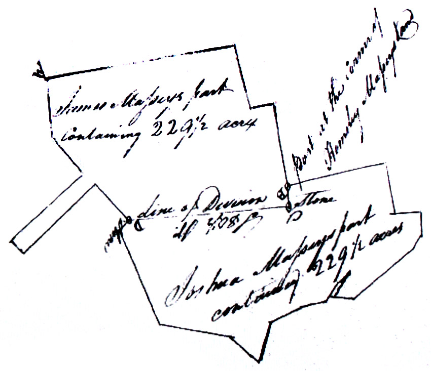
Notes
The plat was
inverted 180 degrees to make it more readable,
so the letters below are upside down on the surveyor's plat.
A. The place of beginning, on the out lines of the whole.
B. A post planted at the corner of Hemsley Massey's land.
C. A post standing South 7-3/4 degrees East 19 perches from the post at
the corner of Hemsley Massey's land, said stone being the place of
beginning of the division between James Massey & Joshua Massey.
D. A stone standing at the end of the division line South 80-1/2
degrees West from the first stone.
|
| 1798/05/07 |
|
Grantor
|
Grantee
|
Parcel
|
Acreage
|
Lib:No:Fol
|
Type
|
|
William
Gilbert and wife Ann
|
James
Massey
|
Jerusalem
|
138.5
|
STW:4:408
|
Deed
|
May 7, 1798: James Massey, farmer
of Queen Anne's County in the State of Maryland, buys for £1,385 from
William Gilbert, also a farmer of Queen Anne's County all that 138-1/2
acre part of the tract called Jerusalem
lying in Queen Anne's County within the following courses: Beginning at
a stone standing in the corner of a fence, marked with the letter B in
the fourth line of the original tract called Jerusalem and at the end
of sixty perches from the beginning of said line, and running from
thence South forty and a half degrees West eighty six perches to a
stone, then North sixty eight and a half degrees West twenty five
perches to a stone, then South fifty seven and three quarter degrees
West one hundred and forty six and a half perches until it intersects
the second line of Jerusalem [at] a stone, then with the aforesaid
second line reversed South South East eighty three perches to a stone,
then North sixty one and a half degrees East two hundred and thirty two
perches to a stone, then North seventy three degrees West thirty seven
perches to a stone, then North forty four and a half degrees East fifty
six perches until it intersects the home line of Jerusalem [at] a
stone, then with that line reversed South thirty degrees five minutes
West forty one and 9/10 perches to a stone, then with the aforesaid
line reversed North West thirty perches to the aforesaid beginning
stone, containing one hundred and thirty eight and a half acres.
Witnesses: Justices of the Peace Dan. Knock and T. Roberts.
|
| 1798/06/12 |
|
Grantor
|
Grantee
|
Parcel
|
Acreage
|
Lib:No:Fol
|
Type
|
|
James Massey & wife
Hannah Massey
|
Hemsley Massey
|
Masseys Part of
Friendship Corrected, Sprys Chance, and Sprys Friendship
|
345
|
STW:4:445
|
Deed
|
June 12, 1798: James Massey,
farmer of Queen Annee's County in the State of Maryland sells for
£1,275 to Hemsley Massey, also farmer of Queen Anne's County, parts of
the following tracts totaling 345 acres: Massey's Part of
Friendship Corrected, Spry's Chance,
and Spry's Friendship, contained within the following courses:
Beginning for the out lines thereof at a Spansih oak tree marked with
the letters IM[T?] standing on the West side of the Unicorn Branch [of
Chester River] it being the beginning tree of a division line formerly
established between James Massey, deceased, and William Massey, also
deceased, by the Will of their late father, James Massey, and running
from thence South sixty three degrees West two hundred and twenty
perches, then South nine and a half degrees East one hundred and
fourteen perches, then South thirty two degrees West two perches, then
South one degree West two perches, then South forty six degrees East
forty six and a half perches, then South West one hundred and six
perches, then South fifty four degrees East seventeen perches, then
North East one hundred and seven perches, then South East fifty two
perches to a stone at one end of a division line between the said James
Massey and Joshua Massey, then by and with the said division line East
eight degrees North one hundred and forty seven perches to another
stone standing at the other end of the aforesaid division line between
the lands of James Massey and Joshua Massey, then North eleven degrees
West one hundred and eight perches, then South eighty degrees West
twenty three perches, then North sixteen and a half degrees West sixty
eight and a half perches, then North fifty eight degrees East eighty
perches to the Forge Mill Pond, then running by and with the said pond
and with the meanders thereof to the aforesaid beginning tree,
containing three hundred and forty five acres. One exception is a forty
foot square burial ground within Massey's Part of Friendship Corrected
that is reserved for James Massey and his heirs with the privilege of
egress and regress. Witnesses: Justices of the Peace T. Roberts and
Dan. Knock.
|
| 1798/09/08 |
|
Grantor
|
Grantee
|
Parcel
|
Acreage
|
Lib:No:Fol
|
Type
|
|
Hemsley Massey &
wife Elizabeth Massey
|
James Massey
|
Jerusalem (in two
parts); Neglect; and Knowless Range
|
123.5 & 46; 60.5;
and 12.38
|
STW:4:499
|
Deed of exchange
|
September 8, 1798: Hemsley
Massey, farmer of Queen Anne's County in the State of Maryland, sells
for 5/- to James Massey, also farmer of Queen Anne's County, 242-3/8
acres in two parts of the tract called Jerusalem, one of the tract called
Neglect, and another from the tract called Knowless (Knowles) Range. The
first part of the tract called Jerusalem, containing 123-1/2 acres,
lies to the Westward of the dividing house of James Massey (which James
Massey lately purchased from William Gilbert of Queen Anne's County),
the courses of which are: Beginning at a stone standing in the corner
of a fence marked with the letter B in the fourth line of the original
tract of Jerusalem and at the end of sixty perches from the beginning
of said line, and running from thence South forty and a half degrees
West eighty six perches, thence North sixty eight and a half degrees
West twenty two perches, then South fifty six degrees fifty two minutes
West one hundred and forty one and a half perches until it intersects
the second line of Jerusalem,, thence North North West one hundred and
four and a half perches to the end of the second line of Jerusalem,
thence East North East two hundred and fourteen perches, thence South
East sixty perches to the aforesaid place of beginning, containing one
hundred and twenty three and a half acres. The second part of
Jerusalem, with 46 acres, lies to the Eastward of the dividing house of
James Massey and is described by the following courses: Beginning at a
stone standing at the original beginning of the original lines of
Jerusalem and running from thence West South West two hundred and sixty
four perches, thence North North West twelve and a half perches, thence
North sixty one and a half degrees East two hundred and thirty two
perches, thence North seventy three degrees West thirty seven perches,
thence North forty four and a half degrees East six perches until it
intersects the original home line of Jerusalem at the end of seventy
six perches from the original beginning of Jerusalem and from thence
with a straight line to the beginning, containing forty six acres.
Third, there is a 60-1/2 acre portion of the tract called Neglect that
is contained within the following metes and bounds: Beginning at a
stone standing at the end of the first line of Jerusalem, marked with
the letters HMB and running from thence South South East twenty perches
to another stone, then North sixty eight degrees East forty nine
perches, thence North sixty six degrees East ninety three perches to
another stone, then South eighty three and a half degrees East ten
perches to another stone, thence North sixty one and a half degrees
East twenty four perches to another stone, then North East seventy six
perches until it intersects the first line of Jerusalem, then with that
line to the place of beginning, containing sixty and a half acres.
Fourth, there is a portion of Knowless Range that lies within the
courses: Beginning at the start, where the East North East lie of
Jerusalem intersects the East forty two degrees North or home line of Robotham's Park and from thence running
with the home line of Robotham's Park reversed North forty two degrees
East one hundred and five and a half perches, thence South forty eight
degrees East forty nine perches until it intersects the third line of
Jerusalem, and from thence by and with Jerusalem East North East to the
place of beginning, containing twelve and three eights acres.
Witnesses: Justices of the Peace Samuel Thomas and T. Roberts.
|
1798/09/14
|
|
Grantor
|
Grantee
|
Parcel
|
Acreage
|
Lib:No:Fol
|
Type
|
|
William Neavite
|
|
Westminister
|
172
|
IC:A:63
IC:A:55
|
Patent
|
September
14, 1798: Westminister: 172 acres - Developer/Owner: William
Neavite
There are two Westministers; the
other one is by John Ross.
|
| 1799/02/01 |
|
Grantor
|
Grantee
|
Parcel
|
Acreage
|
Lib:No:Fol
|
Type
|
|
Abraham Faulkner
(Falconar)
|
James Massey &
Joshua Massey
|
Harrises Hazard;
Friendship and Tilghmans Friendship; and Sprys Chance
|
22.5; 180; and 14
|
STW:4:558
|
Deed
|
February 1, 1799: James Massey
and Joshua Massey, of Queen Anne's County in the State of Maryland, buy
for 5/- from Abraham Falconar of Baltimore, decreed by court order as
trustee of the estate of William Falconar, late of Queen Anne's County,
William Falconar's portions of the tracts called Harris's Hazard (22-1/2 acres), Friendship
and Tilghman's Friendship (180 acres), and Spry's
Chance (14 acres) all lying in Queen Anne's County. Abraham had at
first conveyed these lands at public sale to James Massey, father to
the present James and Joshua Massey, but James the elder died intestate
on December 1, 1795, leaving James Massey, Junior, and Joshua Massey as
his sole heirs. The present deed completes the transfer of the
ownership of the lands described above to James and Joshua Massey as
tenants in common and the proceeds (which were paid but are not stated
in this deed) to the heirs of William Falconar, who are listed:
Peregrine Falconar, John Falconar, William Falconar, Joshua Falconar,
and Ann Falconar. Witnesses: John Scott and T. Howard. Certified by
William Owings, Associate Justice of Baltimore County Court; William
Gilson is Baltimore County clerk.
|
1800/01/01
|
|
Grantor
|
Grantee
|
Parcel
|
Acreage
|
Lib:No:Fol
|
Type
|
|
Conrad Wedershandt
|
|
Broomly Lambeth Addition
|
2-3/16
|
Unpat. cert. 31
|
Certificate
|
1800:
Broomly Lambeth Addition: 2-3/16 acres - Developer/Owner: Conrad
Wedershandt
|
| 1800/01/14 |
|
Grantor
|
Grantee
|
Parcel
|
Acreage
|
Lib:No:Fol
|
Type
|
|
John Comegys, Esquire
|
Daniel Massey and wife
Susanna Massey
|
[illegible]
|
0.25
|
STW:5:173
|
Deed
|
January 14, 1800: Daniel Massey
and wife Susanna of Queen Anne's County in the State of Maryland buy
for £375 from John Comegys, Esquire, of Kent County, a town lot in Sand
Town, Queen Anne's County, a 1/4 acre portion of the tract called
[illegible] that is contained within the following metes and bounds:
Beginning at the North East corner of the said brick messuage and
running from thence North forty five degrees West thirteen perches,
then South forty five degrees West to a lot formerly belonging to
William Moss, since deceased, then with said lot South forty five
degrees East to the main road leading from the Head of Chester to
[Chinck] Mill, then by and with the main road to the beginning,
containing about one quarter acre.[difficult to read; I complained.]
Witnesses: Justices of the Peace James Parker and John Hartt.
|
| 1800/05/01 |
|
Grantor
|
Grantee
|
Parcel
|
Acreage
|
Lib:No:Fol
|
Type
|
|
Benjamin Massey &
wife Elizabeth Massey
|
Benoni Harris
|
Reviving Springs
|
[not stated]
|
STW:5:272
|
Deed
|
May 1, 1800: Benjamin Massey and
his wife Elizabeth of Kent County in the State of Maryland sell for
£583 16/- 8p to Benoni Harris, of Kent County in the State of Delaware,
part of a tract called Reviving
Springs, lying in Queen Anne's County;see Liber
STW No.2 Folio 491 & 492. Witnesses: Justices of the Peace John
Comegys and James Parker.
|
| 1800/08/09 |
|
Grantor
|
Grantee
|
Parcel
|
Acreage
|
Lib:No:Fol
|
Type
|
|
Noah
Massey
|
William
Massey
|
slave
Robert
|
[none]
|
STW:5:269
|
Deed
|
August 9, 1800: William Massey of
Carlisle [Caroline ?] County, State of Maryland, for the sum of £15
buys an 8 year old slave boy named Robert from Noah Massey, farmer of
Kent County. Witnesses: Thom. Roberts and Wm. Frederick.
The deed is endorsed to the effect that if Noah Massey returns the £15
with legal interest on or before the next August 20th, then the
transaction shall be of no effect, meaning that this deed is a mortgage
instrument for a short-term loan.
|
| 1801/01/30 |
|
Grantor
|
Grantee
|
Parcel
|
Acreage
|
Lib:No:Fol
|
Type
|
|
Joshua
Thomas
|
Hemsley
Massey
|
Slave
James
|
[none]
|
STW:5:380
|
Bill of
Sale
|
January 30, 1801: Hemsley Massey
buys for £110 from Joshua Thomas, of Queen Anne's County in the State
of Maryland, the slave named James, age about thirty years and
formerly the property of William Page of Queen Anne's County. Witness:
Justice of the Peace Samuel Thomas.
|
| 1801/03/17 |
|
Grantor
|
Grantee
|
Parcel
|
Acreage
|
Lib:No:Fol
|
Type
|
|
George
Spry
|
William
Massey
|
Slave Nan
& child Hannah
|
[none]
|
STW:5:444
|
Bill of
Sale
|
March 17, 1801: William Massey of
Caroline County in the State of Maryland buys for £25 in specie from
George Spry of Queen Anne's County a slave named Nan, about twenty nine
years old, and her child Hanna, aged three. Witnesses: William Kearney
and Justice of the Peace Samuel Thomas.
|
| 1801/06/25 |
|
Grantor
|
Grantee
|
Parcel
|
Acreage
|
Lib:No:Fol
|
Type
|
|
James Massey & wife
Hannah Massey
|
Benjamin Seegar
|
Jerusalem; Neglect; and
Knowlls Range
|
308; 30.5; and 12.38
|
STW:5:555
|
Deed
|
June 25, 1801: James Massey,
farmer of Queen Anne's County in the State of Maryland sells for £2,531
11/- 3p to Benjamin Seegar, also a farmer of Queen Anne's County, three
tracts of land, totaling 350-7/8 acres. The first is a portion of the
tract called Jerusalem, which
is the same land sold by James Tilghman to Thomas Gilbert.
Courses: Beginning at a large stone standing on the North East side of
thr lane between the lands of John Cacy and James Little and near the
North West corner of said Little's field, and running from said stone
West South West two hundred and sixty four perches unto a stone marked
with the letters HMB and from thence North North West two hundred
perches, then East North East two hundred and seventeen perches, then
South East ninety perches, and from thence with a straight line to the
beginning stone, containing three hundred and eight acres. Second
is another tract, contiguous with the first tract, called Neglect, the
courses for which are: Beginning at the stone marked HMB standing at
the end of the first line of Jerusalem and running from thence South
South East twenty perches to another stone, then North twenty eight
degrees East forty nine perches, then North sixty six degrees East
seventy three perches, then South eighty three and a half degrees East
ten perches, then North sixty one and a half degrees East twenty seven
perches, then North East twenty six perches until it intersects the
first line of Jerusalem, then with the said first line of Jerusalem to
the place of beginning, containing thirty and a half acres. Third is
all of the tract called Knowll's Range:
Beginning at the spot where the East North East line of Jerusalem
intersects the East forty two degrees North or home line of Robotham's Park, and from thence with the
home line of Robotham's Park reversed North forty two degrees East one
hundred and five and a half perches, then South forty eight degrees
East forty nine perches until it intersects the third line of
Jerusalem, and from thence by and with Jerusalem East North East to the
place of beginning, containing twelve and three eighths acres.
The whole of said tracts is thereby three hundred and fifty and seven
eighths acres. Witnesses: Justices of the Peace Mssrs. Roberts and
Thompson.
|
| 1801/09/21 |
|
Grantor
|
Grantee
|
Parcel
|
Acreage
|
Lib:No:Fol
|
Type
|
|
Daniel
Toas Massey
|
Hemsley
Massey
|
Collins
Range
|
46.75
|
STW:5:527
|
Deed
|
September 21, 1801: Hemsley
Massey of Queen Anne's County in Maryland for 280 pounds, 10 shillings
buys a 46.75 acre tract of land called Collins
Range in Queen Anne's County from Daniel Toas Massey, farmer, and
unnamed wife. Courses: Beginning at the second bounded tree of the
original tract of land aforesaid and running from thence with the
second line of the said original tract of land with an allowance of
three degrees for variation East one hundred fifty perches and from
thence with the third line of the original tract of land aforesaid and
with an allowance of three degrees for variation North forty four
perches and seven tenths of a perch thence South eighty nine degrees
West one hundred fifty perches until it intersects the first line of
the said original tract of land and from thence South with an allowance
of three degrees for variation and running with the said first line of
the original tract of land aforesaid forty nine perches and nine tenths
of a perch to the aforesaid place of beginning at the said second
bounded tree of the said original tract of land containing and now laid
out for forty six acres and three fourths of an acre. Witness:
Jon Bready.
|
| 1801/10/31 |
|
Grantor
|
Grantee
|
Parcel
|
Acreage
|
Lib:No:Fol
|
Type
|
| Abraham
Falconar and wife Sarah Hall Falconar |
Sarah
Massey, Anna Massey and Elizabeth Massey |
Robothams
Park |
500 |
STW:5:439
|
Deed |
October 31, 1801: Sarah Massey,
Anna Massey, and Elizabeth Massey (daughters of Joseph Massey and his
late wife Elizabeth (Hall)) as tenants in common buy for 5 shillings
from Abraham Falconar and wife Sarah (Hall) a 500-acre tract called Robotham's Park (inherited by Sarah Hall
and Elzabeth Hall from John Seal). Witnesses: T. Roberts, Joseph
Thompson. |
| 1802/03/09 |
|
Grantor
|
Grantee
|
Parcel
|
Acreage
|
Lib:No:Fol
|
Type
|
|
David
Nevil
|
Hemsley
Massey
|
slave Pere
|
[none]
|
STW:6:30
|
Deed
|
March 9, 1802: Hemsley Massey, of
Queen Anne's County in the State of Maryland, buys for £100 from David
Nevil, also of Queen Anne's County, a slave boy called Pere, about
eighteen years of age. Witnesses: Joseph Thompson and Sarah Busick.
|
| 1802/04/15 |
|
Grantor
|
Grantee
|
Parcel
|
Acreage
|
Lib:No:Fol
|
Type
|
|
Samuel M.
Keene
|
William
Massey
|
slave
Newton
|
[none]
|
STW:6:59
|
Bill of
Sale
|
April 15, 1802: William Massey of
Caroline County in the State of Maryland buys for £75 from Samuel Keene
of Queen Anne's County a Mulatto slave boy called Newton about thirteen
years old. Witnesses: Justice of the Peace Stephen Miers and Woolman
Warner.
|
| 1802/10/07 |
|
Grantor
|
Grantee
|
Parcel
|
Acreage
|
Lib:No:Fol
|
Type
|
|
Gabriel
Duvall
|
James
Massey
|
slave
Jerry
|
[none]
|
STW:6:167
|
Bill of
Sale
|
October 7, 1802: James Massey
buys for $300.00 a 29 year old male slave called Jerry from Gabriel
Duvall of Annapolis in the State of Maryland. William Hindman received
payment from James Massey on behalf of Gabriel Duvall. Witnesses: Isaac
Duvall Hodges.
|
1803/01/01
|
|
Grantor
|
Grantee
|
Parcel
|
Acreage
|
Lib:No:Fol
|
Type
|
|
Hemsley Massey
|
|
The Widows Lot
|
2
|
IC:B:148
|
Patent
|
1803:
The Widows Lot: 2 acres - Developer/Owner:
Hemsley Massey
There is another, similar tract called Widows Lott.
|
| 1803/02/08 |
|
Grantor
|
Grantee
|
Parcel
|
Acreage
|
Lib:No:Fol
|
Type
|
| Daniel
Hockings |
Hemsley
Massey & James Massey |
slave
Eve |
[none]
|
STW:6:264
|
Bill
of Sale |
February 8, 1803: Hemsley Massey
and James Massey of Queen Anne's County in the State of Maryland buy
for £30 from Daniel Hockings, also of Queen Anne's County, the slave
woman called Eve, about forty years old. Witnesses: Sarah Busick and
Samuel Covington and Justice of the PeaceT. Roberts.
|
1803/07/26
|
|
Grantor
|
Grantee
|
Parcel
|
Acreage
|
Lib:No:Fol
|
Type
|
|
Hemsley Massey
|
|
Masseys Meadow
|
9-1/4
|
IC:B:147
IC:B:223
|
Patent
|
July
26, 1803: Masseys Meadow: 9-1/4 acres - Developer/Owner: Hemsley Massey
[The Lib:No:Fol links at left point to a 6 acre patent in 1803, also by
Hemsley Massey - GL,III,ed.]
|
| 1803/08/26 |
|
Grantor
|
Grantee
|
Parcel
|
Acreage
|
Lib:No:Fol
|
Type
|
| Noah Massey |
John
Roberts |
slaves:
Sarah and her children John and James |
[none]
|
STW:6:430
|
Deed |
August 15, 1803 (recorded August
26, 1803): Noah Massey, of Queen Anne's County and State of Maryland,
sells for £300 the 24-year-old slave woman called Sarah and her two
children John (6 years old) and James (18 months old) to John Roberts,
also of Queen Anne's County. Witnesses: [illegible signature] and
Justice of the Peace Thomas Roberts.
|
| 1804/10/04 |
|
Grantor
|
Grantee
|
Parcel
|
Acreage
|
Lib:No:Fol
|
Type
|
|
Daniel Toas Massey
|
Hemsley Massey
|
Collins Range or Collins
His Range
|
399.5
|
STW:6:493
|
Deed
|
October 4, 1804: Hemsley Massey
of Queen Anne's County in Maryland for 1,500 pounds buys a 399.5 acre
tract of land (including the 46.75 acres bought in 1801) called Collins Range or Collins His Range in
Queen Anne's Countyn from Daniel Toas Massey, farmer. Courses:
Beginning at a marked white oak the original beginning tree of the said
tract of land and running from thence South thirteen degrees and one
half of a degree East three hundred and forty one perches up the Red
Lion branch to a marked white oak the second bounded tree of the said
tract of land and from thence running North eighty seven degrees East
one hundred fifty perches and running from thence North three degrees
West three hundred and seventy perches and from thence by a line drawn
South seventy seven degrees West two hundred and ten perches to the
aforesaid beginning tree containing and now laid out for three hundred
and ninety nine acres and one half of an acre of land be the same more
or less which said lines also include the quantity of forty six acres
and three eights of an acre of land heretofore sold and conveyed by the
said Daniel Toas Massey to the said Hemsley Massey and for which no
consideration money is now paid by the said Hemsley Massey to the said
Daniel Toas Massey. Witnesses: William Lindsay, William B.
Hackett, William Joshua Massey, and Hemsley Massey. Deposition by
Thomas L. Burgess regarding the proving of a boundary tree by Abraham
Roberts in ca. 1792.
|
| 1804/10/25 |
|
Grantor
|
Grantee
|
Parcel
|
Acreage
|
Lib:No:Fol
|
Type
|
|
Philip Reed
|
Hemsley Massey
|
Collins Range or Collins
His Range
|
399.5
|
STW:6:495
|
Deed
|
October 25, 1804: Hemsley Massey,
farmer of Queen Anne's County in the State of Maryland buys for $5.00
from Philip Reed, Esquire, of Kent County, a 399-1/2 acre portion of
the tract variously called Collins Range
or Collins His Range lying in Queen Anne's County. Courses:
Beginning at a marked white oak tree, the original beginning of the
said tract, and running thence South thirteen and a quarter degrees
East three hundred and forty one perches up the Red Lyon Branch to
another marked white oak tree, the second bounded tree of the said
tract, and running from thence North eighty seven degrees East one
hundred and fifty perches, thence North three degrees West three
hundred seventy perches, then South seventy seven degrees West two
hundred and ten perches to the aforementioned original beginning white
oak, containing three hundred and ninety nine and a half acres.
Witnesses: Justices of the Peace John Comegys and Isaac Connell.
|
| 1804/12/28 |
|
Grantor
|
Grantee
|
Parcel
|
Acreage
|
Lib:No:Fol
|
Type
|
|
Richard
Covington & wife Elizabeth
|
Hemsley
Massey
|
Manors
Chance
|
150
|
STW:7:197
|
Deed
|
December 28, 1804: Hemsley Massey
of Queen Anne's County in the State of Maryland buys for £175 from
Richard Covington and wife Elizabeth, also of Queen Anne's County, a
portion of the tract called Manor's Chance, lying in Queen Anne's
County. Witnesses: Justices of the Peace Samuel Burgess and
Thomas S. Burgess.
|
| 1805/05/06 |
|
Grantor
|
Grantee
|
Parcel
|
Acreage
|
Lib:No:Fol
|
Type
|
|
James
Massey and wife Hannah
|
Joseph
George, Junior
|
Addition
|
199.06
|
STW:8:191
|
Deed
|
May 6, 1806: James Massey of
Queen Anne's County in the State of Maryland sells for 5/- to Joseph
George, the younger, also of Queen Anne's County, 199-1/16 acres of the
tract called Addition which is contained within the following courses:
Beginning at a stone planted at the end of fifteen and three quarter
perches in a line drawn South forty nine degrees East from the original
beginning of Addition and from thence running South forty nine degrees
East two hundred and four and a quarter perches, then North forty
degrees East four perches, then North seven degrees East eight perches,
then North thirty three degrees East nine perches, then North forty
nine degrees East eleven perches, then North eighty five degrees East
twenty perches, then South eighty four degrees East six perches, then
South fifty and a half degrees East eleven perches, then North
fifty eight degrees East seven perches, then North eighty four degrees
East nine perches, then North sixty four and a half degrees East six
perches, then South eighty five degrees East five perches, then North
sixty one degrees East seven perches, then North fifty six degrees East
fifteen perches, then South forty degrees East seven perches to the
stream of the Golden Bridge Branch, and then up by and with the stream
with the following courses: North forty degrees East eleven perches,
then North fifty six and three quarter degrees East thirteen perches,
then North thirty six and a half degrees East ten perches, then North
eighteen and a half degrees East twenty five perches, then North twenty
four degrees West thirteen perches, then North thirty five and a half
degrees West seven perches, then North thirty and a half degrees West
fourteen perches, then North thirty five degrees West twenty three
perches, then North fourteen degrees West six perches, then North
twenty seven and a quarter degrees East twenty six perches to the road
leading from Hills Cross Roads to Queen Town, then by and with the said
road by the following courses: North sixty one and a half degrees West
nine perches, then South seventy four degrees West thirty perches, then
South sixty three and a half degrees West twenty seven and 2/10 perches
to a gate in the said road, then South fifty seven degrees West
eighteen perches, then South eighty five degrees West sixty perches,
then South eighty one and a half degrees West twenty perches, then
South seventy eight degrees West [seventy eight degrees West] seventy
four perches, and from thence with a straight line to the beginning,
containing one hundred and ninety nine and a sixteenth acres. The
buyer, Joseph George is to maintain a good fence and enclosure from the
gate standing at or near the end of the thirteenth course along and on
the Northern side of the road, and James Massey agrees to maintain his
own fences with the cooperation of Joseph George. Witnesses: Justices
of the Peace William Clayton and Ed. Clayton.
|
| 1805/05/16 |
|
Grantor
|
Grantee
|
Parcel
|
Acreage
|
Lib:No:Fol
|
Type
|
|
John Maynor
|
Hemsley Massey
|
[too many to list; too
hard to read]
|
[???]
|
STW:7:272
|
Deed
|
May 16, 1805: Hemsley Massey of
Queen Anne's County in the State of Maryland buys for £330 from John
Maynor, also of Queen Anne's County, all of his sixth parts of a number
of tracts of land in Queen Anne's County called [illegible] Chance,
[illegible] Tract, Jones Delight, two lots at [illegible] Cross Roads,
being part of a tract called [illegible], Friendship and Spry's Chance which descended to him
from his father Benjamin Maynor, who died intestate about August 1,
18[illegible] ... John Maynor also had a brother, Mark Maynor who died
about September 1, 1803, from whom John Maynor [may have - illegible
reading here] inherited one fourth parts of the tracts called Isaac's
Delight, and [illegible] containing about one hundred and twenty acres.
Witnesses: Justices of the Peace William Clayton and Ed. Clayton.
|
| 1805/09/10 |
|
Grantor
|
Grantee
|
Parcel
|
Acreage
|
Lib:No:Fol
|
Type
|
|
Mary Sands
|
Joshua
Massey
|
slave
George
|
[none]
|
STW:7:349
|
Bill of
Sale
|
September 10, 1805: Joshua Massey
of Queen Anne's County in the State of Maryland buys for £50 from Mary
Sands, also of Queen Anne's County, a slave called George, about ten
years old. Witnesses: Thomas Roberts and John Sands.
|
| 1805/09/16 |
|
Grantor
|
Grantee
|
Parcel
|
Acreage
|
Lib:No:Fol
|
Type
|
|
John Spry
|
Hemsley
Massey
|
Sprys
Adventure
|
76.25
|
STW:7:361
|
Deed
|
September 16, 1805: Hemsley
Massey of Queen Anne's County in the State of Maryland buys for £550
10/- 6p from John Spry, also of Queen Anne's County, a 76-1/4 acre
portion of the tract called Spry's
Adventure, lying in Queen Anne's County which is contained within
the following metes and bounds: Beginning at a marked white oak tree,
the original beginning of Spry's Adventure and running thence North
five and a half degrees East one hundred and eighty five perches to a
stone marked with the letter S, then North sixty four degrees East
sixty one perches to a stone in the side of the road leading from
Sudlers Cross Roads to Miller [illegible] House, then South twelve and
a half degrees East one hundred and seventy two perches to another
stone, then North forty eight and a half degrees West forty seven
perches, and from thence by a straight line to the beginning,
containing seventy six and a quarter acres. Witnesses: Justices of the
Peace Thomas Roberts and George Palmer. |
| 1805/10/28 |
|
Grantor
|
Grantee
|
Parcel
|
Acreage
|
Lib:No:Fol
|
Type
|
|
Benoni
Harris and wife Sarah
|
Samuel
Cacy
|
Reviving
Springs
|
179.25
|
STW:7:373
|
Deed
|
October 28, 1805: Benoni Harris
and his wife Sarah Massey Harris of Kent County in the State of
Maryland sell for £1,125 to Samuel Cacy of Queen Anne's County, Sarah
Harris's undivided moiety in 179-1/4 acres of the land which Sarah
Massey Harris with her sister Elizabeth Massey, wife of Benjamin Massey
of Kent County, inherited from their father, Eleazer Massey, deceased,
called Reviving Springs,
lying in Queen Anne's County. Witnesses: Justices of the Peace T.
Roberts and George Palmer.
|
| 1806/01/04 |
|
Grantor
|
Grantee
|
Parcel
|
Acreage
|
Lib:No:Fol
|
Type
|
|
James Massey and wife
Hannah Massey
|
William Tilghman
|
Addition and Hemsleys
Reserve
|
501.25
|
STW:8:29
|
Mortgage to Secure a Debt
|
January 4, 1806: James Massey,
farmer of Queen Anne's County in Maryland, stands indebted in the sum
of £2,862 8/- 9p to William Tilghman, gentleman of the City of
Philadelphia, and intends to secure the payment of this debt in three
annual and equal installments with legal interest by the following
mortgage on 501-1/4 acres of his land: James Massey, in consideration
of the sum of five shillings paid to him by William Tilghman, sells to
him portions of two tracts, one called Addition, the other, Hemsley's Reserve, which are
included within the following metes and bounds: Beginning at a cedar
post standing in the place of the second original boundary of Addition,
and thence running South forty nine degrees East two hundred and
seventy three perches, thence South forty one degrees West one hundred
and sixty perches a post in the [illegible] and thence North forty and
a quarter degrees West one hundred and twelve perches to the main road,
and thence by and with the said road till it intersects the home line
of Addition, and thence with the said line North forty nine degrees
West eight and a quarter perches to the main road leading from Wye Mill
to Chesterville, and thence with the same road North eleven degrees
East fourteen perches, and thence North forty two degrees East about
ninety perches to the end of the fourth line of Hemsley's Reserve, and
thence North forty nine degrees West sixty two perches to the same main
road, and thence North two degrees East with the same road seventy nine
perches, and thence North forty one degrees East one hundred and eighty
nine perches, and thence South forty nine degrees east forty eight
perches, and thence South twenty seven degrees East sixty eight and a
half perches to the aforesaid beginning cedar post, containing five
hundred and one and a quarter acres. The change in ownership becomes
null and void if the full repayment of the debt and legal interest
thereon is made by January 1, 1808. Witnesses: Justices of the Peace W.
Richmond and Phil. Green.
|
| 1806/01/17 |
|
Grantor
|
Grantee
|
Parcel
|
Acreage
|
Lib:No:Fol
|
Type
|
|
William Tilghman
|
James Massey
|
Addition and Hemsleys
Reserve; and Whitton
|
880.75
|
STW:8:44
|
Deed
|
January 17, 1806:James Massey,
farmer of Queen Anne's County in the State of Maryland, completes the
repayment of his debt to William Tilghman, Esquire, deceased, of the
City of Philadelphia, by purchasing the combined 880-3/4 acres of
Addition, Hemsley's Reserve,
and Whitton for the sum remaining due on the mortgage of January 4,
1806, by a complex transaction. It seems from the records of
Orphan's Court in Kent County that the mortgage was sold to Capt.
Richard Bennett Lloyd, since deceased, who had leased the land to
William Robinson and a man named Green, which he purchased of James
Hindeman, and the land fell to Philemon Tilghman, son of the elder
William, who soon died, leaving the land to be sold for the best
price. Sons James Tilghman and William Tilghman were set to that task,
but James died, leaving the present William Tilghman to complete the
sale to James Massey for £5,724 17/- 6p at the rate of £6 10/- per
acre, of the original 852-3/4 acres plus the 28 acres of the adjoining
tract called Whitton. Courses for the combined tracts of Addition,
Hemsley's Reserve and Whitton: Beginning at a cedar post marked
[backwards B]R standing in the place of the first original boundary of
Addition, and thence running with the first line thereof North forty
two degrees East one hundred perches to the end of the fourth line of
Hemsley's Reserve, thence running (and reversing the same) North forty
nine degrees West sixty two perches to the main road leading from Wye
Mill to Centerville, thence running with the said road North two
degrees East seventy nine perches, then North forty one degrees East
one hundred and eighty nine perches, then South forty nine degrees East
forty eight perches, then South twenty seven degrees East sixty eight
and a half perches to another cedar post standing in the place of the
second boundary of Addition, and thence runningSouth forty nine degrees
East three hundred perches, then South forty one degrees West one
hundred and sixty perches, then South forty nine degrees East one
hundred perches, then South forty one degrees West one hundred and
sixty perches, then North forty nine degrees West eighty perches, then
South forty one degrees West fifty two perches to Wye Mill Pond, thence
by and with and round the meanders of the said pond until it intersects
the end of one hundred and forty nine perches on the fourth line of
Addition near the edge of the pond, and thence up and with the same so
as to exclude the sale of the parcel of the same tract called Addition
made by the said William Tilghman to Wiliam Hemsley [spelling ?]
Esquire, then North twenty three degrees West six perches, then North
eight and a half degrees East ten perches, then North thirty three and
a half degrees East ten perches, then North forty eight degrees West
ten perches, then North sixty five degrees West six perches, then North
sixty nine degrees East four perches, then South eighty two degrees
East ten perches, then South forty seven degrees East eight perches,
then South eighty five and a half degrees East nine perches, then South
seventy six degrees East sixteen perches, then North forty two degrees
East six perchesw, then North sixty four degrees East five perches,
then North sixty five degrees East seven perches, then North seventy
degrees East seven perches, then North seventy three degrees East four
perches, then North one degree West seven perches, then North twelve
degrees East six perches, then North forty degrees West fourteen
perches across the [Wye ?] Branch to a red oak marked with eight
notches, and thence down and with the Northern side of said pond South
fifty six degrees West fifteen perches, then South sixty one degrees
West seven perches, then North eighty seven degrees West five perches,
then South sixty four and a half degrees West six perches, then South
eighty four degrees West nine perches, then South fifty eight degrees
West seven perches, then North fifty and a half degrees West eleven
perches, then South eighty four degrees West six perches, then South
eighty five degrees West twenty perches, then South forty nine degrees
West eleven perches, then South thirty three degrees West nine perches,
then South seven degrees West eight perches, then South forty degrees
West four perches to the end of a line drawen South forty nine degrees
East two hundred and twenty perches from the said beginning,
containing for the present sale eight hundred and eighty and three
quarter acres. Richard Tilghman Earle and Philemon Hemsley, gentlemen
of Queen Anne's County, are hereby appointed to acknowledge the present
indenture and to appear for William Tilghman. William Hemsley appeared
before the Justices of the Peace to testify as to the veracity of
William Tilghman's signature on the indenture. Witnesses: Justices of
the Peace Thomas Roberts and Mr. Pelton.
|
| 1806/01/21 |
|
Grantor
|
Grantee
|
Parcel
|
Acreage
|
Lib:No:Fol
|
Type
|
|
Jonathan
Evans
|
Hemsley
Massey
|
slave
Isaac
|
[none]
|
STW:8:54
|
Bill of
Sale
|
January 21, 1806: Hemsley Massey
of Queen Anne's County in the State of Maryland buys for £60 from
Jonathan Evans, also of Queen Anne's County, the slave named Isaac,
about thirty two years old. Witnesses: C.N. Leatherbury and Justice of
the Peace T. Roberts.
|
| 1806/03/10 |
|
Grantor
|
Grantee
|
Parcel
|
Acreage
|
Lib:No:Fol
|
Type
|
|
John
Massey
|
Daniel
|
slave
Daniel
|
[none]
|
STW:8:114
|
Manumission
|
March 10, 1806: John Massey
executes the manumission of a slave named Daniel, to be effective on
the first of January of the following year, after receiving $600 cash
from Robert Mattey in consideration for doing so. Witnesses:
William Beck and James P. Leary; and ratified by Justice of the Peace
George Palmer of Queen Anne's County.
|
| 1806/06/10 |
|
Grantor
|
Grantee
|
Parcel
|
Acreage
|
Lib:No:Fol
|
Type
|
|
Joshua
Massey
|
Samuel
Elliott
|
slave
Susan
|
[none]
|
STW:8:220
|
Bill of
Sale
|
June 10, 1806: Joshua Massey of
Queen Anne's County in the State of Maryland sells for £60 to Samuel
Elliott a slave girl named Susan, about eighteen years of age.
Witnesses: A. Hawkins and Justice of the Peace T. Roberts.
|
| 1806/09/16 |
|
rantor
|
Grantee
|
Parcel
|
Acreage
|
Lib:No:Fol
|
Type
|
|
Joshua
Massey & wife Sarah McWay Massey
|
William
Matthews
|
Bath;
Bath Meadows; Jennings Beginning ...; Shipton Hill; Harriss's Rambles
or Ralphs Adventure; Harriss's Rambles
|
255; 36;
24; 5; 7.88; and [total not stated]
|
STW:8:39
|
Deed
|
September
16, 1807: Joshua Massey and Sarah Massey, his wife, both of Queen
Anne's County in the State of Maryland, sell for £5 to William
Matthews, also of Queen Anne's County, several tracts in Queen Anne's
County which Sarah McWay Massey inherited from James McWay: Bath; Bath
Meadows; Jennings Beginning ...; Shipton Hill; Harris Rambles or Ralph's Adventure; and Harris Rambled.
Ralphs Adventure was obtained by James McWay from Thomas Ralph and
contains 7-7/8 acres. Harris Rambles was also obtained by James McWay
from Thomas Ralph, but by way of John Fogwell as guardian to the heirs
of Thomas Ralph, and is contained within the following metes and
bounds: Beginning at a Spanish oak tree bounded with six notches (three
on the North side and three on the South side) standing on the East
side and in the main branch of the main ditch running through the farm
of the late Thomas Ralph, and being the beginning of the said tract
which James McWay bought of Thomas Ralph, and running from said
boundary South up the main ditch until it intersects another small
ditch leading into the main ditch, and being the second ditch leading
thereto, at which place a stone is planted, and from said ditch and
stone runs West with the small ditch until it intersects Warren Walls'
land, and then North with Warren Walls's land to the aforesaid
beginning marked Spanish oak, as stated in the Will of James McWay.
Witnesses: Justices of the Peace Tristram Thomas and Robert S. Gamble. |
| 1806/10/08 |
|
Grantor
|
Grantee
|
Parcel
|
Acreage
|
Lib:No:Fol
|
Type
|
|
Benjamin
Sands
|
Joshua
Massey
|
slave Ben
|
[none]
|
STW:8:290
|
Bill of
Sale
|
October 8, 1806: Joshua Massey of
Queen Anne's County in the State of Maryland buys for £112 10/- from
Benjamin Sands a male slave named Ben, about thirty six years old.
Witness: Justice of the Peace Tristam Thomas.
|
| 1807/01/04 |
|
Grantor
|
Grantee
|
Parcel
|
Acreage
|
Lib:No:Fol
|
Type
|
|
Solomon Scott, Sheriff
|
Joshua Massey
|
Toms Adventure;and
Hemisses Rambles
|
48; and not stated
|
STW:8:365
|
Deed
|
January 4, 1807: Joshua Massey of
Queen Anne's County in the State of Maryland buys for the highest bid
of £162 at public sale from Scott Solomon, former Sheriff of Queen
Anne's County, the two separate tracts called Tom's Adventure and Hemisses [Rambles ?]. The present deed
transfers the properties' titles to Joshua Massey upon the further
payment of 5/- by Joshua to the Sheriff. The properties had been
seized by a writ of fieri facias from the Court of Appeals of the
Eastern Shore, dated May 1, 1806, to settle a debt of £337 4/- 8p and
629 pounds of tobacco owed to the estate of James McWay, whose
executrix is Sarah McWay, by William Walker. Tom's Adventure is
contained within the following courses: Beginning at the first place of
beginning of Toms Adventure and running from thence South three degrees
East one hundred and eighty perches, then North sixty degrees East
forty perches, then North twenty two degrees West sixty four perches,
then North forty six degrees East forty six perches, then North fifteen
degrees West seventy perches, and from thence with a straight line to
the beginning, containing forty eight acres. The tract called Hemisses
Rambles is contained within the following courses: Beginning at the
beginning of Tom's Adventure and running North eighty eight degrees
East eighty five perches, then North twenty nine degrees East sixty
nine perches, then South seventy two and a half degrees West one
hundred and five perches, then North eighty eight and a half degrees
West one hundred and three perches, then South forty five degrees West
forty eight perches, then North eighty eight degrees East twenty
perches, then South seventeen and a half degrees East one hundred
and sixty one perches, then North sixty eight degrees East sixty two
perches, and from thence with a straight line to the beginning.
Witnesses: Justices of the Peace William Clayton and Thomas Wright.
|
| 1807/01/06 |
|
Grantor
|
Grantee
|
Parcel
|
Acreage
|
Lib:No:Fol
|
Type
|
|
James
Massey and wife Hannah
|
Richard
Baker
|
Addition;
and Witton
|
193.25
|
STW:8:349
|
Deed
|
January 6, 1807: James Massey of
Queen Ann's County in the State of Maryland sells for 5/- to Richard
Baker, also of Queen Anne's County, portions of the tracts called
Addition and Witton, located in Queen Anne's County. Courses: Beginning
at the end of two hundred and eighty eight perches on the second line
of Addition and running South forty one degrees West one hundred and
fifty perches, then North forty nine degrees West fifteen perches until
it intersects the main stream of the [name not stated] branch, then by
and with the main stream of the branch until it intersects the land
laid down for William Hemsley's Mill Pond, then North forty degrees
East seven perches, then South twelve degrees West six perches, then
South one degree East eleven perches, then South seventy three degrees
West four perches, then South seventy nine degrees West seven perches,
then North sixty five degrees West five perches, then South seventy
degrees West seven perches, then South thirty eight degrees West seven
perches, then South sixty for degrees West five perches, then South
forty two degrees West six perches, then North seventy six degrees West
sixteen perches, then North eighty five and a half degrees West nine
perches, then North forty seven degrees West sixty nine degrees West
eight perches, then North eighty two degrees West ten perches, then
South sixty nine degrees East ten perches, then South thirty three and
a half degrees West ten perches, then South eight and a half degrees
West ten perches, then South twenty one degrees East six perches to the
end of one hundred and forty nine perches on the fourth line of
Addition, then by and with the meander of the mill pond until it
intersects a line drawn South forty one degrees West fifty two perches
from the end of eighty perches on the fourth line of Addition, then
North forty one degrees East fifty two perches, then South forty nine
degrees East eighty perches, then North forty one degrees East one
hundred and sixty perches, then North forty nine degrees West one
hundred perches, then North forty one degrees East one hundred and
sixty perches, and from thence with a straight line to the beginning,
containing one hundred and ninety three and a quarter acres, including
parts of both Addition and Whitton. Witnesses: Justices of the Peace
William Clayton and Ed. Clayton.
|
| 1807/01/18 |
|
Grantor
|
Grantee
|
Parcel
|
Acreage
|
Lib:No:Fol
|
Type
|
|
Henry
Pryor
|
Hemsley
Massey
|
slave
Peter
|
[none]
|
STW:9:154
|
Bill of
Sale
|
January 18, 1808: Hemsley Massey
[of Queen Anne's County in the State of Maryland] buys for
$266.67 from Henry Pryor, administrator of the estate of Cornelius
Comegys, a slave named Peter, twenty two years of age, formerly the
property of Cornelius Comegys. Witnesses: James Britton and Justice of
the Peace George Little.
|
| 1807/02/02 |
|
Grantor
|
Grantee
|
Parcel
|
Acreage
|
Lib:No:Fol
|
Type
|
|
Charles
Price
|
Hemsley
Massey
|
[not
stated]
|
[not
stated]
|
STW:8:376
|
Mortgage
to Secure a Debt
|
February 2, 1807: Hemsley Massey,
gentleman of Queen Anne's County in the State of Maryland, accepts a
bond in the amount of $1,200 from Charles Price, physician, also of
Queen Anne's County to secure a debt of $600, to be repaid by Mr. Price
at the rate of two hundred dollars on each successive December 25th of
the years 1808, 1809, and 1810, with legal interest thereon. Further
security is provided by the indenture ceding title to Mr. Massey of a
lot of land and messuage located at Sudlers Cross Roads in Queen Anne's
County described in a deed bearing the date of January 14, 1807, for
which Mr. Massey paid $5 to Mr. Price; the deed is to become null and
void if Mr. Price makes good on his debt to Mr. Massey. Witnesses:
Justices of the Peace T. Roberts and Robert S. Gamble.
|
| 1807/02/10 |
|
Grantor
|
Grantee
|
Parcel
|
Acreage
|
Lib:No:Fol
|
Type
|
| Hemsley
Massey and wife Elizabeth |
George
Palmer |
The
Addition, The Beginning, & Steads Go Between; and Joneses Delight
|
50;
5 |
STW:8:390
|
Deed
|
February 10, 1807: Hemsley
Massey, gentleman of Queen Anne's County in the State of Maryland sells
for $860.00 to George Palmer, Esquire, also of Queen Anne's County, two
lots located in Queen Anne's County, one of which formerly belonged to
Sarah Maynor, late of Queen Anne's County, being part of several tracts
called The Addition, The Beginning, and Stead's Go Between, which were surveyed
and divided by a commission appointed by Queen Anne's County Court to
distribute the lands among the children of Sarah Maynor, Lot No.
[illegible] being allotted to John Maynor, edest son, who sold it to
Hemsley Massey, the courses for which are: Beginning at the end of the
first line of Lot No.2 and thence running South Sixty eight and a half
degrees East fifty one and 2/3 perches, then North sixty nine degrees
West one hundred and fifty eight perches, and thence with a straight
line to the begining, containing fifty acres. The second lot is part of
a tract called Joneses Delight, formerly the property of Benjamin
Maynor, late of Queen Anne's County, which descended unto John Maynor
and the other children and heirs [asnd after considerable legal steps]
and is contained within the following metes and bounds: Beginning at
the beginning of Joneses Delight and running South thirty nine and a
quarter degrees East twenty six perches, then North thirty four and a
half degrees East twenty six perches, then North thirty nine and a
quarter degrees West thirty perches, then South forty two and a half
degrees West twenty eight perches, and then with a straight line to the
beginning, containing five acres. Witnesses: Justices of the Peace
Thomas Roberts and Trisham Thomas.
|
| 1807/05/30 |
|
Grantor
|
Grantee
|
Parcel
|
Acreage
|
Lib:No:Fol
|
Type
|
|
Hemsley
Massey and wife Elizabeth
Massey
|
Dr. Charles Price
|
Shedmore (Skidmore)
|
1+
|
STW:8:411
|
Deed
|
May 30, 1807: Hemsley Massey,
gentleman of Queen Anne's County in the State of Maryland sells for
$600.00 to Dr. Charles Price, physician, also of Queen Anne's County,
two lots of land, one purchased from Thomas Sudler, late of Queen
Anne's County, the other sold by Benjamin Maynor, also late of Queen
Anne's County, later descended to John Maynor and other children of
Benjamin Maynor, from whom Hemsley Massey purchased them, properly
divided. The presently conveyed tract is described by the following
metes and bounds: Beginning at a stone marked with the letters RM
standing on the South side of the road leading from Sudler's Cross
Roads to Saint Andrews' Chapel in Queen Anne's County and running
thence South fourteen degrees East one hundred and four and a half
yards to a stone marked with the letters IIB, then North sixty nine
degrees East sixty four yards to another stone marked with the letters
IIB, then North fourteen degrees [East or West not stated !] one
hundred and four and a half yards to another stone marked with the
letters IIB standing near a willow tree near the side of the aforesaid
road, and then with the said road to the first place of beginning,
[containing about one acre - GL,III, ed.]. Witnesses: T. Roberts and
Robert S. Gamble.
|
| 1807/05/30 |
|
Grantor
|
Grantee
|
Parcel
|
Acreage
|
Lib:No:Fol
|
Type
|
|
John Figwell, trustee to
convey Thomas Ralph's land
|
Joshua Massey & wife
Sarah McWay Massey and James Pryor, et al.
|
Harriss's Rambles
|
22.5 and 44.75 out of
69.75
|
STW:9:44
|
Deed
|
May 30, 1807: Joshua Massey and
his wife, Sarah McWay Massey of Queen Anne's County in Maryland
purchase for $1 a 22-1/2 acre portion of the the 69-3/4 acre tract
called Harriss's Rambles from the
estate of Thomas Ralph. The legalities of the court case leading up to
the sale are too difficult for me [GL,III, ed.] to read and then
transcribe accurately, but here are the metes and bounds of Harriss's
Rambles: Beginning at a Spanish oak tree bounded with six notches
(three on the North side and three on the South side) standing on the
East and in the branch of the main ditch running through the farm of
the said Thomas Ralph and in the second line of the that part of the
tract that was conveyed by Samuel Keene and wife to Samuel Walls, and
at the distance of three and 8/25 perches from the end thereof, and
from thence running with Wall's second line reversed, allowing one and
a half degree for the variation South West two hundred and thirty nine
perches to the end of the third line of that part of the aforesaid
tract which was conveyed by the said Keene and wife to the said Thomas
Ralph, as per deed bearing the date September 2, 1788, and from thence
with said third line reversed allowing two thirds degree for variation,
North eighty two degrees East ninety nine and 3/10 perches to the
aforesaid main ditch, and running down and with the said ditch North
eleven and a quarter degrees West sixty four perches, then North
seventy two and a half degrees East fifteen and a half perches, then
North one degree West forty two perches, then North one and a half
degrees East fifty two perches, then North nineteen and a quarter
degrees West forty two perches, then by a straight line to the
aforesaid Spanish oak, containing sixty nine and three quarter
acres. Sarah McWay Massey, wife of Joshua Massey, is the sister
of James McWay, deceased. Joshua and Sarah's purchase covers the
following portion of Harriss's Rambles which was devised to Sarah McWay
by James McWay: Beginning at a Spanish oak or red oak tree marked with
six notches (three on the North side and three on the South side) and
from thence running South twenty one degrees West one hundred and
eighteen perches with the land of Joseph Warner Walls, and thence North
eighty six degrees East fifty eight perches to a stone on the West side
of a large ditch, and thence running down said ditch North one degree
West eight perches, then North one and a half degrees East fifty two
perches, then North nineteen and a quarter degrees West forty two
perches, and from thence with a straight line to the beginning marked
oak, containing twenty two and a half acres. There is a further
conveyance of [another portion of Harriss's Rambles] to Ann Pryor,
niece of James McWay, James Pryor and Elizabeth Williamson: Beginning
at the end of one hundred and eighteen perches South twenty one degrees
West from the beginning of Sarah McWay Massey's part [of Harriss's
Rambles] and from thence running South one degree West one hundred and
twenty one perches with said Walls' land, then North eighty one and a
quarter degrees East ninety nine and 3/10 perches to a large ditch and
down said ditch North eleven and a quarter degrees West sixty four
perches, then North seventy two and a half degrees East fifteen and a
half perches, then North one degree West thirty two perches to a stone,
and thence by a straight line to the beginning, containing forty four
and three quarter acres. Witnesses: Justices of the Peace Thomas
Roberts and George Palmer.
|
| 1807/09/13 |
|
Grantor
|
Grantee
|
Parcel
|
Acreage
|
Lib:No:Fol
|
Type
|
| William
Matthews |
Joshua
Massey |
Bath;
Bath Meadows; Jennys Beginning; [illegible] Shipton Hill; and Harris
Rambles |
[not
stated] |
STW:8:38
|
Deed
|
September 13, 1807: Joshua Massey
of Queen Anne's County in the State of Maryland buys for £5 from
William Matthews, also of Queen Anne's County, several tracts of land
lying in Queen Anne's County, including Bath;
Bath Meadows; Jennys Beginning;
[illegible] Shipton Hill; and Harris
Rambles, the last two being conveyed to William Matthews by Joshua
Massey by deed
dated May 14, 1807 (recorded September 16, 1807). Witnesses:
Justices of the Peace Tristram Thomas and Robert S. Gamble.
|
| 1807/12/19 |
|
Grantor
|
Grantee
|
Parcel
|
Acreage
|
Lib:No:Fol
|
Type
|
|
John Massey & wife
Mary Massey
|
Daniel Rochester
|
Bridgewater
|
196
|
STW:9:144
|
Deed
|
December 19, 1807: John Massey
and wife Mary of Queen Anne's County sell for five shillings the 196
acre tract called Bridgewater to
Daniel Rochester. Witnesses: George Palmer and George Little,
Justices of the Peace for Queen Anne's County.
|
| 1807/12/26 |
|
Grantor
|
Grantee
|
Parcel
|
Acreage
|
Lib:No:Fol
|
Type
|
|
Daniel
Rochester
|
John
Massey
|
Bridgewater
|
196
|
STW:9:143
|
Deed
|
December 26, 1807:John Massey of
Queen Anne's County in the State of Maryland buys for 5/- from Daniel
Rochester, also of Queen Anne's County, a 196 acre portion of the tract
called Bridgewater in Queen Anne's
County. Witnesses: Justices of the Peace George Palmer and George
Little.
|
| 1808/02/04 |
|
Grantor
|
Grantee
|
Parcel
|
Acreage
|
Lib:No:Fol
|
Type
|
|
Thomas
Massey
|
Absalom
Farrell
|
[household
goods]
|
[none]
|
STW:9:175
|
Bill of
Sale
|
February 4, 1808: Thomas Massey,
free black of Queen Anne's County in the State of Maryland, sells for
$50.00 to Absalom Farrell, also a free black of Queen Anne's County,
one black horse, one horse cart, three [ewes ?], three new
bedsteads, two feather beds and associated furniture, three iron pots,
one pair hangers, one Dutch oven, four pieces of wood ware, seven rush
bottom chairs, two frying pans, one cupboard & cupboard furniture,
three chests, two scythes & cradles, two shovels & [illegible],
and one sow & seven pigs. Witnesses: Justice of the Peace Robert S.
Gamble and Stansbury Gamble.
|
1809/01/01
|
|
Grantor
|
Grantee
|
Parcel
|
Acreage
|
Lib:No:Fol
|
Type
|
|
Thomas Seegar
|
|
Seegars Purchase
|
212-1/2
|
Unpat. cert. 269
|
Certificate
|
1809:
Seegars Purchase: 212-1/2 acres - Developer/Owner: Thomas Seegar
|
| 1809/03/02 |
|
Grantor
|
Grantee
|
Parcel
|
Acreage
|
Lib:No:Fol
|
Type
|
| Joshua
Massey and wife Sarah |
Ann
Massey Elliott |
Friendship;
Masseys Part of Friendship Corrected, two parts of Bridgewater, and
Nasbys Addition |
[not
stated] |
STW:10:267
|
Deed
|
March 2, 1809: Joshua Massey of
Queen Anne's County in the State of Maryland sells for 5/- to Ann
Massey Elliott, wife of Samuel Elliott, all of the lands which his
father, Hemsley Massey, deceased, left to Joshua's sister Ann Massey,
now Ann Elliott, also of Queen Anne's County. Hemsley Massey left to
Joshua Massey and to his legitimate children all the lands on which he
resided as well as half of the land which he purchased from Philip Reed
and from Daniel T. Massey, that being the half next to the land of
George Palmer. Joshua now wishes to comply with the Will of his
father, Hemsley Massey, by conveying to Ann Massey Elliott her share of
the aforesaid lands, being all that part of Friendship, all of Masseys Part of
Friendship Corrected, two parts of a tract called Bridgewater, and all of the tract
called Nasby's Addition. Witnesses:
Justices of the Peace Thomas Roberts and Robert S. Gamble.
|
| 1809/06/09 |
|
Grantor
|
Grantee
|
Parcel
|
Acreage
|
Lib:No:Fol
|
Type
|
|
Richard Covington &
wife Elizabeth Covington
|
Joshua Massey
|
Chance
|
85.75
|
STW:10:320
|
Deed
|
June 9, 1809: Joshua Massey of
Queen Anne's County in the State of Maryland buys for $1,600.00 from
Richard Covington, also of Queen Anne's County, an 85-3/4 acre portion
of the tract called Chance, lying in Queen Anne's County within the
following metes and bounds: Beginning at the end of the fourth line of
said land and thence running with said land North eighty one degrees
and five minutes West seventy five and a half perches, then South
twenty five and a half degrees East fourteen and a quarter perches,
then North eighty one and three quarter degrees West one hundred and
sixty three and a half perches, then South nineteen and a half degrees
West sixty six perches to the second line of a tract called Skidmore,
and thence with said line North seventy four and a quarter degrees East
one hundred twelve and a half perches to a stone standing at the end
thereof, and thence with the third line of said land South fifteen
degrees thirty five minutes East seventy six perches, thence South
seventy seven degrees East three and a half perches to the end of the
tenth line of Chance, and thence with the eleventh line of Chance South
seventy seven degrees East fifty four perches to a stake, and thence by
a straight line to the beginning, containing eighty five and three
quarter acres. Witnesses: Justices of the Peace Thomas Roberts and
Robert Stevens.
|
| 1809/08/08 |
|
Grantor
|
Grantee
|
Parcel
|
Acreage
|
Lib:No:Fol
|
Type
|
|
Joseph
Sudler
|
Joshua
Massey
|
Skidmore
|
22.63
|
STW:10:343
|
Deed
|
August 8, 1809: Joshua Massey of
Queen Anne's County in the State of Maryland buys for $452.50 from
Joseph Sudler, also of Queen Anne's County, a 22-5/8 acre portion of
the tract called Skidmore, lying in Queen Anne's County within the
following metes and bounds: Beginning at a stone standing at the end of
the second line of Skidmore and thence running with said land South
fifteen degrees thirty five minutes East sixty four and a half perches,
then South eighty degrees West sixty three perches to the public road
leading from Shaller Cross Roads to the head of Chester [River] and
thence with said road North eleven degrees West twenty one perches,
then North one degree West thirty eight and 2/10 perches to the second
line of Skidmore, and then with said line to the first place of
beginning, containing twenty two and five eighths acres. Witnesses:
Justices of the Peace George Palmer and George Little.
|
| 1809/10/27 |
|
Grantor
|
Grantee
|
Parcel
|
Acreage
|
Lib:No:Fol
|
Type
|
|
John
Massey
|
Joshua
Massey
|
Bridgewater
|
500
|
STW:9:192
|
Deed
|
October 27, 1809: Joshua Massey
of Queen Anne's County buys for $5 the 500 acre tract of land called Bridgewater from John Massey as
collateral for the sum of £250 owed by John to Joshua, which sale
becomes null and void if John Massey makes good on his debt. Courses:
Beginning at a white oak and thence runs West South West two hundred
and ninety five perches thence South one hundred and sixty four perches
and from the end of the South line East North East fence three hundred
and fifty six perches then [illegible] straight line by the Unicorn
Branch to the beginning, containing five hundred acres. Witnesses:
George Little and James Brittson; certified by Justices of the Peace
George Little and Robert Stevens.
|
| 1809/12/16 |
|
Grantor
|
Grantee
|
Parcel
|
Acreage
|
Lib:No:Fol
|
Type
|
| James Massey |
sundry slaves
|
slaves Jere, Jacob, Frisby, Rose, Dusk, Ruth,
Eve, Hattie, Eliza, Phillips, James, Rachel, Joseph, Harriett, Edward,
Mary and Henry |
[none]
|
STW:10:449 |
Manumission
|
December 16, 1809: James Massey
of Queen Anne's County in the State of Maryland sets free the following
slaves: Jare, to be free in four years from the first of January
eighteen hundred and ten; Jacob, to be free in six years from the first
of January eighteen hundred and ten; Frisby, to be free in eight years
from the first of January eighteen hundred and ten; Rose, to be free in
six years years from the first of January eighteen hundred and ten;
Dusk, to be free in five years from the first of January eighteen
hundred and ten; Ruth, to be free in eight years from the first of
January eighteen hundred and ten; Eve, to be free in five years from
the first of January eighteen hundred and ten; Hattie, to be free in
sixteen years from the first of January eighteen hundred and ten;
Eliza, to be eighteen years from the first of January eighteen hundred
and ten; Phillips, to be free in eighteen years from the first of
January eighteen hundred and ten; James,to be free in nineteen years
from the first of January eighteen hundred and ten; Rachel, to be free
in nineteen years from the first of January eighteen hundred and ten;
Joseph, to be free in twenty years from the first of January eighteen
hundred and ten; Harriet, to be free in twenty one years from the first
of January eighteen hundred and ten; Edward, to be free in twenty three
years from the first of January eighteen hundred and ten; Mary, to be
free in twenty four years from the first of January eighteen hundred
and ten; and Henry, to be free in twenty five years from the first of
January eighteen hundred and ten. Witnesses: William Clayton and Edward
Clayton.
|
| 1810/06/29 |
|
Grantor
|
Grantee
|
Parcel
|
Acreage
|
Lib:No:Fol
|
Type
|
| Joshua Massey |
sundry slaves
|
Jacob, George, Benjamin, Daniel, Little George,
Nat, Ephraim, Sarah, Henrietta, and Nancy |
[none]
|
STW:9:295 |
Manumission
|
June 29, 1810: Joshua Massey of
Queen Anne's County in the State of Maryland manumits the following
slaves: Jacob and George, both to be free from the present date;
Benjamin to be free in five years from the first day of January,
eighteen hundred and eleven; Daniel to be free in three years from the
first day of January, eighteen hundred and eleven; Little George to be
free in twelve years from the first day of January, eighteen hundred
and eleven; Nat to be free in fifteen years from the first day of
January, eighteen hundred and eleven; Ephraim to be free in twenty
years from the first day of January, eighteen hundred and eleven; Sarah
to be free from the present date; Henrietta to be free in twenty years
from the first day of January, eighteen hundred and eleven; and Nancy
to be free in twenty one years from the first day of January, eighteen
hundred and eleven. Witnesses: Justice of the Peace R.S. Gamble and
Stansbury Gamble.
|
| 1810/08/11 |
|
Grantor
|
Grantee
|
Parcel
|
Acreage
|
Lib:No:Fol
|
Type
|
|
Thomas
Massey
|
James P.
Leary
|
[sundry
animals]
|
[none]
|
STW:9:322
|
Bill of
Sale
|
August 11, 1810: Thomas Massey,
free black of Queen Anne's County in the State of Maryland sells for
$55.00 to James P. Leary, also of Queen Anne's County, one [illegible
animal] aged about ten years, two cows, and one [illegible animal].
Witness: Justice of the Peace Joseph Thompson.
|
1810/09/26
|
|
Grantor
|
Grantee
|
Parcel
|
Acreage
|
Lib:No:Fol
|
Type
|
|
James Tolson
|
Christopher Cox
|
Tolsons Hardship
|
10
|
STW:9:346
|
Deed
|
September
26, 1810: John Tolson of Queen Anne's County in the State of Maryland
sells for £50 to Christopher Cox, also of Queen Anne's County, the
tract called Tolson's Friendship [Hardship
? - GL,III, ed.]that is enclosed within the following metes and bounds:
Beginning at a stone standing at the end of the North West line of the
said tract and running with the said line reversed South forty eight
and a half degrees East forty six perches, then North forty one and a
half degrees East twenty two perches, then [South] forty eight and a
half degrees West twenty eight perches, then North forty one and a half
degrees East thirty two and 7/10 perches, then North forty eight and a
half degrees West eighteen perches to the North East line of said land
and thence by a straight line to the beginning, containing [ten] acres.
Witnesses: William Clayton and Edward Clayton.
|
| 1811/04/09 |
|
Grantor
|
Grantee
|
Parcel
|
Acreage
|
Lib:No:Fol
|
Type
|
|
James
Pryor and wife Mary
|
Joshua
Massey
|
Harriss's
Rambles
|
17
|
STW:9:492
|
Deed
|
April 9, 1811: Joshua Massey of
Queen Anne's County in the State of Maryland buys for $102.00 from
James Pryor, also of Queen Anne's County, a portion of the tract called
Harriss's Rambles, contained
within the following metes and bounds: Beginning at a stone on the side
of a ditch and running with said ditch South one degree East thirty one
and 4/10 perches, then South seventy three degrees West fourteen and
6/10 perches, then South eleven and a quarter degrees East sixty four
perches, thence South eighty one and a quarter degrees West twenty six
and 8/10 perches, then North three degrees West forty three perches,
and then North ten degrees West twenty perches, then North two degrees
West thirty six and a half perches, and thence by a straight line to
the beginning, containing seventeen acres. Witnesses: Justices of the
Peace Robert Stevens and Joseph Thompson.
|
| 1811/04/09 |
|
Grantor
|
Grantee
|
Parcel
|
Acreage
|
Lib:No:Fol
|
Type
|
| Joshua
Massey, John Williamson, and James Pryor |
Rebecca
Thomas |
slave
Alice |
[none]
|
STW:9:494
|
Bill
of Sale |
April 9, 1811: Joshua Massey,
John Williamson, and James Pryor, all of Queen Anne's County in the
State of Maryland, sell for $25.00 to Rebecca Thomas, [free ?] black,
the slave woman named Alice. Witnesses: Justice of the Peace Robert
Stevens and George Meginniss.
|
| 1811/04/17 |
|
Grantor
|
Grantee
|
Parcel
|
Acreage
|
Lib:No:Fol
|
Type
|
| Nicholas
Massey |
Benjamin
Roberts |
slaves
Walter, Mary, James, Tristam, and Jann; and sundry animals, staples,
and furniture |
[none]
|
STW:9:506
|
Bill of Sale |
April 17, 1811: Nicholas Massey
of Queen Anne's County in the State of Maryland sells for $500.00 to
Benjamin Roberts, also of Queen Anne's County, the adult slaves named
Walter and Mary, two lads named James and Tristam, a boy named Jann,
five head [illegible], eight head of cattle, ten head of sheep, seventy
threehead of hogs, forty barrels of corn in the ear, four feather beds
and furniture, two walnut tables and one pine table, and one thousand
weight of [illegible]. Witnesses: Justice of the Peace R.S. Gamble and
Greenberg Gamble.
|
| 1811/05/07 |
|
Grantor
|
Grantee
|
Parcel
|
Acreage
|
Lib:No:Fol
|
Type
|
|
William
P. Ridgeway, Sheriff
|
Nicholas
Massey
|
slave
Trutham
|
[none]
|
STW:9:534
|
Bill of
Sale
|
May 7, 1811: William P. Ridgeway,
Sheriff of Queen Anne's County in the State of Maryland, sells for
$300.00 to Nicholas Massey of Cecil County, a slave named Trutham, age
about seventeen years, acquired by the Sheriff through a writ of fieri
facias from Susan Tolson [illegible] of Joseph against William Warner
and Nicholas Massey [illegible] of John Roberts. [illegible] Marmaduke
Goodman [illegible] against same ... and state use of Benjamin Tolson
against same ... Witnesses: Justice of the Peace N. Baynard and James
Baynard.
|
| 1811/11/06 |
|
Grantor
|
Grantee
|
Parcel
|
Acreage
|
Lib:No:Fol
|
Type
|
|
William
Pell Ridgeway, Sheriff
|
Joshua
Massey
|
slave
Walter
|
[none]
|
JB:1:144
|
Bill of
Sale
|
November 6, 1811: Joshua Massey
of Queen Anne's County in the State of Maryland buys for $250.00 from
William Pell Ridgeway, Sheriff of Queen Anne's County, the slave called
Wat of Walter, formerly the property of Nicholas Massey and his wife,
who are the administrators of the estate of the late John Roberts of
Queen Anne's County, whose assets were sold at public auction to
satisfy the estate's debts. Witnesses: Sidney Palmer and Justice of the
Peace George Little.
|
| 1812/04/28 |
|
Grantor
|
Grantee
|
Parcel
|
Acreage
|
Lib:No:Fol
|
Type
|
|
John
Massey
|
James
Duhanel
|
Bridgewater
& sundry slaves
|
200
|
JB:1:283
|
Deed
|
April 17, 1812 (recorded April
28, 1812): John Massey for the sum of $1.00 sells the 200 acre tract
called Bridgewater (inherited from
his late father Eleazer Massey) and sundry slave boys James, Emmanuel,
Barry and John, and a slave girl named Esther, to be placed in trust
with James Duhanel for his daughters Rachel, Sarah Ann, and unnamed
children. Witnesses: Justices of the Peace Robert Stevens and John
Duhanel.
|
| 1813/06/26 |
|
Grantor
|
Grantee
|
Parcel
|
Acreage
|
Lib:No:Fol
|
Type
|
|
Joshua W. Massey
|
Juliet Massey and Sarah
Ann Massey
|
Bridgewater
|
[not stated]
|
JB:2:112
|
Deed
|
June 26, 1813: Joshua Massey of
Queen Anne's County in the State of Maryland completes the sale of the
tract called Bridgewater to Juliet
Massey and Sarah Ann Massey, the only children and heirs of John
Massey, deceased. John Massey had purchased Bridgewater from Joshua
Massey by a mortgage deed dated October 27, 1809 for for £250; the
mortgage to Joshua Massey has now been fully satisfied and so he his
conveying Bridgewater to Juliet and Sarah Ann Massey for $1.00.
Witnesses: Justices of the Peace Joseph Thompson and John D. Palmer.
|
| 1814/06/03 |
|
Grantor
|
Grantee
|
Parcel
|
Acreage
|
Lib:No:Fol
|
Type
|
| Richard
W.N. Keene |
William
Massey |
slaves
Stutly, Lavis, Mary, Rachel, Jane, Caroline, Nan, Sonnen, Dick, and an
unnamed infant; a number of animals; and household goods |
[none]
|
JB:2:353
|
Bill
of Sale |
June 3,
1814: William Massey of Caroline County in the State of Maryland buys
for $5,664.50 from Richard W.N. Keene of Queen Anne's County, the male
slaves named Stutly, aged forty five years, and Lavis, aged thirty
three years, the women named Mary, aged twenty four years, and Rachel,
aged twenty two years, one girl named Jane, aged twelve years, one D.
named Caroline, aged eight years, one D.named Nan, aged seven years,
one boy named Sonnen, aged three years, another named Dick, aged two
years, a child aged five months, a black mare with a colt, one bay
about ten years old, another about eight years old, one bay horse ten
years old, one black horse six years old, two spotted colts, each two
years old, three spotted black & white cows, one red cow, one white
one with red spots, one black one, one white heifer, two heifers black
& white, two others, etc., sundry beds, furniture, household goods,
and so on. Witnesses: Justice of the Peace [illegible given name]
Busick and V. Keene.
|
| 1814/12/07 |
|
Grantor
|
Grantee
|
Parcel
|
Acreage
|
Lib:No:Fol
|
Type
|
|
William
Price
|
David
Massey
|
Prices
Pharsalia
|
1.0
|
JB:2:434
|
Deed
|
November
15, 1814 (Recorded December 7, 1814): David Massey, free black of Queen
Anne's County in Maryland buys for $20.00 a one acre plot of land
called Price's Pharsalia, lying next
to the road leading between Dixon's Tavern and Bullock Town, from
William Price of Thomas in Queen Anne's County. Courses: Beginning at a
red oak tree standing on the main road leading from Dixon's Tavern to
Bullock Town, and from thence runs South forty three degrees West six
and three quarters perches to intersect the eleventh line of said
tract, and with that line South thirty nine degrees, thirty minutes
East twelve and one half perches, and South forty three degrees East
thirteen perches, and from thence by a straight line to the beginning,
containing one acre. Witnesses acting for the Crown: Justices of the
Peace, Nathaniel Cacy and Jn. D. Thompson.
|
| 1815/05/06 |
|
Grantor
|
Grantee
|
Parcel
|
Acreage
|
Lib:No:Fol
|
Type
|
|
William Tilghman
|
James Massey, Esquire
|
Addition, Hemsleys
Reserve
|
501.25
|
JB:2:529
|
Deed of Release of a
Mortgage
|
May 6, 1815: James Massey,
Esquire, of Queen Anne's County in the State of Maryland
completes for the final payment of $1.00 the purchase of parts of
Addition and Hemsley's Reserve
that he bought for £2,862 8/-9p from William Tilghman of the City of
Philadelphia by deed recorded in Liber
STW No.8 Folio 29, 30 & 31, dated December 30, 1805. Attorneys
William Carmichael and Thomas Hemsley, Esquire, are appointed to
represent William Tilghman. Witnesses: Associate Judge of the Second
Judicial District Lemuel Pennell, James Tilghman and B. [illegible
surname].
|
| 1816/03/11 |
|
Grantor
|
Grantee
|
Parcel
|
Acreage
|
Lib:No:Fol
|
Type
|
|
James
Pryor and wife Mary
|
Joshua
Massey
|
Bath; and
Harriss's Rambles
|
145+; 30
|
TM:5:158
|
Deed
|
March 11, 1816: Joshua Massey of
Queen Anne's County in the State of Maryland buys for $4,000.00 from
James Pryor, also of Queen Anne's County, over 175 acres of land,
comprising all that part of the tract called Bath,
lying in Queen Anne's County within the following metes and bounds:
Beginning at the end of two hundred and thirty five perches on the
first line of Bath and thence running with said line South twenty
degrees and forty minutes West one hundred and fifteen perches to a
stone standing at the end of the first line of Bath, and thence with
the second line thereof South sixty nine degrees, ten minutes East two
hundred and two perches, then North twenty degrees, forty minutes East
one hundred and fifteen perches, and thence by a straight line to the
beginning, containing one hundred and forty five acres and thirty
perches. Also, all the remaining part of the tract called Harriss's Rambles, lying in Queen
Anne's County, containing thirty acres, it being part of the said land
conveyed by John Fogwell to James Massey, and thereafter deeded by
James Massey to his niece Ann Mary Pryor. Witnesses: John D.
Thompson and Lenah Busick.
|
| 1816/03/11 |
|
Grantor
|
Grantee
|
Parcel
|
Acreage
|
Lib:No:Fol
|
Type
|
|
Joseph W.
Walls and wife Rebecca
|
Joshua
Massey
|
Bath
|
6.25
|
TM:5:157
|
Deed
|
March 11, 1816: Joshua Massey of
Queen Anne's County in the State of Maryland buys for $100.00 from
Joseph W. Walls, also of Queen Anne's County, all that part of a tract
of land called Bath lying within the
following metes and bounds: Beginning at the end of the second line of
Bath, formerly conveyed by Humphrey Wells to Gabriel McWay, and from
thence running North North East twenty perches, then East South East
fifty perches, then South eighteen degrees West twenty and a quarter
perches, then Est South East fifty perches, then South eighteen degrees
West twenty and a quarter perches, and from thence with a straight line
to the beginning, containing six and a quarter acres. Witnesses: John
D. Thompson and Lenah Busick.
|
| 1816/07/30 |
|
Grantor
|
Grantee
|
Parcel
|
Acreage
|
Lib:No:Fol
|
Type
|
|
Richard Tilghman Earle
& wife Mary Earle
|
James Massey
|
Darland
|
25
|
TM:1:63
|
Deed to Settle a Mortgage
|
July 30, 1816: James Massey of
Queen Anne's County in the State of Maryland buys the 25 acre tract
called Darland for £114 6/- 8p
from Richard Tilghman Earle, gentleman, also of Queen Anne's County to
satisfy a mortgaged sale from Benjamin Hall of Queen Anne's County to
James Massey, dated May 28, 1805, of the tract, which was purchased by
Benjamin Hall from Edward O. Clark, who obtained the tract from John
Gibson of Anne Arundel County, attorney for Samuel Ridout of Anne
Arundel County. On the deaths of Mssrs. Clark and Hall, the tract came
into the possession of Richard Tilghman Earle, who has obtained a deed
of conveyance from Samuel Ridout for Darland. James Massey paid a part
of the purchase money to Benjamin Hall while still living, and
afterwards Mr. Hall assigned the £50 balance of the money due to Mr.
Earle in trust to pay to Mr. Ridout, and then Mr. Massey completed the
payment due and owing on the bond, so he now desires to obtain a deed
of conveyance for Darland from Mr. Earle. For a final payment of
£64 6/- 8pto Richard Tilghman Earle, James Massey has herewith
purchased Darland. The courses for Darland are: Beginning at the
end of the fourth line of the original Darland and running with the
eleventh and twelfth lines of Darland to the end thereof, thence down
the branch, North Sixty four degrees West forty perches, then South
forty five degrees West, until it intersects the said tenth line of
Darland, thence by and with the said line to the place of beginning,
containing an estimated twenty five acres. Witnesses: Justices of the
Peace Henry Honey and Panom Taylor.
|
| 1816/09/05 |
|
Grantor
|
Grantee
|
Parcel
|
Acreage
|
Lib:No:Fol
|
Type
|
| William
Massey |
Richard
W.N. Keene |
slaves
Stutley, Mary, Rachel, Jane, Caroline, Nan, Lonnon, Dick, an unnamed
infant; animals, furniture and household goods |
[none]
|
TM:1:98
|
Bill
of Sale |
September 5, 1816: William Massey
of Caroline County in the State of Maryland sells for $2,664.50 to
Richard W. Newton Keene of Queen Anne's County the very same slaves,
animals, furniture and household goods bought from Mr. Keene on June
13, 1814; see this deed:
Liber
JB: No.2: Folio 353. One slave named Stutley, aged forty six years,
another named Lavis, aged twenty three years, two women named Mary,
aged twenty four years, and Rachel, aged twenty two years, one girl
named Nan, aged seven years, one boy named Lonnon, aged three years,
another boy named Dick, aged two years, one infant boy, five months
old, one black mare with a colt, one bay with another colt, ten years
old, etc. ... through all the household goods, tools, equipment and so
on. Witness: John M. Deford. [Except for my difficulty in reading the
slaves' names, it is oddly telling that their estimated ages have not
materially changed - GL,III, ed.]
|
| 1816/09/05 |
|
Grantor
|
Grantee
|
Parcel
|
Acreage
|
Lib:No:Fol
|
Type
|
|
William Massey &
wife Elizabeth Massey
|
Richard W.N. Keene
|
Marshland; and Eden Kelly
|
252.75; 13
|
TM:1:95
|
Deed
|
September 5, 1816: William Massey
of Caroline County in the State of Maryland sells for $2,657.00 to
Richard W. Newton Keene of Queen Anne's County 265-3/4 acres of the
lands in Queen Anne's County that are located within the
following metes and bounds: (1) Part of a tract called Marshland, beginning at a red oak at the
original beginning of Marshland, which is also the beginning of another
tract called Eden Kelly, and thence running West twenty nine perches,
then South thirty degrees West by and with the main ditch of Long Marsh
one hundred and thirty two perches to a post fixed for the division
line between Pollard Keene and Nachel Keene, and thence North twenty
three degrees West nine perches until it intersects the line of Winter
House, a tract laid out for Solomon Clayton, deceased, then with the
lines of said land North North East fifteen perches, then West North
West eighteen perches, then North twenty three degrees West twenty two
perches, then North by North West seven and a half perches, then North
seventy three degrees West forty perches until it intersects the twenty
fifth course of said land, being so the line of Wyats Range, thence
with the said twenty fifth line reversed North sixty one degrees East
fifty two perches, then with the twenty fifth line of Marshland
reversed sixty perches, then North thirty one degrees West, then North
fifty four perches, then North by West fifty two perches, then North
thirty nine degrees and ten minutes West two hundred and fifty seven
perches until it intersects the out lines of the said land at the end
of the tenth course thereof, then with the said tenth course reversed
East one hundred and sixty two perches, then with the ninth course
reversed, South twenty three degrees East one hundred and one perches,
then with the eighth course reversed, East twenty perches, and with the
seventh course reversed, South by East one hundred and twenty perches,
then with the sixth course reversed, West North West thirty one
perches, then with the fifth course reversed, South South West eighty
perches, then with the fourth course reversed, East South East sixty
perches, then with the third course reversed, South by East seventeen
perches, and then with a straight line to the aforesaid beginning,
containing two hundred and fifty two and three quarter acres. (2)
Part of the tract called Eden Kelly described by the following courses:
Beginning at a bounded red oak, the original beginning of Eden Kelly
and running thence West forty perches, then North by West fifty nine
perches to the road leading from Queen's Town to Dover, then with said
road North seventy four degrees East thirty six perches, then South
eighty five and a half degrees East sixteen perches to the main ditch
at Long Marsh, then down by and with the said ditch South nineteen and
a half degrees West fifty five perches, then South twenty seven and a
half degrees West sixteen perches to the first line aforesaid, then
with said line reversed to the beginning aforesaid, containing thirteen
and a half acres. Witnesses: Justices of the Peace Senah Busick and
John M. Deford.
|
| 1817/02/06 |
|
Grantor
|
Grantee
|
Parcel
|
Acreage
|
Lib:No:Fol
|
Type
|
| James
Massey and wife Hannah; and Joshua Massey, Jr. |
Joshua
Massey, Sr. |
Masseys
Part of Friendship Corrected, Chance, and Sprys Friendship |
229.5
|
TM:1:216
|
Deed
|
February 6, 1817: James Massey
and Joshua Massey, Junior, of Queen Anne's County in the State of
Maryland, in order to correct the error
of a commission set up to partition the lands of James Massey and
Joshua Massey, Junior, sell for 5/- to Joshua Massey, Senior, also of
Queen Anne's County, 229-1/2 acres, consisting of all of the tract
called Massey's Part
of Friendship Corrected, part of [Spry's
?] Chance, and part of Spry's Friendship, contained within the
following metes and bounds: Beginning at a stone marked with the letter
A which stands near the road leading from [illegible] Tavern to Wills's
[illegible] on Chester River in Queen Anne's County, and also the
beginning of a tract sold by James Massey, Senior to the present James
Massey on the fourteenth of May, seventeen hundred and ninety three and
recorded in Liber
STW No.2 Folio 405 & 406, and running South nine and a half
degrees East sixty five perches, then South thirty two degrees West two
perches, then South one degree West two perches, then South forty five
degrees East forty six and a half perchews, then South West one hundred
and five perches, then South fifty four degrees East seventeen perches,
then North East one hundred and seven perches, then South East fifty
two perches to a stone at one end of the division line between the
lands of James Massey and Joshua Massey, Junior as fixed on by the
commission aforesaid, thence by and with the said division line East
eight degrees North one hundred and forty seven perches to another
stone standing at the other end of the aforesaid division line between
the lands of James Massey and Joshua Massey, Junior, then North eleven
degrees West one hundred and eight perches, then South eighty degrees
West twenty three perches, then North fifteen and a half degrees West
sixty eight and a half perches to a stone marked with the letter B, and
from thence with a straight line to the beginning, containing two
hundred and twenty nine and a half acres. Witnesses: Justices of the
Peace John Elliott and James P. Leary [spelling ?].
|
| 1817/04/04 |
|
Grantor
|
Grantee
|
Parcel
|
Acreage
|
Lib:No:Fol
|
Type
|
| James
Massey and wife Hannah |
Joshua
Massey, Jr. |
Friendship,
Sprys Friendship, Masseys Part of Friendship Corrected, Sprys Chance,
and Hazard |
229.5
out of 449 |
TM:1:197
|
Deed
Correcting the Error of a Commission |
April 4,
1817: James Massey, son of James Massey, deceased, of Queen Anne's
County in the State of Maryland sells for 5/- to Joshua Massey, Junior,
all of Friendship and parts of Hazard, 229-1/2 acres out of the 449
acres of land in Queen Anne's County, comprising parts of the following
tracts: Friendship, Spry's Friendship, Massey's Part of
Friendship Corrected, Spry's Chance,
and Hazard that the brothers
inherited from their late father, James Massey, who died intestate.
James Massey later petitioned the Court to create a commission to
partition these lands; on November 3, 1797, this commission issued to
Mssrs. Benjamin Roberts, Thomas Seegar, George Jackson, Samuel
Rochester, and James Roseberry to enter upon the premises and execute
their duties, which they completed on May 17, 1798. James Massey is to
receive all that part lying to the Northward of the division line as
being contiguous to his other lands; and Joshua Massey, Junior, is to
receive the lands lying to the Southward of the division line as laid
out in Liber
RT No.3, Folio 314, 315, & 316 of the land records of Queen
Anne's County. Subsequently this decision was appealed to the Court of
Appeals for the Eastern Shore in the May Term of 1815 and found
wanting, leaving Joshua Massey's title to his lands defective; the
present deed corrects this situation. Joshua Massey's share of his
inheritance now is to consist of all of Friendship and part of Hazard,
lying within the following metes and bounds: Beginning at the end of
the second line of a tract called Calebs Lott and from thence running
South West fourteen perches, then South South East one hundred and
seven and 1/10 perches, then South eighty two degrees East seventy
seven perches, then South fifty four degrees East thirty eight
perches, then North twelve degrees East forty three and a half perches,
then North sixty one degrees East thirty five perches, then North
seventy nine degrees East thirty five and a half perches to the end of
the second line of Harris's Hazard, and with said line reversed, East
thirty five perches to the main road leading from Saint Paul's Chapel
to John Turner's Mill, and with said road North forty seven and a half
degrees East sixty four perches, then North forty five degrees East
twenty three perches, then North nineteen degrees East thirteen and a
half perches to the beginning of the aforesaid tract called Hazard,
then North forty eight degrees West forty perches, then North thirteen
and a half degrees West fifty four perches, then South seventy degrees
West one hundred and twenty five perches, then South twelve degrees
East fifteen and a quarter perches, and from thence with a straight
line to the first place of beginning, containing two hundred and twenty
nine and a half acres. Witnesses: Justices of the Peace Gideon Emory
and John Wilmer.
|
| 1817/07/22 |
|
Grantor
|
Grantee
|
Parcel
|
Acreage
|
Lib:No:Fol
|
Type
|
|
James
Massey
|
John
Wells Emory
|
Addition;
& Hemsley's Reserve
|
501.25
|
TM:1:359
|
Deed of
Mortgage
|
July 22, 1817: James Massey of
Queen Anne's County in the State of Maryland, in order to secure a debt
of $9,000.00 owed to John Wells Emory, also of Queen Anne's County,
puts up his bond for $18,000.00 and mortgages 501-1/4 acres of land,
consisting of part of the tract called Addition and part of the tract
called Hemsley's Reserve to
Mr. Emory, the metes and bounds of which are: Beginning at a cedar port
standing on the place of the second original boundary of Addition and
thence running South forty nine degrees East two hundred and seventy
three perches, thence South forty one degrees West one hundred and
sixty perches to a post in the branch, thence North forty and a quarter
degrees West one hundred and twelve perches to the main road, then by
and with the said road till it intersects the home line of Addition,
and thence with said line North forty nine degrees West eighty and a
quarter perches to the main road leading from Wye's Mill to
Centerville, thence with said road North eleven degrees East fourteen
perches, thence North forty two degrees East about ninety perches to
the end of the fourth line of Hemsley's Reserve, and thence North forty
nine degrees West sixty two perches to the same main road, thence North
two degrees East with the same road seventy nine perches, thence South
twenty seven degrees East sixty eight and a half perches to the
aforesaid beginning cedar post, containing five hundred and one and a
quarter acres. If the debt is paid at the rate of $2,250.00 by January
1 in the years 1819, 1820, 1821 n.and 1822 with legal interest thereon,
then this sale becomes null and void. Witnesses: Justices of the Peace
Thomas Kent and Gideon Emory.
|
| 1819/02/09 |
|
Grantor
|
Grantee
|
Parcel
|
Acreage
|
Lib:No:Fol
|
Type
|
|
Sarah,
Anna & Elizabeth Massey
|
Samuel
Cacy
|
Massey's
Addition
|
285
|
TM:2:45
|
Deed
|
February 9, 1819: Sarah Massey of
New Castle County in the State of Delaware, Anna Massey and Elizabeth
Massey, both of the City of Baltimore in the State of Maryland sell for
$6,555.00 to Samuel Cacy, of Queen Anne's County, part of the tract
called Massey's [spelling?] Addition
contained within the following metes and bounds: Beginning at a stone
at the end of the second line of Jonathan [illegible surname]'s part of
Dungannon, and thence running with said line reversed South seventy
four and a half degrees West two hundred and twenty seven perches to a
stone, then North three degrees West one hundred and twenty two and
1/16 perches to a stone, thence South Seventy six and a half degrees
West ninety six and 2/10 perches to the first line of Dungannon, and
with said line North three degrees West seventy nine and 2/10 perches
to the end thereof, thence North eighty seven degrees East one hundred
perches, then North twenty three degrees West eight and 9/10 perches to
the end of the first line of that part of Massey's Addition heretofore
conveyed by Charles Basset to Jonathan Hall, and thence with that part
of Massey's Addition North fifteen degrees West seventy nine perches,
then North forty two degrees East fourteen perches, then South forty
eight degrees East two hundred and seventy two and 8/10 perches to Bridgewater, then South three degrees
East seventy eight and 2/10 perches to the said [illegible]'s Land, and
thence with a straight line to the beginning, containing two hundred
and eighty five acres. Excepted is the burial ground now enclosed with
poling, the dimensions of which are forty two feet by twenty two feet,
where Sarah Massey, Anna Massey, and Elizabeth Massey and their heirs
are to have free access forever to bury their dead, should they incline
to do so, and for no other use whatsoever. Witnesses: Justices of the
Peace John Elliott and Josias Sallaway.
|
| 1819/04/05 |
|
Grantor
|
Grantee
|
Parcel
|
Acreage
|
Lib:No:Fol
|
Type
|
|
Joshua W. Massey &
wife Pamelia L. Massey
|
Edward Sudler
|
Sheppards Forrest,
Chance, and Sledmore
|
186
|
TM:2:84
|
Deed
|
April 5, 1819: Joshua W. Massey
of Queen Anne's County in the State of Maryland sells for $4,464.00 to
Edward Sudler, also of Queen Anne's County, 186 acres, consisting of
parts of the tracts called Sheppard's
Forrest, [Spry's ?] Chance, and
Sledmore, lying in the upper part of Queen Anne's County within the
following metes and bounds: Beginning at a white oak tree in the field
and to be the beginning tree of Sheppard's Forrest belonging to the
aforesaid Joshua W. Massey. and from said white oak tree North sixty
nine and three quarter degrees West one hundred and ninety three and a
half perches, thence South twenty and a quarter degrees West one
hundred perches, thence South sixty nine and three quarter degree East
ninety and a half perches and to intersect the Sledmore line now
established and assigned by all the parties, Joshua W. Massey, John
Elliott, and Edward Sudler, and the fence fixed on the line agreed
upon, and thence running by and with said fence and line agreed upon,
North seventy four and a half degrees East one hundred qand ninety
perches to the main road and to a stone across and on the other
side of the main road being fixed for a corner of Sledmore when sold by
Joseph Sudler to Joshua W. Massey, and from thence runs South one
degrees East thirty eight and 2/10 perches, thence South eleven degrees
East twenty one perches, thence North eighty degrees East sixty two
perches, thence South fifteen and a half degrees East seven and a
quarter perches, thence South seventy seven degrees East fifty nine
perches, thence North three and a quarter degrees East one hundred and
four perches and to the divisional line between Joshua Massey, Junior
and Remy Covington's heirs, and thence North eighty one and three
quarter degrees West fifteen and a half perches, thence south twenty
five and a half degrees east fourteen and a quarter perches, thence
North eighty one and three quarter degrees West one hundred and sixty
three and a half perches, and thence with a straight line to the
beginning, containing one hundred and eighty six acres. Witnesses:
Justices of the Peace John Elliott and Lenah Busick.
|
| 1819/04/05 |
|
Grantor
|
Grantee
|
Parcel
|
Acreage
|
Lib:No:Fol
|
Type
|
| Sarah
Massey (a.k.a. Sarah Falconar), Anna Massey and Elizabeth Massey
|
Joel
Smith |
Robothams
Park |
329.25
|
TM:2:82
|
Deed
|
April 5, 1819: Sarah Massey,
a.k.a. Sarah Falconar, of New Castle County in the State of Delaware
and Anna Massey and Elizabeth Massey, both of the City of Baltimore in
the State of Maryland sell for $6,585.00 to Joel Smith, of Queen Anne's
County, 329-1/4 acres of that part of Robotham's
Park lying within the following metes and bounds: Beginning at a
stone set in the ground where a small drain empties into Cuthbert's
Mill Pond, and thence running up said drain South eighty two degrees
East twelve perches, then South seventy three degrees East ten perches,
then South eighty two degrees East thirty four perches, then South
sixty three degrees East twenty four and 4/10 perches to the home line
of said land, and thence with said line reversed, North forty five
degrees East fifty six and a half perches to Jerusalem, and then with that
tract North twenty four and a half degrees West twenty one perches to a
stone, then North sixty five and a half degrees East forty seven and
2/10 perches to said line of Robotham's Park, and with said line
reversed North forty two degrees East one hundred and two perches to a
stone, then North forty eight degrees West two hundred and fifty
perches to a stone, then South forty two degrees West one hundred and
sixty nine perches to the branch, and thence by and with the branch and
Mill Pond, South forty eight degrees East six perches, then South
thirty six degrees East fifteen perches, then South seventy degrees
East ten perches, then South forty degrees East twelve perches, then
South [eleven] degrees West fourteen perches, then South thirteen
degrees East ten perches, then South thirty four degrees East nine
perches, then South eighty seven degrees East ten perches, then South
thirty four degrees East five perches, then South seven degrees West
ten perches, then South twenty eight degrees East six perches, then
South fifty four degrees East six perches, then South thirty degrees
East nine perches, then South ten degrees East twelve perches, then
South three degrees east ten perches, then South twenty eight degrees
West eight perches, and thence with a straight line to the beginning,
containing three hundred and twenty nine and a quarter acres.
Witnesses: John Falconar and Justices of the Peace John Elliott and
Josias Sallaway. Samuel Farnandis and John S. Abell, Justices of
the Peace for Baltimore County, certified the two signatures of Sarah
(Massey) Falconar. William Gibson is Baltimore County clerk.
|
| 1820/05/01 |
|
Grantor
|
Grantee
|
Parcel
|
Acreage
|
Lib:No:Fol
|
Type
|
|
Hester
Fairbank
|
James
Massey and John Baggs
|
sundry
animals and household goods
|
[none]
|
TM:2:217
|
Bill of
Sale
|
May 1, 1820: Hester Fairbanks of
Queen Anne's County in the State of Maryland sells for $400.00 to James
Massey and John Baggs, also of Queen Anne's County, five feather beds
and furniture, one yoke of steers, one cart, one grey mare, one
[illegible] mare, one black horse, one iron grey mare, fourteen head
black cattle, different ages and sizes, which property is now in my
possession. Witnesses: William [illegible surname] and Justice of the
Peace Samuel Smyth.
|
| 1820/05/02 |
|
Grantor
|
Grantee
|
Parcel
|
Acreage
|
Lib:No:Fol
|
Type
|
|
William A. Massey
|
James Britton
|
Town lot in Millington
(i.e., Head of Chester)
|
0.5
|
TM:2:219
|
Deed
|
May 2, 1820: William A. Massey of
Queen Anne's County in the State of Maryland sells for $300.00 to James
Britton, also of Queen Anne's County, a 1/2 acre town lot in the
village of Millington, formerly Head of Chester, adjoined on the
North by a lot belonging to Samuel Shane, on the West by a lot
belonging to Isaac Jackson, and on the South by a another lot belonging
to the said James Britton. Witnesses: Justices of the Peace George
Arliner and William Baynard.
|
| 1822/07/05 |
|
Grantor
|
Grantee
|
Parcel
|
Acreage
|
Lib:No:Fol
|
Type
|
|
Josiah
Massey
|
Robert
Thompson
|
Slave
David
|
[none]
|
TM:3:7
|
Bill of
Sale
|
July 5, 1822: Josiah Massey of
Qwueen Anne's County in the State of Maryland sells for $400.00 to
Robert Thompson his slave David, age about twenty one years. Witnesses:
Arthur E. Sudler and C. Goodhand.
|
| 1822/09/18 |
|
Grantor
|
Grantee
|
Parcel
|
Acreage
|
Lib:No:Fol
|
Type
|
| Ebenezer
T. Massey and Emily Ann Massey |
Joshua
W. Massey |
Maynors
Chance, Sprys Adventure, Masseys Meadows, and Widows Lott |
150;
76.25; 3+; 2 |
TM:3:50
|
Deed |
August 12, 1822 (Recorded
September 18, 1822): Ebenezer T. Massey and Emily Ann Massey of Kent
County in Maryland sell for $4,600.00 all or parts of the following
tracts of land, all lying in Queen Anne's County: Maynor's Chance (150
acres), Spry's Adventure (76-1/4
acres), Massey's Meadows (3+ acres), and
Widow's Lott (2 acres),
following the directive of an act of the Assembly passed February 15,
1822, to Joshua W. Massey of Queen Anne's County. These tracts
abut each other and several other tracts: Dunganon, Shepherd's Forest, Shephard's
[illegible] Addition, and Massey's Part of Friendship Corrected: A
tract of land called Maynor's Chance: Beginning at a red oak, the
original beginning, and runs thence, South East one hundred and seven
perches, and South West one hundred and six perches, then West North
West two hundred and ninety six perches, then North thirty four degrees
East one hundred and eleven perches and South four degrees East one
hundred and thirty two perches, and from thence with a straight line to
the aforesaid red oak, containing one hundred and fifty acres of land
more or less; Also a tract or part of a tract of land called Spry's
Adventure: Beginning at a red oak, the original beginning of said
tract, and thence North five degrees and thirty minutes East one
hundred and eighty eight perches to a stone marked with the letter
[illegible], then North sixty four degrees East sixty one perches to a
stone in the center of the road leading from [illegible] Crossroads to
[illegible] Corners and with said road South twelve degrees and thirty
minutes East one hundred and seventy two perches to another stone,
thence North forty eight degrees and thirty minutes West forty seven
perches, then in a straight line to the first place of beginning,
containing seventy six acres and one fourth of an acre of land more or
less; Also a tract of land called Massey's Meadows: Beginning at the
end of the third line of Maynors Chance, and from thence running with
the fourth line thereof North thirty one degrees East fifty six perches
to the fourth line of Dunganon, and thence with that line South forty
one degrees and thirty minutes West sixty six and a half perches to the
fifth line of Shepherd's Forest, and thence with that line South
seventy one degrees East twenty perches to Shepherds [illegible]
Addition and with that line reversed North forty seven degrees and
thirty minutes East eight perches to the third line of Maynors Chance
aforesaid, and from thence by a straight line to the first place of
beginning, containing three acres [illegible] and 33 perches more or
less; Also one other tract of land called Widow's
Lott: Beginning at the end of the sixth line of Spry's Adventure,
and from thence running with the seventh line hereof South forty four
degrees and thirty minutes West six and a half perches to the first
line of Maynor's Chance, and thence with that line South forty eight
degrees East fifty four perches to the sixth line of Massey's Part of
Friendship Corrected and with that line reversed North eleven degrees
West eleven perches to the sixth line following [illegible] aforesaid
and from thence by a straight line to the first place of beginning,
containing two acres. Witnesses: George Palmer and Edward Coppage,
Justices of the Peace for Queen Anne's County.
|
| 1822/10/30 |
|
Grantor
|
Grantee
|
Parcel
|
Acreage
|
Lib:No:Fol
|
Type
|
|
Joshua W.
Massey
|
George W.
Abraham
|
slave
Silvia
|
[none]
|
TM:3:73
|
Bill of
Sale
|
October 30, 1822: Joshua W.
Massey of Queen Anne's County in the State of Maryland sells for $85.00
to George W. Abraham, of [illegible] Saint James State of Dominion
[spelling ?], his slave girl Silvia, age about twenty four, stout made,
dark complexion, about five feet four or five inches high, and a slave
for life. Witness: Edward Coppage.
|
| 1823/05/10 |
|
Grantor
|
Grantee
|
Parcel
|
Acreage
|
Lib:No:Fol
|
Type
|
|
Henry
Tilghman & wife Martha
|
James
Massey
|
Durland
& Bloomly Lambath
|
54+
|
TM:4:166
|
Deed
|
May 10, 1823: James Massey of
Queen Anne's County in the State of Maryland buys for $5.00 from Henry
Tilghman and his wife Martha, formerly of Kent County, all their
right,title and interest in the tracts called Durland and Bloomy Lambath. Benjamin Hall, late
of Queen Anne's County, father to the said Martha Hall Tilghman, sold
Durland by deed dated May 28, 1805 to James Massey. Hall had purchased
Durland from Edward O. Clarke, who in turn had obtained it from John
Gibson of Anne Arundel County, attorney for Samuel Ridout of Anne
Arundel County; however, no legal title was tied to Edward O. Clarke or
to Benjamin Hall, both of whom have died, having first conveyed all
their right and title to Durland to Richard Tilghman Earle, who has
since conveyed Durland from Samuel Ridout by deed dated July 19, 1816
to James Massey. Henry Tilghman and his wife Martha now wish to convey
to James Massey all their right, title and interest in Durland to James
Massey. There's more: another tract called Bloomy Lambath that Henry
Tilghman purchased from John B. McDerstrand and wife. Courses for both
parcels: Beginning at the tenth line of Durland, and running with the
eleventh and twelfth lines of Durland to their end, and then running
North sixty seven degrees West seventy five and three quarter perches,
then with a straight line to the beginning, containing fifty four
acres. one rood, twenty perches. Witnesses: Justices of the peace
Thomas Roberts and Erhu. H. Conroy.
|
| 1823/06/21 |
|
Grantor
|
Grantee
|
Parcel
|
Acreage
|
Lib:No:Fol
|
Type
|
|
James
Massey
|
|
slave
Jack Dio
|
[none]
|
TM:3:185
|
Manumission
|
June 21, 1823: James Massey of Queen Anne's County in the State of
Maryland manumits his slave Jack Dio. Witnesses: J.M. Baynard and John
J. Miers.
|
| 1823/07/10 |
|
Grantor
|
Grantee
|
Parcel
|
Acreage
|
Lib:No:Fol
|
Type
|
| Thomas
L. Emory |
James
Massey |
slave
Dick, a.k.a. Richard Monday |
[none]
|
TM:3:191
|
Deed
|
July 10, 1823: James Massey of
Queen Anne's County in the State of Maryland buys for $160.00 from
Thomas L. Emory, of the City of Baltimore in Baltimore County, the
slave Richard Monday for the period of ten years until May 1836, at
which time Richard Monday will be thirty five years old and entitled to
his freedom by virtue of a deed of manumission recorded among the
records of Baltimore County. Witnesses: [illegible signatures] Justices
of the Peace for Baltimore County.
|
| 1823/08/23 |
|
Grantor
|
Grantee
|
Parcel
|
Acreage
|
Lib:No:Fol
|
Type
|
|
Johua I.
Massey
|
|
slave
Fanny Britton
|
[none]
|
TM:3:210
|
Manumission
|
August 23, 1823: Joshua I. Massey
of Queen Anne's County in the State of Maryland for the sum of $225.00
[from whom ? - GL,III.ed.] manumits his slave Fanny Boli, a.k.a. Fanny
Britton, twenty six years old. Witnesses: Nathan Pencook and Isaac
Jackson and Justice of the Peace Edward Eubanks.
|
| 1824/01/26 |
|
Grantor
|
Grantee
|
Parcel
|
Acreage
|
Lib:No:Fol
|
Type
|
|
James T. Hensley &
Elizabeth Richmond
|
James Massey
|
Lambeth Fields
|
6.0
|
TM:3:267
|
Deed
|
January 26, 1824: James Massey of
Queen Anne's County in the State of Maryland makes an agreement with
Elizabeth Richmond and James Tilghman Hensley, both also of Queen
Anne's County, to exchange lands along the borders of two properties to
straighten their common boundary. In the present transaction
James Massey purchases 6 acres of Lambeth Fields from Elizabeth
Richmond and James Tilghman Hensley for $1.00. The transaction was made complex
by the untimely death of Robert Tinto, the previous owner of one of the
two properties, who had entered into the boundary-straightening
agreement with James Massey, but who left no will, and also had sold
his lands to James Tilghman Hemsley without any legal conveyance, so
that his lands descended to his heir, Elizabeth Richmond. Elizabeth
Richmond and James Tilghman Hemsley now wish to correct this situation,
and James Massey is also willing to do so, so that part of James
Massey's tract called Addition in Queen Anne's County is now to be
exchanged with Elizabeth Richmond and James Tilghman Hemsley's tract
called Lambeth Fields upon payment of one dollar by James Massey to
Elizabeth Richmond and James Tilghman Hemsley. The exchanged portion of
Lambeth Fields is given by the following metes and bounds: Beginning at
a persimmon tree standing in a valley near the main road leading from
[illegible name] to Earton, and running South forty nine and a half
degrees East forty seven and 8/10 perches, then South forty and a half
degrees West forty and 4/10 perches, then with a straight line to the
beginning, containing six acres. [for the complementary part of
Addition see Liber
TM No.3 Folio 271]. Witnesses: Justices of the Peace James Gibson
and A.M. Hobbs.
|
| 1824/02/07 |
|
Grantor
|
Grantee
|
Parcel
|
Acreage
|
Lib:No:Fol
|
Type
|
|
James Massey & wife
Frances Massey
|
James T. Hensley &
Elizabeth Richmond
|
Addition
|
8.0
|
TM:3:271
|
Deed
|
February 7, 1824: James Massey of
Queen Anne's County in the State of Maryland sells for $1.00 to
Elizabeth Richmond and James Tilghman Hensley, both also of Queen
Anne's County, 8 acres of his tract called Addition in order to
complete the exchange of lands along the borders of their properties to
straighten their common boundary. The parcel conveyed from Addition is
given by the following metes and bounds: Beginning at the end of a line
drawn South forty nine degrees East fifteen and three quarter perches
from the original beginning of Addition, and running thence North
eighty and a quarter degrees East thirty five and three quarter
perches, thence North nine degrees West fifty and a quarter perches,
thence South forty and a half degrees West forty six perches, thence
with a straight line to the beginning, containing eight acres. [for the
complementary transaction and explanation thereof, see Liber
TM No.3 Folio 267]. Witnesses: Justices of the Peace James Gibson
and A.M. Hobbs.
|
| 1824/05/05 |
|
Grantor
|
Grantee
|
Parcel
|
Acreage
|
Lib:No:Fol
|
Type
|
|
Arthur Seegar & wife
Frances H. Seegar
|
Joshua W. Massey
|
Seegars Purchase
|
217.5
|
TM:3:311
|
Deed
|
May 5, 1824: Joshua W. Massey of
Queen Anne's County in the State of Maryland buys for $2,127.00 from
Arthur Seegar, a 217.5 acre portion of the tract called Seegar's Purchase, contained within the
following metes and bounds, agreeable to the patent: Beginning at a
stone marked No.1 standing in or near the fourth line of [Pnick Kech
Out ?] and thence running South twenty nine and three quarter degrees
West one hundred and twenty six perches to a stone standing at the end
of the third line of said land, and thence with said line reversed
South fifty nine and three quarter degrees East ninety nine perches to
a tract called Buck Island Resurveyed, and thence running with said
land reversed South eighty nine degrees West five and a half perches,
North fifty nine and a quarter degrees West forty five perches, then
South eighty seven degrees West eighty five perches, then South three
degrees East one hundred and nine and 8/10 perches to the first line of
a tract called Forest of Sherwood, and thence with said line reversed,
South eighty seven degrees West forty seven and 7/10 perches to a
bounded white oak tree, the beginning of said land, and also the
beginning of a tract called Serenity, and thence running with the home
line of Serenity North eighty three degrees West twelve and 7/10
perches, then North two degrees West one hundred and five and 6/10
perches, then North fifty nine degrees West one hundred and a half
perches, then North thirty one and three quarter degrees East one
hundred and sixty two perches, then South eighty degrees East fifty
eight and a half perches to a white oak marked with twelve notches, and
thence by a straight line to the beginning, containing two hundred and
seventeen and a half acres. Witnesses: Justices of the Peace James
Gibson and A.M. Hobbs.
|
| 1825/02/16 |
|
Grantor
|
Grantee
|
Parcel
|
Acreage
|
Lib:No:Fol
|
Type
|
| James
Massey and wife Frances |
Thomas
Murphy & wife Sarah Massey Murphy |
Golden
Square (i.e., Addition and Hemsleys Reserve); and Broomily Lambeth
& Durland |
503+
& 54+ |
TM:3:423
|
Deed
|
February 16, 1825: James Massey
of Queen Anne's County in the State of Maryland sells a combined 557
plus acres in several tracts for $9,000.00 and $5.00, respectively, to
Thomas Murphy for one undivided moiety and to Sarah Massey Murphy for
the other undivided moiety, both of Queen Anne's County, in the tract
called Golden Square, composed of the tracts called Addition and Hemsley's Reserve, which the said
James Massey obtained from William Tilghman of the City of Philadelphia
on October 9, 1805, and also all that part of a tract called
Lambeth Fields, which Elizabeth Richmond and James Tilghman Hemsley had
conveyed by a joint deed on January 21, 1824 to James Massey, and
contained within the following metes and bounds: Beginning at a cedar
post standing at the end of the first line of the tract called Addition
and running South forty nine degrees East two hundred and eighty eight
perches, then South forty one degrees West one hundred and sixty
perches, then North forty nine degrees West fifteen perches to the main
stream of the Golden Branch, and thence by and with the same North
eighteen and a half degrees East twenty five perches, thence North
twenty four degrees West thirteen perches, then North thirty two and a
half degrees West seven perches, then North thirty and a half degrees
West fourteen perches, then North thirty five degrees West twenty three
perches, then North fourteen degrees West six perches, then North
twenty seven and a quarter degrees East twenty six perches to the main
road, then with said road North sixty one and a half degrees West nine
perches, then South seventy four degrees West thirty perches, then
South sixty three and a half degrees West seven and 2/10 perches, then
South fifty seven degrees West eighteen perches, then South eighty five
degrees West sixty perches, then South eighty one and a half degrees
West twenty perches, then South seventy eight degrees West seventy four
perches, then West twenty six perches to a pond called Nobbs [spelling
?] Pond, thence through the said pond North nine and a half degrees
West one hundred and twelve perches to a persimmon tree, then North
forty nine degrees West thirteen perches to the main road leading from
Wye Mill to Conbe [spelling ?] Hills, then North two degrees East
seventy nine perches, then North forty one degrees East, one hundred
and eighty nine perches, then South forty nine degrees East forty eight
perches, then South twenty seven degrees East sixty eight and a half
perches to the beginning, containing five hundred three acres
[illegible] and eighteen perches. Also, all that part of a tract
called Durland which Richard
Tilghman Earle heretofore conveyed to James Massey on July 30, 1816,
and also part of a tract called Broomily
Lambeth, of which two parts Henry Tilghman and wife conveyed to
James Massey on May 9, 1823, which are contained within the following
metes and bounds: Beginning at a stone standing at the end of the tenth
line of the tract called Durland and running with the eleventh and
twelfth lines of the same to the end thereof, and then running North
sixty seven degrees West forty perches, then South forty five degrees
West one hundred and twenty four perches, then South thirty nine and a
quarter degrees East seventy five and 3/10 perches, then with a
straight line to the beginning, containing fifty four acres [illegible]
and twenty perches. Witnesses: Justices of the Peace James Gibson and
A.M. Hobbs.
|
| 1825/03/01 |
|
Grantor
|
Grantee
|
Parcel
|
Acreage
|
Lib:No:Fol
|
Type
|
| James
Massey |
John
Wells Emory |
Neals
Residence, Lords Gift, Hemsley, Emorys Fortune and Coomerys Addition
(a.k.a. Bennetts Outlett) |
414
|
TM:3:436
|
Deed
of Mortgage |
March 1, 1825 (executed October
29, 1824): James Massey of Queen Anne's County in the State of Maryland
to secure a debt of $5,000.00, executes a bond for $10,000.00 and
initiates the sale for $5.00 to John Wells Emory, also of Queen Anne's
County, of 414 acres of land, comprising all or parts of the tracts
lying in Queen Anne's County called Neale's
Residence, Lord's Gift, Hemsley, Emory's Fortune and Coomery's Addition (a.k.a. Bennett's Outlett)
which were heretofore conveyed by Richard Hall of Queen Anne's County
to James Massey by deed dated May 6, 1814, and recorded in Liber TM No.
1 Folio 357, 358 & 359, contained within the following metes and
bounds near Queens Town: Beginning at a stone standing near the edge of
Queens Town Creek, marked with the letters BN, being the original
beginning of Neal's Residence, and running thence with the waters of
said creek North forty seven degrees East sixty two perches to a lot of
gound heretofore conveyed by Richard Hall to Greenberry Griffin, and
with said lot South fifty four degrees East sixteen perches, then North
twenty six degrees East eleven and a half perches, then North fifty one
degrees West fifteen and three quarter perches to the waters of the
creek aforesaid, and then by and with the waters of said creek North
twenty seven degrees East fifty five and 7/10 perches, then North forty
nine degrees East seventy eight perches to the mouth of Meckling Creek,
and up by and with the said creek South sixty eight degrees East thirty
six perches, then South fifty one degrees East fifty four perches, then
South thirty eight and a half degrees East forty one perches, then
South seventy one and three quarter degrees East thirteen and a half
perches, then North sixty nine degrees East four perches to a
locust post, then South seventy degrees East sixty six perches to a
stone standing on the side of the main road leading from Centerville to
Queenstown, marked with the letters N.H.A.K. 1775, then South fifteen
and a half degrees West twenty one and three quarter perches to a stone
standing near the fork of the roads leading to Queenstown and Wye
Neck, and then with the said Wye Neck Road South ten degrees East one
hundred and six and a half perches to a [illegible] post standing on
the hill near the branch and then across said branch South eighty two
and a half degrees East twenty one perches, then South twenty seven
degrees East twenty four perches, then South twenty nine and a half
degrees West thirty two perches, then South eighteen and a half degrees
West thirty perches, then South thirty three degrees West thirty two
perches, then South forty two degrees West, fourteen perches, then
South seventy five degrees West thirteen and a half perches, then North
sixty two degrees West twenty perches, then North sixty three and a
quarter degrees West twenty seven perches to the main road leading from
Wye Neck to Queenstown, and near the Beaver [Sains ?] then with said
road North seventy one degrees West eight perches, then North forty
eight degrees West twelve perches, then North thirty five degrees West
eight perches, then North sixty five degrees West twenty perches, then
North sixty eight degrees West twenty eight perches, then North forty
nine degrees West thirty eight perches, then North forty degrees West
twenty four perches, then North thirty seven degrees West twenty
perches, then North fifty seven and a half degrees West fifteen and
2/10 perches, then North thirty five and a half degrees East fifteen
and 3/10 perches, then North sixty three degrees West fourteen and 9/10
perches, then North seven degrees West three and 1/10 perches, then
South eighty six degrees West fourteen 1nd 9/10 perches, then North
sixty four an a half degrees West six and 2/10 perches, then North
thirty five and a half degrees East thirty one and 9/10 perches, then
North fifty and a half degrees West eleven and 1/10 perches, then South
thirty five and a half degrees West thirty nine and 9/10 perches, then
North eighty eight degrees West eight perches, then North fifty degrees
West six and 4/10 perches, then South fifty nine degrees West forty
perches to Queens Town Creek aforesaid, and by and with the waters of
said creek North seventy eight degrees West eleven perches, then North
forty five degrees West eight perches, then North fourteen degrees West
seventeen and a half perches, then North eighteen and a half degrees
East eight perches, then North thirty degrees East ten perches, then
North eighteen and a half degrees East ten perches, and from thence
with a straight line to the beginning stone, containing four hundred
and fourteen acres. James Massey is obligated to pay his debt of
$5,000.00 to John Wells Emory by November 1, 1824, in which case this
sale becomes null and void; until then, James Massey has free and
unencumbered use of the lands herein described. Witness: Lem.
Tunnell, Associate Judge of the Second Judicial District of Maryland.
|
| 1827/10/23 |
|
Grantor
|
Grantee
|
Parcel
|
Acreage
|
Lib:No:Fol
|
Type
|
|
Ebenezer
T. Massey
|
Joshua I.
Massey
|
Sprys
Chance
|
16
|
TM:4:430
|
Deed
|
October 23, 1827: Joshua I.
Massey of Queen Anne's County in Maryland for 200 dollars buys a 16
acre tract of land called Spry's Chance
and another tract of 33 acres called Friendship (purchased from Robert
Holliday or Holoday by Benjamin Massey, deceased) from Ebenezer T.
Massey and wife Emily. Adjoining lands include parcels owned by
Joseph Thompson, Benjamin Covington. Witnesses: George Palmer,
and Brn. Seegar.
|
| 1829/05/05 |
|
Grantor
|
Grantee
|
Parcel
|
Acreage
|
Lib:No:Fol
|
Type
|
| Joshua
W. Massey, deceased, and Pamela L. Massey, the executrix of his estate
|
James
Graves |
slave
Mary Graves |
[none]
|
TM:5:205
|
Manumission
|
May 5, 1829: Joshua W. Massey of
Queen Anne's County in the State of Maryland sells for $90.00 to James
Graves his slave, Mary Graves, wife of James Graves, free black.
Joshua W. Massey recently purchased Mary Graves, age twenty seven, from
Oli S. Pardee and his wife Susan, formerly Susan Elliott, executrix of
John Elliott, late of Queen Anne's County. Joshua W. Massey
hereby obligates himself to set Mary Graves free upon the payment of
the aforesaid $90.00 with legal interest thereon from the 15th of July
1828 to the present. The payment of $90.00 plus legal interest of
$3.53-1/2 was acknowledged on March 30, 1829, by Pamela L. Massey,
executrix of the estate of the late Joshua W. Massey, who thereupon
declared Mary Graves free forever. Witnesses: Benjamin S.
Elliott, Justice of the Peace Arthur C. Sudler, and Elizabeth Boyer.
|
| 1831/09/20 |
|
Grantor
|
Grantee
|
Parcel
|
Acreage
|
Lib:No:Fol
|
Type
|
| James
Massey |
His slaves
|
slaves
Frisby, Moses, Richard, Morris, John Henry, Semeon Thomas, Clarissa,
Ann, Tilla, Rebecca and Rose |
[none]
|
TM:6:102
|
Manumission
|
September 20, 1831: James Massey
of Queen Ann'e County in the State of Maryland manumits his slaves:
Frisby, Moses, Richard, Morris, John Henry, Semeon Thomas, Clarissa,
Ann, Tilla, Rebecca and Rose according to the following schedule:
Frisby to be free in six years from January 1, 1832; Moses to be free
in seven years from January 1, 1832; Richard to be free in fifteen
years from January 1, 1832; Morris to be free in twenty two years from
January 1, 1832; John Henry to be free in twenty five years from
January 1, 1832; Semeon Thomas to be free in twenty seven years from
January 1, 1832; Clarissa to be free on the first day of January, 1832;
Anne to be free in twelve years from January 1, 1832; Rebecca to be
free in twelve years from January 1, 1832; Tilla to be free in eleven
years from January 1, 1832; Rose to be free in twenty five years from
January 1, 1832; and together with all the issue of the said Ann,
Rebecca, Tilla and Rose that may be born after the date of these
presents. All the male issues are to be free at the age of twenty
seven; and all of the female issues are to be free at the age of twenty
five, and their descendants in like manner to the latest posterity.
Witnesses: W.M. Cain and John Alexander.
|
| 1831/11/12 |
|
Grantor
|
Grantee
|
Parcel
|
Acreage
|
Lib:No:Fol
|
Type
|
| Richard
T. Earle |
James
Massey |
Neales
Residence, Lords Gift, and Hemsleys Reserve |
[not
stated] |
TM:6:141
|
Release
of Mortgage |
November 12, 1831: James Massey
of Queen Anne's County in the State of Maryland buys for $1.00
from Richard Tilghman Earle, also of Queen Anne's County, the lands Neale's Residence, Lord's Gift, and Hemsley['s Reserve ?], which had
been encumbered by a mortgage between Richard Hall of Queen Anne's
County, to whom the lands were devised by his father Francis Hall in
his Will dated April 30, 1796, and afterwards by deed of mortgage to
Richard Tilghman Earle in a deed dated May 6, 1817, on which a balance
remained due of $3,500.50 to Mr. Earle, which balance was afterwards
satisfied by James Massey to Richard I. Jones, to whom Mr. Earle had
assigned and transferred the mortgage. As he has been paid in full by
virtue of the receipt of Richard I. Jones, Richard Tilghman Earle now
is ready to execute the present deed for the further sum of one dollar
paid to him by James Massey. Witness: Associate Judge of the Second
Judicial District of Maryland F. B. Hopper.
|
| 1833/06/22 |
|
Grantor
|
Grantee
|
Parcel
|
Acreage
|
Lib:No:Fol
|
Type
|
| James
Massey |
John
Dio, free black |
Henny
Dio, Sarah and Henny, his wife & children |
[none]
|
TM:6:463
|
Bill
of Sale |
June 22, 1833: James Massey of
Queen Anne's County in the State of Maryland sells for $40.00 to John
Dio, colored man, one slave woman called Henny Dio, wife of the said
John Dio, one slave child named Sarah and one slave child named Henny,
children of the said John and Hennny Dio. Witness: Justice of the Peace
Edward M. Connsey.
|
| 1833/08/09 |
|
Grantor
|
Grantee
|
Parcel
|
Acreage
|
Lib:No:Fol
|
Type
|
| Joseph
Pennington & wife Letilia Ann, Samuel Walters & wife Mary, and
Anderson Walters |
James
Massey |
Hazard
|
243
|
TM:6:511
|
Deed
|
August 29,
1833: Joseph N. Penington and his wife
Letilia Ann Penington, Samuel Walters, and Anderson Walters, all
of Queen Anne's County in the State of Maryland, sell for [an un-named
amount] to James Massey, also of Queen Anne's County, the tract called Hazard, which belonged to Robert
Walters, late of Queen Ann'e County, and which lies on the Main Road
leading from Queens Town to Kent Island, and which Robert Walters
purchased from William Banff and his wife by deed dated February 19,
1788, which land was laid out and surveyed for Robert Braodaway in
1695, and later by his Last Will and Testament dated February 13, 1796,
probated in Orphans Court of Queen Anne's County, devised to his son
Samuel Walters, who later died intestate in 1812, leaving the said
Letilia Walters, Samuel Walters [and his wife Mary Walters] and
Anderson Walters, his heirs at law, infants under age. Letilia Ann
Walters has since married Joseph N. Penington, and she and Samuel
Walters and Anderson Walters have also reached their majorities and are
herewith selling their interests in Hazard to James Massey. Hazard is
enclosed within the following metes and bounds: Beginning at the end of
the West line from the beginning of a tract called Comesy's Range, and
running North forty three degrees West one hundred and seventy eight
perches to a tract called Burten upon Wallices, then South West one
hundred and ninety four perches to a tract called Wrights Chance, then
with Wrights Chance South eighty nine perches to a tract called Sayer's Forrest, then with Sayer's
Forrest East two hundred and eighty eight perches to Comsey's Range,
then with a straight line to the beginning, containing two hundred and
forty three acres. Witnesses: Justices of the Peace John Lucas, 3rd and
Francis D. Rochester |
| 1833/08/29 |
|
Grantor
|
Grantee
|
Parcel
|
Acreage
|
Lib:No:Fol
|
Type
|
| Joseph
Pennington & wife Letisha (Telia) Ann, Samuel Walters & wife
Mary, and Anderson Walters |
James
Massey |
Hazard
|
243
|
TM:6:513
|
Deed
|
August 29, 1833: James Massey of
Queen Anne's County in the State of Maryland buys for $750.00 from
Joseph N. Pennington & wife Letisha (Telia) Ann, Samuel Walters,
and Anderson Walters, also of Queen Anne's County, 243 acres of the
land called Hazard which devised
from Robert Walters to Samuel Walters, who died intestate in 1812,
leaving the land to pass through Orphans Court to his infant heirs,
Letisha Walters (now Letisha Pennington), Samuel Walters, and Anderson
Walters, who now have come of age. The metes and bounds of Hazard
are: Beginning at the end of the West line from the beginning of a
tract called Connsey's Range, and running North forty three degrees
West one hundred and [ninety] four perches to a tract called Wright's
Chance, and then by and with Wright's Chance, South eighty nine perches
to a tract called Sayer's Forrest,
then with Sayer's Forrest East two hundred and eighty eight perches to
Connsey's Range aforesaid, then with a straight line to the beginning,
containing two hundred and forty three acres. Witnesses: Justices of
the Peace John Lucas 3rd and Francis D. Rochester.
[Note: this second instance of the Pennington - Massey deed for Hazard
was apparently transcribed into the records of Queen Anne's County
twice, transcription errors included - GL,III,ed.]
|
| 1833/10/30 |
|
Grantor
|
Grantee
|
Parcel
|
Acreage
|
Lib:No:Fol
|
Type
|
| Isaac
Hines, trustee to convey Isaac Jackson's land |
Ebenezer
Thomas Massey |
[not
stated] |
3.0
|
TM:6:527
|
Deed
|
October 30, 1833: Ebenezer Thomas
Massey of Kent County in the State of Maryland buys for from Isaac
Hines, trustee assigned by Chancery Court of Maryland to dispose of
three acres of the lands of Isaac Jackson, who had sold them to
Ebenezer Thomas Massey by a deed which remained unpaid at the time of
Mr. Jackson's death, a balance of $500.00 remaining due, since
satisfied by payment of that sum with legal interest to trustee Isaac
Hines, and to Sarah Elizabeth Jackson, widow of Isaac Jackson in lieu
of dower, so Mr. Hines has agreed to execute the persent deed. The land
at issue is contained within the following metes and bounds: Beginning
at the North East corner Sam. Chase's lot and running on the main
street to the intersection of a lot belonging to the heirs of William
Parks, and then back to [illegible] and then South the same distance so
on the main street, and then to the beginning, containing three acres.
Witnesses: John N. Woodall and William Colgan.
|
| 1834/03/03 |
|
Grantor
|
Grantee
|
Parcel
|
Acreage
|
Lib:No:Fol
|
Type
|
|
David
Massey
|
Elizabeth
Jackson
|
Slave
Elizabeth Jackson
|
[none]
|
JT:1:285
|
Manumission
|
September 18, 1834 (Recorded
March 3, 1835): David Massey of Queen Anne's County in Maryland
manumits Elizabeth Jackson, seventeen years of age, thereby setting her
free from slavery, service, and servitude forever. Witnesses:
Matthias George and Louisa Tinte; certified by Justice of the Peace for
Queen Anne's County, Matthias George.
|
| 1834/05/17 |
|
Grantor
|
Grantee
|
Parcel
|
Acreage
|
Lib:No:Fol
|
Type
|
|
Gerald Comsey
|
James Massey
|
Dover Dams & Neales
Residence
|
1.0
|
JT:1:111
|
Deed of Land Exchange
|
May 17, 1834: James Massey of
Queen Anne's County in the State of Maryland agrees with Gerald Comsey,
also of Queen Anne's County, to exchange adjoining lots in Queenstown,
and so for $5.00 James Massey buys from Mr. Comsey the lots called
Dover Dams and Neal's Residence contained within the following metes
and bounds: Beginning at a stone standing on the forty second
line of Neale's Residence and near a
large elm tree marked with the letters I.M. and running South fifty
degrees East until it intersects the fortieth line of Neal's Residence,
then with that line North thirty five and a half degrees East to the
end thereof, then with the forty first line thereof North fifty and a
half degrees West eleven and 1/10 perches, then with a straight line to
the beginning, containing one acre. Witnesses: Justices of the Peace
William Harper and John McFeely.
|
| 1834/05/17 |
|
Grantor
|
Grantee
|
Parcel
|
Acreage
|
Lib:No:Fol
|
Type
|
|
James Massey & wife
Frances Massey
|
Gerald Comsey
|
Town lot
|
1.0
|
JT:1:109
|
Deed of Land Exchange
|
May 17, 1834: James Massey of
Queen Anne's County in the State of Maryland agrees with Gerald Comsey,
also of Queen Anne's County, to exchange adjoining lots in Queenstown,
and so for $5.00 James Massey sells to Mr. Comsey a lot called Neale's Residence, which is contained
within the following metes and bounds: Beginning at a stone standing at
the North East corner of a lot sold by Richard Hall, late of Queen
Anne's County to a certain Thomas Connsey, and running with the said
lot and a lot sold by the said Hall to Charles Hobbs until it
intersects the lot of the said Gerald Connsey, and being the fortieth
line of the tract called Neal's Residence, then by and with the said
line North thirty two and a half degrees East until it intersects the
end of the first line of the lands deeded by Gerald Connsey to James
Massey, then South fifty degrees East to a stone standing at the South
East corner of the lot now to be conveyed by this indenture to Mr.
Connsey and from thence with a straight line to the beginning,
containing one acre. Witnesses: Justices of the Peace William Harper
and John McFeely.
|
| 1834/07/15 |
|
Grantor
|
Grantee
|
Parcel
|
Acreage
|
Lib:No:Fol
|
Type
|
|
Ebenezer T. Massey &
wife Emily Ann Massey
|
Samuel O. Meginniss
|
Collins Range
|
400
|
JT:1:139
|
Deed
|
July 15, 1834: Ebenezer T. Massey
and wife Emily Ann Massey of Kent County in the State of Maryland sell
for $3,000.00 to Samuel O. Meginniss of Queen Anne's County all that
tract called Collins Range,
containing 400 acres, excepting 24 acres willed by Hemsley Massey, late
of Queen Anne's County to Joshua Massey, also deceased and late of
Queen Anne's County, and a few acres sold by Ebenezer T. Massey and
wife to Winbert [illegible surname], which land descended to Ebenezer
T. Masseyand wife Emily Ann Massey by the death of her father Hemsley
Massey, late of Queen Anne's County, all lands lying in the upper part
of Queen Anne's County whereon John Jones now lives, which was
purchased by Hemsley Massey from Daniel T. Massey, late of Queen Anne's
County,and is bounded on the North by the lands of John Rochester's
heirs, on the East by the lands of Samuel Cacy, on the South by the
lands of Joshua W. Massey's heirs, and on the West by the [two letters]
Lyon Branch, containing about three hundred and seventy acres.
Witnesses: Justices of the Peace Matthias George and John N. Woodall.
|
| 1834/07/21 |
|
Grantor
|
Grantee
|
Parcel
|
Acreage
|
Lib:No:Fol
|
Type
|
| William
R. Massey |
Pamela
Massey |
Bath,
Friendship Manors, Chance, White Oak, Adventure, and Browne's Purchase
|
[not
stated] |
JT:1:143
|
Agreement
|
July 21, 1834: William R.Massey
of Baltimore County in the State of Maryland agrees to relinquish his
one sixth moiety in all the lands in Queen Anne's and Kent counties
that he inherited from Joshua W. Massey in exchange for $1,000.00 in
cash (less any money owed by William R. Massey to Pamela L. Massey at
the time of settlement on the first of January next) and the transfer
of slaves Robert and Shadrach paid to him by Pamela L. Massey of the
City of Baltimore. The lands are: Bath,
Friendship Manors, Chance, White Oak, Adventure, and Browne's Purchase,
which Joshua W. Massey purchased from James Barr of Kent County.
Witnesses: Ebenezer T. Massey and Thomas Sappington.
|
| 1834/09/12 |
|
Grantor
|
Grantee
|
Parcel
|
Acreage
|
Lib:No:Fol
|
Type
|
|
Charles
C. Shawne
|
David
Massey
|
slaves:
Susan and Elizabeth
|
[none
|
JT:1:168
|
Note
|
September 12, 1834: David Massey,
free black of Queen Anne's County in Maryland, executes a note for
$44.33 for a slave girl Elizabeth and a slave woman named Susan, aged
65, said Elizabeth to be freed on September 10, 1837, from all right of
the estate of Charles C. Shawn, who died before September 30, 1828, the
date on which David Massey paid the last dollar to settle the note.
|
| 1834/10/07 |
|
Grantor
|
Grantee
|
Parcel
|
Acreage
|
Lib:No:Fol
|
Type
|
|
William
Grason
|
James
Massey
|
Comseys
Range
|
4.0
|
JT:1:179
|
Deed
|
October 7, 1834: James Massey of
Queen Anne's County in the State of Maryland buys for $50.00 from
William Grason, also of Queen Anne's County, 4 acres of that part of
Comsey's Range, lying to the West and North of the following
metes and bounds: Beginning at a stone marked with the letter A placed
by a small red oak on the line which divides the land of said Grason
from that part of Comsey's Range which
was purchased at a trustee's sale by Benjamin Blunt and running South
seven and a half degrees West nineteen and 2/10 perches till it
intersects the first line of Sayer's
Forrest extended across the North line of Comsey's Range and then
with that first line reversed a West course to the North line of
Comsey's Range aforesaid, the said part containing four acres.
Witnesses: Justices of the Peace Robert B.Tate and James Harris, Junior.
|
| 1834/10/17 |
|
Grantor
|
Grantee
|
Parcel
|
Acreage
|
Lib:No:Fol
|
Type
|
|
James
Massey
|
William
Grason
|
Comseys
Range
|
0.5
|
JT:1:188
|
Deed
|
October 17, 1834: James Massey of
Queen Anne's County in the State of Maryland sells for $5.00 to William
Grason, also of Queen Anne's County, 0.5 acre of that part of Comsey's Range which lies to the East and
South of the following line: Beginning at a stone marked with the
letter A placed by a small red oak on the line which divides the land
of the said Grason from that part of Comsey's Range which was purchased
at a trustee's sale by Benjamin Blunt and running South seven and a
half degrees West nineteen and 2/10 perches till it intersects the
first line of Sayer's Forest
extended across the North line of Comsey's Range the said part
containing half an acre, the said part being curved [caused ?] by the
lines of a tract called Hazzard as it is some times laid down.
Witnesses: Justices of the Peace Robert B.Tate and James Harris, Junior.
|
| 1835/03/13 |
|
Grantor
|
Grantee
|
Parcel
|
Acreage
|
Lib:No:Fol
|
Type
|
| Edward
Coppage |
Richard
Massey |
slave
Henny, sister of Richard Massey |
[none]
|
JT:1:286
|
Deed
|
March 13, 1835: Richard Massey,
free black of Queen Anne's County in the State of Maryland buys for
$5.00 from Edward Coppage, also of Queen Anne's County, a slave named
Henny, age over forty years, she being Richard Massey's sister.
Witnesses: Justice of the Peace Matthias George and William N. Foster.
|
| 1835/06/09 |
|
Grantor
|
Grantee
|
Parcel
|
Acreage
|
Lib:No:Fol
|
Type
|
|
Ann
McAllister
|
Richard
Massey
|
Hazzard
|
[dower
right]
|
JT:1:366
|
Deed
|
June 9, 1835: Richard Massey of
Queen Anne's County in the State of Maryland buys for $175.00 from Ann
McAllister, also of Queen Anne's County, her right of dower in the
tract called Hazzard, lying in Queen Anne's County, which belonged to
her deceased husband Samuel Walters and which subsequently passed from
him to his heirs [illegible phrase] Ann, Samuel and Anderson Walters.
Witnesses: Justice of the Peace Robert B. A. Tate and Edward H. Coursey.
|
| 1835/06/09 |
|
Grantor
|
Grantee
|
Parcel
|
Acreage
|
Lib:No:Fol
|
Type
|
| William
R. Massey |
Henry
Bruce |
[All
his inherited lands on the Eastern Shore of Maryland] |
[not
stated] |
JT:1:127
|
Deed
of Mortgage |
June 9, 1835: William R. Massey
of the City and County of Baltimore, indebted to Henry Bruce to the
extent of $678.06, mortgages as security all the lands inherited from
Joshua W. Massey lying on the Eastern Shore of Maryland to Henry Bruce,
said conveyance to be null and void if Mr. Massey satisfies the debt
within one month from the present date. Witnesses: Justices of
the Peace in the City of Baltimore John Mitchell and Samuel Pickering.
Certified by [illegible signatures].
|
| 1836/07/01 |
|
Grantor
|
Grantee
|
Parcel
|
Acreage
|
Lib:No:Fol
|
Type
|
|
William
R. Massey
|
John
Palmer
|
slave
Robert
|
[none]
|
JT:2:101
|
Bill of
Sale
|
July 1, 1836: William R. Massey
of the City of Baltimore in the State of Maryland sells for $50.00 to
John Palmer the slave named Robert, who is now in the possession of
Col. John Tilghman, together with all the wages due for the said Robert
and not paid at the time of the execution of this deed. Witness: Selah
[Fisher].
|
| 1837/04/04 |
|
Grantor
|
Grantee
|
Parcel
|
Acreage
|
Lib:No:Fol
|
Type
|
|
James Massey &
William Stevens
|
Pere Wilmer
|
Town lot
|
5+
|
JT:2:201
|
Deed
|
April 4, 1837: James Massey and
William Stevens of Queen Anne's County in the State of Maryland, acting
as trustees for the estate of Thomas Murphey, late of Queen Anne's
County, sell for $570.00 to Pere Wilmer, also of Queen Anne's County,
5+ acres from among the lands which Thomas Murphey had purchased from
Henry Darsden adjoining Centerville, particularly a lot located on the
South side of the public road leading from Centerville to the wharf,
contained within the following metes and bounds: Beginning at the North
West corner of the stable standing on the North West corner of the
house and garden of the said Thomas Murphey bounding on Water Stree and
Liberty Street in the town of Centerville, and running thence with the
main road from Cenetrville to the wharf North fifteen and three quarter
degrees West twenty two perches, thence South thirty five and a half
degrees West forty nine and 7/10 perches, then South fourteen degrees
East twenty two and 4/10 perches, and from thence with a straight line
to the beginning, containing five acres and one rood and seventeen
perches. Witness: John B. Eccleston, Special Judge of the Second
Judicial District of Maryland.
|
| 1837/04/06 |
|
Grantor
|
Grantee
|
Parcel
|
Acreage
|
Lib:No:Fol
|
Type
|
|
Elijah E. Massey &
wife Mary E. Massey
|
Juliett Duhamel
|
London Bridge Renewed
|
0.1
|
JT:2:202
|
Deed
|
April 6, 1837: Elijah E. Massey
of Millington in Queen Anne's County in the State of Maryland sells for
$450.00 to Juliett Duhamel of Queen Anne's County a 0.1 acre town lot
from the tract called London Bridge Renewed, lying in Sand Town, Queen
Anne's County, within the following metes and bounds: Beginning at a
stone standing on the East side of the road that leads from Millington
to Church Hill and running South forty nine degrees West sixty six
feet, then South East to the division line between the heirs of Thomas
Gilpin and the late Gilbert Falconar, then North East sixty six feet,
then North West to the beginning at the aforesaid stone, being the lot
in Sand Town formerly conveyed by Gilbert Falconar to William Knock.
Witnesses: Justices of the Peace Thomas J. Britton and William Colgan.
|
| 1837/05/08 |
|
Grantor
|
Grantee
|
Parcel
|
Acreage
|
Lib:No:Fol
|
Type
|
|
Ebenezer T. Massey &
wife Emily Ann Massey
|
Christopher Garthand
|
Shedmore (Skidmore)
|
[not stated]
|
JT:2:217
|
Deed
|
May 8, 1837: Ebenezer T. Massey
and his wife, formerly Emily Ann Massey, formerly of Kent County in the
State of Maryland sells for $150.00 to Christopher Garthand of Queen
Anne's County, all of the tract called Shedmore (or Skidmore) that
Emily Ann Massey inherited from her father, Hemsley Massey, deceased,
which is described in the deed dated January 14, 1807, and
recorded in Liber
STW, [No.8], Folio 411, 412 & 413. Witnesses: Justices of the
Peace Thomas J. Britton and William Colgan.
|
| 1837/09/19 |
|
Grantor
|
Grantee
|
Parcel
|
Acreage
|
Lib:No:Fol
|
Type
|
| James
H. Massey |
Israel
Griffith & Ebenezer T. Massey |
Friendship,
Bath, Collins Range, Maynors Chance, Sprys Adventure, etc. |
[not
stated] |
JT:2:235
|
Deed
to secure a debt |
September
19, 1837: James H. Massey of Spring Hill in the State of Mississippi,
trading as the firm of Massey & Wapon, is indebted $3,668.19 to the
house of trade of Israel Griffith upon two promissory orders, one dated
at Baltimore August 21, 1837 between Massey & Wapon and Ebenezer T.
Massey, the other between Massey & Wapon and Israel Griffith for
$1,168.19. In order to secure the payment of these debts and to
hold Ebenezer T. Massey harmless, James H. Massey sells for $5.00 to
Israel Griffith and Ebenezer T. Massey one undivided fifth part being
the share and interest of the said James H. Massey which he inherited
from Joshua W. Massey, late of Queen Anne's County, father to James H.
Massey, consisting of the Queen Anne's County tracts called Friendship,
Bath, Collins
Range, Maynor's Chance, Spry's
Adventure and a tract located in Kent County, together with all the
slaves of his late father, whether divided or undivided. The present
conveyance is to take place only if James H. Massey fails to satisfy
the enumerated debts; if he does make good, the sale becomes null and
void and of no effect. Ebenezer T. Massey has the option to pay some of
the debt himself and thereby to share in the ownership of the lands
should James H. Massey default. Witnesses: Justices of the Peace
William Warfieldand Thomas B. Tottinger. Thomas Kell is Baltimore
County clerk.
|
| 1839/03/01 |
|
Grantor
|
Grantee
|
Parcel
|
Acreage
|
Lib:No:Fol
|
Type
|
| William
R. Massey and wife Emily Ann Massey |
Christopher
Neale deed of trust |
Friendship,
Bath, Manors Chance, White Oak, Sprys Adventure, [illegible name]
Purchase in Queen Anne's & Kent counties |
2,600÷6
|
JT:2:623
|
Deed
of Trust |
March 1, 1840: William R. Massey
and wife Emily Ann of the Town of Alexandria, District of Columbia,
being indebted to [difficult reading ahead !] A.C. Lazonas, John H.
Jannoy, Grupper & Dean - Merchants [illegible] George L. Bumford of
George Town, Crawford of McKim, George & Mayes, Mason & Hanlen,
George C. Rollins, merchants of Baltimore and Bank of Potomac
Alexandria [illegible words] amounting to about $2,800.00 which William
R. Massey desires to pay to his creditors, through a deed of trust to
Christopher Neale, one sixth of his equity in the following lands:
Friendship, Bath, Manor's Chance, White
Oak, Spry's Adventure, [illegible
name] Purchase, containing in all about 2,600 acres in Queen Anne's and
Kent counties, all of which belonged to his father, the late Joshua W.
Massey of Queen Anne's County, subject first to the dower right of
Pamela L. Massey, widow of Joshua W. Massey, and also to a previous
mortgage made and executed by William R. Massey to Joseph [illegible
surname] of Baltimore for $1,000 or thereabouts. Should William
R. Massey [somehow] repay the stated debt, then this indenture becomes
null and void. If he defaults, then Christopher Neale is entitled
to sell the aforesaid listed tracts piecemeal for cash until the debt
is satisfied. Witness: Justice of the Peace William Branch; William
Brant is District of Columbia Clerk.
|
| 1839/04/15 |
|
Grantor
|
Grantee
|
Parcel
|
Acreage
|
Lib:No:Fol
|
Type
|
|
James Massey & wife
Frances Massey
|
Trustees of Public
School No.17
|
Town lot for Public
School No.57
|
0.75
|
JT:2:532
|
Deed
|
April 15, 1839: James Massey of
Queen Anne's County in the State of Maryland sells for $50.00 to James
Harris, Junior, James Sykes, and William Reed, also of Queen Anne's
County, Trustees of Public School District No.57, who were chosen by
the taxable residents of Queenstown in Queen Anne's County to select a
place to site a public school according to the Act of Assembly passed
in 1825 to promote primary public school education, the presently
conveyed lot, called Neale's Residence,
located within the following metes and bounds: Beginning at a stone
standing near the house formerly belonging to Henry Jones, but now the
property of Miss Mary Adams, and running with a lot belonging to Gerald
Comsey North thirty eight degrees East eleven and 4/10 perches to a
stone standing at the corner of the lot of the said Gerald Comsey, then
South fifty degrees East sixteen perches to the main road, then with
the main road and the lot of Miss Mary Adams to the place of beginning,
containing three quarters of an acre. Witnesses: Justices of ther Peace
Daniel Neunam and William Harper.
|
| 1839/05/06 |
|
Grantor
|
Grantee
|
Parcel
|
Acreage
|
Lib:No:Fol
|
Type
|
|
Thomas Gilpin and
unnamed wife
|
Ebenezer T. Massey
|
London Bridge and Halls
Harbor
|
110
|
JT:2:551
|
Deed
|
May 6, 1839: Ebenezer T. Massey
of Kent County in the State of Maryland buys for $880.00 from
Thomas Gilpin of Brandywine Delaware a part of two large tracts in
Queen Anne's County called London Bridge and Hall's Harbor which is on the South side
of Chester River and on the East side of Sand Town and described by the
following courses: Beginning at the beginning stone of Hall's Harbor
and running thence in the line thereof South forty six degrees East one
hundred and twenty two perches and twenty four parts to a corner on the
said line of a tract sold by the said Thomas Gilpin to John E. Stuart,
thence with a line thereof North forty four degrees East one hundred
and seventeen perches to a corner on a line of land of James Brown,
thence with a line thereof North sixty four and a half degrees West six
perches to a poplar corner, thence North seventeen and a half degrees
West twenty three perches to a poplar corner, thence North forty four
degrees East with the said James Brown's line twenty perches to
Chesster River, and then to be bounded on the North side of this tract
by the same by the several courses of the said river, until where it is
intersected by a line bounding the several lots of the said Sand Town
lying on the East side of the said road or street, thence from the said
intersection on Chester River by a line running South forty two degrees
West fifty eight perches along and bounding the Easternmost end of the
said several lots as held in Sand Town, by the several [illegible
phrase] till it comes to a line of London Bridge, thence with the same
North forty five and three quarter degrees West twenty and a half
perches to [illegible place name] thence with the same South eight and
a quarter degrees West about ninety two perches, thence North forty
four degrees East twenty four perches to the beginning stone,
containing one hundred and ten acres. Also the said Thomas Gilpin
includes in the conveyance an access lot from the said road, twenty
feet wide along the East side of Hall's Harbor on the course of South
forty six degrees East one hundred and twenty two perches to John E.
Stuart's land and from the beginning stone of Hall's Harbor out to the
public road of Queen Anne's County. Witnesses: Justices of the Peace
William Colgan and Thomas J. Britton.
|
| 1839/06/09 |
|
Grantor
|
Grantee
|
Parcel
|
Acreage
|
Lib:No:Fol
|
Type
|
|
Joshua I.
Massey
|
Benjamin
Covington
|
[goods
& chattels]
|
[none]
|
JT:2:585
|
Bill of
Sale
|
June 9, 1839: Joshua I. Massey of
Queen Anne's County in the State of Maryland sells for $75.00 to
Benjamin Covington. also of Queen Anne's County the following goods and
chattels: One bay horse, one white cow, one brindle cow, one red cow,
one red bull calf, one white & black calf, one cook stove, and one
carpet of forty yards. Witness: Arthur E. Sudler.
|
| 1839/12/27 |
|
Grantor
|
Grantee
|
Parcel
|
Acreage
|
Lib:No:Fol
|
Type
|
|
Charles C. Murray
|
James Massey
|
Hazard; and Friendship
& Sprys Chance
|
229.5 & 49
|
JT:2:668
|
Deed of Mortgage
|
December 27, 1839: James Massey
of Queen Anne's County in the State of Maryland buys for $5.00 from
Charles C. Murray of Kent County all those parts of Friendship and Hazard lying in Queen Anne's County
to secure a promissory note for $1,060.00 that he accepted from Charles
C. Murray, said note to be negotiable at the House of McQuban [spelling
?] in the Town of Millington. The courses for the mortgaged tract are
as follows: Beginning at the end of the second line of a tract called
Caleb's Lot and from thence running South West fourteen perches, then
South South East one hundred and seven and 1/10 perches, then South
eighty two degrees East seventy seven and 1/10 perches, then South
eighty degrees East seventy seven perches, then South fifty four
degrees East thirty eight perches, then North twelve degrees East forty
three and a half perches, then North sixty one degrees East thirty five
perches, then North seventy nine degrees East thirty six and a half
perches to the end of the second line of Harriss's
Hazard, and with said line reversed East thirty six perches to the
main road leading from St6. Paul's Chapel to John Turner's Mill, and
with said road North forty seven and a half degrees East sixty four
perches, then North forty five degrees East twenty three perches, then
North nineteen degrees East thirteen and a half perches to the
beginning of Hazard, then North forty eight degrees West forty perches,
then North thirteen and a half degrees West fifty four perches, then
South seventy degrees West one hundred and twenty six perches, then
South twelve degrees East fifteen and a quarter perches, and from
thence with a straight line to the first place of beginning, containing
two hundred and twenty nine and a half acres, which lands were
purchased by Joshua Massey from James Massey by deed dated August 7,
1817. Also those tracts located in Queen Anne's County called Spry's Chance and Friendship, containing
forty nine acres which Joshua Massey purchased from Ebenezer T. Massey
by deed dated September 9, 1817. This mortgage deed to become null and
void if Charles C. Murray makes good on his promissory note of
$1,060.00 on or before December 7, 1840. Witnesses: Justices of the
Peace John McFeely and Thomas C. Wilson.
|
| 1839/12/27 |
|
Grantor
|
Grantee
|
Parcel
|
Acreage
|
Lib:No:Fol
|
Type
|
|
Joshua I. Massey &
wife Harriet M. Massey
|
Charles C. Murray
|
Hazard; and Friendship
& Sprys Chance
|
229.5 & 49
|
JT:2:667
|
Deed
|
December 27, 1839: Joshua I.
Massey & wife Harriet M. Massey of Queen Anne's County in the State
of Maryland sell for $2,600.00 to Charles C. Murray of Kent County
229-1/2 acres of that part of the tract called Hazard contained within the
following metes and bounds: Beginning at the end of the second
line of Caleb's Lot and from thence running South West fourteen
perches, then South South East one hundred and seven and 1/10 perches,
then South eighty two degrees East seventy seven perches, then South
fifty four degrees East thirty eight perches, then North twelve degrees
East thirty six and a half perches, to the end of the second line of
Hazard, and with said line reversed East thirty six perches to the main
road leading from Saint Paul's Church to John Turner's Mill, and with
said road North forty seven and a half degrees East sixty four perches,
then North forty five degrees East twenty three perches, then North
nineteen degrees East thirteen and a half perches to the beginning of
the tract called Hazard, then North forty eight degrees West forty
perches, then North thirteen and a half degrees West fifty four
perches, then North seventy degrees West one hundred and twenty six
perches, then South twelve degrees East fifteen and a quarter perches,
and from thence with a straight line to the beginning, containing two
hundred and twenty nine and a half acres. Also two other tracts
in Queen Anne's County called Spry's
Chance and Friendship, containing forty nine acres which
Joshua Massey purchased from Ebenezer T. Massey by a deed dated
September 6, 1827. Witnesses: Justices of the Peace Arthur E. Sudler
and William Wallis.
|
| 1840/05/05 |
|
Grantor
|
Grantee
|
Parcel
|
Acreage
|
Lib:No:Fol
|
Type
|
|
Joshua I. Massey &
wife Harriett M. Massey
|
Samuel I. Jarman
|
Jerusalem and Tilghmans
[Friendship]
|
190.5
|
JT:3:76
|
Deed
|
May 5, 1840: Joshua I. Massey and
wife Harriet M. Massey of Queen Anne's County in the State of Maryland
sell for $1.00 plus $400.00 to Samuel I. Jarman, also of Queen Anne's
County the dower rights of Harriet M. Massey in the lands that were
inherited by Peregrine Little, late of Queen Anne's County, from his
deceased brother James Little, and subsequently inherited by Harriet
Maria Massey, his widow, who has since intermarried with Joshua I.
Massey. The lands are Jerusalem
and Tilghman's Freshes [Friendship - hard to read this name] and are
contained within the following metes and bounds: Beginning at a marked
chestnut, the beginning of Tilghman's Freshes, and running thence
[North or South ?] sixty three aqnd a half degrees East with the last
line of Tilghman's Freshes reversed two hundred and eighty seven
perches till it intersects the first line of a tract called Brothby's
Failure, then with that line West South West one hundred and sixty
eight and a half perches to a road commonly known by the name of the
rolling road, then with the same road North seventy three and a haslf
degrees West one hundred and eight perches till it intersects the West
South West line of Jerusalem, being the place of beginning of James
Gilbert's part of Jerusalem, then with the [first] line of Gilbert's
land reversed North sixteen and a half degrees West one hundred and
sixteen perches to the beginning of that line, and from thence with a
straight line to the beginning of the premises hereby intended to be
granted, containing by estimation one hundred and ninety and a half
acres. Witnesses: Justices of the Peasce Arthur E. Sudler and William
Wallis.
|
| 1841/01/03 |
|
Grantor
|
Grantee
|
Parcel
|
Acreage
|
Lib:No:Fol
|
Type
|
|
David
Massey
|
John R.
Hamm
|
Prices
Pharsalia
|
1.0
|
JT:3:200
|
Deed
|
January 3, 1841: David Massey,
free black of Queen Anne's County in the State of Maryland, sells for
$40.00 to John R. Hamm, also of Queen Anne's County, all the portion of
Price's Pharsalia lying within
the following metes and bounds: Beginning at an oak stump where it is
contemplated to have a stone planted, standing on the road leading from
Dixon's Old Tavern to Bullock Town, and from thence running South forty
three degrees West six and three quarter perches to intersect the
eleventh line of Price's Pharsalia, and with that lineSouth thirty nine
and a half degrees West twelve and a half perches, then North forty
three degres east nineteen perches, and from thence by a straight line
to the beginning, containing one acre, being the same land that was
conveyed by William Price to David Massey by deed dated November 15,
1814, duly recorded in Liber
JB No. 2 Folio 434 & 435, one of the land record books of Queen
Anne's County. Witnesses: Justices of the Peace Arthur E. Sudler and
Matthias George.
|
| 1841/01/13 |
|
Grantor
|
Grantee
|
Parcel
|
Acreage
|
Lib:No:Fol
|
Type
|
| Israel
Griffith |
Ebenezer
T. Massey |
Friendship,
Bath, Collins Range, Maynors Chance, Sprys Adventure, etc. |
[not
stated] |
JT:3:198
|
Purchase
of Mortgage |
January 13, 1841: Ebenezer T.
Massey of Kent County in the State of Maryland buys for $703.37 from
Israel Griffith of the City of Baltimore the mortgage deed of William
R. Massey of Spring Hill in the State of Mississippi recorded in Liber
JT No.2 Folio 235, 236 & 237 and dated September 4, 1837. By
this deed Ebenezer T. Massey becomes the owner of any and all payments
made by William R. Massey to satisfy the referenced deed of mortgage.
|
| 1841/05/27 |
|
Grantor
|
Grantee
|
Parcel
|
Acreage
|
Lib:No:Fol
|
Type
|
|
James Massey & wife
Frances Massey
|
Valentine Bryan
|
Town lot from Neals
Residence
|
<0.5
|
JT:3:276
|
Deed
|
May 27, 1841: James Massey of
Queen Anne's County in the State of Maryland sells for $38.00 to
Valentine Bryan, also of Queen Anne's County, a town lot, part of the
tract called Neale's Residence in
Queen Anne's County, lying within the following metes and bounds:
Beginning at a stone marked RT standing in the forty second line of the
tract called Neal's Residence that was sold to James Massey by Richard
Hall, and running thence North fifty degrees and forty minutes West
twelve and 7/10 perches, then South thirty nine and three quarter
degrees West four and a half perches, then South fifty and a quarter
degrees East six and 4/10 perches, thence with a straight line to the
beginning, containing forty three perches. Witnesses: Justices of the
Peace Samuel Kerber and William Reed.
|
1842/01/01
|
|
Grantor
|
Grantee
|
Parcel
|
Acreage
|
Lib:No:Fol
|
Type
|
|
[not stated]
|
Joshua W. Massey
|
Tilghmans Friendship
|
[not stated]
|
IT:1:213
|
Land Commission
|
1842: Joshua
W. Massey Estate of Harris Rambles,
Tilghmans Friendship, Manor, Collins Range,
Bath
|
| 1842/01/03 |
|
Grantor
|
Grantee
|
Parcel
|
Acreage
|
Lib:No:Fol
|
Type
|
|
Walter
Massey
|
Charles
Bradley
|
[not
stated]
|
25
|
JT:3:422
|
Deed
|
January 3, 1842: Walter Massey of
Caroline County in the State of Maryland sells for $200.00 to Charles
Bradley, free man of color of Queen Anne's County, a tract lying partly
in Caroline County and the rest in Queen Anne's County that was
inherited by Walter Massey from his father, William Massey. Witnesses:
Justices of the Peace N. Whittry and John Clough.
|
| 1842/04/21 |
|
Grantor
|
Grantee
|
Parcel
|
Acreage
|
Lib:No:Fol
|
Type
|
|
James Massey & wife
Frances Massey
|
Vestry of St. Paul's
Parish
|
Neals Residence
|
3+
|
JT:3:501
|
Deed
|
April 21, 1842: James Massey and
his wife Frances of Queen Anne's County in the State of Maryland sell
for $1.00 to the Vestry of St. Paul's Parish in Queen Anne's County,
represented by John Tilghman, Pere Wilmer, Robert Goldsborough, Junior,
William A. Spencer, Kensey Harrison, William B. Lucas, Charles C.
Tilghman, and Richard T. Earle, Junior, part of the tract called Neale's Residence, lying in Queen Anne's
County within the following metes and bounds: Beginning at a stone
standing on the South side of the road leading from Centerville to
Queenstown, and running from thence South ten and a half degrees West
twenty one and an eighth perches to another stone, then North sixty
degrees West eight perches to another stone, then North seven and a
half degrees East sixteen and a quarter perches to another stone
standing on the side of the road aforesaid, thence by and with said
road to the beginning, containing three acres and thirty seven perches.
Witness: Justices of the Peace Benjamin Seegar and Robert Larrimore.
|
| 1842/05/07 |
|
Grantor
|
Grantee
|
Parcel
|
Acreage
|
Lib:No:Fol
|
Type
|
|
Ebenezer T. Massey &
wife Emily Ann Massey
|
Samuel Stinson
|
Bentons Luck
|
48+
|
JT:3:533
|
Deed
|
May 7, 1842: Ebenezer T. Massey
and wife Emily Ann of Kent County in the State of Maryland sell for
$125.00 to Samuel Stinson of Queen Anne's County a portion of the tract
called Benton's Luck contained within the
following metes and bounds: Beginning at a stone a short distance North
West of the dwelling of the said Samuel Stinson and running thence by
and with the land of said Stinson North forty five and a half degrees
East one hundred and eighty three perches to another stone, thence by
and with the land of [illegible tract name] South forty five degrees
West one hundred and [forty] one and three quarter perches, and then by
and with the land belonging to the heirs of John Binner.... South half
a degree East fifty six perches to the place of beginning, containing
forty eight acres, one rood, and thirty two perches. Witnesses: Justice
of the Peace Thomas A. Britton and James Smith.
|
| 1842/07/09 |
|
Grantor
|
Grantee
|
Parcel
|
Acreage
|
Lib:No:Fol
|
Type
|
| James
H. Massey & wife Anna E. Massey |
Ebenezer
T. Massey |
Friendship,
Maynors Chance, Bath, Collins Range, Sprys Adventure, etc., in Queen
Anne's County and in Kent County |
[not
stated] |
JT:3:579
|
Deed
|
July 9, 1842: James H. Massey
& wife Anna E. Massey of Batesville, Independence County, in the
State of Arkansas, sell for $3,000.00 to Ebenezer T. Massey of Kent
County in the State of Maryland parts of the following tracts inherited
by James H. Massey from his father Joshua W. Massey, including
Friendship, Maynors Chance, Bath, Collins Range, Spry's Adventure, and several others
lying in Queen Anne's County as well as several in Kent County, as well
as all the share and interest of James H. Massey in all the slaves and
other personal estate of his aforesaid late father. Witnesses: Thomas
Johnson, B.A. Massey, and Thomas Johnson, President Judge of the Third
Judicial Circuit of the State of Arkansas; Charles St. Pelham is Clerk
of the Circuit Court for the County of Independence in the State of
Arkansas.
|
| 1843/02/13 |
|
Grantor
|
Grantee
|
Parcel
|
Acreage
|
Lib:No:Fol
|
Type
|
|
William
W. Lucas
|
James
Massey
|
Household
goods and chattels
|
[none]
|
JT:4:29
|
Bill of
Sale
|
February 13, 1843: James Massey,
of Queen Anne's County and State of Maryland and guardian to the heirs
of Thomas Murphy, late of Queen Anne's County, buys for $1,901.51 from
William W. Lucas, also of Queen Anne's County, all the goods, furniture
and household stuff [long list following] to settle a debt owed by said
Lucas to said Massey's charges. Witness: Justice of the Peace
W.D. Legg.
|
| 1843/03/05 |
|
Grantor
|
Grantee
|
Parcel
|
Acreage
|
Lib:No:Fol
|
Type
|
|
James
Massey & wife Frances
|
James P.
Stockell
|
Town lot
|
0.5
|
JT:4:46
|
Deed
|
March 5, 1843: James Massey of
Queen Anne's County in the State of Maryland sells for $50.00 to
James P. Stockell, also of Queen Anne's County all that part of a tract
called [illegible] Resistance lying in Queen Anne's County within the
following metes and bounds: Beginning at the South East corner of a lot
named [Farmesh] formerly belonging to Rect. John A. [Troup] but now in
the possession of Rect. Thomas Wilson and running [parallel] with the
post and plank fence of the said James Massey and within five feet of
the [illegible] in the North East side of the main road leading to
Queenstown and thence by and with this [fence] until it strikes the
house of the said Wilson's [Rectory], then by and with the line of the
said Wilson to the place of beginning, containing an estimated half
acre.
|
1843/08/10
|
|
Grantor
|
Grantee
|
Parcel
|
Acreage
|
Lib:No:Fol
|
Type
|
|
Joseph M. Smith & wife Jane Smith
|
John Dodds
|
Abbott or Alberts Delight
|
86
|
JT:4:167
|
Deed
|
August 10,
1843: Joseph M. Smith and his wife Jane Smith of Queen Anne's
County in the State of Maryland sell for $410.00 to John Dodds, also of
Queen Anne's County, the 86 acre tract called Abbott or Albert's Delight which is contained within
the following metes and bounds: Beginning at the end of the first line
of the tract called [Jamisons ?] and running from thence North forty
five and a half degrees West one hundred and thirty [six] perches to
the main Road, then with the Main Road North fifty four degrees East
sixty five perches, then North seventy nine degrees East twenty six
perches, then North sixty seven degrees ten perches, then South thirty
five and a quarter degrees East one hundred and seventy six perches,
then by a straight line to the beginning, containing eighty six acres,
which tract was conveyed to the said Joseph M. Smith by Thomas N. Ford,
Sheriff of Queen Anne's County, by deed dated November 8, 1842, as
recorded in Liber JP No.2, Folio [633 ?]. Witnesses: Arthur E. Sudler
and John N.F. Jackson.
|
1844/09/07
|
|
Grantor
|
Grantee
|
Parcel
|
Acreage
|
Lib:No:Fol
|
Type
|
|
Joseph Sparks
|
John Dodd
|
New Hope
|
38.5
|
JT:4:364
|
Deed
|
September
7, 1844: Joseph Sparks of Queen Anne's County in the State of Maryland
sells $231.00 to John Dodd, also of Queen Anne's County, the tract
called New Hope that lies in Queen Anne's County within the following
metes and bounds: Beginning at the end of one perch South thirty two
degrees West from the second corner of that part of said land sold by
William Atkinson to William Moss, and thence running North forty seven
degrees West forty perches to the third line of that part of a tract
called McCoy's Pleasure that was sold
by James Chairs to David Lindsay, then with that line reversed South
seventy one degrees West forty and 6/10 perches to a tract called The
Bodkin, then South twelve and a half degrees West fifty perches until
it intersects the second line of a tract called Albert's Delight, then with that line
reversed, South thirty six and three quarter degrees East eighty eight
perches to a stone nob [No.4 ?], then [North] seven and a half degrees
East twenty one perches to a stone nob [No.3 ?], then North twenty nine
degrees East fourteen perches to a stone nob [No.6 ?], then by a
straight line to the beginning, containing thirty eight and a half
acres. Witnesses: Justices of the Peace John H. Moss and Joseph D.
Anthony.
|
| 1845/08/19 |
|
Grantor
|
Grantee
|
Parcel
|
Acreage
|
Lib:No:Fol
|
Type
|
|
Joshua W. Massey
|
Richard Jarell
|
After all was said &
done: Seegar's Purchase
|
52+
|
JT:4:498
|
Commission
|
August 19, 1845: A commission is
set up to divide the lands of the late Joshua W. Massey of Queen Anne's
County in the State of Maryland and is made up of the following men:
Jesse Knock, William H. Foster, Arthur E. Sudler, James Giant [maybe
Skint], and Edward Coppage, all of Queen Anne's County. The lands
at issue are: Friendship, Maynors Chance, Irish Farm etc. The heirs of
Joshua W. Massey are: William R. Massey, James H. Massey, Marietta I.
Dobbs (wife of Alexander Dobbs, formerly Marietta Massey) Joseph A.
Massey, Thomas C. Massey, Benjamin A. Massey and Pamela L. Massey, his
widow. Thomas C. Massey, who was a minor, initiated the formation
of this commission in order properly to divide the lands of Joshua W.
Massey. Accordingly, the commission set about evaluating the
lands as follows:
Tilghman's
Friendship: 342 acres at $15.00 per acre - $5,130.00;
Lot No.2, called Bath: 317+ acres at $10.00 per acre -
$3,178.45;
Lot No.3, a.k.a. Bath: 140 acres at $10.00 per acre -
$1,400.00; and
Lot No.4, called Seegar's Purchase: 122 acres at $10 -
$1,220.00.
They thereupon scheduled and advertised at public sale at Dixon's
Tavern in Queen Anne's County, all of the above lands, excepting the
dower right of Pamela L. Massey. Ebenezer T. Massey subsequently
became the highest bidder for Friendship; James [illegible surname] of
Lots No.'s 2 & 3; Lot No.4, being mainly woodland, was divided
among Lots No.'s 1, 2 & 3 [... unintelligible negotiations
following...].
The metes and bounds of Seegar's Purchase (bought by Richard Jarrell)
are: Beginning at a stone planed in the low ground at the beginning of
the second line of Seegar's Purchase and running thence South fifty
nine and a half degrees East sixty two perches, then South eighty nine
and a quarter degrees West five and a half perches, then North forty
nine degrees West fourteen and a half perches, then South eighty six
degrees and nineteen minutes West seventy nine perches, then South
[two] degrees East one hundred and ten perches, then South eighty eight
degrees West forty seven and 7/10 perches, then North seventy nine
degrees West thirteen and 9/10 perches, then North fifty minutes West
one hundred and five and [6]/10 perches, then North seventy two and a
quarter degrees east one hundred and six and a half perches to the
place of beginning, containing fifty two acres and fifty nine perches.
Witnesses: Justices of the Peace Mr. Bradley and Thomas Rue.
|
| 1847/02/09 |
|
Grantor
|
Grantee
|
Parcel
|
Acreage
|
Lib:No:Fol
|
Type
|
| Jesse
Knock et al. commission to sell Joshua W. Massey's land |
James
Merrick |
Bath;
Harriss's Rambles; and Seegars Purchase |
462;
68.5; and 169+ |
JT:5:186
|
Commission
|
February 9, 1847: A commission
described in Liber
JT No.4 Folio 498 evaluated and then sold at public auction the
lands of the late Joshua W. Massey of Queen Anne's County in the State
of Maryland. The present deed describes the sale and lands conveyed to
James Merrick, also of Queen Anne's County. However, William R.
Massey has by now alienated all his individual interest in his father's
estate to Mssrs. [Perma] and Fisher of the City of Baltimore; James H.
Massey has alienated all his interest to Ebenezer T. Massey of Kent
County; and Thomas E. Massey is still a minor. The present
commission is composed of the same men as the above-referenced previous
commission and evaluated the lands at issue the same as before, except
for the lands sold as part of Seegar's
Purchase in the above referenced deed. The land called Bath, presently conveyed to James Merrick,
is described by the following metes and bounds: Beginning at a hickory
tree standing in the South side of the main road leading from
[illegible] to Dixon's Tavern and running thence South twenty three
degrees West two hundred and fifty perches to a stone,then South sixty
seven degrees East two hundred and a half perches, then North seventy
five and a half degrees East one hundred and fifteen perches, then
South sixty seven and a half degrees East forty eight perches, then
North twenty five and a quarter degrees East twenty and a half perches,
then South sixty seven degrees East one hundred and five and a quarter
perches, then South thirty eight degrees East twenty five and a quarter
perches to a stone on the side of a ditch, then South eighty five
degrees East seven perches, then North thirty nine and a half degrees
West forty nine perches, then North nineteen and a half degrees East
seventy five perches, then North seventy and a quarter degrees West six
perches, then North twenty six degrees East twenty perches, then North
sixty nine degrees West thirty one perches, then North nineteen and a
half degrees East fifty one perches, then North seventy and a
half degrees West fifty perches, then South nineteen and a half degrees
West seventy six perches, then North seventy and a half degrees West
eight perches, then North nineteen and a half degrees East sixty
perches, then North seventy and a half degrees West seventy eight
perches, then North eighty one degrees West forty five perches, then
South thirty six and as half degrees West sixteen perches, then North
eighty five degrees West six and a quarter perches, then South forty
[nine] degrees East [seven] and a quarter perches, then South fifty
five degrees East twelve perches, then South eight and a half degrees
East seven perches, then South forty one and a half degrees West four
and a half perches, then South twenty one degrees East five perches,
then South twenty six and a half degrees West fourteen perches, then
with a straight line to the beginning, containing four hundred and
sixty two acres. Also, part of a tract called Harriss's Rambles, the courses of
which are: Beginning at a stone alongside of a large ditch and also at
the end of the sixth line of Bath and running thence South twenty
[nine] degrees West two hundred and thirty nine perches, then North
eighty [nine] and a quarter degrees East ninety nine and three quarter
perches, then North nine and a quarter degrees West sixty four and
three quarter perches, then North seventy four and a half degrees East
fifteen perches thirty nine and three quarter perches, then North five
and a half degrees East [sixty five] perches, then North seventeen and
a quarter degrees West forty five perches,then with a straight line to
the beginning, containing [sixty] eight and a half acres. Also,
that part of Seegar's Purchase contained within the following courses:
Beginning at a stone marked [illegible] and running from thence South
twenty nine and three quarter degrees West one hundred and twenty six
perches to another stone at the end of the third line of Friendship and
from thence South twenty five and a quarter degrees West one hundred
and six and a half perches, then North [sixty] nine degrees West [one]
hundred and a half perches, then North thirty six and three quarter
degrees East one hundred and forty five perches, then South eighty
degrees East [sixty] eight perches to a white oak marked with twelve
notches, thence by a straight line to the beginning, containing one
hundred and sixty nine acres and thirty three perches. Witnesses: Jesse
Knock, William A. Foster, Arthur E. Sudler and James [illegible
surname].
|
| 1847/03/10 |
|
Grantor
|
Grantee
|
Parcel
|
Acreage
|
Lib:No:Fol
|
Type
|
|
Francis
R. Cacy
|
Ebenezer
T.Massey
|
[illegible]
|
50
|
JT:5:200
|
Deed
|
March 10,
1847: Ebenezer T. Massey of Kent County in the State of Maryland buys
for $412.00 from Francis R. Cacy of Queen Anne's County a fifty acre
tract in Queen Anne's County, the metes and bounds of which are
[unintelligible ...] Witnesses: Justices of the Peace E.E. Massey and
Wesley Inman.
|
| 1847/12/07 |
|
Grantor
|
Grantee
|
Parcel
|
Acreage
|
Lib:No:Fol
|
Type
|
| Pamela
L. Massey |
Ebenezer
T. Massey |
Maynors
Chance, Tilghmans Friendship, and Collins Range |
213+;
20; and 20 |
JT:5:345
|
Deed
|
December
7, 1847: Pamela L. Massey, Joshua A. Massey, and [] his wife, all of
the County of Sumples in the State of Alabama, Benjamin A. Massey and
Anna Massey, his wife, Thomas E. Massey and Sara Massey, his wife, and
Alexander F. Dobbs and Henrietta Dobbs, his wife, all of the State of
Ohio, sell for $3,000.00 to Ebenezer T. Massey of Kent County in the
State of Maryland the tracts called Maynor's Chance, Tilghman's
Friendship, and Collins Range,
formerly the property of Joshua W. Massey, deceased, who was the
husband of Pamela L. Massey and the father of Joshua A. Massey,
Benjamin A. Massey, Thomas E. Massey, and Henrietta I. Dobbs, his
children and heirs at law. Maynor's Chance is contained within
the following metes and bounds: Beginning at a stone standing on the
East side of the main road leading from Sudlersville to Millington and
running from said stone North twenty five degrees East thirty nine
perches, thence North seven and a quarter degrees East eighty eight
perches, thence North ten and a quarter degrees West one hundred and
seventy seven and a half perches, thence South sixty five and three
quarter degrees West sixty one and a half perches, thence North forty
one and a quarter degrees West one hundred and nineteen perches, thence
South eighteen degrees and twenty minutes West one hundred and seven
perches, thence South sixty eight degrees East two hundred and forty
eight perches, and from thence [with a straight line] to the beginning,
containing two hundred and thirteen acres and three roods. Also,
all that portion of the tract called Friendship contained within the
following courses: Beginning at the beginning of Maynor's Chance and
running by and with the main road North twenty five degrees East thirty
nine perches, thence North seven and a quarter degrees East eighty
eight perches, thence South five and a quarter degrees East one hundred
and twenty five perches, thence with a direct line to the beginning,
containing twenty acres. And also, all that part of Collins Range
contained as follows: Beginning at the end of the first line of Collins
Range and running from thence East one hundred and fifty perches,
thence North twenty five and 2/10 perches, thence South eighty nine
degrees West one hundred and fifty perches, and from thence to the
place of beginning, containing twenty acres, assigned to Pamela L.
Massey for life as her dower.
|
1848/01/24
|
|
Grantor
|
Grantee
|
Parcel
|
Acreage
|
Lib:No:Fol
|
Type
|
|
Nathaniel Crisp
|
|
Alberts Delight
|
3-1/16
|
GGB:5:374
GGB:6:595
|
Patent
|
January
24, 1848: Abbott or Albert's Delight: 3 acres, 1 rod, and 16
perches - Developer/Owner: Nathaniel Crisp.
|
| 1848/05/09 |
|
Grantor
|
Grantee
|
Parcel
|
Acreage
|
Lib:No:Fol
|
Type
|
|
Ebenezer
T. Massey
|
William
Anderson
|
Town lot
|
[not
stated]
|
JT:5:448
|
Deed
|
May 9, 1848: Ebenezer T. Massey
of Kent County in the State of Maryland sells for $150.00 to William
Anderson of Queen Anne's County, a town lot in an unintelligible place.
Witnesses: Justices of the Peace E.E.Massey and John N. Woodall.
|
| 1848/05/09 |
|
Grantor
|
Grantee
|
Parcel
|
Acreage
|
Lib:No:Fol
|
Type
|
| John
McCormick & wife Jane Ann McCormick |
Ebenezer
T. Massey |
Maynors
Chance, Tilghmans Friendship, Collins Range and Harriss's Rambles
|
200+;
20; 20; and 181+ |
JT:5:449
|
Deed
|
May 9, 1848: Ebenezer T. Massey
of Kent County in the State of Maryland buys for $400.00 from John
McCormick and wife Jane Ann McCormick of Alexandria in the State of
Virginia,a portion of the lands devised to William R. Massey which he
subsequently sold to Henry Bruce, and thence from Bruce to John
McCormick, which lands are Maynor's Chance, Tilghman's Friendship, Collins Range and Harriss's Rambles. Maynor's Chance is
contained within the following metes and bounds: Beginning at a stone
on the West side of the main road leading from Sudlersville to
Millington and about twenty perches from a stone in the main road and
running thence South fifty one and a half degrees East twenty perches
to a stone in the road, then with the main road North twenty five
degrees East thirty nine perches, then North seven and a quarter
degrees East eighty eight perches, then North ten and a quarter degrees
West one hundred and seventy seven and 8/10 perches to a stone, then
South sixty five and three quarter degrees West sixty one and 4/10
perches to a stone, then South seven and a quarter degrees West one
hundred and eighty six and a half perches to an oak stump, then North
forty one and a quarter degrees West one hundred and nineteen perches,
then South forty eight and a half degrees West one hundred and sixteen
and 7/10 perches, then South seventy five and a quarter degrees East
twenty perches, then North forty six and a quarter degrees East six
perches, then by a straight line to the beginning, containing two
hundred and [illegible numbers] and thirty five perches. For the tract
of woodland called Collins Range, the metes and bounds are: Beginning
at the end of the first line of Collins Range and running thence East
one hundred and fifty perches, then North twenty five and 3/10 perches,
then South eighty nine degrees West one hundred and fifty perches,
thence to the place of beginning, containing twenty acres. For the
tract called Tilghman's Friendship, the courses are: Beginning on the
east side of the main road leading from Sudlersville to Millington at a
large red oak tree standing on the side of said main road and also at
the end of or near the first line of Tilghman's Friendship, and running
thence with the main road South seven and a quarter degrees West eighty
eight perches, then South twenty five degrees West thirty nine perches
to a stone alongside of the main road, then North forty seven and a
half degrees East one hundred and four and 3/10 perches, then by a
straight line to the beginning, containing twenty acres. For the tract
called Harriss's Rambles, the metes and bounds are: Beginning at the
end of one hundred and nine perches by a line drawn North one half
degree West from a [illegible] white oak tree standing near the
dwelling, then North sixty one degrees East nineteen and a half
perches, then North forty eight degrees East sixty six perches, then
North fifty two degrees East forty six perches, then North twelve and a
half degrees West seventy perches, then North thirty one and a half
degrees East fifty nine perches, then South seventy five degrees West
one hundred and five perches, then North eighty six degrees West one
hundred and three perches, then South forty seven and a half degrees
West forty eight perches, then North eighty nine and a half degrees
East twenty perches, then South fifteen degrees East one hundred and
sixty one perches, then North seventy and a half degrees East until it
strikes on the line drawn from the beginning, containing one hundred
and eighty one acres [illegible] and eight perches. Witnesses: Chief
Judge of the Circuit Court of the District of Columbia N. Branch;
William Brent is Clerk of the Circuit Court of the District of Columbia.
|
| 1848/05/29 |
|
Grantor
|
Grantee
|
Parcel
|
Acreage
|
Lib:No:Fol
|
Type
|
| Jesse
Knock et al. commission to sell Joshua W. Massey's land |
Ebenezer
T. Massey |
Tilghmans
Friendship; with Pamela L. Massey's dower held back |
362;
(-20) |
JT:5:493
|
Commission
|
May 29,
1848: A commission described in Liber
JT No.4 Folio 498 evaluated and then sold at public auction the
lands of the late Joshua W. Massey of Queen Anne's County in the State
of Maryland. The present deed describes the sale and lands conveyed to
Ebenezer T. Massey of Kent County in the State of Maryland. As before,
the commissioners are Jesse Knock of Kent County, and William H. Foster
and Arthur E. Sudler of Queen Anne's County. The commission was
established by petition from Benjamin A. Massey to dispose fairly the
lands of Joshua W. Massey, now among them the tracts called Tilghman's
Friendship, Pryor's [illegible], and Maynor's Chance. For Tilghman's
Friendship, the metes and bounds are: Beginning at a point in the
middle of the main road, being about one perch distant from a locust
tree standing on the East side of the main road leading from
Sudlersville to to Millington, and running thence South ten and a
quarter degrees East one hundred and eight perches, then South seven
and a quarter degrees West eighty eight perches, then South twenty five
degrees West thirty nine perches to a stone on the main road, then
North forty four and a quarter degrees East one hundred and four and
3/10 perches, then South fifty six and a half degrees East fifty two
perches to a stone, then North eighty four and a quarter degrees East
one hundred and forty five and a half perches to a stone, then North
ten degrees West fifteen and a half perches to a stone, then North
seventy two and a half degrees East one hundred and ten perches to the
stream of the mill pond, then with said mill pond until it intersects a
line drawn from the beginning North sixty seven degrees East two
hundred and fifty and 6/10 perches, containing three hundred and sixty
two acres, except that part of said tract, called Tilghman's Friendship
which lies on the East side of the main road: Beginning at a large red
oak tree standing on the side of the main road, and also at the end or
near the first line of said lands, and running thence with the main
road South seven and a quarter degrees West eighty eight perches, then
South seventy five degrees West thirty one perches to a stone along the
side of the main road, then North forty four and a half degrees East
one hundred and four and 3/10 perches, then by a straight line to the
beginning, containing twenty acres, which was assigned to Pamela L.
Massey as part of her dower. Witnesses: Justices of the Peace Samuel J.
Jarman and Jonathan Downs.
|
| 1849/06/12 |
|
Grantor
|
Grantee
|
Parcel
|
Acreage
|
Lib:No:Fol
|
Type
|
|
John C. Keene
|
Ebenezer T. Massey
|
Bridgewater
|
214
|
JT:6:99
|
Deed of Mortgage to
Secure a Debt
|
June 12, 1849: Ebenezer T. Massey
of Kent County in the State of Maryland in order to secure a bond for
$1,001.00 to Clinton [illegible surname] accepts the mortgage of John
C. Keene of Queen Anne's County for a tract called Bridgewater, lying in Queen Anne's
County containing two hundred and fourteen acres as well as a long list
of farm animals and equipment, personal and household items, said sale
to become null and void if the terms of the bond are satisfied.
Witnesses: Justices of the Peace: John Tilghman and Mr. Bailey.
|
1850/02/20
|
|
Grantor
|
Grantee
|
Parcel
|
Acreage
|
Lib:No:Fol
|
Type
|
|
Christopher C. Harper & wife Caroline N. Harper
|
Charles Seth
|
Westminster & Tolsons Hardship
|
12.5 & 10
|
JT:6:258
|
Deed
|
February 20, 1850: Christopher
C. Harper and his wife Caroline N. Harper of Queen Anne's County in the
State of Maryland sell for $300.00 to Charles Seth, also of Queen
Anne's County, (1) the 12-1/2 acre tract called Westminster which is contained within
the following metes and bounds: Beginning as a stone and running thence
North forty eight and a half degrees West forty five and a half
perches, thence South forty one and a half degrees West forty three and
[6/10 ?] perches, thence South forty seven and a half degrees East
forty five and a half perches, then with a straight line to the
beginning, containing twelve and a half acres, being the South East
half of the twenty five acre lot which the late Christopher Cox
purchased from Edward Lloyd; also, (2) all that part of the tract
called Tolson's Hardship which is
contained within the following metes and bounds: Beginning at a stone
standing at the end of the North West line of said tract, and thence
running with the said line reversed South forty eight and a half
degrees East forty six perches, then North forty one and a half degrees
East twenty two perches, then North forty eight and a half degrees West
twenty eight perches, then North forty one and a half degrees East
thirty two and 7/10 perches, then North forty eight and a half degrees
West eighteen perches to the North East line of said tract, and thence
with a straight line to the beginning, containing ten acres, which was
conveyed to Christopher Cox by James Tolson by deed dated April 23,
1810, recorded in Liber STW No.9, Folio 346,
and which was devised by the said Christopher Cox by his Last Will and
Testament to the above named Christopher C. Harper. Witnesses: John M.
[illegible surname] and N. Bailey; John Tilghman is Queen Anne's County
clerk.
|
| 1850/05/30 |
|
Grantor
|
Grantee
|
Parcel
|
Acreage
|
Lib:No:Fol
|
Type
|
|
Edward F.
Rasin & wife Ann
|
Ebenezer
T. Massey
|
[illegible
name]
|
43
|
JT:6:348
|
Deed
|
May 30, 1850: Ebenezer T. Massey
of Kent County in the State of Maryland buys for $500.00 from Edward F.
Rasin and his wife Ann a portion of the tract called [illegible name]
lying in Queen Anne's County within the following metes and bounds:
Beginning at the South West end of the divisional line between Thomas
M. Blackiston's land and the land of Ebenezer T. Massey, and running
thence with the same Thomas M. Blackiston's land South sixty six
[degrees] West thirty five and 84/100 perches, then South nineteen and
a quarter [degrees] West one hundred andtwenty three and 76/100 perches
to his lasnd, which formerly belonged to the heirs of Joshua W. Massey,
now owned by Ebenezer T. Massey, then with that land the following
corners and distances: South forty one and a half [degrees] East
seventy three perches, then North seven and a quarter [degrees] East
one hundred and eighty eight and 76/100 perches to the aforesaid
beginnning, containing forty three and an eighth acres. Witnesses: John
R. Hamm and Jonathan Downs; John Tilghman is Queen Anne's County clerk.
|
| 1850/07/08 |
|
Grantor
|
Grantee
|
Parcel
|
Acreage
|
Lib:No:Fol
|
Type
|
|
Josiah
Massey
|
Joseph
Landman
|
slave
Pere Landman
|
[none]
|
JT:6:371
|
Bill of
Sale
|
July 8, 1850: Josiah Massey, one
of the administrators of the estate of William H. Kirby, late of Queen
Anne's County in the State of Maryland, sells for $20.00 to Joseph
Landman of Queen Anne's County, the slave named Pere Landman, age about
sixty years. Witness: Justice of the Peace Thomas I. Milton.
|
| 1850/09/14 |
|
Grantor
|
Grantee
|
Parcel
|
Acreage
|
Lib:No:Fol
|
Type
|
|
Ebenezer T. Massey &
wife Emily Ann Massey
|
Edward F. Rasin
|
Maynors Chance
|
39+
|
JT:6:425
|
Deed
|
September 14, 1850: Ebenezer T.
Massey and wife of Kent County in the State of Maryland sell for
$500.00 to Edward F. Rasin, also of Kent County, the portion of
Maynor's Chance lying in Queen Anne's County within the following metes
and bounds: Beginning at the end of the second line or that which bears
South nineteen and a quarter degrees West of the land sold by said
Rasin to said Massey, and running thence with said land [illegible]
South nineteen and a quarter degrees West seventy eight and 76/100
perches to C. Goodhand's land, then with that land the first four
following courses and distances: North sixty eight [degrees] West
eighty five and 56/100 perches, then South thirty seven degrees West
six and 52/100 perches, then North seventy one degrees West four and
68/100 perches, then North twenty three degrees West eight and 62/100
perches to a stone, then North forty eight and a half degrees East one
hundred and ten and 28/100 perches, then South forty ine and a half
degrees East forty seven and 36/100 perches to the aforesaid beginning,
containing thirty nine acres, two roods, and twelve perches. Witnesses:
Justices of the Peace John K. Hamm and Jonathan Downs; John Tilghman is
Queen Anne's County clerk.
|
| 1851/05/15 |
|
Grantor
|
Grantee
|
Parcel
|
Acreage
|
Lib:No:Fol
|
Type
|
|
Jane C.
Kirby
|
Josiah
Massey
|
slave
Mary Tilghman
|
[none]
|
JT:6:624
|
Bill of
Sale
|
May 15, 1851: Josiah B. Massey of
Kent County in the State of Maryland buys for $229.43 from Jane C.
Kirby of Queen Anne's County her slave Mary Tilghman, age twenty five
to thirty years, of dark complexion, and a slave for life.Witness:
Justice of the Peace Samuel J. Jarman; John Tilghman is Queen Anne's
County clerk.
|
1852/01/14
|
|
Grantor
|
Grantee
|
Parcel
|
Acreage
|
Lib:No:Fol
|
Type
|
|
John Tilghman &
Lloyd Tilghman
|
Benjamin H.C. Massey
|
slave Bill or William
|
[none]
|
JP:1:8
|
Bill of Sale
|
January 14, 1852: John Tilghman
and Lloyd Tilghman of Queen Anne's County in the State of Maryland,
trustees appointed to sell the real estate of William Seward, deceased,
of Queen Anne's County, sell for $380.00 to Benjamin H.C. Massey, who
is now and has been for several months last part a bona fide resident
of Kent County, the slave Bill or William, whose term of servitude will
end on the twentieth day of December, eighteen hundred and sixty four.
Witnesses: Justice of the Peace Thomas Bunby and E.E. Massey; John
Palmer is Queen Anne's County clerk.
|
1852/02/03
|
|
Grantor
|
Grantee
|
Parcel
|
Acreage
|
Lib:No:Fol
|
Type
|
|
Ebenezer T. Massey
|
Mary E. Massey
|
London Bridge &
Halls Harbour; Town lot
|
110; & 3
|
JP:1:17
|
Deed
|
February 3, 1852: Ebenezer T.
Massey of Kent County in the State of Maryland sells for $2,000.00 to
Mary E. Massey of Queen Anne's County, the Queen Anne's County tracts
called (1) London Bridge, that lies on the South side of Chester River
and partly adjoining on the East side of Sand Town, being part of his
large tract of land severally called London Bridge and Halls Harbour and is contained within
the following metes and bounds: Beginning at the beginning stone of
Halls Harbour and running thence in the line thereof, South fifty six
degrees East one hundred and twenty two perches [and twenty four parts
?] to a corner on the said line of a tract sold by Thomas Gilpin to
John E. Stewart, thence with a line thereof North fifty four degrees
East one hundred and seventeen perches to a corner on a line of land of
James Brown, thence with a line thereof North sixty four and a half
degrees West six perches to a poplar corner, thence North seventeen and
a half degrees West twenty three perches to a poplar corner, thence
North forty four degrees East with the said James Brown's line twenty
perches to Chester River,, and then to be bounded on the North side of
this [illegible] by the same by the several courses of the said river
until where it is intersected by a line bounding the several lots of
the said Sand Town, lying on the East side of the said roads or street,
thence from the said intersection on Chester River, by a line running
South forty two degrees West fifty eight perches along and bounding the
Easternmost ends of the several lots of ground as held in Sand Town by
the several owners thereof as they are situate till it comes to a line
of London Bridge, thence with the same North forty five and three
quarter degrees West twenty and a half perches to Lower Ford, thence
with the same South eight and a quarter degrees West ninety two
perches, thence North forty four degrees East twenty four perches to
the beginning stone, containing one hundred and ten acres; and also (2)
the lot lying in Sand Town that was purchased by the said Ebenezer T.
Massey from the late Isaac Jackson, also of Queen Anne's County, on
October 26, 1832, as appeared by a Chancery deed given to Ebenezer T.
Massey by the late Isaac Hines of Kent County dated October 5, 1833,
that is contained within the following metes and bounds: Beginning at
the North East corner of Samuel Chase's lot in Sand Town and running
thence on the Main Street till it intersects a lot belonging to the
heirs of William Parks, thence West to Chester River, thence South the
same distance as on Main Street, thence to the beginning, containing
three acres. Witnesses: Justices of the Peace Samuel I. Jarman and
Jonathan Downs; John Palmer is Queen Anne's County clerk.
|
1852/04/24
|
|
Grantor
|
Grantee
|
Parcel
|
Acreage
|
Lib:No:Fol
|
Type
|
|
Clinton Cook
|
John C. Hurn
|
Bridgewater
|
214
|
JP:1:76
|
Deed
|
April 24, 1852: Clinton Cook of Queen
Anne's County in the State of Maryland sells for $1,151.00 to John C.
Hurn, also of Queen Anne's County, one undivided moiety or half
interest in the land of the late James Slant which by decree of the
Court of Chancery of Maryland dated March 9, 1849, passed in the cause
between Thomas Walker, complainant, and William Slant and others, was
ordered to be sold by the appointed trustee Clinton Cook. The affected
tract is called Bridgewater and
lies in the Upper Election District of Queen Anne's County adjoining
the lands of Thomas N. Blackiston and others; it contains two hundred
and fourteen acres. Witnesses: Justices of the Peace John H. Rowlenson
and N. Bailey; John Palmer is Queen Anne's County clerk.
|
1852/06/14
|
|
Grantor
|
Grantee
|
Parcel
|
Acreage
|
Lib:No:Fol
|
Type
|
|
John C. Hurn
|
Ebenezer T. Massey &
Charles McCollister
|
Bridgewater
|
614
|
JP:1:134
|
Mortgage Deed to Secure
a $500 Note
|
June 14, 1852: Ebenezer T. Massey of Kent County and Charles
McCollister of Queen Anne's County, both in the State of Maryland, buy
by endorsing a $500.00 note, negotiable at the Farmers Bank of Easton,
dated June 11, 1852, and payable six months after that date, from
John C. Hurn for the tract called Bridgewater
as security and to indemnify the said Ebenezer T. Massey and Charles McCollister
against loss or liability. Bridgewater, lying in Queen Anne's County in
the First Election District, was formerly owned by James Stant,
deceased, and adjoins the lands of Thomas H. Blackiston and others and
contains six hundred and fourteen acres, it being the same land that
was purchased from Clinton Cook, trustee for the sale of the real
estate of James Stuart, deceased, by deed dated March 31, 1852, and
recorded in Liber
JT No.1, Folio 76. If John C. Hurn does truly pay to the Farmers
Bank of Easton the amount of the note and interest thereon on or before
the date of its due, then the present conveyance shall b void and of no
effect. Witnesses: Justices of the Peace Samuel I. Jarman and Arthur E.
Sudler; John Palmer is Queen Anne's County clerk.
|
1852/10/19
|
|
Grantor
|
Grantee
|
Parcel
|
Acreage
|
Lib:No:Fol
|
Type
|
|
Thomas A. Dodd, Thomas Doss, Henry Dodd & wife
Susan Dodd, Nancy Dodd, and Alexander Dodd & wife Catharine Dodd
|
Theodore R. Straughn
|
Abbott or Alberts Delight & New Hope
|
[not stated here; see links below]
|
JP:1:223
|
Deed
|
October 19, 1852: Thomas A.
Dodd, Thomas Doss, Henry Dodd and his wife Susan Dodd, Nancy Dodd, all
of Queen Anne's County in the State of Maryland, and Alexander Dodd and
his wife Catharine Dodd, both of Talbot County, sell for $509.60 to
Theodore R. Straughn of Queen Anne's County (1) the tract called Abbott
or Albert's Delight, lying in Queen
Anne's County, which was conveyed by Joseph M. Smith and his wife Jane
Smith to John Dodd by deed dated July 15, 1843, and recorded in Liber JT No.4, Folio 167 and (2) the tract called
New Hope, also of Queen Anne's County, which was conveyed by Joseph
Sparks to the said John Dodd by deed dated September 7, 1844, and
recorded in Liber JT No.4, Folio 364, both of
which tracts descended to the present grantors and also to Mary
Fountain, wife of George Fountain, and Mary H. Miller, wife of Jonathan
Miller, as heirs at law upon the death of John Dodd. [statements of
proportions granted to each follow - GL,III, ed.] Witnesses: Justice of
the Peace of Queen Anne's County John H. Rowlenson, Justice of the
Peace of Talbot County Pere Robinson, Justice of the Peace of Queen
Anne's County T. Sutton and Justice of the Peace of Talbot County
William B. Wheeler; Samuel T Hopkins is Talbot County clerk.
|
1853/10/04
|
|
Grantor
|
Grantee
|
Parcel
|
Acreage
|
Lib:No:Fol
|
Type
|
|
Frances Massey
|
Charles J.B. Mitchell
|
Neales Residence, Lords
Gift, Hemsley, Emorys Fortune, and Comseys Addition or Ronnies
Outlet
|
412
|
JP:1:525
|
Release of Dower
|
October 4, 1853: Frances Massey,
widow of James Massey, deceased, both of Queen Anne's County in the
State of Maryland agrees with Charles J.B. Mitchell, also of Queen
Anne's County, to exchange her dower rights in all that 412 acre
plantation lying in Queen Anne's County adjoining Queen's Town, on
which the said James Massey resided at the time of his death, and which
is composed of parts of various tracts called Neale's Residence, Lord's Gift, Hemsley, Emory's Fortune,
and Comsey's Addition or
Ronnie's Outlet, containing four hundred and twelve acres, which the
said Charles J.B. Mitchell already owns, in return for an annuity or
rent charge during her lifetime of three hundred and fifty dollars.
payable in equal quarterly installments, commencing from December 1,
1854, on the last days of March, June, September and December of the
year 1854 and of each and every year thereafter as long as the said
Frances Massey may live without any deduction or abatement for any
cause whatever. Witnesses: Justices of the Peace S.D. Betton and John
Chambers; John Palmer is Queen Anne's County clerk.
|
1854/05/23
|
|
Grantor
|
Grantee
|
Parcel
|
Acreage
|
Lib:No:Fol
|
Type
|
Elijah E. Massey
|
David N. Smith
|
house & lot
|
[not stated]
|
JP:2:82
|
Sale for Back Taxes
|
May 23, 1854: Elijah E. Massey,
former collector of State and County taxes for Queen Anne's County in
the State of Maryland, sells at public auction for $4.60 in back taxes
for the years 1849 & 1850 (plus $5.00 for this deed) to David N.
Smith, also of Queen Anne's County, the lot and house belonging to
James Kelly, deceased, lying in Halls Cross Roads in Queen Anne's
County, after advertising the sale in The Sentinel, a paper published
in Centerville, Queen Anne's County, and in other places. The lot and
house lies between and adjacent to the lots of John T. Meredith, Joshua
Chance, and the said David N. Smith, also situated in the Village of
Halls Cross Roads. Witnesses: William B. Hurst and Justice of the Peace
T. Sutton.
|
1854/07/25
|
|
Grantor
|
Grantee
|
Parcel
|
Acreage
|
Lib:No:Fol
|
Type
|
Elijah E. Massey
|
James P. Dudley
|
Town lot
|
[not stated]
|
JP:2:135
|
Sale for Back Taxes
|
July 25, 1854: Elijah E. Massey,
formerly collector for Queen Anne's County in the State of Maryland,
sells for $12.84, bid at public auction after advertising in the
Weekly Sentinel in Centerville, Queen Anne's County and in other
places, in order to collect $5.94 in back taxes, to James
P. Dudley, also of Queen Anne's County, the land of Elijah Newnam lying
in Queen Anne's County in the Upper Election District and adjoining the
lands of the late John S. Pennington, and which lies on the right hand
side of the road leading from Turners Mill to the Andover Branch
bridge. Witnesses: Justices of the Peace Robert Booker and Henry A.
Forman; John Palmer is Queen Anne's County clerk.
|
1854/08/23
|
|
Grantor
|
Grantee
|
Parcel
|
Acreage
|
Lib:No:Fol
|
Type
|
Madison Brown
|
James M. Seegar
|
Hazard
|
243
|
JP:2:154
|
Deed
|
August 23, 1854: Madison Brown,
appointed trustee by Queen Anne's County District Court in the case of
John Perry and his wife, complainants, and Charles J.B. Mitchell
and other defendants, to sell the undivided moiety in the real estate
called Hazard, subject to the
dower right of Frances Massey, widow of James Massey, deceased, and
lying in Queen Anne's County and contained within the following metes
and bounds: Beginning at a tract called Comseys Range and running
thence North forty three degrees West one hundred and seventy eight
perches to a tract called Burton Upon Waley, thence South West one
hundred and ninety four perches to a tract called Wrights Chance, then
by and with Wrights Chance South eighty nine perches to a tract called Sayer's Forest, thence with Sayer's
Forest East two hundred and eighty eight perches to Comseys Range
aforesaid, and thence with a straight line to the beginning, containing
two hundred and forty three acres, for the sum of $745.00. Witness:
Justice of the Peace Robert C. Baynard; John Palmer is Queen Anne's
County clerk.
|
1854/08/23
|
|
Grantor
|
Grantee
|
Parcel
|
Acreage
|
Lib:No:Fol
|
Type
|
|
Frances Massey, James M.
Seegar, Frances A.H. Seegar, and Louisa Stevens
|
Samuel C. Ridgeway
|
Hazard
|
243
|
JP:2:154
|
Deed
|
August 23, 1854: Frances Massey, James M. Seegar, Frances A.H.
Seegar, and Louisa Stevens, all of Queen Anne's County in the State of
Maryland, sell for $2,100.00 to Samuel C. Ridgeway, of the City of
Baltimore, the tract called Hazard,
lying in Piney Neck in Queen Anne's County, which is contained within
the following metes and bounds: Beginning at the end of the West line
from the beginning of a tract called Comseys range and running thence
North forty three degrees West one hundred and seventy eight perches to
a tract called Burton Upon Waley, thence South one hundred and ninety
four perches to a tract called Wrights Chance, thence by and with
Wrights Chance South eighty nine perches to a tract called Sayer's Forest, thence with Sayer's
Forest East two hundred and eighty eight perches to Comseys Range
aforesaid and thence with a straight line to the said beginning,
containing two hundred and forty three acres, which said land was
conveyed by J.N. Pannington and wife and others to James Massey by deed
dated March 9, 1833 and recorded in Liber TM No.6,
Folio 511, and which was devised to William Stevens, the husband of
the said Louisa Stevens and to the said Louisa Stevens by the aforesaid
James Massey by his Last Will and Testament dated December 28, 1842,
and recorded in Liber TCE No.12, Folio 147 in the Office of the
Register of Wills of Queen Anne's County, and the undivided moiety as
aforesaid devised to the said William Stevens was conveyed subject to
the dower right of the said Frances Massey to the said James M. Seegar
by Madison Brown by deed dated August 23, 1854 and recorded in Liber JP No.2, Folio 154. Witness: Justice of the
Peace Robert C. Baynard; John Palmer is Queen Anne's County clerk.
|
1854/09/19
|
|
Grantor
|
Grantee
|
Parcel
|
Acreage
|
Lib:No:Fol
|
Type
|
Madison Brown
|
John A W. Bryan
|
Sayers Forest
|
50
|
JP:2:179
|
Deed
|
September 19, 1854: Madison Brown, appointed trustee by Queen
Anne's County District Court in the case of John Perry and his wife,
complainants, and Charles J.B. Mitchell and other defendants, to
sell real estate related to the case, sells for $200.00 to John A.W.
Bryan, also of Queen Anne's County, an undivided moiety subject to the
dower right of Frances Massey, widow of James Massey, deceased, both of
Queen Anne's County, of part of a tract called Sayer's Forest, situate in Piney
Neck, Queen Anne's County, supposed to contain fifty acres, and which
is said to have been purchased many years ago from John Lloyd Tilghman
by the aforesaid James Massey, but for which there is no deed of
record. The present deed solemnizes the current transaction. Witness:
Justice of the Peace T. Fulton [Sutton ?]; John Palmer is Queen Anne's
County clerk.
|
1855/05/23
|
|
Grantor
|
Grantee
|
Parcel
|
Acreage
|
Lib:No:Fol
|
Type
|
Charlotte Ann Meredith
|
|
slave Eliza
Massey |
[none]
|
JP:2:392
|
Manumission
|
May 23, 1855: Charlotte Ann
Meredith of Queen Anne's County in the State of Maryland manumits for
$1.00 her slave named Eliza Massey for and after January 1, 1865,
provided that she shall then be of sound mind and body and capable of
labor to procure sufficient food and raiment with other requisite
necessities of life; she will be about thirty years old at the time
aforesaid. Witnesses: Justice of the Peace C.H. Weakley and John
Carter.
|
1856/04/01
|
|
Grantor
|
Grantee
|
Parcel
|
Acreage
|
Lib:No:Fol
|
Type
|
|
Elijah E. Massey
|
David Harris
|
Woodlands; Westminster
& Tolsons Hardship
|
12.5 & 10
|
JP:3:22
|
Sale for Back Taxes
|
April 1, 1856: Elijah E. Massey, formerly Collector of State
and County taxes for Queen Anne's County in the State of Maryland,
sells, after suitable advertising in the Baltimore Weekly Clipper and
in the Centerville Times and other places, for a high bid of $6.49 to
cover $1.47 in back taxes to David Harris, also of Queen Anne's County,
the following tracts: (1) part of Woodlands,
which Charles Seth purchased from Christopher C. Harper and wife be
deed dated July 31, 1849, and recorded in Liber JT No.6, Folio 258, and
lying within the following metes and bounds: Beginning at a stone and
running North forty eight and a half degrees West forty five and a half
perches, then South fifty one and a half degrees West forty three and
two thirds perches, then South forty seven and a half degrees East
forty five and a half perches, then with a straight line to the
beginning, containing twelve and a half acres, being the South East
half of a twenty five acre lot, which the late Christopher Cox
purchased from Edward Lloyd; and (2) also all that part of a tract of
land called Westminster and Tolson's Hardship which is included
within the following metes and bounds: Beginning at a stone standing at
the end of the North West line of said tract and running with the said
line reversed South forty eight and a half degrees East forty six
perches, then North fifty one and a half degrees East twenty two
perches, then North forty eight and a half degrees West twenty eight
perches, then North forty one and a half degrees East thirty two and
7/10 perches, then North forty eight and a half degrees West eighteen
perches to the North East line of said land, and thence by a straight
line to the beginning, containing ten acres, which was conveyed to the
said Christopher Cox by James Tolson be deed dated April 23, 1810,
recorded in Liber STW No.9, Folio 346, and
which his said parcels were devised by Christopher Cox to the above
named Christopher Harper [... illegible to end of page ...] Witness:
Justice of the Peace Jonathan Davis.
|
1856/09/03
|
|
Grantor
|
Grantee
|
Parcel
|
Acreage
|
Lib:No:Fol
|
Type
|
|
John R. Carville & wife Sarah E. Carville
|
Theodore R. Straughn
|
McCoys Pleasure
|
39.75
|
JP:3:144
|
Deed
|
September 3, 1856: John R.
Carville and his wife Sarah E. Carville of Queen Anne's county in the
State of Maryland sell for $450.00 to Theodore R. Straughn, also of
Queen Anne's County, the 39-3/4 acre tract called McCoy's Pleasure which lies within the
following metes and bounds: Beginning at a certain stone marked DL
standing at the end of eighty nine and a half perches in the South
twenty degrees West two hundred and four perches on the line of the
said land, running from thence with the said line South twenty eight
degrees West one hundred and fourteen and a half perches to the end
thereof, then South, fifteen degrees East fifty perches, then South
seventy three and a half degrees East sixty eight perches, and from
thence with a straight line to the beginning, containing thirty nine
and three quarter acres, as will appear on a deed from Jas. Chairs to
David Linsey dated January 6, 1789, and recorded in Liber JW No.1,
Folio 232. Witness: Justice of the Peace James Woodall.
|
1856/09/22
|
|
Grantor
|
Grantee
|
Parcel
|
Acreage
|
Lib:No:Fol
|
Type
|
|
Edwin E. Pratt &
wife Elizabeth E. Pratt
|
Benjamin H.C. Massey
& Daniel C. Hopper
|
Relief, Roes Chance
& Baynards Pasture
|
532+ net
|
JP:3:156
|
Deed
|
September 22, 1856: Benjamin H.C. Massey of Kent County and Daniel
C. Hopper of Queen Anne's County, both in the State of Maryland, buy
for $3,727.00 from Edwin E. Pratt and his wife Elizabeth E. Pratt, both
of Queen Anne's County, the several tracts called Relief, Roe's Chance
and Baynard's Pasture, lying in Queen
Anne's County and now reduced into one tract enclosed within the
following metes and bounds: Beginning at a large oak tree, the
beginning of Relief, and running thence North sixty five degrees East
one hundred and sixty six perches, then North eighty four and a half
degrees East thirty and a half perches, thence South seventy degrees
east seventy two perches to the public road from Ruthsbury to
Bridgetown, then with the road North fifty five degrees East eight
perches, then North forty five degrees East thirty four perches, then
North thirty three and a half degrees East thirty two perches, then
North forty three and a quarter degrees East sixteen perches, then
North sixty three degrees East twenty seven and three quarter perches,
then North twenty three degrees West eight and a quarter perches,
thence North thirty degrees West ninety four and a half perches, thence
North sixty and a half degrees East eighty two and a half perches,
thence South seventy six and a half degrees East seven and a half
perches, thence North fifteen degrees West twelve perches, thence North
thirty three degrees West forty perches, thence North sixty one and a
half degrees West fourteen perches, thence North forty six and a half
degrees West one hundred and fifty perches, thence South forty three
and a half degrees West nine perches, thence South twelve and three
quarter degrees East one hundred and sixty three perches, thence South
eighty six and a half degrees West two hundred and thirty six perches,
thence North one and a half degrees West twenty six perches to the
branch, thence with the branch West eighteen perches, thence South
sixty four degrees West eighteen perches, thence South three and a
quarter degrees West eighteen perches, thence South thirteen and a half
degrees West eleven perches, thence South ten and three quarter degrees
East twenty four perches, thence North forty three degrees West fifteen
and 4/10 perches, thence North twenty four and a quarter degrees West
eight perches, thence North fourteen and a half degrees West fourteen
perches, thence North forty four and a half degrees West four perches,
thence North sixteen and a half degrees West fourteen perches, then
North twenty three and a quarter degrees West eight perches, thence
North forty nine and a half degrees West ten perches, thence North
forty four and a half degrees West seven perches, thence North fifty
eight and a half degrees West eighteen perches, thence North fifty
three degrees West eight perches, thence North sixty five and a half
degrees West seven perches, thence North twenty one and three quarter
degrees West seven perches, thence North forty four degrees West eight
perches, thence South one and a half degrees West one hundred and fifty
four perches to another branch, and thence North eighty sight degrees
West nine perches, thence South one degree East seven perches, thence
South sixty nine degrees East seventy three perches, thence South eight
degrees East twelve perches, thence South fourteen and three quarter
degrees East seventy five perches, thence South eighty eight degrees
East ten perches, then North seventy four and a half degrees East
sixteen perches, thence South thirty three and a half degrees East
nineteen perches, then South fifty three and a half degrees East eleven
perches, thence North twenty two and a half degrees East ten perches to
the beginning, containing five hundred and eighty five acres, three
roods and thirty five perches, part of which was previously sold to
Pere Wilmer, reference being to the plat of J.W. Thompson, Esquire,
leaving five hundred and thirty two acres, one rood and thirty five
perches to be conveyed by the present deed. Witness: Justice of the
Peace Robert C. Baynard.
|
1856/12/16
|
|
Grantor
|
Grantee
|
Parcel
|
Acreage
|
Lib:No:Fol
|
Type
|
|
John J. Elliott
|
Theodore R. Straughn & wife Elizabeth Straughn
|
Silicate
|
[not stated]
|
JP:3:213
|
Mortgage Deed
|
December
16, 1856: John J. Elliott executes his single bill to Theodore R.
Straughn for the payment of $145.75 within twelve months with interest
from this date and secures payment thereof by mortgaging the tract
called Silicate lying in the Town of Centerville and warranted against
any claim of dower by his wife. Witnesses: F. Sullin and Justice of the
Peace Robert C. Baynard. [References: Liber JP No.3, Folio 212 and
Liber JP No.2, Folio 300].
|
1857/01/13
|
|
Grantor
|
Grantee
|
Parcel
|
Acreage
|
Lib:No:Fol
|
Type
|
|
Theodore R. Straughn & wife Elizabeth A. Straughn
|
John J. Elliott
|
Abbott or Alberts Delight,
New Hope & McCoys Pleasure
|
86, 38.5 & 39.75
|
JP:3:235
|
Deed
|
January
16, 1857: Theodore R. Straughn and his wife Elizabeth A. Straughn
[of Queen Anne's County in the State of Maryland sell for $2,000.00 to
John J. Elliott in fee all the three tracts lying in Queen Anne's
County of which John Dodd [Dodds] died seized and possessed and which
the said Theodore R. Straughn purchased from the heirs of John Dodd,
that is, Thomas A. Dodd, Thomas Dodd, Henry Dodd, Susan Dodd, Mary
Fountain, wife of George Fountain, and Mary Miller, wife of Jonathan
Miller, and Alexander Dodd , as described in Liber JP No.1, Folio
223 as Abbott or Albert's Delight and New Hope; and also McCoy's
Pleasure as described in Liber JP No.3, Folio
144. Witnesses: F. Sullin and Justice of the Peace Robert C.
Baynard.
|
1857/05/14
|
|
Grantor
|
Grantee
|
Parcel
|
Acreage
|
Lib:No:Fol
|
Type
|
|
Benjamin H.C. Massey
& wife Bersheba Massey and Daniel B. Hopper & wife Anna A.
Hopper
|
Hamilton J. Day
|
Relief, Roes Chance and Baynards Pasture
|
200 net
|
JP:3:302
|
Deed
|
May 14, 1857: Benjamin H.C. Massey and his wife Bersheba
Massey, both of Kent County, and Daniel B. Hopper and wife Anna A.
Hopper, both of Queen Anne's County, all four in the State of Maryland,
sell for $1,800.00 to Hamilton J. Day of Caroline County in fee simple,
all those 200 acres (net) of parcels lying in Tulleys Neck in Queen
Anne's County, called Relief, Roe's Chance and Baynard's
Pasture, and contained (1) within the following metes and bounds:
Beginning at a stone at the end of the first line of said land
purchased by said Daniel C. Hopper and Benjamin H.C. Massey from Edwin
E. Pratt, and at the end of the first line of Theodore R. Straughan's
part of the same land, and running from thence North nine degrees West
one hundred and seventy four perches to another stone, thence North
eighty six and a half degrees East one hundred and eighteen perches,
thence South twelve and three quarter degrees East three perches,
thence East nineteen perches, thence North sixteen degrees East thirty
one perches, thence South sixty seven degrees East sixteen and a half
perches, thence South thirty six degrees West twenty perches, thence
South three and a half degrees West twenty four perches, thence South
twenty four degrees East fourteen perches, thence South thirty degrees
East ninety four and a half perches, thence South twenty three degrees
East eight and a quarter perches, thence South forty three and a
quarter degrees West sixteen perches, thence South thirty three and a
half degrees West thirty two perches, thence South forty five degrees
West thirty four perches, thence South fifty five degrees West eight
perches, thence North seventy degrees West seventy two perches, thence
South eighty four and a half degrees West thirty and a half perches to
the beginning, containing one hundred and eighty three acres, three
rood and nine perches; and (2) another part of a parcel, detached from
the first described parcel, and separated from it by the woodlot
belonging to Pere Wilmer, and a six acre lot sold to Mary Handy
[illegible symbols] and contained within the following metes and
bounds: Beginning at a marked oak tree at the end of the fifth line of
Pere Wilmer's lot, and running thence North forty degrees East thirty
two perches, thence North sixty degrees East forty seven perches,
thence North forty six and a half degrees West seventy eight
perches, thence South twenty degrees West fifty perches, thence South
twelve and three quarter degrees East fifty six perches to the
beginning, containing twenty one acres, three roods and twenty two
perches, being part of the said tracts called Relief, Roes Chance and
Baynards Pasture, and which said tracts are parts of the tracts
conveyed to the said Daniel C. Hopper and Benjamin H.C. Massey by Edwin
E. Pratt and wife by deed recorded in Liber JP
No.3, Folio 156. Witnesses: W.J. Hopper and Justices of the Peace
T.K. Slaughter and Matthew V. Boyer, Esquire; James F. Gordon is Kent
County clerk.
|
1857/10/01
|
|
Grantor
|
Grantee
|
Parcel
|
Acreage
|
Lib:No:Fol
|
Type
|
|
Theodore R. Straughn
|
Benjamin H.C. Massey
& Daniel C. Hopper
|
Town lot
|
[not stated]
|
JP:3:371
|
Assignment of Mortgage
|
October 1, 1857: Theodore R.
Straughn, having signed the single bill from John J. Elliott in his
favor to Benjamin H.C. Massey and
Daniel C. Hopper, which single bill was intended to be secured by the
mortgage deed hereinafter recited, the said Theodore R. Straughn grants
to Benjamin H.C. Massey and to Daniel
C. Hopper all that property which is described in a deed of mortgage
from the said John J. Elliott to the said Theodore R. Straughn dated
December 16, 1856, and recorded in Liber JP No.3,
Folio 213, the quantity of interests hereby conveyed being the
interest of the said Theodore R. Straughn under the said mortgage.
Witnesses: Justice of the Peace T.K. Slaughter and J. Wilkinson.
|
1857/12/02
|
|
Grantor
|
Grantee
|
Parcel
|
Acreage
|
Lib:No:Fol
|
Type
|
Rebecca S. Legg
|
James Massey
|
slave James Massey
|
[none]
|
JP:3:403
|
Manumission
|
December 2, 1857: Rebecca S. Legg
of Queen Anne's County in the State of Maryland manumits her slave boy
James Massey, age fourteen months, his freedom to commence when he
shall arrive at the age of thirty five years. Witnesses: Justice of the
Peace William H. Miller and Edward C. Legg.
|
1857/12/02
|
|
Grantor
|
Grantee
|
Parcel
|
Acreage
|
Lib:No:Fol
|
Type
|
Rebecca S. Legg
|
Henrietta Massey
|
slave Henrietta Massey
|
[none]
|
JP:3:404
|
Manumission
|
December 2, 1857: Rebecca S. Legg of Queen Anne's County in the
State of Maryland manumits her slave boy Henrietta Massey, age eighteen
years and her increase, their freedom to commence when they [they ! -
GL,III, ed.] shall arrive at the age of thirty three years. Witnesses:
Justice of the Peace William H. Miller and Edward C. Legg. |
1858/02/09
|
|
Grantor
|
Grantee
|
Parcel
|
Acreage
|
Lib:No:Fol
|
Type
|
|
Benjamin H.C. Massey
& wife Bersheba Massey and Daniel C. Hopper & wife Anna A.
Hopper
|
Theodore R. Straughn
|
Relief, Roes Chance and Baynards Pasture
|
326+
|
JP:3:439
|
Deed
|
February 9, 1858: Benjamin H.C. Massey and his wife Bersheba
Massey of Kent County and Daniel C. Hopper & wife Anna A. Hopper of
Queen Anne's County, all four in the State of Maryland, sell for
$3,912.00 to Theodore R. Straughn in fee, all that tract lying in
Tullys Neck, Queen Anne's County, that is composed of parts of the
parcels called Relief, Roe's Chance and Baynard's
Pasture, that is contained within the following metes and bounds:
Beginning at a large oak tree, the beginning of Relief, and running
thence North sixty five degrees East one hundred and sixty six perches
to the beginning of that part of the same tracts sold by the said
Benjamin H.C. Massey and Daniel C. Hopper to the Reverend William Day,
and thence North nine degrees West one hundred and seventy four
perches, thence South eighty six and a half degrees West one hundred
and eighteen perches, thence North one and a half degrees West seventy
six perches to the branch, then with the branch West eighteen perches,
thence South sixty four degrees West eighteen perches, then South fifty
degrees West twenty perches, thence South fifty two degrees West
sixteen perches, thence South three and a quarter degrees West eighteen
perches, thence South thirteen and a half degrees West eleven perches,
thence South ten and three quarter degrees East seventy four perches,
thence North forty three degrees West fifteen and 4/10 perches, thence
North twenty four and a quarter degrees West eight perches, thence
North fourteen and a half degrees West fourteen perches, thence North
forty four and a half degrees West four perches, thence North sixteen
and a half degrees West fourteen perches, thence North twenty three and
a quarter degrees West eight perches, thence North forty nine and a
half degrees West ten perches, thence North forty four and a half
degrees West seven perches, thence North fifty eight and a half degrees
West eighteen perches, thence North fifty three degrees West eight
perches, thence North sixty five and a half degrees West seven perches,
thence North twenty one and three quarter degrees West seven perches,
thence North forty four degrees West eight perches, thence South one
and a half degrees East one hundred and fifty four perches to another
branch, and thence North eighty eight degrees West nine perches, South
one degree East seven perches, thence South sixty nine degrees East
seventy three perches, thence South eight degrees East ten perches,
thence North seventy four and a half degrees East sixteen perches,
thence South thirty three and a half degrees East nineteen perches,
thence South fifty three and a half degrees East eleven perches, and
thence North twenty five and a half degrees East ten perches to the
beginning, containing three hundred and twenty six acres, one rood and
thirty five perches. Witnesses: Justices of the Peace Matthew V. Boyer
and J.K. Slaughter; James F. Gordon is Kent County clerk.
|
1859/07/26
|
|
Grantor
|
Grantee
|
Parcel
|
Acreage
|
Lib:No:Fol
|
Type
|
|
John W. Duling
|
Elijah E. Massey
|
[not stated]
|
[not stated]
|
MB:1:178
|
Deed of Forced Sale in
Bankruptcy
|
July 26, 1859: Elijah E. Massey, appointed by the Circuit
Court of Queen Anne's County in the State of Maryland to sell the
property, both real and personal, of the insolvent John W. Duling, also
of Queen Anne's County, accepts for a payment of $1.00 every item of
value of Mr. Duling, except clothes and bedding for himself and his
family and other exempted property. Witness: Justice of the Peace A.A.
Duhamel
|
1859/07/27
|
|
Grantor
|
Grantee
|
Parcel
|
Acreage
|
Lib:No:Fol
|
Type
|
Elijah E. Massey
|
William S. Price
|
Toms Fancy Enlarged
|
100
|
MB:1:181
|
Sale for Back Taxes
|
July 27, 1859: Elijah E. Massey,
formerly Collector of Queen Anne's County in the State of Maryland,
sells at public auction after advertising in the Centerville Times,
Public Advertiser and Baltimore Clipper and other places and receiving
a high bid of $4.41 to cover $2.30 in back taxes from the year 1849,
sells to William S. Price, also of Queen Anne's county, the 100 acre
tract called Toms Fancy Enlarged,
that belonged to Henry Satterfield, and which lies in the Second
Election District of Queen Anne's County, adjoining the lands of James
Meredith, deceased, the land of Nathaniel Satterfield, the lands of
John Porter and the land commonly known as the Duhamel Farm. Witness:
John C. Dyott and Justice of the Peace A.A. Duhamel.
|
1859/07/28
|
|
Grantor
|
Grantee
|
Parcel
|
Acreage
|
Lib:No:Fol
|
Type
|
Elijah E. Massey
|
Mary Smith
|
Town lot & house
|
[not stated]
|
MB:1:180
|
Deed
|
July 28, 1859: Elijah E. Massey
and Elizabeth Price, administratrix of John C. Price, who during his
lifetime bought a house and lot in the Third District of Queen Anne's
County for $2.72 to satisfy back taxes from Elijah E. Massey as Tax
Collector for Queen Anne's County in the State of Maryland, said taxes
having been charged to Christopher Price, and then entered into a
contract with Mary Smith, wife of David Smith, and so Elijah E.
Massey has completed the sale of said house and lot for $128.88 to Mary
Smith. The house and lot of this deed lie adjacent to the White Marsh
Farm of Walter S. Turpin of Queen Anne's County on the East side and
along the Main Road. Witnesses: J.B. Brown and Justice of the Peace
Robert H. Baynard
|
1859/08/02
|
|
Grantor
|
Grantee
|
Parcel
|
Acreage
|
Lib:No:Fol
|
Type
|
Elijah E. Massey
|
William S. Price
|
Bradford & Timber Swamp
|
80
|
MB:1:189
|
Sale for Back Taxes
|
August 2, 1859: Elijah E. Massey,
formerly Collector of Queen Anne's County in the State of Maryland,
sells, after advertising in the Centerville Times & Public
Advertiser and in the Baltimore Clipper as well as elsewhere in order
to collect $5.13 in back taxes owed by Samuel Duhamel's heirs, for a
high bid of $5.13 to William S. Price, the tracts called Bradford and Timber Swamp (as one entity) that lie
on the Main Road leading from Centerville to Church Hill in Queen
Anne's County and adjoining the lands of James Merrick, Ezekiel hawley
and others, containing eighty acres. Witnesses: John C. Dyott and
Justice of the Peace A.A. Duhamel.
|
1860/01/09
|
|
Grantor
|
Grantee
|
Parcel
|
Acreage
|
Lib:No:Fol
|
Type
|
Elijah E. Massey
|
S.H. Knock & J.K. Hines
|
Goods & chattels
|
[none]
|
MB:1:248
|
Bill of Sale
|
January 9, 1860: Elijah E. Massey
of Queen Anne's County in the State of Maryland sells for $600.00 to
S.H. Knock and J.K. Hines, both of Kent County, the following goods and
chattels: Four bedsteads, four beds & bedding, two bureaus, two
wash stands, two mahogany frame looking glasses, one clothes press, two
woolen carpets, one [illegible] carpet, one rag carpet, eight cane
bottom chairs, twelve Windsor chairs, one small sofa, two setees, one
eight day clock, one gold watch, one work stand, one secretary, one
[more] sofa, one lot cupboard ware, two dozen knives & forks, one
cook stove, one airtight stove, two bay horses (Mark & Charly), one
farm wagon & harness, four hogs, one wheat fan, two ploughs, and
two cultivators. Witness: Justice of the Peace Benjamin Kirby.
|
1860/01/18
|
|
Grantor
|
Grantee
|
Parcel
|
Acreage
|
Lib:No:Fol
|
Type
|
Elijah E. Massey
|
James A. Edwards
|
Goods & chattels
|
[none]
|
MB:1:252
|
Bill of Sale
|
January 18, 1860: Elijah E.
Massey of Queen Anne's County in the State of Maryland, being indebted
to James A. Edwards, also of Queen Anne's County, by his bond dated
June 10, 1859, to the firm of Edwards & Stewart in the full &
just sum of $150.00, executes this conditional bill of sale to secure
his payment of the debt. The items sold are: One New York wagon &
harness. Witness: Justice of the Peace Benjamin Kirby.
|
1862/08/20
|
|
Grantor
|
Grantee
|
Parcel
|
Acreage
|
Lib:No:Fol
|
Type
|
|
Edward Beck & wife
Mary Elizabeth Beck
|
Josiah Massey
|
Bradford, Bradford
Addition, Timber Swamp, Ridleys Chance, Greens Discovery &
Partnership Addition
|
160+ & 6
|
MB:2:130
|
Deed
|
August 20, 1862: Josiah Massey of
Kent County in the State of Maryland buys for $3,350.00 from Edward
Beck and his wife Mary lizabeth Beck, also of Kent County, the combined
parcels called Bradford, Bradford['s] Addition, Timber Swamp, Ridley's Chance, Green's Discovery & Partnership Addition that are
together contained within the following metes and bounds: Beginning at
a large stone, the beginning of Greens Discovery, and running thence
North fifty three and a quarter degrees East seventy four and a half
perches, thence South seventy and a half degrees East seventy four
perches to a stone, thence North nineteen and a half degrees East
twenty six perches, thence South seventy and a half degrees East eighty
perches, thence South eighty seven and a half degrees East thirty one
perches, thence North three degrees East five perches, thence North
nine and a half degrees West ten perches, thence North twenty six and a
half degrees West fourteen perches, thence North sixty nine and a half
degrees West six perches, thence North one degree West fifteen perches
to a cedar post at the end of the first line of Bradford, thence North
seventy and a half degrees West three hundred and twenty perches to a
stone, thence North nineteen and a half degrees West fifty perches to a
stone, thence South seventy and a half degrees East fifty two perches
to a stone, thence South twenty four degrees East thirty six perches,
thence South sixty six degrees West twenty eight perches, thence South
twenty four degrees East seventy eight perches, and thence with a
straight line to the beginning, containing one hundred and sixty acres
and twenty three perches. Also, all that part of a tract adjacent to
the before-mentioned land which is described in a deed from Samuel
Sullivan and wife and George Shoebrooks and wife to Edward Beck,
containing six acres and three roods. The said farm and lands adjoin
the lands of Samuel Meredith, Mr. Skinner and others, and [was] deeded
to Edward Beck by William T. Ruth and his wife. A small part of the
said lands containing one hundred and sixty acres and twenty three
perches, cut off by the new road containing a half acre, and as
inclosed by fence in Skinners field, and the said six acres and three
roods purchased as aforesaid of Sullivan and Shoebrooks and their wives
are not intended to be embraced in or covered by the above warranty.
Witnesses: Mary W. Postlethewaite and Notary Public E.J. Galt.
|
1863/02/12
|
|
Grantor
|
Grantee
|
Parcel
|
Acreage
|
Lib:No:Fol
|
Type
|
William S. Kirby
|
Josiah Massey
|
slave Abigail Dutton
|
[none]
|
MB:2:244
|
Bill of Sale
|
February 12, 1863: Josiah Massey
of Kent County in the State of Maryland buys for $90.00 from William S.
Kirby of Queen Anne's County the slave woman Abigail Dutton for the
term of three years from January 1, 1863, thence the woman being a
slave for the aforesaid length of time and no longer, for which time
she bone fide belongs to William Kerby. Witness: Justice of the Peace
Elijah Pierce.
|
1863/06/01
|
|
Grantor
|
Grantee
|
Parcel
|
Acreage
|
Lib:No:Fol
|
Type
|
|
Samuel L. Duhamel &
wife Elizabeth Duhamel
|
Josiah Massey
|
Town lot
|
[not stated]
|
MB:2:334
|
Deed
|
June 1, 1863: Josiah Massey of
Kent County in the State of Maryland buys for $120.00 from Samuel L.
Duhamel and his wife Elizabeth Duhamel, both of Queen Anne's County,
all that part or South [sic] and part of a double house and lot in Sand
Town or Millington and the improvements thereon in Queen Anne's County
which was devised by Samuel Chase to the said Elizabeth Duhamel,
forrmerly Elizabeth Chase in fee and which adjoins that part devised by
Samuel Chase to Mary Ann Greenwood and now owned by Caleb Clon and on
the other side adjoining the property of Henry Hammond and also
fronting on Main Street. Witnesses: Daniel Duhamel and Justice of the
Peace Robert Booker.
|
1863/07/14
|
|
Grantor
|
Grantee
|
Parcel
|
Acreage
|
Lib:No:Fol
|
Type
|
|
Emily A. Massey &
Elijah Birdsall
|
John W.E. Sudler
|
Brick Kiln Corner
|
[not stated]
|
MB:2:379
|
Deed
|
July 14, 1863: Emily A. Massey
and Elijah Birdsall sell for $125.00 to John W.E. Sudler a lot of
ground with all improvements, lying in Queen Anne's County on the Main
Road leading from Sudlersville to Millington and being part of the farm
owned by the late Ebenezer Massey of Kent County in the State of
Maryland and adjoining the said farm and the lands of John W.E. Sudler
and being known recently as the Brick Kiln Corner. Witness: Justice of
the Peace William D. Stoopes; Jesse K. Hines is Kent County clerk.
|
1864/01/29
|
|
Grantor
|
Grantee
|
Parcel
|
Acreage
|
Lib:No:Fol
|
Type
|
|
Philemon B. Hopper,
trustee
|
Benjamin H.C. Massey
|
New Hope, Abbott
and McCoys Pleasure
|
38.5, 82 & 39.75
|
SED:1:66
|
Deed
|
January 29, 1864: Benjamin
H.C.Massey buys for $1,500.00 from Philemon B. Hopper, trustee
appointed to sell the lands involved in the case of Benjamin H.C.
Massey and Daniel C. Hopper vs. John J. Elliott and decreed to be sold
by the Circuit Court of Queen Anne's County, including 160 acres in the
the three tracts called New
Hope, Abbott (or Albert's Delight)
and McCoys Pleasure which were sold by Theodore R. Straughn and his
wife to the said John J. Elliott by deed dated December 16, 1856, and
recorded in Liber JP No.3, Folio 235; New Hope
(thirty eight and a half acres) was sold by Joseph Sparks to John Dodd
by deed dated September 7, 1844, and recorded in Liber
JT No.4, Folio 364; Abbott (eighty two acres, a.k.a. Albert's
Delight) is described in a deed from Joseph M. Smith and his wife to
the said John Dodd recorded in Liber JT No.4,
Folio 167; and McCoy's Pleasure
(thirty nine and three quarter acres) is described in a deed from John
B. Carvill and his wife to the said Theodore R. Straughn recorded in Liber JP No.3, Folio 144. Witness: Justice of the
Peace Robert C. Baynard.
|
1864/03/15
|
|
Grantor
|
Grantee
|
Parcel
|
Acreage
|
Lib:No:Fol
|
Type
|
James C. Stevens
|
|
slave John C.
Massey |
[none]
|
SED:1:122
|
Manumission
|
March 15, 1864: James C. Stevens
of Queen Anne's County in the State of Maryland manumits his slave John
C. Massey in light of his enlistment in the United States Army, his
freedom to commence October 3, 1863, the date of his enlistment in the
Seventh Regiment of Colored troops. Witnesses: Justice of the Peace
James B. Ruth and John M. Ruth
|
1864/12/01
|
|
Grantor
|
Grantee
|
Parcel
|
Acreage
|
Lib:No:Fol
|
Type
|
|
Thomas G.H. Massey
|
Charles H.B. Massey
|
(Tilghmans Friendship
2X) & Woodbridge Corrected
|
(362 & 20) and 50
|
SED:1:404
|
Deed
|
December 1, 1864: Thomas G.H.
Massey of Kent County in the State of Maryland sells for $5,000.00 to
Charles H.B. Massey, also of Kent County, the 362 acre tract called
Tilghmans Friendship, lying in Queen Anne's County between Sudlersville
and Millington, it being the same tract which was conveyed to the late
Ebenezer T. Massey by Jesse Knock, W.H. Foster, and Arthur E. Sudler,
commissioners appointed to divide and sell the real estate of Joshua W.
Massey, by deed dated June 3, 1848, and recorded in Liber
JT No.5, Folio 493; another part
of Tilghmans Friendship lying in Queen Anne's County, containing twenty
acres, which was conveyed to Ebenezer T. Massey by Pamela L. Massey and
Joshua A. Massey and others by deed dated September 18, 1841, and
recorded in Liber JT No.5, Folio 345; and also
a portion of the tract called Woodbridge
Corrected (designated in the Last Will and Testament of Ebenezer T.
Massey as the Cacy Purchase) lying in Queen Anne's County, containing
fifty acres, which had been conveyed to Ebenezer T. Massey by Francis
C. Cacy by deed dated September 13, 1846, and recorded in Liber JP
No.5, Folio 200, all of which lands were devised by the late Ebenezer
T. Massey to his wife Emily Ann Massey for and during her natural life
and after her death to his son, the said Thomas G.H. Massey, in fee
simple. Witness: Justice of the Peace of Kent County John T. Hurtt;
Jesse K. Hines is Kent County clerk.
|
1865/05/02
|
|
Grantor
|
Grantee
|
Parcel
|
Acreage
|
Lib:No:Fol
|
Type
|
|
Elijah E. Massey &
Sallie W. Massey
|
William Ashley
|
Massey Land
|
5+
|
SED:1:529
|
Deed
|
May 2, 1865: Elijah E. Massey,
Samuel M. Comegys and his wife George Ann C. Comegys, Jesse K. Hines
and his wife Emily A. Hines, Charles Tilden and his wife Amelia B.
Tilden, and Sallie M. Massey, all of Kent County in the State of
Maryland, sell for $400.00 to William Ashley Palmer, also of Kent
County, the 5+ acre town lot [of utterly unreadable, detailed metes and
bounds] lying in the First Election District of Queen Anne's County in
Sand Town. Witnesses: Justice of the Peace William B. Tessbit for E.E.
Massey, S.W. Comegys, G.A.C. Comegys & Sallie M. Massey and Justice
of the Peace Henry M. Earnest for Jesse K. Hines, Emily A. Hines,
Charls Tilden and Amelia C. Tilden; Jesse K. Hines is Kent County clerk.
|
1866/02/10
|
|
Grantor
|
Grantee
|
Parcel
|
Acreage
|
Lib:No:Fol
|
Type
|
|
Thomas H. Carville &
wife Francis E. Carville
|
Benjamin H.C. Massey
|
Ashlon, Southampton
& Barton
and Brotherhood
|
161+ less 44+, less 20
|
SED:2:213
|
Deed
|
February 10, 1866: Benjamin H.C.
Massey of Kent County in the State of Maryland buys for $1,625.72 from
Thomas H. Carville and his wife Francis E. Carville, both of Queen
Anne's County, the combined tracts (netting
96- acres) Ashlon, Southampton and Barton [and
Brotherhood ?], formerly belonging to the estate of Jonathan Neville,
deceased, that are contained within the following metes and
bounds: Beginning at a stone as boundary of Ashlon and running thence
South eighty seven degrees West seventy five perches, thence North
three degrees West one hundred and six and two thirds perches to a
stone, thence North eighty seven degrees East seventy five perches to a
stone, thence North three degrees West one hundred and sixty seven and
two thirds paerches to a stone, thence South thirty six and three
quarter degrees East one hundred and seventy five and two thirds
perches to the branch, thence South sixty nine degrees West six
perches, thence South forty eight degrees West sixteen perches, thence
South forty six degrees West twenty eight perches, thence South thirty
nine degrees West eleven perches, thence South thirteen degrees West
fourteen perches, thence South forty two degrees West forty perches,
thence South forty six degrees West fourteen perches, thence South four
degrees West eighteen perches, thence South thirty four degrees West
five perches, thence South five and three quarter degrees West ten and
a half perches, thence South sixty nine degrees East fifty three
perches, thence South thirty eight degrees East forty perches, thence
South fourteen and a quarter degrees East sixty one perches, thence
South sixty one and a half degrees West fifty one and three quarter
perches, and thence North nineteen and a half degrees West one hundred
and thirty four and a quarter perches to the beginning, containing one
hundred and sixty one acres, one rood and thirty six perches, excepting
and reserving thereout forty four acres and thirty six perches
previously sold to Phillip Potts, and also excepting thereout twenty
acres previously sold to James P. Dudley by deed and subject to a
mortgage to James B. Palmer for five hundred dollars, which mortgage
and interest thereon from December next is to be paid by the daid
Benjamin H.C. Massey as part of the consideration of the present deed
and indenture. The whole tract describe above is the same which was
conveyed to Thomas H. Carville by commissioners for the sale of the
lands of the heirs of John Neville, hereby reserving and excepting
thereout one acre now used as a burying ground with right of ingress
and egress. Witnesses: Justice of the Peace James B. Rush [or Rath] and
John C. May.
|
1866/06/14
|
|
Grantor
|
Grantee
|
Parcel
|
Acreage
|
Lib:No:Fol
|
Type
|
|
Charles H.B. Massey
& wife Mary A.O. Massey
|
Thomas G.H. Massey
|
(Tilghmans Friendship
2X) and Woodbridge Corrected
|
362 & 20 and 50
|
SED:2:347
|
Deed
|
June 14, 1866: Charles H.B. Massey and his wife Mary A.O.
Massey, both of Kent County in the State of Maryland, sell for
$5,000.00 to Thomas G.H. Massey of Westmoreland County in the State of
Virginia all that tract called Tilghmans Friendship, lying in Queen
Anne's County between Sudlersville and Millington, containing three
hundred and sixty two acres, it being the same tract which was conveyed
to the late Ebenezer T. Massey by Isaac Knock, W.H. Foster and Arthur
B. Sudler, commissioners appointed to divide or sell the real estate of
Joshua W. Massey by deed dated June 3, 1848, and recorded in Liber JT No.5, Folio 493; also [another] part of
Tilghmans Friendship containing twenty acres which was conveyed to
Ebenezer T. Massey by Pamela L. Massey and Joshua A. Massey and others
by deed dated September 8, 1841, [probably what is recorded in Liber JT No.5, Folio 345 -
GL,III, ed.] and also the tract, part of Woodbridge Corrected, designated in
the Last Will and Testament of Ebenezer T. Massey as the Cacy Purchase,
containing fifty acres, it being the same tract conveyed to Ebenezer T.
Massey by Francis H. Cacy by deed dated September 13, 1846, [and
recorded in Liber JT No.5, Folio 200] all of
which tracts were devised by the late Ebenezer T. Massey to his wife
Emily Ann Massey for and during her natural life, and after her death
to his son, the said Thomas G.H. Massey in fee simple by his Last Will
and Testament, and which were conveyed by the said Thomas G.H. Massey
to the said Charles H.B. Massey by deed dated December 19, 1864,
recorded in Liber SED No.1, Folio 404.
Witness: Justice of the Peace for Kent County John F. Hurtt; Jesse K.
Hines is Kent County clerk.
|
1866/09/26
|
|
Grantor
|
Grantee
|
Parcel
|
Acreage
|
Lib:No:Fol
|
Type
|
William F. Massey
|
John H. Evans
|
woodland
|
47+
|
SED:2:532
|
Deed
|
September 26, 1866: William F.
Massey of Queen Anne's County in the State of Maryland sells for
$952.25 to John H. Evans, also of Kent County, all that 47+ acre lot of
woodland formerly belonging to the Kinsley Farm, of which Josiah
Massey, late of Queen Anne's County died possessed, which is described
in a cause in the Circuit Court of Queen Anne's County in Equity,
entitled, "William F. Massey vs. Mary Jane Massey and heirs," as being
contained within the following metes and bounds: Beginning as a large
oak tree on the South side of the road from Church Hill to South East
Creek and running thence South seventeen degrees West thirty seven and
7/10 perches, thence South forty eight and a half degrees East seventy
two perches, thence North fifty two and a half degrees East eighty four
perches, thence North forty six degrees West thirty two perches, thence
North eighty degrees West thirty four perches, thence North eighty one
degrees West sixteen perches, thence North twenty three and a half
degrees East thirty four perches, thence North forty three degrees West
forty three and a half perches, and thence South twenty degrees West
sixty perches to the place of beginning, containing forty seven acres,
two roods and eighteen perches. Witness: James [illegible initial] Ruth.
|
1867/12/04
|
|
Grantor
|
Grantee
|
Parcel
|
Acreage
|
Lib:No:Fol
|
Type
|
|
Elijah E. Massey, George
Ann C. Comegys, Jesse K. Hines & wife Emily A. Hines, Charles
Tilden & wife Amelia D. Tilden and Sallie W. Massey
|
Anna L. Darling
|
Town lot
|
1.0
|
SED:3:320
|
Deed
|
December 4, 1867: Elijah E. Massey, George Ann C. Comegys, Jesse
K. Hines & wife Emily A. Hines, Charles Tilden & wife Amelia O.
Tilden and Sallie W. Massey, all of Kent County in the State of
Maryland, sell for $100.00 (paid by the late Samuel C. Walters in 1839)
to Anna L. Darling of Queen Anne's County, all that parcel of land
lying in the First Election District of Queen Anne's County in the
Village of Sand Town and located within the following metes and bounds:
Beginning in the South East corner of the Hurn Lot and running in a
straight line with Elijah E. Massey's Lane to the river, thence with
said river until it intersects the lands of John S. Walters, thence
with said lands and the lands of William Johnson and the Hurn Lot to
the place of beginning, containing one acre with free ingress and
egress to and from the same through the aforesaid lane. Witness:
Justice of the Peace for Kent County William B. Turbit; Jesse K. Hines
is Kent County clerk.
|
1868/01/10
|
|
Grantor
|
Grantee
|
Parcel
|
Acreage
|
Lib:No:Fol
|
Type
|
|
John B. Brown, trustee,
William Elliott & wife Sarah A. Elliott, and James R. Burns &
wife Susan Burns
|
Cloudsbury H. Clark
|
Bradford and Elliotts Addition
|
163+
|
SED:3:336
|
Deed
|
January 10, 1868: John B. Brown,
(trustee appointed by the Circuit Court of Queen Anne's County in
Equity in the case of William F. Massey vs. Mary Jane Massey and
others) William Elliott & wife Sarah A. Elliott, and James R.
Burris & wife Susan Burris, all of Queen Anne's County in the State
of Maryland, sell for $3,567.80 to William Elliott and James R. Burris,
who have since sold the land to Cloudsbury H. Clark in fee simple.
These lands lie in Queen Anne's County and adjoin the lands of Richard
Skinner and Ezekiel F. Sharsley and others, and are described by the
following metes and bounds: Beginning at a large stone, the beginning
of Bradford, and running thence North fifty seven degrees East eighty
seven perches, thence South sixty eight degrees East sixty nine and
6/10 perches, thence North thirty five degrees East one and three
quarter perches, thence South sixty one degrees East twenty perches,
thence South fifty four degrees East eleven and a half perches, thence
South eighty nine degrees East eighteen perches, thence South eighty
five degrees East twelve perches, thence North eighty five degrees East
forty seven perches, thence North twenty degrees West fifty three
perches, thence North sixty seven and a half degrees West three hundred
and ten perches to a stone, thence South twenty two degrees West fifty
one perches to a stone, thence South sixty seven and a half degrees
East fifty [six ?] and 6/10 perches to a stone, thence South twelve and
a half degrees West forty three and 9/10 perches, and thence South
thirty two and a half degrees East eighty perches to the beginning,
containing one hundred and sixty three acres and sixteen perches.
Witness: Justices of the Peace R. Goldsborough and James B. Ruth.
|
1868/01/17
|
|
Grantor
|
Grantee
|
Parcel
|
Acreage
|
Lib:No:Fol
|
Type
|
|
John Brown & David
H. Crane, commissioners
|
William H. Mace, Charles
R. Mace, John H. Mace, Carville V. Mace, Sophia V. Mace, Franklin Mace, Ann C.Jones, and Alfred Mace
|
Tullys Lot
|
247+ less 4 = 243+
|
SED:3:346
|
Deed
|
January 17, 1868: John Brown & David H. Crane, commissioners
appointed by the Circuit Court of Queen Anne's County to divide the
real estate of John Hendris, deceased, and Mary Ann Baker and George
Vickers, executors of Samuel E. Baker, late of Kent County, deceased,
sell to William H. Mace, Charles R.
Mace, John H. Mace, Carville V. Mace, and Sophia V. Mace, all of
Baltimore County, Franklin Mace of Montgomery County, Ann C.Jones, wife
of T.P. Jones of Cecil County, and Alfred Mace of Baltimore City, lands
which formerly belonged to Anna Maria Brice, late of Queen Anne's
County, and which descended to sundry children and heirs, and which
were petitioned to be divided by Thomas Walker, but could not
economically be so distributed among the said heirs, which were then
sold to a purchaser, the said John Hendris, who died intestate without
having paid the purchase price, followed by Samuel E. Baker, who did
manage to pay his bid price after public auction and who subsequently
sold the lands to Samuel V. Mace. The present deed solemnifies this
complex series of transactions. The land, called Tullys Lot, contains 247+ acres (less 4
acres previously sold) and is described by the following metes and
bounds: Beginning at a stone on the public road adjoining a tract
formerly belonging to the heirs of Fos and running thence South eighty
seven and three quarter degrees West one hundred and nine and 3/20
perches, thence South eleven and a quarter degrees East four and 5/10
perches, thence South seventy eight and three quarter degrees West one
hundred and sixteen perches to a bounded poplar [tree], thence South
thirty two degrees East two hundred and fifteen perches, thence South
eighty eight degrees East eight perches, thence South sixty three and a
half degrees East one hundred and fifty four perches, thence North
twenty seven degrees East ten perches, thence North forty seven and a
half degrees East twenty eight perches, thence North forty four degrees
West seventy three perches, thence North eleven and a half degrees West
one hundred and fifty perches, thence North seventy eight degrees East
thirty seven and a half perches to the road aforesaid, then with the
road North twenty degrees West fifty and 17/20 perches to the
beginning, containing two hundred and forty seven acres, three roods
and three perches, exempting therefrom four acres sold off, leaving now
conveyed two hundred and forty three acres, three roods and three
perches. Witnesses: Justice of the Peace for Queen Anne's County James
B. Ruth of John Brown Crane and Justice of the Peace for Kent County
James Graves for Mary A. Baker and G. Vickers; G.K. Hones is Kent
County clerk.
|
1868/01/17
|
|
Grantor
|
Grantee
|
Parcel
|
Acreage
|
Lib:No:Fol
|
Type
|
|
William H. Mace & wife Henrietta M. Mace,
Charles R. Mace, John H. Mace, Carville V. Mace, Sophia V. Mace, Alford Mace,
Franklin Mace & wife Frances R. Mace, and Thomas S. Jones &
wife Ann C. Jones
|
Rhoda Riley
|
Tullys Lot
|
247+ less 4 = 243+
|
SED:3:349
|
Deed
|
January 17, 1868: William H. Mace and his wife Henrietta M. Mace,
Charles R. Mace, John H. Mace, Carville V. Mace, and Sophia V. Mace,
all of Baltimore County in the State of Maryland, Alford Mace of
Baltimore City, Franklin Mace and his wife Frances R. Mace, both of
Montgomery County, and Thomas S. Jones and his wife Ann C. Jones, both
of Cecil County, sell for $3,500.00 to Rhoda Riley (wife of Joseph
Riley) the tract called Tully's Lot
contains 247+ acres and is contained within the following metes and
bounds: Beginning at a stone on the public road
adjoining a tract formerly belonging to the heirs of Fos and running
thence South eighty seven and three quarter degrees West one hundred
and nine and 3/20 perches, thence South eleven and a quarter degrees
East four and 5/10 perches, thence South seventy eight and three
quarter degrees West one hundred and sixteen perches to a bounded
poplar [tree], thence South thirty two degrees East two hundred and
fifteen perches, thence South eighty eight degrees East eight perches,
thence South sixty three and a half degrees East one hundred and fifty
four perches, thence North twenty seven degrees East ten perches,
thence North forty seven and a half degrees East twenty eight perches,
thence North forty four degrees West seventy three perches, thence
North eleven and a half degrees West one hundred and fifty perches,
thence North seventy eight degrees East thirty seven and a half perches
to the road aforesaid, then with the road North twenty degrees West
fifty and 17/20 perches to the beginning, containing two hundred and
forty seven acres, three roods and three perches, exempting therefrom
four acres sold off, leaving now conveyed two hundred and forty three
acres, three roods and three perches. [See Liber SED No.3, Folio 346.] Witnesses:
J.D. Bloor as to signatures of William H. Mace, Henrietta M. Mace,
Charles R. Mace, John H. Mace, Carville V. Mace and Sophia V. Mace;
John S. Hollingshead as to signatures of Franklin Mace and Frances R.
Mace; Justice of the Peace for Cecil County William K. Pearce as to
signatures of Thomas P. Jones and Ann C. Jones; and Justice of the
Peace for Baltimore City A.D. Evans as to signature of Alford Mace;
Justice of the Peace for Baltimore County S. Pinkerton; Edward H. Ady
is Baltimore County clerk; George Robinson is Baltimore City clerk;
John S. Hollingshead is Notary Public in Washington, D.C.; and David
Scott is Cecil County clerk.
|
1868/03/25
|
|
Grantor
|
Grantee
|
Parcel
|
Acreage
|
Lib:No:Fol
|
Type
|
|
Elijah E. Massey and
wife Sallie W. Massey, Samuel W. Comegys & wife George Ann C.
Comegys, Amelia Octavia Tilden, Jesse K. Hines & wife Emily A. Hines
|
Sarah A.S. Walters
|
Jackson Lot
|
~3
|
SED:3:398
|
Deed
|
March 25, 1868: Elijah E. Massey and wife Sallie W. Massey of
Queen Anne's County in the State of Maryland, Samuel W. Comegys and his
wife George Ann C. Comegys, Amelia Octavia Tilden, Jesse K. Hines and
his wife Emily A. Hines of Kent County together sell for $1,000.00 to Sarah A.S.
Waters, also of Queen Anne's County, the parcel known as the Jackson
Lot, located in Sand Town in Queen Anne's County, and which is bounded
on the North by the lots belonging to Mr. Henry H, Hammond and Thomas
[illegible], on the West by Chester River and the meadow lot belonging
to Thomas A. Cook, on the South by the lots of Thomas J. [illegible]
and the heirs of James [illegible], and on the East by the Main Street
or road of said Village, it having belonged to Mary E. Massey and from
whom it descended in fee to George Ann C. Comegys, wife of Samuel W.
Comegys, Emily A. Hines, wife of Jesse K. Hines, Amelia Octavia Tilden,
and Sallie W. Massey, [who are] her children and heirs at law, and in
which her husband Elijah E. Massey is entitled to a life estate [and]
is tenant by the courtesy to have an to hold the said lot, which
contains about three acres, unto Sara A.S. Waters, her heirs and
assigns in fee simple, forever. Witnesses: Justice of the Peace for
Kent County Thomas J. Britton as to A.O. Tilden, Jesse K. Hines &
Emily A. Hines; Justice of the Peace for Kent County James Graves;
Jesse K. Hines is Kent County clerk.
|
1900/01/01
|
|
Grantor
|
Grantee
|
Parcel
|
Acreage
|
Lib:No:Fol
|
Type
|
|
|
|
|
|
|
|
|
1900/01/02
|
|
Grantor
|
Grantee
|
Parcel
|
Acreage
|
Lib:No:Fol
|
Type
|
|
|
|
|
|
|
|
|