North
Cascades 1968 with the Explorers Club of Pittsburgh
9. The Whatcom Peak Climb
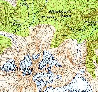 |
The map at left
shows our destination, Whatcom Peak. This
link shows the larger immediate area within our view during the
climb. The routes of the first
day's hike and the second
day's hike. The maps are scanned from the Mt. Shuksan (1950) and Mt. Challenger (1953) 1:62,500 series USGS topographic maps of the State of Washington. Here is the entire area of interest. You can look at the Mt. Shuksan 1:24,000 series topographic map here. Whatcom Peak can be found here. The first couple of days are a bit of a blur, considering that I am looking back over thirty-seven years that have elapsed since we were in the North Cascades. |
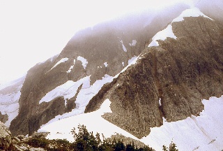 |
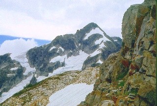
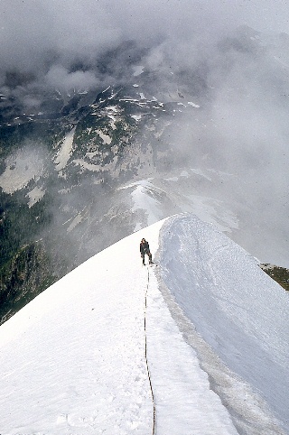
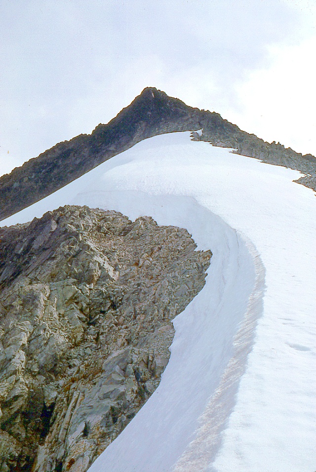
Here is the
bottom portion of the route
to Whatcom Peak, the knife-edge ridge running towards the upper
right. This mountain isn't all that high, but the summit is
reputed to have great views. The weather was too miserable for
Mike and I to abandon our companions for the much more challenging trip
across Challenger Glacier to Mt. Challenger, the most prominent
peak in the Pickett Range. That would have taken two or
three days. |
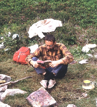 |
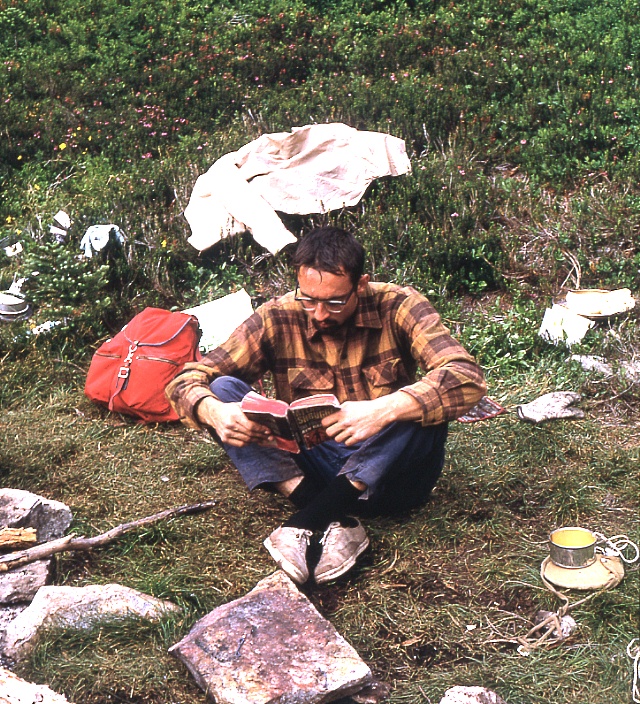
Mike
taking it easy the day before our climb ... |
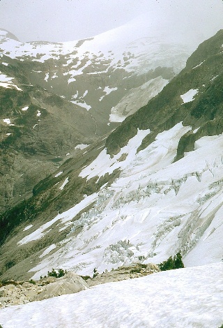 |
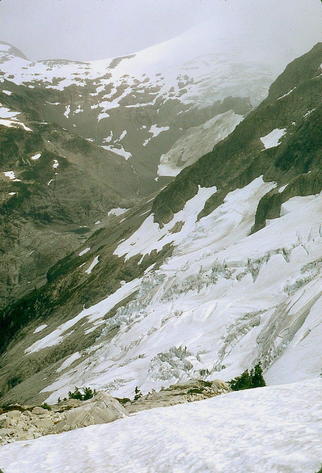
Mt.
Challenger (snow- and glacier-covered in the distance) as seen from
the beginning of our Whatcom Peak climb. Here's a link to more recent, 1:24,000 scale topographic maps of the area around Mt. Challenger. Here's an interesting article about a "grand tour" of the North Cascades, which includes Whatcom Pass and the mountains we could see during our climb of Whatcom Peak. |
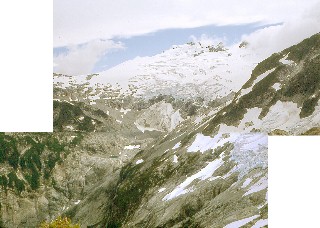 |
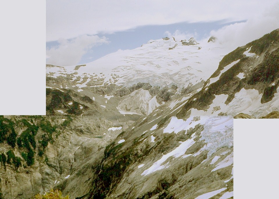
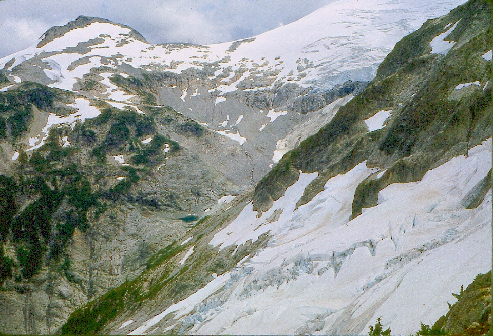
What's
impressive to me is that we are looking at so much exposed rock here, looking
east from near Whatcom Pass. At the right are the lower
slopes of Whatcom Peak; in the distance lies Mt. Challenger. These two images were made from slightly different vantage points, so there is obvious mismatch at the lower right, where the view is shown better in the preceding image. |
 |
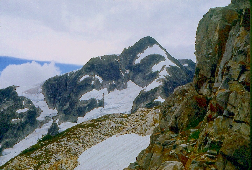
Whatcom
Peak from near the start of our climb. |
 |
Looking across
Whatcom Peak's small (!) glacier at the lower
slopes of Mt. Challenger. |
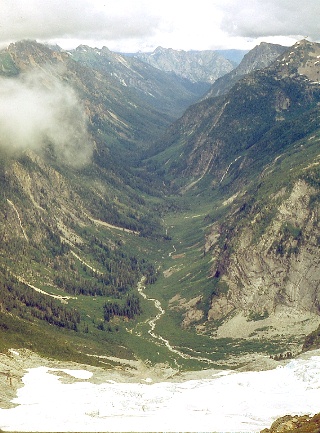 |
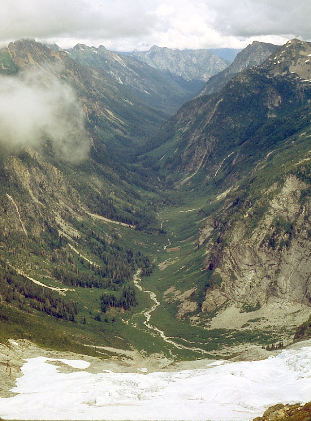
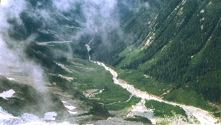
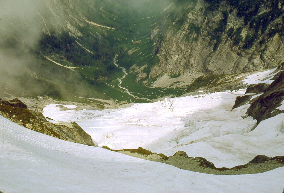
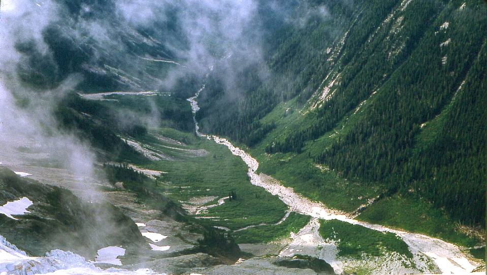
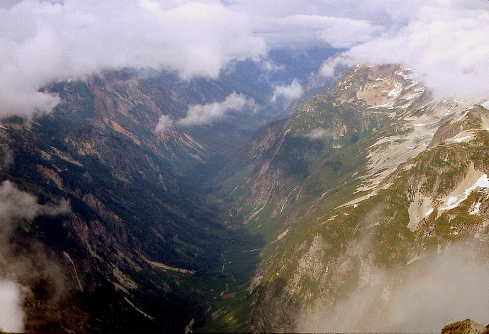
Really nice view
of the glacial
valley east of Whatcom Pass. |
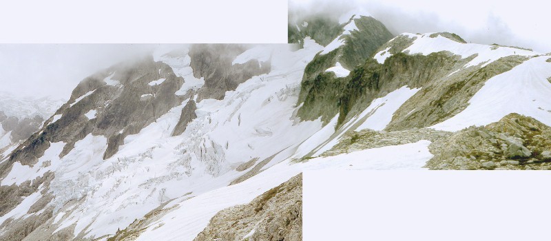 |
| In the composite
image above, there are climbers crossing Whatcom Peak's glacier and
approaching us. We could see them move. Here's
a closer view scanned from the same transparency. The
climbers are above the crevasse at the extreme upper right there.
The route to Whatcom Peak lies along the right-hand skyline, with the
summit in the clouds at the highest point in the image. These
climbers reached Whatcom Pass before Mike and I returned from our climb
of Whatcom Peak. They were soaked and miserable, we were given to
understand afterwards. There's
a double-wide image of them and the glacier here. |
|
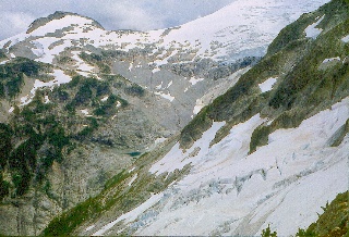
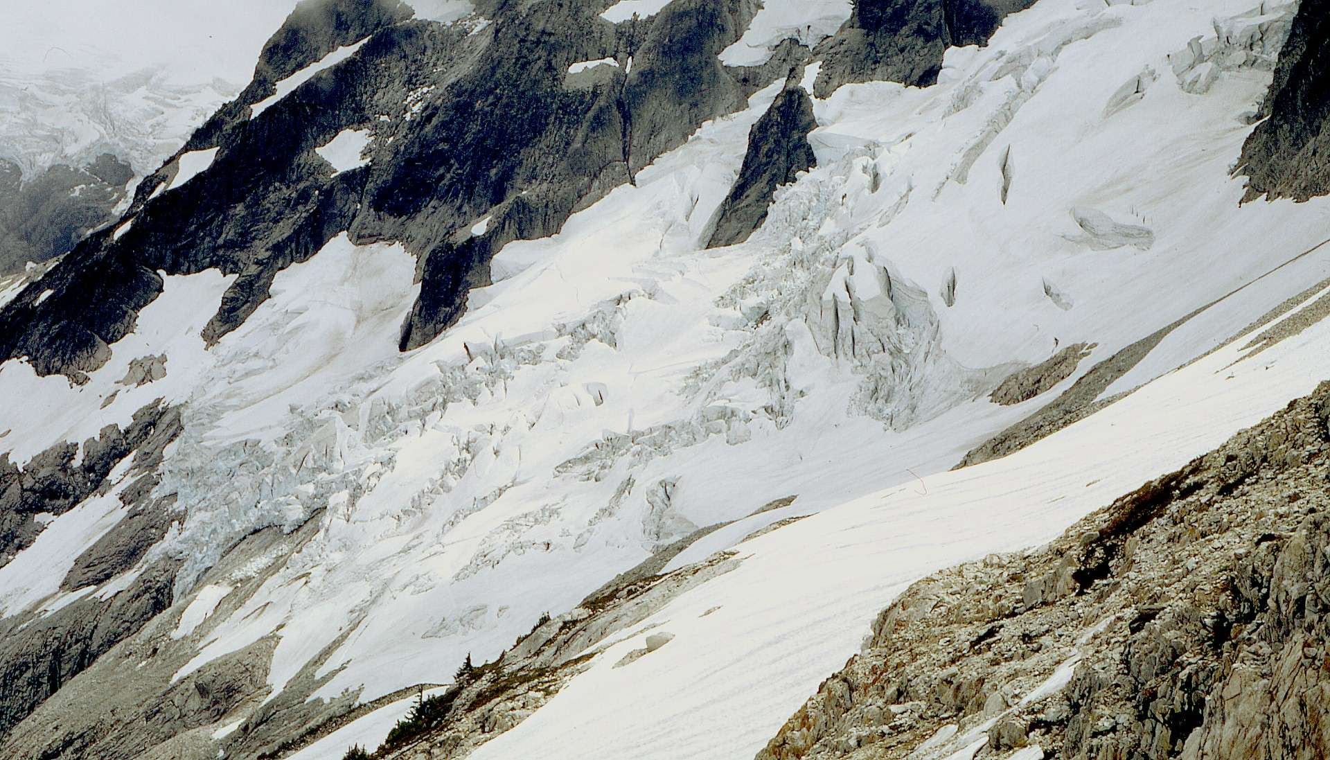
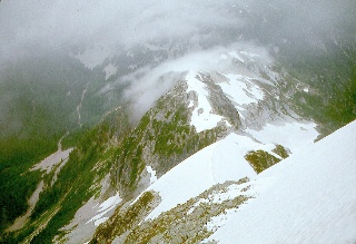
Here's another
view of the glacier
below Whatcom Peak and the show-covered upper reaches of Mt. Fury
along the skyline. |
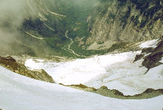 |
Looking down
across Whatcom's glacier into
the head of the valley below. |
 |
A closer
look at the valley above. |
 |
Mike
taking a breather while I shoot pictures. Look at the next
image to see what Mike saw behind me. |
 |
Looking up
from the same position as in the image above. |
 |
Mike
looking down into that splendid alpine valley below Whatcom Peak. |
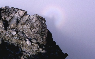 |
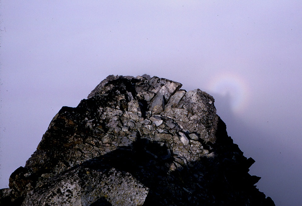
Spectre of
the Brocken. That's my
shadow with the ice-crystal halo around it. The phenomenon is
associated with a German mountain named "The Brocken." The first
linked image bears an eerie resemblance to mine ... I found this "ghost" in several more images here and here while preparing this webpage. |
 |
This is Mt.
Fury (8288 feet) across the saddle (ca. 6250 feet) between Mt.
Challenger and its unnamed subsidiary peak (7374 feet) to the
left. I'm near the Whatcom Peak summit (7574 feet).
The relative elevations look OK to me. Here's a link to more recent, 1:24,000 scale topographic maps in the area around Mt. Fury. |
 |
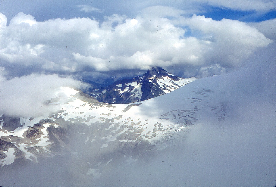
This may be Mt.
Challenger seen through the clouds, judging from the snow leading
nearly to its summit. |
 |
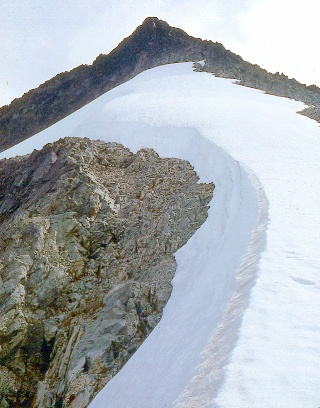
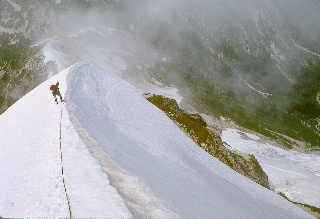
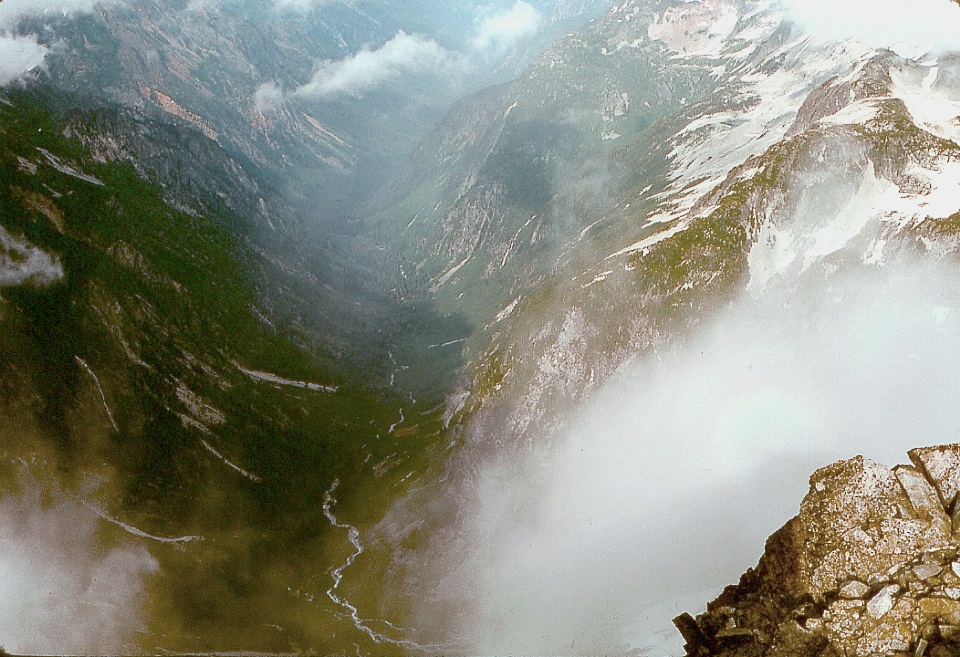
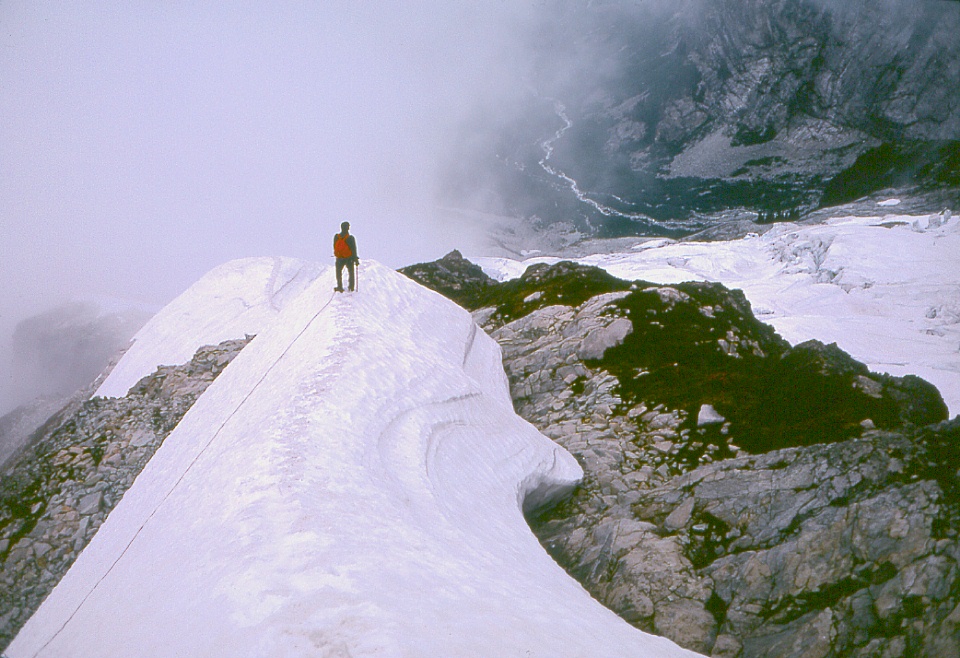
Looking
down at our route up Whatcom Peak. |
 |
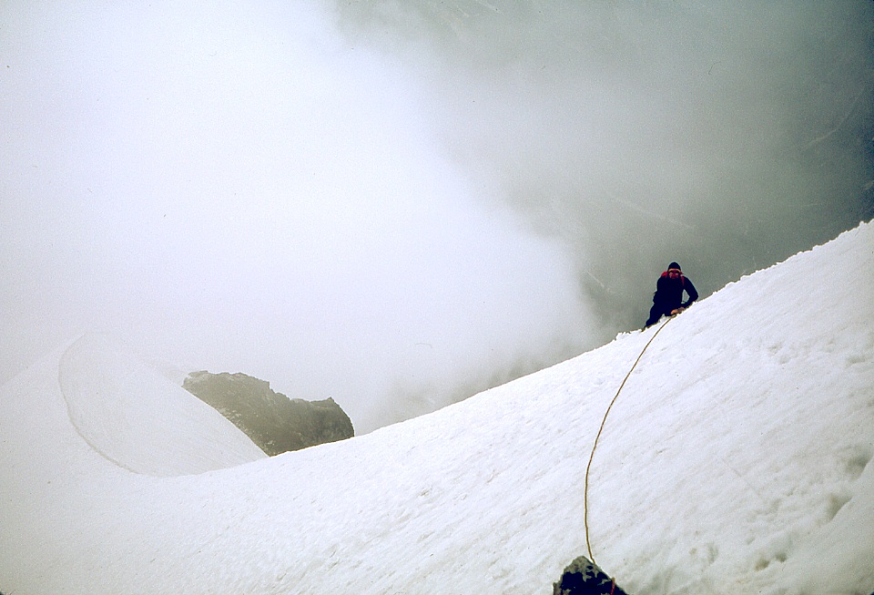
Mike
belaying me while I shoot pictures. After this we had to speed up; and the clouds didn't afford many views. |
 |
On the way back down from the summit of Whatcom Peak. We made it back to camp late, feeling our way in the dark along the complex paths on Whatcom Pass. Our companions came out to meet us with a little light. |